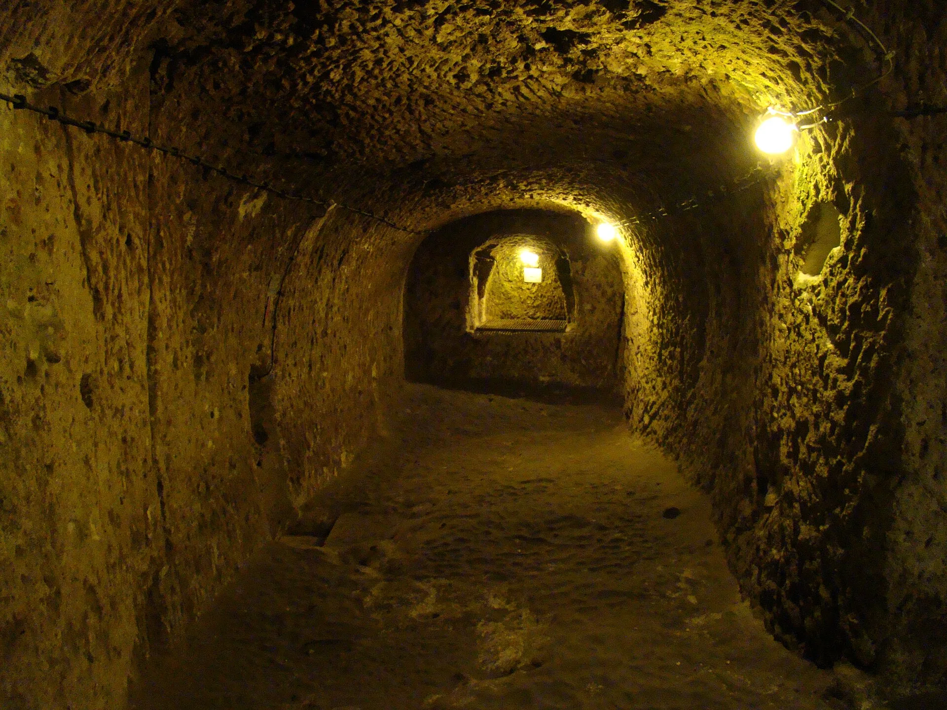

How old is Derinkuyu? Separate a starting date from a history of use
There is no single securely agreed founding date that resolves every part of Derinkuyu. The 2026 chapter by Ali Yamaç and Ezgi Tok explicitly identifies the dating of Cappadocia's underground shelters as contested. Its abstract describes a regional inventory of 253 shelters, not 253 tourist attractions and not 253 parts of Derinkuyu. The authors' chapter abstract
That distinction matters when reading dramatic headlines. A date associated with an object found in a chamber does not, by itself, date the first cutting of every chamber around it. A later community may reuse a space, change an opening, clear earlier deposits or connect rooms. A visitor sees a surviving arrangement, not a time-lapse of the work that produced it.
Think of four different questions: when excavation began, when the complex expanded, when a particular room was used, and when the site opened to modern visitors. They can have four different answers. If an account gives you one year, identify which question it actually answers before repeating it as the age of the underground city.
Derinkuyu belongs to the World Heritage property Göreme National Park and the Rock Sites of Cappadocia, inscribed in 1985. UNESCO places the underground settlements within a larger landscape of dwellings, churches and rock-cut communities. That regional recognition is more informative than suggesting Derinkuyu received a separate inscription solely for being deep.
A useful guide should be able to distinguish an accepted interpretation from a debated one. Ask “What helps date this part?” rather than demanding a definitive answer to the whole complex. An explanation based on decoration, finds or comparison is worth hearing on its own terms. A responsible admission of uncertainty can be the most accurate part of the conversation.
The history becomes easier to follow when you hold a particular feature in mind. A doorway may have been altered; adjoining rooms may have served different purposes over time. Look for the explanation of a specific space, then place it within the wider regional story. A few well-understood details will survive the journey home more readily than a list of rulers detached from the architecture.
The landscape was volcanic before it became architectural
Cappadocia's rock-cut spaces belong to a volcanic landscape. Kazancı and Suludere's geological study discusses the distribution of ignimbrites and the relationship between the region's rock and its characteristic landforms. The important starting point for a visitor is that the material existed before the room: excavation transformed part of a geological deposit into an architectural space. Geological Bulletin of Turkey study
That is a different act from stacking blocks. A mason building a wall chooses and places material; a person cutting a chamber removes it. The remaining rock forms the ceiling, floor and sides. Where a passage joins a room, the opening is a decision about what to take away and what to leave carrying the surrounding material.
Use that distinction to look carefully without testing anything. Observe a doorway's shape, the transition between a broad room and a narrow passage, or the relationship between a wall surface and an adjoining opening. Do not scratch, rub or tap the rock to decide how soft it feels. The surface is part of the place you have come to understand.
The old equation “easy to carve, therefore safe forever” is not a reliable conclusion. Aydan and Ulusay's rock-mechanics research examined environmental conditions and long-term behaviour at Derinkuyu, including moisture and freezing–thawing effects. Their published abstract describes monitoring at the fifth and seventh floors. It is evidence of a research programme, not a personal safety assessment for today's visitor. The 2013 study's abstract
For the actual visit, the current open route and staff instructions matter more than an amateur judgement about a chamber's appearance. A space that looks intact is not automatically open. Equally, seeing monitoring equipment or a repair does not give a visitor enough information to diagnose a problem. Let conservation and visitor management remain the responsibility of the people assigned to them.
A surface walk elsewhere in Cappadocia can complement this chapter of the story. Below ground you experience cut space; above ground you see weathering and erosion shaping the wider landscape. Choose a recognised, currently accessible route rather than treating every opening in rock as an invitation. An interesting geological connection never grants access to private property or a closed cavity.
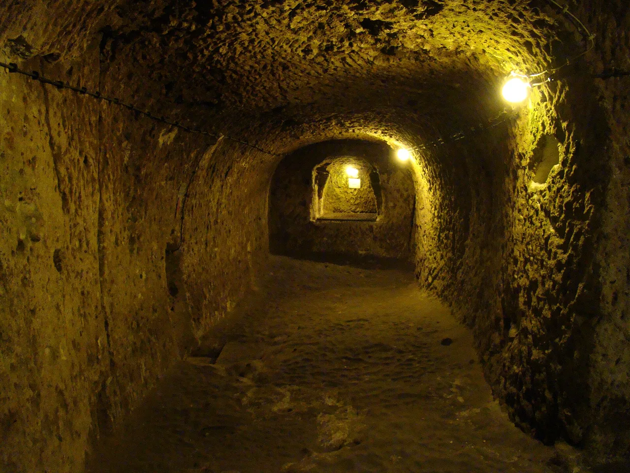
What to see: follow needs, not a checklist of room names
The current Ministry description identifies storage, water, religious spaces and passages that could be closed by large stone barriers. It also describes some connections as narrow enough for one person. These details give a useful framework for looking: supplies, circulation, controlled access and shared life. Ministry's Derinkuyu listing
Start with an ordinary doorway. How does its height compare with the space beyond? Can people pass each other, or would movement need to be organised? You can notice these relationships without deciding that every narrow opening was designed for exactly the same reason. Ask what the evidence says about the particular feature in front of you.
The Ministry’s English account places stables and food-processing spaces on upper levels, where animals and supplies were easier to bring in. Think through that arrangement as you look at storage: a sack, a vessel and an animal each need a different kind of passage. The height and position of openings help turn a room label into a practical question about how the complex worked.
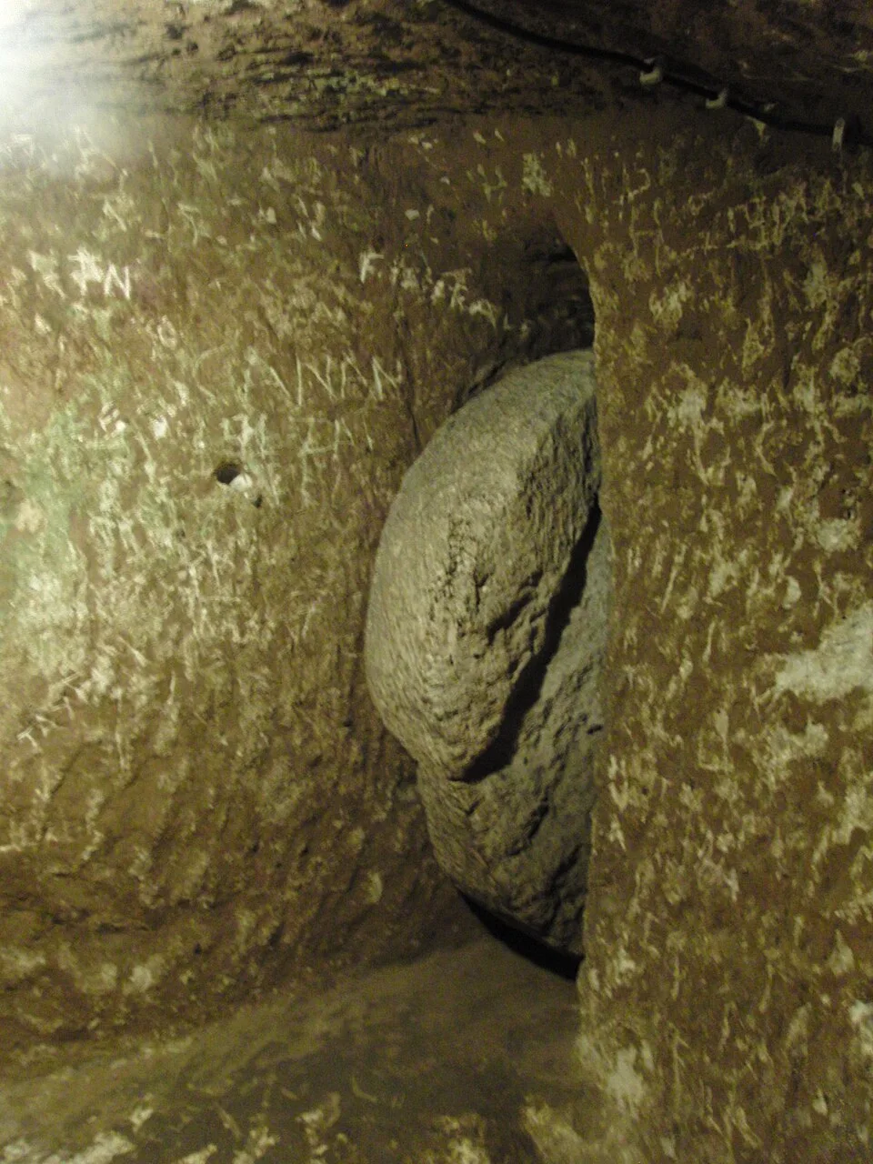
Look at stone barriers as parts of a system rather than props. Their interest lies in how an opening could be controlled and how a person would reach the mechanism. Do not try to move anything or demonstrate an explanation yourself. A guide or display can explain the arrangement without visitors adding wear to it.
GoTürkiye identifies a barrel-vaulted hall on the second level as a missionary school, with study spaces alongside it, and describes a cross-shaped church deeper in the complex. These interpretations add education and worship to the story of shelter. If your open route includes the relevant spaces, look at the ceiling and plan as well as the room name. GoTürkiye: the school and church
Finally, consider circulation as a whole. The public route organises a modern visit; it does not necessarily reproduce one historical person's daily movement. Arrows, barriers and lighting are useful visitor infrastructure. Keep them mentally separate from the older architecture, while following them physically throughout the visit.
Water gives you a third feature to remember alongside a doorway and a store. The Ministry’s English account describes a roughly 55-metre shaft that also served as a well. Consider the vertical relationship: the surface, the rooms and the means of reaching essential water. Stay behind the visitor barriers while looking; a shaft is best understood through its explanation and the site plan.
Depth, floors and the famous population figure
Descriptions of Derinkuyu often combine total estimated depth, the number of identified levels and the portion open to visitors. Those measurements are not interchangeable. A statement about the whole complex does not establish how far your permitted route descends, and a floor count is not a guarantee that every floor is open on your day.
The Ministry’s Turkish description calls Derinkuyu an eight-level complex; its English description gives an approximate total depth of 85 metres and says about a tenth is visitable. GoTürkiye also publishes the latter figures. These are descriptions of the site’s extent and accessible portion, not a measurement of today’s walking circuit. Use the entrance information for the route actually open during your visit. GoTürkiye’s depth and access summary
The frequently repeated capacity claim of twenty thousand people is another reason to slow down. Capacity is an estimate about how many people a place might accommodate under particular assumptions. Population is a claim about who actually lived there at a particular time. Repeating one as the other removes exactly the information a reader needs to judge it.
The useful distinction is between a capacity estimate and a documented community. A refuge might be occupied intensively for a short period, while storage or other rooms could remain useful under different conditions. Ask a guide how the proposed number relates to water, provisions and duration. That turns an impressive headline into an explanation of the pressures that any underground community would face.
The same principle applies to maps that depict extensive connections. A diagram may combine surveyed spaces, inferred links or a simplified layout for visitors. Read its key. Do not assume a line means there is a walkable public passage, and do not attempt to follow a connection beyond the marked visitor route.
A worthwhile visit can stay close to what you can see: the change in scale between a passage and a chamber, the position of a barrier, and the relationship between levels. Keep one photograph or note for each of those observations. Together they explain more about Derinkuyu than a single depth figure, and give you something specific to compare with another rock-cut settlement.
Derinkuyu or Kaymaklı: choose by the visit you want
If you have room for one underground city, begin with your route and interests. Derinkuyu offers the particular arrangement described above, including spaces interpreted as religious and educational. Kaymaklı is a separate complex with its own layout. Going to both makes sense for someone who wants to compare underground architecture; it is less compelling if the second visit displaces the surface landscape you also came to see.
GoTürkiye's regional guide identifies an eight-level complex at Kaymaklı with four levels described as visitable. It also notes houses built around the entrances. That is a useful reason to pay attention to the relationship between the underground spaces and the settlement above. The account describes a regional pattern, not a promise that today's visitor circuit will include every feature in an online diagram. GoTürkiye's underground-city overview
For Derinkuyu, a productive interest is vertical organisation: how passages, shafts and rooms relate across levels. For either site, compare the entrance information, route conditions and interpretation actually available. Claims that one is automatically “easy” or “best for claustrophobia” hide important differences between people. Neither a guidebook ranking nor another traveller's confidence tells you how you will feel in a narrow passage.
If someone in your party is uncertain, settle the arrangement before buying a multi-stop tour. Can that person remain comfortably above ground? Where will everyone meet? Will a guide remain with the underground group? Agreeing on a surface option makes the day more relaxed and avoids a hurried decision after the group has already entered.
Two underground visits are most useful when you compare a small set of features. Choose a doorway, a circulation pattern and a room associated with daily needs. Ask how each was identified. You then have an architectural comparison rather than two nearly identical folders of dim photographs. Leave enough time between visits to write down which observation belongs to which site.
For a broader day, pair one underground city with a surface destination instead. The regional tourism board lists underground settlements, Ihlara and other archaeological places within its suggested routes, but those routes are introductions to possibilities, not verified one-day driving schedules. Choose one combination that fits your departure point, daylight and energy. Official regional route suggestions
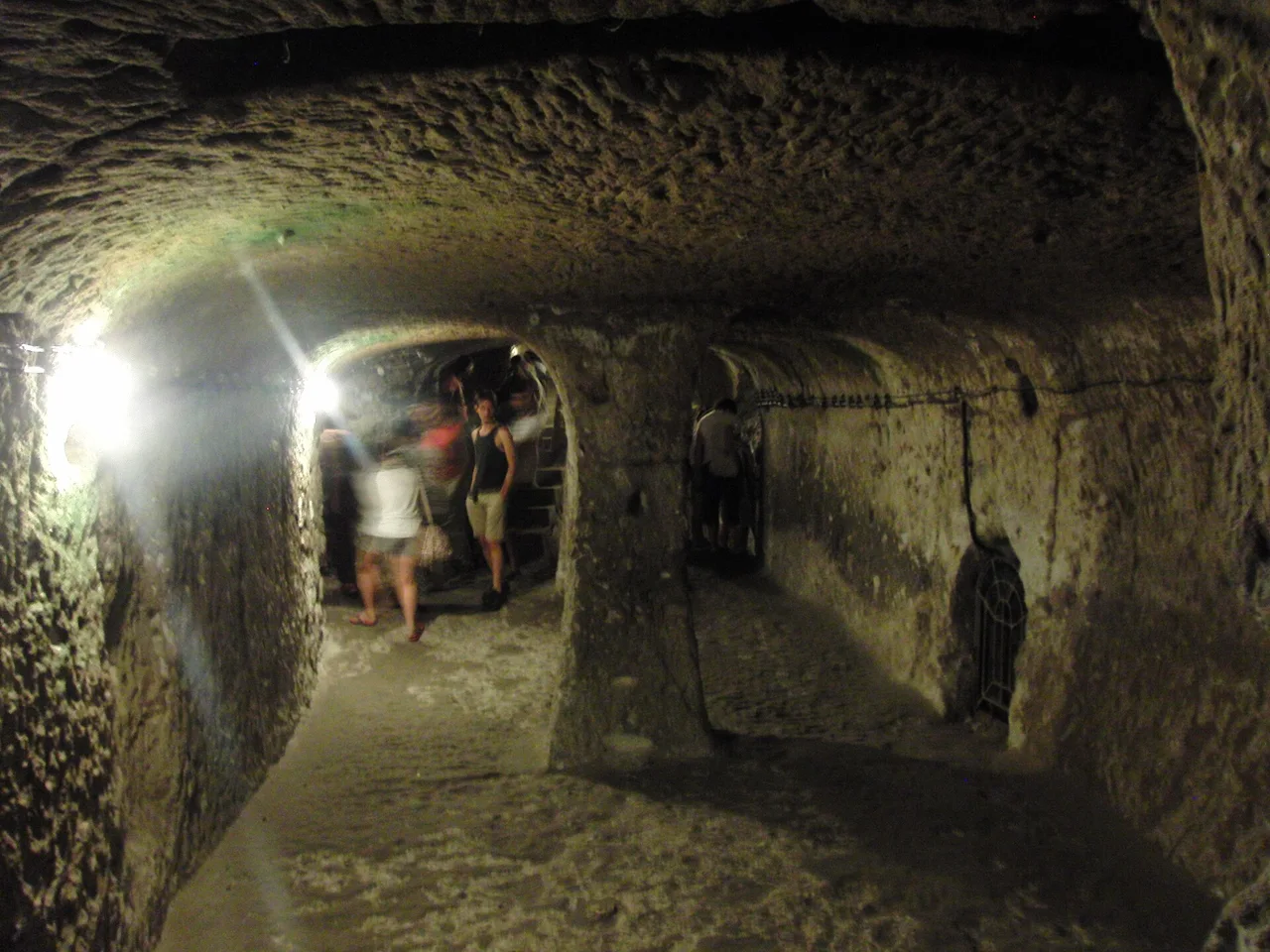
The weather above ground still shapes an underground visit
Derinkuyu is often put into an itinerary as an escape from summer heat. That overlooks the rest of the day: the journey, a possible queue, lunch and any surface walk. Plan clothing for both environments. A light layer that can be packed away is more versatile than dressing for a single advertised underground temperature.
Nevşehir's official long-term weather statistics show the regional contrast clearly. For the 1959–2025 record, January's mean temperature is about −0.1°C and July's about 21.4°C; average daily maximums reach roughly 28.5°C in July. These are station statistics, not Derinkuyu chamber readings or a forecast for your travel date. They explain why a summer day bag and a winter day bag need different outer layers. Turkish meteorological service: Nevşehir statistics
On a hot, bright day, keep drinking water and sun protection available for time outside. Store sunglasses and a hat securely before entering, rather than carrying several loose items while bending through passages. Plan an unhurried meal or shaded break after the visit if the rest of your route involves exposed viewpoints.
In colder conditions, the important question is the journey as well as the attraction. Check the actual forecast and road conditions before committing to a driving circuit. Wear an outer layer suited to the day and choose shoes with reliable grip. A coat that feels right outside may become cumbersome in confined spaces; arrange your bag so you can carry it without dragging it against the walls.
For spring and autumn, use the same two-environment approach. Look at the day's forecast rather than assuming a month guarantees mild weather. A removable layer and compact weather protection help when the itinerary moves between the underground city and a surface stop. Leave space in the bag for those layers before buying souvenirs.
Build a little flexibility into the surface part of the day. You can move lunch or a town break around the available entry arrangement, while keeping the return journey settled. Ask locally about group arrivals if crowding is a concern. This works particularly well when you have chosen Derinkuyu as the main outing rather than one of many fixed stops.
Getting to Derinkuyu without confusing a region with a town
Cappadocia is a region, so “hotel in Cappadocia” is not a precise departure point. Your journey depends on whether you are staying in Göreme, Ürgüp, Uçhisar, Nevşehir or elsewhere. Begin with the accommodation address, then the museum entrance, then any additional stop. This simple order prevents a regional map from becoming an unrealistic day plan.
The Ministry places the underground city in Derinkuyu district on the Nevşehir–Niğde road, approximately thirty kilometres from Nevşehir. Its visitor listing gives the address as Bayramlı Mahallesi, Şemşili Yolu Sokak No. 15, Derinkuyu. Save the museum name in Turkish, Derinkuyu Yeraltı Şehri, as well as the map pin. It is useful when asking a driver to confirm the destination.
With a hired car, compare the full route rather than the straight-line distance. Include time for parking, reaching the entrance and returning to the vehicle. If combining another archaeological site, check its closing time before deciding which comes first. The underground visit should not force the rest of the afternoon into a race between ticket offices.
With a driver, agree on whether the quote covers a one-way transfer, a return with waiting, or a longer itinerary. Ask where the driver will meet you afterwards and save a contact number. A vehicle booked for several stops may have different waiting arrangements from a simple transfer. Write the included stops down so everyone has the same expectation.
For public transport, establish the departure stop, any change of vehicle, the Derinkuyu stop and the last practical return before setting out. Save those details alongside the museum address. An early decision about the return leaves you free to enjoy the visit and a meal, instead of spending the afternoon searching for a connection. Current local transport information is needed for your particular base.
The embedded map is for the destination's surface location. It does not show a navigable underground route. Inside, use the site's signs and staff directions. Before descending, agree on a visible meeting point above ground and a reasonable plan if members of your party finish at different times.
Tickets and museum passes: compare the same visit
Separate three purchases: site admission, transport and interpretation. A museum ticket gets you the admission it specifies; a tour may combine several services; a regional pass covers only its stated sites and validity period. Comparing those headline prices without separating the contents can make a package look cheaper or more expensive than it really is.
The current official listing was checked on 19 September 2026. It displayed daytime hours of 08:00–18:45 and a separate night-visiting period of 19:00–21:00, with the night ticket office closing at 20:15. Recheck close to travel because these are operating details, not permanent features of the site. Do not arrive at the listed closing time expecting a complete visit.
The listing also gives a 200 TL night supplement specifically for Turkish-citizen MüzeKart holders with a Turkish identity number. That is a restricted-category amount, not the standard international visitor ticket. Foreign visitors should compare the applicable admission or Museum Pass offer and its day/night conditions. Keep the official product description with the purchase so its eligibility and coverage remain clear.
A current standard admission price could not be verified from the retrieved official listing, so the calculator deliberately leaves it editable. Enter the price quoted by the official ticket channel for your category and date. An empty field is an unanswered planning question, not free entry. This is more useful than carrying an old lira price forward with a new year attached.
To decide on a pass, make a short list of sites you genuinely intend to enter during its validity. Add their applicable individual admission prices, then compare that sum with the pass price. Check exclusions, extra-charge areas and night visits separately. A longer list of included attractions is not a saving if you would not otherwise visit them.
Use one currency throughout the calculator. If a service is quoted in euros and another in Turkish lira, convert them using the rate and fees relevant to your payment before adding them. Record the conversion date in your own notes. A displayed estimate is only as useful as the figures supplied; it is not a live exchange-rate or ticket feed.
For two travellers sharing transport, enter two people, the admission amount per person and the vehicle quote once. A guide quote for the whole party is also entered once. Accommodation uses rooms multiplied by nights, while food uses a per-person allowance for the excursion. Leave out a component only when it truly does not apply or is already included elsewhere.
Read the tour itinerary before its colour or headline
Cappadocia day tours are often marketed with short route names. What matters for this visit is the actual underground city named in the itinerary. Check that the product says Derinkuyu if that is the place you want. A photograph of a stone passage or a general promise to visit an underground city does not settle the destination.
Then look at the time allocation. How much of the day is transport, how much is at the underground site and how many other stops are included? A long list can mean variety, but it can also mean short visits. Choose a product whose pace suits your interest in reading the place, rather than assuming that the greatest number of stops gives the best value.
Ask whether admission and a guide are included, what language the guiding uses and whether the guide accompanies the group inside. Clarify any shopping stops and whether participation or purchases are optional. These details are particularly useful when two tours show similar routes but different prices.
Explain any concern about confined spaces before booking. The operator should be able to describe the route and the arrangements for someone who remains above ground. Avoid paying first and hoping the guide will solve an unsuitable itinerary on arrival. A surface alternative can be a normal part of a mixed group's day.
Keep the final itinerary and cancellation terms with your booking confirmation. The official information link below is a reference for the site, not a tour endorsement. The accommodation link is an ordinary convenience link without affiliate tracking. We do not label a service personally tested when the editorial team has not used it.
A smaller bag makes more sense in a narrow passage
For Derinkuyu, start with the shape of the bag. A compact, close-fitting day bag is easier to manage than a large rigid pack when you need to bend. Put loose straps away and carry only the equipment needed for this outing. If you have larger luggage, arrange appropriate storage before arriving; do not assume the attraction offers a luggage room.
Wear clothes that allow you to bend and take steps comfortably. Secure closed footwear with grip is a practical choice for moving through a historic underground route. Try the combination at home: can you bend without the bag shifting forward or an item falling from a pocket? This small check is more useful than buying specialist-looking equipment for an ordinary visitor circuit.
In warm weather, bring sun protection for the surface part of the day and a light layer you can put on or remove. Keep drinking water in a closed bottle and follow the site's rules about food and drink. A hat belongs in the bag once it interferes with your view or movement below ground.
For a winter or cold-weather visit, add the coat, hat and gloves appropriate to the actual forecast. Think about where they will go if you remove them. Carrying a bulky coat in one hand while holding a phone in the other is an avoidable inconvenience in a low passage. The illustration below separates surface-weather items from the compact underground kit.
A charged phone is useful for saved tickets, the meeting point and contact details. Put it away while negotiating steps or a low opening. Take photographs only where permitted and where stopping does not obstruct the route. A large tripod or extended selfie stick is poorly suited to a shared confined passage; confirm equipment rules if photography is a main purpose of the trip.
Keep essential personal items accessible. If a health condition affects your ability to use steps or confined routes, seek advice relevant to you and discuss practical access with the site before travel. An online packing list cannot make the route suitable for everyone. There is no need to add climbing or cave-exploration equipment for the public visit, and such equipment never grants permission to explore closed spaces.
Use the illustration as a quick final bag check: compact essentials for the descent, then the surface-weather additions that fit your day. Place your saved meeting details where you can find them easily and leave spare space for a removed layer. Once the bag is packed, try wearing it and bending comfortably; fewer loose objects will make movement simpler.
Come back to the present-day town
An underground visit can make the settlement above it feel like an entrance hall. Resist that habit. People live and work in Derinkuyu; homes, shops and ordinary streets are part of the present, not props for a story about vanished inhabitants. Keep doorways clear, ask before photographing a person closely and distinguish public visitor areas from private property.
A few Turkish words are enough to begin politely: “Merhaba” means hello, “Teşekkür ederim” means thank you, and “Lütfen” means please. “Yeraltı şehri” is the term you will see for underground city. Use a greeting naturally and let the other person choose whether the conversation continues in Turkish or another shared language. A memorised phrase is an introduction, not a claim to local expertise.
Lunch can add another strand of Cappadocia's material culture. GoTürkiye describes testi kebab as a dish cooked in a sealed clay vessel and also highlights regional mantı and apricot-and-meat preparations. Ask what a restaurant actually serves that day, how long preparation takes and what ingredients are used. A vegetarian diner or someone with an allergy should discuss the specific dish rather than relying on its English title. GoTürkiye's regional food introduction
The clay vessel provides a connection to Avanos, known for pottery production. If you include a workshop elsewhere in your Cappadocia trip, ask who made the piece, whether it is intended for cooking or decoration, and how to care for it. A demonstration can be interesting without creating an obligation to buy. Confirm any participation fee before joining an activity. Pottery in the regional tourism account
For visits to active places of worship on your wider route, follow the clothing, shoe and photography instructions at the entrance. Keep a versatile layer available for appropriate coverage. The underground museum and a functioning religious building are different settings; one practical outfit may serve both, but the behaviour and access rules belong to each place.
When sharing the day afterwards, distinguish the historical communities described in interpretation from the people you met today. Avoid describing residents as survivors of an unchanged ancient way of life. A useful travel story can hold both an unusual past and an ordinary present without forcing one to stand in for the other.
Build a day with one clear centre
For a focused Derinkuyu outing, organise the journey and return first, then leave room for the underground visit and a meal above ground. Read a short historical introduction before entering. Inside, concentrate on three features rather than trying to remember every room name. Afterwards, look back at the plan or your notes while the relationship between the spaces is still fresh.
For an architecture day, compare Derinkuyu with Kaymaklı if transport and opening times allow. Use the same questions in both places: how do people move, where are supplies kept, and how are openings controlled? Take a break between them. The purpose is to see differences, not to descend twice simply because both names appeared on a list.
For a varied regional day, choose one underground visit and one surface experience. A recognised valley route, a museum or a pottery visit can each provide a different perspective, but they need different time and transport allowances. Do not combine all three automatically. Check the actual route and conditions before committing to a walk after a fixed-time excursion.
For a mixed group, make the surface plan explicit. Someone who does not enter should know where to wait or what nearby activity is genuinely available, and how the group will reunite. Choose a plan that respects that person's interests rather than leaving them to improvise beside the ticket queue.
After the visit, one small question can lead to worthwhile reading: how was a particular space identified, or how did people manage water in other rock-cut settlements? The free research resource in the reading section offers a way to pursue the regional question without treating every surveyed cavity as a tourist destination.
Three reading paths: underground research, daily culture and the wider journey
Göreme and Şahinefendi: History inside the Rocks of Cappadocia, edited by Andrea Bixio, Roberto Bixio and Andrea De Pascale, is the specialist choice. Its 2023 surveys concern those two areas, rather than providing a Derinkuyu visitor manual. The publisher offers an English-and-Italian text and a free personal-use PDF. It is particularly relevant if the relationship between underground shelters and water systems has caught your attention.
Turkey — Culture Smart! by Charlotte McPherson approaches the country through customs and contemporary social life. Consider it for the part of travel that a monument guide cannot cover: how to enter everyday interactions with a little more understanding. As with any national introduction, use it as context rather than a prediction about every individual you meet.
Diana Darke's Eastern Turkey includes Cappadocia within a wider regional journey. The listed second edition dates to 2014 and is offered as an e-book, so its attraction here is background and geographical context. Use current official information for prices, access, transport and travel conditions; this older edition is not a substitute for those checks.
You do not need to buy all three. Start with the free official site information, then select the kind of reading you enjoy. The recommendations are based on publisher descriptions and contents, not a claim that our team has reviewed every page. Amazon links below search by title and author; compare the edition and format, and use the publisher's free download where that meets your needs.
Questions to settle before going underground
Can I visit if I dislike enclosed spaces?
The route includes narrow connections and changes in level. Ask the site about the current circuit and make a decision that fits your own comfort and needs. Do not treat the visit as a test of courage or assume that a companion's reassurance is an access assessment. A surface alternative is a reasonable choice.
Does the museum pass cover every visit?
Check the exact product, eligibility, validity and visit type. Turkish-citizen MüzeKart terms and foreign-visitor Museum Pass terms are different. Night-visiting arrangements may have separate conditions. Confirm coverage before payment rather than relying on a pass logo in an old blog post.
Can I explore beyond the marked circuit?
No visitor should cross barriers or enter closed passages. The research literature describes many spaces outside ordinary tourist access. A published plan, photograph or story about a connecting tunnel is information about the site, not permission to follow it.
Is Derinkuyu worth visiting without a dramatic founding story?
Yes, if its architecture and history interest you. The scale of the work, the organisation of essential needs and the repeated use of underground space are substantial subjects in their own right. You can enjoy the place without choosing the most sensational date or capacity figure.
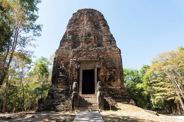
For another setting where buildings make more sense as parts of a living landscape, continue to our Sambor Prei Kuk guide to brick temples and their wider setting. The places have different histories and materials; the connection is the pleasure of looking beyond a single famous shape.
A closer look.
Documentary photographs from 2009 and 2012. They do not establish today’s open route or facilities.

Sok Heng Oeun
Sok Heng Oeun is the owner and editor of Hidden Corners. The Hidden Corners Editorial Team supports image preparation and editorial checks under his direction.
Sok Heng Oeun on Facebook ↗Research and AI-assisted editorial preparation. Publication authorized by Sok Heng Oeun; an individual owner reading review is not recorded. This guide does not claim a firsthand team visit.
Sources & image credits
Sources supporting this guide. Dated prices and access reports can change; confirm with the responsible authority before travelling.
- The authors' chapter abstract ↗
- Göreme National Park and the Rock Sites of Cappadocia ↗
- Geological Bulletin of Turkey study ↗
- The 2013 study's abstract ↗
- Official Derinkuyu visitor listing ↗
- GoTürkiye's underground-city overview ↗
- Official regional route suggestions ↗
- Turkish meteorological service: Nevşehir statistics ↗
- GoTürkiye's regional food introduction ↗
- Pottery in the regional tourism account ↗
- Regional underground research — free personal-use PDF through publisher ↗
- Turkey — Culture Smart! — Charlotte McPherson ↗
- Eastern Turkey — Diana Darke ↗
Photograph credits
- Derinkuyu Passage · Bjørn Christian Tørrissen · 2009 · CC BY-SA 3.0. Resized and converted to WebP; display crop may apply. These adaptations remain available under their respective licences.
- Derinkuyu Door · TobyJ · 7 August 2012 · CC BY-SA 4.0. Resized and converted to WebP; display crop may apply. These adaptations remain available under their respective licences.
- Derinkuyu Chamber · TobyJ · 7 August 2012 · CC BY-SA 4.0. Resized and converted to WebP; display crop may apply. These adaptations remain available under their respective licences.
Packing and outfit graphics: AI-generated editorial illustrations. Portrait: supplied by Sok Heng Oeun.


_(2).jpg)