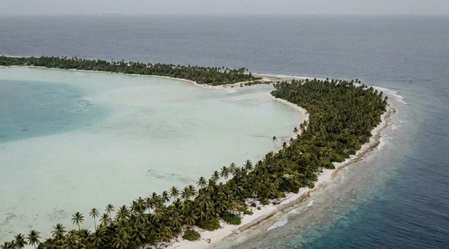
AI illustration
 Written and edited by
 Somewhere between the last week of May and the third week of June 1998, someone drove heavy machinery onto a stony tabletop west of Marree, in the far north of South Australia, cut the outline of a hunting figure kilometres tall into the desert crust, and left. Landsat imagery brackets the whole operation to a few weeks. Twenty-eight years later nobody has proved who did it — and the more uncomfortable fact, the one the story is usually told without, is that nobody asked the people whose country it is.
Silence Index — D-007
Effectively unvisited
Ranks 25 of 99 scored dossiers — quieter than 76% of the others we have scored. A low score is not a warning; it describes who else will be standing next to you.
How the total is weighted. These are the fixed weights of the four inputs, the same on every dossier — not this place’s scores. We do not publish per-input bars, because the per-input values were never recorded article by article and inventing four plausible numbers that sum to the total would be a fabrication dressed as a chart.
This dossier was scored before 2 September 2026, when the fourth input became night darkness. It keeps the input it was reasoned with until it is re-scored at its next source re-check; the methodology page records the change.
The index is a desk instrument scored by this publication, not a field measurement. How it is calculated, and where it fails.
What is actually out there
This is a desk-researched dossier; no one from this publication has flown the site. What follows is assembled from official and institutional records and from the reporting of established news organisations, with the disagreements between them left visible rather than smoothed over.
Marree is a settlement at the junction of the Oodnadatta and Birdsville tracks, roughly 685 km north of Adelaide by road. The Bureau of Meteorology's station there records a mean January maximum of 38.0 °C and mean annual rainfall of 161.7 mm. The country is gibber — what the Australian National Botanic Gardens describes as desert pavement, a surface of closely packed angular stone, in this part of the continent derived from the breakdown of silcrete, and darkened over long periods by desert varnish. It is a landscape with almost nothing standing on it and almost nothing growing on it, which is precisely why a drawing works there.
The figure itself is harder to pin down than the story implies. NASA's Earth Observatory, working from Landsat imagery, gives it as spanning 3.5 kilometres. Australian accounts, including the geospatial trade journal Spatial Source, describe a figure of more than four kilometres head to toe with a perimeter of some 28 kilometres and an outline around 70 metres wide; press accounts have put the cut lines at somewhere between 25 and 30 centimetres deep. Those numbers do not fully reconcile, and the reason they do not is itself worth stating: nothing was surveyed to a published standard before wind began taking the edges off. What everyone agrees on is that it depicts a standing male figure holding what appears to be a stick or a boomerang, and that it is among the largest figurative marks human beings have ever made on the ground.
The land beneath it is not empty in the legal sense at all. It is Crown land held under pastoral lease, and it sits within the country of the Arabana people. South Australian Native Title Services records that the Arabana native title application — filed as Dodd v State of South Australia — was lodged on 16 January 1998, and puts the determination area at approximately 68,823 square kilometres. The Australian Institute of Aboriginal and Torres Strait Islander Studies records that the determination was finally made in May 2012, describes the area as almost 70,000 square kilometres including the towns of Marree and William Creek and Kati Thanda-Lake Eyre, and notes that it was declared under a tent at Finniss Springs, ending a claim that had run fourteen years. The two figures are the same determination stated to different precision; we give both rather than splitting them.
Set those two dates beside each other and the geoglyph stops being a harmless curiosity. When the figure appeared, the country under it was the subject of a native title application five months old.
The two-week window
The dating is the strongest evidence in the entire case, and it is not testimony — it is photography. The United States Geological Survey holds Landsat 5 scenes of the plateau from May 1998 showing an unmarked surface, and from June 1998 showing the completed figure. The USGS publishes those images by month rather than by day, so the precise fortnight quoted in some retellings is tighter than the public record supports; what the public record does support is a window of weeks. Spatial Source names the charter pilot who first reported it, Trec Smith, and dates the sighting to 26 June 1998.
Then came the correspondence, which is the part that reads like fiction and is not. CNN's account records anonymous faxes sent to the Marree Hotel and to Adelaide's The Advertiser, announcing the world's largest work of art, written in American spellings and imperial measurements. In January 1999 a plaque was found buried at the site; it is reported as carrying United States flag imagery, and Spatial Source records that it bore a passage from H. H. Finlayson's 1946 book The Red Centre. Seven years after that, in May 2006, the Marree Hotel's Phil Turner received an anonymous message containing roughly half a dozen grid coordinates and the line, as he recalled it, "This may be what you're looking for." Tested on the ground, those coordinates proved accurate to 150 millimetres. When a restoration crew went out in 2016 they reportedly found some 250 bamboo stakes still standing along the perimeter — original set-out markers, left where they were driven.
None of this describes an eccentric with a shovel. It describes survey control, earthmoving plant, fuel, logistics and a plan — and a person or group who went on quietly feeding the story for at least eight years afterwards while never once accepting credit for it.
The part that is genuinely disputed
The famous dispute is authorship, and it has not moved much. Suspicion has long attached to Bardius Goldberg, an Alice Springs artist known to be interested in making work visible from space, who died in 2002 having, by the accounts available, neither confirmed nor denied it. A competing reading points to American hands, on the strength of the faxes and the plaque; the region had a long-running joint Australian–United States defence presence at Woomera, and the Woomera Prohibited Area — 122,000 square kilometres, described by the Department of Defence as the largest land-based test range in the Western world — lies away to the west and south-west. In June 2018, after two years of his own investigation, the entrepreneur Dick Smith publicly offered A$5,000 for information identifying the maker, telling SBS he would pay even if the informant insisted on anonymity. Nobody collected. That failure is a data point in its own right: for twenty-eight years the strongest incentive anyone has attached to this mystery has been an offer of money in exchange for a private conversation, and it has not been enough.
But authorship is the shallow dispute. The deeper one is whether the thing should be there, and whether the way it has been kept there was consented to. Both halves of that question are live, and the sources disagree.
SBS reported the August 2016 restoration as a collaborative act: a group of Marree locals and businesses led by Phil Turner, working with the Arabana Aboriginal Corporation and compiling imaging data to make sure they were retracing the original outline rather than inventing a new one. NASA's Earth Observatory records the same event as local business owners re-cutting a fading tourist draw with a construction grader over about five days. Against that, a 2022 article by Cameron Algie for the planning and environment law firm Kellehers Australia records the position of the Arabana elder Reginald Dodd OAM — the named applicant in the very determination that carries his name, chair of the Arabunna Peoples Committee since 1996, and South Australia's Senior Australian of the Year for 2019 — that the grading tore through fragile soils and destroyed ancient campsites across the tabletop. That account also records that a 317-page nomination to place the country on the National Heritage List, prepared without charge by consultants, was refused by the responsible Minister, and that no one was ever prosecuted.
The question that has never really been asked is not who cut the figure. It is why the answer to that was allowed to matter more than the ground it was cut into.
The legal frame is worth stating plainly, because it is routinely mangled. Under section 23 of the Aboriginal Heritage Act 1988 (SA), as the South Australian Attorney-General's Department sets out, it is an offence to damage, disturb or interfere with an Aboriginal site or object without the Minister's authorisation. We could not establish from any official register that the geoglyph itself is a protected Aboriginal site — it is a modern intrusion, not an Aboriginal work — and readers should be sceptical of anyone who tells them otherwise. The archaeology of the plateau it was cut into is a separate and much older question, and it is that, not the drawing, that the objection concerns. On the public record we could find, neither the 1998 cutting nor the 2016 re-cutting produced a prosecution.
 AI illustration
Why it looks like that
A geoglyph of this kind is not carved. It is subtracted. UNESCO's description of the Nasca lines in Peru — the obvious comparison, and the only real one at this scale — explains the method exactly: the figures were made by removing the overlying weathered gravels to reveal the lighter bedrock beneath. Marree works on identical physics. The gibber surface is dark, varnished and stable; a metre or two down the substrate is pale. Scrape a 70-metre band off the top and you have written in pale ink on a dark page, at a scale nothing on the ground can perceive.
Where the two sites part company is durability. UNESCO attributes Nasca's two-thousand-year survival to sitting in one of the driest places on Earth, with among the lowest rainfall rates in the world. Marree, at 161.7 mm a year, is arid but nothing like that, and it is windy. NASA's imagery record shows the lines fading through the 2000s until, by 2013, they were barely detectable in Landsat 8 scenes at all. The figure was not vandalised; it simply blew shut.
The 2016 solution was cleverer than a redraw. Rather than only scraping again, the crew cut wind grooves along the outline, designed to trap water so that vegetation would eventually pick out the figure in green — a line that maintains itself by growing rather than by staying bare. "It will be there forever," Turner told SBS, "not because of the work we've done but because we've created wind grooves." Note what that means. The largest anonymous drawing on the continent is now legible partly because someone engineered a rainfall trap into it. It is no longer purely a subtraction; it is a managed object.
One practical consequence of the physics: contrast is everything. The USGS notes that roughly 3,000 feet of altitude is needed to take in the whole figure, and low sun is what makes a shallow, wide, low-contrast line read at all.
What popular coverage gets wrong about the Marree Man
The version that circulates in listicles and social posts is more confident than the record on almost every count, and we can be specific about where. It gives the figure one authoritative height, usually a shade over four kilometres. In fact NASA's Earth Observatory measures 3.5 kilometres from Landsat imagery, while Spatial Source gives more than four kilometres with a 28-kilometre perimeter, and the figures cannot be reconciled because nothing was surveyed to a published standard before the wind began taking the edges off.
The famous two-week window is likewise tighter in the retelling than in the evidence. The USGS publishes its Landsat 5 scenes by month — an unmarked plateau in May 1998, the completed figure in June — which supports a window of weeks, not the precise fortnight the potted versions quote.
The largest error, though, is not a number but an omission. The popular telling treats the plateau as unowned emptiness onto which a prank was harmlessly drawn. It is Arabana country: South Australian Native Title Services records that the native title application had been lodged on 16 January 1998, five months before the figure appeared, and the 2016 re-cutting is the subject of a documented objection from the Arabana elder Reginald Dodd, recorded by the law firm Kellehers Australia. A mystery story with the ownership left out is not a shorter version of the truth. It is a different story, and we decline to retell it that way.
How to actually see it
From the air, in practice — and the honest version of that sentence is that there is no lawful, practical ground alternative worth pursuing.
The plateau is pastoral-lease country. Under section 48 of the Pastoral Land Management and Conservation Act 1989 (SA), a person may travel or camp temporarily on a designated public access route, and may cross pastoral land by means other than a motor vehicle, horse or camel after giving notice to the lessee — but travelling across pastoral land by motor vehicle requires the consent of the lessee or of the Minister. We could not identify any public access route that reaches the figure, and there is no track, sign or lookout at it. Even if you stood on it with permission, you would be standing in a 70-metre-wide scrape on a flat tabletop and seeing, essentially, nothing. This is not a site that rewards persistence on the ground; it is a site that is invisible from it by design.
Charter and scenic flights operate seasonally out of Marree, William Creek and Coober Pedy, and the Marree Man is normally sold as part of a Kati Thanda-Lake Eyre circuit rather than on its own. South Australia's official Kati Thanda-Lake Eyre visitation fact sheet lists Wrightsair, Arid Air, Arkaroola and Chinta Air among the operators flying the lake from neighbouring towns; that listing is for lake flights, so confirm directly with any operator whether the geoglyph is actually on the route before you pay. We do not publish fares for this flight, because no source we regard as reliable publishes them: ask for the price, the aircraft type, the flight duration and whether the Marree Man is guaranteed, in writing, before booking. Book the first departure of the day for the low sun.
The quieter and far cheaper option is to skip the aircraft and take the lake instead. Kati Thanda-Lake Eyre National Park is co-managed with the Arabana and Dieri peoples; National Parks and Wildlife Service South Australia lists vehicle entry at $14.40 and camping at $23.10 per night, with viewing areas at Level Post Bay and on the Oodnadatta Track. Halligan Bay Point campground closes from December to mid-March because of extreme heat, which is a fair proxy for when not to be in this country at all. Recreational access to the lake bed itself — walking, swimming, diving, boating and landing aircraft — is prohibited under the National Parks and Wildlife Act 1972, and the official visitor guidance records the Arabana view that the lake is a sacred and dangerous place not to be entered without appropriate cultural authority. A 4WD and genuine outback preparation are stated requirements, not suggestions.
If a budget stretches to exactly one flight in this region, the case for spending it on a flood year over the lake rather than on the geoglyph is strong. The figure reads much the same from 3,000 feet in any year. The lake does not.
Why the Silence Index is 86
We have moved this dossier down from 88, and the reasoning should be visible rather than asserted. The Index weighs footfall pressure at 30 per cent, access friction at 30 per cent, acoustic floor at 20 per cent and unresolved questions at 20 per cent.
- Unresolved questions — full marks. Twenty-eight years, a publicly funded reward that has gone unclaimed, and an authorship question that is not merely unanswered but structurally resistant to answering. Our own methodology names the Marree Man as an example of this input, and it still earns it.
- Access friction — very high. No public access route, no lawful vehicle approach without a lessee's consent, and nothing to see if you got there. The effective gate is an aircraft seat departing from a town of a few dozen people, 685 km from the nearest capital, in a season bounded by lethal summer heat.
- Footfall pressure — high, but not perfect. This is where the site is weaker than its reputation. The 2016 restoration was undertaken explicitly to keep a fading tourist draw legible, and its organiser publicly forecast a rise in overnight stays. A landscape feature that is actively maintained for visitation is not the same thing as one that has simply been left alone.
- Acoustic floor — the weak input, and the reason for the two-point fall. There is no version of this visit in which the group stops moving and hears nothing. The plateau is silent; your experience of it is delivered through a piston engine at 3,000 feet, and the only way to reach even that is another engine on a track. We score the visit, not the postcard.
Net, 86 — still inside the band our methodology calls early: real friction, low footfall, open questions, and a defensible argument for not going. Scores are reviewed annually and they mostly move down. This one just did.
What is worth carrying away is not the whodunnit. The record here is thinner than the retellings suggest: two satellite months, a pilot's report, some faxes, a plaque, a set of coordinates posted eight years late, and a great many second-hand attributions that dissolve when you reach for the original. Almost everything confidently asserted about the maker is inference dressed as fact.
What is not in doubt is the sequence. Someone made a very large decision about someone else's country, in the middle of a native title claim, and declined to put their name to it; and when the mark began to disappear, it was re-cut — again by people who were not, all of them, in agreement that it should be. A mystery that has to be maintained with a grader every couple of decades is not really being preserved. It is being curated. That is a smaller and sadder thing, and it is the honest description of what is out there now.
Corner Codex — D-007
- Place
- A stony plateau west of Marree, Far North, South Australia
- Coordinates
- 29.5°S, 137.5°E — Arabana country
- Land status
- Crown land under pastoral lease, inside the Arabana native title determination area (Dodd v State of South Australia, determined May 2012)
- Getting there
- Effectively air-only. Charter and scenic flights operate seasonally from Marree, William Creek and Coober Pedy. No track, no sign, no lookout, nothing legible from the ground.
- Permits
- None to overfly. Crossing pastoral land by motor vehicle requires the lessee's or the Minister's consent under the Pastoral Land Management and Conservation Act 1989 (SA).
- Season
- April–September. Marree's mean January maximum is 38.0 °C and mean annual rainfall 161.7 mm (Bureau of Meteorology).
- Silence Index
- 86 / 100
- Still unexplained
- Who cut it, with whose survey equipment, and why nobody has claimed the A$5,000 offered publicly for the answer.
The Traveler's Panel · checked
Changing information. Prices, permits, seasons and road access change, sometimes at short notice. Everything here is a starting point for your own confirmation — not a quote, and not a guarantee. Verify with the operator and the relevant official body before you book.
| Season | April – September |
| Avoid | December – mid-March (the park's own campground closes for heat) |
| Days needed | 1 day on site; 2 days each way from Adelaide by road |
| Difficulty | Easy in the air; the outback approach is the demanding part |
| Guide | A charter pilot; there is no ground guiding to buy |
| Cost band | $$$ — flight fares are not reliably published; ask in writing |
Getting there — Marree · William Creek · Coober Pedy (CPD)
- The geoglyph is legible only from the air. There is no lookout, no marked track and nothing to see at ground level. Do not plan a ground visit.
- Marree sits at the junction of the Oodnadatta and Birdsville tracks, roughly 685 km north of Adelaide by road via Port Augusta. Two days is a realistic drive.
- Alternatively fly to Coober Pedy (CPD) and pick up a scenic flight there; Marree and William Creek also operate as flight bases.
- Most flights sell the Marree Man as part of a Kati Thanda-Lake Eyre circuit. Confirm with the operator that the geoglyph is actually on the route before paying.
- Take the first departure of the day. The lines are wide, shallow and low-contrast; low sun is what makes them read.
- Crossing pastoral land by vehicle requires the lessee's or the Minister's consent under the Pastoral Land Management and Conservation Act 1989 (SA). Public access routes are the only general right of vehicle passage.
Indicative costs — verify before booking
| Scenic flight | Not published by any source we regard as reliable. Request price, aircraft type, duration and route inclusions in writing before booking. |
| Kati Thanda-Lake Eyre National Park vehicle entry | $14.40 per vehicle, listed by National Parks and Wildlife Service South Australia |
| Park camping | $23.10 per night, listed by National Parks and Wildlife Service SA |
| Accommodation in Marree | Limited; rates are not published centrally — enquire directly |
| Fuel | Remote-area pricing on the tracks; budget generously and do not rely on one bowser |
What to pack
- Far more water than seems necessary — mean annual rainfall at Marree is 161.7 mm
- Fuel range planning: fill at every opportunity on the tracks
- A satellite communicator if you are driving the Oodnadatta or Birdsville tracks
- Sun protection calibrated for a place with a 38.0 °C mean January maximum
- Recovery gear and a stated route left with someone, if driving
- A fast shutter; you will be shooting through perspex from a moving aircraft
Where to stay
Marree is the practical base: a small settlement at the meeting of two of Australia's best known outback tracks, with limited beds and no published central tariff — enquire directly and book ahead in the cooler months, when the region's flight and track traffic concentrates. William Creek is smaller again and functions largely as an airstrip with a pub attached. Coober Pedy, on the sealed Stuart Highway, is the easiest arrival by air and the only place in the region with a real choice of rooms, including dugout accommodation cut into the rock. Inside the national park, Halligan Bay Point campground is 4WD-access only and closes from December to mid-March because of extreme heat.
Safety & responsible travel
- This is Arabana country, inside the native title determination area recognised in May 2012. Treat it as country under recognised ownership, not as a curiosity with no owner.
- The 2016 restoration is reported by SBS as having been carried out in collaboration with the Arabana Aboriginal Corporation. It is also the subject of a documented objection from the Arabana elder Reginald Dodd OAM, who describes the grading as having destroyed archaeological deposits. Both accounts belong in any honest telling.
- Do not attempt to walk or drive onto the figure. Beyond the access law, the surface is thin sandy soil over stone and erodes readily once broken.
- Recreational access to the Kati Thanda-Lake Eyre bed — walking, swimming, diving, boating and landing aircraft — is prohibited under the National Parks and Wildlife Act 1972.
- Under section 23 of the Aboriginal Heritage Act 1988 (SA) it is an offence to damage, disturb or interfere with an Aboriginal site or object without ministerial authorisation.
- Tell someone your route before driving the tracks, carry recovery gear, and check the Desert Parks Bulletin before departing.
Nearby, and quieter
Kati Thanda-Lake Eyre — Australia's largest salt lake, co-managed with the Arabana and Dieri peoples, with designated viewing areas at Level Post Bay and on the Oodnadatta Track and a standing prohibition on entering the lake bed. The Oodnadatta and Birdsville tracks themselves, which meet at Marree. Wabma Kadarbu Mound Springs Conservation Park, within the same native title determination area, where artesian water reaches the surface. Coober Pedy's underground dwellings, on the drive in from the west.
Getting there, in order
- 1Marree
- 2William Creek
- 3Coober Pedy (CPD)
Each leg is a separate booking and a separate chance to be weathered out. Build spare days into the chain, not onto the end of it.
Where it is
Marree, Far North, South Australia · 29.5300°S 137.4700°E · Open in Google Maps · OpenStreetMap
Key locations
- Marree Man — the figure itself, on the gibber tabletop at Finniss Springs
29.5301°S 137.4656°E - Marree — the town at the Oodnadatta–Birdsville junction; the faxes came to its hotel
29.6511°S 138.0708°E - Marree Airport — charter and scenic flights leave from here, seasonally
29.6631°S 138.0650°E - William Creek — the other flying base for the Kati Thanda-Lake Eyre circuit
28.9044°S 136.3514°E - Halligan Bay Point — lakeside campground, closed December to mid-March for extreme heat
28.5767°S 136.9348°E
Coordinates are for orientation and are accurate to roughly the width of the feature named, not to a doorway. Several of these points are inside protected areas or need a permit, a guide or a boat — read the access notes above before you plan a route to any of them.
Sources & further reading — checked
- NASA Earth Observatory — Marree Man. Measured span of 3.5 km from Landsat imagery; the fading of the lines to near-invisibility by 2013; and the August 2016 restoration by local business owners using a grader over about five days, including the deliberate cutting of water-trapping wind grooves
- U.S. Geological Survey (EROS) — EarthView: Marree Man Geoglyph in Australia Does Reappearing Act. The dating evidence: Landsat 5 scenes showing the plateau unmarked in May 1998 and the completed figure in June 1998, plus the July 2000 and November 2016 comparison scenes and the ~3,000 ft altitude needed to see the whole figure
- South Australian Native Title Services — Arabana Aboriginal Corporation RNTBC. The native title application Dodd v State of South Australia was lodged on 16 January 1998 — five months before the geoglyph appeared — and the determination area of approximately 68,823 square kilometres covering Marree, Oodnadatta and Lake Eyre
- AIATSIS — Native Title Newsletter, December 2012. The Arabana determination of May 2012: area of roughly 70,000 sq km including Marree and William Creek, the fact that much of it is under pastoral lease, and that the determination was declared at Finniss Springs after a fourteen-year claim
- Pastoral Land Management and Conservation Act 1989 (SA), s 48 — AustLII. The actual access law: travel and temporary camping on public access routes; crossing pastoral land by motor vehicle, horse or camel requires the consent of the lessee or the Minister
- Attorney-General's Department, Government of South Australia — Guidance on Aboriginal heritage. Section 23 of the Aboriginal Heritage Act 1988 (SA): the offence of damaging, disturbing or interfering with an Aboriginal site or object without ministerial authorisation
- National Parks and Wildlife Service South Australia — Kati Thanda-Lake Eyre National Park. Published vehicle entry fee of $14.40 and camping fee of $23.10 per night, co-management with the Arabana and Dieri peoples, and the prohibition on recreational access to the lake bed
- Government of South Australia — Kati Thanda-Lake Eyre National Park visitation fact sheet. The lake-bed prohibition in detail (walking, swimming, diving, boating and landing aircraft) under the National Parks and Wildlife Act 1972, the Halligan Bay campground closure from December to mid-March for heat, the Arabana statement on the lake, and the named scenic-flight operators serving the lake
- Bureau of Meteorology — Climate statistics, Marree (station 017031). Mean January maximum of 38.0 °C, mean July maximum of 19.1 °C and mean annual rainfall of 161.7 mm — the basis for the season advice and for the durability discussion
- Australian National Botanic Gardens — Stony downs and gibber plains. What gibber is, the silcrete origin of the stony surface in north-eastern South Australia, and the desert varnish that darkens exposed surface rock — the physical basis for why a scraped line reads pale against it
- UNESCO World Heritage Centre — Lines and Geoglyphs of Nasca and Palpa. The technique of geoglyph-making — removing overlying weathered gravels to reveal lighter material beneath — and the extreme aridity that explains why Nasca survives and Marree does not
- Australian Government, Department of Defence — Woomera Prohibited Area. The scale and status of the Woomera Prohibited Area (122,000 sq km, the largest land-based test range in the Western world), the regional context behind the persistent American-authorship theory
- SBS News — Giant Marree Man in SA makes a comeback. The 2016 restoration as reported: Phil Turner and local businesses, collaboration with the Arabana Aboriginal Corporation, the imaging data used to retrace the original, and Turner's quoted explanation of the wind grooves
- SBS News — $5,000 reward offered to solve South Australia's Marree Man mystery. Dick Smith's June 2018 reward, the two years of investigation behind it, and his stated willingness to pay an informant who insisted on anonymity
- CNN Style — Cash reward offered to solve mystery of giant outback geoglyph. The anonymous faxes sent to the Marree Hotel and The Advertiser in American spellings and imperial units, the buried plaque bearing United States flag imagery, and the range of authorship theories in circulation
- Spatial Source (Australian geospatial industry journal) — Marree Man: a mystery rendered in earth. Survey-side detail: charter pilot Trec Smith and the 26 June 1998 sighting, the reported four-kilometre height, 28 km perimeter and 70 m line width, the anonymous 2006 grid coordinates accurate to 150 mm, the Finlayson plaque, and the restoration cost against the government quote
- Kellehers Australia — 'The Marree Man', Cameron Algie (7 July 2022). The documented objection: Arabana elder Reg Dodd's position that the grading destroyed ancient campsites on the tabletop, the 317-page National Heritage List nomination refused by the Minister, and the absence of any prosecution
- Governor-General of the Commonwealth of Australia — Reginald Dodd OAM. Establishing Reg Dodd's standing: Medal of the Order of Australia, chair of the Arabunna Peoples Committee since 1996, and South Australia's Senior Australian of the Year 2019
- State Library of South Australia — Arabana research guide. Arabana country and the traditional ownership of the Kati Thanda-Lake Eyre region, name variants (Arabunna, Urabunna), and the documentary record of Finniss Springs
Official and scientific bodies are the authority for safety, regulatory and scientific claims. Commercial operators are used only for practical detail such as tour length, meeting points and indicative pricing — never for a safety or scientific statement.
How this was made
Desk research. Compiled from official bodies, scientific and conservation sources, established journalism and licensed operators. Not based on a personal visit.
Editor’s method note — what we checked, corrected and could not verify
- Desk research only. Nobody from this publication has flown over the Marree Man or stood on the plateau. The dossier is built from NASA's Earth Observatory and the USGS Landsat record, South Australian Native Title Services and AIATSIS, South Australian and Commonwealth legislation and departmental guidance, National Parks and Wildlife Service South Australia, the Bureau of Meteorology, UNESCO, the Department of Defence, the State Library of South Australia, the Governor-General's honours record, and reporting from SBS, CNN, Live Science, the geospatial trade journal Spatial Source and a planning and environment law firm.
- Every one of the twenty source URLs was reopened for this audit in August 2026. All twenty still load and none had to be replaced or deleted. One body claim was corrected on attribution.
- We corrected the attribution of the determination area. The dossier credited AIATSIS with a figure of roughly 68,800 square kilometres. That precise figure comes from South Australian Native Title Services, which gives 68,823; AIATSIS describes the same determination as almost 70,000. Both are now named and neither is averaged into the other.
- The size of the figure itself is genuinely disputed and the dossier does not resolve it. NASA, working from Landsat, gives 3.5 kilometres from the tip of the stick to the toes. Spatial Source, writing for a surveying readership, gives more than four kilometres head to toe with a 28-kilometre perimeter and a 70-metre outline. SBS reported the 2016 restoration as retracing a 4 km outline. Nothing was surveyed to a published standard before the wind began taking the edges off, which is why the numbers do not close.
- The two accounts of the 2016 restoration are irreconcilable and both are printed. SBS reports it as a collaboration with the Arabana Aboriginal Corporation, using compiled imaging data to retrace the original. Kellehers Australia records the Arabana elder Reginald Dodd OAM's position that the grading tore through fragile soils and destroyed ancient campsites, that a 317-page National Heritage List nomination prepared without charge was refused by the Minister, and that nobody was prosecuted. We do not adjudicate between them.
- The dating window is tighter in retelling than in the record. The USGS publishes its Landsat 5 scenes by month — an unmarked plateau in May 1998, the completed figure in June 1998 — which supports a window of weeks rather than the specific fortnight quoted in some accounts. Spatial Source dates the charter pilot's sighting to 26 June 1998.
- One source supports its claim only partially and we say so. The Australian National Botanic Gardens page establishes what gibber is and that the stony surface of north-eastern South Australia derives from the breakdown of silcrete cappings, and it notes that desert varnish collects on exposed surface rocks — but it does not describe the darkening mechanism. The physical argument in the body about a pale scrape reading against a dark surface rests on that page for the material and on UNESCO's Nasca description for the method.
- Things we could not verify: who cut the figure, which remains unestablished twenty-eight years on and after a standing cash offer; the depth of the original cut, reported variously at about 25 and about 30 centimetres; the exact span of the figure, for the reasons above; the price of any current scenic flight, which no source we regard as reliable publishes and which we therefore decline to quote; whether the geoglyph or the ground beneath it appears on any official register of Aboriginal sites, which we could not establish either way; whether any investigation followed the 1998 cutting, as distinct from the absence of a prosecution; and the current condition of the lines, the most recent published assessment being Live Science's of November 2025.
- Coordinates for the key locations come from the GeoNames gazetteer, which carries the geoglyph itself as a named feature at Finniss Springs and agrees with this panel's own position to within about 100 metres. Neither NASA's Earth Observatory nor the USGS, both quoted in the piece for the figure's dimensions, publishes a coordinate for it. Level Post Bay is left off: it is named in the South Australian visitor material but not gazetteered.
- Added 15 August 2026: a section on what popular coverage gets wrong, drawing only on sources already cited for this dossier.
AI is used to draft this text, and a human checks it. Every figure, date and quotation above was verified by Tony Hall against the source cited for it in the reference list; where sources disagree, the disagreement is shown rather than resolved, and where a claim could not be confirmed it is either marked unverified or left out. The illustrations are AI-created and labelled as such — no photograph on this site is presented as a record of a real place. Full disclosure · Editorial policy.
Access details change — recheck before you travel. Found an error? Tell us — corrections are dated and shown in place.