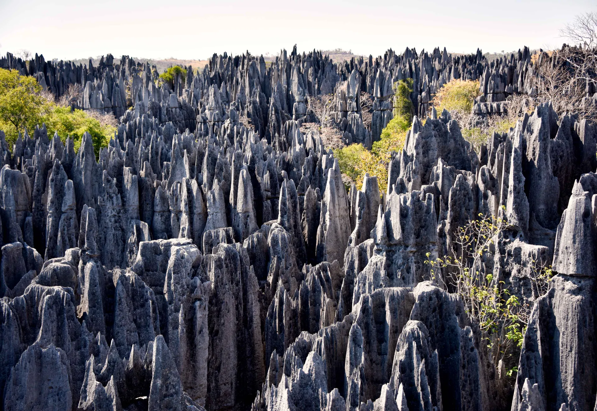

The edge of one blade
At the crest of a tsingy blade, the rock between two rain channels can thin to a partition with almost no width at all. That is where the sharpness lives, and it has a mechanism.
Karst scientists call the channels rillenkarren. They are small, straight, parallel grooves that start at the very top of a steep limestone surface and run directly down its fall line. In the classic laboratory study of how they form, J. R. Glew and D. C. Ford described them as "tightly packed together, interfluves being limited to mere partitions tapering to razor-sharp edges." The phrase is a geomorphologist's, not a travel writer's, and it is precise: the ridge between two grooves is not a ridge of rock that resisted. It is what remains when two grooves have eaten towards each other from both sides.
What cuts them is rain, but in a specific way. Glew and Ford ran simulated rainfall over soluble blocks tilted between 22 and 60 degrees and found that the grooves form only where the sheet of water on the surface is too thin to cushion the impact of falling drops — about 0.15 millimetres thick at the head of a 45-degree slope in their experiments. Each drop strikes almost bare rock. A little further down, the water film thickens, the drops stop reaching the stone, and the grooves die out into a smooth planar surface. So the most aggressive dissolution is concentrated at the top of every steep face, which is exactly where a blade is thinnest.
That is why the edges are sharp and why they stay sharp. The same process that removes rock also keeps the crest pointed, because the crest is permanently the zone of thinnest water and hardest impact. The Hungarian team who surveyed the Bemaraha tsingy in detail listed "blade ridges (with rillenkarren)" among the characteristic forms on its surface, alongside runnels, solution pans and rainpits, and noted that the karren here are considerably larger than those at Ankarana in the north.
Everything else in this guide is the same rock at a larger scale. The blade sits in a field of blades; the field is cut by fissures that behave in a way surface rain cannot explain; the fissures hold a forest; the forest holds animals found nowhere else; the animals and the rock sit on land that the Sakalava and others live around and that the dead are said to occupy; and all of it is reached, for seven months of the year, down a single unpaved road. Each chapter steps out one frame.
Nobody from Hidden Corners has been to Bemaraha. What follows is built from peer-reviewed geomorphology, Madagascar National Parks' own published information, IUCN and UNESCO assessments, and Malagasy press reporting, with check dates recorded. Two prices are moving as this is written, and the budget chapter sets out exactly what could and could not be confirmed.
How the blades were made from below
A single blade is sharpened from above. The field of blades was not made that way, and the difference is the most interesting thing the published geology says about Bemaraha.
The rock is a Jurassic limestone sequence 300 to 500 metres thick, laid down as shallow marine carbonate. The geoheritage inventory of the International Union of Geological Sciences places it in the Bajocian to Bathonian stages, close to 170 million years old; IUCN's 2025 conservation assessment describes it as mid-Jurassic and "approximately 200 mya". The two figures do not agree, and this guide reports both rather than choosing. Faulting tilted the beds so that they dip to the west, and two sets of joints cut through them, one striking north-north-east to south-south-west and one west-north-west to east-south-east. Those joints are the grid on which everything else was drawn.
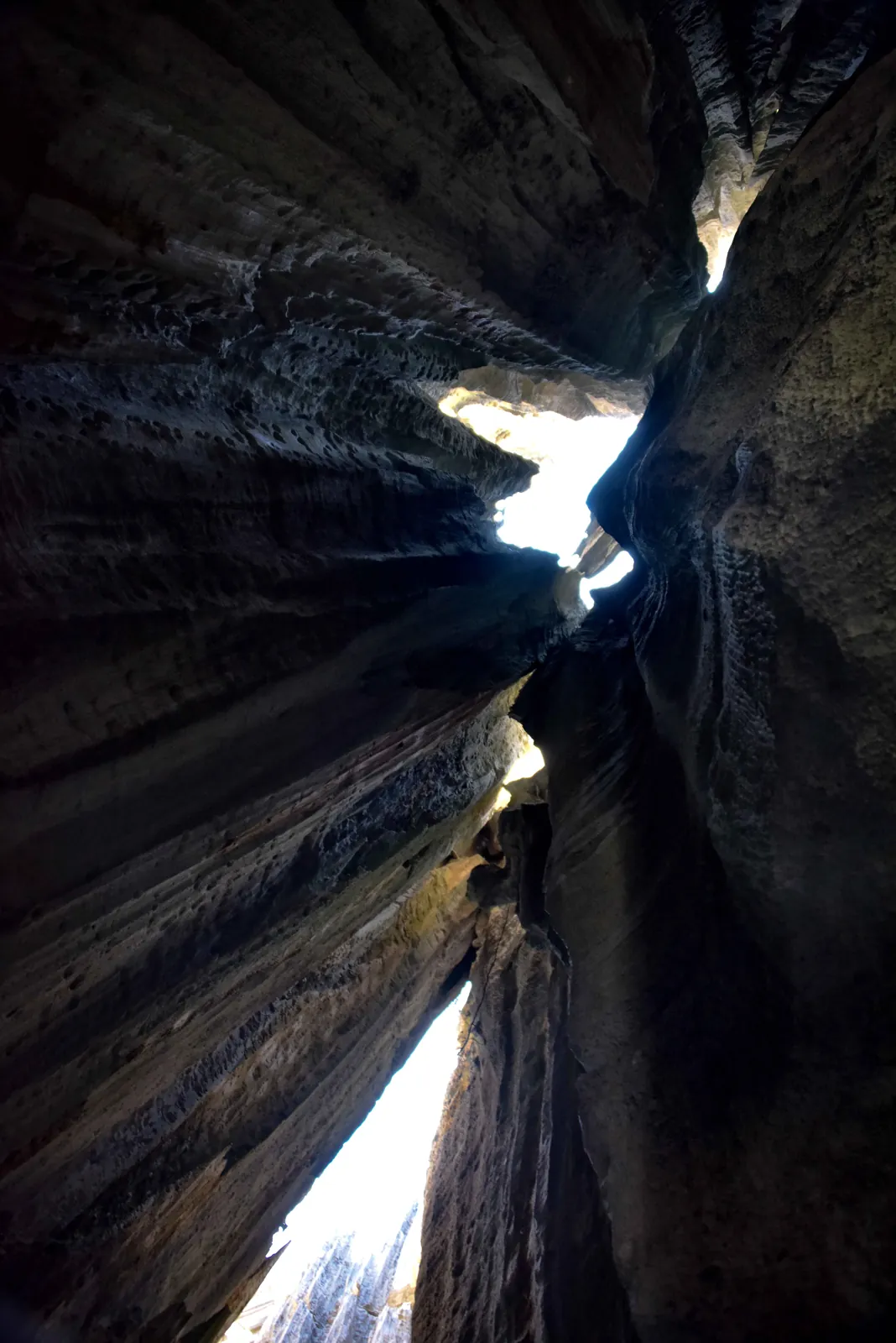
The obvious explanation is that rain ran into the joints and widened them into fissures, leaving the rock between standing as pinnacles. In 2008 Márton Veress and colleagues, working from surveyed profiles and measured fissure directions, published a paper in the International Journal of Speleology that rejects that as the main mechanism. Their argument is partly chemical — surface water carrying little dissolved load, they wrote, "cannot widen joints into a dense and labyrinth-like grike system" — and partly a matter of shape. Fissures cut from the surface downwards should narrow as they deepen. At Bemaraha the most widespread type of composite fissure does the opposite: it is "narrow at the top and wide at the bottom and has oval cross-section." That is the profile of a cave passage, not a crack. The paper states the conclusion directly: the fissures "could not have been formed by dissolution due to the action of surface waters" working alone.
Their reconstruction, which builds on earlier work by Delaty and colleagues, runs like this. The base level for the whole massif is the Manambolo River. For most of the landscape's history the karst water table sat just below the surface — in the area they called the Little Tsingy, at most one or two metres down. Water moving at and below that level dissolved horizontal passages along the joints. Seasonal flooding of the Manambolo raised and lowered the water table, and during glacial periods, when sea level fell, the lower parts of the cave network could have extended down towards the old sea level. The caves widened and joined. Then they were opened to the sky, either because dissolution from above broke through into them or because their roofs fell in. The authors found features consistent with collapse, and they noted that "natural bridges develop from partially destroyed roofs" — a surviving piece of cave ceiling left spanning a fissure. They also recorded pendants, spires a few decimetres high of the kind that hang from cave roofs.
It is worth being exact about what the paper claims, because popular accounts tend to flatten it into "the tsingy are collapsed caves." The paper's own summary is that most fissures were "created from caves formed under the karst water table and subsequently opened up to the surface," and that the predominant process "may have been downward progressing dissolution or the collapse of cave roofs." The origin in caves is the finding. Exactly how each cave was opened is left as two possibilities.
Soil and plants did the rest of the deepening. Soil collects on fissure floors and is washed in from the blade tops around them; the paper notes that it "is preserved on grike floors favouring further deepening", and that where deep fissures let in enough light, "the acids and the stress produced by roots contribute to solution." The forest that grows in the gaps is not decoration on a finished landscape. It is still part of the machinery.
The two areas the survey measured show the same process at two depths. In the Little Tsingy, beside the river, fissures are mostly one to three metres wide, though some reach five or even eight, and five to twenty metres deep, spaced ten to fifteen metres apart. In the Great Tsingy, eight kilometres to the north, fissures run from a few metres to some tens of metres wide and mostly 80 to 120 metres deep, spaced fifteen to thirty metres apart. One runnel on the Great Tsingy was more than ten metres deep and less than a metre wide, its floor stepped in rises of one to two metres. The survey gives the highest point of the Little Tsingy as 190 metres above sea level, only 140 metres above the river's present low-water level of 50 metres, which is why the water table could never have been far below the surface there.
The rainfall that drives all this is seasonal. The paper gives 1,000 to 1,500 millimetres a year for the Bemaraha region, and cites Morondava, on the coast to the south, as an example of how concentrated it is: 710 millimetres of an annual 780 fall in the four months of the wet season. An earlier version of this guide attached the 710-millimetre figure to Bemaraha itself. That was wrong, and it is corrected here.
For scale, UNESCO describes pinnacles rising up to 100 metres, and IUCN describes the Bemaraha plateau as 250 kilometres long. The word tsingy is glossed in nearly every travel account as "where one cannot walk barefoot". The scientific literature uses the word untranslated, and this research found no scholarly source for the gloss. It is a good line, and it may be folk usage, but it is not an established etymology.
Readers who like landforms whose obvious story turns out to be wrong will find a parallel in our guide to the Richat Structure, where the popular story of something striking from above gave way, as here, to a process working from below.
What the pinnacles do to a body
Put the two previous chapters together and you have the terrain a visitor actually moves through: a lattice of razor-crested blades standing over fissures that are, on the Great Tsingy, commonly as deep as a thirty-storey building is tall, and that widen as they go down. There is no ground between the blades in the ordinary sense. There is the top of the rock, and there is a drop.
Madagascar National Parks' response to that geometry is two rules, both published on its Bemaraha page and neither negotiable. A guide must accompany every visit to the park. And, in the park's own words, the "port de baudrier" — wearing a harness — is "obligatoire pour toute visite des Tsingy", compulsory for any visit onto the tsingy. The harness is the park's answer to fissures that do not have a bottom within reach. The guide is its answer to a labyrinth that, as the fissure survey makes plain, has no natural paths through it.
The park publishes its circuits by what they ask of you, and reading them in that light is more useful than reading them as a menu. Tantely is described as the site's "test" circuit, with the park's own parenthesis explaining what is being tested: vertigo, and ease of movement. It exists to find out, before a longer day, how a given person handles exposure. Andamozavaky is the panoramic circuit, listed with a suspension bridge and sunset. Anjohimanitsy is offered over one or two days. Manambolobe begins with an abseil down into a limestone shaft. Berano is a caving circuit through underground galleries and canyons. Andadoany and Ankeligoa move through the canyons at the fissure bottoms, which the park describes as a way to see the genesis of the tsingy — a description that fits the cave-origin reading closely.
The fixed equipment on the Grand Tsingy circuits — cables, bridges and anchored sections that operators describe as via ferrata — is widely mentioned in travel accounts, and Dadamanga, an Antananarivo-based operator whose Bemaraha access guide was updated on 10 September 2026, distinguishes the Petit Tsingy by its "easier walking trails" from the Grand Tsingy with its "via ferrata sections, suspension bridges". MNP's page names the bridge and the harness but does not publish a description of the fixed protection itself, its standard or its inspection. This guide therefore does not describe how the protection is built or how it is used. That is the guide's job on the day, and it is the reason the guide is compulsory.
Three things the rock does to a body are worth knowing before arriving, because none of them depends on the equipment.
It abrades. A surface finished in razor-edged partitions acts on skin, fabric and soft footwear like a coarse file. Every contact with the rock to steady yourself is a contact with those edges. This is why gloves, long sleeves and stiff-soled boots appear in the packing chapter, and why they are there for abrasion rather than for comfort.
It reflects. Bare pale limestone throws heat and light back up at you as well as receiving them from above. The park opens at 06:30, and the early start is not an arbitrary rule: it is the only part of the day when the rock is not also a heat source.
It keeps what it takes. Anything dropped between blades falls into a fissure that may be tens of metres deep and is not, in any practical sense, recoverable. Loose straps, lanyards and bags are a hazard to the owner's belongings and, on a cabled section, a snag.
The rule about the harness sits badly with people who think of themselves as competent scramblers. The geometry does not care. A slip on a normal mountain path usually ends on the path. A slip between blades ends in a slot whose walls converge overhead and widen below, which is the worst shape of hole to fall into and the hardest to be extracted from. The park's rule reflects the rock's structure, not an assumption about visitors.
The forest in the gaps
Step back from the blades and look down. The fissures, canyons and gorges between them are a separate habitat with conditions the tops do not share: shade, trapped soil, retained moisture and, at the bottoms of the wider canyons, something closer to forest floor than rock.
The fissure survey explains why vegetation is there at all. Soil washes off the blade tops and accumulates on fissure floors; where fissures are deep but wide enough to let light in, roots establish, and their acids and physical stress deepen the rock further. The plants are feeding on the same process that made their habitat. In the widest gaps the result is a forest standing in a stone corridor, below a canopy of limestone rather than beside one.
The published plant counts differ by source and date, and they are given here as published. IUCN's 2025 assessment records at least 583 plant species from 102 families on the Bemaraha plateau, citing botanical work by Rabarison in 2000 and Schatz in 2001, and its 2020 assessment gave 84 per cent national endemism for that flora. Madagascar National Parks' own page now speaks of a flora of more than 650 plant species. The difference probably reflects later collecting rather than disagreement, but no source found here reconciles them.
The same forest-and-rock split runs through the animal record. The reference herpetological survey of the plateau, by Bora and colleagues, published in Herpetological Conservation and Biology in 2010 from fieldwork between January and April 2006, found that 48 per cent of the amphibians and reptiles recorded "appear to be dependent on forest habitat". Nearly half the herpetofauna of a place famous for bare rock needs trees.
That forest is not only in the fissures. The Bemaraha massif stands above a band of dry deciduous forest along the foot of its escarpment and in the country around it, and it is here, rather than on the pinnacles, that the pressures recorded by IUCN concentrate. The 2025 assessment rates fire, agricultural encroachment and selective logging as high threats, each affecting scattered areas within the property. A limestone lattice cannot be cleared for pasture or cut for charcoal. The forest at its base can.
The dwarf chameleons illustrate how fine this pattern gets. A study published in Oryx in 2008 recorded three Brookesia species in the national park. B. brygooi is widespread in western Madagascar. B. perarmata is endemic to the park. B. exarmata appeared restricted to the karst forests of the plateau — the forests in and among the limestone. The authors found the highest densities of the priority species in Bendrao forest, and named overgrazing, bushfires, tree removal and agricultural expansion as the pressures on them.
The Manambolo gorge, which the river cuts through the massif, is the largest of the gaps and the easiest to see. MNP describes its walls as abrupt, 50 to 80 metres high. It has its own chapter below, because it is also the park's lowest-effort way in.
The species the limestone keeps
Bemaraha's endemism is the product of isolation at several scales at once: a massif walled off by cliffs and rivers, fissure habitats walled off from each other by rock, and a strict reserve walled off by law. Several of its animals are recorded from nowhere else, and several have changed status or even name within the last two decades. The details below are current to the sources cited and should be rechecked, because Red List categories move.
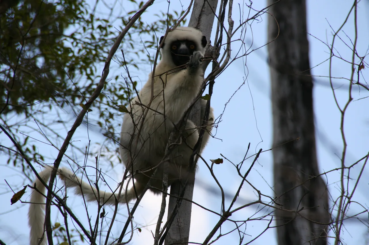
Decken's sifaka, Propithecus deckenii. This is the white sifaka that appears in most photographs of the pinnacles. Its range lies west of the Mahavavy River and north of the Manambolo, which places the tsingy near its southern limit. The IUCN Red List assessment by King and Rakotonirina, published in 2020, lists it as Critically Endangered. Many travel pages, and the previous version of this guide, still describe it as Endangered; that is out of date. Its presence on bare limestone is part of the spectacle, but the forest in and below the massif is what sustains it.
The Bemaraha woolly lemur, Avahi cleesei. Described in 2005 by Thalmann and Geissmann, from a type locality about three kilometres east-north-east of the village of Ambalarano, it is known from subhumid forest at the base of the escarpment north of the Manambolo and nowhere else. The Red List summary compiled by the Lemur Conservation Network from the 2020 IUCN assessments lists it as Critically Endangered. It is nocturnal and was unknown to science until this century, which says something about how much of the massif's edge has been examined.
The brown lemur, and a name that changed. Visitor literature for Bemaraha routinely lists the red-fronted brown lemur, Eulemur rufifrons. In 2008 Mittermeier and colleagues split the old red-fronted brown lemur into two species, with the Tsiribihina River as the boundary: E. rufifrons to the south and the red lemur, E. rufus, to the north, in dry forest as far as the Betsiboka. Bemaraha lies north of the Tsiribihina. On the published range boundaries, then, the brown lemur of the massif should be E. rufus, and the name visitors see may be a survival of the older taxonomy. This research found no Bemaraha-specific survey confirming which name applies, and records it as an open question rather than resolving it. Both species are assessed as Vulnerable in the 2020 Red List assessments, so the conservation picture is the same under either name.
The reptiles and amphibians. Bora and colleagues recorded 19 amphibian and 60 reptile species from ten sites between 57 and 571 metres above sea level. Thirteen per cent were previously unknown to science; a further 15 per cent were of uncertain status and possibly undescribed; 28 per cent are endemic to the Bemaraha plateau. They reported species richness significantly higher than at any other dry-forest site in Madagascar and recommended further survey "especially in the centre of the national park and in the Réserve Naturelle Intégrale." Descriptions have followed slowly. The nocturnal gecko Paroedura neglecta was collected at two sites in central-western Bemaraha in 2006 and formally described in Salamandra in 2019. Its describers reported at least six Paroedura species from the massif, and could not confirm three others previously reported, which they attributed to limited sampling.
The trade, and a shift in the record. Two species from the massif have long been targets for collectors: the dwarf chameleon Brookesia perarmata and the leaf-tailed gecko Uroplatus henkeli. IUCN's 2020 assessment said collection apparently continued at unknown rates. Its 2025 assessment puts it in the past tense, saying both "were both formerly collected illegally from within the Tsingy de Bemaraha National Park." Whether that reflects a real decline in collecting or a change in what the assessors could document is not stated. For a visitor the practical point is unchanged: if a guide finds a Brookesia, look and move on, and treat any offer to show animals off-circuit with suspicion.
The part nobody may count. The larger, northern part of the massif is a Réserve Naturelle Intégrale, a strict nature reserve, closed by law to everything except approved research and specific ritual use. That is where the herpetologists said survey was most needed. The numbers above therefore describe a fraction of the massif, and very likely an undercount of what it holds.
Sakalava land, Vazimba tombs and the guides at the gate
Widen the frame again and the massif stops being a natural object and becomes somebody's surroundings. The sources on this are thinner than the geology, and this chapter stays inside what they say.
Madagascar National Parks describes the population around Bemaraha as mixed but majority Sakalava, and characterises the Sakalava as an ethnic group whose rules on the rational use of biodiversity, expressed through fady — prohibitions — have a conserving effect on nature. That is the park authority's own framing, and it deserves to be read as such: a statement by a conservation agency about a neighbouring people, not an ethnography.
The dead occupy the landscape too. MNP's description of the Oliha circuit, which takes in natural pools, names "tombeaux des Vazimba" — Vazimba tombs — among its features. IUCN's 2025 assessment goes further, stating that "the Tsingy of Bemaraha are believed to be the tomb sites of the aborigines' ancestors, the 'vazimba' and the final resting place of the souls of the ancestors," and that local communities regard the protected areas as sacred zones known as ala faly. In Malagasy tradition the Vazimba are associated with the island's earliest inhabitants, and the belief IUCN records attaches that memory to the tsingy themselves. This guide does not go further than that, and does not publish or request images of tombs.
The conduct that follows is simple. Where a circuit passes tombs, the guide's instruction on distance, approach and photography is the rule. There is no version of that encounter in which a visitor's own judgement improves on the guide's.
The guides are the local institution the whole visit runs through. The Association des guides touristiques du Bemaraha sets its own tariffs. It notified the industry by letter in September 2025 of an increase first intended for 1 January 2026, and applied it from mid-April 2026, at the opening of the season. Its president, François Tsimihozo Tongasoa, told L'Express de Madagascar that the revision was driven by "trois principales raisons": the rising cost of living, the practice of a difficult profession, and the seasonality of tourism.
The third reason is the one visitors are least likely to consider. The park's published season runs from mid-April to mid-November. A Bemaraha guide's earning year is roughly seven months long, and it ends when the road closes. A July fee is also paying for a February.
The same report carried a dissenting voice, and it belongs here too. A driver who brings visitors to the park told the paper that the increase "ne me dérangerait pas" — would not bother him — if it came with better service, adding that at busy periods the welcome at one of the country's most remote destinations was not always up to standard, with "personnel peu qualifié", insufficiently trained staff. Both views are on the record; neither is ours to settle.
The guides also work inside a landscape under pressure at its edges. IUCN's 2025 assessment rates tourism impacts as a very low threat, localised to under five per cent of the property, and notes that "tourism impacts remain spatially limited due to inaccessibility". The rock that forces visitors onto a handful of circuits is also containing them. The high threats — fire, agricultural encroachment, selective logging — come from the surrounding land economy, which is the economy the guides' households belong to. For a comparison with a Malagasy massif where that relationship is still being worked out, our guide to the Makay is the natural companion to this one.
Rules, fees and the 1 November change
This is the chapter most likely to be out of date when you read it. What follows is exactly what could be verified, and when.
The rules. Madagascar National Parks publishes visiting hours of 06:30 to 16:30. A guide is compulsory for every visit, and a harness is compulsory on the tsingy. Neither the guide nor the harness is included in the entry ticket.
Who may go where. The massif is administratively two places. The southern part was redesignated a national park by decree in 1997 and is the only part open to tourism. The northern and larger part remains a Réserve Naturelle Intégrale; Article 12 of Madagascar's 2015 Code de Gestion des Aires Protégées prohibits access and resource use throughout such a reserve except for research or very specific ritual purposes approved in its management plan. The area figures conflict — MNP gives 157,710 hectares, while the older UNEP-WCMC datasheet gives 152,000, of which 85,370 are strict reserve and 72,340 national park — and IUCN recommended in 2020 that the question be clarified. Bemaraha was inscribed on the World Heritage List in 1990 as the Tsingy de Bemaraha Strict Nature Reserve; since the 2023 boundary modification it has been one of six components of the Andrefana Dry Forests serial property, 734,298 hectares with an 838,035-hectare buffer zone.
1. Park entry, per person per day. An older MNP Bemaraha page, checked on 29 September 2026 but now returning 404, listed 55,000 ariary for a foreign adult and 25,000 for a foreign child, with Malagasy rates of 2,000 and 500.
The change. MNP has announced that entry fees across its parks will double. The start date has moved more than once. Midi Madagasikara reported in November 2025 that an increase first set for 1 January 2025 had been postponed to November 2026 at the request of tour operators; an August 2025 report in L'Express de Madagascar had given 1 January 2026. L'Express reported in May 2026 that the doubling takes effect on 1 November 2026, the first change in twelve years, with 65 per cent of ticket revenue going directly to maintenance, wildlife protection and management. The published tiers set international rates of 130,000 ariary for "exceptional" parks such as Isalo and Ankarana, 110,000 for UNESCO Biosphere Reserves and the Nosy Hara marine park, 90,000 for "escape" parks such as Andringitra and Masoala, and 45,000 for "adventure" parks. Bemaraha does not appear in any tier list found in this research. It is a World Heritage property, not a Biosphere Reserve, so the 110,000 tier cannot be assumed. No post-November figure for Bemaraha is quoted here, and no report was found after May 2026 either confirming or moving the date again. If you travel on or after 1 November 2026, check MNP directly and assume a substantial increase.
The August 2025 report also listed complementary activities, including access to natural pools, at 50,000 ariary for international visitors from 1 September 2026. Whether that applies to the natural pools on Bemaraha's Oliha circuit could not be established.
2. Guiding, per group. The guides' association's rates from mid-April 2026, as reported by L'Express on 5 May 2026: standard circuits 260,000 ariary for one to four foreign visitors, up from 175,000, and 310,000 for five or six; national visitors 230,000 to 260,000 for one to six. The exceptional circuits — listed as Broadway, the Manambolobe gorge, Andadoany, the Manambolo gorge, and the Grand and Petit Tsingy — cost 330,000 to 370,000, about 30 per cent more than in 2025. A pirogue trip of one to two hours is 50,000, up from 35,000. "Broadway" does not appear among MNP's nine named circuits, and the two lists have not been reconciled; ask what a circuit name means on the day.
The unit matters. Guiding is priced per group, so four people on a standard circuit pay a quarter each of what one person alone pays. Joining others is materially cheaper, and in a seven-month season it spreads a limited number of guide-days further.
3. Vehicle. Usually the largest single cost, not published by the park, and quoted per vehicle. Get it in writing before leaving Morondava, including fuel, the driver's food and lodging, and both ferry crossings.
Earlier versions of this guide gave dollar conversions. They have been removed: the ariary figures are the prices, and the exchange rate moves faster than this page will be revised.
The Manambolo by pirogue
The river is the largest frame of the rock itself. In the fissure survey's reconstruction, the Manambolo is the base level for the entire Bemaraha karst: its floods raised and lowered the water table that dissolved the caves, and its present low-water level, about 50 metres above sea level, sets how deep the system can drain. The gorge it has cut through the massif is therefore not a separate attraction beside the tsingy. It is the drain the tsingy were made around.
MNP lists the Gorges de Manambolo as one of its nine circuits and describes walls 50 to 80 metres high. The guides' association lists the Manambolo gorge among its exceptional circuits, and a pirogue trip of one to two hours as a separate 50,000-ariary charge. The park's description does not give durations, and it is worth asking whether a quoted gorge trip includes the pirogue, the guide, or both.
For visitors who do not want sustained exposure, the gorge is not a consolation. It shows the massif in section — the full height of the rock from the water, rather than its surface from above — and it involves no harnessed climbing. For everyone else it is the natural counterweight to a day on the Grand Tsingy.
The river is also a way to arrive. MNP documents a pirogue descent from Ankavandra to Bekopaka along the Manambolo, taking three to four days, with Ankavandra itself reached by air. It is the slowest approach and the only one that enters the massif along the line that made it. The park gives no current operator, price or schedule for it, and this guide does not invent one.
The Morondava–Bekopaka road
The last frame is the road, and it governs everything else.
The main route. Route nationale 8 runs 198 kilometres from Morondava to Bekopaka, the village at the park's main entrance. Only about the first 15 kilometres are paved; the rest is unpaved. It crosses the Tsiribihina by ferry at Belo-sur-Tsiribihina and the Manambolo near Bekopaka, and it passes the Avenue of the Baobabs about 20 kilometres north of Morondava. MNP gives the Morondava–Bekopaka drive as about eight hours by 4x4, including a river crossing of about an hour, and states that the route is usable from May to November.
Getting to Morondava. MNP gives Antananarivo to Morondava as about 600 kilometres, roughly a day. Dadamanga's September 2026 guide gives the drive as eighteen hours and notes commercial flights to Morondava and private charters to Bekopaka.
The Antsalova approach. MNP documents a secondary road of about 100 kilometres to Bekopaka, around four hours by 4x4, also May to November.
The river approaches. Besides the Manambolo descent from Ankavandra, MNP lists a motorised pirogue from Miandrivazo to Belo-sur-Tsiribihina on the Tsiribihina, about three days, which joins the RN8 at Belo.
Security. The approach from Miandrivazo passes through country covered by specific security advisories; our guide to the Makay massif sets out the current US ratings for that corridor, and the two should be read together by anyone combining them.
The map on this page shows Bekopaka and the massif for orientation. It does not show circuits, does not establish that the road or either ferry is passable, and no part of the strict reserve to the north is open to visitors.
When the road shuts
MNP publishes access to Bemaraha as seasonal, from mid-April to mid-November. It describes the climate as dry tropical with two sharply contrasting seasons: rain from November to April, dry from May to October. Its road information gives the overland routes as usable from May to November. The three statements do not quite line up, and the gap — the second half of April — is when the park may be open but the road not yet reliably passable.
A dated operator source adds a different picture of the closing end. Dadamanga's access guide, updated on 10 September 2026, states that the park "closes annually around mid-December, typically reopening starting sometime in April", and that the company does not sell Bemaraha trips after the end of November or before the first week of May. That later closing date conflicts with MNP's mid-November, and this guide does not resolve it. The park authority's figure is the one to plan around; the operator's is a reminder that the edges of the season are set by the road on the day rather than by a date.
Heavy rain can interrupt roads, river crossings and transfers. The useful preparation is a dated local access report and a cancellation plan agreed before departure.
Mid-April to June. The road has only just reopened; confirm the track and both ferries rather than assuming. This is also when the guides' tariffs change, as they did in mid-April 2026.
July to September. The dry, reliable heart of the season and the busiest. The popular pinnacle circuits are not solitary on a peak-season morning.
October to mid-November. The hottest, dustiest end of the window, with fewer visitors and a closing date to respect. Trips after 1 November 2026 will fall under the new entry tariff.
In every month the same two constants apply: start at 06:30, before the limestone becomes a second sun, and treat the eight-hour drive as a full day each way.
What to settle before you pay
Most visitors arrive on an arranged trip from Morondava. The questions worth asking are unusually concrete.
- Which circuits, by name. A trip sold as "the tsingy" may mean only the Petit Tsingy. Ask which circuits, on which days, and whether each is a standard or exceptional circuit on the guides' tariff.
- What is included. Entry, guiding, harness, pirogue, vehicle, fuel, both ferries, the driver's costs and meals are separate by default.
- Which entry tariff. For travel on or after 1 November 2026, ask whether the quote uses the old or new park fee and who pays the difference.
- Exposure. If height or narrow ground is a problem, say so early. Tantely exists to test exactly that, and the gorge is a complete visit on its own.
- Margins. For late April, early May or November dates, ask what happens if the road or a ferry is not passable.
Madagascar National Parks is the authority on hours, circuits and tariffs; it does not sell tours. Hidden Corners has no commercial relationship for this destination, has tested no operator and names none as a recommendation.
Packing for a surface that files
The list follows from what the rock does: it abrades, it reflects, and it keeps what falls into it. Add a long dusty drive at either end.
Stiff-soled boots or approach shoes, broken in, with good grip. Soft trainers do badly against razor-crested limestone.
Lightweight gloves. Every hand placement is on a rasp-like surface; gloves are the item most often wished for.
Long sleeves and long trousers in light fabric, as abrasion protection. Trousers also sit better under a supplied harness than loose shorts.
Sun protection from below as well as above. A brimmed hat, sunglasses, and sunscreen under the chin and nose, where reflected light reaches.
More water than the distance suggests. Effort on cabled ground in heat is not comparable to walking a path.
Nothing dangling. Secure camera straps and lanyards, and carry a lens cloth for limestone dust. Anything dropped into a fissure is gone.
A dry bag for the pirogue on the Manambolo.
For the road. Dust protection for electronics, and everything needed for eight hours within reach.
No harness, helmet or climbing hardware is on this list. Safety equipment is the park's requirement and the guide's responsibility, and bringing your own does not change either. Confirm the guide's required equipment before travelling.
Shaping the days
Four days from Morondava is the realistic minimum: a driving day in, two days at the park, a driving day out. Three park days make the gorge and the longer circuits realistic rather than theoretical.
Arrival afternoon. If light allows after the drive, Tantely or the Petit Tsingy are the lower-commitment introductions, and a sensible way to learn how you handle the terrain before a full day on it.
A pinnacle day. Start at opening on the Grand Tsingy circuits and aim to be off the exposed rock before the middle of the day.
A gorge day. The Manambolo by pirogue is shaded, low-effort, and shows the massif in section. Follow the guide's instruction wherever tombs are passed.
A further day opens the specialist circuits — Manambolobe's abseil, Berano's caves, Oliha's pools — which the guides' tariff and MNP's descriptions suggest are where the variety lies.
Many itineraries combine Bemaraha with the Avenue of the Baobabs, which sits on the same road near Morondava.
Further reading
These are recommended from publishers' descriptions, abstracts and assessments, not from our own reading of complete texts.
- IUCN World Heritage Outlook, Andrefana Dry Forests. Free, finalised in October 2025, and unusually candid about threats, research gaps and cultural values, including the Vazimba belief. Read the assessment.
- Hilary Bradt and Daniel Austin, Madagascar (Bradt Travel Guides). The standard English-language practical guide to the country. Check the edition, and check tariffs against MNP: no printed guide will be current on the November 2026 change. Edition unverified; publisher search.
- Nick Garbutt, Mammals of Madagascar: A Complete Guide. An illustrated field guide to the island's mammals. Note that editions predating the 2008 brown-lemur split will use older names. Edition unverified; publisher search.
Free and open: Madagascar National Parks' Bemaraha page for hours, circuits and the current tariff, and the Veress et al. paper on how the tsingy formed.
Questions travellers ask
Why is the rock so sharp?
Rain striking a thin film of water on steep limestone cuts tightly packed grooves called rillenkarren; the partitions between them taper to razor-sharp edges, and the process keeps the crests pointed.
Are the tsingy collapsed caves?
The 2008 survey concluded that most fissures began as caves formed below the water table and were later opened to the surface — by collapse of their roofs or by dissolution from above. The cave origin is the finding; the opening mechanism is left as two possibilities.
When is the park open?
MNP publishes mid-April to mid-November, 06:30 to 16:30, and gives the roads as usable May to November.
How much does it cost?
The former official page listed 55,000 ariary per foreign adult per day; confirm today's entry fee with MNP. Guiding, from a published 260,000 ariary per group, and transport are separate. Entry fees are announced to double from 1 November 2026; Bemaraha's new figure could not be confirmed.
Do I need a guide and a harness?
Yes. A guide is compulsory for every visit, and a harness for any visit onto the tsingy.
Can I enter the strict nature reserve?
No. The northern reserve is closed by law except for approved research and specific ritual use.
Which lemurs might I see?
Decken's sifaka is the one most often photographed on the pinnacles, and it is Critically Endangered. No sighting is guaranteed; keep your distance and never bait.
Back to the edge
Every frame in this guide has widened out from one small fact: where rain meets steep rock through a film too thin to stop it, the rock between two grooves is worn down to an edge.
Below that edge the blade stands over a fissure that began as a cave. The fissure holds soil and roots that are still deepening it. The forest there holds a chameleon found only here and a lemur that was unknown until 2005. Around the massif live the people whose dead are believed to rest in it, and the guides whose season is as long as the road is open.
A visitor meets all of that at the smallest scale: a gloved hand on a crest, on a harness, with a guide. The glove is there because of the edge. The harness is there because of the cave. The guide is there because of everything in between.
Sources
- Madagascar National Parks, Bemaraha — season, hours, tariffs, circuits, access, population and climate; rechecked 29 September 2026 — parcs-madagascar.com
- Glew, J. R. and Ford, D. C. (1980), "A simulation study of the development of rillenkarren", Earth Surface Processes — academia.edu
- Veress, M., Lóczy, D., Zentai, Z., Tóth, G. and Schläffer, R. (2008), "The origin of the Bemaraha tsingy (Madagascar)", International Journal of Speleology 37(2) — digitalcommons.usf.edu
- IUGS, Tsingy of Bemaraha geoheritage site — iugs-geoheritage.org
- IUCN World Heritage Outlook, Andrefana Dry Forests, assessment finalised 11 October 2025 — worldheritageoutlook.iucn.org
- UNESCO World Heritage Centre, Andrefana Dry Forests and the 2023 boundary modification — whc.unesco.org, decision
- Bora, P. et al. (2010), amphibians and reptiles of the Tsingy de Bemaraha plateau, Herpetological Conservation and Biology 5(1) — madagasikara-voakajy.org, abstract
- Köhler et al., Paroedura neglecta, Salamandra 2019 — salamandra-journal.com
- Oryx (2008), dwarf chameleon conservation in Tsingy de Bemaraha National Park — cambridge.org
- Lemur Conservation Network, IUCN Red List status of lemurs (2020 assessments) — lemurconservationnetwork.org
- Von der Decken's sifaka, citing King and Rakotonirina (2020) IUCN assessment — wikipedia.org
- Red lemur and the 2008 split of Eulemur rufus and E. rufifrons — wikipedia.org, wikipedia.org
- L'Express de Madagascar, park entry fees to double from 1 November 2026, May 2026 — lexpress.mg
- L'Express de Madagascar, park entry fee increase, August 2025 — lexpress.mg
- L'Express de Madagascar, Bemaraha guiding tariffs revised, 5 May 2026 — lexpress.mg
- Midi Madagasikara, fee increase postponed to November 2026, 25 November 2025 — midi-madagasikara.mg
- Code de Gestion des Aires Protégées (2015), Article 12 — faolex.fao.org
- Route nationale 8 (Madagascar) — wikipedia.org
- Dadamanga, how to get to Tsingy de Bemaraha, updated 10 September 2026 — dadamanga.mg
- ACAPS, Madagascar cyclone and access analyses, 2024–2026
Photograph credits
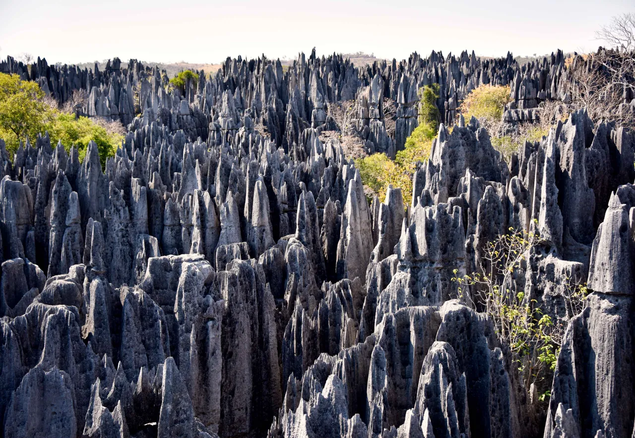
- Tsingy Pinnacles Wide · Rod Waddington · 6 January 2016, 00:24:35 · CC BY-SA 2.0. Resized and converted to WebP; framing may crop the hero. These adaptations remain available under their respective licences.
- Tsingy Fissure Detail · Rod Waddington · 15 June 2016, 22:10:15 · CC BY-SA 2.0. Resized and converted to WebP; framing may crop the hero. These adaptations remain available under their respective licences.
- Tsingy Sifaka · Marco Zanferrari · 23 August 2008 (according to Exif data) · CC BY-SA 2.0. Resized and converted to WebP; framing may crop the hero. These adaptations remain available under their respective licences.
Portrait supplied by Sok Heng Oeun.
A closer look.
Dated photographs show the place, details and wider setting. They are not evidence of present access or conditions.

Sok Heng Oeun
Sok Heng Oeun is the owner and editor of Hidden Corners. The Hidden Corners Editorial Team supports image preparation and editorial checks under his direction.
Sok Heng Oeun on Facebook ↗Research and AI-assisted editorial preparation. Publication authorized by Sok Heng Oeun; an individual owner reading review is not recorded. This guide does not claim a firsthand team visit.
.jpg)


_01.jpg)
