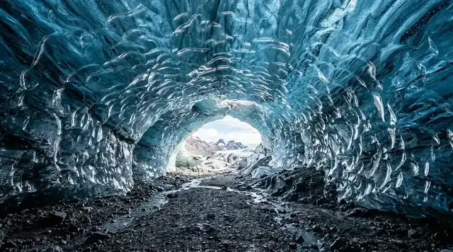
AI illustration
 Edited by
 The Bieszczady do not become empty where the road ends. They become legible. Above the last beech trees, the long grass crests called połoniny hold an eastern horizon with few buildings and no alpine theatrics. Below them, quiet valleys keep another geography: old road alignments, fruit trees without houses, church foundations, wells, crosses and cemeteries. What looks like wilderness is also a landscape from which communities were removed.
This is the far south-east of Poland, where the national park meets Slovakia and Ukraine and where a mountain walk can pass through three different kinds of boundary: the climatic edge of the forest, the protected edge of a trail and a state frontier. The responsible journey is not a search for a blank place. It is an encounter with beech forest, borderland memory and the return of vegetation to fields that were still inhabited within living memory. Silence here deserves attention, but never amnesia.
The empty valley has an address
At first glance, the upper San valley appears to fulfil the Bieszczady myth: forest folding into meadow, a narrow road, then almost nothing before the Ukrainian border. The park itself calls this lower belt the Kraina Dolin, the Land of Valleys. Yet pre-war maps place villages along the water and roads. The park's cultural inventory still follows their structure through church sites, cemeteries, roadside crosses, wells, cellars, field boundaries and old orchard trees. Berehy Górne, Caryńskie, Dźwiniacz Górny, Beniowa and Sianki are not romantic names invented for trails. They are places whose built fabric largely disappeared while their ground plan remained.
Their loss was neither one event nor a neutral retreat from poor soil. The Second World War brought occupation, killing and Polish-Ukrainian violence; the post-war border remade the region; population transfers in 1944–1946 sent many Ukrainian residents to Soviet Ukraine. In 1947, Operation Vistula deported more than 140,000 Ukrainians from south-eastern Poland as a whole and dispersed them across Poland's northern and western territories; the Institute of National Remembrance records the last removals taking place in 1951. The park's own cultural inventory measures what that left behind. Of 51 churches standing in the area in 1939, five survive. Of 44 manors with their farms, none. Of more than 1,342 houses, none. Of 54 cemeteries, twenty survive and a further twelve as traces. Individual villages experienced this sequence differently, so no single sentence can stand in for every family, but the landscape's sudden depopulation cannot be described honestly without forced displacement.
The people most closely associated with many high Bieszczady villages are usually described as Boykos, an Eastern Carpathian highland community within the wider Ukrainian and Ruthenian cultural world. Before war, borders and later national categories hardened, life here was also religiously and linguistically mixed, with Jewish and Polish neighbours in the wider region. A careful visitor does not turn that complexity into a decorative folklore label. Read the cemetery inscriptions where they survive, use the names adopted by the park, and let an absent house remain evidence rather than a prop for a photograph. The valley is quiet because history happened to it, not because nobody ever belonged there.
In Bieszczady, silence is not proof that a place was always empty; sometimes it is what remains after an address loses its house.
 AI illustration
Połoniny: grass above a beech treeline
The feature that makes the Polish Bieszczady instantly recognisable is not a sharp summit but a long, open crest. Połonina Caryńska rises in rounded grassy backs above Ustrzyki Górne and Brzegi Górne; Połonina Wetlińska extends west toward Smerek. These are subalpine communities generally above 1,200 metres, sitting directly over crooked beech woodland. Unlike much of the Western Carpathians, there is no continuous upper belt of spruce forest between beech and open ground. That compressed sequence—valley, lower-montane beech, wind-shaped beech and grass—is the visual grammar an honest illustration must preserve.
The origin of the połoniny has long been debated. The park's botanical account concludes that natural climatic forces probably created the high open belt before settlement, while centuries of grazing, livestock penning, shrub cutting and haymaking lowered and modified the forest edge. Pastoral use largely stopped around 1940, and vegetation has been reorganising ever since. The ridges are therefore neither a man-made lawn nor an untouched alpine relic. Their plant communities carry both natural limits and human work, and the boundary between them continues to move.
Połonina Caryńska offers a compact way to read that structure. The official nature path runs about 9 kilometres between Ustrzyki Górne and Brzegi Górne, with park timings of roughly 3 hours 25 minutes in one direction and 3 hours 15 minutes in the other. Clay-rich ground becomes slick after rain, and the crest has no shelter from lightning or wind. Its highest point is about 1,297 metres, but elevation alone explains little. The experience comes from walking a horizontal line between forested basins, seeing the Tarnica group to the east and Połonina Wetlińska to the west while the border remains a distant, wooded seam.
A połonina is not an alpine summit stripped of rock; it is an Eastern Carpathian conversation between climate, beech and centuries of grazing.
The forest returned, but memory did not vanish
Bieszczady National Park now covers 29,201.06 hectares. About 86 percent is forest, while the official biosphere profile assigns roughly 6 percent to połoniny and 8 percent to other non-forest land. Those proportions can make the wooded landscape seem timeless. Some stands are exceptionally natural and old, but elsewhere forest has advanced across former fields and pastures since the villages were emptied. The park identifies spontaneous secondary succession on extensive depopulated agricultural land as one of its defining ecological processes. Alder, hazel, willow and young trees enter abandoned grass; later woodland closes around orchard survivors and stonework.
That return does not erase human geometry. In Berehy Górne and Caryńskie the former strip-field pattern can still be read in vegetation and relief. At Wołosate, the official path toward Tarnica begins near an old Boyko cemetery and a vanished church site; a restored well, a cellar fragment and fruit trees mark a former farmstead. In Beniowa and Sianki, cemetery stones and chapel or church foundations survive in the upper San landscape. They are protected heritage, not loose artefacts. Do not stand on masonry, move a carved fragment, clear plants for a picture or geotag a fragile object without context.
The park calls the lack of cultural continuity a central conservation problem. Buildings can be repaired, but a chain of everyday knowledge—where a path led, who used a spring, how a feast day sounded—cannot simply be reconstructed after a community has been dispersed. That is why a nature walk through an old valley needs historical attention. The forest is real recovery, habitat and refuge; it can also make an inhabited past harder to see. The most truthful view holds both facts at once: trees have returned by their own ecological momentum, and the ground beneath them remains a cultural archive.
Succession can cover a field boundary with forest, but it cannot turn the field into a place that was never worked.
A beech forest shared across borders
The Bieszczady form the Polish part of the Eastern Carpathians, built largely from alternating sandstone and shale deposited in a deep sea and later folded as Carpathian flysch. Softer layers weather into saddles and valleys while resistant beds hold ridges and rock outcrops. On that terrain, beech dominates the lower-montane forest and bends into low, contorted forms near the upper limit. Dead trunks, cavities and decaying wood support fungi, insects and birds that managed plantations cannot easily imitate. The park is one of Poland's most important refuges for large woodland fungi and for species tied to old, structurally complex forest.
In July 2021, four beech-forest components inside the park joined UNESCO's transnational serial World Heritage property, Ancient and Primeval Beech Forests of the Carpathians and Other Regions of Europe. The property now links component areas in eighteen countries and tells a continental story: European beech recolonised large parts of Europe after the last Ice Age and continues to express remarkable ecological flexibility. World Heritage status does not convert each component into a visitor attraction. Some value lies precisely in processes unfolding away from paths, where fallen wood remains and forest dynamics proceed with minimal interference.
The wider International East Carpathians Biosphere Reserve joins protected areas in Poland, Slovakia and Ukraine. It began as a Polish-Slovak reserve in 1992 and became trilateral in 1998. Published area figures differ among current official pages because national parks, biosphere zones and later reporting boundaries are not the same geometry; the safe lesson is the connected landscape, not one oversized statistic. Wolves, lynx, brown bears, European bison and red deer use habitat that does not recognise a tourist map. Conservation here is cross-border even when people must obey every national frontier.
The numbers are worth stating carefully, because they are usually quoted at the wrong scale. Bison are counted for the Bieszczady specifically: a single-day inventory in March 2026, run by the local forest districts under the Krosno regional directorate, found 880 free-living animals on the Polish side and about sixty more across the Slovak border — roughly a hundred more than the year before. Researchers reading that result worry about density, habitat pressure and the eye parasite telaziosis rather than about scarcity. Wolves, bears and lynx are not counted for the park alone. The Statistical Office in Rzeszów estimated the whole Podkarpackie voivodeship at about 1,300 wolves, 322 brown bears and some 304 lynx in 2023, the last figure being roughly half of every lynx in Poland. Applying a voivodeship total to a single ridge is one of the commonest errors in writing about these mountains.
The forest is continuous in ecological time, but a hiker still moves through legal borders, protected zones and histories that cannot be merged into one number.
Two walks, two versions of remoteness
For the open ridge, choose a signed route across Połonina Caryńska and arrange transport at both ends. Starting from Ustrzyki Górne gives a steady climb through beech before the ridge opens; beginning at Brzegi Górne reverses the sequence. A shorter ascent from Przełęcz Wyżniańska reaches the crest and can continue toward either valley, but it still requires a legal trail, a park ticket and a return plan. Clear weather can expose a wide Eastern Carpathian horizon; cloud can reduce the same ridge to wet grass and the next marker. Do not promise yourself a photograph that conditions may refuse.
For the historical landscape, use one of the park's designated nature-history paths rather than improvising through a vanished village. The Tarnawa Niżna–Dźwiniacz Górny route is officially listed at 9.7 kilometres and about 2 hours 40 minutes each way. The upper San path begins from the Bukowiec parking area and approaches protected traces around Beniowa and Sianki under current access rules. Wołosate offers a more compact pairing of cemetery, former church site and the 4.4-kilometre official ascent toward Tarnica; the park estimates about 2 hours 5 minutes upward to the pass, with the summit spur beyond.
These are not interchangeable experiences. The crest is exposed, popular and visually expansive; the former-village valley is lower, more layered and ethically demanding. If time allows, separate them across two days. Let the first day explain how the land is shaped and the second explain why it looks sparsely settled. A rushed itinerary that races from Tarnica to a cemetery and then to a border marker collects symbols without context. The hidden corner is not one secret coordinate. It is the relationship among ridge, forest, former field and frontier, understood slowly enough that none becomes a background for the others.
Bieszczady becomes more remote when you stop measuring remoteness by kilometres and begin reading what each kilometre contains.
 AI illustration
The border is real, not a scenic metaphor
At Kremenaros, also called Krzemieniec, the borders of Poland, Slovakia and Ukraine meet. A marked route from the Rawka massif reaches the tripoint, and the regional tourism authority describes the Polish-Ukrainian border segment there as the only part of that state line in Poland opened to tourist traffic. That does not mean the frontier itself is generally open. Ukraine is outside the Schengen Area, the boundary is actively controlled, and a painted post is not permission to step across. Stay exactly on the authorised trail and obey temporary instructions from the park and Border Guard.
A route that continues legally into Slovakia may still be affected by seasonal, conservation or operational changes. Verify the same day's park notice and official cross-border status before building a through-hike. Never follow a map app along a faint border track, detour around a closed section or approach a restricted landmark such as Opołonek. The park normally allows access there only during a supervised event with advance registration. In border terrain, an apparently harmless shortcut can become both a conservation breach and an international incident.
Drones are not a solution to restricted access. Bieszczady National Park and its buffer lie within restricted flight zone EP R10, and tourist drone flights require the director's permission; the park's visitor rules do not make the area available for ordinary drone use. Commercial photography and filming also require consent and a fee. Keep the visual story at human height: trail, grass, forest, stone and distance. That perspective is not a limitation. It is more faithful to how a lawful visitor actually encounters the mountains.
A border marker may fit inside a photograph, but the law, history and living frontier around it do not.
Access is organised, even when the view looks wild
In 2026, the park's one-day walking ticket is 11 zł for a standard adult and 5.5 zł for eligible concessions. It applies to the listed tourist trails and nature paths, is collected year-round and can be bought online or at information-and-ticket points where staffed. Keep proof of payment. The governing rule is simpler than any opening-hour table: use marked routes only and walk between sunrise and sunset. Active notices override routine access, and they turn over quickly. As of August 2026 the park has the Bukowiec–San Sources nature-history path on a marked detour for works running from 15 July to 30 September, and the Tarnawa Niżna footbridge over the Roztoka stream closed indefinitely with a designated ford as the alternative. Read the current notice board on the morning you walk, not the one quoted in an article.
Most park trails do not admit dogs. Limited exceptions exist on named road or route sections, generally with a lead and muzzle, while properly marked assistance dogs are treated separately. Bicycles belong on public roads and designated cycling routes, not ordinary hiking trails. Wild camping is prohibited; use Bereżki, Górna Wetlinka, Tarnawa Niżna or another currently authorised site only after checking its operating status. Open flame and camp stoves are not permitted on trails, and fires belong only in designated, managed places under their current rules.
Wetlina and Ustrzyki Górne are the most practical walking bases, while Lutowiska serves the upper San side. Road access is the dependable framework; seasonal private buses and minibuses may connect trailheads, but schedules fluctuate and should not be treated as a guaranteed last ride. Confirm both ends of a linear hike before departure, carry cash as well as a card, and never park on a verge that blocks residents, buses or emergency vehicles. A place can feel remote while depending on ticket staff, trail crews, rescuers, public roads and local accommodation. Paying for those systems is part of visiting responsibly.
Bieszczady is not off-grid; its quiet is held together by rules, trail workers, residents and a return journey arranged before the climb.
Leave with the silence intact
The rounded ridges are serious mountains. Rain turns flysch-derived clay into a slide; fog erases junctions; wind and thunderstorms arrive on exposed grass without shelter. In winter, snow can hide markers and cornices, daylight contracts and the park directs visitors to its current notice and the GOPR avalanche bulletin. Carry a paper or offline map, insulating and waterproof layers, water, food, a headlamp for emergencies rather than planned night travel, and enough battery to call for help. GOPR's mountain emergency numbers are 985 and 601 100 300, and its Ratunek app can transmit a caller's location.
Brown bears live in the park and its buffer. The park advises against night and very early entry, asks walkers to remain on marked paths, make normal human sound in dense woodland and carry every food scrap out. If a bear appears, do not approach, shout or run; keep calm, give it distance and withdraw along the way you came. This is not a reason for theatrical fear or for trying to obtain a wildlife image. Wolves and lynx are even less likely to perform for a visitor. The safest encounter is often evidence—a track or sound—left unpursued.
Spend at least one night locally, buy from village businesses and consider a licensed Beskid guide for history as much as navigation. Photograph memorials without staging them, do not sit on graves, and avoid language that sells deportation as a route to pristine nature. On the ridge, stay on the hardened line even when a parallel strip of grass looks cleaner; erosion spreads quickly where thousands chase the same angle. Bieszczady's strongest story is not that nobody knows it. It is that a popular mountain landscape can still reveal what tourism usually crops out: the people who left, the forest that returned and the border that remains.
The ethical souvenir from Bieszczady is not proof that you found an empty place; it is a better understanding of why the place became quiet.
Hiddencorners position
Present Bieszczady as a real, inhabited and historically disrupted border landscape—not an untouched escape. Pair one open-ridge walk with one designated former-village route, use only authorised trails from sunrise to sunset, and distinguish ecological succession from historical erasure. The hook is emptiness; the correction is memory.
Why the Silence Index is 76
Bieszczady earns a high Silence Index because forest covers most of the national park, settlement is sparse in the upper valleys, the open ridges sit beyond road noise and large protected areas continue across three countries. On a weekday or shoulder-season route, wind in grass and beech leaves can dominate for long periods.
Tarnica, Połonina Wetlińska and Połonina Caryńska are among Poland's best-known mountain walks and can be crowded on summer weekends and autumn colour days. Roads, car parks, grazing, forestry beyond the core and border operations are present. Silence is route- and time-dependent, never a promise of solitude.
Corner Codex — D-031
- Place
- Bieszczady National Park, Poland
- Coordinates
- Approx. 49.125°N, 22.657°E for Bieszczady National Park; Połonina Caryńska crest approximately 49.138°N, 22.604°E
- Getting there
- Reach Wetlina, Ustrzyki Górne or Lutowiska by road; verify seasonal bus/minibus services and pre-arrange the return from any linear ridge walk
- Rules
- Marked trails only, sunrise to sunset, current 2026 ticket required on listed routes; no ordinary drone use, wild camping, off-trail travel or dogs on most paths
- Season
- Late May–June for fresh vegetation, September for clearer air, or midweek October colour; avoid storm forecasts, saturated clay and peak-weekend crowding
- Silence Index
- 76 / 100
- Still open
- How the park can protect recovering forest and fragile cultural traces while visitor pressure concentrates on a handful of famous ridges
Silence Index
A legacy editorial rating based on desk research. It is not an acoustic measurement or a safety rating.
Earlier and later dossiers used different fourth inputs. Individual input scores were not recorded, so these totals cannot be independently reproduced or used for precise comparisons between places.
Read the method and its limitations →
The Traveler's Panel · checked
Changing information. Prices, permits, seasons and road access change, sometimes at short notice. Everything here is a starting point for your own confirmation — not a quote, and not a guarantee. Verify with the operator and the relevant official body before you book.
| Protected area | 29,201.06 ha national park; roughly 86% forest, 6% połoniny and 8% other non-forest land in the official biosphere profile |
| Highest summit | Tarnica, 1,346 m—the highest peak of the Polish Bieszczady, reached only by designated trails |
| Signature route | Połonina Caryńska, about 9 km between Ustrzyki Górne and Brzegi Górne; official average time roughly 3 h 15–25 min |
| History route | Tarnawa Niżna–Dźwiniacz Górny, 9.7 km and about 2 h 40 min each way through a former-village landscape |
| 2026 entry | 11 zł standard one-day ticket; 5.5 zł eligible concession; buy online or at a park information-and-ticket point |
| Public hours | Authorised paths from sunrise to sunset only; live closures and conservation notices override routine access |
| Emergency | GOPR 985 or +48 601 100 300; install Ratunek and save an offline map before leaving reliable signal |
Getting there
- Check the park's current tourist notice, weather and GOPR conditions on the morning of travel.
- Choose either Połonina Caryńska for an open ridge or an official former-village path for cultural history; do not compress both into one rushed day.
- Buy the dated park ticket and confirm parking or the exact last bus/minibus from the finishing trailhead.
- Start after sunrise with an offline map, waterproof layers, food, water and emergency numbers stored.
- Remain on the marked route, give memorials and wildlife distance, and carry out every scrap including food waste.
- Finish before sunset and spend locally rather than sleeping in a park car park or improvising a campsite.
Indicative costs — verify before booking
| Park entry | 2026 one-day ticket: 11 zł standard or 5.5 zł eligible concession; verify current terms before arrival |
| Parking | Varies by official lot, season and vehicle; pay locally or through the current park system and retain proof |
| Local transfer | Seasonal and operator-dependent; agree the route and fare before a linear hike |
| Licensed guide | No stable universal tariff; request a quote for the group size, language, route and historical interpretation |
| Verify | Prices and availability change. Confirm current details directly before booking. |
What to pack
- Paper or offline topographic map plus the day's official trail notice
- Waterproof boots with grip for clay, rain shell and a warm layer even in summer
- Water, food and a sealed bag for every wrapper and food scrap
- Charged phone, power bank, Ratunek app and GOPR numbers 985 / 601 100 300
- Sun protection and a hat for the treeless ridge; tick protection for valley vegetation
- Small binoculars and a notebook; no drone, playback speaker or equipment intended for off-trail filming
Where to stay
Wetlina works well for Połonina Wetlińska and western routes; Ustrzyki Górne is the most direct base for Połonina Caryńska, Szeroki Wierch and Tarnica; Lutowiska is better positioned for the upper San and Tarnawa side. Book registered accommodation, confirm meals and transport in shoulder season, and ask hosts about locally operated transfers. Wild camping and casual overnight parking inside the national park are not substitutes for a legal stay.
Safety & responsible travel
- Check storms, wind, visibility, snow and the current GOPR bulletin; open grass ridges offer little shelter.
- Use marked routes only between sunrise and sunset and obey temporary closures immediately.
- Clay and flysch paths become extremely slippery after rain; adjust the route, not just the walking time.
- Never cross the Ukrainian frontier or follow an unsigned border track; a map line is not a legal crossing.
- Around bears, stay calm, keep distance and withdraw without running; prevent encounters by remaining on trails and carrying out food waste.
- Do not enter cemeteries or ruins as photo sets, move stones, touch fragile carvings or disclose sensitive wildlife locations.
Nearby, and quieter
The Bieszczady Forest Railway offers a separate, managed way to understand the region's transport and forestry history outside the high ridges. Sanok's Museum of Folk Architecture provides essential Boyko, Lemko and regional building context that the vanished villages can no longer show in situ. On the Slovak side, Poloniny National Park continues the beech-forest landscape, but any cross-border walk requires a current route and seasonal check. Solina is easier to reach and much busier; it should not be presented as the same kind of quiet landscape.
Where it is
Poland · 49.1250°N 22.6570°E · Open in Google Maps · OpenStreetMap
Key locations
- Ustrzyki Górne — the main walking base, ticket point and one end of the Caryńska path
49.1050°N 22.6494°E - Brzegi Górne — mapped as Berehy Górne: the other end of the 9 km path, and a former village
49.1411°N 22.5681°E - Połonina Caryńska — the open grassy crest at about 1,297 m, with no shelter from lightning
49.1378°N 22.6036°E - Tarnica — the highest summit in the Polish Bieszczady, 1,346 m
49.0747°N 22.7264°E - Wołosate — old Boyko cemetery, vanished church site and the 4.4 km ascent toward Tarnica
49.0658°N 22.6806°E - Krzemieniec — called Kremenaros, where Poland, Slovakia and Ukraine meet
49.0881°N 22.5669°E - Tarnawa Niżna — upper San former-village path and camp site; the Roztoka footbridge is closed
49.1253°N 22.7947°E
Coordinates are for orientation and are accurate to roughly the width of the feature named, not to a doorway. Several of these points are inside protected areas or need a permit, a guide or a boat — read the access notes above before you plan a route to any of them.
Sources & further reading — checked
- Bieszczady National Park — park history and protected values. Used for the 1973 establishment, ecological values, secondary succession, international designations and 2021 UNESCO beech components.
- Bieszczady National Park — Natura 2000. Used for the current legal area of 29,201.06 ha and protected habitats and species.
- Bieszczady National Park — cultural heritage. Used for former village layouts, church sites, cemeteries, roads, field boundaries, mills, crosses and the problem of lost cultural continuity.
- Bieszczady National Park — UNESCO MAB and East Carpathians. Used for the park's forest, połoniny and non-forest proportions and the 1992/1998 biosphere-reserve chronology.
- UNESCO Man and the Biosphere — East Carpathians. Used to cross-check the trilateral reserve, beech and beech-fir forest, poloniny, large mammals and current social pressures.
- UNESCO World Heritage Centre — Ancient and Primeval Beech Forests. The transnational serial property's 93 component parts in 18 countries, its post-glacial beech recolonisation story, and the boundary modifications of 2011, 2017 and 2021 — the page does not itself identify which components were added in 2021.
- Bieszczady National Park — vegetation of the połoniny. Used for the natural and pastoral origins of the open ridge belt, the 1,200 m context and post-1940 succession.
- Bieszczady National Park — geology. The two nappes built mainly of alternating sandstones and shales laid down in a deep marine environment, and the way variation in the thickness and number of sandstone beds produces the Bieszczady's characteristic ridge-and-valley morphology.
- Bieszczady National Park — Połonina Caryńska nature path. Used for the official 9 km route, endpoints, average timings and slippery-clay warning.
- Bieszczady National Park — trails and nature paths. The park's index of its thirteen nature paths and their themes, including 'Wołosate–Tarnica' and 'W dolinie górnego Sanu'. The index carries no lengths or timings; those come from the individual route pages.
- Bieszczady National Park — Wołosate–Tarnica nature-history path. The official 4.40 km length, 2 h 05 min ascent and 1 h 05 min descent, and the start at the old Boyko cemetery in Wołosate below Tarnica at 1,346 m.
- Bieszczady National Park — Tarnawa Niżna–Dźwiniacz Górny nature-history path. The official 9.70 km length and average walking time of about 2 h 40 min in each direction.
- Bieszczady National Park — current tourist notice. The live 2026 closures: the Bukowiec–San Sources nature-history path on a marked detour for works from 15 July to 30 September 2026, and the Tarnawa Niżna footbridge over the Roztoka closed indefinitely with a designated ford as the alternative.
- Bieszczady National Park — 2026 entry-fee schedule. Used for the official 2026 one-day prices of 11 zł and 5.5 zł and the listed paid routes.
- Bieszczady National Park — regulations and fees. The park's landing page for the current Regulamin BdPN, entry and parking price lists and the campsite and fire-shelter regulations. Replaces a direct PDF link that had gone dead; the individual file URLs on this site are rotated, the landing page is not.
- Twoje Bieszczady — BdPN visitor regulations and 2026 price list. A full reproduction of the park regulations used to read the rules the official PDF link no longer served: movement on trails permitted only from sunrise to sunset, dogs banned from trails and nature paths except sections along public roads, bivouacking allowed only at Bereżki, Tarnawa Niżna and Górna Wetlinka, fires only at prepared sites, no drone flights, and commercial filming requiring the director's consent and a fee.
- Bieszczady National Park — drones in the park. Used for restricted flight zone EP R10 and the requirement for park-director permission.
- Institute of National Remembrance — Operation Vistula 1947. Used for the documented deportation of more than 140,000 Ukrainians from south-eastern Poland in 1947 and the later endpoint of removals.
- Podkarpackie Travel — the Poland-Slovakia-Ukraine tripoint. Used for the authorised Kremenaros route and the warning that only a specific Polish-Ukrainian border segment is open to tourist traffic.
- Bieszczady National Park — bear encounters. Used for official advice on timing, trails, normal sound, food waste and safe withdrawal during a bear encounter.
- Bieszczady GOPR. The mountain emergency numbers 985 and 601 100 300, and the free Ratunek app for Android and iOS.
- Esanok — Bieszczady bison inventory, March 2026. The March 2026 single-day count by Bieszczady forest districts under RDLP Krosno: 880 free-living bison on the Polish side and about 60 on the Slovak side, up roughly 100 on the previous year.
- Hub.pl — Bieszczady bison counted. The same March 2026 total of 880, the mandate for the count running through the General Directorate for Environmental Protection since 2009, and the researchers' concern about density, disease risk and telaziosis rather than about numbers being too low.
- Nowiny24 — Podkarpackie large-mammal figures. The Statistical Office in Rzeszów's 2023 estimates for the Podkarpackie voivodeship as a whole: about 1,300 wolves, 322 brown bears and roughly 304 lynx, the last being about half of Poland's total of 630.
- Fundacja Dziedzictwo Przyrodnicze — Turnicki teraz. That the Turnicki National Park on the Pogórze Przemyskie, first proposed in the 1980s, has still not been created and remains the subject of an active campaign against continued logging.
Official and scientific bodies are the authority for safety, regulatory and scientific claims. Commercial operators are used only for practical detail such as tour length, meeting points and indicative pricing — never for a safety or scientific statement.
How this was made
Desk research. Compiled from official bodies, scientific and conservation sources, established journalism and licensed operators. Not based on a personal visit.
Editor’s method note — what we checked, corrected and could not verify
- Desk research only. Nobody from this publication has been to the Bieszczady. The dossier is built from Bieszczady National Park's own pages and downloadable regulations, UNESCO's World Heritage and biosphere records, the Institute of National Remembrance, the regional tourism authority and GOPR.
- Of the seventeen original sources, fifteen still load and support what we cited. Two were repaired: the geology link pointed at a menu page rather than the geology article, and the visitor-rules PDF had gone dead because the park rotates its file URLs. We now cite the park's stable regulations landing page and, separately, a full reproduction of the regulations we could actually read. Nine sources were added.
- One source description was overstated and has been corrected. The park's index of nature paths carries route themes but no lengths or timings; those figures come from the individual route pages, which we have now cited directly for Wołosate–Tarnica at 4.40 km and Tarnawa Niżna–Dźwiniacz Górny at 9.70 km.
- The most important body correction is a stale closure. The article carried a temporary closure of part of the Ustrzyki Górne–Wołosate path from 22 May 2026 for horse grazing. That notice has gone. The park's current board instead lists a marked detour on the Bukowiec–San Sources path for works running 15 July to 30 September 2026, and the Tarnawa Niżna footbridge over the Roztoka closed indefinitely with a ford as the alternative. We have replaced one with the other and left the point about live notices intact.
- We have added the large-mammal figures the article previously handled only qualitatively, and we are explicit about what they count. The bison figure is Bieszczady-specific: 880 free-living animals on the Polish side in the March 2026 single-day inventory by forest districts under RDLP Krosno, plus about 60 across the Slovak border, up roughly 100 on the previous year. The wolf, bear and lynx figures are not park figures. The Statistical Office in Rzeszów's 2023 estimates cover the whole Podkarpackie voivodeship: about 1,300 wolves, 322 brown bears and roughly 304 lynx. Older forestry counts for the Bieszczady forests alone gave 565 wolves and 200 bears in 2016, which is a different geography and a decade older; we have not merged the two.
- The East Carpathians chronology checks out as stated. The park's own biosphere page says the reserve was created in 1992 as a bilateral Polish–Slovak transboundary area and became trilateral with Ukraine in 1998; UNESCO's entry gives 1998 and 108,935 hectares. The article's caution about area figures differing between pages is correct and we have not tried to reconcile them.
- We have strengthened the deportation section with the park's own inventory of losses rather than softening it. Of 51 churches standing in 1939, five survive; of 44 manors with farms, none; of more than 1,342 houses, none; of 54 cemeteries, twenty survive and twelve as traces. The Institute of National Remembrance gives over 140,000 Ukrainians deported from south-eastern Poland in 1947 under Operation Vistula, with the last removals in 1951. The article's framing — that no single sentence covers every village — stands.
- We checked the Turnicki National Park proposal on the Pogórze Przemyskie, which coverage sometimes confuses with Bieszczady expansion. It has not been created, nearly four decades after it was first proposed, and remains a campaign. The article makes no claim about it and we have not added one.
- Things we could not verify: whether the park's UNESCO beech components have changed since July 2021, since the World Heritage page lists boundary modifications without naming which components moved; the current bear population inside the park itself, which the park's own bear-encounter page declines to give; whether the 2026 entry-fee schedule has been revised since we read it; the operating status of the Chatka Puchatka shelter, which the park describes only as affected by recent severe weather; whether the Tarnawa Niżna footbridge has a repair date; seasonal bus and minibus services to the trailheads, which no operator publishes as a stable timetable; and the 2024–2026 wolf and bear counts for the Bieszczady specifically, as opposed to the voivodeship, which we could not find published — the State Forests page carrying them is closed to automated retrieval.
- Coordinates for the key locations are from GeoNames, including the tripoint, which it records under the Polish name Krzemieniec with Kremenaros and Kremenec as variants. Berehy Górne is GeoNames' spelling of the place the park signs as Brzegi Górne. Elevations in GeoNames disagree slightly with the park's own figures; we have used the park's in the text and GeoNames only for position.
AI is used to draft this text, and a human checks it. Tony Hall is responsible for editorial verification against the reference list. Our standard is to distinguish documented facts, disputed accounts and claims we could not verify. Errors can remain; readers can report them through the corrections page. The illustrations are AI-created and labelled as such — no photograph on this site is presented as a record of a real place. Full disclosure · Editorial policy.
Access details change — recheck before you travel. Found an error? Tell us — corrections are dated and shown in place.