Journal Silence Index About The editor The team Contact
Hiddencorners

An independent field journal

The world still has quiet corners. We go and check.

Dossier 01 · The Corner Codex

Real places that refuse to explain themselves

98 destination dossiers across 69 countries, plus 1 route and 5 methodology notes. Every dossier carries a Silence Index and a Traveler's Panel with maps, permits, indicative costs and seasons.

98 of 98 dossiers shown

AI-created editorial illustration for the dossier on The 800-Year LedgerRemote · UnexplainedD-001
Socotra · Yemen

The 800-Year Ledger

Socotra's dragon trees are not dying — they are failing to be born. The 100-year sapling, the 480,000 goats, the 609 tourists evacuated in January, and who actually governs the island now.

Find it: Socotra, Yemen · 12.5°N 53.9°E · via Hadibo (main town) · Socotra International Airport (SCT)

Silence Index94 / 100
AI-created editorial illustration for the dossier on The Island Under a Permanent CloudRemoteD-020
Faroe Islands

The Island Under a Permanent Cloud

Litla Dimun explained: how its cap cloud forms, the 413-metre cliffs, private ownership and sheep, why landings are rare, and where to see it lawfully.

Find it: Faroe Islands · 61.6°N 6.7°W

Silence Index93 / 100
AI-created editorial illustration for the dossier on The Last MammothsRemote · VanishingD-052
Wrangel Island · Russia

The Last Mammoths

Mammoths survived on Wrangel Island for millennia after Giza was built. The 2024 genomes show a small, inbred, stable population — and no slow collapse.

Find it: Wrangel Island (Ostrov Vrangelya), Chukotka Autonomous Okrug, Russian Federation · 71.2°N 179.7°W · via Chukotka mainland → Long Strait → Wrangel Island (permitted access only)

Silence Index93 / 100
AI-created editorial illustration for the dossier on The Thermometer of the EarthRemote · LandscapeD-016
Iran

The Thermometer of the Earth

The Lut Desert recorded 80.8°C by satellite and holds no heat record, because it has no weather station. Why the two numbers cannot be compared — and why Death Valley's 1913 record is now under formal challenge.

Find it: Iran · 30.6°N 57.9°E · via the route, for the record

Silence Index92 / 100
AI-created editorial illustration for the dossier on The Land Both States RefuseRemoteD-056
Bir Tawil · Egypt–Sudan boundary

The Land Both States Refuse

Two colonial lines drawn three years apart. Each state's preferred line hands this quadrilateral to the other, because the same line hands the far larger Hala'ib Triangle to itself. Egypt proposed the trade explicitly in February 1958.

Find it: Bir Tawil and the Egypt–Sudan boundary zone · 21.9°N 33.6°E · via No sanctioned route exists. The only recent published crossing ran Abu Hamed → Nubian Desert → Bir Tawil, about forty hours by vehicle

Silence Index92 / 100
AI-created editorial illustration for the dossier on The Island That Makes CrustRemote · LandscapeD-045
Nishinoshima · Japan

The Island That Makes Crust

An intra-oceanic volcano a thousand kilometres from Tokyo is erupting magma with the silica content of continental crust. It has buried the island it grew from, wiped out the only plant population on it, and nobody is allowed to land except after wading in.

Find it: Nishinoshima, Ogasawara Islands, Japan · 27.2°N 140.9°E · via Tokyo → Ogasawara ferry → Chichijima → 130 km west by chartered vessel (landing by authorisation only)

Silence Index92 / 100
AI-created editorial illustration for the dossier on The Forest That Cuts BackRemote · LandscapeD-002
Tsingy de Bemaraha · Madagascar

The Forest That Cuts Back

Madagascar's Tsingy de Bemaraha: the mid-April to mid-November season, official park fees, the mandatory guide rule, and how the limestone blades formed.

Find it: Tsingy de Bemaraha, Madagascar · 18.7°S 44.8°E · via Morondava (MOQ) → Bekopaka

Silence Index91 / 100
AI-created editorial illustration for the dossier on Two Sources for One BrineRemote · UnexplainedD-058
Wright Valley · Antarctica

Two Sources for One Brine

The saltiest natural water in Antarctica has two published explanations that cannot both be right: salts pulling moisture from the air, or brine rising from a fractured-dolerite aquifer. This dossier gives both cases and declines to pick.

Find it: Don Juan Pond and Wright Valley, Victoria Land, Antarctica · 77.6°S 161.2°E · via Christchurch → McMurdo Station → helicopter into Wright Valley → pre-approved science plan and NSF Environmental Officer notification

Silence Index91 / 100
AI-created editorial illustration for the dossier on The Rock That Does Not DissolveUnderground · RemoteD-059
Cerro Sarisariñama · Venezuela

The Rock That Does Not Dissolve

Two numbers circulate for the largest shaft and they are not the same measurement. The rock was supposed to be insoluble. And nobody has been able to fly in legally for years.

Find it: Cerro Sarisariñama, Bolívar, Venezuela · 4.7°N 64.2°W · via Caracas → Ciudad Bolívar → helicopter charter → summit plateau (authorisation required)

Silence Index91 / 100
AI-created editorial illustration for the dossier on The Island That Kept the Old CalendarRemoteD-021
Scotland

The Island That Kept the Old Calendar

Foula, Shetland: why Yule falls on 6 January, the weather-dependent ferry from Walls and flight from Tingwall, 376-metre cliffs, seabirds and off-grid power.

Find it: Scotland · 60.1°N 2.1°W

Silence Index90 / 100
AI-created editorial illustration for the dossier on The Hottest Inhabited PlaceRemote · LandscapeD-036
Danakil Depression · Ethiopia

The Hottest Inhabited Place

A volcano silent for 12,000 years erupted here in November 2025, and Tigray forces entered Afar the same month. What the heat record actually measures, why Dallol's pools are sterile, and what both governments now say.

Find it: Danakil Depression, Afar, Ethiopia · 14.2°N 40.3°E · via Historically Mekele → Danakil by 4×4 convoy. See the advisory note below

Silence Index90 / 100
AI-created editorial illustration for the dossier on The Rail That Lost Flight TwiceRemote · LandscapeD-054
Aldabra Atoll · Seychelles

The Rail That Lost Flight Twice

Aldabra was drowned by a Pleistocene sea-level high stand and everything on it died. Rails recolonised from Madagascar and lost flight a second time. What the 2019 paper says is far more careful than the headlines it produced.

Find it: Aldabra Atoll, Aldabra Group, Seychelles · 9.4°S 46.4°E · via Mahé → chartered or expedition vessel, about 1,140 km south-west → SIF authorisation → landing at Picard

Silence Index90 / 100
AI-created editorial illustration for the dossier on The Cave With Its Own WeatherUnderground · RemoteD-003
Hang Son Doong · Vietnam

The Cave With Its Own Weather

Hang Son Doong holds a narrower record than the headlines claim. What UNESCO, the survey and the permit regime establish — and what is still unmeasured.

Find it: Phong Nha–Kẻ Bàng National Park, Vietnam · 17.5°N 106.2°E · via Đồng Hới (VDH) → Phong Nha

Silence Index89 / 100
AI-created editorial illustration for the dossier on Two Witnesses, Forty-Eight MetresContested · MeasuredD-187
Challenger Deep, Mariana Trench · Western Pacific

Two Witnesses, Forty-Eight Metres

Two peer-reviewed papers from 2021 each measured the deepest point on earth to within six metres. One says 10,935 m; the other says 10,983 m. Both still stand, and this publication cannot tell you which is right.

Find it: Challenger Deep, southern Mariana Trench, western Pacific · 11.4°N 142.6°E · via Apra Harbor, Guam — the working port for every modern expedition to the trench

Silence Index89 / 100
AI-created editorial illustration for the dossier on Closed by a Notice, Not a BaseRestricted · MeasuredD-198
Minami-Iōtō, Ogasawara · Japan

Closed by a Notice, Not a Base

Environment Agency Notice No. 32 of 2 June 1983 makes the whole of Minami-Iōtō a restricted entry district under the Nature Conservation Law. Nothing about it is a defence matter.

Find it: Minami-Iōtō, Volcano Islands, Ogasawara Village, Tokyo · 24.2°N 141.5°E · via There is no gateway. The nearest lawful ground is Chichijima, about 330 km north

Silence Index89 / 100
AI-created editorial illustration for the dossier on Northernmost Land, ReconfirmedRemote · UnexplainedD-043
Kaffeklubben Ø · Peary Land, Greenland

Northernmost Land, Reconfirmed

Kaffeklubben Ø sits at 83°39′54″N. Nine islets reported further north since 1978 all turned out to be stranded icebergs, in 26 to 47 metres of water.

Find it: Kaffeklubben Ø (Inuit Qeqertaat), north of Peary Land, Greenland · 83.7°N 30.6°W · via Nuuk — Expedition Office, Ministry for Nature and Environment (permits only; there is no passenger gateway to this coast)

Silence Index88 / 100
AI-created editorial illustration for the dossier on The Substitution, Written DownRestricted · ContestedD-169
Serranía de Chiribiquete, Caquetá & Guaviare · Colombia

The Substitution, Written Down

The ICOMOS evaluation of nomination 1174 records that tourism is not authorised inside Chiribiquete, and that Colombia developed La Lindosa to keep visitors out. The shelters are probably still being painted.

Find it: Serranía de Chiribiquete, Caquetá and Guaviare, Colombia · 0.5°N 72.8°W · via There is no gateway. The nearest lawful destination is San José del Guaviare, and it is a different archaeological site

Silence Index88 / 100
AI-created editorial illustration for the dossier on The Lagoon That Sealed ItselfRemote · UnexplainedD-046
Île de la Passion-Clipperton · France

The Lagoon That Sealed Itself

An atoll whose reef ring closed over its passes in the nineteenth century and has stayed shut. Fresh rainwater floats on trapped ocean water that tritium dates to the closure. And a sovereignty and governance history that most reference works still get wrong.

Find it: Île de la Passion-Clipperton, eastern Pacific · 10.3°N 109.2°W · via Acapulco or Isla Socorro → about 1,000 km of open Pacific by vessel → authorised landing only

Silence Index88 / 100
AI-created editorial illustration for the dossier on Rationed, Not ForbiddenRestricted · MeasuredD-200
Heard Island and McDonald Islands · Australia

Rationed, Not Forbidden

Heard Island is not closed, and it is not in Antarctica. It is an Australian territory with a public permit ledger running 2008 to 2035, a five-month lead time and a biocide rule for your boots. It has never had a boat.

Find it: Heard Island and McDonald Islands, southern Indian Ocean · 53.1°S 73.5°E · via No scheduled service has ever existed. Chartered vessel from a southern port, roughly a fortnight of Southern Ocean each way, permit lodged five months before you sail

Silence Index88 / 100
AI-created editorial illustration for the dossier on Fourteen Forts on One IslandRemote · Sacred & ancientD-053
Rapa · Îles Australes, French Polynesia

Fourteen Forts on One Island

Ten large ridge forts and four small ones, mapped and test-excavated in 43 days in 2002. Thirty AMS dates. And ovens, hearths, storage pits and fish bone inside every one of them — which is what settles the argument about what they were for.

Find it: Rapa (Rapa Iti), Îles Australes, French Polynesia · 27.6°S 144.3°W · via Papeete → Tuha'a Pae IV, Grand Voyage rotation → Ha'urei, Rapa (about four days at sea)

Silence Index88 / 100
AI-created editorial illustration for the dossier on The Order That Never Says RockallContested · MeasuredD-192
Rockall, Western Isles · Scotland

The Order That Never Says Rockall

Britain annexed Rockall in 1955 and made it Scottish in 1972. On 22 July 1997 an Order in Council redrew British fishery limits by arcs measured from St Kilda instead. The word Rockall appears nowhere in it.

Find it: Rockall and the 1997 British fishery limit, west of Scotland · 57.6°N 13.7°W · via There is no gateway. The nearest land is St Kilda, about 305 km east, and it is itself uninhabited

Silence Index88 / 100
AI-created editorial illustration for the dossier on The White Floor Is a LakeLandscape · RemoteD-060
Tibesti · Chad

The White Floor Is a Lake

Radiocarbon on fossil stonewort algae 300 metres above the floor dates a lake at least 300 metres deep inside a hyperarid massif. The landform is a caldera, not a maar. And Chad's north is a Do Not Travel zone with landmines.

Find it: Trou au Natron, Tarso Toussidé, Tibesti, Chad · 21.0°N 16.6°E · via N'Djamena → Ministry of Interior permit → Faya-Largeau → Bardaï → Tibesti tracks

Silence Index88 / 100
AI-created editorial illustration for the dossier on The Island Made of Moving SandRemote · LandscapeD-024
Sweden

The Island Made of Moving Sand

Gotska Sandon National Park: the summer boats from Farosund and Nynashamn, beach landings without a harbour, marked campsites, moving dunes and seal rules.

Find it: Sweden · 58.4°N 19.2°E

Silence Index87 / 100
AI-created editorial illustration for the dossier on Blind Until AugustMeasured · Contested · RestrictedD-182
Halley, Brunt Ice Shelf · Antarctica

Blind Until August

The instrument that found the ozone hole cannot measure in the dark. Its record, always called continuous since 1956, lost the whole of the 2017 and 2018 ozone-hole seasons and had them rebuilt from satellites.

Find it: Halley VI Research Station, Brunt Ice Shelf, Antarctica · 75.6°S 25.5°W

Silence Index87 / 100
AI-created editorial illustration for the dossier on The Largest Anonymous Artwork on EarthUnexplained · RemoteD-007
Marree · South Australia

The Largest Anonymous Artwork on Earth

A figure kilometres tall was cut into a South Australian plateau in mid-1998. Satellites date it to weeks. Nobody has proved who made it, or asked first.

Find it: Marree, Far North, South Australia · 29.5°S 137.5°E · via Marree · William Creek · Coober Pedy (CPD)

Silence Index86 / 100
AI-created editorial illustration for the dossier on The Waterfall With No RailingsRemote · LandscapeD-033
Kaieteur Falls · Guyana

The Waterfall With No Railings

Kaieteur's park was cut from 116.6 km² to 19.4 km² in 1973 to allow mining, and only restored in 1999. The height, the flow, the missing railings and the three deaths — what the record actually says.

Find it: Kaieteur Falls, Guyana · 5.2°N 59.5°W · via Georgetown · Eugene F. Correia (Ogle) aerodrome → Kaieteur airstrip

Silence Index86 / 100
AI-created editorial illustration for the dossier on The Eye of the SaharaUnexplained · LandscapeD-070
Guelb er Richât · Mauritania

The Eye of the Sahara

The Richat Structure is not an impact crater. It is a 40 km eroded dome over a Cretaceous alkaline complex — and its real open questions are better.

Find it: Richat Structure (Guelb er Richât), Adrar, Mauritania · 21.0°N 11.5°W · via Atar (ATR) → Ouadâne → Guelb er Richât

Silence Index86 / 100
AI-created editorial illustration for the dossier on Declared, Then CorrectedContested · RestrictedD-193
Chagos Archipelago · British Indian Ocean Territory

Declared, Then Corrected

The 640,000 km2 reserve is real. So is the finding, published on the BIOT Administration's own conservation page, that a tribunal held the 2010 declaration 'was not in accordance with the provisions of the Convention'.

Find it: Chagos Archipelago and the BIOT Marine Protected Area, central Indian Ocean · 6.2°S 71.8°E · via There is no gateway. Private yacht under a BIOT mooring permit, outer islands only — and permit consideration has been paused since 31 March 2026

Silence Index86 / 100
AI-created editorial illustration for the dossier on The Note Nobody WroteUnexplained · ContestedD-177
19°14'S 159°57'E, Coral Sea · New Caledonia (French EEZ)

The Note Nobody Wrote

An island 25 km long sat at 19°14'S, 159°57'E until a research ship crossed it in 2012. Two hydrographic offices had already deleted it, in 1974 and 1985. What survived was a coastline file with no record of its source.

Find it: Charted position of Sandy Island, Coral Sea, north-west of New Caledonia · 19.2°S 159.9°E

Silence Index86 / 100
AI-created editorial illustration for the dossier on Refused in Writing: SurtseyRestricted · MeasuredD-197
Surtsey · Iceland

Refused in Writing: Surtsey

You may apply. There is a form, a gazetted fee and a three-month appeal. The published refusal of 2 September 2021 reads: the project has little educational or scientific value. The reason is not danger. It is a seed.

Find it: Surtsey Nature Reserve, Vestmannaeyjar, Iceland · 63.3°N 20.6°W · via Reykjavík → Landeyjahöfn → Heimaey by ferry. Surtsey is seen from the sea, not landed on

Silence Index86 / 100
AI-created editorial illustration for the dossier on The Station on the SandbarRemoteD-145
Sulu Sea · Philippines

The Station on the Sandbar

A no-take marine park 150 km from land, permanently staffed from a concrete station on a sandbar, open to divers for about three months a year. In 2024 it took 3,686 visitors against a modelled daily capacity of 456 to 511 divers.

Find it: Tubbataha Reefs Natural Park, Sulu Sea, Philippines · 9.0°N 119.9°E · via Manila or Cebu → Puerto Princesa → accredited liveaboard → 10–12 hours across the Sulu Sea

Silence Index86 / 100
AI-created editorial illustration for the dossier on The Sky That Stayed DarkRemote · LandscapeD-015
Namibia

The Sky That Stayed Dark

Four different figures for the reserve's size, a gold tier that DarkSky quietly stopped issuing, and a fairy-circle argument that has been declared solved at least four times and is not. What the meters actually read at NamibRand, and how the bed cap works.

Find it: Namibia · 25.0°S 16.0°E

Silence Index84 / 100
AI-created editorial illustration for the dossier on Nothing Was Missing From the RecordMeasured · RestrictedD-184
Dickson Fjord · Greenland

Nothing Was Missing From the Record

About 4,500 seismic stations recorded the 2023 Dickson Fjord seiche cleanly at 10.88 millihertz. The USGS catalogue holds it as a magnitude 4.3 landslide computed from zero stations, with no azimuthal gap.

Find it: Dickson Fjord and Ella Ø, North-East Greenland National Park · 72.8°N 26.3°W · via Iceland → Nerlerit Inaat (Constable Pynt) → chartered vessel or expedition ship north into Kong Oscar Fjord

Silence Index84 / 100
AI-created editorial illustration for the dossier on The Handaxe Made of GlassLandscape · Sacred & ancientD-061
Gilf Kebir · Egypt

The Handaxe Made of Glass

Reidite in one zircon grain in ten says hypervelocity impact. Shocked quartz in bedrock says the crater existed and eroded. A 2026 paper says the newest evidence still cannot tell impact from airburst. And the whole strewn field is a military border zone.

Find it: Gilf Kebir plateau and the silica glass field, Egypt · 23.7°N 25.9°E · via Cairo → Dakhla Oasis → military and interior permits → licensed desert convoy → Gilf Kebir

Silence Index84 / 100
AI-created editorial illustration for the dossier on Naming Species Before the LandRemote · VanishingD-051
Hindenburg Wall · Papua New Guinea

Naming Species Before the Land

A 2013 survey logged 1,108 species on a limestone escarpment in Western Province, 89 of them new to science and unnamed. The land belongs to the villages that guided the survey. The minerals underneath belong to the State. Those are two different questions.

Find it: Hindenburg Range and Wall, Western Province, Papua New Guinea · 5.3°S 141.5°E · via Port Moresby → Tabubil (air) → helicopter or multi-day walk, with landowner agreement

Silence Index84 / 100
AI-created editorial illustration for the dossier on No Cause of DeathRemote · UnexplainedD-048
Kvitøya · Svalbard, Norway

No Cause of Death

Three men reached an ice-covered island in October 1897 with clothing, rifles and food, and died there within weeks. The camp was found in 1930. A century of hypotheses has not settled it, and the way the remains were handled in 1930 is why it cannot be.

Find it: Andréeneset, Kvitøya, Svalbard · 80.1°N 31.4°E · via Longyearbyen → expedition vessel east along Nordaustlandet → Kvitøya (ice permitting)

Silence Index83 / 100
AI-created editorial illustration for the dossier on The Permission and the EscarpmentRemote · LandscapeD-146
Sabah · Malaysia

The Permission and the Escarpment

A 58,840-hectare saucer of Miocene sandstone drained by one river through one gorge, entered only with written permission from Yayasan Sabah and a ranger. Tourism Malaysia's own page says the Murut knew it long before the 1947 pilot did.

Find it: Maliau Basin Conservation Area, Sabah, Malaysia · 4.8°N 116.9°E · via Kota Kinabalu → Keningau (or Tawau) → 4WD on logging roads → Maliau Basin Reception → Studies Centre

Silence Index83 / 100
AI-created editorial illustration for the dossier on The Island That Speaks After the Ferry LeavesRemoteD-022
Ireland

The Island That Speaks After the Ferry Leaves

Toraigh, County Donegal: the Magheroarty ferry, a working Gaeltacht of about 140 people, the eastern cliffs, the island painters and protected seabirds.

Find it: Ireland · 55.3°N 8.2°W

Silence Index82 / 100
AI-created editorial illustration for the dossier on The Lake That Turned Into a MarshVanishingD-030
Lithuania

The Lake That Turned Into a Marsh

A deeply researched guide to Lithuania's Žuvintas Biosphere Reserve: its ageing lake, reed islands, 410-metre trail, birdlife, access rules and restoration.

Find it: Lithuania · 54.5°N 23.6°E

Silence Index81 / 100
AI-created editorial illustration for the dossier on The Lake That Turns RedLandscape · VanishingD-040
Lake Natron · Tanzania

The Lake That Turns Red

Lake Natron does not turn animals to stone — it contains almost no calcium, and the famous photographs were posed. What is true: 75% of the world's lesser flamingos, a volcano erupting since 2017, and a mine that keeps coming back.

Find it: Lake Natron, northern Tanzania · 2.4°S 36.0°E · via Arusha → Lake Natron (4×4, about 6–7 hrs)

Silence Index81 / 100
AI-created editorial illustration for the dossier on Nine Hours in Twenty-FourMeasured · RestrictedD-186
Mauna Loa Baseline Observatory · Hawai'i

Nine Hours in Twenty-Four

The analyser at Mauna Loa runs every hour of the day. NOAA's documentation says only 9.0 hours a day survive selection, and that from December 2022 to July 2023 the curve was measured 21 miles north, on another mountain.

Find it: Mauna Loa Baseline Observatory, north flank of Mauna Loa, Hawai'i · 19.5°N 155.6°W · via Hilo → Daniel K. Inouye Highway (Route 200) → Mauna Loa Observatory Road — closed to the public

Silence Index81 / 100
AI-created editorial illustration for the dossier on The Penguins Were Already LeavingRemote · VanishingD-044
Zavodovski · South Sandwich Islands

The Penguins Were Already Leaving

The world's largest penguin colony lost two-thirds of its chinstraps in thirteen years. A volcano buried half the island in the middle of that period and is blamed for it. The first full survey shows most of the loss happened before the ash fell.

Find it: Zavodovski Island, South Sandwich Islands · 56.3°S 27.6°W · via Stanley, Falkland Islands → 7 days by chartered yacht → Zavodovski (landing by permit only)

Silence Index81 / 100
AI-created editorial illustration for the dossier on The Village Beyond the Weather MapRemoteD-023
Norway

The Village Beyond the Weather Map

Traena on the outer Helgeland coast: express boats and the car ferry, the four inhabited islands, Sanna and Kirkhelleren, water supply, weather and season.

Find it: Norway · 66.5°N 12.1°E

Silence Index80 / 100
AI-created editorial illustration for the dossier on The Monastery in the SeaSacred · RemoteD-035
Skellig Michael · Ireland

The Monastery in the Sea

Skellig Michael rations itself to 180 visitors a day — a permit worth €8.5 million that has been litigated three times. The 618 unrailed steps, the 2009 deaths, the seabirds, and the rockfall now taking the stairway.

Find it: Skellig Michael, County Kerry, Ireland · 51.8°N 10.5°W · via Portmagee, Glen Pier, Valentia, Ballinskelligs or Derrynane

Silence Index79 / 100
AI-created editorial illustration for the dossier on Lakes That Are PumpedLandscape · RemoteD-062
Ounianga · Chad

Lakes That Are Pumped

The world record for potential evaporation, no outflow, and eighteen permanent lakes. The mechanism is a groundwater pump driven by the evaporation itself. Two of the most repeated facts about the place do not survive a look at the measurements.

Find it: Lakes of Ounianga, Ennedi-Ouest, Chad · 19.0°N 20.7°E · via N'Djamena → Ministry of Interior permit → Faya-Largeau → Ounianga Kebir → Ounianga Serir

Silence Index79 / 100
AI-created editorial illustration for the dossier on The Forest Behind the Iron CurtainRemoteD-029
Latvia

The Forest Behind the Iron Curtain

A deeply researched guide to Latvia's Slītere National Park: Cape Kolka, Livonian villages, Soviet border history, forest trails, buses and responsible access.

Find it: Latvia · 57.8°N 22.6°E

Silence Index78 / 100
AI-created editorial illustration for the dossier on Largest, By Which MeasureUnderground · RemoteD-079
Sarawak Chamber · Gunung Mulu, Sarawak, Malaysia

Largest, By Which Measure

Sarawak Chamber's floor covers about 164,000 square metres. China's Miao Room holds more air. Laser scans in 2011 and 2013 split one record in two.

Find it: Gunung Mulu National Park, Sarawak, Malaysia — Sarawak Chamber lies within Gua Nasib Bagus in the Melinau Paku valley · 4.1°N 114.9°E · via Miri → Mulu Airport (AirBorneo, ~30 min) → Park HQ → Melinau Paku valley on foot

Silence Index78 / 100
AI-created editorial illustration for the dossier on The Room That Exists OnceVanishing · UndergroundD-006
Vatnajökull · Iceland

The Room That Exists Once

The Vatnajokull ice caves are closed May to September. What the 2024 Breidamerkurjokull collapse changed, who now runs the park, and how the season actually works.

Find it: Vatnajökull National Park, Iceland · 64.0°N 16.8°W · via Keflavík (KEF) → Ring Road → Jökulsárlón / Skaftafell

Silence Index77 / 100
AI-created editorial illustration for the dossier on The Mountains That Empty at the BorderRemoteD-031
Poland

The Mountains That Empty at the Border

Bieszczady National Park: the open poloniny above the beech treeline, valleys emptied of villages, UNESCO beech forest, trail tickets and border rules.

Find it: Poland · 49.1°N 22.7°E

Silence Index76 / 100
AI-created editorial illustration for the dossier on The Coastline That Will Not Stay PutLandscapeD-025
Finland

The Coastline That Will Not Stay Put

A deeply researched 2026 guide to Finland's Kvarken Archipelago: land uplift, Svedjehamn, Saltkaret, trails, buses, boats and responsible access.

Find it: Finland · 63.4°N 21.3°E

Silence Index75 / 100
AI-created editorial illustration for the dossier on The Season That Has No DateLandscapeD-028
Estonia

The Season That Has No Date

A deeply researched 2026 guide to Estonia's Soomaa National Park: fifth-season floods, Riisa bog, dugout canoes, current closures and responsible access.

Find it: Estonia · 58.4°N 25.0°E

Silence Index74 / 100
AI-created editorial illustration for the dossier on The Cable Car That Never ArrivesSacred & ancient · RemoteD-057
Choquequirao · Cusco and Apurímac, Peru

The Cable Car That Never Arrives

Four different investment figures, five award dates that have all passed, and an excavation percentage that no Peruvian government body appears to publish. What the primary sources actually say about Peru's other Inca city.

Find it: Choquequirao and its approaches, Cusco and Apurímac, Peru · 13.4°S 72.9°W · via Cusco or Abancay → Cachora (Apurímac) → Capuliyoc → Playa Rosalina → Marampata → Choquequirao, about two days on foot

Silence Index74 / 100
AI-created editorial illustration for the dossier on A Quarter of Eight ThousandMeasured · Contested · VanishingD-167
Prosperous Bay Plain · St Helena

A Quarter of Eight Thousand

The 2025 audit of Britain's £285.5m South Atlantic runway never argues that aircraft cannot land. Its complaint is arithmetic: 2,112 tourists in 2023, against a business case projecting about 8,000 for that year.

Find it: St Helena Airport, Prosperous Bay Plain, St Helena · 16.0°S 5.6°W · via Johannesburg O.R. Tambo → St Helena (HLE), about six hours, one flight a week

Silence Index74 / 100
AI-created editorial illustration for the dossier on The Sea That Was MovedVanishingD-014
Uzbekistan & Kazakhstan

The Sea That Was Moved

The Aral Sea did not die — it split in 1987, and Kazakhstan's half has come back. 23.5 km³ of water, salinity down from 30 to 7.9 g/L, and 4,200 tonnes of fish landed in six months of 2026.

Find it: Moynaq and the Aral basin, Uzbekistan & Kazakhstan · 43.8°N 59.0°E · via Tashkent → Nukus → Moynaq

Silence Index72 / 100
AI-created editorial illustration for the dossier on Two Witnesses, One LakeContested · Measured · RestrictedD-189
Lake Chad · Chad, Cameroon, Niger and Nigeria

Two Witnesses, One Lake

UNEP says Lake Chad is under 1,500 sq km and 90 per cent gone. A 2020 multi-satellite study says its extent has been flat for twenty years. The basin's own commission publishes 8,000 to 14,000 sq km.

Find it: Lake Chad, Sahel — Chad, Cameroon, Niger and Nigeria · 13.1°N 14.5°E · via N'Djamena → Bol or Baga Sola by road, under Chadian escort. Every shore is under a do-not-travel advisory

Silence Index72 / 100
AI-created editorial illustration for the dossier on Restored by ResolutionContested · MeasuredD-208
Drake Passage · Southern Ocean

Restored by Resolution

The Southern Ocean was an official ocean from 1937 to 1953, then nothing for seventy years. It returned on 3 May 2023 by IHO Resolution 2/2023, and the 60°S limit it was given was copied from a chart-numbering region.

Find it: Drake Passage and the 60°S line, Southern Ocean · 59.0°S 62.0°W · via Ushuaia → Cape Horn → Drake Passage → 60°S → South Shetland Islands (about two days at sea)

Silence Index72 / 100
AI-created editorial illustration for the dossier on Held at 3,440 FeetAfterlife · Restricted · ContestedD-205
Spirit Lake, Washington · United States

Held at 3,440 Feet

Spirit Lake has had no natural outlet since 1980. Its level is held at about 3,440 feet by a tunnel that is heaving shut, and the July 2026 draft decision puts a permanent road across its most protected ground.

Find it: Spirit Lake and Harrys Ridge, Mount St Helens National Volcanic Monument, Washington · 46.3°N 122.1°W · via Randle → Forest Road 25 → Forest Road 99 → Windy Ridge Viewpoint. The western approach on State Route 504 is closed

Silence Index72 / 100
AI-created editorial illustration for the dossier on The Desert in the Middle of the SeaLandscapeD-026
Denmark

The Desert in the Middle of the Sea

A deeply researched 2026 guide to Denmark's Anholt: the Grenaa ferry, Ørkenen lichen heath, lighthouse walk, Totten seal sanctuary and responsible island stays.

Find it: Denmark · 56.7°N 11.6°E

Silence Index71 / 100
AI-created editorial illustration for the dossier on It Stopped Being UnexploredRemote · LandscapeD-063
Makay · Madagascar

It Stopped Being Unexplored

An inter-ministerial decree in February 2026 and a handover to Madagascar National Parks in May. The massif everyone still calls unexplored has been surveyed since 2010 and managed since 2017 — and the limit was always logistics, not mystery.

Find it: Makay massif, between the Tsiribihina and Mangoky, Madagascar · 21.2°S 45.2°E · via Antananarivo → Miandrivazo → Malaimbandy (north) or Beroroha (south) → road head → on foot with porters

Silence Index71 / 100
AI-created editorial illustration for the dossier on What Cleared Actually MeansSacred & ancient · UnexplainedD-144
Xiangkhouang Province · Laos

What Cleared Actually Means

UNESCO's own nomination file lists the clearance status of all fifteen components. Most say jar groups and pathways cleared — not the site. One says not cleared. And the jars are around two thousand years older than the burials beside them.

Find it: Megalithic Jar Sites, Xiangkhouang Plateau, Laos · 19.4°N 103.2°E · via Vientiane or Luang Prabang → Phonsavan (flight or mountain road) → Site 1, then Sites 2 and 3

Silence Index70 / 100
AI-created editorial illustration for the dossier on Where the Roads Disappear Under the North SeaVanishingD-027
Germany

Where the Roads Disappear Under the North Sea

Hallig Hooge in the North Frisian Wadden Sea: how Landunter floods work, the ten inhabited warften, ferry timetables set by water, birds and mudflat rules.

Find it: Germany · 54.6°N 8.6°E

Silence Index69 / 100
AI-created editorial illustration for the dossier on The Crater With No Birth CertificateUnexplained · VanishingD-151
Darvaza, Ahal · Turkmenistan

The Crater With No Birth Certificate

Everyone dates the fire to 1971. Landsat thermal imagery dates the start of combustion to between September 1987 and February 1988, the Turkmen oil ministry's own Turkmen-language pages say 1963, and the geologists who should know told a visiting expedition they had no records going back that far.

Find it: Darvaza gas crater, Karakum Desert, Turkmenistan · 40.3°N 58.4°E · via Ashgabat → Bokurdak → Ýerbent → Darvaza (about 270 km north by highway)

Silence Index68 / 100
AI-created editorial illustration for the dossier on The Dash in Every ColumnMeasured · Restricted · ContestedD-180
Asmara · Eritrea

The Dash in Every Column

The World Bank publishes 3,607,003 people in Eritrea for 2025. The UN census register holds a dash against it in all four rounds since 1985, and Eritrea's own statistics office has twice printed that none was taken.

Find it: Eritrea — Asmara, the highlands and the Red Sea coast · 15.3°N 38.9°E

Silence Index67 / 100
AI-created editorial illustration for the dossier on The Hundred-Dollar Fee, ItemisedMeasured · ContestedD-176
Koror · Palau

The Hundred-Dollar Fee, Itemised

Palau's $100 visitor fee is sold as the green fee funding the world's largest marine sanctuary. The statute cuts it six ways: $30 is the Green Fee, $25 is an airport charge, and $10 names the sanctuary.

Find it: Koror, Airai and the Palau National Marine Sanctuary · 7.3°N 134.5°E · via Fly into Roman Tmetuchl International Airport, Airai, then road bridge to Koror

Silence Index67 / 100
AI-created editorial illustration for the dossier on The Desert That FlowersLandscapeD-013
Chile

The Desert That Flowers

Six blooms in eleven years, not one every five to seven. A national park created in 2023 and taken to court in 2025 over 376 mining concessions. And record rain in July 2026 that may produce the biggest bloom yet.

Find it: Atacama Region bloom zone, Chile · 28.2°S 71.2°W · via Santiago → Copiapó or Vallenar · Calama for San Pedro

Silence Index66 / 100
AI-created editorial illustration for the dossier on The Darkest SkyLandscapeD-038
Aoraki Mackenzie · New Zealand

The Darkest Sky

Aoraki Mackenzie stopped being the world's largest dark sky reserve in 2022, and the 'Gold tier' it is sold on no longer exists. What the measurements actually show, and what the 1981 lighting ordinance really did.

Find it: Aoraki Mackenzie Dark Sky Reserve, New Zealand · 43.9°S 170.5°E · via Christchurch (CHC) → Takapō / Lake Tekapo (~3 hrs by road)

Silence Index66 / 100
AI-created editorial illustration for the dossier on Five Paragraphs, No WomenRestricted · ContestedD-171
Athos Peninsula · Greece

Five Paragraphs, No Women

Article 105 of the Greek Constitution runs to five paragraphs and never uses the word women. The ban on female entry sits in Article 186 of a 1924 Charter, and its prison sentence in a decree of 1953.

Find it: Athos peninsula (Aghion Oros), Central Macedonia, Greece · 40.3°N 24.2°E · via Thessaloniki → Pilgrims' Bureau → Ouranoupoli → boat to Dafni. Men only, permit required

Silence Index66 / 100
AI-created editorial illustration for the dossier on Enjoined, Not DefeatedRestricted · Contested · MeasuredD-195
Darién Gap · Panama–Colombia

Enjoined, Not Defeated

The Darién Gap is not an engineering failure. The road was authorised in 1970 and funded to $100 million; a federal court enjoined it in 1975 on three NEPA grounds, and Congress repealed the authority in 2012.

Find it: The Darién Gap, Panama–Colombia · 8.3°N 77.3°W

Silence Index66 / 100
AI-created editorial illustration for the dossier on The Mirror With a SeasonLandscapeD-034
Salar de Uyuni · Bolivia

The Mirror With a Season

Space agencies calibrate satellites against the Salar de Uyuni's 77 cm of relief. Beneath it lies the world's largest lithium resource and not one certified reserve. Mirror season, costs, altitude and the real risk.

Find it: Salar de Uyuni, Bolivia · 20.1°S 67.5°W · via La Paz → Uyuni (fly ~1 hr, or drive 10–12 hrs)

Silence Index64 / 100
AI-created editorial illustration for the dossier on The Stones That Were FilmedRemote · LandscapeD-147
Racetrack Playa, Death Valley · California

The Stones That Were Filmed

The rocks slide because 3 to 6 millimetres of ice break up in the sun and a gentle breeze shoves the panels along. It was filmed and GPS-logged in December 2013 and published in August 2014. The framing that science cannot explain it was already false in 1999, in a United States Geological Survey publication.

Find it: Racetrack Playa, Death Valley National Park, California · 36.7°N 117.6°W · via Las Vegas or Furnace Creek → Ubehebe Crater (pavement ends) → Teakettle Junction, 20 miles of gravel → The Grandstand, 26 miles → the sliding rocks, 2 miles further south

Silence Index61 / 100
AI-created editorial illustration for the dossier on Pause Five: A Line, Not a VerdictAfterlife · Measured · RestrictedD-202
Soufrière Hills · Montserrat

Pause Five: A Line, Not a Verdict

Montserrat's volcano last extruded lava in February 2010. Its own hazard committee says parts of Zone V carry very low hazard and puts an unheralded eruption at one in 25,000 a year. The Government declined to redraw the line.

Find it: Soufrière Hills and Zone V, Montserrat · 16.7°N 62.2°W · via Antigua (V.C. Bird) → 20 minutes by air to John A. Osborne Airport, or about 90 minutes on the seasonal ferry

Silence Index59 / 100
AI-created editorial illustration for the dossier on The Painted HighlandLandscape · RemoteD-011
Iceland

The Painted Highland

The road in is F224, not F225. The reserve is 446 km², not 470. The mountains hold about 225 cubic kilometres of rhyolite. And the last five years of Vegagerðin's own opening dates run from 23 May to 23 June — not 'late June'.

Find it: Iceland · 64.0°N 19.1°W · via Reykjavík → Hella → the Highlands

Silence Index58 / 100
AI-created editorial illustration for the dossier on The Lagoon That Is LeavingVanishing · LandscapeD-032
Jökulsárlón · Iceland

The Lagoon That Is Leaving

Jökulsárlón did not exist in 1932. It is now Iceland's deepest lake and still growing — and the single-lane Ring Road bridge beside it is not scheduled for replacement before 2033, while its sea defences expire around 2050.

Find it: Jökulsárlón, southeast Iceland · 64.0°N 16.2°W · via Keflavík (KEF) → Ring Road (Route 1), about 5 hours east

Silence Index58 / 100
AI-created editorial illustration for the dossier on The Pirated RiverVanishing · LandscapeD-065
Ä'äy Chù (Slims River) · Yukon, Canada

The Pirated River

In May 2016 the Kaskawulsh Glacier's retreat rerouted the Slims River in four days. Kluane Lake fell 1.7 m and the valley became a dust source.

Find it: Ä'äy Chù (Slims River) valley and Lhù'ààn Mân' (Kluane Lake), Yukon, Canada · 61.0°N 138.6°W · via Whitehorse → Haines Junction → Alaska Highway north → Thechàl Dhâl' Visitor Centre

Silence Index58 / 100
AI-created editorial illustration for the dossier on The Statues Came Home FirstSacred & ancientD-142
Preah Vihear Province · Cambodia

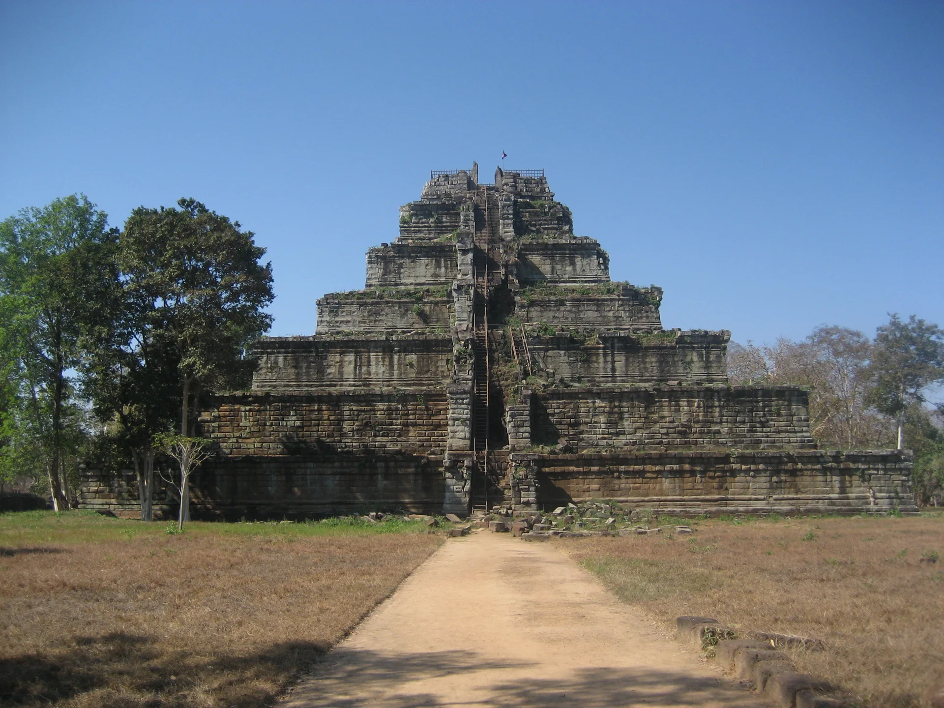
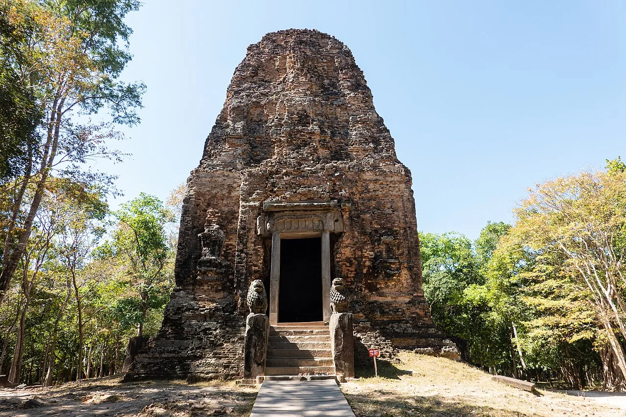
The Statues Came Home First

Inscribed by UNESCO in September 2023. The UNESCO-funded clearance inside the property covered 300,000 square metres of a 4,711-hectare site and buffer zone, and no agency publishes what fraction is confirmed clear. Also: the capital was not abandoned.

Find it: Koh Ker, Preah Vihear Province, Cambodia · 13.8°N 104.5°E · via Siem Reap → Dam Dek or Beng Mealea road → Srayang → Koh Ker ticket gate → Prasat Thom

Silence Index58 / 100
AI-created editorial illustration for the dossier on The Drawings That Kept Their SecretUnexplainedD-018
Peru

The Drawings That Kept Their Secret

Thirteen died in a Nazca overflight on 1 August 2026 and the operator is suspended. Meanwhile AI nearly doubled the known figures, and the astronomical calendar theory has been tested on 2,308 lines and rejected.

Find it: Nasca and Palpa, Ica Region, Peru · 14.7°S 75.1°W · via Lima → Nasca, about 400 km south on the Panamericana

Silence Index57 / 100
AI-created editorial illustration for the dossier on Thilafushi's Tonnage SheetContested · MeasuredD-212
Thilafushi, Kaafu Atoll · Maldives

Thilafushi's Tonnage Sheet

The Greater Malé area generated 836 tonnes of waste a day in the baseline used to size Thilafushi's incinerator. Construction debris was 530 tonnes. Resort waste was 48 tonnes — six per cent. And nobody weighs it.

Find it: Thilafushi, Kaafu Atoll, Maldives · 4.2°N 73.4°E · via Malé → Thilafushi by industrial ferry, roughly 30 minutes. It is a leased workplace, not a destination

Silence Index57 / 100
AI-created editorial illustration for the dossier on The City That Hid DownwardUnderground · SacredD-004
Derinkuyu · Cappadocia · Türkiye

The City That Hid Downward

Derinkuyu, Cappadocia: official Turkish sources disagree on its depth, levels and age. What the record actually establishes, and how to visit it quietly.

Find it: Derinkuyu, Nevşehir, Türkiye · 38.4°N 34.7°E · via Nevşehir Kapadokya (NAV) or Kayseri (ASR) → Nevşehir → Derinkuyu

Silence Index54 / 100
AI-created editorial illustration for the dossier on The 1964 Naming BargainContested · MeasuredD-210
Antarctic Peninsula · Antarctica

The 1964 Naming Bargain

A 1964 deal between the American and British naming committees split the peninsula at the Cape Jeremy–Cape Agassiz line and gave the whole a third name. Chile and Argentina were not parties. Their names remain current.

Find it: Antarctic Peninsula — Graham Land, Palmer Land, Tierra de O'Higgins, Tierra de San Martín · 69.5°S 65.0°W

Silence Index53 / 100
AI-created editorial illustration for the dossier on The Valley That Learned to HostLandscapeD-017
Jordan

The Valley That Learned to Host

ICOMOS recommended deferral and rejected Wadi Rum's cultural case; the Committee inscribed it anyway. The script isn't Thamudic, the Seven Pillars aren't Lawrence's, and tourism fell 70% in 2024.

Find it: Wadi Rum Protected Area, Jordan · 29.6°N 35.4°E · via Aqaba (~1 hr) or Petra (~1.5 hrs) by road · Desert Highway

Silence Index49 / 100
AI-created editorial illustration for the dossier on The Beach That KillsLandscapeD-041
Reynisfjara · Iceland

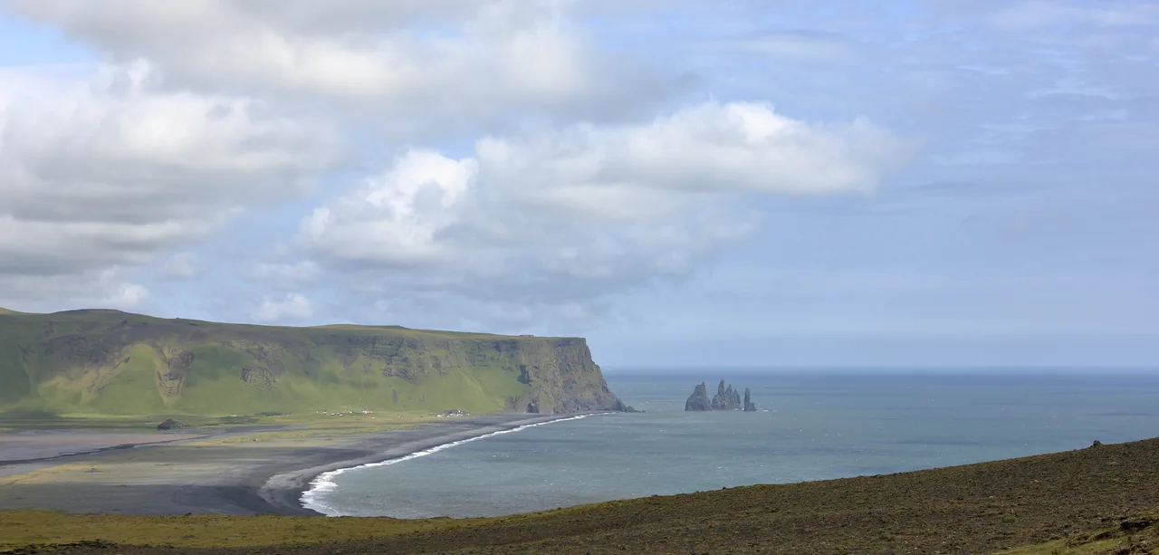
The Beach That Kills

Six deaths documented individually, a warning light removed by the sea in February 2026, and a beach that has moved 500 metres inland in fifty years. What Iceland actually measures, and why calm days are the dangerous ones.

Find it: Reynisfjara, near Vík, south Iceland · 63.4°N 19.0°W · via Ring Road (Route 1) → Vík í Mýrdal, about 2.5 hrs from Reykjavík

Silence Index47 / 100
AI-created editorial illustration for the dossier on The Inverted CathedralUnderground · SacredD-005
Chand Baori · Rajasthan · India

The Inverted Cathedral

Chand Baori at Abhaneri, Rajasthan: what the record actually supports about its dating, depth and step count, and how to see the stepwell properly.

Find it: Chand Baori, Abhaneri, Rajasthan · 27.0°N 76.6°E · via Jaipur (JAI) → Abhaneri

Silence Index46 / 100
AI-created editorial illustration for the dossier on The Cave Under the VolcanoUnderground · VanishingD-019
Iceland

The Cave Under the Volcano

A year-round ice cave on a glacier the Met Office told people to stay off in 2023. The ash is not one eruption, the ash does not keep the cave cool, and none of the post-2024 ice-cave rules apply here.

Find it: Iceland · 63.6°N 18.9°W · via Keflavík (KEF) → Route 1 → Vík í Mýrdal

Silence Index45 / 100
AI-created editorial illustration for the dossier on Five People a WeekRestricted · Measured · AfterlifeD-204
Santillana del Mar, Cantabria · Spain

Five People a Week

Altamira is widely said to have reopened in 2015. The Ministry of Culture's own page says its board agreed a strict access regime of five people a week — a monitored trial that has never ended.

Find it: Cueva de Altamira and the Museo Nacional y Centro de Investigación de Altamira, Cantabria · 43.4°N 4.1°W · via Santander airport → Torrelavega → Santillana del Mar; the museum is signposted from the village

Silence Index44 / 100
AI-created editorial illustration for the dossier on Divided Eleven WaysContested · MeasuredD-173
Galápagos Islands · Ecuador

Divided Eleven Ways

The Galápagos fee doubled to $200 on 1 August 2024. The resolution that set it gives the national park 45 per cent and ten other bodies the rest. In the last published year its line was $8,079,363.90 of $17,954,142.

Find it: Galápagos province, Ecuador · 0.7°S 90.3°W · via Quito or Guayaquil → Seymour (Baltra) or San Cristóbal by air; fees paid at both ends

Silence Index44 / 100
AI-created editorial illustration for the dossier on The River That Reversed LessVanishing · LandscapeD-143
Tonlé Sap · Cambodia

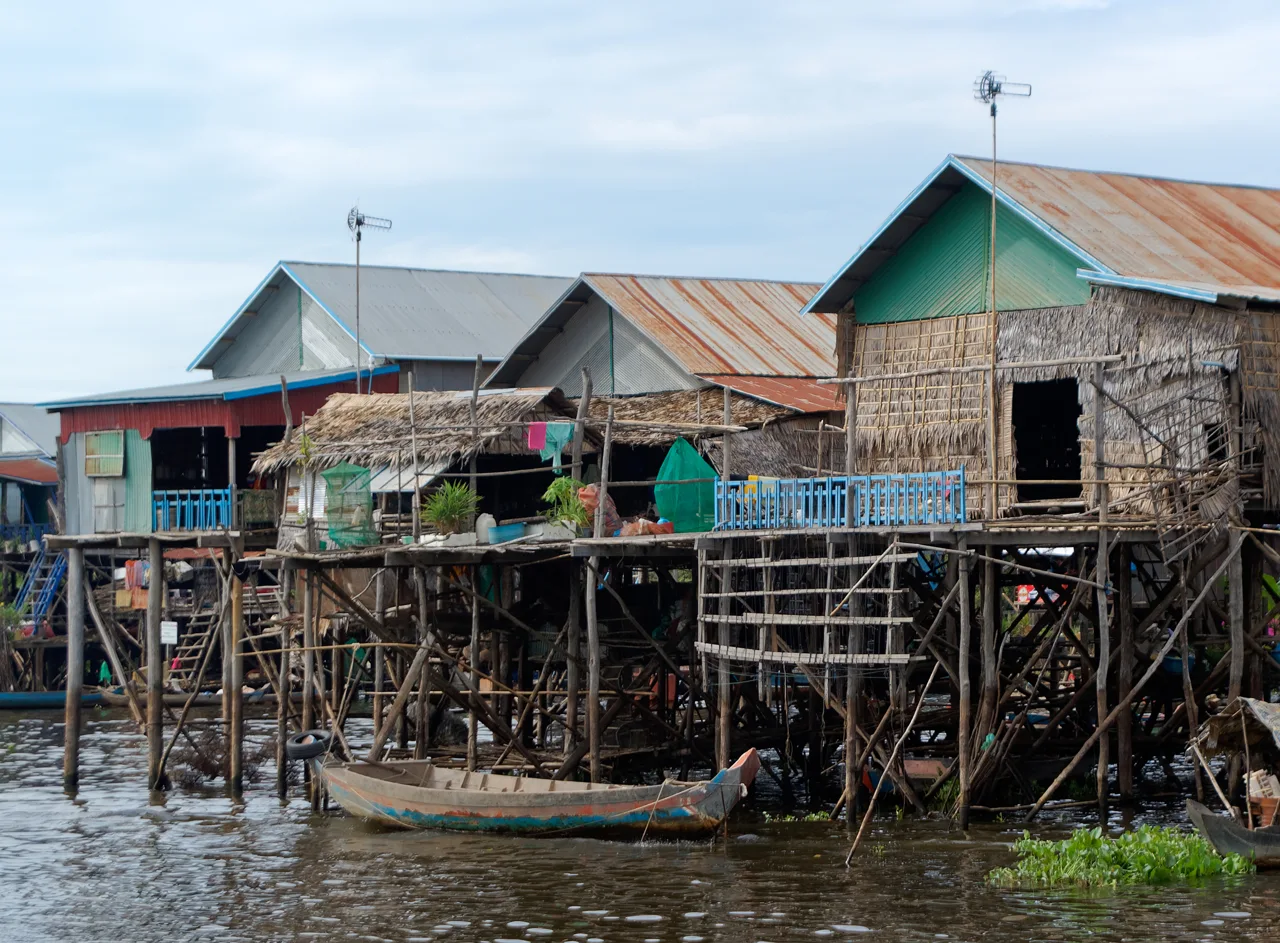
The River That Reversed Less

The Mekong pushes back up the Tonlé Sap river every monsoon and fills a lake six times its dry-season size. That inflow has fallen by 40 to 50 per cent since 1998, and as of November 2025 the leading explanation is not dams. It is sand.

Find it: Tonlé Sap lake and floodplain, Cambodia · 12.9°N 104.1°E · via Siem Reap → Phnom Krom landing (Chong Kneas) · or road east to Kampong Phluk / Kampong Khleang

Silence Index44 / 100
AI-created editorial illustration for the dossier on The Accessible WildernessLandscapeD-009
Iceland

The Accessible Wilderness

Skaftafell stopped being a national park in 2008 and its administrator stopped existing in 2025. Sixty to a hundred million cubic metres of mountainside sit above the glacier next door. What the parking fee buys, and what the guiding rules actually say.

Find it: Iceland · 64.0°N 17.0°W · via Keflavík (KEF) → Ring Road → Skaftafell

Silence Index43 / 100
AI-created editorial illustration for the dossier on The Island That Comes and GoesSacredD-037
Mont-Saint-Michel · France

The Island That Comes and Goes

The tide does not run at the speed of a galloping horse — the abbey's own operator says so. What the 15-metre range really means, how often it is actually an island, and whether the €184.7m de-silting worked.

Find it: Mont-Saint-Michel, Normandy, France · 48.6°N 1.5°W · via Beauvoir park-and-ride → free shuttle (~12 min) or 45 min on foot

Silence Index42 / 100
AI-created editorial illustration for the dossier on Yulara's Real BoundaryMeasured · ContestedD-213
Yulara, Northern Territory · Australia

Yulara's Real Boundary

Yulara draws its water on one licence: NT 5003, 1,600 megalitres a year from the Dune Plains Basin, with no water control district behind it and no allocation plan. Ten dwellings in the town it supplies are owned outright.

Find it: Yulara, Northern Territory, Australia · 25.2°S 131.0°E · via Direct jet to Ayers Rock (Connellan) Airport, 5.8 km from the town, or 465 km by road from Alice Springs

Silence Index41 / 100
AI-created editorial illustration for the dossier on The Tide-Locked CastleSacredD-012
Cornwall

The Tide-Locked Castle

National Trust members do get in free — against a rationed, pre-booked allocation, and they still pay for parking and every boat. The causeway is a 21st-century rebuild, and Storm Goretti took 119 trees in January.

Find it: St Michael's Mount, Marazion, Cornwall · 50.1°N 5.5°W · via Marazion → the Mount, on foot or by ferry

Silence Index40 / 100
AI-created editorial illustration for the dossier on The Glacier That LeavesVanishing · LandscapeD-010
Iceland

The Glacier That Leaves

Ninety-three metres in the 2024-25 glacier year, measured at one of three stakes on the same snout. A lagoon that may grow ninefold. And a July 2026 hazard notice that stopped the tours.

Find it: Iceland · 63.5°N 19.4°W · via Keflavík (KEF) → Route 1 → Road 221

Silence Index39 / 100
AI-created editorial illustration for the dossier on Native Place UncertainUnexplained · ContestedD-181
World Museum, Liverpool · United Kingdom

Native Place Uncertain

The only surviving spotted green pigeon sits in a drawer in Liverpool. Databases give its locality as Tahiti, as Oceania, as the South Pacific. Its 1783 description says 'Native place uncertain'. No register says more.

Find it: World Museum, William Brown Street, Liverpool · 53.4°N 3.0°W · via Liverpool Lime Street → 300 m north-west on foot to William Brown Street

Silence Index39 / 100
AI-created editorial illustration for the dossier on The Island That Chose ArtRemoteD-008
Naoshima · Japan

The Island That Chose Art

Japan's 2025 census counted 2,932 people on Naoshima against a record year of visits. What art-led revival on the Seto Inland Sea did, and did not, fix.

Find it: Naoshima, Kagawa, Japan · 34.5°N 134.0°E · via Okayama → Uno Port · or Takamatsu

Silence Index38 / 100
AI-created editorial illustration for the dossier on The Temple Before FarmingUnexplained · SacredD-039
Göbekli Tepe · Türkiye

The Temple Before Farming

The excavators of Göbekli Tepe no longer call it a temple, and the famous “only 5% excavated” line came from a 2008 magazine interview. What the evidence now says, and what you actually see.

Find it: Göbekli Tepe, Şanlıurfa, Türkiye · 37.2°N 38.9°E · via Şanlıurfa (GNY) → site (~15 km northeast)

Silence Index38 / 100
AI-created editorial illustration for the dossier on Denmark Did Not Build These RunwaysMeasured · ContestedD-174
Nuuk and Ilulissat · Greenland

Denmark Did Not Build These Runways

The filed accounts set out a DKK 5.1bn plan in which Greenland injects DKK 2,400m of equity and Denmark DKK 700m. By 2025 the plan is DKK 5,266m, DKK 2,599m is written off and the airport company's equity is negative.

Find it: Nuuk and Ilulissat international airports, west Greenland · 66.7°N 51.3°W · via Copenhagen or Keflavik to Nuuk by scheduled jet; Ilulissat direct from Copenhagen from 29 October 2026

Silence Index36 / 100
AI-created editorial illustration for the dossier on Porto Marghera Took the ShipsContested · Afterlife · MeasuredD-214
Porto Marghera, Veneto · Italy

Porto Marghera Took the Ships

The 2021 decree closed three canals to large ships and ordered berths built at Marghera for those same ships. The port handled 584,284 cruise passengers in 2025, up 6.7%. Nobody publishes how many landed at Marghera.

Find it: Porto Marghera and the Municipalità di Marghera, Comune di Venezia · 45.5°N 12.2°E · via Venezia Mestre or Venezia Porto Marghera station → Marghera by bus or on foot; the cruise quays themselves are inside the port perimeter

Silence Index34 / 100
AI-created editorial illustration for the dossier on Two Witnesses, One Missing CenturyContested · MeasuredD-191
Akrotiri, Santorini · Greece

Two Witnesses, One Missing Century

The eruption date is not settled. Radiocarbon gives 1609-1560 BCE; the archaeological sequence gives about 1500 BCE; ice cores offer 1611, 1561 or 1538 BCE. Popular accounts split the difference. We will not.

Find it: Akrotiri, Santorini (Thíra), South Aegean, Greece · 36.4°N 25.4°E · via Athens or Piraeus → Santorini (Thíra) by air or ferry → the south of the island by road

Silence Index34 / 100
AI-created editorial illustration for the dossier on Three Instruments, One TownContested · MeasuredD-207
Daingean Uí Chúis (Dingle) · Ireland

Three Instruments, One Town

The 2004 placenames order did not give Dingle a different English name. Under section 33 of the Official Languages Act 2003 it removed the English name's legal force entirely, and only an Act of 2011 gave one back.

Find it: Daingean Uí Chúis (Dingle), Corca Dhuibhne, Co. Kerry · 52.1°N 10.3°W · via Kerry Airport or Tralee → N86 west to Dingle (about 50 km), then the R559 for the peninsula

Silence Index22 / 100

Open the full journal index →

We do not chase the ten best beaches. We chase the last hours of a place before it is discovered — the season, the light, the silence, the story nobody has finished telling yet.

Every entry is a dossier, not a listicle: what is known, what is still unexplained, exactly how to get there, and what your arrival costs the place.