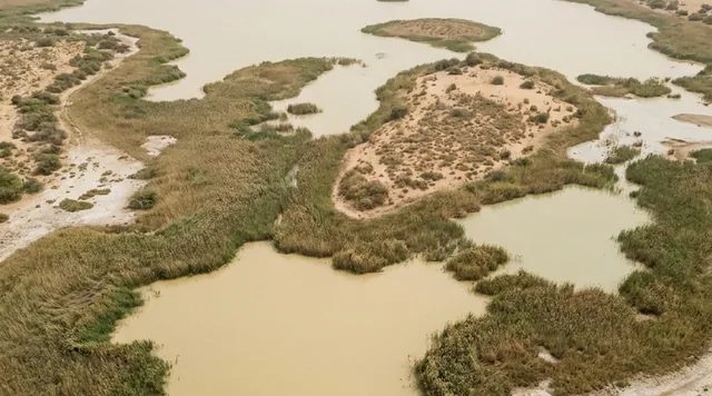
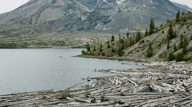
AI illustration
 Edited by
 The Aral Sea did not die. In 1987 it split in two, and the two halves then had opposite fates. Kazakhstan dammed its half and the water came back — twenty-three and a half cubic kilometres of it, with the salinity down by three quarters and four thousand tonnes of fish landed in the first six months of this year. Uzbekistan's half became a desert. Almost everything written about this place describes only the southern two thirds.
What actually happened to the water
This is a desk-researched dossier; nobody from this publication has been to Moynaq. It is built from the World Bank's own project audit, NASA and ESA, the FAO, peer-reviewed limnology and epidemiology, UN agencies, Kazakh and Uzbek government sources and established news.
Start with the baseline, because the round numbers in circulation are softer than the real ones. In 1960 the Aral Sea covered 68,000 km², held 1,093 cubic kilometres of water, sat at 53.4 metres above datum and ran at a salinity of 10 grams per litre. By 2010 it was 14,280 km², 98.1 km³, and 130 g/L — a 79% loss of area, 91% of volume, and a twelve-fold increase in salt.
The cause is not mysterious and it is not climate. Inflow from the Amu Darya and Syr Darya fell from about 54 cubic kilometres a year before large-scale irrigation expansion to about five. The FAO's basin figures explain why: mean annual river runoff of 116 km³ against annual withdrawals of 110 to 117 km³, across 7.9 million hectares under irrigation. The basin consumes essentially its entire runoff, for cotton, rice, wheat, maize and fodder. The sea was not lost. It was spent.
By 2000 the northern lobe had separated from the south. In 2014 the eastern lobe of the South Aral disappeared completely.
 AI illustration
The dam that worked
In August 2005 Kazakhstan completed a thirteen-kilometre dike across the Berg Strait at Kokaral, closing off its northern basin so the Syr Darya could fill it. It is worth being precise about the money, because the figure in circulation is the appraisal estimate rather than the outturn. The Bank's audited completion report gives total financing required at US$85.79 million at appraisal and US$83.34 million as the actual, the difference being a Project Preparation Facility refinancing of $1.80m and a front-end fee of $0.65m that fell away. Against that sit an IBRD loan of $64.50m and $21.29m from the Kazakh government. Note whose money that second line is: this was Kazakhstan borrowing and co-funding, not aid.
The results, from the Bank's audited completion report:
The water level rose from 38 to 42 metres above Baltic datum, then stabilised between 39 and 42 — roughly four metres in under two years. Area grew from 2,400 km² in 2001 to 3,300 km² by 2009. Salinity fell from 23–25 g/L to 9.5–10 g/L, back under the threshold at which freshwater fish survive. The shore came from 75 kilometres away from Aralsk harbour to 35 or 40.
And then the fishery. The catch was 52 tonnes in 2004. By 2007 it was 2,834 tonnes. A fifty-fold recovery in three years. Later accounts extend the series to about 6,000 tonnes by 2016, with eighteen fish species returned — carp, bream, pike-perch, roach, asp, saberfish, rudd — and more than a thousand fishermen working again. Cattle in the project zone rose from 185,000 head to 260,000. Fifteen million fingerlings were released in 2008; the recovery was deliberately stocked, not spontaneous.
The most recent official figures, from July 2026: volume 23.5 km³, salinity 7.9 grams per litre — down a tenth on the year — and 4,200 tonnes landed in the first half of 2026.
The honest caveats
Three, and they matter.
First, the fishery is volatile. The catch fell from 7,800 tonnes to 3,900 during 2025. The recovery has been described, in a fair-minded assessment, as imperfect, unnatural and weak — it depends on upstream releases from Kyrgyzstan and on glaciers that are melting.
Second, this is a fraction of what was lost. The North Aral is one basin of a sea that had 68,000 km². Soviet-era catch across the whole sea reached 40,000 tonnes a year. Four thousand tonnes is a real economy for the people who fish it and a rounding error against what existed.
Third, phase two has taken twenty years to start. The concept was costed at US$190 million in 2019 with a board date of March 2021, and did not proceed — in part because Uzbekistan, in Eurasianet's reporting, has never condoned work to restore the northern Aral. It was relaunched in May 2025, targeting a level of 44 metres, an area of 3,913 km² and a volume of 34 km³, by raising the Kokaral dam up to two metres and adding a control structure near Amanotkel. The timeline runs 2026 to 2029, with financing to be secured by the end of this year.
The other half
Now the south, and the comparison is the whole argument.
Measurements taken in October 2014 put the Western Large Aral at 115 grams per kilogram of salt at the surface and 121.5 at the bottom — a strongly stratified brine with a maximum depth of 32.6 metres and seven diatom species. Chernyshev Bay ran at 131.7 to 133.8. In the same study, the North Aral measured 11.1 g/kg, with a fully mixed water column and 150 diatom taxa.
One is a functioning brackish ecosystem. The other is a stratified pool of brine with almost nothing living in it. They were the same sea sixty years ago.
What replaced the water is the Aralkum, a new desert of roughly 60,000 km² covering about 90% of the former lakebed. Modelled dust emissions from it rose from 14.3 teragrams a year in 1984–99 to 27.1 Tg/yr in 2000–2015.
That figure is worth holding onto, because travel writing about this place routinely quotes "75 to 100 million tonnes of toxic salt a year." The peer-reviewed modelled estimate is 27.1 million tonnes — real, doubling, and less than half what gets printed.
The trees, and the arithmetic nobody does
Uzbekistan's answer to the dust is saxaul, a desert shrub planted to bind the seabed. It works. In seven-year-old plantations wind speed at ground level approaches zero and salt-dust storms are prevented; a single mature bush arrests up to four tonnes of migrating sand, with roots reaching ten to fifteen metres.
The scale is the problem. UNDP's flagship Green Aral Sea initiative has planted 823,000 trees across 658.2 hectares since 2020. The dried seabed covers 2.7 million hectares. That is roughly 0.024% of it. Government-led planting is larger, but this is the figure that can be verified, and the gap between efficacy and coverage is the honest story.
What it did to people
The health data attracts exaggeration, so here is what is actually measured — from Kazakh-side studies zoned by distance from the sea, which is what makes them credible.
Respiratory disease in the "catastrophe zone" ran at 10,744 per 100,000 in 2016, against 5,879 in the control zone. Chronic cough in surveyed children: 8.1% against 4.6%. Cancer incidence between 2004 and 2013 was 211.6 per 100,000 in the catastrophe zone against 130.7 in the control region — up 61.9% — with a clean gradient through the crisis zone at 205.4 and the pre-crisis zone at 152.7.
The signature is oesophageal cancer. Of 10,382 cancer cases recorded between 1999 and 2009, 17.8% were oesophageal — ahead of lung at 12.7% and stomach at 12.6%. Oesophageal cancer leading a regional cancer profile is highly abnormal.
Psychological disorders ran at 642.9 per 1,000 in the Aral zone against 451.5 in wider Kyzylorda. Tuberculosis in Khorezm is about 113 per 100,000, three times the Uzbek national average.
The UN's multi-partner trust fund for the region had improved conditions for approximately 293,000 residents as of December 2023, working through eight agencies.
Moynaq
The town that gives this dossier its ship graveyard was an industrial fishing port, and the numbers describe a functioning economy rather than a picturesque one. The canned fish combine was begun in 1932 and completed in 1941, designed for ten million cans a year; by 1958 it was producing twenty-one million and was one of the largest enterprises in Karakalpakstan. It closed in 1990, by which point it was processing fish trucked in from elsewhere.
The regional fishing workforce fell from 60,000 in the mid-1970s to 700 by the early 1980s. Over 500 vessels and barges once worked these waters. About a dozen of them now sit on dry sand as an open-air museum, with an observation deck, a memorial and the Museum of the History of the Aral Sea. The sea has receded over a hundred kilometres.
And since 2018 the memorial has hosted an electronic music festival. Stihia ran 29 to 31 May 2025 with over eighty artists and more than 5,000 guests, alongside a science forum. Whether it runs in 2026 we could not confirm — the official site still shows 2025 content — so check before planning a trip around it.
A festival on a dead seabed sounds like it ought to be tasteless. In practice it is the only mechanism anyone has found for bringing several thousand people, half of them international, to a town whose entire industry was removed by a decision taken in Moscow.
Why the Silence Index is 72
Access friction is substantial: a flight or a sixteen-hour train to Nukus, then three hours by taxi to Moynaq, then three or four more by jeep to reach the present shoreline. Footfall is low and seasonal. The acoustic floor on the Aralkum is close to absolute — a flat salt desert with no settlement, no traffic and, on most of it, no vegetation. What holds the score down is that Moynaq itself is a functioning town with a museum, a road and a music festival, and that the ship graveyard is now a managed visitor site rather than a discovery.
What popular coverage gets wrong
The standard account — repeated in listicles, social posts and casual guidebook summaries — is that the Aral Sea dried up and died. It did not. It split in two between 1987 and 1989, a separation NASA's Earth Observatory records as complete by 2000, and the halves then had opposite fates. The World Bank's audited completion report shows the northern basin's catch rising from 52 tonnes in 2004 to 2,834 in 2007 once the Kokaral dam had closed the Berg Strait, and the most recent official figures, reported by the Astana Times in July 2026, put the North Aral at 23.5 cubic kilometres, a salinity of 7.9 grams per litre, and 4,200 tonnes of fish landed in six months. "The sea that died" describes only the southern two thirds.
The second error is the dust. Travel writing routinely asserts that the exposed seabed throws up 75 to 100 million tonnes of toxic salt a year. The peer-reviewed modelled estimate, published in Atmospheric Chemistry and Physics in 2024, is 27.1 teragrams a year for 2000–2015 — roughly double the 1984–1999 rate, and still less than half the figure that gets printed.
Third, the distances. Claims that the water now lies 150 or 200 kilometres from Moynaq circulate unsourced; the Karakalpakstan tourism board's own page says the sea has receded over a hundred kilometres, and that is the only figure we will stand behind. The correction cuts both ways, though: Global Voices reported the northern catch falling from 7,800 to 3,900 tonnes during 2025, against a Soviet-era catch of 40,000 tonnes a year across the whole sea in Eurasianet's account. The recovery is real. It is not a resurrection.
 AI illustration
What is coming next
The thing that could undo the northern recovery is being dug right now, and it is not in any of the five Central Asian states.
Afghanistan's Qosh Tepa canal will run 285 kilometres, a hundred metres wide and eight and a half deep. Over 200 kilometres has been excavated, completion is expected in 2028, and it is projected to divert roughly 20% of the Amu Darya's flow — from a point upstream of everything downstream of it. Afghanistan is not party to the water-sharing arrangements that govern the basin.
Tajikistan's Rogun dam gets mentioned in the same breath and should not be. It stands at 135 metres against a planned 335, the World Bank has suspended financing pending a credible financing strategy and dam safety protocols, and it primarily reallocates flow seasonally on a tributary. Qosh Tepa is net consumptive. That is a different kind of threat entirely.
Against that, the mechanism that exists does still function. At the 91st meeting of the Interstate Commission in November 2025, all five states agreed allocations for the year: 55.4 km³ on the Amu Darya, of which 4.2 km³ was allocated to the Aral Sea and its delta, half to be delivered in winter and early spring.
That last figure is the one to watch. For most of this story the sea got whatever was left over, which was nothing. It now has a number of its own, written into an agreement between five governments. It is a small number. It is not zero, and that is new.
Corner Codex — D-014
- Place
- Aral Sea basin — Karakalpakstan, Uzbekistan and Kyzylorda, Kazakhstan
- Coordinates
- 43.77°N, 59.02°E (Moynaq)
- 1960 baseline
- 68,000 km² · 1,093 km³ · salinity 10 g/L
- By 2010
- 14,280 km² · 98.1 km³ · salinity 130 g/L
- The cause
- River inflow cut from about 54 km³/yr to about 5 km³/yr
- The split
- 1987–89. Two basins, two entirely different outcomes
- North Aral now
- 23.5 km³, salinity 7.9 g/L, 4,200 t of fish landed in H1 2026
- South Aral now
- Salinity 115–134 g/kg. Seven diatom species. The Aralkum covers ~60,000 km²
- Kokaral dam
- 13 km, completed August 2005; project outturn US$83.34m
- Silence Index
- 72 / 100
Silence Index
A legacy editorial rating based on desk research. It is not an acoustic measurement or a safety rating.
Earlier and later dossiers used different fourth inputs. Individual input scores were not recorded, so these totals cannot be independently reproduced or used for precise comparisons between places.
The Traveler's Panel · checked
Changing information. Prices, permits, seasons and road access change, sometimes at short notice. Everything here is a starting point for your own confirmation — not a quote, and not a guarantee. Verify with the operator and the relevant official body before you book.
| Season | Spring and autumn. Summer is fiercely hot, winter fiercely cold |
| Nukus → Moynaq | About 3 hours by taxi |
| Moynaq → the shoreline | A further 3–4 hours by jeep |
| Ship graveyard | About a dozen vessels, an observation deck and a museum in town |
| Visa | British nationals visa-free for 30 days; registration required within 3 days |
| Advisories | Neither the UK nor the US restricts Karakalpakstan or the Aral region |
Getting there — Tashkent → Nukus → Moynaq
- Tashkent to Nukus is a 1 hour 40 flight from about 520,000 UZS, or a 16–20 hour train from about 230,000. The train is the better introduction to the scale of the basin.
- Nukus to Moynaq is roughly three hours by taxi, quoted at 500,000–800,000 UZS; shared taxis and minibuses also run via Kungrad. From Urgench, allow five hours.
- Moynaq is not the shoreline. The sea has retreated over a hundred kilometres, and reaching the water from the town takes a further three to four hours by jeep across the seabed.
- The North Aral, the half that has recovered, is a different country and a different trip — Aralsk in Kazakhstan's Kyzylorda region, with the shore now 35–40 km away rather than 75.
- The FCDO's only regional warning in Uzbekistan concerns the Afghan border: the Friendship Bridge is closed to foreigners, the Amudarya bank is fenced with a heavy military presence, and photographing military infrastructure risks arrest.
Indicative costs — verify before booking
| Day trip from Nukus | US$60–100 |
| Two-day tour | About US$300; from Khiva, US$450–550 |
| Yurt camp bed | From about US$10 in a five-person yurt with breakfast |
| Stihia festival ticket, 2025 | 350,000 UZS early rising to 750,000; camping 150,000 for a 3×3 m plot |
| Note | Prices are indicative and largely from festival-year listings — reconfirm |
What to pack
- Dust protection — a proper mask, not a scarf. The Aralkum emits an estimated 27 million tonnes of salt and dust a year, and it carries agricultural residue.
- Far more water than the distances suggest. There is nothing between Moynaq and the shore.
- Layers for a large daily temperature swing on an open salt plain.
- Cash in local currency. Card infrastructure thins out fast west of Nukus.
- Sun protection at desert strength — the salt surface reflects.
Where to stay
Nukus is the practical base — hotels, the extraordinary Savitsky Museum, and the transport connections. Moynaq itself has guesthouses and yurt camps, including beds from about ten dollars, and staying overnight is the only way to see the ship graveyard without a crowd and to reach the shoreline in a single day. There are yurt camps out on the seabed near the present water for anyone doing the full crossing. Khiva, five hours east, is where most itineraries arrive from and has the full range of accommodation.
Safety & responsible travel
- Do not climb on the ships. They are the memorial, they are corroding, and they are the reason anyone comes.
- Do not describe this as a natural disaster in front of people who live here. The inflow was cut from 54 km³ a year to about 5 by irrigation policy. It was a decision.
- Take a guide onto the seabed and do not drive out alone. The surface is salt crust over mud, there is no phone coverage, and there is nothing out there.
- Be careful what you repeat about Vozrozhdeniya island. Eleven anthrax burial pits were remediated under a US$6 million programme from 2002; the risk from the land bridge is stated as prospective, and no verified human infection has been attributed to the site since.
- Spend money in Moynaq. The town lost its entire industry and the visitor economy is what replaced it.
Nearby, and quieter
The Savitsky Museum in Nukus holds one of the world's great collections of Soviet avant-garde art, assembled and hidden here precisely because Karakalpakstan was too remote for Moscow to police — it is the other reason to come to this region. Khiva's walled Itchan Kala is five hours east. Across the border in Kazakhstan, Aralsk is the town on the other side of this story: the harbour that got its sea back, with the shore now 35–40 km away instead of 75, and the Kokaral dam a further drive beyond it.
Getting there, in order
- 1Tashkent
- 2Nukus
- 3Moynaq
Each leg is a separate booking and a separate chance to be weathered out. Build spare days into the chain, not onto the end of it.
Where it is
Moynaq and the Aral basin, Uzbekistan & Kazakhstan · 43.7700°N 59.0200°E · Open in Google Maps · OpenStreetMap
Key locations
- North Aral Sea (Small Aral) — the half that came back — the reason this is a split, not a death
46.4500°N 60.7300°E - Kokaral Dam — the 12 km dike of 2005 that holds the Syr Darya in the northern basin
46.1088°N 60.8027°E - Aralsk — the Kazakh port the water has been walking back towards
46.8017°N 61.6631°E - Moynaq — the Uzbek fishing town, the ship cemetery and the museum
43.7683°N 59.0214°E - Nukus — gateway city and airport, about three hours south of Moynaq
42.4586°N 59.6056°E
Coordinates are for orientation and are accurate to roughly the width of the feature named, not to a doorway. Several of these points are inside protected areas or need a permit, a guide or a boat — read the access notes above before you plan a route to any of them.
Sources & further reading — checked
- Changes in water volume of the Aral Sea after 1960 (Applied Water Science, Springer). The 1960 baseline of 68,000 km², 1,093 km³, level 53.4 m and salinity 10 g/L; the 2010 figures of 14,280 km², 98.1 km³ and 130 g/L; and the 1987 intermediate marker
- FAO — Irrigation in the countries of the former Soviet Union in figures. Inflow falling from about 54 km³/yr to about 5 km³/yr; basin runoff of 116 km³ against withdrawals of 110–117 km³; and 7.9 million hectares under irrigation
- World Bank — Implementation Completion Report ICR0000874, Syr Darya Control and Northern Aral Sea Project. Total financing required of US$85.79 million at appraisal against US$83.34 million actual, with an IBRD loan of $64.50m and $21.29m from Kazakhstan; the water level rising from 38 m to 42 m; area growing from 2,400 km² to 3,300 km²; salinity falling from 23–25 g/L to 9.5–10 g/L; the shore moving from 75 km to 35–40 km from Aralsk; and the catch rising from 52 tonnes in 2004 to 2,834 in 2007
- World Bank — Kazakhstan's Syr Darya Control and Northern Aral Sea Project brief. The 13 km Kok-Aral dike completed in August 2005; the release of 15 million fingerlings in 2008; and the summary that area shrank almost 70% and level fell almost 20 m between 1960 and 2004
- Focus on Geography — Ecological restoration and economic recovery in Kazakhstan's Northern Aral Sea region. The dam's engineering detail — body about 200 m wide, spillway capacity 395 m³/s — and the extended fishery series to about 6,000 tonnes by 2016 with 18 species returned and over 1,000 fishermen employed
- Izhitskiy et al. — Present state of the Aral Sea: diverging physical and biological characteristics of the residual basins (Scientific Reports). The October 2014 measurements: Western Large Aral at 115–121.5 g/kg, strongly stratified, with seven diatom species; against the North Aral at 11.1 g/kg, fully mixed, with 150 diatom taxa
- NASA Earth Observatory — World of Change: Aral Sea. That the North had separated from the South by 2000, and that the eastern lobe of the South Aral disappeared completely in 2014
- ESA — Earth from Space: The shrinking Aral Sea (March 2025). Independent confirmation of the 1960 area of about 68,000 km², and the current state of the eastern and western lobes
- Atmospheric Chemistry and Physics 24, 11451 (2024). The Aralkum covering about 60,000 km², roughly 90% of the former lakebed; and modelled dust emissions rising from 14.3 Tg/yr (1984–1999) to 27.1 Tg/yr (2000–2015)
- UNDP Uzbekistan — Green Aral Sea. 823,000 trees planted across 658.2 hectares since 2020 against 2.7 million hectares of dried seabed; and the finding that in seven-year-old plantations wind speed approaches zero, with one mature bush arresting up to four tonnes of migrating sand
- Zhumadilov et al. — Health Impact of Drying Aral Sea (Water 13(22):3196). Respiratory disease at 10,744 per 100,000 in the catastrophe zone against 5,879 in the control zone; chronic cough at 8.1% against 4.6% in children; cancer incidence of 211.6 against 130.7 per 100,000 with a dose-response gradient; oesophageal cancer at 17.8% of 10,382 cases; and the tuberculosis figures for Khorezm and Karakalpakstan
- UNDP Multi-Partner Trust Fund Office — Human Security Trust Fund for the Aral Sea Region. Improved conditions for approximately 293,000 residents as of December 2023, across eight UN agencies
- CABINET project, University of Oxford — Moynaq canned fish combine. Construction begun 1932 and completed 1941 for ten million cans a year, reaching 21 million by 1958; closure in 1990; and the regional fishing workforce falling from 60,000 in the mid-1970s to 700 by the early 1980s
- Karakalpakstan tourism board — Moynaq and the ship graveyard. Over 500 vessels once working these waters; the sea receding over 100 km; and the current site with about a dozen vessels, an observation deck, memorial and museum
- Eurasianet — Northern Aral's promise stunted by dam height, international disputes (October 2020). That Uzbekistan has never condoned work to restore the northern Aral and called the structure's condition an emergency; and the Soviet-era peak catch of 40,000 tonnes a year
- World Bank — Concept PID, North Aral Sea Development and Revitalization Project (P170187). The original phase two concept at US$190 million with a board date of March 2021 that did not proceed
- The Times of Central Asia — Kazakhstan and World Bank launch second phase (May 2025). The relaunch on 19 May 2025 targeting a level of 44 m Baltic, area 3,913 km² and volume 34 km³, with a projected refill of four to five years
- The Astana Times — Kazakhstan steps up Aral restoration (July 2026). The most recent official figures: volume 23.5 km³, salinity 7.9 g/L down 10% year on year, and 4,200 tonnes landed in the first half of 2026
- Global Voices — How Kazakhstan resurrected the North Aral Sea (May 2026). Level 40.4 m Baltic and 870 km² of dried seabed reclaimed; the catch falling from 7,800 to 3,900 tonnes during 2025; and the assessment that the recovery is imperfect and dependent on upstream releases and melting glaciers
- The Times of Central Asia — Central Asian countries agree 2026 water allocations (December 2025). The 91st Interstate Commission meeting agreeing 55.4 km³ on the Amu Darya including 4.2 km³ for the Aral Sea and delta, half delivered in winter and early spring
- The Times of Central Asia — Afghanistan advances Qosh Tepa canal (April 2026). The canal at 285 km long, 100 m wide and 8.5 m deep, with over 200 km excavated, completion expected in 2028, and a projected diversion of roughly 20% of Amu Darya flow
- The Times of Central Asia — Tajikistan's Rogun dam delayed as World Bank freezes funding (August 2025). Rogun at 135 m against a planned 335 m, the World Bank suspension pending a credible financing strategy and dam safety protocols, and the distinction from a net-consumptive diversion
- Nuclear Threat Initiative — Vozrozhdeniye Open-Air Test Site. The site's history as Aralsk-7 from 1954 to 1992; the agents tested; the anthrax burial; and the statement that connection to the mainland increases the prospective risk of pathogens spreading via rodents and insects
- Arms Control Association — US to clean up Soviet-era germ warfare site in Uzbekistan. The October 2001 agreement under Cooperative Threat Reduction: up to US$6 million to dismantle about 20 buildings and remediate 11 anthrax burial pits, from early 2002
- Stihia festival — official site and FAQ. The 2025 edition on 29–31 May at the Muynak Aral Sea Memorial, the artist line-up, ticket and camping prices, and the transport guidance from Tashkent and Nukus
- Uzbekistan Travel — Tourism and culture unite at Stihia festival, Muynak. Over 5,000 guests attending the 2025 edition
- UK FCDO — Uzbekistan travel advice and regional risks. That there is no blanket warning and no specific warning for Karakalpakstan, Nukus, Moynaq or the Aral region; and the Afghan border restrictions
- Caravanistan — Moynaq and the Aral Sea. Practical transport via Kungrad, jeep times to the shoreline, yurt camp and tour pricing. A specialist travel resource rather than a primary source, and flagged as such
Official and scientific bodies are the authority for safety, regulatory and scientific claims. Commercial operators are used only for practical detail such as tour length, meeting points and indicative pricing — never for a safety or scientific statement.
How this was made
Desk research. Compiled from official bodies, scientific and conservation sources, established journalism and licensed operators. Not based on a personal visit.
Editor’s method note — what we checked, corrected and could not verify
- Desk research only. No one from this publication has been to Moynaq or Aralsk.
- The framing has been corrected. The sea did not die; it split in 1987–89, and the two basins then diverged completely. Any account that describes 'the Aral Sea drying up' is describing the southern two thirds only.
- We do not repeat the '75 to 100 million tonnes of toxic salt a year' figure common in travel writing. The peer-reviewed modelled estimate is 27.1 Tg/yr for 2000–2015.
- Where the World Bank's audited completion report and its promotional brief disagree — the brief says the shore moved from 100 km to 25 km, the report says 75 km to 35–40 km — we follow the audited report.
- We corrected the project cost in the August 2026 audit. This dossier gave US$85.79 million as what the Kokaral scheme cost, which is the sum of the two financier lines but not the outturn. The completion report's financing table carries both columns: 85.79 as total financing required at appraisal, 83.34 as actual, the gap being a Project Preparation Facility refinancing of $1.80m and a $0.65m front-end fee that dropped out. The body now gives both and labels which is which.
- On Vozrozhdeniya we state only what is documented: the agents tested, the eleven burial pits, the US$6 million remediation from 2002, and a prospective risk from the land bridge. We found no verified human infection attributable to the site since decontamination, and no completion certification either.
- Nine things we could not verify: whether Stihia is running in 2026; the Kokaral dam's structural crest height; the precise current distance from Moynaq to the shoreline, where '150 km' and '200 km' both circulate unsourced; Moynaq's current population; the frequently quoted '100,000 people left the region'; official Uzbek saxaul and dust figures, the UNECE report having refused access; the total tonnage of anthrax buried on Vozrozhdeniya; the North Aral volume discrepancy between the official 23.5 km³ and the 27 km³ in press reports, likely a seasonal peak; and whether the 60,000 fishing workforce figure is Moynaq-specific or regional.
- Added 15 August 2026: a section on what popular coverage gets wrong, drawing only on sources already cited for this dossier.
- Coordinates for the key locations are from the GeoNames gazetteer for Aralsk, Moynaq and Nukus, and from OpenStreetMap for the Kokaral dam and for the North Aral itself. The North Aral pin is a point in open water rather than a place — it marks the basin the dam saved, not a shoreline, and that shoreline moves. The ship cemetery is inside Moynaq and is not given a separate pin.
AI is used to draft this text, and a human checks it. Tony Hall is responsible for editorial verification against the reference list. Our standard is to distinguish documented facts, disputed accounts and claims we could not verify. Errors can remain; readers can report them through the corrections page. The illustrations are AI-created and labelled as such — no photograph on this site is presented as a record of a real place. Full disclosure · Editorial policy.
Access details change — recheck before you travel. Found an error? Tell us — corrections are dated and shown in place.