
The lake expands because the river changes direction
The Mekong River Commission explains the central mechanism: high Mekong flows during the wet season can reverse the direction of the Tonlé Sap River, pushing water toward the lake. As conditions change, the lake releases water back through its outlet. Rainfall and tributaries also matter. The result is a seasonal exchange within a connected river system, not a self-contained lake that simply fills when rain lands on its surface. MRC geographic explanation.
Think of a doorway between two rooms rather than a tap above a bowl. What happens on one side affects movement through the connection. The analogy is only a way to picture the relationship; a real river has changing channels, friction, tributaries and a vast catchment behind it. But it helps explain why a clear sky above your boat tells you little about the wider forces controlling the lake level.
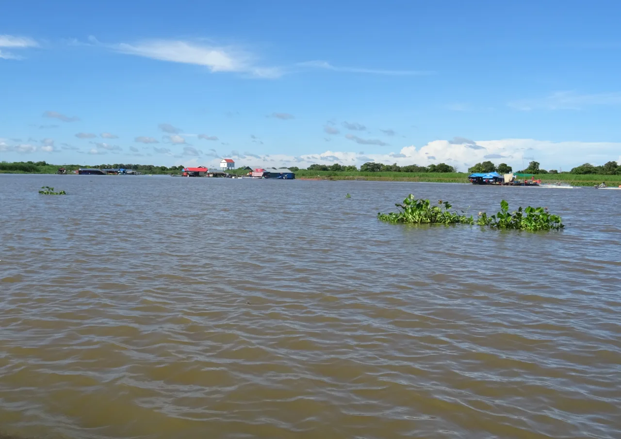
This matters for travel because the shoreline is not a fixed stage set. The distance between a landing, a settlement and open water can change. A channel that is visually enclosed at one time can lead into a broader flooded landscape at another. A boat route advertised with photographs from a different month may therefore be accurately located and still create the wrong expectation for your visit.
It also matters for the famous reversal itself. A boat trip near Siem Reap does not necessarily take you to the Tonlé Sap River where the direction of flow is measured. You should not expect to watch a dramatic switch happen beside your boat on demand. Ask your guide to explain your position in the system. Understanding the connection may be more revealing than looking for a visible event that the itinerary never actually reaches.
Keep three clocks separate: the season, the current weather and the longer history of change. Seasonal expansion is a recurring process. A storm is a shorter event. A multi-year shift in flood timing requires records across many years. A good explanation can connect them without pretending that one photograph measures all three.
To continue reading about water beyond the lake, explore Angkor Wat’s water and temple landscape. Treat the two guides as different perspectives, not as evidence that their water systems work in the same way.
A changing flood pulse is more than a smaller photograph
Researchers have documented changes to the flood pulse, but the details deserve more care than a headline about a lake “disappearing.” A 2022 study in Hydrology and Earth System Sciences analysed records from 1960–2019 across the Cambodian floodplains. It reported changes in flood timing, levels and reverse flow, and discussed local water withdrawals and channel changes alongside upstream influences. Its conclusion was not that a single cause explained every part of the observed decline. Flood-pulse research and study period.
For the reader, the first question is what was compared with what. A wet-season maximum and a dry-season minimum are different measurements. The area of open water, the volume moving through a river and the length of time a floodplain stays inundated are also different. They may be connected, but a percentage change in one should not be silently presented as a change in all of them.
The second question is time. A paper published recently may analyse observations that end several years earlier. That can still make it valuable research, but it does not become a live report on the conditions during your trip. When a guide uses an older study to explain the lake, check whether it preserves the study period. A publication date is not the date of every measurement inside it.
For a visitor, the practical consequence is curiosity rather than instant diagnosis. Ask what the current water conditions mean for the route, fishing activity or access to a particular habitat. Treat a resident's account as a situated experience, not a survey of every community. If you later describe the visit, separate what you personally observed from what a source or guide explained.
There is room for concern without a countdown. The lake can face serious pressures while remaining a place where people work, adapt, disagree and make plans. Presenting it only as something to see “before it is gone” can erase those decisions. A more useful travel story asks what is changing, how we know, and what kinds of activity help residents and habitats remain viable.
Floating, stilted and seasonally flooded are different things
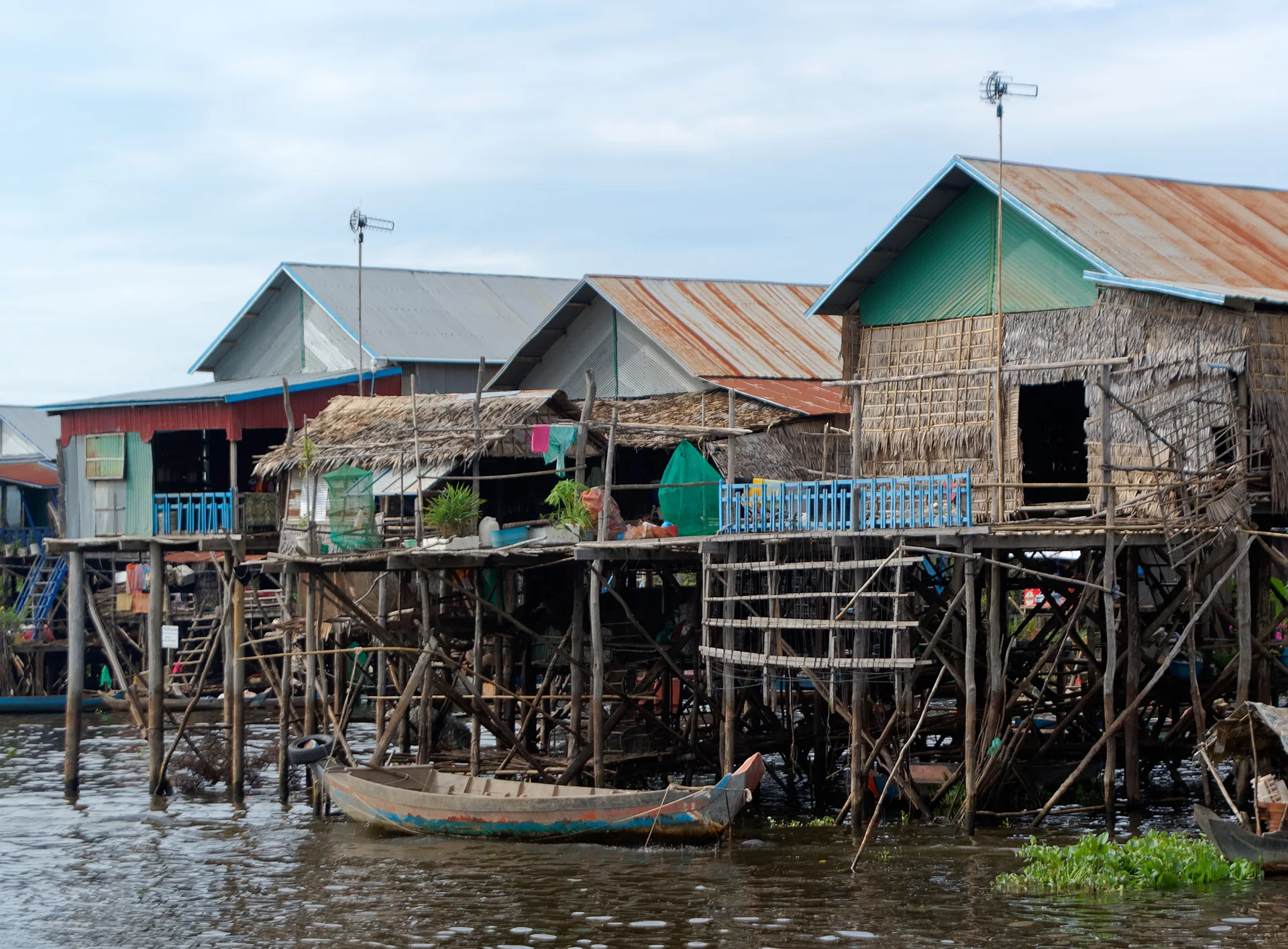
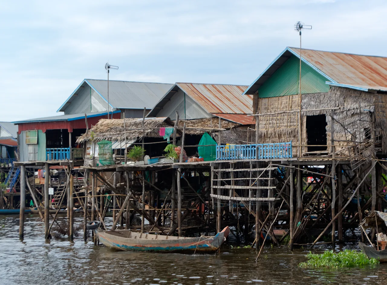
The phrase “floating village” is convenient for a booking page, but it can flatten several kinds of settlement into one picture. A floating building rests on a buoyant support. A stilt house stands on fixed supports while the waterline changes around it. A village may contain different structures and different relationships to the water. Look closely before deciding which word describes the home in your photograph.
At Kampong Phluk, the raised houses are part of the reason visitors are interested in the settlement. The Ministry of Tourism has documented its work with the Kampong Phluk Ecotourism Community. That identifies a living community involved in tourism; it does not certify every commercial listing that uses the village's name or guarantee a particular water level. Ministry community-tourism account.
Try an architectural observation that does not require approaching a private doorway. Notice the relationship between a living floor, its access steps and the current surface below it. Look at how boats are tied and where shared movement takes place. Ask which features change with the season and which remain fixed. These details can explain more about adaptation than a dramatic portrait taken without permission.
Be cautious with interpretations of objects. Nets, cages, engines and containers have specific uses; a visitor may identify them incorrectly. A boat passing your group may be carrying passengers or goods rather than fishing. Ask a guide to explain an activity when doing so will not interrupt the people working. Record a name or a short description if you want to write an accurate caption later.
The distinction also improves trip selection. If you want to understand raised-house architecture, say so. If you want open lake views, a forest boat section or a birding route, say that instead. A provider can then explain whether the current route serves your interest. Buying a vague “floating village experience” leaves too much of the decision inside someone else's assumptions.
Choose a visit by purpose, not by an authenticity ranking
Start with Chong Kneas, Kampong Phluk and Prek Toal as different planning questions, not a league table. The first is associated with a published boat-ticket system; the second can be a way to understand a settlement of raised houses and its seasonal setting; the third calls for a more specialised birding plan. The exact service and conditions still need checking. A destination name is not a complete itinerary.
For a defined boat tariff: Chong Kneas
Angkor Enterprise publishes boat categories and prices for Chong Kneas, with separate schedules for international and national/local visitors. That makes it possible to begin with an official figure. It does not mean the fare covers your road transfer, a guide, a meal or every optional stop. Ask the seller to identify the boat category, passenger capacity, route and inclusions before comparing it with a packaged excursion.
For the relationship between homes and water: Kampong Phluk
Ask what the current water level allows the visit to show. Does the itinerary include a walk, a main boat ride, a smaller boat section or some combination? What is optional, and who operates it? A photograph of boats close to the living floors of tall houses may be a poor expectation for another season. The useful comparison is between your interest and today's route, not between two polished advertising images.
For birds and habitat: Prek Toal
A specialist birding excursion is a different commitment from a short scenic ride. Sam Veasna Conservation's own itinerary describes boat transfers, a ranger and a community motorboat section for its Prek Toal visit. Use that as an example of the planning involved, not as a promise about every operator or a timetable that will never change. Ask about the current season, observation arrangements, equipment and full return time. SVC sample itinerary.
Other lake communities may suit your route, but avoid equating a longer drive with a more “real” population. People do not become less authentic because visitors know their village. Judge the quality of a visit by consent, explanation, transparent pricing and the way it handles everyday life. Those are questions you can actually ask before paying.

Residents are your hosts, not the subject of a performance
UNESCO's biosphere-reserve description identifies Khmer, Cham and Vietnamese residents and livelihoods that include fishing, aquaculture and agriculture. That is a useful reminder that Tonlé Sap is not one culturally uniform village. Avoid assigning a religion, nationality, language or legal status to somebody based on the shape of a house or an impression formed from a boat. UNESCO biosphere profile.
Begin an encounter with what is appropriate to the situation. Someone moving goods, looking after a child or preparing food may not have time to talk. A guide's introduction can help, but it does not replace the person's own willingness to engage. Keep a question short, listen to the answer and let the interaction end naturally. You do not need a personal story from every person you meet for the visit to have value.
For photographs, distinguish a wide view of the settlement from a close image of an identifiable person. Ask before making the second, and be especially careful with children and private domestic moments. Permission to buy something or enter a commercial area is not permission to photograph everything around it. If someone refuses, lower the camera without turning the refusal into a negotiation.
Useful language is a gesture of attention, not a test of your host. Ask your guide which greeting is appropriate in the situation and how to pronounce it. A simple thank-you delivered with patience is more useful than a phrase copied without understanding its formality. Where a community uses another language in daily life, let the guide explain that variation instead of assuming every interaction follows the same script.
Dress for an ordinary visit among other people. Choose clothing that works for boarding, sitting and the weather, and bring suitable coverage if the itinerary includes a pagoda or another sacred place. A krama may be an optional practical textile, but wearing one does not confer local knowledge. The essential cultural preparation is to understand the route and behave considerately once you are there.
Make generosity accountable
A visit can create opportunities to buy a meal, pay a boat operator or purchase work made locally. Those transactions are more useful when the price, recipient and service are clear. Ask how a community-based visit is organised and which parts are locally operated. A product's use of the word “community” should begin a conversation about arrangements, not end it.
Be particularly cautious when an itinerary makes access to children part of its appeal. ChildSafe advises travellers against school and orphanage visits as tourist attractions and encourages support through responsible child-protection channels. A brief visit by strangers is not a substitute for a child having privacy, stable relationships and education. ChildSafe traveller guidance.
If someone asks you to buy goods for a school or make an immediate donation, take time to understand the organisation and how the money will be used. You can decline politely without making a judgment about everyone in the village. If you want to contribute later, use a channel you can investigate and an organisation whose purpose, governance and reporting are clear. An urgent request during an excursion should not remove that choice.
The same principle applies to environmental claims. A tour saying it “protects the lake” should be able to explain how. It might employ local people, contribute to a documented programme or follow a particular wildlife practice. Those are different actions, and none automatically proves that every part of the business is sustainable. Ask for the specific contribution rather than a badge or a reassuring adjective.
You can also make the visit easier for others through small decisions: avoid handing out sweets from a moving boat, keep packaging secure, ask where waste can be disposed of properly, and do not block a working landing while taking photographs. These choices are less dramatic than a donation photograph. They are also more closely connected to the ordinary responsibilities of being a guest.
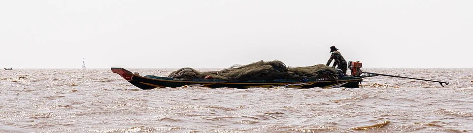
Ask about water level before asking for the best month
A month name is an imperfect proxy for what you want to see. Seasonal patterns help, but water conditions and the operation of a specific route are what determine your experience. If a flooded-forest section is your priority, ask whether it is currently operating and what it involves. If raised houses interest you, ask how the waterline will affect the view and the amount of walking or boating.
The Mekong River Commission describes the basin's flood season broadly as June to November. That is regional context, not a guarantee that a particular village route is at a particular level on your travel date. The commission also publishes monitoring and forecasting information, which can help you understand changing conditions. A local operator still needs to confirm the actual excursion. MRC seasonal context · Monitoring and forecasts.
In higher-water conditions, ask about the boat journey, boarding arrangements and how long you will be away from a comfortable place to stop. Rain protection and a secure place for a phone become useful practical questions. More water does not automatically mean better conditions for every passenger or every activity. The point is to understand the tradeoff before making a promise to your travelling companions.
In lower-water conditions, ask how far the route extends, what the landscape looks like and whether any advertised section is shortened or unavailable. Some visitors may find exposed structures or a different relationship between land and water particularly interesting. Others may be disappointed if they expected a particular postcard scene. Honest current photographs and a clear description can prevent both the wrong booking and an unfair review afterwards.
For hot periods, including an April trip, compare morning and later departures in terms of actual shade, travel and rest. A sunset label does not tell you how many hours the preceding excursion spends in the sun. Confirm drinking water, the boat's seating and shade, and the return arrangement. Let the conditions shape the visit instead of making comfort depend on the colour of the sky at the end.
Your destination is a landing, not the middle of the lake
For a Siem Reap excursion, confirm the named settlement, the road-transfer destination and the boat boarding point separately. A map pin placed in the open lake is useful for explaining regional geography, but it is not somewhere a driver can take you. Booking messages should identify where you meet, where you board and whether those arrangements change with water conditions.
Ask for the complete trip duration, including pickup rounds, road travel, waiting, the boat section and the return. “Two hours on the lake” and “a two-hour tour” may describe very different products. If you have a flight, bus or another timed commitment afterwards, tell the provider before booking. Leave a margin that reflects the journey rather than the most optimistic product description.
Transport choices should match the party. A shared service may have a lower per-person price and less flexibility; private transport can make it easier to change the departure or return. But a private vehicle does not necessarily mean a private boat, and a boat charter does not necessarily include a guide. Ask about each part instead of treating the word “private” as a blanket description of the whole day.
Keep the return arrangement explicit. Record the driver's or organiser's contact information, the agreed meeting point and what to do if the boat returns later than expected. Save the relevant booking details before leaving reliable connectivity. A photograph of the correct vehicle and a written meeting point can be more useful than trying to reconstruct the plan at a busy landing.
The embedded map is intended to show the wider lake and its relationship to the journey, not to recommend an unverified road or landing. Use the provider's current directions for the final approach. Do not follow a navigation shortcut onto a track or private access simply because it looks shorter on a screen. A route is useful only if it is both appropriate and available.
Check the boat before the photograph
Before committing to an excursion, ask about passenger capacity, seating, suitable lifejackets and how weather changes are handled. If you are travelling with children, confirm that appropriately sized equipment will actually be available for them. A statement that lifejackets exist somewhere on the vessel is less useful than knowing that each passenger can use one that fits.
Boarding can be an important accessibility question. Explain any difficulty with steps, balance, transfers or sitting for a long period before booking. Ask for a current description or photograph of the boarding arrangement and seating. “Easy tour” is subjective, and a provider cannot address a need it has not been told about. You should be able to decide from specific information rather than a general reassurance.
Keep hands free when boarding where possible, secure loose items and follow the operator's instructions about movement. Do not stand or lean out for a better frame if that conflicts with those instructions. A boat trip is not made safer by the fact that other passengers appear relaxed. If the equipment or passenger arrangements differ materially from what was agreed, resolve that before departure.
Weather decisions belong in the plan as well. Ask who decides whether the trip runs, what alternatives are available and how cancellation or shortening affects payment. Do not assume a forecast for central Siem Reap fully describes conditions across the water. A provider should be able to discuss the actual route and the limits of its service without promising that weather never disrupts it.
For an activity involving a separate smaller boat, make the same enquiries again. It is a different part of the excursion and may have a different operator, fare or equipment. Declining an optional section is a reasonable choice. No view, forest corridor or social-media photograph needs to become a compulsory test of confidence.
A boat price is not a whole-day price
Angkor Enterprise's Chong Kneas page lists international-visitor boat fares of US$28 for up to five people and US$38 for six to eight. Larger categories are US$70 for nine to fourteen, US$90 for fifteen to nineteen, US$120 for twenty to twenty-five, US$150 for twenty-six to thirty-five and US$180 for thirty-six to forty-two. The page says tickets are bought at the counter rather than online. These details were checked on 15 September 2026. Official Chong Kneas boat tariffs.
Those are the published Chong Kneas international-visitor categories, not a price list for every village, forest ride or wildlife reserve on Tonlé Sap. The same official page has different categories for national/local visitors. Check the classification that applies to your party and confirm the service included. Do not use a low figure from one category to argue about a different product without first understanding the difference.
For two international visitors in the smallest published category, the US$28 boat amount would be US$14 each if split equally. That arithmetic does not include transport from Siem Reap, guiding, food or optional activities. Equally, do not multiply the whole-boat charge by two and accidentally double it. Write “per boat” beside the amount before comparing it with a tour advertised “per person.”
The budget tool in this guide is a worksheet for the complete party. Enter a verified boat quote once, then add shared road transport and guide costs, meals per person and any genuinely additional fees. If a packaged excursion includes the boat or transfer, do not enter those components again. Keep optional small-boat sections separate so you can decide whether they matter to your visit.
Accommodation usually belongs in your wider Siem Reap budget, not automatically in the cost of the lake excursion. Include an extra night only if the plan requires one. When comparing two departures, consider the effect on the rest of the day as well as the total price. Saving a small amount is less helpful if the timetable creates an expensive or stressful connection afterwards.
What a useful listing should tell you
A good booking decision begins with a named place and a described route. Look for the departure point, travel time, boat arrangement, guide language, group size and return plan. Then examine what changes seasonally. If the listing's main attraction is a flooded-forest section, ask whether that section is currently available, included in the price and operated by the same provider.
Photographs need the same care as wording. An image may show the correct village in a different season; it may also show a nearby community that is not on your itinerary. Ask for the names of the places pictured when it affects your decision. An operator's ability to explain the route is more useful than a large collection of beautiful but unidentified images.
Reviews can help identify repeated practical issues, but read them in context. A traveller seeking a quick sunset ride may value different things from a birder or a family interested in village architecture. Look for comments about explanation, transparency and how a changed plan was handled. A star rating cannot tell you whether the particular experience matches your purpose.
Our Viator resource leads to Siem Reap experiences and may earn Hidden Corners a commission on a qualifying booking. It is a marketplace, not an official lake-ticket office, and we do not claim to have personally tested every listed tour. Check the destination, inclusions and cancellation conditions yourself. An editorial lake photograph beside the link is not a picture of a specific vehicle or guide.
For a Siem Reap stay, the Booking.com link is currently an ordinary resource without affiliate tracking. Compare pickup convenience with the other things you want from your accommodation: room configuration, meal options, cancellation terms and onward travel. There is no requirement to choose a property marketed around a lake tour if another location suits the rest of your visit better.
Pack for a boat seat, a landing and the weather
Start with what must stay dry and accessible. Put your phone, booking confirmation and essential documents in a protective pouch, and save contact information offline. Keep money organised so you can pay an agreed fare without exposing everything you are carrying. Bring only the identification required for the day's arrangements, and avoid filling the bag with documents that have no purpose on the excursion.
Choose shoes for the transfer as well as the seat. You may need to board across a landing, step into a boat or walk during a stop. Ask what surfaces the actual route involves. Footwear that feels secure on you is more useful than an outfit chosen only for photographs. If a visit includes a sacred place, bring appropriate coverage and follow the local requirements there.
For sun exposure, consider a hat that will stay secure, comfortable coverage, sunglasses if useful and sunscreen used according to its label. Carry drinking water and confirm whether the operator supplies any. Shade should be an actual feature you have asked about, not an assumption that every boat has an effective canopy. For hot-season travel, a lighter itinerary and a suitable departure can matter as much as the contents of the bag.
For rain, protect electronics before leaving the landing and choose a light layer that is practical in a seated position. Keep loose plastic bags and wrappers contained so they cannot blow into the water. A small bag that can be closed securely is easier to manage than several open shopping bags. A cloth for damp hands or a wet seat can be useful without becoming another expensive travel accessory.
For birding, discuss binoculars and any equipment rental with the specialist provider. Do not buy a large lens solely because an itinerary lists impressive species; your interests, viewing distances and the operator's guidance matter. A notebook and a reliable identification reference may help you remember more than additional equipment. The packing illustration here is a reminder of categories, not a claim that you must own the pictured products.
Two ways to give the day a clear purpose
A settlement-focused excursion
Before departure, choose the community and ask what the current water conditions allow. Confirm the road transfer, main boat trip, any walking, optional activities and the return. Tell the guide that you are interested in the relationship between homes, work and changing water rather than a sequence of staged photo opportunities. That gives the provider something specific to respond to.
During the visit, choose a few observations to follow. Compare fixed supports with floating structures, ask how access changes through the year and notice the distinction between public activity and private domestic space. Take wide views that preserve context. If a conversation is welcomed, let it develop around something the person wants to explain rather than trying to extract a dramatic story of hardship.
Leave room for a pause and a decision about any optional section. If the weather, equipment or timing does not suit your party, shorten the plan. On the return, record the place names and date alongside your photographs. Those notes will stop a seasonal view from becoming an inaccurate general description later.
A habitat-focused birding day
Discuss your birding experience, mobility and equipment before booking. Ask how much time is spent transferring compared with observing, which local staff or rangers are involved, and what access is possible in the current season. A specialist day may start earlier and involve more travel than the scenic trip beside it in a search result. Compare the full commitment.
During observation, follow the guide's directions about distance, movement and noise. A species list is a statement of possibilities, not a guarantee that every bird will appear. Leave the day open to what is actually present. Afterwards, keep the names of confirmed sightings separate from birds you hoped to see; accuracy makes a modest list more meaningful than an impressive but uncertain one.
Prefer a separate day focused on architecture? The Koh Ker temple guide helps you plan around the pyramid and the surrounding temples.
Read enough to ask a better question
For a first introduction, begin with the Mekong River Commission's explanation of the region and UNESCO's biosphere-reserve profile. Together they establish the relationship between water, habitat and livelihoods without requiring a technical background. Read with a practical question in mind: what kind of landscape will this particular excursion show, and what part of the wider system will remain outside it?
If the long-term changes interest you, turn to the flood-pulse paper and note its study period before its headline findings. Read the abstract and conclusion, then look at how the authors define their comparisons. You do not need to reproduce the calculations to understand why measurement periods and locations matter. Keep a note of any apparent inconsistency rather than repeating a number solely because it appears in a scholarly abstract.
A more recent policy development is the Tonlé Sap Biosphere Reserve Strategic Plan for 2026–2030, whose launch UNESCO reported in July 2026. The stated priorities include conservation, livelihoods and climate resilience. That announcement records a planning commitment, not proof that every intended result has already been achieved. It is a useful starting point for following what organisations and communities do next. UNESCO strategic-plan announcement.
The book shelf below offers wider Cambodian context, with publisher information so you can inspect editions and contents before buying. A broad cultural guide can help with everyday expectations; a Khmer history can place a lake visit beside an Angkor visit; an academic collection can open a more specialised question. None replaces current route, weather or ticket information.
Choose one next step rather than a stack of books you will not open. It might be a short official introduction before departure, a question for the guide during the trip and a focused paper afterwards. Reading is most useful when it changes your attention: a building becomes an adaptation, a channel becomes a connection, and an ordinary journey becomes easier to describe accurately.
For an earlier architectural chapter to read alongside the Angkor books, explore Sambor Prei Kuk’s brick architecture.
Questions before you choose the boat
Will I see the river reverse?
Not necessarily. A lake excursion from the Siem Reap side does not automatically include the Tonlé Sap River or a place where its direction of flow is readily observable. The reversal explains the system; it is not a scheduled spectacle beside every village. Ask where the itinerary goes and what the guide will help you understand.
Is the dry season a bad time to visit?
It depends on your purpose and the actual route. A lower waterline changes the appearance of homes and the possibilities for boating. It may make one advertised activity unsuitable while giving another kind of observation more clarity. Ask for a current description and select the visit accordingly rather than accepting a blanket verdict.
Does my Angkor pass cover the trip?
Do not assume so. A temple pass, a Chong Kneas boat ticket and a packaged village or wildlife excursion are different purchases. Confirm the inclusions in writing. If a seller offers a combined package, ask which admissions and transport components are included and which remain payable separately.
Which village is the most authentic?
That is not a useful ranking of people's homes. Ask instead which visit explains its location well, respects residents, prices its activities clearly and fits your interests. A community can participate in tourism and still have ordinary daily life. Your responsibility is to understand how your visit is arranged.
Can children enjoy the excursion?
Some families may find a suitable trip, but the answer depends on the boat, equipment, boarding, duration, weather and individual needs. Discuss these details before paying, including correctly fitting lifejackets. Keep the plan flexible and do not confuse the presence of children in marketing photographs with evidence that a service suits your own family.
What should I remember when I leave?
Remember the date, the place and the limits of the view. Tonlé Sap is larger than a boat route and more varied than a single label. A careful visit leaves you with an understanding of one part of it, an accurate account of what you saw and a reason to keep learning about the people and water beyond the frame.
A closer look.
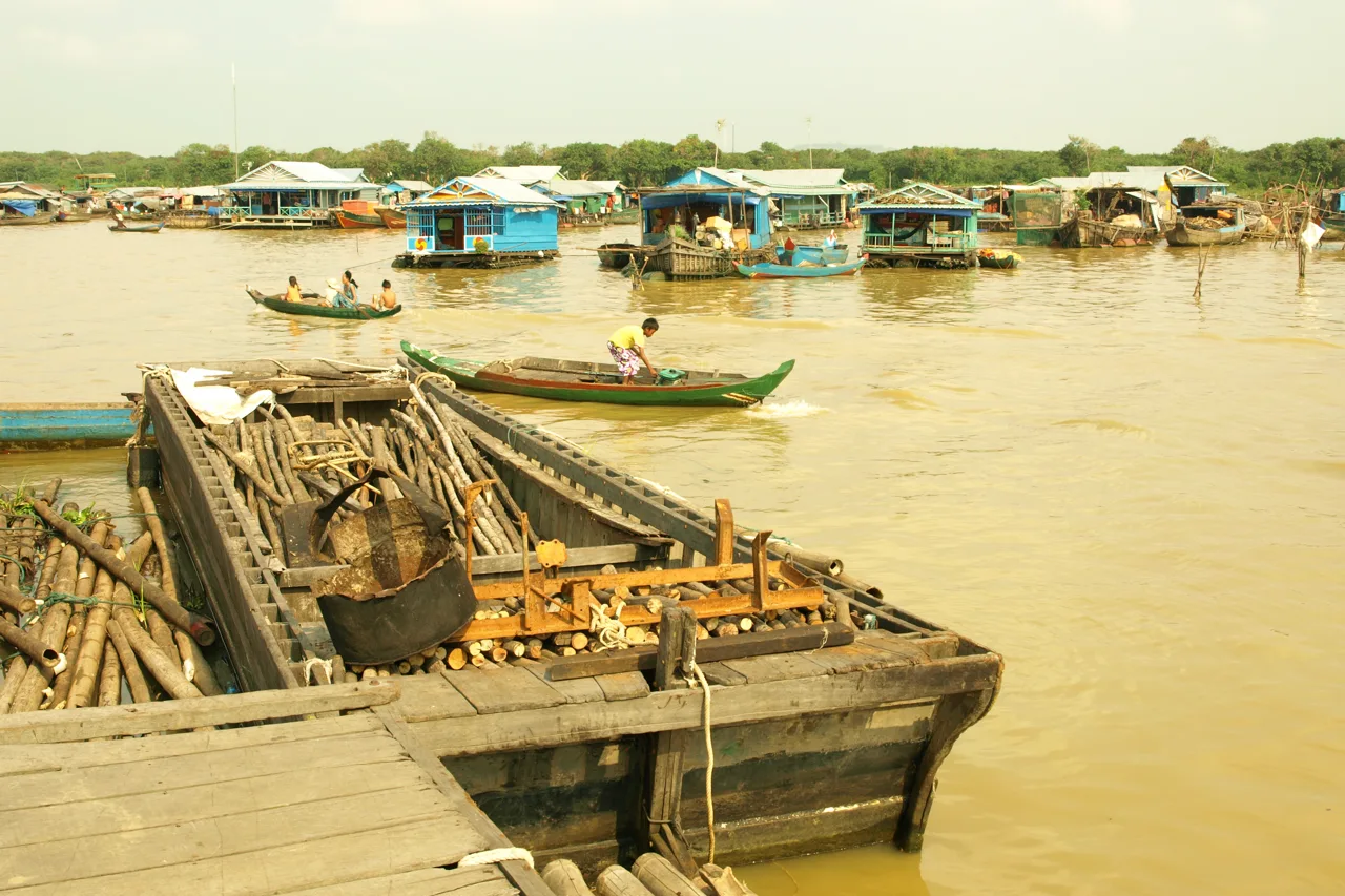
Dated photographs show different parts of the destination. They are documentary context, not promises about current access, water conditions or wildlife sightings.

Sok Heng Oeun
Sok Heng Oeun is the owner and editor of Hidden Corners. The Hidden Corners Editorial Team supports image preparation and editorial checks under his direction.
Sok Heng Oeun on Facebook ↗Research and AI-assisted editorial preparation. Publication authorized by Sok Heng Oeun; an individual owner reading review is not recorded. This guide does not claim a firsthand team visit.
Sources & image credits
Sources supporting this guide. Dated prices and access reports can change; confirm with the responsible authority before travelling.
- MRC geographic explanation ↗
- Flood-pulse research and study period ↗
- Ministry community-tourism account ↗
- SVC sample itinerary ↗
- UNESCO biosphere profile ↗
- ChildSafe traveller guidance ↗
- MRC seasonal context ↗
- Monitoring and forecasts ↗
- Official Chong Kneas boat tariffs ↗
- UNESCO strategic-plan announcement ↗
Photograph credits
- Tonle Chong Kneas · jokertrekker · 2010-02-02 · CC BY 3.0. Resized and converted to WebP; display may crop to fit. These adaptations remain available under their respective licences.
- Tonle Floating · Christophe95 · 2018-07-03 · CC BY-SA 4.0. Resized and converted to WebP; display may crop to fit. These adaptations remain available under their respective licences.
- Tonle Phluk · Jakub Hałun · 2017-11-29 · CC BY-SA 4.0. Resized and converted to WebP; display may crop to fit. These adaptations remain available under their respective licences.
- Tonle Fisher · HansenHimself · 2020-02-21 · CC BY 4.0. Uses a publisher-provided resized version, converted to WebP; display may crop to fit. These adaptations remain available under their respective licences.
- Tonle Tailorbird · Charles J. Sharp · 2025-02-24 · CC BY-SA 4.0. Uses a publisher-provided resized version, converted to WebP; display may crop to fit. These adaptations remain available under their respective licences.
Packing and outfit graphics: AI-generated editorial illustrations. Portrait: supplied by Sok Heng Oeun.