AI illustration
 Edited by
 Between the first and the eighth of August 2026, Vallenar received 186.9 millimetres of rain — more than four years' worth. Alto del Carmen took 210.8. Chile declared a state of catastrophe. The threshold that triggers a desert bloom is fifteen millimetres, and this was more than twelve times that, in exactly the zone that flowered last year.
The frequency everyone gets wrong
This is a desk-researched dossier; nobody from this publication has been to the Atacama. It is built from CONAF, Chile's meteorological and water agencies, ESO, NASA, peer-reviewed geology and ecology, SEC filings, UNESCO and established Chilean news.
Almost every account of the desierto florido says it happens every five to seven years. That number has institutional backing — the Pontificia Universidad Católica quotes it — but the record does not support it as a description of the last decade.
Verified blooms: 2015, which produced two in one year, in April–May and again in September–October; 2017; 2021, documented in a peer-reviewed study near Caldera; 2022; a winter bloom in 2024, the first out-of-season event since 2015; and 2025. That is six events in eleven years.
Satellite data pushes it further. A GIMMS NDVI analysis reported by NASA identified thirteen greening events between 1981 and 2015 — an average return of about 2.7 years.
The discrepancy is definitional rather than a contradiction, and it is worth saying so. A satellite "greening event" includes modest vegetation activation invisible to a visitor. CONAF's desierto florido is a much higher bar. But the honest summary for anyone planning a trip is that this is far more frequent than the folklore, and increasingly unpredictable in its timing.
 AI illustration
What actually triggers it
CONAF's operational figure is that the phenomenon activates when rainfall exceeds 15 millimetres — more precisely, at least 15 mm across the Atacama Region within six weeks. An academic variant puts it above 20 mm.
But rain alone is not enough. As a University of Chile botanist puts it, two conditions are necessary: a certain quantity of precipitation and cold waves. That is why the 2024 event surprised everyone — it came in winter, on only 11 to 12 millimetres of April rain plus heavy coastal cloud.
The 2024 bloom is also the best available lesson in scale. It covered a few hundred square kilometres. A typical spring bloom covers 15,000. CONAF's own head of biodiversity called it "una activación vegetal acotada" — a limited vegetal activation, under 1% of the region. Photographs of a good bloom and photographs of a poor one look identical at close range.
More than two hundred species of annual plants and geophytes are involved. That figure is CONAF's and is the defensible one; some estimates suggest the true number could be double, but "over 400" is not supported.
The park that is being sued
Chile did create a national park for this, and the usual date given is wrong.
Parque Nacional Desierto Florido was created by Decreto N°12, published in the Diario Oficial on 12 June 2023 — not 2025. It covers 57,107.4 hectares in two sectors, Travesía and Chañarcillo, about 30 km south of Copiapó, protecting interior Mediterranean desert scrub, the endangered Pintoa chilensis and guanaco habitat alongside the bloom itself.
What happened in 2025 was litigation. Chile's mining association sought to have the park invalidated, was rejected in June 2025, filed suit in July, and the environmental court declared the case admissible on 6 August 2025 — arguing that the park covers 376 mining concessions and amounts to regulatory expropriation. As far as we could verify, that case has not been resolved.
There is a further irony that any visitor should know. CONAF's own 2025 forecast gave a "very low probability" of the bloom appearing inside the national park created to protect it. The flowers that year were around Huasco, Freirina, Vallenar and Llanos de Challe — up to eighty-five kilometres south. The park has no visitor infrastructure and, twenty months after creation, no dedicated funding.
The driest place, precisely
The hyperarid core receives under two millimetres a year. Quillagua holds the driest recorded long-term average at 0.5 mm a year across 1964 to 2001, and Arica went 172 consecutive months without rain between October 1903 and January 1918.
Note what that is not. It is not "it has never rained." No weather station we could find is credibly reported as having never recorded rain, and Guinness — usually the source of that claim — makes no such statement.
What happens when it does rain is more interesting than never. In 2015 and 2017 the Yungay area received about 40 millimetres, roughly ten times normal, in events for which there is no record of anything comparable for at least 500 years. They created previously unrecorded hypersaline lagoons that lasted months — and killed most of the resident microbial community by osmotic shock, leaving mainly halophiles behind, including a species new to science.
In this desert, rain is a catastrophe rather than a relief. Which is a useful thing to hold in mind while watching it flower.
The desert is also much older than was thought until three months ago. A study published in Nature Communications in May 2026, using cosmogenic nuclide dating across 135 samples, places the onset of hyperaridity in the core at about 45 million years — some twenty million earlier than the previous consensus, and before both the Humboldt Current and major Andean uplift. Erosion rates run below 0.1 metres per million years. And yet the same basin held ephemeral lakes during past interglacials. Nothing here is as static as it looks.
The sky, and the threat that was called off
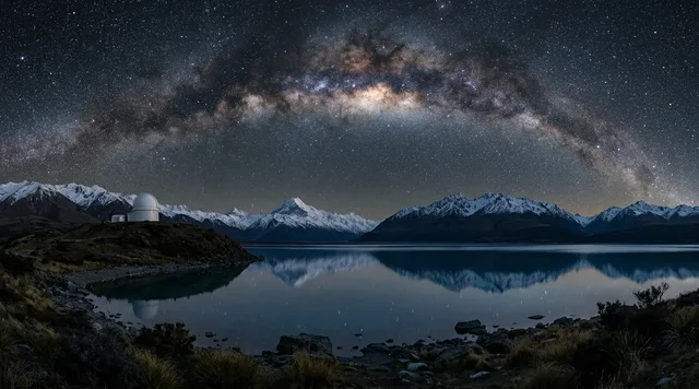
The Atacama holds the world's most important concentration of ground-based astronomy: ALMA's 66 antennas on the Chajnantor plateau above 5,000 metres, the Very Large Telescope at Paranal at 2,635, and the Extremely Large Telescope under construction on Cerro Armazones at 3,046 — a 39-metre mirror of 798 segments, 978 square metres of collecting area, €1.45 billion, with telescope first light due March 2029 and scientific first light December 2030.
In December 2024 an energy company submitted plans for a green hydrogen and ammonia complex of over 3,000 hectares carrying more than a thousand light sources, about eleven kilometres from the VLT. ESO's analysis in March 2025 was blunt: light pollution up at least 35% at the VLT, at least 55% at the neighbouring gamma-ray observatory, and seeing degradation of up to 40%. Its conclusion was that the only way to save Paranal's skies was to relocate the complex. In December 2025 nearly thirty astronomers led by a Nobel laureate appealed to the Chilean government.
And then it stopped. The company announced the project's discontinuation on 23 January 2026 and formally withdrew it from environmental evaluation on 6 February. ESO's director-general was careful about the precedent: green energy projects are fully compatible with observatories if they are sited far enough away.
Chile has also legislated. Its lighting norm, in force since October 2024, caps blue-light content at 7% nationally and 1% in designated special protection areas.
The salar, and what the water is doing
The Salar de Atacama is a different part of this desert and a harder story.
Between 1986 and 2020, roughly 913 million cubic metres of brine were extracted across both operators. The main producer's own filing to US regulators shows extraction declining from 1,159 litres per second in 2024 to a planned 822 by 2030, against a lease that runs to the end of that year.
The measurable consequence is not a drained lake. It is subsidence. Satellite radar interferometry shows the salar sinking at one to two centimetres a year, with the phreatic level down about ten metres in several wells. The researcher who published it put the risk plainly: subsidence caused by irreversible changes in permeability can be a very serious problem. Outside the salar nucleus, drawdown is generally under 25 centimetres.
And there is a biological signal that is hard to explain away. Thirty years of counts published in Proceedings of the Royal Society B found Andean and James's flamingo numbers at the Salar de Atacama fell 10 to 12% over eleven years while populations at other lakes showed no decline. One salar, one trend, one obvious variable.
The people who live there have at least been paid. A ten-month indigenous consultation covering 28 Atacameño — Lickanantay — communities and 40 associations concluded in September 2025, with contracts running to 2060 and funds that could yield up to US$150 million a year, roughly ten times the previous figure. Whether that is compensation or consent is a judgement this dossier will not make for you.
Why the Silence Index is 66
Access friction is moderate: paved highway from Santiago or a flight to Copiapó, no permit, no cap — but the bloom zone is spread across hundreds of kilometres of unsignposted coastal desert, and the event itself is unpredictable enough that most visitors miss it. Footfall concentrates hard on San Pedro de Atacama, seven hundred kilometres north, which is a different place entirely. The acoustic floor across the bloom zone is genuine: this is empty land, and in a non-bloom year nobody goes at all. What holds the score down is that both ends of the desert are heavily industrialised — by lithium in the salar and by astronomy on the ridges.
Two things worth separating
First, the Chinchorro mummies. They are real, they are astonishing, and they are not near San Pedro. UNESCO inscribed them in 2021, dating them from approximately 7400 BP to 2840 BP — roughly 5450 to 890 BCE. The earliest predate Egyptian mummification by about two and a half thousand years. But they are on the far northern coast in Arica y Parinacota, over a thousand kilometres from the bloom zone and from the San Pedro circuit. Three separate trips get merged into one in most coverage.
Second, San Pedro's attractions are mostly not run by the state. Valle de la Luna, Laguna Chaxa, Miscanti and Miñiques and the rest are administered by Atacameño communities — Toconao, Socaire, Coyo — rather than by CONAF. That is not a footnote. It determines where your entrance fee goes.
 AI illustration
What happens next
Almost certainly a bloom, and possibly a very large one.
The July and August 2026 storms broke records that had stood since 1987. La Serena took over 150 millimetres in four days against an annual average of about 75. Vallenar received 186.9 millimetres and Alto del Carmen 210.8 in a single early-August event. A climatologist at the University of Santiago called it the worst storm ever recorded in La Serena. The president declared a state of catastrophe across the whole Coquimbo Region and Huasco Province.
That is more than twelve times CONAF's trigger threshold, delivered into precisely the zone that bloomed in 2025.
But we are not going to tell you there will be a bloom, because CONAF has not said so. Its 2025 announcement came on 11 August; as of 13 August 2026 there is no 2026 equivalent. Check CONAF directly in late August or September before planning anything around it — and check the roads too, because a state of catastrophe means damaged infrastructure in the exact area you would be driving to.
One last note against the temptation to draw a climate conclusion. CONAF's own biodiversity chief explicitly declined to attribute the 2024 winter bloom, saying it is not established whether it was directly related to climate change, or to El Niño or La Niña. Another researcher warns in the opposite direction — that the drought periods between blooms are getting longer. A desert that flowers more often is not obviously a desert doing better.
Corner Codex — D-013
- Place
- Atacama and Coquimbo regions, northern Chile
- Coordinates
- 28.2°S, 71.2°W (the bloom zone, around Vallenar and Huasco)
- Bloom trigger
- About 15 mm of rain across the region within six weeks, plus cold waves
- Recent blooms
- 2015 (twice), 2017, 2021, 2022, 2024, 2025 — six events in eleven years
- Species
- More than 200 annual plants and geophytes
- The national park
- Parque Nacional Desierto Florido, 57,107.4 ha, created 12 June 2023
- Its legal status
- Contested — a mining-association suit went to court in August 2025
- Hyperarid core rainfall
- Under 2 mm a year. Quillagua averages 0.5 mm
- Age of hyperaridity
- About 45 million years — revised upward in May 2026
- Silence Index
- 66 / 100
Silence Index
A legacy editorial rating based on desk research. It is not an acoustic measurement or a safety rating.
Earlier and later dossiers used different fourth inputs. Individual input scores were not recorded, so these totals cannot be independently reproduced or used for precise comparisons between places.
The Traveler's Panel · checked
Changing information. Prices, permits, seasons and road access change, sometimes at short notice. Everything here is a starting point for your own confirmation — not a quote, and not a guarantee. Verify with the operator and the relevant official body before you book.
| Bloom season | Usually September to November, peaking October. Winter blooms now happen too |
| 2026 status | Record rain in July–August. No CONAF bloom announcement as of 13 August |
| Where | Huasco, Freirina, Vallenar, Canto del Agua and Parque Nacional Llanos de Challe |
| Not where | CONAF gave the national park itself 'very low probability' in 2025 |
| Valle de la Luna | CLP 10,800 general · CLP 5,400 seniors and students. No entry on foot |
| Advisory | US Level 2. Theft on buses to and from Calama and San Pedro is specifically flagged |
Getting there — Santiago → Copiapó or Vallenar · Calama for San Pedro
- The bloom zone is the Atacama Region around Vallenar and Huasco, reached from Copiapó or directly up Route 5 from Santiago. It is not San Pedro de Atacama, which is 700 km north and a completely different trip.
- Check CONAF's own announcements before travelling. They publish the bloom zone each year and it moves — in 2025 it ran from Totoral in the north to Caleta Chañaral de Aceituno in the south, and largely missed the national park.
- Check road conditions too. A state of catastrophe was declared for Coquimbo Region and Huasco Province in July–August 2026 after record rainfall, and infrastructure damage in the bloom zone is likely.
- For San Pedro de Atacama: fly to Calama, then about an hour by road. Most sites there are administered by Atacameño communities rather than CONAF, with their own hours and check-in requirements — Miscanti and Miñiques require compulsory check-in at the Socaire control post.
- El Tatio sits at about 4,300 m. Acclimatise in San Pedro first and go at dawn, which is when the geysers perform and also when it is coldest.
Indicative costs — verify before booking
| Valle de la Luna | CLP 10,800 general · CLP 5,400 seniors and students |
| Lagunas Miscanti & Miñiques | CLP 2,000–4,000 domestic · CLP 4,000–8,000 international |
| Laguna Chaxa | Administered by Comunidad Toconao; open daily 08:00–19:00 |
| The bloom | Free. It happens on open desert and roadside |
| Note | Fees go to Atacameño communities at most San Pedro sites, not to the state |
What to pack
- Sun protection beyond anything you would normally carry. The Atacama records the highest UV radiation on Earth.
- Warm layers for altitude — El Tatio at 4,300 m before dawn is genuinely cold.
- A macro lens or close-focusing camera. The bloom is a carpet from a distance and individual flowers close up; the second is the better picture.
- Water at desert quantities, and more if you are going above 4,000 m.
- Nothing to dig with. Collecting seeds or bulbs is prohibited and it is how a bloom zone dies.
Where to stay
For the bloom, Vallenar and Copiapó are the practical bases — ordinary Chilean provincial towns with hotels, fuel and supermarkets, and nothing touristic about them, which is appropriate for a phenomenon that only exists some years. Huasco on the coast is smaller and closer to the southern bloom zone. For the San Pedro circuit, San Pedro de Atacama itself is the only real option and has everything from hostels to high-end lodges; it also sits at 2,400 m, which makes it a sensible place to spend a night before going up to El Tatio. The two ends of this dossier are a two-day drive apart.
Safety & responsible travel
- Stay on established routes and do not drive onto the flowers. CONAF's rules for the bloom are explicit: no picking, no collecting seeds or bulbs, no pets, established routes only.
- Use SERNATUR-registered operators, and report damage on 133 or 134.
- Understand where your money goes at San Pedro. Most sites are run by Atacameño communities — Toconao, Socaire, Coyo — and that is a reason to pay the fee rather than avoid it.
- Do not repeat 'it has never rained here.' It is unsupported, and the truth is better: the 2015 and 2017 rains were unprecedented in 500 years and killed most of the resident microbial life.
- Be careful about attributing the bloom to climate change. CONAF's own biodiversity chief declined to, and another researcher notes the droughts between blooms are lengthening.
Nearby, and quieter
Parque Nacional Llanos de Challe, on the coast north of Huasco, is the reliable bloom park — CONAF names it every year, unlike the newer Desierto Florido park inland. Around San Pedro: Valle de la Luna, the Salar de Atacama and Laguna Chaxa's flamingos, the Miscanti and Miñiques lakes, and El Tatio, the largest geothermal field in the southern hemisphere. Far north in Arica y Parinacota, over a thousand kilometres away, the Chinchorro mummy sites hold the oldest artificial mummification on Earth — a separate journey, not a day trip.
Getting there, in order
- 1Santiago
- 2Copiapó or Vallenar · Calama for San Pedro
Each leg is a separate booking and a separate chance to be weathered out. Build spare days into the chain, not onto the end of it.
Where it is
Atacama Region bloom zone, Chile · 28.2000°S 71.2000°W · Open in Google Maps · OpenStreetMap
Key locations
- Vallenar — the base town for the bloom zone; 186.9 mm of rain in early August 2026
28.5761°S 70.7592°W - Huasco — coastal town at the centre of CONAF's 2025 bloom zone
28.4658°S 71.2225°W - Freirina — named in CONAF's 2025 bloom announcement with Huasco and Vallenar
28.5092°S 71.0811°W - Llanos de Challe — the plain inside the national park CONAF names for the bloom every year
28.2136°S 71.0475°W - Carrizal Bajo — northern access to Llanos de Challe; the Los Pozos ranger post is south of here
28.0825°S 71.1469°W - Copiapó — regional capital and CONAF Atacama's office; the new park lies 30 km south
27.3672°S 70.3319°W - Alto del Carmen — took 210.8 mm in the single early-August 2026 storm
28.7594°S 70.4864°W
Coordinates are for orientation and are accurate to roughly the width of the feature named, not to a doorway. Several of these points are inside protected areas or need a permit, a guide or a boat — read the access notes above before you plan a route to any of them.
Sources & further reading — checked
- CONAF — Parque Nacional Desierto Florido. Creation by Decreto N°12 published 12 June 2023; area of 57,107.4 ha in the Travesía and Chañarcillo sectors; the 15 mm rainfall activation threshold; the protected scrub, Pintoa chilensis and guanacos; and the absence of visitor infrastructure
- CONAF — Vive la magia del Desierto Florido 2025. More than 200 species of annual plants and geophytes; the 2025 bloom zone from Totoral to Caleta Chañaral de Aceituno covering Huasco, Freirina, Vallenar and Llanos de Challe; the 'very low probability' forecast for the national park itself; and the visitor rules
- CONAF Atacama — Desierto Florido 2025 ya es una realidad. Rainfall of over 40 mm on 1 August 2025 in Huasco Province, and the bloom running from mid-September, peaking in October and ending in late November or early December
- NASA Earth Observatory — Atacama Greening. The GIMMS NDVI analysis identifying 13 greening events between 1981 and 2015, and 2017 as the last major event prior to 2019
- Pontificia Universidad Católica de Chile — Desierto florido: las claves. The institutional 'every five to seven, or ten years' framing and its link to El Niño — the figure this dossier tests against the event record
- La Tercera — No ocurría hace una década: el desierto de Atacama florece en pleno invierno. CONAF's precise trigger of at least 15 mm across the region within six weeks, and the historical bloom years from 1983 to 2002 including the two separate blooms of 2015
- Universidad de Chile, Facultad de Ciencias Forestales — Desierto Florido revive tras años de sequía. The 2022 bloom; the academic 20 mm variant of the threshold; and the requirement for both rainfall and cold waves
- AFP via Phys.org — Unusual rainfall brings winter bloom to Chile's Atacama (July 2024). The 2024 winter bloom on 11–12 mm of April rain, covering a few hundred km² against a typical spring bloom's 15,000 km²; CONAF's description of it as a limited activation under 1% of the region; and the refusal to attribute it to climate change
- Martínez-Harms et al. (Frontiers in Ecology and Evolution, 2022). Peer-reviewed documentation of the September–October 2021 blooming event near Caldera
- La Tercera — SONAMI se va contra la extensión del Parque Nacional Desierto Florido. The mining association's invalidation request of August 2024, its rejection in June 2025, the suit filed in July and declared admissible on 6 August 2025, and the argument that the park covers 376 mining concessions
- La Tercera — Emergencia sin precedentes: Coquimbo y Huasco baten récords históricos de lluvia (2026). The state of catastrophe declared for Coquimbo Region and Huasco Province; over 150 mm in four days at La Serena against a 1987 record of 125 mm and an annual average near 75 mm
- Radio Atacama — Provincia Huasco concentró mayores precipitaciones regionales (August 2026). The 8 August 2026 totals: Vallenar 186.9 mm, Alto del Carmen 210.8 mm, Amolanas 109 mm and Copiapó 24.2 mm, from INIA, DGA and CEAZA networks
- Ritter et al. — Scientific Reports 9 (2019). Hyperarid core rainfall under 2 mm a year, and diatom evidence for ephemeral lakes in the basin during past interglacials
- Azua-Bustos et al. — Scientific Reports (2018). Yungay mean annual values mostly below 4 mm; the 2015–2017 rains delivering about 40 mm with no comparable record for at least 500 years; the resulting hypersaline lagoons; and the osmotic-shock die-off of the resident microbial community
- Guinness World Records — Driest place. Quillagua at 0.5 mm a year across 1964–2001, and Arica's 172 rainless months from October 1903 to January 1918 — and the absence of any claim that a station has never recorded rain
- Ritter-Prinz et al. — Nature Communications 17 (May 2026). Hyperaridity in the core beginning about 45 million years ago — some 20 million earlier than the previous consensus and before the Humboldt Current and major Andean uplift — from 135 samples using cosmogenic nuclides, with erosion rates below 0.1 m/Myr
- ESO — Industrial megaproject threatens Paranal skies (March 2025). The INNA complex of over 3,000 ha with more than 1,000 light sources about 11 km from the VLT; projected light pollution increases of at least 35% at the VLT and 55% at CTAO-South; seeing degradation up to 40%; and ESO's call for relocation
- ESO — AES Andes discontinues the INNA project (February 2026). The announcement of discontinuation on 23 January 2026, the formal withdrawal from environmental evaluation, and the director-general's statement on siting distance
- ESO — Extremely Large Telescope facts and timeline. Cerro Armazones at 3,046 m; the 39 m mirror of 798 segments and 978 m² collecting area at €1.45 billion; and telescope first light in March 2029 with scientific first light in December 2030
- ESO — ALMA. The 66 antennas on the Chajnantor plateau at 4,576–5,044 m, with baselines from 150 m to 16 km
- Ministerio del Medio Ambiente, Chile — Norma Lumínica. D.S. N°1/2022 in force since October 2024, capping blue-light content at 7% nationally and 1% in special protection areas
- SQM — SEC Technical Report Summary, Salar de Atacama. Brine extraction declining from 1,159 L/s in 2024 to 822 L/s by 2030, and the CORFO lease running to 31 December 2030
- Link et al. — Water 17(22) (November 2025). Cumulative brine extraction of about 913,200,000 m³ between 1986 and 2020 across both operators, and drawdown outside the salar nucleus generally under 25 cm
- Delgado et al. — IEEE Transactions on Geoscience and Remote Sensing (2024). InSAR measurement of subsidence at 1–2 cm a year, phreatic levels down about 10 m in several wells, and the warning about irreversible changes in permeability
- Gutiérrez et al. — Proceedings of the Royal Society B (2022), via University of South Carolina. Thirty years of counts showing Andean and James's flamingo numbers at the Salar de Atacama falling 10–12% over eleven years while other lakes showed no decline
- La Tercera — El detalle de los pagos del acuerdo Codelco-SQM a las comunidades. The ten-month indigenous consultation covering 28 Atacameño communities and 40 associations, contracts running to 2060, and funds potentially yielding up to US$150 million a year
- UNESCO — Settlement and Artificial Mummification of the Chinchorro Culture. Inscription in 2021 under criteria (iii) and (v), with dating from approximately 7400 BP to 2840 BP — 5450 BCE to 890 BCE — in the Arica y Parinacota Region
- Reserva Nacional Los Flamencos — access and tickets. Valle de la Luna at CLP 10,800 general and 5,400 concession with no entry on foot; Laguna Chaxa administered by Comunidad Toconao; Miscanti and Miñiques pricing and the compulsory Socaire check-in
- IUGS Geoheritage — El Tatio geothermal field. El Tatio at about 4,300 m with more than a hundred major surface manifestations, described as the largest and most diverse geothermal field in the southern hemisphere
- Azua-Bustos et al. — Frontiers in Astronomy and Space Sciences (2021). The Atacama as a Mars analogue: the highest UV radiation on Earth, mean relative humidity of 17.3% at María Elena South matching Curiosity's Mars readings, and the lowest cited mean rainfall of 0.15 mm a year
- US Department of State — Chile Travel Advisory. Level 2, Exercise Increased Caution, updated 2 July 2026, with the specific warning about theft on buses to and from Calama and San Pedro de Atacama
Official and scientific bodies are the authority for safety, regulatory and scientific claims. Commercial operators are used only for practical detail such as tour length, meeting points and indicative pricing — never for a safety or scientific statement.
How this was made
Desk research. Compiled from official bodies, scientific and conservation sources, established journalism and licensed operators. Not based on a personal visit.
Editor’s method note — what we checked, corrected and could not verify
- Desk research only. No one from this publication has been to the Atacama.
- We correct our own previous framing on frequency. Six verified blooms in eleven years, and a satellite record of thirteen greening events in thirty-five years, do not support 'every five to seven years' as a description of the present. We explain the definitional gap rather than declaring one source wrong.
- The national park was created on 12 June 2023, not in 2025. What happened in 2025 was the mining association's legal challenge, which we could verify only as far as admissibility on 6 August 2025.
- We do not state that a 2026 bloom will happen. The rainfall vastly exceeds CONAF's threshold in the right zone, but CONAF has issued no 2026 announcement as of 13 August, and we present it as expected rather than confirmed.
- We drop the claim that some Atacama weather stations have never recorded rain. No authoritative source supports it; Guinness, usually cited for it, makes no such claim.
- Ten things we could not verify: a confirmed 2026 bloom; the outcome of the mining suit against the park; Albemarle's brine extraction rate; Laguna Cejar's fee and status; total lithium-related freshwater extraction, which the literature itself identifies as a data gap; the ELT's current percentage completion, last officially given as half in July 2023; the source paper behind the '13 greening events' figure, which was access-blocked; the Universidad de La Serena species chapter, blocked by robots.txt; and road and access conditions around Vallenar and Huasco after the 2026 storms, which anyone travelling must check independently.
- Coordinates for the key locations are taken from the GeoNames gazetteer, cross-checked against CONAF's own park and access pages for Llanos de Challe. Parque Nacional Desierto Florido is deliberately absent: CONAF publishes no coordinates for either sector, the creating decree's boundary schedule could not be opened, and we would rather leave the park off the list than pin it in the wrong quebrada.
AI is used to draft this text, and a human checks it. Tony Hall is responsible for editorial verification against the reference list. Our standard is to distinguish documented facts, disputed accounts and claims we could not verify. Errors can remain; readers can report them through the corrections page. The illustrations are AI-created and labelled as such — no photograph on this site is presented as a record of a real place. Full disclosure · Editorial policy.
Access details change — recheck before you travel. Found an error? Tell us — corrections are dated and shown in place.