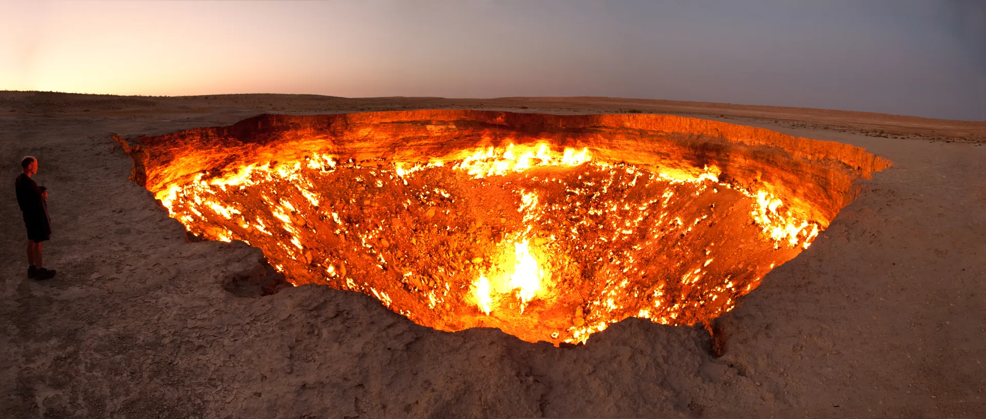

Three dates, and who stands behind each
1963, 1971, 1988. Three years, all published, all attached to the same hole in the Karakum Desert, but they do not establish one agreed date for the same event.
1971 is the popular date, and it is what the English-language news page of Turkmenistan's oil and gas ministry published on 11 January 2022: Soviet geologists near the settlement of Darvaza drilled into an underground cavity, the ground above collapsed, equipment fell in, and the escaping gas was deliberately lit so it would not poison people and livestock. NASA's Earth Observatory used the same year in September 2011, as do most encyclopaedias, newspapers and tour brochures. None cites a record.
1963 comes from the same ministry. On 24 June 2022 its news section carried a report on Turkmengaz research opening with a different sentence entirely: in 1963 an exploratory well was drilled on the Chaljulba structure of the Central Karakum group of fields, a shallow gas-filled cavity was found, and the soil above collapsed into it. Same crater, same website, same year of publication, eight years apart in the telling.
1988 is not a claim about the hole at all. It is a claim about the flame, and it comes from an instrument. A team led by Adriana Valverde at the Universitat Politècnica de València, with the UN Environment Programme's methane observatory, worked back through the Landsat archive and found no thermal signature through the mid-1980s and a clear one afterwards. The bracket is narrow: the last image with no burning is dated 20 September 1987, the first showing it 27 February 1988.
What follows is a file rather than a travel article. Each chapter is one source, described for what it is, what it establishes, and what it cannot reach; the practical material comes after, because in Turkmenistan the paperwork is a larger part of the trip than the crater is. Nobody from Hidden Corners has been there: this is desk research, with the key sources rechecked on 30 September 2026, and where sources conflict the conflict stays on the page.
Exhibit A: two pages, one government website
What the source is. Two news items on oilgas.gov.tm, the site of Turkmenistan's Ministry of Oil and Gas, both still live when we rechecked them on 30 September 2026. The first, dated 11 January 2022, reports President Gurbanguly Berdimuhamedov instructing officials to find a way to put the fire out. The second, dated 24 June 2022, reports the Scientific Research Institute of Natural Gas under the Turkmengaz state concern developing a method to bring the crater under control.
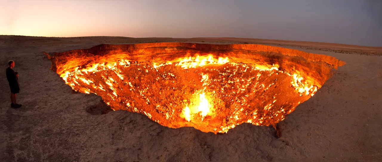
What it shows. The state has published two incompatible origin accounts within six months, in the same place, without acknowledging the other. The January page gives 1971 and describes a drilling rig hitting a void near Darvaza. The June page gives 1963 and names a specific geological target, the Chaljulba structure of the Central Karakum group of fields, then describes a sinkhole sixty metres across and about twenty deep that has burned for nearly six decades. Both pages agree the gas was set alight on purpose to stop it poisoning people and animals. Neither says who lit it, or when.
What it cannot show. Neither page cites a document, a file number, an archive or an author. They are press releases, not records, and a state publishing two years is evidence about that state's records rather than about the crater. It does not prove concealment. It fits better with an organisation that holds no primary source and has drawn, on different occasions, on two secondary traditions. The 1963 page is the more interesting of the two because it is the more specific: an unsourced date attached to a named geological structure looks copied out of a technical summary rather than a caption.
One further official layer. The crater has had a state name since 2018 — Garagum ýalkymy, the Shining of Karakum — and the settlement it is named after was abolished and rebuilt: Derweze was dismantled in 2004 on Saparmurat Niyazov's order, reportedly as an unpleasant sight for visitors, and a village of the name re-established on 28 April 2016 by renaming a nearby settlement called Aeroport. A paper trail should not be assumed continuous across that.
Exhibit B: the Soviet drilling record
What the source is. There is not one. This chapter exists to say so precisely, because the absence is the most consequential item in the file.
What would exist if the standard story were true. An exploratory well in the Soviet gas industry generated paper: a drilling licence and plan, a daily driller's log, a geological completion report, an incident report if equipment was lost, a field development summary. A blowout that swallowed a rig would have been investigated. Those documents, if created, would sit in the technical archives of the successor organisation — the Scientific Research Institute of Natural Gas under Turkmengaz, the institute now designing the crater's extinction — and in whatever Soviet-era ministry holdings passed to the Turkmen state in 1991. None has been published, cited or publicly catalogued.
What has been established from the outside. Only this: the 2026 satellite study reports that the crater is visible on a Landsat 1 image of 25 October 1972. That is a genuine document, freely available, and it fixes one end of the range. The hole existed by late October 1972. It does not distinguish 1963 from 1971, and it cannot, because the sensor that took it — the Multispectral Scanner, with a ground sample of roughly 57 by 79 metres — could barely resolve the crater at all and had no thermal or shortwave infrared band. Landsat 1 did not launch until July 1972 in any case. Before that date there is, for this location, no accessible imagery of any kind.
What it cannot show. An absence of records is not evidence that records never existed, nor evidence of a cover-up. Soviet industrial accidents were routinely unpublicised rather than actively suppressed, technical archives in the region are frequently uncatalogued, and thirty-five years have passed since the institutional break of 1991. The question is open, and the party best placed to close it has not. If anyone can produce a dated drilling log, it is Turkmengaz.
Exhibit C: the only person who went in
What the source is. A National Geographic interview published on 17 July 2014 with the Canadian explorer George Kourounis, who descended to the crater floor in 2013 on a National Geographic-funded expedition and is the first person known to have done it — as far as we can find, still the only one.
What it shows. Three things, and the smallest matters most here. The physical account: a heat-reflective suit, self-contained breathing apparatus and a custom Kevlar climbing harness, because ordinary rope would not survive the descent. The science: soil from the floor yielded bacteria living in the hot, methane-rich conditions that were absent from soil outside the crater — a result of real value to astrobiologists, who care about what survives in exactly such places. And the archive. Kourounis went looking for the origin story on the ground and reported that local Turkmen geologists told him the collapse may have happened in the 1960s and the gas may not have been lit until the 1980s. On the paperwork he was plain: "the department of geology just didn't have anything that dated back that far."
What it cannot show. This is testimony reported second-hand in an interview, not a cited source. We do not know which geologists, which department, or what they were working from; they may have been repeating a local tradition rather than consulting anything. Kourounis was not there as a historian. And a single conversation in 2013 cannot establish a negative about a national archive.
It earns its place in the file for a different reason. In 2013, working geologists in Turkmenistan described a 1960s collapse followed by a 1980s ignition. Twelve years later, a satellite team with no knowledge of that conversation independently dated the ignition to the winter of 1987–88 and left the collapse year open between 1963 and 1971. Two sources that could not have coordinated arrived at the same shape of answer. That is not proof. It is the only corroboration in the file.
Exhibit D: the Landsat archive
What the source is. Valverde, Irakulis-Loitxate, Gorroño, Pei and Guanter, "Satellite-based assessment of methane emissions from the Darvaza gas crater." Posted as an open-access preprint on EarthArXiv on 20 June 2025, revised to a third version on 2 July 2026, and subsequently published in Geophysical Research Letters in 2026 under DOI 10.1029/2025GL120321. The journal's page was not accessible to us, so the wording quoted here is from the open preprint; the journal version is the version of record.
What it shows. That a burning pit is a thermal object, and thermal objects leave a trace. Landsat 1 to 3, flying from 1972, carried only visible and near-infrared bands: they could see the hole but not the heat. Landsat 4 and 5, from 1984, added the Thematic Mapper with the thermal and shortwave infrared bands needed to register a fire. Working through that record, the team found the transition. In a scene of 20 September 1987 the thermal band is quiet; in a scene of 27 February 1988 it is not. Those two dates are the whole of the claim. The paper's timeline figure shows both Landsat 5 scenes — Band 7 in greyscale, thermal Band 6 in orange — with nothing in 1987 and an unmistakable source in 1988.
What it cannot show. Four limits, most of them stated by the authors.
- It dates the flame, not the hole. The paper calls the formation year uncertain and "assumed to be either in 1963 or 1971." A pit can collapse, vent cold gas and sit unlit for decades without registering on any thermal sensor.
- The dark years are not all evidence. Between 1972 and 1984 no thermal band flew over this site, so silence in that period means nothing. The informative window is only 1984 to 1987: three years of an instrument capable of seeing a fire and not seeing one.
- Revisit gaps are real. The bracket is five months wide because that is how often a usable, cloud-free scene arrived, not because anything is known about the interval.
- It says nothing about agency. No satellite records who struck the light, on whose instruction, or whether anyone wrote it down.
Set against the 1971 story, the finding is narrower than headlines suggest and more damaging than they convey. The flame is the only element of the popular account an instrument could ever have checked, and when one finally did, it came out sixteen or seventeen years late.
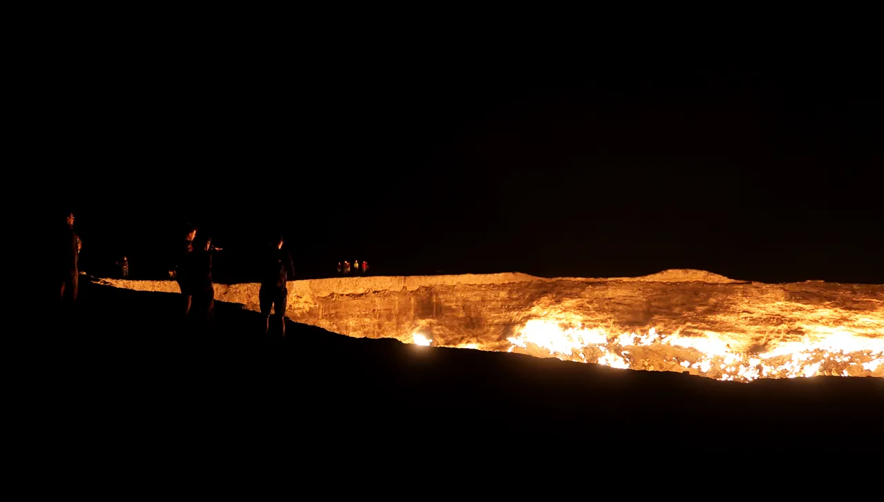
Exhibit E: what the methane shows
What the sources are. Three independent bodies of measurement. The Valverde study used five hyperspectral instruments — EnMAP, PRISMA, EMIT, GF-5A and ZY-1E — to look for unburned methane above the crater between 2020 and 2025. Capterio, which tracks gas flaring from orbit, published its own analysis in April 2024 and has continued it. Carbon Mapper, a US non-profit, has its own methane observations. The last two were drawn together in New York Times reporting of 4 May 2026, which we could not open; those figures are second-hand, as carried by AccuWeather on 14 May 2026 and The Cool Down on 6 May 2026.
What they show. The crater emits two ways at once, and only one is photogenic. Burning methane becomes carbon dioxide, which warms the atmosphere far less per tonne; methane that escapes the flame does not. Valverde's team detected 44 plumes of unburned methane over five years, at roughly 1,000 to 3,000 kilograms an hour, totalling 71 kilotonnes give or take 21. Carbon Mapper's series, as reported, averages nearer 1,300 kilograms an hour across 2022 to 2025 — and gives 1,960 in October 2025.
That October figure is the most important number in this file, because of what the flames were doing at the same time. Capterio's infrared analysis, as reported by the New York Times, puts the fall in heat intensity at more than 75 per cent over three years. Valverde's team, independently, report a more than twofold drop in visible burning from September 2023 — and then state the finding flatly: no clear correlation has been found between the reduction in flaring and the intensity of methane emissions. Their explanation is that part of the gas escapes directly to the atmosphere through multiple subsurface fissures, bypassing combustion. On that reading, a well that lowers pressure at the crater floor reduces the gas flared without reducing the gas vented.
What they cannot show. Plume detection is opportunistic: a hyperspectral instrument sees the site only when it passes over, in daylight, with the right geometry and no cloud, so 44 plumes over five years is a sample and not a census, and the rates are retrievals with real uncertainty. The study's lifetime total — at least 800 kilotonnes if the crater formed in 1971, or 900 if in 1963, each plus or minus 300 — is arithmetic rather than measurement: it extrapolates a modern rate back across decades of unknown reservoir pressure, to a formation date the same paper says is unknown. The authors call it conservative because it excludes everything that burned. It is still a number built on the date nobody has.
For scale rather than blame: the International Energy Agency has for years ranked Turkmenistan's oil and gas sector among the world's most methane-intensive, and the country joined the Global Methane Pledge at COP28 in December 2023. Darvaza is the leak everybody can see. It is not the largest.
Exhibit F: the programme to end it
What the sources are. A chain of dated state announcements carried by the Turkmen energy press and picked up regionally, plus independent satellite series and one outside engineer's assessment.
The chronology, as published. In 2010 President Gurbanguly Berdimuhamedov called for the crater to be dealt with; nothing verifiable followed. In 2018 it acquired its official name. In January 2022 he ordered officials to find a way to extinguish it, citing environmental harm, the health of nearby residents and the loss of exportable gas. In June 2023 Irina Luryeva, head of a laboratory at the Scientific Research Institute of Natural Gas, said a project existed to limit gas flow to the crater but that "work has not yet begun, because it is necessary to carry out a theoretical study." In April 2024 Capterio reported that flaring had roughly halved since September 2023, after an inclined sidetrack well was drilled to divert some of the flow before it reached the crater floor. At a conference in June 2025 Luryeva said the reduction in fires was "nearly threefold." On 28 December 2025 Turkmengaz announced a further well to "completely eliminate uncontrolled gas emissions into the atmosphere."
What the engineering actually is. Not firefighting. Safety teams who went in hoping to fit flow-control equipment found gas leaking from many separate surface outlets, so capping was abandoned: sealing one vent risks raising pressure and opening another. The replacement strategy is reservoir depletion. The crater is fed from the Chaljulba structure of the Zeagli–Darvaza field group, where gas-bearing layers lie between roughly 200 and 950 metres and are hydrodynamically connected rather than isolated. Drill into the most productive of them, extract hard, and let the pressure driving gas to the surface fall away. Starve it rather than smother it.
What the sources cannot show. No completion date appears in any statement we found, and no well-by-well production data has been released, so the state's causal claim — our wells, therefore fewer flames — cannot be checked from outside. Capterio's later data complicates it: as reported in May 2026, the flames may have dimmed before the 2024 wells went in, through natural changes underground. Sukru Merey, a natural gas engineering specialist at Batman University in Turkey, told RFE/RL that eliminating leakage to the crater completely may not be possible and that the work would cost millions of dollars.
Two things are therefore true at once. The spectacle is measurably shrinking on independent data and may end; and nobody has shown that less methane is reaching the atmosphere.
Exhibit G: the size of the hole
What the sources are. Everything that has ever printed a measurement. There is no published survey.
What they show. A spread hard to explain by measurement error alone.
- 60 m across, about 20 m deep — both Turkmen ministry pages, the Turkmengaz institute as reported in 2023 and again in December 2025.
- 69 m across, 30 m deep — National Geographic's 2014 expedition report, given as 225 by 99 feet.
- 70 m across, 20 m deep — an Agence France-Presse report of January 2022.
- about 70 m across, 20 m deep — the research team's own conference abstract at EGU in 2025.
- 60 to 70 m across, about 30 m deep — the same team's full paper.
- "the 100-metre-wide crater" — NASA's Earth Observatory, September 2011, describing what the Advanced Land Imager resolved from orbit.
The outliers show the mechanism. NASA's 100 metres came from an orbital sensor rather than a tape; the ministry's 60 comes with no method at all; and every figure in between is a repetition of one of the others, rounded on the way.
What they cannot show. The actual dimensions. None of these figures is presented with a method, an instrument or a date of measurement, and a crater with an undercut, actively eroding rim is not a fixed object anyway. The same drift affects the flames: Luryeva described flame heights up to fifteen metres in June 2023; reporting in May 2026 described flames five or six feet high. Both may be accurate for their moment, which is the point.
The wider lesson is the one that explains 1971. A fact with no source behind it is not weakened by repetition; it is strengthened, because each repetition becomes the next writer's citation, until the chain is long enough that nobody walks back down it.
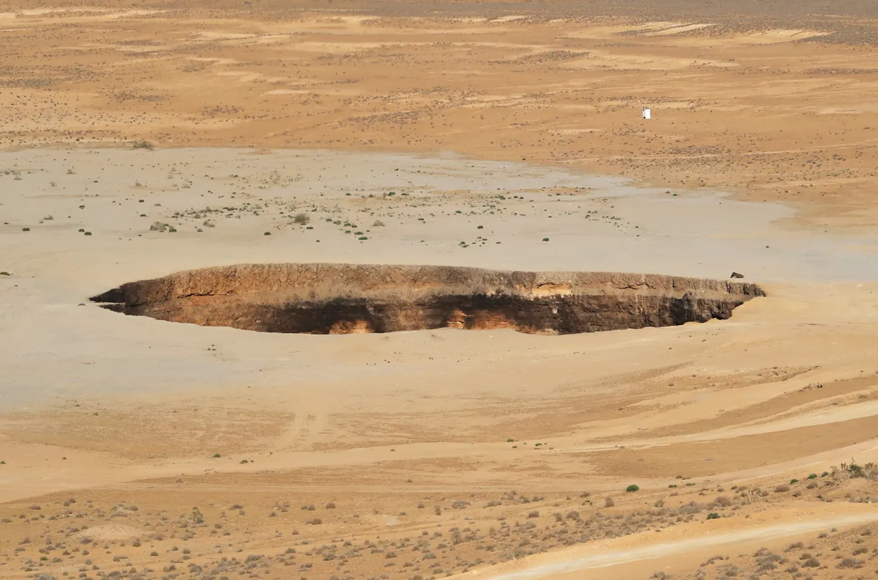
Exhibit H: what the tour industry sells
What the sources are. Operator websites, which are advertising; and reporting that quotes operators, which is not.
What they show. Two quite different things. The reporting is useful: Dylan Harris of the British operator Lupine Travel told Radio Free Europe at the end of December 2025 that the flames had declined gradually over several years and sharply in the year before, with photographs from 2025 showing scattered tongues of flame rather than a burning floor. That is a dated, attributable observation from someone who takes groups there, and it agrees with the satellite record. RFE/RL's own photographs show tourist yurts, helipads and a guesthouse.
The websites are a different kind of document. In September 2026 they still largely carry the 1971 story as fact and describe the crater in its 2011 condition. Their descriptions of the rim camps — yurt counts, showers, an open-air restaurant — are plausible and consistent with the news photographs, and none we found is sourced or dated.
What they cannot show. Who runs any of it, and under what authority. We could find no published operator name for the rim camps, no published legal or licensing status, no published capacity, and no admission charge for the crater itself. No official source we found establishes how tourist camps inside a working gas field are licensed, or who inspects them. The Embassy of Turkmenistan in Washington publishes a directory of travel agencies that provide visa support; it presents them as contacts, not as a roster of vetted providers.
The practical consequence is narrow. When an operator quotes a price you are buying sponsorship, a vehicle, a driver, a guide and a bed from a company whose regulatory standing you cannot verify from outside the country, at a site with no published safety regime. That is an argument for asking the questions in the booking chapter, not against going — and for treating anything an operator's website says about dates, dimensions or current flames as marketing until a dated photograph backs it.
What the file changes at the rim
If the file above is right, what to look at is not what the famous photographs show. Six specifics follow from the evidence rather than the atmosphere.
Look at the fracture pattern, not the floor. Gas does not rise evenly; it follows cracks. Fires cluster along fissures in the floor and at points around the wall, which is why visitors in 2025 described isolated flame fields rather than a carpet. Those are the same fissures the methane studies say are venting unburned gas past the flame.
What you cannot see is the larger part. The plumes measured at 1,000 to 3,000 kilograms an hour are invisible, detectable only in the shortwave infrared. At the rim you watch the fraction that ignites.
Arrive before sunset. In daylight the crater reads as a pale scorched bowl with heat shimmer, and with the fire this reduced, the transition to darkness matters more than it did when the floor was fully alight.
Treat the rim as unsurveyed. The edge is unconsolidated desert sediment over an undercut wall — and that wall is why nobody has measured the crater properly. Reports mention a barrier along part of the rim. Treat any fence as the closest sensible point rather than a suggestion, stand well back where there is none, and remember there is no rescue service within an hour.
Stand upwind. Heat and combustion products rise downwind, along with whatever is not burning.
Read the infrastructure as part of the exhibit. The yurts, generators, helipads and guesthouse are not incidental, and nor are the production wells in the surrounding field. You are inside an industrial gas province, looking at a leak its operator is trying to close. Most tours also stop at two nearby collapse pits, one holding water and one bubbling mud: the same ground failure without the match.
The invitation system
Turkmenistan is not closed. It is sponsored. That distinction shapes every trip to this crater, and the rules are published by three governments, in three places, not identically.
The letter of invitation is the whole system. Every visa category requires one. For tourists it is obtained through a travel agency in Turkmenistan, but — the part usually lost in summaries — the Turkmen embassy in London states that the letter is issued by the State Migration Service of Turkmenistan itself and "serves as a basis for the Embassy to issue a visa." The Washington embassy adds that it must be certified by that service and is valid only three months from certification. The agency is the applicant; the state is the inviter. You are, literally, invited by the government to visit the government's country.
Timings. The UK Foreign Office, on a page updated 4 June 2026, says embassy applications are referred to Ashgabat and can take up to a month. The London embassy quotes ten business days once it holds the certified letter, one to three expedited, and a month simply to get a transit letter approved. Work back from your travel date by at least two months.
Costs, and one discrepancy. Both embassies publish fees, and the figures are in the budget chapter below. The point to note here is that the two governments describe the arrival charge differently: the FCDO lists a US$14 migration fee, while the US State Department, on a page updated 23 May 2025, cites "a $29 registration fee". We cannot reconcile those from published sources; assume both and carry cash.
Visa on arrival exists, conditionally. It is available at Ashgabat airport and some land borders, but only with the certified letter in hand and prior approval from the Ministry of Foreign Affairs; it runs ten days, extendable by ten. The State Department's warning is blunt: arrive without a visa or certified letter and officials may hold you at the airport.
Registration is a two-ended obligation. Stay more than three working days and you must register with the State Migration Service within three days of arrival. The State Department adds what the UK page does not: you must also register your departure a day before you leave. Failure can bring fines, arrest or deportation, and deportation carries a bar on return of up to five years. Your hotel or agency normally handles both ends; confirm in writing which.
Transit visas are not a way in. Fewer than five days, their own invitation arranged in advance, entry and exit only at the crossings named on it, up to a month to process, not obtainable at the Baku seaport, and explicitly non-convertible to a tourist visa. They exist for crossing the country, not for stopping in the middle of it.
The e-visa is legislated and not operating. President Serdar Berdimuhamedow signed a decree on 18 April 2025 providing for electronic visas, reported as a step towards abolishing the invitation letter. Types, issuing procedure and validity had, at the last summary we could find, yet to be decided, and neither embassy site we checked offers one. Plan on the letter; confirm anything simpler with an embassy before buying a flight.
Restricted zones and conduct. Foreigners may not enter designated restricted zones — border areas and the Caspian coast among them — without separate permission from the State Migration Service. The FCDO's safety page, also updated 4 June 2026, says it is illegal to photograph certain buildings and to check before taking pictures of or near airports, military infrastructure, police stations, government buildings and embassies. Ask your guide before photographing anything official, highway checkpoints included. That guide is a licensed professional doing a regulated job rather than a minder to be worked around, and political questions may be uncomfortable for them rather than for you.
The road north from Ashgabat
The crater sits in Ahal Province at approximately 40.25°N, 58.44°E, in open desert off the P-1 highway running north from Ashgabat to Daşoguz. The last few kilometres are sand track needing four-wheel drive and a driver who has done it before.
Distances, plainly. The state gas company's own reckoning puts the crater about 270 kilometres north of the capital; Derweze, the nearest named settlement, is recorded at about 260. Treat both as approximate: neither is a measured road distance, and circulating figures differ by the length of the final track. The highway itself runs roughly 560 kilometres across the Karakum — a figure from enthusiast road documentation rather than an official source.
The road is being rebuilt. On 22 February 2026 President Serdar Berdimuhamedov approved, at a Cabinet meeting, a complete reconstruction of the Ashgabat–Daşoguz highway with new bridges along its entire length, to international quality and road-safety standards. No timeline or contractor appeared in the announcement. For a visitor in 2026 or 2027 that means roadworks and diversions rather than a finished motorway — worth asking an operator about, because works on a single-corridor desert highway can add hours.
Night driving is the real hazard. The FCDO states that driving standards are poor and that road travel at night outside cities is particularly dangerous because of the condition of the roads — which collides directly with the fact that the sight is nocturnal. Every competent itinerary resolves it the same way: drive north in daylight, reach the rim before dusk, sleep at the camp, drive on next morning. An operator proposing a there-and-back night run from Ashgabat is proposing the one thing the official advice warns against.
Other ways through. Derweze has a Trans-Karakum railway station at Içoguz and a small cargo airstrip, and the site has helipads. None is a public route; they are listed so nobody mistakes them for one.
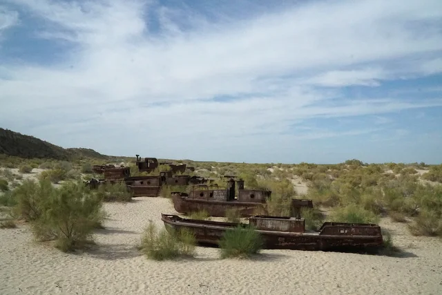
Onward. North of the crater the highway continues to Köneürgench, the ruined Khorezmian capital and a World Heritage site, and on towards the Uzbek border — and beyond it, the dry bed of the Aral Sea, the subject of our guide to Moynaq and the sea that was moved. The two make a hard pair: one Soviet-era decision that emptied a sea and is exhaustively documented, one that may or may not have lit a desert and is documented by nobody.
The map on this page marks the crater's position for orientation only. A pin is not a route, and it does not establish that any track is open or any camp operating.
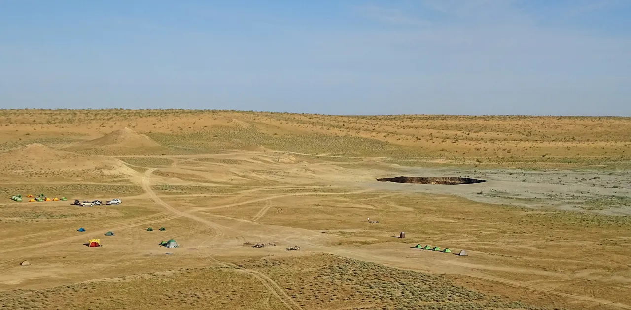
When to go, and the second clock
The Karakum has a continental desert climate with a violent daily range. Britannica gives July averages of 30 to 34°C for the central desert, implying afternoon highs well above that, and January averages from about −4°C in the north to 4°C in the south, with swings from −20°C to 10°C possible inside a day. The weather station at Ýerbent, on the same highway south of the crater, records an average July high near 39°C and average January lows just below freezing. Rain is scarce — around 70 to 150 millimetres a year, more than half of it between December and April.
Spring, roughly April to early June, and autumn, September to early November, are the comfortable windows: warm days, cool nights, and after winter rain a brief flush of desert plants. They are also when most groups run, so the rim will not be yours.
High summer makes the drive and the daylight stops punishing, and the camp has no shade. The crater visit is after dark, which helps; the rest of the day does not.
Winter gives the longest nights, the best contrast against a reduced fire, and genuinely cold camping. Sub-zero nights in a yurt need a proper sleeping system; ask the operator what bedding and heating the camp provides in the month you are going rather than assuming a yurt is warm.
The second clock. There is now a timing question with nothing to do with weather. Heat intensity has fallen by more than three-quarters in three years on independent data, and the state has announced a well intended to end uncontrolled emissions altogether, with no completion date. If seeing fire is the point of the journey, sooner is safer than later, and the most useful thing you can do before paying is ask for dated photographs from the operator's most recent group — not a gallery image, a photograph with a month on it. If the gas is cut off as planned, what remains is a scorched pit with an unusually well-documented argument attached. That may still be worth the visa, but it is a different trip, and better chosen than discovered.
Budget: what has a published price
No admission fee for the crater is published, and we will not estimate one. What has official, dated figures is the cost of being admitted to the country.
- Visa. Embassy of Turkmenistan in Washington fee table, checked 21 September 2026: single entry up to 10 days US$35; single entry up to 12 months US$385; expedited 12-month US$755; multiple entry US$75–1,015. The London embassy charges the sterling equivalent at the Bank of England rate on the day of application, and lists transit at the equivalent of US$10. Fees vary by nationality and mission, so check the mission you will actually use.
- Arrival charges. UK FCDO, updated 4 June 2026: migration fee US$14, COVID-19 test on arrival US$31, tourism tax US$2 per person per day. The US State Department instead cites a US$29 registration fee. Budget for both.
Everything else arrives bundled into a tour quote that moves with things you control. Group size is the largest lever, because vehicle, driver and guide are per-party costs — two people pay far more per head than six. Route length changes the ratio: a crater-only overnight costs less than a loop continuing to Köneürgench and Daşoguz, but the loop makes better use of a visa that took two months to obtain. Camp standard varies between basic tents, shared yurts and newer fixed facilities; ask what bedding, heating, lavatories and meals are included rather than what is available. And confirm whether the invitation letter is inside the price, and what happens to your money if it is refused.
The real budgeting risk is not the total but its form. Turkmenistan is largely a cash society for visitors: international ATMs are few, carry a 3 per cent withdrawal charge where they exist, and damaged or older US$100 notes are frequently refused. Work out arrival fees, tips, uncovered meals and a contingency in clean, recent dollars before you fly. The calculator on this page covers only the official per-person entry charges; it carries no tour price, because we have no verified quote to put in it.
Booking: you are choosing a sponsor
Your operator is also your route to a state-certified invitation, which makes this a more consequential choice than a day trip anywhere else. The questions worth asking before a deposit follow from what this article could not verify.
- Is the company itself registered in Turkmenistan, or reselling a local partner? Which entity requests the letter from the State Migration Service, and in whose name?
- What is the refund position if the letter is refused, if a border closes, or if the fire is out before you travel?
- When did their last group stand at the rim, and will they send a dated photograph from it?
- Does the itinerary reach the crater before dusk, and does it avoid night driving on the Ashgabat–Daşoguz highway — including any diversions from the 2026 reconstruction programme?
- Who operates the camp, and what exactly does it provide in the month you are going: bedding, heating, water, lavatories?
- Will they handle both arrival and departure registration with the State Migration Service, and is the tourism tax included?
Embassies of Turkmenistan publish the visa forms, the fee tables and the agency directories, and they are the authority on the rules; they do not sell tours. Hidden Corners carries no affiliate links and no commercial relationship for this destination. The two companies named in this article appear only because news reports quote them.
Packing for a desert night beside a shrinking fire
The kit follows the shape of the trip: a long vehicle day, a few hours on sand in the dark, a night with a large temperature swing, and a border system that runs on paper and cash.
Always. Passport with at least six months' validity beyond departure. A colour print of the certified letter of invitation, and spare passport photographs for registration — the Washington embassy still specifies a photograph glued rather than stapled to the form, which tells you what kind of process this is. Tour voucher and agency telephone numbers on paper, because connectivity is restricted. Clean, recent US dollar notes in mixed denominations. Closed shoes with grip for loose sand. A headlamp with a low or red setting: the track from camp to crater is unlit and you want your hands free. Water beyond what the vehicle carries, and a power bank, since camps may run on limited generator hours.
Hot months. Brimmed hat, sunglasses and sunscreen for the daytime stops. Loose, long, light clothing that covers skin rather than exposing it. Electrolyte sachets for the drive. A light scarf or buff for blowing sand — a comfort item, not protective equipment.
Cold months. Insulated jacket, warm hat and gloves for standing still on a rim at night, a thermal base layer for sleeping, and a sleeping bag or liner if the camp's bedding is basic, which you should establish before you go rather than on arrival.
Near the crater. No loose synthetic scarves or trailing straps near heat; keep camera batteries warm in winter and out of direct sun in summer. None of it makes an undercut edge safe.
Choose from the written checklist according to the season, your lawful itinerary and the operator's arrangements.
Further reading, and the sources you can check yourself
Chosen from publishers' descriptions and published reviews. None is a current access guide; visa rules change faster than books.
- Erika Fatland, Sovietistan (MacLehose Press, 2019; translated from Norwegian by Kari Dickson). A travel account of the five Central Asian republics; the publisher notes she travelled incognito through Turkmenistan, where journalists are restricted, and watches ancient customs collide with gas production. The closest thing in print to a feel for the guided-visa system.
- Adrienne Lynn Edgar, Tribal Nation: The Making of Soviet Turkmenistan (Princeton University Press, paperback 2006, 320 pp.). The publisher calls it the first book in any Western language on Soviet Turkmenistan: an archival study of how a socialist nation was assembled from genealogical Turkmen identities in the 1920s and 1930s. Read it for the institution that later drilled the Karakum, and for how it kept records.
- Sébastien Peyrouse, Turkmenistan: Strategies of Power, Dilemmas of Development (M.E. Sharpe 2012, now Routledge, 264 pp.). The publisher calls it the first comprehensive introduction to contemporary Turkmenistan in English. For the gas sector the crater belongs to, and the political economy that decides what gets published.
Free and current, and worth going to directly: the Valverde preprint is open access and readable by a non-specialist, and the UK Foreign Office advice for Turkmenistan is the clearest English statement of the entry rules.
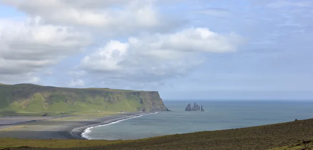
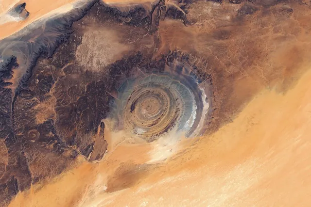
Two companion pieces approach the same problem differently. For a landform confidently mislabelled from a distance and then corrected by orbital evidence, see the Richat Structure, the eye that is not a crater. For a place where the change is measured year by year and the measurements are public, see Sólheimajökull.
Questions travellers ask
Is the Door to Hell still burning?
Yes, on the most recent reporting we could verify. In May 2026 the pit was described as still significantly alight, with flames of five or six feet — against flame heights of up to fifteen metres described by a Turkmengaz researcher in 2023. Infrared analysis puts the fall in heat intensity at more than 75 per cent over three years. A plan to cut the gas off entirely was announced on 28 December 2025 with no deadline. Ask your operator for a dated photograph.
So when did it actually start burning?
Between 20 September 1987 and 27 February 1988, if you accept the satellite evidence, which is the only independent evidence there is. That dates the fire. When the hole formed is genuinely unknown: 1963 and 1971 are both published by the Turkmen state, neither with a source, and the only hard limit is a Landsat image of 25 October 1972 in which the crater already exists.
Why does everyone say 1971, then?
Because it was printed early by outlets readers trust, and each printing became the next writer's citation. NASA's Earth Observatory used it in 2011 without citing a source; the state's own English page uses it. Nobody walked back down the chain until somebody looked at the thermal band.
Can I visit independently?
Not in any practical sense. Every visa needs an invitation certified by the State Migration Service, and for tourists that comes through a Turkmen travel agency, which means a guided tour. Transit visas are short, tied to named crossings and non-convertible.
Is it dangerous?
The risks are ordinary ones in an unusual place: an undercut, unsurveyed edge, heat or cold, a long desert road official advice says should not be driven at night, and limited medical care. The unburned methane is not a hazard to a visitor upwind at the rim; it is a hazard to the atmosphere.
Is it a meteorite crater or a volcano?
Neither. It is a collapse pit over a shallow gas reservoir, burning where the gas meets the air.
Will it be worth going if the fire goes out?
That depends why you travel. The spectacle would be gone; the case file would be complete, and the only thing left to look at.
What a document would have to say
The file closes open, and it is worth being exact about what would close it.
A single piece of paper would do it. It would have to be a primary record made at the time: a driller's daily log, a well completion report, an incident report, or a field development summary for the Zeagli–Darvaza field group. It would have to carry a date, a well identifier tying it to the Chaljulba structure, and a description of the event — a cavity met at shallow depth, loss of the hole, subsidence at surface. To settle the second question it would have to record ignition separately, with its own date and the authority that ordered it, because every account agrees the gas was lit deliberately and none says when or by whom.
Such a document, if it was made, would be in one of three places: the technical archive of the Scientific Research Institute of Natural Gas under Turkmengaz — the institute that published the 1963 date and is now designing the crater's extinction; the ministerial holdings inherited by the Turkmen state in 1991; or, because Soviet exploration reporting flowed upward, possibly a copy in the all-union geological records now held in Moscow. None has published anything, and in 2013 a visiting expedition was told the geology department had nothing that old.
Until one of them produces it, the honest statement is short. A pit existed by 25 October 1972. Something began burning in it between 20 September 1987 and 27 February 1988. Everything between those two facts is testimony; everything before the first is assertion. The government that owns the hole has published two years and no record, and is now, well or badly, engineering away the only part of it an outside instrument can measure.
Go if you want to see it. But the caption under your photograph should carry a question mark, and you now know exactly which word it belongs to.
Sources
- Valverde, Irakulis-Loitxate, Gorroño, Pei and Guanter, “Satellite-based assessment of methane emissions from the Darvaza gas crater”, EarthArXiv preprint v3, 2 July 2026 — eartharxiv.org. Published version: Geophysical Research Letters, 2026, DOI 10.1029/2025GL120321 (publisher page not accessible to us on 21 September 2026).
- Valverde et al., EGU General Assembly 2025 abstract EGU25-11171 — copernicus.org
- Turkmenistan Ministry of Oil and Gas, news item of 11 January 2022 (1971 account) — oilgas.gov.tm; news item of 24 June 2022 (1963 account, Chaljulba structure) — oilgas.gov.tm
- National Geographic, “Q&A: the first-ever expedition to Turkmenistan's Door to Hell”, 17 July 2014 — nationalgeographic.com
- NASA Earth Observatory / Earth Matters blog, “Gates of Hell”, 14 September 2011 — science.nasa.gov
- Capterio / FlareIntel, “A new perspective on old flames: satellite tracking of emissions reduction at the 60-year Darvaza fire crater”, 23 April 2024 — flareintel.com
- AccuWeather, “Turkmenistan's fiery Gates of Hell crater is dimming”, 14 May 2026, reporting Capterio data and New York Times coverage of 4 May 2026 — accuweather.com
- The Cool Down, “The Gates to Hell are closing”, 6 May 2026, reporting Carbon Mapper methane figures — thecooldown.com
- RFE/RL, “Closing the Gates of Hell”, 31 December 2025 — rferl.org
- The Times of Central Asia, “Turkmen scientists develop plan to extinguish the Darvaza gas crater”, 31 December 2025 — timesca.com
- AKIpress, “Project to extinguish Darvaza gas crater developed in Turkmenistan”, 21 June 2023 (Luryeva statement) — akipress.com
- CIRA satellite library, “Fires reduce in the Darvaza gas crater”, time series 16 February 2022 – 11 May 2025 — satlib.cira.colostate.edu
- UK FCDO, Turkmenistan entry requirements and safety and security, both updated 4 June 2026 — entry requirements, safety and security
- US Department of State, Turkmenistan country information, updated 23 May 2025 — travel.state.gov; travel advisory Level 1, 21 August 2026 — travel.state.gov
- Embassy of Turkmenistan, London, visa information — uk.tmembassy.gov.tm; Embassy of Turkmenistan, Washington, visa requirements and travel-agency directory — usa.tmembassy.gov.tm
- Government of Turkmenistan, “Major modernisation will be carried out on the key highway Ashgabat–Dashoguz”, 22 February 2026 — turkmenistan.gov.tm
- Britannica, Karakum Desert climate — britannica.com
- Valverde et al., Geophysical Research Letters 2026, Figure 2 caption (timeline: last non-flaring Landsat scene 1987/09/20, first flaring scene 1988/02/27) — researchgate.net
- Wikipedia, "Darvaza" (settlement history, Içoguz station) and "Ýerbent" (climate table citing NOAA) — Darvaza, Ýerbent
- IEA Global Methane Tracker, regional insights — iea.org
Photograph credits
- Darvaza Panorama 2011 · Tormod Sandtorv · 30 September 2011, 16:07:44 · CC BY-SA 2.0. Resized and converted to WebP; framing may crop the hero. These adaptations remain available under their respective licences.
- Darvaza Night Rim · John Pavelka from Austin, TX, USA · 7 May 2018, 12:32 (according to Exif data) · CC BY 2.0. Resized and converted to WebP; framing may crop the hero. These adaptations remain available under their respective licences.
- Darvaza Daylight Bowl · John Pavelka from Austin, TX, USA · 7 May 2018, 07:55 (according to Exif data) · CC BY 2.0. Resized and converted to WebP; framing may crop the hero. These adaptations remain available under their respective licences.
- Darvaza Surroundings · Bjørn Christian Tørrissen · 12 May 2015, 04:55:36 · CC BY 4.0. Resized and converted to WebP; framing may crop the hero. These adaptations remain available under their respective licences.
Portrait supplied by Sok Heng Oeun.
A closer look.
Dated photographs show the place, details and wider setting. They are not evidence of present access or conditions.

Sok Heng Oeun
Sok Heng Oeun is the owner and editor of Hidden Corners. The Hidden Corners Editorial Team supports image preparation and editorial checks under his direction.
Sok Heng Oeun on Facebook ↗Research and AI-assisted editorial preparation. Publication authorized by Sok Heng Oeun; an individual owner reading review is not recorded. This guide does not claim a firsthand team visit.


.jpg)
.jpg#Licensing)