
The promise, dated 15 June 2026
On 15 June 2026 the executive director of Peru's investment promotion agency said the Choquequirao cable car would be awarded to a concessionaire in October or November 2026, with civil works beginning in 2027.
Luis Del Carpio Castro told the state news agency Andina that several companies were interested, mostly European, and that they were expected to form consortiums. The investment he attached to the project was US$261 million. It was a clear statement, from the right official, in the right place.
It was also the ninth or tenth such statement, depending on how you count, in a run going back to 2011. Each one named a date. Each date passed. This guide lays them out in order, with their figures, because the sequence explains more about Choquequirao than any single announcement does.
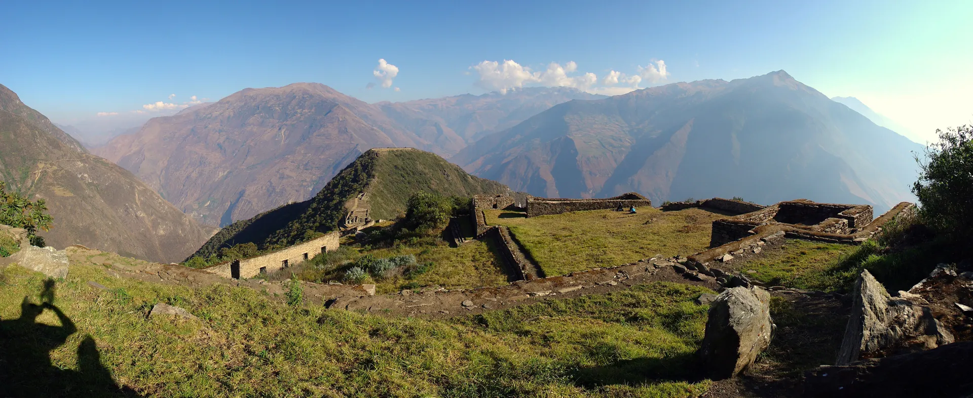
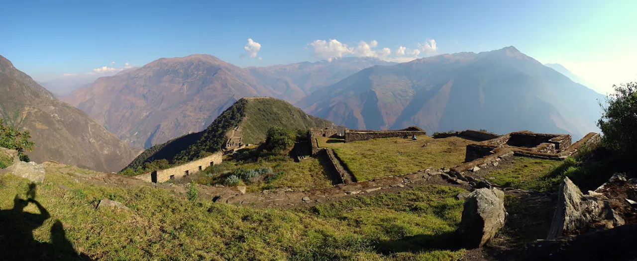
Two things are worth fixing before the ledger starts. The first is that the project is not officially called a cable car. Its name in ProInversión's documents is the Mejoramiento de los Servicios Turísticos Públicos del Parque Arqueológico Choquequirao — the improvement of public tourism services at the Choquequirao archaeological park. The cable system is the visible part of a package that also includes roads, buses and trail works. The second is that the site at the far end is a large Inca complex on a ridge above the Apurímac gorge, reached today on foot over roughly two days because there is no road, and that what is known about it is thinner than the investment figures imply.
Nobody from Hidden Corners has walked to Choquequirao, and this guide carries no trekking route advice — a refusal explained where it matters, further down. What follows is desk research from ProInversión's tender documents and project pages, the Dirección Desconcentrada de Cultura de Cusco, MINCETUR, the Ministry of the Environment's legal register, the state news agency Andina, Peruvian business and regional press, peer-reviewed work in Heritage, and UNESCO. Where a number circulates without an official publisher, we say so rather than repeating it.
August 2011 to May 2013: an intention, and the first price
The earliest entry in the ledger is political rather than procedural. In August 2011, the regional presidents of Apurímac and Cusco — Elías Segovia and Jorge Acurio — announced an intention to build a cable car linking San Ignacio de Kiuñalla, on the Apurímac side, to Choquequirao. We have not been able to open a contemporary report of that announcement and record it here as unverified; it is the date Spanish-language chronologies of the project give as the starting point.
The first entry we can read directly is from August 2013, when the Associated Press filed a report on the plan. The specification then was a tramway three miles long — about five kilometres — carrying 400 people an hour in each direction, strung roughly a kilometre above the river. The cost was US$45 million. It was to open in late 2015. It was expected to bring 3,000 tourists a day.
Two numbers in that report are worth holding on to for the rest of this guide. The first is what Choquequirao was receiving at the time: about five visitors a day. The second is a sentence the report carried without attribution — that about 30 per cent of Choquequirao had been cleared for tourism, with the rest still under vegetation. Thirteen years later that figure, in the 30 to 40 per cent range, is still the single most repeated claim about the site, and we still cannot find a Peruvian government body publishing it.
Elías Segovia, quoted in that 2013 report as president of the Apurímac regional government, framed the project the way it has been framed ever since: it would generate tourist services, and it would generate great investment. Peru's Ministry of Housing had presented the project earlier that year; a 2025 Peruvian business-press review of the country's stalled cable cars counted the wait from 2013 and made it twelve years. Spanish-language chronologies put the May 2013 announcement at S/125 million, and a revision published with the tender bases in January 2014 at S/152 million; we could not open contemporary sources for either figure.
The ridge the promise points at
Before the ledger goes any further it is worth being concrete about the destination, because the announcements are not.
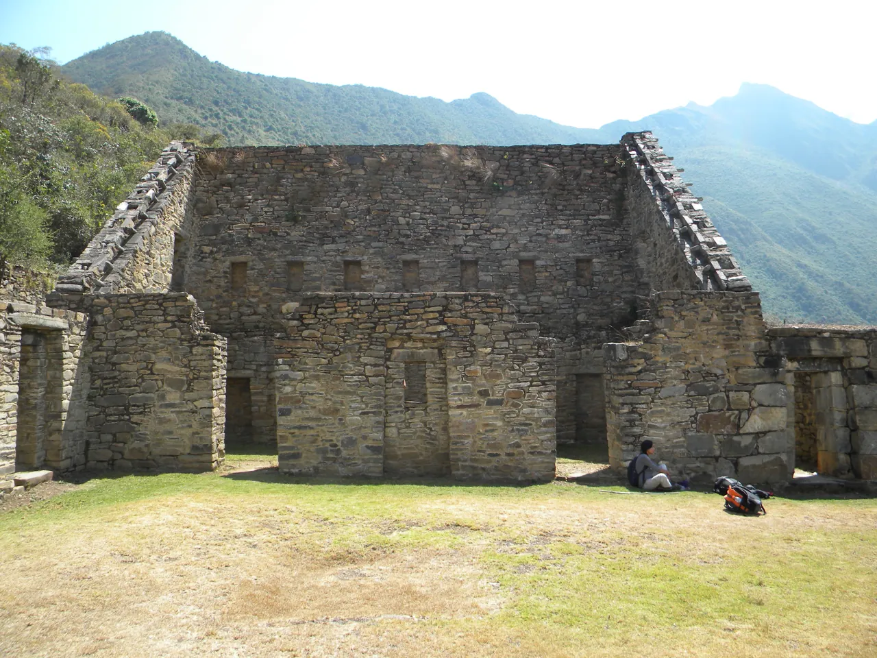
The most recent peer-reviewed treatment of the site is a 2025 paper in the open-access journal Heritage by Esenarro and colleagues. It describes Choquequirao as a ceremonial, administrative and residential centre — a gathering place for public and ceremonial events including the worship of the sun, the earth and water — whose position on the mountain also served a defensive purpose. That is three functions and arguably a fourth, which is why the complex is spread across sectors with different jobs rather than concentrated in a single monumental core.
The paper covers ten sectors distributed across 1,800 hectares, and gives areas for five of them. An upper sector of 4 hectares carries the political and ceremonial architecture. A lower sector of 4 hectares holds ritual, administrative and residential space together with camelid storage. A southern sector of 5 hectares contains the ushnu and priestly enclosures set on terraces. The eastern slopes account for 7 hectares and the western for 2, both agricultural and residential.
The camelid storage is the detail that turns a monument back into a working place. Storage implies surplus; surplus implies movement; movement implies that this ridge was a node on something rather than a retreat from it. A centre with storage for camelids above a major river looks less like a refuge than a piece of state infrastructure.
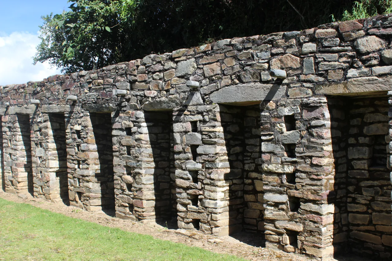
On construction the paper is specific, and this is the thing to look at on arrival. The researchers describe a seismic-resistant strategy assembled from three techniques: the calculated inclination of the walls, the precise spacing of the joints between stone blocks, and the use of structural ties. None of that is decoration. It is a set of responses to a region that shakes, worked out in stone, and it is part of why substantial parts of the complex are still standing after five centuries of neglect and cloud forest.
They also note a hierarchy in the materials. Masonry ranges from simple coursed work up to dressed stone, and the dressed stone is reserved for sacred spaces. You can read the importance the builders assigned to a structure directly off the quality of its stonework — a more useful thing to know when you get there than any excavation percentage.
What the paper does not contain matters as much as what it does. There is no excavation percentage, no visitor numbers, no mention of the cable car. The constraints it lists are a lack of emphasis on preserving the site, the physiographic, geological and climatic conditions that make access difficult, limited funding for scientific research, and inadequate circulation for visitors — research funding named before visitor infrastructure, which is the reverse of the order in which the state is currently spending.
October 2014: a judge stops the concession
The first tender was real. ProInversión convened a Concurso de Proyectos Integrales to hand the project to a concessionaire, and it reached the bidding stage. It was never awarded.
On 19 October 2014 the business daily Gestión reported that ProInversión's Pro Desarrollo committee had formally suspended the process four days earlier, on 15 October, "until further notice". The suspension was not a policy decision. It complied with a precautionary order issued by the First Mixed Court of Anta, in the Cusco Superior Court of Justice, on an action brought by the mayor of Anta, Eulogio Uscamayta, against ProInversión and the Apurímac regional government. The investment figure at that point was S/123 million.
The substance of the objection was not archaeology or environment. It was money: residents and authorities on the Cusco side wanted the revenue from a cable car whose only station would have stood in Apurímac to be shared between the two regions. A project designed as a single line from Kiuñalla to the ruins had produced a jurisdictional fight before a cable was strung.
The injunction was lifted. On 30 March 2015 Gestión reported that ProInversión had drawn up a new schedule: consultations closing on 27 April, a contract version on 1 July, and the award in the second half of 2015. The investment was still S/123 million excluding tax. That award did not happen either. Chronologies of the project record it as still judicially paralysed in March 2016 — again, a claim we could not open a contemporary source for, and which we flag as unverified.
The end of that first tender is documented from the other side. Reporting in October 2020 on the project's redesign stated plainly that the 2014 concession process had been cancelled in May 2017, because people in Cusco — specifically in the district of Mollepata — objected to the departure point being in Apurímac. Six years after the first political announcement, the state had a cancelled tender and a boundary argument.
What has actually been cleared
The claim carrying most travel writing about Choquequirao is that only 30 to 40 per cent of it has been cleared or excavated, and that the rest lies under cloud forest. Some versions say two thirds remain buried. It is a good line. It may well be true. We cannot find a Peruvian government body publishing it.
The trail of the figure runs like this. It appears in the 2013 Associated Press report as "about 30 percent", attributed to nobody. It appears as "only 40 per cent excavated" in Infobae's October 2024 investigation into land trafficking at the site, attributed there to "some studies" without naming one. It does not appear on the Dirección Desconcentrada de Cultura de Cusco's own Choquequirao park pages, which we opened. It does not appear in the 2025 Heritage paper, which describes the complex sector by sector and gives no percentage at all.
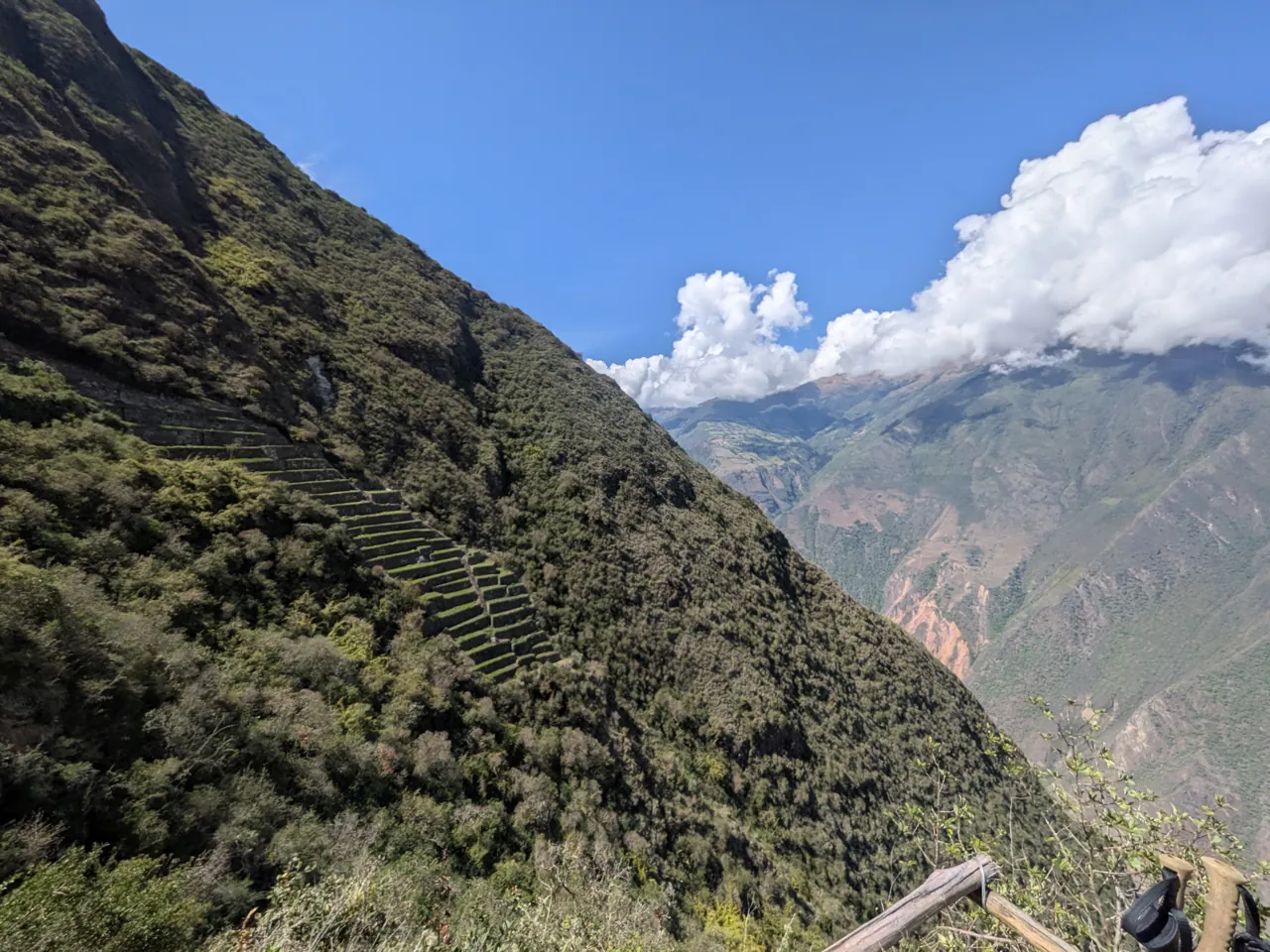
What the state does publish is a different kind of number, and it is more informative. In December 2024 the Ministry of Culture announced the completion of the restoration of 187 Inca terraces in the Paqchayoq sector. The work took four years, from 2021, and cost over S/10.9 million. That is what intervention at Choquequirao actually looks like when it is funded: one sector, four years, one hundred and eighty-seven terraces, eleven million soles.
Set that against the arithmetic available from the Heritage paper. Add the five sectors for which it gives areas and you get 22 hectares of described architecture inside an 1,800-hectare complex. That is not an excavation percentage and it is not a substitute for one. It is, however, the most precise published account of what has been documented, and it is consistent with a site that is mostly not yet dug.
Why does an unpublished percentage matter to a visitor? Because it is doing rhetorical work in every argument about the site's future. "Only 40 per cent excavated" is the sentence that makes Choquequirao an undiscovered Machu Picchu waiting to be revealed, which in turn supports spending hundreds of millions of dollars on getting people to it. A figure with no publisher is carrying an investment argument. The honest position is that the proportion is unknown to us and appears to be unpublished — and that a reader should notice when it is quoted at them with confidence.
October 2020: the project is reformulated into two
The response to a boundary fight over one cable car was to design two.
In October 2020 the reformulated project appeared: two interconnected cable systems forming a circuit, one climbing from Huanipaca in Apurímac and one from Santa Teresa in Cusco, both reaching Choquequirao. Carlos Milla, then president of Cusco's regional tourism chamber, described it as a loop — people would enter by one and leave by the other. The award was expected in 2021.
It was not awarded in 2021. In December 2021 the specialist construction press reported the investment at US$260 million and the tender deferred: the project still lacked a viability declaration under Peru's public investment framework, still lacked social agreement with local and regional governments in Cusco, faced geological complexity requiring extensive consultation, and needed ProInversión board approval before structuring could proceed. Tendering, on the best case then available, would happen in the third or fourth quarter of 2022, with the award slipping to 2023.
By June 2022 the government was describing the project as blocked since 2020 for want of a favourable opinion from local governments, and proposing a multisectoral commission to unblock it. The figure quoted that month was US$250 million, with S/42 million of complementary works earmarked for Mollepata — the district whose objection had helped kill the first tender.
The underlying dispute had not gone away; it had changed shape. In April 2023 La República reported a territorial argument between two Cusco provinces, Anta and La Convención, over which district Choquequirao actually sits in — and therefore over who would receive the revenue a cable car generated. Anta cited its own creation law, placing the site in Mollepata district. La Convención cited a national statistics institute map and a 2019 government publication placing it in Santa Teresa. A community leader from Anta said dialogue had produced nothing and that the culture ministry had not stated which province had jurisdiction. The president of La Convención's defence front proposed shared management: entry through Anta, exit through La Convención.
The price, meanwhile, kept climbing. In September 2023 a MINCETUR team led by Zoila Cavero Reap, the ministry's general director of tourism strategy, put the integral project at S/770 million at a working session in Apurímac. A month later the figure was S/782 million including Comptroller supervision, with completion in 2030 and projected gains of S/4,300 million by 2050. The trade and tourism minister, Juan Carlos Mathews, called it the most important tourism investment in Peru's history.
The llamas built into the terrace walls
Choquequirao's most distinctive surviving feature is not a building. It is a set of animals set into the retaining walls of its agricultural terraces, in white stone against grey.
The figures are camelids — llamas — made from pale rectangular slabs set vertically into the masonry, so that they are part of the wall's structure rather than applied to its surface. Accounts differ slightly on the count. A 2011 account by an architect who had worked on the site's survey gives 23 figures across the walls of 15 terraces. A 2020 feature on the research of the archaeologists Gori Tumi Echevarría and Zenobio Valencia García gives 24, including mother-and-calf pairs, reading them as a procession ascending towards the main plaza. We report the discrepancy rather than choosing.
The interpretive claim is large, and it is the researchers' rather than ours: Echevarría has described the Choquequirao camelids as the only great instance of three-dimensional naturalistic decoration of its kind in the Americas, pointing to anatomical detail — differentiated leg lengths, hoof positions — that gives the figures movement. The earlier account reads the herd as facing north, towards the snow peak of Qoriwayrachina, with an anthropomorphic figure standing among them with its arms out.
The dates matter more than the interpretation, because they are the best available answer to how much of this place is known. The terraces carrying the llamas were seen in topographic survey work in 1986 but not investigated, because getting to them was too difficult. They were cleared of vegetation and recorded in 2004, during cadastral and delimitation work funded under a Peru–France countervalue arrangement. The most photographed thing at Choquequirao was, in other words, not documented until this century — and it was found not by an excavation campaign but by a mapping exercise.
That is the concrete meaning of an unexcavated site. Not that treasure is buried under it, but that ordinary, visible, structural features go unrecorded for decades because nobody has had the funding or the access to walk that particular slope and cut back the growth.
February 2024: the plan with the exact figure
In February 2024 the project acquired the kind of precision that makes a proposal look imminent. ProInversión's promotion plan put the investment at US$220,943,917 plus tax — a figure given to the dollar — and set the shape of the concession: six years for design and construction, twenty years of operation and maintenance, twenty-six years in total, subject to optimisation during the promotion phase.
The engineering was described segment by segment. In the northern zone, a 9.4-kilometre access road for buses; a first cable section of 2.5 kilometres from San Juan at 4,075 metres down to Maizal at 2,901 metres, needing four support towers; a second section of 3.8 kilometres from Maizal to the Abra Choquequirao at 3,517 metres, needing one. In the southern zone, a 1.3-kilometre tourist road in the San Miguel sector and a 4.2-kilometre cable crossing the Apurímac canyon to a terminus at Unión, at 3,005 metres. ProInversión's own event material later described the whole aerial system as over 10.6 kilometres, cutting a two-day approach to about twenty minutes.
The benefits were quantified too: more than a million additional visitors a year, and S/768 million of tourist spending on lodging, food, transport, local commerce, guides and crafts. By August 2024 the two termini had names in the press — Yanama, in Santa Teresa district in Cusco, and Kiuñalla, in Huanipaca district in Apurímac — and the project was being described as the largest public-private partnership in Peru's tourism sector, with the tender to be convened in the first half of 2025 and visitor numbers rising from 8,000 a year to over a million.
It is worth pausing on how much the promise itself has changed while keeping the same name. In 2013 it was five kilometres, 400 people an hour, US$45 million, fifteen minutes, 3,000 visitors a day. In 2018 the governor of Apurímac described 5.1 kilometres, about fifteen minutes, and 150,000 visitors in the first year against 5,500 then. In 2023 the journey time in circulation was thirty minutes. By 2024 it was 10.6 kilometres, twenty minutes and over a million a year. These are not refinements of one design. They are different projects sharing a destination.
March 2025 to June 2026: a schedule with no dates in it
On 28 March 2025 ProInversión convened the national and international public tender. The investment figure that travelled with the announcement was US$261 million; the award was expected in the fourth quarter of 2025. Central stations were named at Yanama in Cusco and Huanipaca in Apurímac, with intermediate stations at Abra San Juan, Maizal and Abra Choquequirao on the Cusco side and Kiuñalla and Unión on the Apurímac side. ProInversión's project director, Aldo Laderas, had spent that March on the socialisation process with local authorities in La Convención and Santa Teresa.
The fourth quarter of 2025 passed. On 28 October 2025 Del Carpio said the project was in the package ProInversión planned to award before July 2026.
Then, on 29 December 2025, ProInversión issued Circular No. 9, modifying Annex 30 of the tender bases — the referential schedule. The revised timetable sets the submission of bids at 25 days after publication of the final version of the concession contract, and the award at 10 days after bids are submitted and technical proposals opened. In other words, the published schedule for a project first announced in 2011 contains no calendar dates at all. Every remaining milestone is expressed relative to an event, the publication of the final contract, that has not yet happened.
The spoken dates kept moving regardless. In February 2026 Del Carpio told RPP that the award would be concretised within the next three or four months — by May or June.
In April 2026 two things were reported within days of each other. Five bidders, national and international, had acquired participation rights, with the award expected before the end of 2026 and construction from 2027. And an analysis of the 443 comments submitted on the second draft of the concession contract set out why investors were hesitating: risk allocation seen as disproportionately favouring the state, inflexible payment schemes, insufficiently defined technical and operational specifications, full concessionaire liability for inaccurate environmental studies, the state's unwillingness to take on the acquisition and management of private land, and a lack of clarity about the complementary infrastructure connecting the two regions. The investment figure attached to that reporting was US$441.57 million, for a co-financed public-private partnership.
One clause deserves its own sentence. The draft contract terminates if the service is suspended for more than 180 days — and it does so even where the cause is not attributable to the concessionaire, including archaeological discoveries and natural disasters. On a site that closed for over two months in the 2026 rainy season, and whose bridges failed in 2025, that is not hypothetical. A bidder reading the closure record would be doing arithmetic about how many consecutive bad seasons it takes to reach 180 days, and about what happens if their own tower foundations turn up Inca material.
Which brings the ledger to 15 June 2026 and Del Carpio's October-or-November. Searching again on 30 September 2026, we found no later statement from ProInversión on the project, no publication of the final contract, and no award to anybody. ProInversión's own public project page, last modified on 28 October 2025, was still showing an investment of US$363.25 million and an award scheduled for the first quarter of 2026 — a quarter that ended six months ago. Four figures now circulate for the same project: US$220.9 million, US$261 million, US$363.25 million and US$441.57 million. Lowest to highest is double, and none of them is the 2013 figure of US$45 million, which the current one exceeds by nearly a factor of ten.
Three Choquequiraos, and the ground underneath
Anyone comparing figures across these sources will hit an area problem, and it is worth separating the three things that share the name.
The archaeological complex. About 1,800 hectares of terraces, plazas and enclosures on the ridge above the Apurímac. This is the site itself.
The Parque Arqueológico de Choquequirao. The DDC Cusco's own park page gives 522,878.30 hectares with a perimeter of 367.09 kilometres, spanning districts in both Cusco and Apurímac. That is over five thousand square kilometres — a landscape-scale designation covering a section of the Vilcabamba range, not a fenced ruin.
The Área de Conservación Regional Choquequirao. An environmental designation created by Decreto Supremo 022-2010-MINAM on 24 December 2010, covering 103,814.39 hectares across the Santa Teresa and Vilcabamba districts of La Convención and the Limatambo and Mollepata districts of Anta, from 1,800 to 6,000 metres. MINCETUR's inventory record for it, last updated in June 2022, rates its conservation state as good and lists spectacled bear, puma and condor.
The third designation produces a confusion worth correcting. In reporting on the land dispute, the Cusco regional government's tourism manager, Saúl Capipani, is quoted invoking "Supreme Decree 022 of 2010" as the instrument making areas within the archaeological park intangible and unsaleable. The only Supreme Decree 022 of 2010 we could locate establishes the regional conservation area under the Ministry of the Environment — a protected-areas instrument, not a heritage one. The intangibility of pre-Hispanic immovable heritage in Peru derives from the general cultural heritage law, Ley 28296, which is what the Marampata community leader quoted in the same article cites. We flag the mismatch rather than repeat the attribution.
The land itself is the part the tender cannot route around. Inside the park boundary, 71 hectares are claimed by around 200 parties. The Cooperativa Agrícola Ganadera Altos Salkantay is registered with the national property registry as the owner of over 30,000 hectares; its vice-president, César Álvarez, says the land was adjudicated to the cooperative's members in 1972. Sales are reported to have begun in 2020. The regional government says park land cannot be sold or commercially developed; a community leader in Marampata argues the sales breach heritage law. Nothing we could open shows any of it resolved since October 2024.
That is unresolved land title, inside a heritage park, on the corridor the concession runs through. And it is not our inference that this matters to the tender: the state's refusal to take on the acquisition and management of private land is one of the named investor concerns in the April 2026 analysis. The 71 hectares are not local colour alongside the project. They are one of the reasons the award keeps moving.
What a cable car would be delivering people to
Suppose the award lands, the contract survives its 180-day clause, the land is bought and the towers go up. Six years of construction from a late-2026 award puts opening somewhere around 2033. What arrives at the top?
Peru has run this experiment once. The cable car to Kuelap, the Chachapoya walled site in Amazonas, opened in 2017 at a cost of US$21 million — twenty-six cabins, four kilometres, twenty minutes, a thousand passengers an hour. It worked exactly as intended: visitor numbers went from roughly 40,000 a year to over 120,000 by 2019. Then, on 10 April 2022, a section of Kuelap's perimeter wall collapsed. The Ministry of Culture had declared the site in emergency two months earlier, on 11 February. The minister attributed the collapse to earthquakes and heavy rain and observed that the site had been abandoned for years. The cable car stopped. The southern wall did not reopen until June 2026, nearly four years later, with restoration reported at 78 per cent complete in August 2025. Kuelap now runs to a maximum daily capacity of 864 visitors, with 70,000 to 75,000 projected for 2026 — below its 2019 peak.
The lesson of Kuelap is not that cable cars are bad. It is that access capacity and conservation capacity are separate budgets on separate clocks, and that building the first does not produce the second. Peru's larger case says the same more loudly. In August 2026 the Comptroller General reported that Machu Picchu had taken 91,000 visitors above its established limits across 2024 and 2025, and documented the result: wear of original flooring, loss of surface cover, erosion of the floors of pre-Hispanic terraces, deterioration of worked stone. The daily limits there are now 4,500 in low season and 5,600 in high. A carrying-capacity study completed in 2015 was not implemented at the time, and the private sector is asking for a new one.
Choquequirao has no equivalent study that we could find, and for most of the period covered by this ledger it has had no current master plan either. In January 2021 the DDC Cusco and the regional agency Plan COPESCO signed an agreement to update the Choquequirao master plan, covering research, conservation, enhancement, management, administration and social use. In March 2026 — five years later — Cusco authorities were reported coordinating actions to draw up a master plan covering research, conservation, social use and tourism development, with Plan COPESCO allocating S/200,000 for 2026 to begin the work. Whether that is a continuation of the 2021 agreement or a fresh start we cannot resolve from the published notices; the 2021 wording says update, the 2026 wording says elaborate.
Hold the two budgets next to each other. Two hundred thousand soles, in 2026, to begin writing the document that would determine how many people the site can take and what gets dug. Against US$441.57 million to deliver them. The planning instrument is funded at roughly one part in eight thousand of the access infrastructure, and it is being written afterwards.
The state's argument is real and should be stated fairly. Access infrastructure is intended to integrate local populations into the economic activity it generates; ProInversión has put the social benefit at more than S/400 million a year, and the communities on both approaches have a legitimate stake in that. But the case for the cable car and the case for the site being ready to receive what a cable car delivers are two different arguments, and only one of them has been funded.
When the authorities let anyone in
The controlling factor is the rainy season, and the last two years have shown what that means in practice rather than in theory.
The dry season, roughly May to September, is when the approach is normally open and operators run. It is also when the 2026 reopening took effect, from mid-April.
The rainy season, roughly November to March, is when the failures have happened. On 10 March 2025 the DDC Cusco suspended entry in a notice signed by its director, Jorge Moya Coháguila, after intense rain broke a cable tensor on the pedestrian bridge over the Apurímac at Playa Rosalinas, leaving it dangerously tilted, and destroyed the small bridge over the Chunchumayo stream between Marampata and the site, with landslides and rockfalls along the approach. Cusco recorded 589 climate-related emergencies between December 2024 and March 2025, more than any other Peruvian region. In 2026 the whole park was closed from 1 February, and the Río Blanco section was still impassable when the rest reopened.
The shoulders are where the risk concentrates, because the forecast rather than the calendar decides. The January 2026 closure discussion was explicitly driven by rainfall forecasts coming in normal to above normal for January and February and above normal for March.
The practical rule this suggests is not about months. Choquequirao's access is an administrative decision taken on technical reports, published by the DDC Cusco and the Ministry of Culture, and revised at short notice. Check the DDC Cusco directly, close to your dates, and plan for the possibility that a route open when you booked is closed when you arrive. Operators who walk this trail weekly will know the current state of the Río Blanco section and the bridges better than any published guide, including this one.
Where it is, and why there is no route here
The geography. The site sits above the Apurímac in the Vilcabamba range, spanning the Cusco and Apurímac regions. The usual gateway is Cachora in Apurímac, reached from Abancay or Cusco by road; Huanipaca is the other approach. Capuliyoc is the pass at the head of the standard descent. There is no road to the site and no vehicle access.
The approach. Roughly two days on foot each way from Cachora, descending to the Apurímac and climbing the far side past Playa Rosalina and Marampata. The walk is normally done with arrieros and pack animals, which is both the practical way to move supplies over that profile and the local economy the trail supports.
Opening hours. The DDC Cusco gives the park's visiting hours as 07:00 to 16:00. Its own page states that the park does not have accessible entry for people with disabilities, because of the distance and the condition of the route. Food, alcohol, animals, camping inside the monument, climbing on archaeological walls and unauthorised drone flights are all prohibited.
Why there is no route description here. Two bridges on this system failed in March 2025, a whole-park closure ran from February to mid-April 2026, and one section was still impassable at reopening. A stage-by-stage description written without current knowledge of the ground would be a liability rather than a service, and we are not going to publish one. The DDC Cusco and the Ministry of Culture publish the access decisions; licensed operators know the day-to-day state of the ground. Use both.
If the cable car is built. The projected journey time is about twenty minutes, from a system whose corridor runs through the disputed land described above. Civil works were projected to start in 2027 at the earliest, after an award that had not happened at our check, and the concession allows six years to build. Nothing about a visit in the next several years should be planned around it.
The map on this page shows the site and the gateway towns for orientation. It does not show the trail, it does not establish that any section is currently open or safe, and it must not be used for navigation.
What it costs, and the price nobody publishes
We could not confirm a current official entry price for Choquequirao from a Peruvian government source, and we are not going to publish a third-party figure as if it were official. The DDC Cusco's own park page carries visiting hours and rules but no tariff.
What can be established is the structure. Ministry of Culture entry tariffs are set by ministerial resolution and are tiered. The last instrument we could read directly, Resolución Ministerial 030 of 29 January 2016, took effect on 1 January 2017 and set Choquequirao at roughly 55 to 60 soles for adults, 30 for students, and 15 to 25 for schoolchildren and children up to twelve. Reporting at the time was explicit that the increase applied only to foreign visitors, with rates for Peruvians handled separately. So the answer to whether nationals pay a different price is yes, structurally — but the 2016 figures are a decade old and should not be relied on. Ask the DDC Cusco or your operator for the current rate and the national rate.
The shape of the wider cost:
- Per person: the archaeological park entry ticket.
- Per party: transport from Cusco or Abancay to the gateway, and the muleteer and pack animals, which scale with days and load rather than with the number of walkers. Small groups pay far more per head.
- Per person per day: a guide, if you take one, and food.
- Camping fees at the campsites along the route, which are run locally.
- Contingency: genuinely necessary here. A route closure or a bridge failure can rewrite a four- or five-day plan, and the 2026 precedent is a two-month shutdown.
There is no calculator on this page, because there is no confirmed official per-person price to put in one.
One observation about the economics as they stand. The present arrangement distributes money along the ground — muleteers, campsites, Marampata, the gateway villages — because the ground is the only way in. That is the specific thing a cable system changes, and it is why "integrating local populations" is a contested claim rather than an obvious one. Who the money reaches depends on where people stop, which is precisely what Anta and La Convención have been arguing about since before the first tender was cancelled.
Questions to ask before you pay
Most people walk to Choquequirao on an organised trek arranged in Cusco, and the questions worth asking are unusually concrete given the last two years.
- What is the current status of the route, including the Río Blanco section and the bridges, and when did your last group complete it?
- What happens to my money if the DDC Cusco suspends access before or during my trip? Get the answer in writing.
- Are muleteers and pack animals included, and how are they paid?
- Is the park entry ticket included, at what rate, and is there a national rate?
- What is the group size, and what is the daily altitude profile? The descent to the Apurímac and the climb out are the demanding part, in both directions.
- What is the plan if someone cannot continue, on ground with no vehicle access?
The Dirección Desconcentrada de Cultura de Cusco is the authority on access and ticketing and does not sell treks. We carry no affiliate links or commercial relationships for this destination, have not tested any operator, and name none.
Preparing for a two-day approach
This is general preparation for a multi-day walk at altitude in the Andes, not a route-specific kit list. The operator's list governs and the ground's condition varies. What follows is the reasoning rather than a shopping list.
The profile is the problem. The approach is a long descent followed by a long climb, twice. Descent is what damages knees and toes, so broken-in boots with a snug heel and room at the front matter more here than on a flat trek, and trekking poles are close to essential rather than optional.
Altitude. The wider conservation area spans 1,800 to 6,000 metres and the walk crosses a wide band of it. Acclimatise in Cusco or Abancay before starting rather than arriving and walking, and treat altitude illness as a plan rather than a possibility — know the symptoms, and know that descent is the treatment. This is a medical matter for a travel-health professional, not a packing decision.
Sun and heat in the gorge. The Apurímac canyon is hot and exposed, and it is the low point of each day rather than the high one. Sun protection as a system — brimmed hat, sunglasses, long light sleeves, sunscreen — plus more water capacity than the distance suggests, and salts.
Cold at the top. The ridge and the campsites are a different climate from the river. A warm layer and a proper sleeping system, whatever the daytime temperature was.
Rain, even in the dry season. A waterproof shell and a dry bag or liner for anything that must stay dry. Cloud forest is cloud forest.
Water and weight. Capacity plus a treatment method. Mules carry the loads, and what you ask them to carry is a real thing rather than an abstraction; pack for what you will use, and carry out what you carry in, because there is no waste infrastructure on this ground and none inside the monument, where camping is prohibited in any case.
What no kit does. It does not make a closed route open, and it does not substitute for the operator's judgement about bridge and trail conditions.
Use the written checklist with your operator's route and the current conditions.
Further reading
These rest on publishers' descriptions and published abstracts rather than our own full readings, except the Heritage paper, which is open access and which we read for this article.
- Esenarro et al., on Choquequirao, Heritage (MDPI), 2025. Open access, peer-reviewed, and the source of the sector-by-sector description, the construction analysis and the conservation constraints used here. It is also, notably, the paper that does not give an excavation percentage. Read it free.
- Terence N. D'Altroy, The Incas (Wiley-Blackwell, Peoples of America series; second edition 2014, ISBN 9781444331158). The standard single-volume scholarly account of the Inca state — its administration, storage, roads and provincial architecture, which is the context that makes a site with camelid storage and an ushnu legible. Recommended from the publisher's description.
- Kim MacQuarrie, The Last Days of the Incas (Simon & Schuster trade paperback, 17 June 2008, 544 pages, ISBN 9780743260503). Narrative history of the Spanish conquest and the Inca resistance; the publisher's description centres on Pizarro, Atahualpa and the rediscovery of the hidden capital at Vilcabamba — the period and region Choquequirao belongs to. Popular rather than scholarly.
Free, current and more useful for an actual trip than any of them: the Dirección Desconcentrada de Cultura de Cusco for access decisions and notices, and ProInversión's project page if you want to follow the tender yourself — including whether the figure on it has been updated since our check.
For another place where the official story and the documentary record diverge, see Darvaza. For a landscape where a management handover and an announced tourism circuit are about to change who benefits, see the Makay massif.
Questions travellers ask
Is the cable car built?
No. As of 30 September 2026 the concession had not been awarded, and the final contract that the bid timetable depends on had not been published. The latest projection we found, from ProInversión's executive director in June 2026, was an award in October or November 2026 with civil works from 2027, and the concession allows six years to build. Projected award dates have slipped since 2013.
Can I visit right now?
The park reopened from mid-April 2026 after a closure that began on 1 February, but the Río Blanco section was excluded from that reopening. Access is an administrative decision revised at short notice. Check the DDC Cusco close to your dates.
How long is the walk?
Roughly two days each way from Cachora, involving a descent to the Apurímac and a climb up the far side. We do not publish a route description; the condition of the ground and its bridges changed twice in two years.
How much of the site has been excavated?
Unknown to us. The widely quoted 30 to 40 per cent has no Peruvian government publisher we could find, and the most recent peer-reviewed paper gives no percentage at all. What the state has published is that 187 terraces in one sector were restored between 2021 and 2024 for over S/10.9 million.
Is it a UNESCO World Heritage site?
No, and it is not on Peru's Tentative List either. We checked the World Heritage Centre's page for Peru: thirteen inscribed properties and twenty-four Tentative List entries, and Choquequirao is on neither.
What does it cost?
We could not confirm a current official entry price. Ministry of Culture tariffs are set by ministerial resolution and are tiered by nationality and status; the last figures we could read directly date from 2016. The larger costs are transport, muleteers and guiding, charged per party rather than per person.
Is it "the next Machu Picchu"?
That is a projection, not a description. Choquequirao received about five visitors a day in 2013 and at least seventy a day when it closed in March 2025; the figure used to justify the cable car is over a million a year.
The filter
Everything above is a story about a cable car. The thing it is actually about is the filter.
What protects Choquequirao at the moment is not a policy. There is no current master plan, no published carrying-capacity study, no settled land title and no published figure for how much of the complex has been dug. What protects it is a descent into the Apurímac gorge and a climb out of it, twice, which means that the number of people on the ridge on any given day is set by how many are willing to do that. Five a day in 2013. Seventy a day in March 2025. Somewhere between four and nine thousand a year, depending on the year and the source.
That filter is accidental and it is not virtuous. It excludes the old, the unfit, the poor and the short of time from a site that belongs to Peru. Nobody should defend a gorge as a conservation instrument. But it is the instrument currently doing the work, and the documents show the state removing it before building a replacement.
It is also going quietly, without a tender. In November 2025 a route into Choquequirao from Santa Teresa was reported at 90 per cent complete — 10.5 kilometres of improved track, retaining walls, rest stops, viewpoints and signage, executed by the district municipality since 2022, cutting the approach from about three days to about eight hours. No concession, no consortium, no US$441.57 million. A municipality with a budget and a grader has been dismantling the filter while everyone watched the ledger.
So the question worth asking is not whether the cable car will arrive. On the record above, the only honest answer is that it has been about to arrive for fifteen years. The question is what will be in place on the ridge when the walk stops being the price of entry — and on the published evidence, at the time of writing, the answer is a master plan with S/200,000 against it and a percentage nobody has ever published.
Sources
- ProInversión, Circular No. 9 of 29 December 2025 modifying Annex 30 (schedule) of the tender bases for the Choquequirao concession — proinversion.gob.pe (PDF)
- ProInversión, Choquequirao project page and project event page — investinperu.pe, project event page
- RPP, Del Carpio on the 2026 portfolio and an award within three or four months, February 2026 — rpp.pe
- Andina, ProInversión projects an October–November 2026 award, 15 June 2026 — andina.pe
- Gestión, ProInversión suspends the concession process on a court order, 19 October 2014 — gestion.pe
- Gestión, award to be granted in the second half of 2015 after the injunction is lifted, 30 March 2015 — gestion.pe
- Gestión, the project is reformulated into two routes after the 2014 tender is cancelled in May 2017, 11 October 2020 — gestion.pe
- Revista Construir, tender deferred to 2022, 2 December 2021 — construir.com.pe
- Turiweb, government seeks to unblock the project, 30 June 2022; and award before July 2026, 28 October 2025 — turiweb.pe, turiweb.pe
- La República, the cable car and the Anta–La Convención jurisdictional dispute, 22 April 2023 — larepublica.pe
- Perú Construye, S/770 million for the integral project, 11 September 2023 — peruconstruye.net
- Infobae, S/782 million and completion in 2030, 9 October 2023 — infobae.com
- El Diario del Cusco, the promotion plan's figures, segments and 26-year concession, 24 February 2024 — diariodelcusco.pe
- Gestión, twelve years of waiting and the Kuelap comparison, 24 February 2025 — gestion.pe
- Energiminas, socialisation and the station list, 24 March 2025 — energiminas.com
- Gestión, ProInversión launches the public tender, 28 March 2025 — gestion.pe
- Miradas Noticias, five bidders in the running, 21 April 2026 — miradasnoticias.com
- Gestión, investor concerns on the second draft contract and the 180-day termination clause, 23 April 2026 — gestion.pe
- Associated Press via Fox News, the 2013 specification, cost and the "30 per cent cleared" claim, 28 August 2013 — foxnews.com
- El Comercio, the Apurímac governor on the cable car, 1 March 2018 — elcomercio.pe
- Esenarro et al., Choquequirao, Heritage 8(12), 494 (MDPI), 2025 — mdpi.com
- Dirección Desconcentrada de Cultura de Cusco, Choquequirao archaeological park page and access notices — culturacusco.gob.pe, March 2025 suspension notice, February 2026 suspension
- RPP, restoration of 187 terraces in the Paqchayoq sector completed, 28 December 2024 — rpp.pe
- DDC Cusco and Plan COPESCO sign an agreement to update the master plan, January 2021 — culturacusco.gob.pe
- Diario El Sol del Cusco, authorities coordinate to draw up the master plan with S/200,000 for 2026, 14 March 2026 — diarioelsolcusco.pe
- Andina, ministry and regional bodies agree to reopen the Capuliyoc–Cachora route, 27 March 2026 — andina.pe
- Infobae, intense rain isolates the site and the daily visitor figure, 12 March 2025; reopening the following week, 17 April 2026; 71 hectares and 200 claimants, 25 October 2024 — infobae.com, infobae.com, infobae.com
- Gestión, the Kuelap wall collapse and cable car closure, 12 April 2022; Infobae, the south wall reopens after nearly four years, 11 June 2026 — gestion.pe, infobae.com
- Infobae, Comptroller General warns of visitor overload and damage at Machu Picchu, 14 August 2026 — infobae.com
- RPP, an alternative route from Santa Teresa at 90 per cent complete, 12 November 2025 — rpp.pe
- La República, the llamas of Choquequirao and the research of Echevarría and Valencia, 8 November 2020; Diario Correo, the camelid murals and their recording in 2004, 7 January 2011 — larepublica.pe, diariocorreo.pe
- Andina, ticket price adjustment under Resolución Ministerial 030-2016-MC, 2 December 2016 — andina.pe
- MINCETUR national tourism inventory record, Área de Conservación Regional Choquequirao, updated June 2022 — mincetur.gob.pe
- MINAM legal register, Decreto Supremo 022-2010-MINAM establishing the regional conservation area — sinia.minam.gob.pe
- UNESCO World Heritage Centre, Peru — whc.unesco.org
Photograph credits
- Choquequirao Terraces · Martin St-Amant ( S23678 ) · 18 August 2007 · CC BY 3.0. Resized and converted to WebP; framing may crop the hero. These adaptations remain available under their respective licences.
- Choquequirao Masonry · JORGE DIAZ RIVAS · 13 May 2017, 09:59:11 · CC BY-SA 4.0. Resized and converted to WebP; framing may crop the hero. These adaptations remain available under their respective licences.
- Choquequirao Llama Terraces · Gedankenstuecke · 6 November 2025, 09:20:28 · CC BY-SA 4.0. Resized and converted to WebP; framing may crop the hero. These adaptations remain available under their respective licences.
- Choquequirao Sector Plaza · Kaanek · 25 March 2013 · CC BY-SA 3.0. Resized and converted to WebP; framing may crop the hero. These adaptations remain available under their respective licences.
Portrait supplied by Sok Heng Oeun.
A closer look.
Dated photographs show the place, details and wider setting. They are not evidence of present access or conditions.

Sok Heng Oeun
Sok Heng Oeun is the owner and editor of Hidden Corners. The Hidden Corners Editorial Team supports image preparation and editorial checks under his direction.
Sok Heng Oeun on Facebook ↗Research and AI-assisted editorial preparation. Publication authorized by Sok Heng Oeun; an individual owner reading review is not recorded. This guide does not claim a firsthand team visit.


_01.jpg)
