
The word that did the work
“One of the last unexplored areas of the island.” That is how a Malagasy tour operator describes the Makay massif on its website. Another calls the place “The Last Lost World Of Madagascar.” The phrasing echoes the films that first carried the massif to a wide audience: a documentary called Makay : le dernier éden — the last Eden — and a 3D adventure film made for Canal+ in 2010, Makay, les aventuriers du monde perdu: the adventurers of the lost world.
This guide is about that word, because in the Makay the word has done real work. It raised money. It helped get a protected area declared. It sells trekking packages. And it makes a checkable claim about a place where people graze zebu, harvest tubers and medicinal plants, and know the canyon routes that visiting scientists then had to hire them to follow.
So we went looking underneath it: who first said the Makay was unexplored, what was on the record before anybody said it, what the expeditions actually published, what the word does commercially now, and what has happened to the paperwork — because in 2026 the massif changed managers, and two official sources give two different dates and two different places for the ceremony.
What we found is not a scandal. It is something more ordinary: a claim true in a narrow technical sense, stretched in a marketing sense, since quietly moderated by the organisation most associated with it, and still resold by third parties who did not do the stretching.
Nobody from Hidden Corners has been to the Makay. This is desk research, checked between 20 and 30 September 2026, drawn from peer-reviewed taxonomic and social-science literature, a university anthropology thesis, Malagasy government pages and press, the managing organisations’ own material, operators’ sales copy, and current UK and US travel advice. Where the only available account is an interested party’s own, we say so.
Who said it, and when
The chronology is not disputed, and its most detailed version is on the protected area’s own conservation-history page, last modified in July 2025.
In November 2001 the French television presenter Nicolas Hulot filmed the massif from a hot-air balloon for Ushuaïa Nature. In August 2004 Evrard Wendenbaum, a French photographer and scientist, set out with a friend by mountain bike from Antananarivo and got no further than the foothills, for want of topographic maps. He came back in August 2007 with a team of eleven — eight of them porters — and got in. That expedition produced Makay : le dernier éden.
The scientific programme followed the film, not the other way round. In December 2009 the newly founded association Naturevolution sent a first scientific mission of about a dozen researchers into the southern forests for roughly four weeks. A three-month inventory began in October 2010 with nearly sixty international scientists, and a further mission worked the south in 2011.
One small inconsistency is characteristic. The conservation-history page dates the first scientific mission to December 2009; Naturevolution’s science pages call the 2010 campaign, “Makay Nature 2010”, the first scientific expedition ever conducted in the massif. Both statements come from the same organisation, and the year matters only because the superlative is the thing being sold. We report both.
The peer-reviewed literature broadly corroborates the shape of the story. A 2022 paper in ZooKeys on the Makay’s water beetles, by researchers from the University of Antananarivo and Sorbonne Université, dates the start of scientific missions to describe the massif’s biodiversity to 2010 and describes the area as having long remained unexplored. Independent scientists, publishing in a journal with no stake in the fundraising, used the word too.
So the claim was not fabricated. What happened to it afterwards is the interesting part.
What the word was for
“Unexplored” in the Makay was, from the beginning, an instrument of conservation policy rather than a neutral description. The sequence makes that plain.
In 2011 — the year after the big inventory — Naturevolution filed a first request for protected-area status with both the Ministry of the Environment and the Ministry of Culture. Two ministries, because the case being made was that the massif held natural and cultural heritage: canyons and endemic species on one side, rock paintings on the other. The Culture Ministry inscribed the Makay in the national cultural heritage by decree in July 2017. The Environment Ministry declared it a temporary new protected area on 21 November 2017 and named the Malagasy association Naturevolution Madagascar as delegated manager.
Six years from request to paperwork, and the word was the lever. A film called The Lost World gets made for Canal+; a film called A Sandstone Plateau in Western Madagascar That Herders Have Used for Generations does not.
It is only fair to note where the organisation’s language has landed since. Naturevolution’s current page on the Makay’s biodiversity does not say “lost world” or “terra incognita”. It describes “ecosystems that have been little studied because they are difficult to access” — which is precise, defensible and exactly right. The strong claims now live mostly in two places: in the titles of films made around 2007 to 2010, and in the sales copy of tour operators who had nothing to do with making them. The campaign succeeded, the campaigner moved on to careful language, and the phrase kept earning money for other people.
Who already knew the Makay
Here is the part the word erases, and it is the honest subject of this guide.
The Makay has no permanent settlement inside it. That is true, and it is the fact the “uninhabited wilderness” reading leans on. What it omits is the rest of the sentence. The peer-reviewed social-science study of the area — Fromont and colleagues in PLOS ONE, 2022 — puts it this way: there are “no permanent settlements within the Makay itself, but numerous villages of less than 500 inhabitants, sparsely populated and dispersed, are established around the area.” And: “Local people are farmers and zebu raisers, and use and manage the resources of the Makay, especially for access to pasture, fresh water, and the harvesting of tubers or medicinal plants.”
Use and manage. Not visit occasionally. The same paper notes that archaeological remains, the Makay’s rock paintings among them, “prove that the region has long been inhabited”.
Among the people living around the massif are the Bara, pastoralists of southern Madagascar. In 2025 the University of Kent accepted a doctoral thesis by Kahir Abdul, Navigating New Frontiers: The Beronono Bara of Madagascar and the Emergence of Tourism in the Highlands, built on participant observation and ethnographic fieldwork with the Beronono Bara of the Makay. It is the only extended fieldwork we found in which the people of the Makay are the subject rather than the setting.
Its central finding cuts directly against the discovery frame. The Bara, the thesis argues, “are not only subjects of tourism but actively participate in its production, using it as a tool of cultural preservation and empowerment”. The people a lost-world brochure leaves out are, on this account, among the people running the tours.
Set that against the PLOS ONE study’s own method. Its thirty-two respondents were twelve researchers, nine members of local environmental organisations, six researchers from an interdisciplinary evaluation programme, and five tour-operator representatives. No local residents. The authors are candid about why: “because of logistical constraints, we were not able to go to the Makay itself, which prevented us from including local people in this study” — a gap they name as a research priority.
That is not a criticism of authors who named the gap themselves. It is an illustration of the mechanism this guide is about. When even the social study of a conservation project cannot reach the people who live at the site, “unexplored” is measuring the reach of outside researchers, not the state of the place. The Makay was legible to the people around it the entire time. It was illegible to the literature.
The record before the expeditions
If the Makay were genuinely blank before 2007, there should be nothing about it in the older technical literature. There is something.
Start with the rock. The massif’s bedrock is the Triassic unit geologists call Isalo II — also known as the Makay Formation — which extends across the Morondava and Mahajanga basins. The rivers that drain it are part of the country’s basic hydrography: the Sakeny running north to the Tsiribihina, the Makay River draining the south-eastern slopes into the Mangoky, the Morondava and the Maharivo flowing west to the Mozambique Channel. We could not establish when the formation name was first used, but its existence makes the point: the Makay was a subject for geologists before it was a subject for biologists, and a geologist’s dossier is not an empty one.
Then the plants. In 2004 — three years before Wendenbaum’s first successful expedition — the succulent specialist John Lavranos published Pachypodium makayense, a new species from Madagascar, in the Cactus and Succulent Journal (volume 76, page 85). It is named for the Makay. Somebody had been there, collected it and got it to a taxonomist before the lost-world framing existed. In a neat illustration of how unsettled all of this is, another botanist, Lüthy, reduced it to a subspecies — Pachypodium rosulatum subsp. makayense — in Bradleya in the same year, and that is the rank Kew’s Plants of the World Online currently accepts.
None of this makes the 2007–2011 expeditions redundant. A named sandstone formation and one succulent are not a biological inventory, and the expeditions produced the first systematic one. But it does change what the claim can honestly say. The accurate version is narrow and still impressive: before 2009, no systematic biological survey of the Makay had been carried out. The inaccurate version is the one on the posters.
What the expeditions actually published
This is the check that matters most. If a decade of expeditions found a lost world, the evidence should be sitting in taxonomic journals under formal names and dates.
It is there. Not in the quantities the sales copy implies, but genuinely there, in real journals, with real authorities. The descriptions we could verify, in publication order:
- 2012 — a bat flea. Lagaropsylla makay, described by Laudisoit, Prié and Beaucournu in Zoosystema 34(4): 737–744.
- 2015 — a periwinkle. Catharanthus makayensis, described by Lucile Allorge, Peter Phillipson and Richardson Razakamalala in Candollea 70(1). At description it was known from just two localities about twenty kilometres apart inside the massif, on sandy riverbanks and damp rock between 400 and 600 metres.
- 2015 — a scorpion. Grosphus makay, described by Wilson Lourenço and Lucienne Wilmé in Revista Ibérica de Aracnología 26: 55–61, from material collected in the Makay in March 2010 by B. L. Fisher and colleagues.
- 2020 — a diving beetle. Laccophilus makay, described by Manuel and Ramahandrison in a paper on four new Malagasy species of Laccophilus.
- 2021 — four leafhoppers. Vladimir Gnezdilov, in Zoosystema 43(16): 297–310, described Limentinus oryx, L. nielsoni, L. nigrifacies and Calodia makayensis from the Makay, and recorded the genus Calodia from Madagascar for the first time.
- 2021 — an ant. Aphaenogaster makay, described by Csősz and Fisher; the holotype was collected in the Makay mountains at 510 metres on 24 November 2010 and is held at the California Academy of Sciences.
- 2022 — two more diving beetles. Copelatus malavergnorum and C. zanabato, in the ZooKeys paper described below.
That is a real body of work: roughly a dozen formally described taxa carrying the massif’s name or drawn from its material, across several journals over a decade, by authors in France, Russia, Hungary, the United States and Madagascar. It is exactly the slow, unglamorous output you would expect, and more than we expected to find.
Now set it against what is claimed. One operator’s site states that “over a hundred new species have been identified in the massif” in the past decade and that “about 40 species have been described as new to science” among the flora alone. We could not find a published list, review paper or database export supporting either figure, and we will not assert from a desk that they are wrong. We note only that the number we could verify from primary taxonomic literature is an order of magnitude smaller, and that “identified” and “described as new to science” are different operations. A specimen flagged in the field as probably new is not a described species until somebody writes the paper.
The lemurs show the same gap between a number and its source. The figure of nine species comes from one publication: Dolch, Wendenbaum and Rakotonirina, “Assessment of lemur diversity in the Makay massif”, Lemur News 16: 48–53. Surveys ran 13 November to 17 December 2010 and 6 to 27 January 2011 across twelve sites and reported “at least 9 different taxa in 4 families”, the first comprehensive data on the massif’s lemur community. The second author is the expedition’s organiser, so this is published but not independent — and while Naturevolution’s 2017 expedition page still gives nine confirmed species, its biodiversity page gives eleven, without saying what the extra two are.
Then there is the finding that complicates the whole story. The 2022 ZooKeys paper — Ramahandrison, Rakouth and Manuel, volume 1127, pages 1–60 — surveyed aquatic beetles at sixty-two sites over three campaigns from 2016 to 2018 and recorded seventy-four species. Its conclusion was not the one a lost world implies. The inner massif, “although well-preserved and little deforested”, had “relatively low endemism level and low species diversity” — on the diversity measure the authors used, half that of Isalo, the geographically close and geologically similar massif that already has a national park. Diversity was higher in the deforested, human-impacted peripheral sites.
That is one taxonomic group and should not be generalised to lemurs or plants. But it is the best-designed published test of the Makay’s biological exceptionality we could find, and it came back negative. A place can be hard to reach, well preserved, worth protecting and scientifically productive without being the richest thing in the neighbourhood. All four are true here. “Lost world” is not the fifth.
One absence is worth recording, because it concerns the massif’s cultural headline. Naturevolution reports 465 rock paintings found in the Makay during the 2010–2011 expeditions, with conservation and mapping work since. When Burney and colleagues published their study of the rock art of Andriamamelo Cave, in the Journal of Island and Coastal Archaeology in 2020, this is how they cited the Makay material: “Other parietal art has been reported informally from the Makay region of southern Madagascar (Anonymous 2018).” Informally. Anonymous. If 465 paintings have since been published properly, we could not find the paper.
What the word sells
Words like this end up on price lists, and that is where a traveller meets them.
One Malagasy operator markets the Makay under the heading “an iconic Terra Incognita”, calls it “one of the last unexplored areas of the island”, and reaches for “last Eden” and “paradise lost” on the same page. Another, MTT Tsiky Zara Group, runs a dedicated Makay site headed “The Last Lost World Of Madagascar” and sells ten trekking packages of five to fifteen days, explicitly using local porters and guides. Both are selling a real and demanding trip, and the operators’ own practical detail is consistent and sobering: five to nine hours of walking a day, an eight- to ten-hour four-wheel-drive approach, a season of roughly May to November, and a fitness requirement that includes swimming and scrambling.
What the word adds to that is scarcity. “Difficult, remote, multi-day, carried” describes the product accurately and is a reason to charge for expertise. “Unexplored” offers the buyer something else: the position of explorer. It is the difference between selling a hard walk and selling a first.
Two consequences follow. The first is that the position of explorer is only available if the people already there are not counted. Every one of those packages runs on local porters and guides who know the routes. The product is their knowledge. The pitch is its absence.
The second is that it sets an expectation the massif may not meet. A visitor promised a lost world who receives a hot, superb, physically punishing walk through worked country, in the company of people who are at home there, has been sold the wrong trip. Our guide to the Richat Structure deals with a related problem at a different site: a place whose popular description is simply the wrong explanation, and whose visitors arrive looking for something that is not there.
None of this is an argument against going, or against the operators, who as far as we can tell are describing a trip they genuinely run and employing people locally to run it. It is an argument for reading the brochure as a brochure.
Why the science had to be carried
If “unexplored” is the wrong word, something still has to explain why the literature was thin for so long. The answer is in the landform, and it also explains what conservation here has to measure.
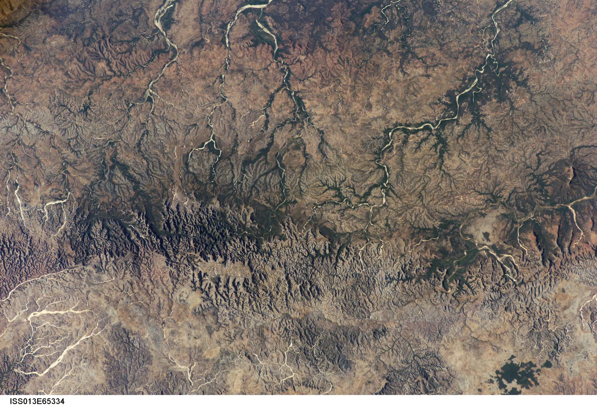
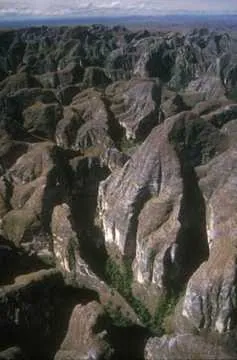
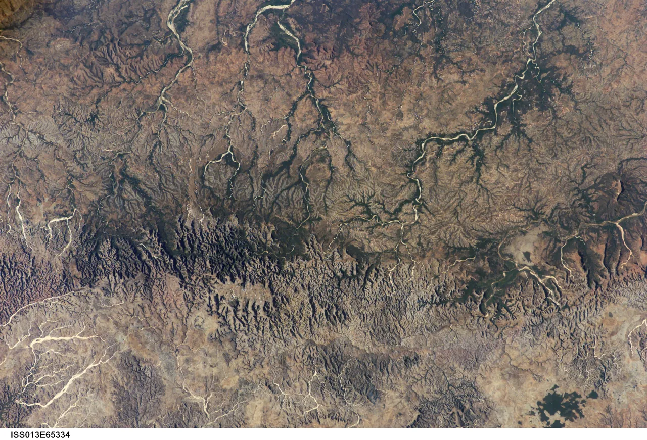
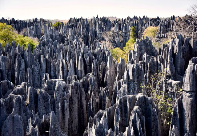
The word massif misleads. This is not an uplifted block of mountains but a sandstone plateau taken apart by water. Some 4,000 square kilometres of it run about 150 kilometres north-north-east to south-south-west and up to 50 kilometres across, straddling the boundary between the Atsimo-Andrefana and Menabe regions, in the districts of Beroroha to the south and Malaimbandy to the north. It rises to around 1,000 metres. Rivers have cut it into a labyrinth of canyons several hundred metres deep.
The ecological consequence is the part that changes what conservation means here. Each canyon holds its own strip of gallery forest, walled off from its neighbours by bare sandstone. Fire — which the protected area’s own managers name as the main cause of forest degradation in the region — rarely crosses a two-hundred-metre cliff. So what survives in the Makay is not one continuous forest under pressure but many small ones sitting in natural fire refuges. We present that as our explanation rather than a cited finding; it is consistent with the geology and with the managers’ own threat ranking, but we did not locate a paper that states the mechanism.
If it is right, the relevant conservation question is not how much forest is left overall but how many individual pockets are still intact — and that is much harder to see from orbit. A canopy fragment a hundred metres wide at the bottom of a shadowed slot is precisely what remote sensing is bad at. The work has to be done on the ground, and the ground is reached on foot.
Which is the actual reason the record was thin. The 2017 expedition, which ran from 22 July to 2 September, worked three forest zones: Menapanda, the largest; Makaikely in the south, described on the organisation’s own account as a forest “that had yet to give rise to any study”; and Mahasoala in the north, “also untouched by scientific studies until then”. Those two sectors were blanks not because they were undiscoverable but because a mist net, a camera trap, a herbarium press and weeks of food have to be carried in, for days, by people, into canyons with no vehicle access.
The expedition’s reported results are correspondingly specific rather than spectacular: the first camera-trap images of fossa in the Makay, conservation and mapping work on the rock paintings, and several dozen ecovolunteers alongside the scientists. What is known about the Makay has the shape of what could be walked in — and, from the 2007 team of eleven with its eight porters onwards, of what porters could carry.
The pressures the word obscures
A lost world is threatened by intruders. An inhabited working landscape is threatened by economics. The Makay is the second thing, and the two published rankings of its problems both say so — while disagreeing about the order, which is itself informative.
The PLOS ONE respondents — researchers, NGO staff and operators, not residents — put insecurity from zebu theft, anthropogenic fires and hunting at the core, and treated mining and timber harvesting as more peripheral problems. The protected area’s own site, last modified in July 2025, orders things differently: bushfire first, named as the main cause of forest degradation and blamed for erosion that silts the rice paddies villagers depend on; then wood cutting; then honey harvesting, where trees are felled or burned to reach wild hives, which it calls very destructive across the region; then poaching of lemurs and tenrecs, driven by an annual three-month food shortage; then plant collection, which it judges not a real threat; then waste.
Look at what the second list actually is. Almost every item is a livelihood under stress. The honey cutter and the hunter in the lean season are not intruders in this landscape; they are people doing arithmetic. That goes a long way to explaining why the conservation model here has been community-based rather than exclusionary, and why the arithmetic of alternatives matters more than the boundary line.
One thing has changed since both rankings were compiled, and it concerns the peripheral item. On 27 January 2026 Madagascar unfroze mining permits that had been suspended since November 2010, leaving the mining cadastre office with more than three thousand pending applications, according to reporting by Mongabay’s French service in February 2026. The new mining code bars permits within five hundred metres of a protected area, and a ministry director is quoted saying the cadastre’s system refuses to validate any application encroaching on a protected zone. Others are less sanguine: the head of the Malagasy environmental coalition Alliance Voahary Gasy questioned whether a transitional government should be granting thirty-year permits at all. The same reporting notes that the mining ministry receives 0.19 per cent of the state budget and that environmental oversight runs from two regional offices for the whole country.
We found no evidence either way that any application touches the Makay. We are recording only that a threat both published assessments called peripheral was reopened by the state, nationally, in the same weeks that new protection paperwork for the Makay was being signed.
The structure built to hold the line is substantial, and it is local. The protected area’s partner list names twenty-four communes, local associations of guides, porters and beekeepers, the University of Antananarivo, the Madagascar Biodiversity Center and the IUCN Amphibian Specialist Group, alongside both the Environment and Culture ministries. A separate programme, “the sentinels of the Makay”, has been progressively recruiting around twenty eco-guards, predominantly local people with intimate knowledge of the terrain, to patrol at least twice a week for fire, poaching and illegal activity and to maintain visitor infrastructure. We could not establish whether that programme is currently operating, or under whose authority.
The paper trail, and two dates that do not agree
The administrative history of the Makay is the least glamorous part of this story and the part most likely to affect anybody planning a visit. It also contains a straightforward contradiction between two official sources, which we report rather than resolve.
The sequence, as the documents give it. Request to two ministries, 2011. Cultural heritage decree from the Ministry of Culture, July 2017. Temporary protected-area status from the Ministry of the Environment on 21 November 2017, with Naturevolution Madagascar named delegated manager. Delegation renewed in 2019. Then, in 2020, according to the organisation’s own conservation-history page, the temporary-status process halted and Naturevolution Madagascar lost its management delegation; a new association, Naturevolution Makay, was set up to carry the projects on.
That last point corrects a common impression — including one we held before this revision. The 2026 handover did not displace a manager who had held the mandate continuously since 2017. On the organisation’s own account the delegation lapsed six years earlier, and what happened in 2026 filled a gap rather than ended a tenure. The PLOS ONE study, writing in 2022, describes protection by a 2017 temporary decree and the creation of the protected area as “an on-going process” — which fits.
Then February 2026. On 5 February, at the Carlton Anosy hotel in Antananarivo, the Malagasy state signed twenty-one inter-ministerial orders granting temporary protection to new protected areas — fifteen terrestrial, five marine, one mixed, totalling 1,819,844 hectares — together with around ten management-delegation decisions. The prime minister, Herintsalama Rajaonarivelo, framed it as a reversal: “after ten years without creating protected areas, the refoundation government reverses the trend.” The environment minister at that point was Mickaël Manesimana Rafanomezantsoa. No source we found names the Makay among the twenty-one, and we are not going to assume it.
And here is the contradiction. The Ministry of Environment published a page, dated 23 February 2026, announcing that “the official ceremony transferring management of Makay Natural Park” had been held that week — on 20 February, at Maroantsetra. It credits Madagascar National Parks with thirty-five years of experience and a network of forty-eight protected areas. It gives no area, no decree number and no previous manager.
The Malagasy daily press reports a different ceremony. Newsmada, on 11 May 2026, describes the handover taking place that day at Malaimbandy commune in the Menabe region: the Environment Ministry handing the 4,000-square-kilometre Makay massif to Madagascar National Parks, following evaluation of NGO submissions in January and an inter-ministerial order of February designating the area protected. The massif is described as ranking fifth in size among Madagascar’s protected areas. A different environment minister, Nolave Luck Aristide Andriatsihala, is quoted promising that “the Malaimbandy commune and surrounding regions will experience large-scale development through benefits generated by sustainable tourism activities in collaboration with local communities”. Madagascar National Parks announced a tourist circuit linking Isalo, Bemaraha and the Makay. Naturevolution is not mentioned.
Two official-adjacent sources, two dates three months apart, two places about a thousand kilometres apart, two different ministers. They cannot both describe the same event.
We have a reading, and we offer it as a reading rather than a finding. Maroantsetra is nowhere near the Makay. It is the gateway town for Makira Natural Park, a large protected area in the north-east with a similar-sounding name — and one whose formal name really is “Natural Park”, where the Makay’s own institutions call it “Aire Protégée du Makay”. The simplest explanation for the February page is that it concerns Makira. We could not confirm that, found no report of a Makira handover in February 2026, and do not state it as fact. Newsmada’s account has a small problem of its own: it calls 11 May 2026 a Friday, and it was a Monday.
Practically, this means: do not rely on any single published date for the Makay’s management status, including ours. Confirm with Madagascar National Parks directly.
What has and has not followed. Madagascar National Parks now states that it manages forty-nine protected areas, up from the forty-eight cited in February, which is at least consistent with the Makay joining the network. As of our check in September 2026 its website carries no Makay page and no Makay tariff.
The announced Isalo–Bemaraha–Makay circuit is the thing to watch, because it is not a small idea: Isalo and Bemaraha are among the country’s best-known parks. Our guide to Tsingy de Bemaraha describes what a functioning Malagasy park with a published tariff and a guides’ association looks like in practice, which is presumably the model. Announcing a circuit and building one are different projects, though; for how long that gap can run, see our guide to Choquequirao, where a transformative access scheme has been imminent for well over a decade.
What the record supports about seeing it
We have not walked these canyons and will not describe them as though we had. What the documentary record supports is this, and no more.
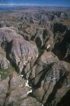
The canyon system. Sandstone walls several hundred metres deep, dissected into a labyrinth rather than a single valley. The scale is horizontal as much as vertical: not one great gorge but many, interlocking.
Gallery forest in the floors. Strips of forest surviving where the walls have kept fire out, each effectively isolated from its neighbours. If you are standing in one, the cliffs around you are the reason there is anything green.
Lemurs. Nine taxa in four families were reported in the published survey; Naturevolution’s biodiversity page now says eleven species. Nobody promises sightings and neither do we.
Fossa. Camera-trapped in the Makay for the first time on the 2017 expedition, which tells you both that they are present and how rarely they are seen.
Rock paintings. Found in 2010–11, with conservation and mapping work since, and, as far as we could find, still not properly published in the archaeological literature. These are active sites in a live research and heritage programme, not photo stops. Whatever your guide says about distance, approach and touching is the rule.
The villages and the people in them. Settlements around the massif hold fewer than five hundred people each, on the peer-reviewed account, and there is no permanent settlement inside. You will be walking through inhabited, worked, grazed country in the company of people who live there. Ask before photographing anybody, and treat the arrangement as employment rather than adventure staffing.
When it is possible to go
Western Madagascar has a marked wet season and a dry one, and the Makay’s accessibility follows the road surface and the river levels rather than the calendar.
The dry season, roughly May to October, is when walking expeditions into the massif run. Rivers are lower and crossable, canyon floors passable, and the unpaved approach roads usable. It is the window every operating account we could find uses — one operator gives its season as May to November — and it covers the 2017 scientific expedition, 22 July to 2 September.
The wet season, roughly December to April, brings cyclone risk and can make unsealed access roads and river crossings impracticable. Ask the operator about the specific road and crossings for your dates rather than applying a national road statistic to this journey.
The shoulders, April–May and November, depend entirely on how the season has actually behaved. Ask whoever is organising the expedition what the rivers are doing, not what the month usually does.
Two notes specific to this place. Multi-day walking in dissected sandstone in the dry season means heat, sun and a great deal of ascent and descent — operators quote five to nine hours of walking a day. And there are no resupply points inside the massif, so the water and food plan is the expedition’s plan, not something adjusted on the day.
Location and access: the road is the risk
This is the section that should determine whether you go. The US advisory was checked on 20 September 2026 and the UK advice rechecked on 30 September.
The United States. The State Department advisory of 5 December 2025 places Madagascar at Level 2, Exercise Increased Caution, overall — but rates six specific areas at Level 3, Reconsider Travel, for violent crime it describes as armed carjacking, banditry, mugging, home invasion and kidnapping, occurring at any time, in a context where local police often lack the resources and training to respond effectively. Two of the six are directly relevant here:
- National Road 34 between Miandrivazo and Malaimbandy — the northern access road to the Makay.
- The Menabe Region south of Morondava — the region the northern massif sits in.
The advisory also notes that US government employees require special permission to drive between major cities after dark.
The United Kingdom. The FCDO’s regional-risks page, last updated on 9 September 2026, is closer to the American position than it was when this guide was first drafted. It does not advise against travel to the region, but it now names RN34 among the roads carrying particular risk, alongside RN7, RN27, RN10, RN35 and RN1 between Tsiroanomandidy and Maintirano, and it flags the west coast between Belo sur Tsiribihina and Toliara. On the security problem that shapes the whole area it is explicit: “Violent incidents involving cattle rustlers (‘dahalo’) in southern Madagascar have resulted in fatalities.” And, reassuring in one specific respect: “Tourists have not been targeted, but you should avoid staying in rural areas without security arrangements.” For the south it advises using a recognised tour operator.
Put plainly: the massif itself is not the hazard. The approach carries a specific, named, current warning from two governments, and it is the same insecurity — armed groups, zebu theft — that the conservation literature identifies as a primary pressure on the area. These are not two separate facts about the Makay. They are one fact seen from two directions.
The geography. Malaimbandy, the northern entry, sits at roughly 20.35°S, 45.60°E. Beroroha, the southern entry, at roughly 21.67°S, 45.17°E. Miandrivazo, the junction town on the northern approach, at roughly 19.53°S, 45.46°E. Operators quote eight to ten hours of four-wheel-drive to reach the massif; past the road head, everything is on foot with porters for several days.
What this means practically. There is no self-drive, walk-in version of the Makay. Access runs through organised expeditions with local guides and porters, and the organisation handling it is also the entity making the security judgement about the road on the day you travel. That judgement is the most important thing you are buying. Ask what their current assessment of RN34 is, what the alternative is if it changes, and when their last group travelled it.
The transition. Management changed hands in 2026, a tourism circuit has been announced but, as far as we can establish, not built, and the two official accounts of the handover do not agree. Arrangements, permissions and fees may all change. Confirm current requirements with Madagascar National Parks rather than relying on any guide written before your trip, including this one.
The map on this page shows the massif’s general position and the two entry towns. It is an orientation aid. It does not show a route, does not establish that any road is currently safe, and nothing on it should be treated as a track that can be walked without local guidance.
Budget: what we can and cannot tell you
We found no published entry tariff for the Makay and we are not going to estimate one. That reflects a real transition rather than an oversight. Madagascar National Parks took over management in 2026 and publishes tariffs for its parks, but as of our check in September 2026 its site carries no Makay page and no Makay fee — check Madagascar National Parks directly.
One dated, official change is worth knowing even though it does not name the Makay: entry fees across the Madagascar National Parks network double from 1 November 2026, the first change in twelve years, with the agency stating that 65 per cent of ticket revenue funds maintenance, protection and management. If a Makay tariff appears, it will appear on that new scale.
What is certain is the shape of the cost, and it is unusual enough to set out:
- The expedition, per party. Guides, porters, food carried in, camp equipment and the transfer to the road head. Porterage is the defining cost of a Makay trip, because everything that enters the massif is carried, and porter numbers scale with days and party size rather than with distance.
- Vehicle transfer. Eight to ten hours on unpaved road, priced per vehicle and often a large single line. Get it quoted in writing before departure.
- Any park or community fees, which are in flux following the handover and the national tariff change.
- Domestic flights if you avoid part of the road approach.
Two things follow. Small groups pay disproportionately more per head, because porter and vehicle costs are per party. And the proportion of your money that stays in the communes around the massif is a legitimate question to ask before booking — the existing model was explicitly built on local employment, and whether that survives the transition is the open question of the next two years.
There is no calculator on this page, because there is no published per-person official price to put in one.
Arranging a visit, and the questions that matter
The Makay is not somewhere you book a ticket to. It is somewhere you join an organised expedition, and the choice of organiser is the whole decision. Useful questions:
- What is your current security assessment of the RN34 approach, and when did your last group travel it? What is the alternative if it changes?
- Following the 2026 handover, what permissions are now required, and from whom? Have you confirmed that with Madagascar National Parks this season?
- Who are the guides and porters, how are they recruited, and what are they paid? Are they from the communes around the massif?
- What is the medical and evacuation plan from inside the canyons, where there is no vehicle access?
- What is carried in and what is carried out, including waste?
- What is the group size, and how many porter-days does that imply?
An organiser who answers the security and evacuation questions concretely is demonstrating the competence you are actually paying for. One who answers the employment question concretely is demonstrating something else worth knowing. And an organiser whose sales copy still leads with “unexplored” is telling you which story they are selling; that is not disqualifying, but it is information.
We carry no affiliate links or commercial relationships for this destination, have not tested any operator, and endorse none. Madagascar National Parks is the authority on current access and fees; it does not sell expeditions.
Preparing for a carried expedition
This list assumes a multi-day guided walk in dissected sandstone in the dry season, everything carried, no resupply. The organiser’s own list governs.
The principle. Everything you bring is carried by someone, over rough ground, for days. Weight is not an abstraction here; it is a person’s load. Pack for what you will use, not for what you might.
Documents and money. Passport and visa, printed itinerary and permissions, emergency contacts on paper, and cash in small denominations. Assume connectivity in the massif is zero.
Walking. Broken-in boots with good grip and ankle support; sandstone is abrasive and unforgiving of thin soles. Two pairs of socks minimum. Trekking poles help on the descents.
Sun and heat. A brimmed hat, sunglasses, sunscreen, and long lightweight sleeves and trousers rather than bare skin — the dry season is hot and exposed on the plateau surfaces between canyons. A buff or light scarf for dust.
Water. Capacity for the day’s walking plus a treatment method — filter, tablets or both. Water sources inside the massif are the expedition’s plan; carry your share.
Camp. A lightweight sleeping bag suited to dry-season nights, which are cooler than the days, plus a liner. A headtorch with spare batteries.
Health. Personal medication in quantity, a personal first-aid kit including blister treatment, oral rehydration salts, and insect repellent. Discuss malaria prophylaxis and vaccinations with a travel-health professional well before departure — that is a medical decision, not a packing one.
Leaving no trace. A dry bag for waste you carry out, and nothing disposable you can avoid. The site’s own managers list waste among the area’s problems.
What no kit does. None of this makes the road approach safe, none of it substitutes for a guide in a canyon labyrinth, and none of it authorises entering the massif independently.
Confirm the final kit with the expedition organiser, particularly what guides and porters supply.
Further reading
These rest on publishers’ descriptions and published abstracts rather than our own full readings. The first is free.
- Fromont et al., “Towards an inclusive nature conservation initiative: preliminary assessment of stakeholders’ representations about the Makay region, Madagascar”, PLOS ONE, 26 August 2022. Open access, and the single most useful thing to read before going: a peer-reviewed study of how the conservation project here is seen by the people running, studying and selling it — including an unusually frank account of whom it could not reach. Read it free.
- Kahir Abdul, Navigating New Frontiers: The Beronono Bara of Madagascar and the Emergence of Tourism in the Highlands, doctoral thesis, University of Kent, 2025. Long-form ethnographic fieldwork with a Makay community, and the only source we found in which the people of the massif are the subject rather than the backdrop. Read the abstract at least if you want to know whose landscape you would be walking through. University of Kent repository.
- Peter Tyson, The Eighth Continent: Life, Death and Discovery in the Lost World of Madagascar (William Morrow, 2000; later issued by Bradt as Madagascar: The Eighth Continent). Narrative non-fiction following scientists in the field in Madagascar. Useful context for the expedition culture this article describes — and worth reading critically, since its subtitle is precisely the framing the Makay has outgrown.
- Hilary Bradt and Daniel Austin, Madagascar (Bradt Travel Guides). The standard English-language practical country guide, regularly revised. Check the edition date; it will be more current on transport and logistics than on the Makay’s management, which is newer than any printed guide. Edition unverified — the link is an ordinary publisher search.
Free and current, and more useful than any book for the decision: the US State Department advisory for road-by-road ratings, the UK FCDO regional risks page, and makay.org for the protected area’s own account of the place, its partners and its conservation chronology.
Questions travellers ask
Is the Makay really unexplored?
No, and the accurate version is narrower. Its bedrock gave its name to a geological formation, a plant was named Pachypodium makayense in 2004, and the people living around the massif have used and managed it throughout. What is true is that no systematic biological survey existed before 2009–2010, and that two of the three forest sectors worked in 2017 had no prior scientific study.
Did the expeditions actually discover new species?
Yes. We verified around a dozen formally described taxa from Makay material published between 2012 and 2022, including a bat flea, a periwinkle, a scorpion, an ant, three diving beetles and four leafhoppers, in journals including Zoosystema, Candollea and ZooKeys. We could not verify the much larger figures — “over a hundred” — used in some operators’ marketing.
Is it safe to go?
The massif itself is not the concern. The northern access road, RN34 between Miandrivazo and Malaimbandy, carries a US Level 3 “Reconsider Travel” rating for armed carjacking, banditry and kidnapping, as does the Menabe Region south of Morondava. The UK FCDO also names RN34 among risky roads and says dahalo cattle rustlers have caused fatalities in southern Madagascar, though tourists have not been targeted. Read both advisories yourself and ask your organiser for their current assessment.
Can I visit independently?
Not sensibly. Access is through organised expeditions with local guides and porters; everything past the road head is multi-day walking in a canyon labyrinth with no vehicle access and no resupply.
Who manages it now?
Madagascar National Parks, following a 2026 handover from the Ministry of Environment. The ministry and the Malagasy press give two different dates and places for that ceremony — 20 February at Maroantsetra, and 11 May at Malaimbandy — and we could not reconcile them. Naturevolution Madagascar held a delegated mandate from November 2017 but, on its own account, lost it in 2020.
What does it cost?
We found no published entry tariff, and the fee position is in transition. Madagascar National Parks fees double network-wide from 1 November 2026. The dominant costs are the vehicle transfer and porterage, both charged per party rather than per person.
When can I go?
The dry season, roughly May to October, with one operator quoting May to November. The wet season brings cyclones to western Madagascar and makes unpaved approach roads and river crossings a serious problem.
Exploration, when people already live there
There is a line in the protected area’s partner list that is easy to read past. Among the ministries and the universities and the IUCN specialist group and the twenty-four communes, it lists the local associations of guides, of porters and of beekeepers. Not by name — we looked, and no individual organisation is identified — but as a category, on the same page, in the same list.
Most expedition accounts do not do even that. The people who carry the equipment are usually the unnamed infrastructure of a discovery narrative: the reason a scientist got somewhere, written out of the account of getting there. The reason to notice it here is structural rather than sentimental. The 2007 team that first got into the canyons was eleven people, eight of them porters. Two of the three sectors surveyed in 2017 were blanks in the literature purely because of what it costs to walk equipment into a canyon. The people who could walk it in were not support. They were the method.
Which is the answer to the question this guide started with. “Unexplored” is not a property of a landscape. It describes a relationship between a place and a particular set of institutions — universities, journals, funders, broadcasters — and it says nothing about whether anyone knows where the water is. A massif can be a blank in Zoosystema and a well-used grazing country at the same time. It was both, for decades.
The useful test, then, is not whether the Makay stays wild. It was never wild in the sense the films implied: it is grazed, walked, burned, harvested and painted. The test is narrower and much easier to check. A tourist circuit has been announced linking this massif to two of Madagascar’s best-known parks. A national agency now holds the mandate, and a network-wide fee rise takes effect on 1 November 2026. In three years, who is employed at the road heads at Malaimbandy and Beroroha — and are they the same people whose knowledge of the terrain made the place legible to everybody else?
That is a question with an answer. Unlike the word we started with, it can be checked.
Sources
- Fromont, Blanco, Culas, Pannier, Razafindrakoto, Roubaud & Carrière, “Towards an inclusive nature conservation initiative: preliminary assessment of stakeholders’ representations about the Makay region, Madagascar”, PLOS ONE, 26 August 2022 — journals.plos.org
- Kahir Abdul, Navigating New Frontiers: The Beronono Bara of Madagascar and the Emergence of Tourism in the Highlands, PhD thesis, University of Kent, 2025 — kar.kent.ac.uk
- Ramahandrison, Rakouth & Manuel, “The aquatic Adephaga of the Makay, central-western Madagascar, with description of two new diving beetle species”, ZooKeys 1127: 1–60, 2 November 2022 — zookeys.pensoft.net
- Gnezdilov, “New species of the genera Limentinus and Calodia from the Makay Massif of Madagascar”, Zoosystema 43(16): 297–310, 2021 — sciencepress.mnhn.fr
- Manuel & Ramahandrison, Laccophilus makay sp. nov., in “Four new species of the diving beetle genus Laccophilus Leach, 1815 from Madagascar”, 2020 — zenodo.org
- Lourenço & Wilmé, “Scorpions collected in the Makay Mountain range, Madagascar, and description of one new species”, Revista Ibérica de Aracnología 26: 55–61, 2015
- Laudisoit, Prié & Beaucournu, “Une nouvelle espèce de Lagaropsylla de Madagascar”, Zoosystema 34(4): 737–744, 2012
- Csősz & Fisher, Aphaenogaster makay species account and type data — antwiki.org
- Lavranos, Pachypodium makayense, Cactus and Succulent Journal 76: 85 (2004); current treatment as P. rosulatum subsp. makayense — Plants of the World Online
- Dolch, Wendenbaum & Rakotonirina, “Assessment of lemur diversity in the Makay massif”, Lemur News 16: 48–53
- Burney et al., “Rock art from Andriamamelo Cave in the Beanka Protected Area of western Madagascar”, Journal of Island and Coastal Archaeology, 2020 — doi.org
- Wikipedia, Makay Massif and Isalo II (geography, rivers and the Makay Formation name; tertiary source) — en.wikipedia.org, en.wikipedia.org
- Newsmada, “Conservation de la biodiversité: Madagascar s’acquiert 21 nouvelles aires protégées”, 6 February 2026 — newsmada.com
- Newsmada, “Aire protégée: le MNP prend la gestion du Massif Makay”, 11 May 2026 — newsmada.com
- Ministry of Environment and Sustainable Development, “Gestion du Parc Naturel de Makay: une nouvelle ère sous l’égide de Madagascar National Parks”, dated 23 February 2026 — environnement.mg
- Mongabay (French service), Rivonala Razafison, “Madagascar: un vaste chantier écologique autour du dégel des permis miniers”, 25 February 2026 — fr.mongabay.com
- L’Express de Madagascar, “Les tarifs d’entrée dans les parcs nationaux doublés”, 18 May 2026 — lexpress.mg
- US Department of State, Madagascar travel advisory, Level 2 with six Level 3 areas, 5 December 2025 — travel.state.gov
- UK FCDO, Madagascar travel advice, regional risks, updated 9 September 2026 (rechecked 30 September 2026) — gov.uk
- Makay protected area, conservation history (modified 2 July 2025) — makay.org
- Makay protected area, threats and partners — makay.org/les-menaces, makay.org/partenaires
- Naturevolution, Makay 2017 expedition record and Makay biodiversity pages — naturevolution.org
- Naturevolution, “Les sentinelles du Makay” eco-guard programme — naturevolution.org
- Madagascar National Parks — parcs-madagascar.com
- Operator marketing language quoted in this guide: Ndao i Travel and makaytour.com (MTT Tsiky Zara Group)
Photograph credits
- Makay Orbit · Earth Science and Remote Sensing Unit , Lyndon B. Johnson Space Center · 8 August 2006, 07:39:11 · Public domain. Resized and converted to WebP; framing may crop the hero. These adaptations remain available under their respective licences.
- Makay Detail Aerial · Madamax · 19 February 2015 · CC BY-SA 4.0. Resized and converted to WebP; framing may crop the hero. These adaptations remain available under their respective licences.
- Makay Detail Canyon · Madamax · 19 February 1998 · CC BY-SA 4.0. Resized and converted to WebP; framing may crop the hero. These adaptations remain available under their respective licences.
Portrait supplied by Sok Heng Oeun.
A closer look.
Dated photographs show the place, details and wider setting. They are not evidence of present access or conditions.

Sok Heng Oeun
Sok Heng Oeun is the owner and editor of Hidden Corners. The Hidden Corners Editorial Team supports image preparation and editorial checks under his direction.
Sok Heng Oeun on Facebook ↗Research and AI-assisted editorial preparation. Publication authorized by Sok Heng Oeun; an individual owner reading review is not recorded. This guide does not claim a firsthand team visit.


.jpg)
_01.jpg)
