
Condition of the ground, 1926
In 1926 the ground at Kepong was used up. It had been forest once. Then Chinese miners had worked it for tin, open-cast and with gravel pumps, and dumped the overburden and mine refuse across parts of it. Then cattle grazed it, vegetable growers cultivated it, it was abandoned, and it was grazed again. By the time the foresters took it over, whatever merit the surface soil once had was, in the words of Malaysia's own nomination dossier, "leached well out of it". The worst patches carried nothing but lalang, Imperata cylindrica, a coarse grass that regular burning kept in charge.
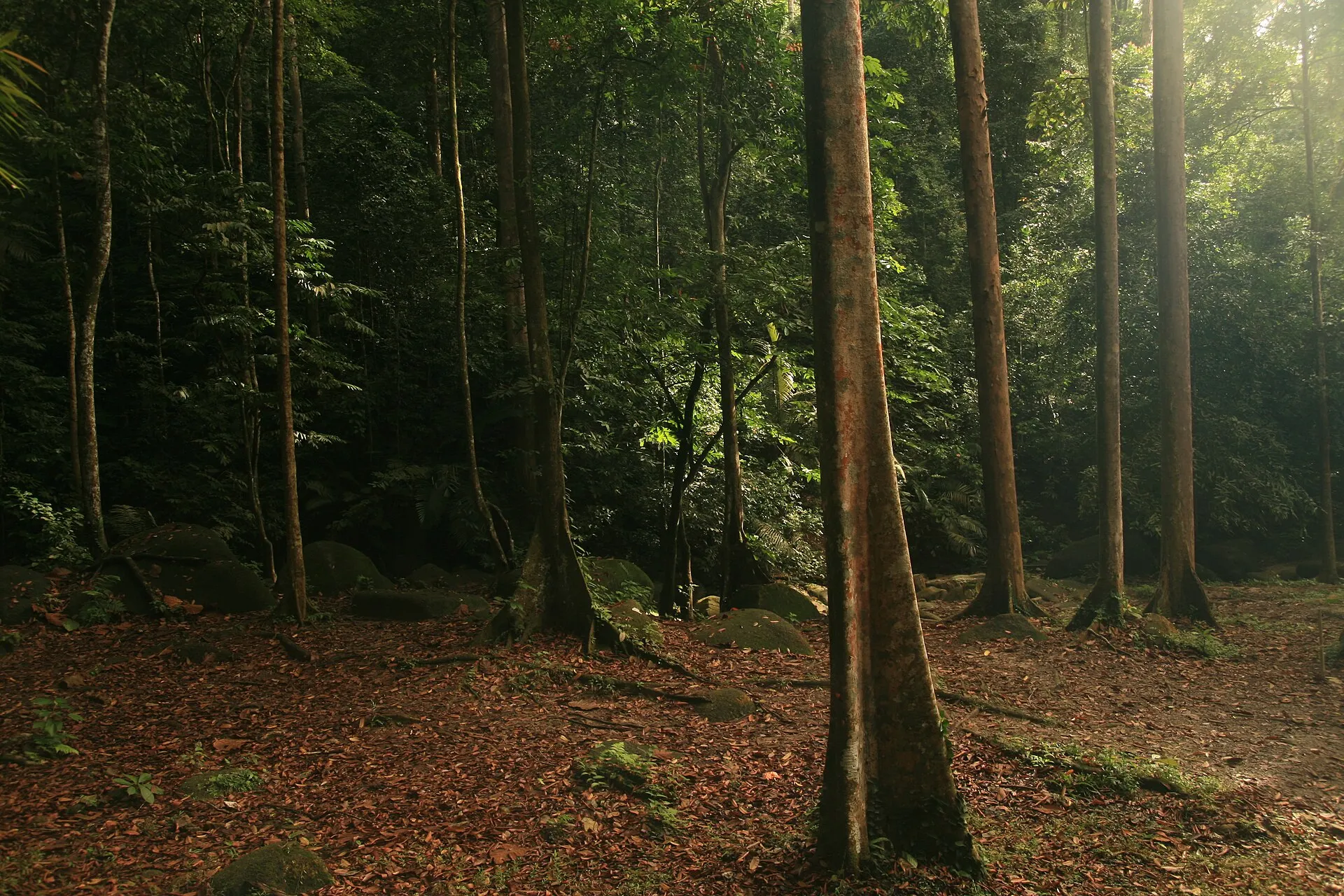
The same ground, sixteen kilometres north-west of central Kuala Lumpur, is now 589 hectares of closed-canopy lowland rainforest wrapped around a working research institute. On 11 July 2025 the World Heritage Committee inscribed it as the Forest Research Institute Malaysia Forest Park Selangor, under criterion (iv), one of the cultural criteria. UNESCO's short description of what it recognised is three words long: "designed forested landscape".
A designed landscape has a designer's record, and this one has a century of them. The first tree went into a numbered field in 1926. Species were counted by the end of the following year. Hectare totals were logged decade by decade, and the institute has been publishing on what it grew ever since. So this guide reads the forest the way the forest was made: as a notebook, one dated entry at a time, from the lalang to the reports now due to UNESCO.
It is desk research. Nobody from Hidden Corners has walked these trails. The entries draw on the nomination dossier, the ICOMOS evaluation and the Committee's decision, FRIM's own visitor pages and Malaysian reporting, and where those sources disagree, as they do on several dates and figures, the disagreement is printed rather than smoothed over.
One correction shapes everything that follows. Some reference lists give FRIM's criteria as (ii) and (v). Those are the criteria Malaysia proposed. UNESCO's heritage advisers found neither demonstrated, suggested (iv) instead, and the Committee inscribed the forest under that criterion alone. That episode is the 2013–2025 entry below, and it is the best evidence there is for what the listing is actually about.
Entry, 1926: a botanist is given worked-out ground
The institute's founding is usually told in two sentences. G. E. S. Cubitt, the chief conservator of forests, asked Frederick William Foxworthy to set up a separate forest research unit, and Foxworthy chose Kepong. The nomination dossier adds that the post of Forest Research Officer went to Foxworthy after several years as head of the Forest School and Investigations Division, and it names his deputy, J. G. Watson. ICOMOS, summarising the dossier, dates the establishment across 1925 and 1926.
Why Kepong? The sources give two reasons, and they are different. The encyclopaedic history of FRIM says Foxworthy picked the site because tin mining and agriculture had already stripped it of its original forest: bare ground was what a station for learning to grow tropical hardwoods needed. The ICOMOS evaluation says he chose it for its "abundant water resources and proximity to another forest reserve (Bukit Lagong Forest Reserve)". The two are not incompatible, and the dossier's own account of the land available for planting — abandoned mining land, overburden, cattle, lalang — makes the degraded condition plain either way. But the second reason is the one with consequences a century later. Bukit Lagong is still next door, and in 2025 it became the most discussed threat in the whole inscription file.
The first entry in the field record is specific. According to the dossier, "the first tree was planted in 1926 in Field 12." The unit of this experiment was the field, and fields were numbered. That numbering is why the forest can be read as a record at all: a stand is not just a stand but a field with a planting date and a species list against it.
The first question was survival. By the end of 1927, ICOMOS reports, 161 species had been planted "to test their resistance in the harsh environment". That number is worth pausing on. Nobody in 1926 knew which tropical trees would establish on leached, compacted mine spoil under a sun that the lalang did nothing to soften. The only way to find out was to plant widely and watch what died.
The labour was local and large. ICOMOS gives the establishment workforce as approximately ten scientists and two hundred staff and labourers recruited locally. The dossier's own phrase for the two men at the top is that "Foxworthy and J. G. Watson spent the rest of their working lives on it". The rest of the working lives of the two hundred are not recorded in anything this guide could find, which is itself a fact about whose notes survive.
Margin note: the city and the forest are the same story
Why was there worked-out ground sixteen kilometres from Kuala Lumpur in 1926? Because of what Kuala Lumpur was for.
The city grew up around 1857 at the confluence of the Klang and Gombak rivers. Kuala lumpur means muddy confluence, a description before it was a name. The spot mattered because it was the furthest point up the Klang to which supplies could conveniently be brought by boat, which made it the collection and dispersal point for tin mines inland. A member of the Selangor royal family had hired prospectors to open mines in the valley; eighty-seven Chinese prospectors were brought upriver to Ampang, then dense jungle, and sixty-nine of them died. The mines worked, and the settlement at the muddy confluence became the capital of a country.
Tin mining in the Klang Valley did what alluvial tin mining does. It stripped vegetation, moved earth in enormous volumes and left compacted ground without topsoil. Kepong's land was worked by exactly the methods the dossier names — open-cast pits and gravel pumps — and then passed through the cattle-and-vegetables cycle that finished the job.
The mining left water behind as well as damage. The executive summary of the nomination notes that mining ponds and lakes remain within the property as remnants of those activities. The water features a visitor walks past are not landscaping. They are the holes.
So the city and the forest belong in one frame. Kuala Lumpur is what the tin economy built. FRIM is what was planted on ground the tin economy had finished with. They are about seventy years apart in origin and sixteen kilometres apart on the map, and they can be seen together: the Skywalk looks out towards the city, and Selangor's official news agency describes a footpath inside the park with views of the Petronas Twin Towers. That view is not a bonus. It is the whole argument of the listing, visible in one direction.
Entry, 1928: forty-two hectares and the nurse trees
By 1928, according to the encyclopaedic history, the first experimental plantation covered 42 hectares, predominantly dipterocarps, grown with nitrogen-fixing nurse trees. The dossier describes the same technique in its own terms: "Fast-growing nurse trees were used to provide overhead shade," and "nurse trees were planted to protect seedlings which grew from saplings to pole-sized trees with juvenile crowns."
That sequence is the technical heart of the whole site. Dipterocarps — the family behind the emergent giants of Southeast Asian lowland forest and much of the region's commercial timber — do not establish well as seedlings on open, sun-baked ground. So the planters put something else in first, something quick and tolerant, to cast shade and hold the soil, and brought the trees they actually wanted up underneath. The dossier records the result in a single sentence: "As the planted seedlings grew into saplings and pole-sized trees, the soil regained its fertility." The nurse trees' job was to make themselves unnecessary.
Which nurse trees? Neither the dossier passages nor the ICOMOS evaluation that this guide could read names the nurse species, and the encyclopaedic source only calls them nitrogen-fixing. Popular accounts sometimes supply a genus. This guide will not, because none of the primary documents checked here does.
The working day was set by the climate. The dossier's description of the method is plain enough to quote whole: planting "was carried out from dawn to 10 am to avoid the midday heat. As much as possible, planting was carried out on rainy days. Weeding was carried out every month, at least during the first year, to remove competing vegetation. There was no machinery of any kind, no irrigation, and no pesticides. All the work was done manually." Monthly weeding matters more than it sounds. Lalang returns fast, and a seedling smothered in its first year is a data point lost.
The layout came from rubber. ICOMOS reports that "the rubber estate planning layout was selected for the creation of the new forest reserve, as it was a widespread type of plantation in the region." That is a revealing choice: the most familiar industrial landscape in 1920s Malaya was repurposed as the grid for a forest. It is also, as the nomination entry below explains, where the evidence ran out. ICOMOS adds that "no historical documentation seems to survive that could attest to the chosen original layout or to the models that inspired the layout."
What the dipterocarp collection became. The plantings grew into a dedicated Dipterocarp Arboretum, which the dossier puts at about 6.5 hectares holding more than 120 dipterocarp species in genera including Anisoptera, Cotylelobium, Dipterocarpus, Dryobalanops, Neobalanocarpus, Parashorea, Shorea, Upuna and Vatica. For a visitor who has only ever heard "dipterocarp" as a single word, that list is the reminder that it is a family of hundreds of trees, most of them commercially valuable and several of them now hard to find in the wild.
Entry, 1932 to 1939: every field planted
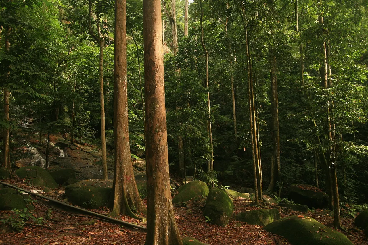
At the end of 1932 Foxworthy retired. By then, according to ICOMOS, "every plot of land had been planted with a mixture of many species, with the first species planted already reaching six metres in height." Six years from lalang to six-metre trees is the first measurable success in the notebook. Note the word mixture: the fields were not blocks of a single species, and that changes how to read them on the ground, which the 2026 entry takes up.
The institute built itself inside its experiment. The dossier and ICOMOS describe a small campus going up alongside the plantings:
- Villa Aromatica, 1927 — a two-storey Art Deco bungalow built for the head of the institute.
- The Administration Building, 1929 — "designed in Art Deco style with Malay vernacular architectural elements". ICOMOS notes that it has kept its main external character while its function, interior use and spatial arrangements have changed over time.
- Staff housing, early 1930s — semi-detached houses and bungalows for scientists. Villa Aromatica and the semi-detached houses are no longer lived in; they serve as offices or representational spaces.
- The avenues, from 1928 — Jalan Foxworthy runs from the main gate past the Administration Building, lined, in the dossier's list, by mahogany (Swietenia macrophylla), tembusu (Cyrtophyllum fragrans) and merawan siput jantan (Hopea odorata). A jelutong avenue and royal palms decorate other parts of the grounds.
Those buildings are inside the inscribed property, not beside it. A visitor looking at the Administration Building is looking at part of the listed ensemble, the same way a visitor at an industrial heritage site looks at the mill house.
Not every building survived to be listed. ICOMOS writes that "it is concerning that wooden buildings have been demolished without any prior documentation", and the Committee's decision asks Malaysia to establish documentation archives for buildings and landscape features. For a site whose whole claim rests on record-keeping, that is the notebook's first missing page.
How much was planted by 1939? The sources disagree. The encyclopaedic history gives 154 hectares of plantation by 1939. The dossier, citing FRIM's plant database, says that "between 1926 and 1944, 372.2-ha or 63.2% of the nominated property were planted." Some of the gap may be the five extra years and some may be a difference in what is being counted — formal plantation versus any planted ground inside today's boundary — but neither source says so, and this guide does not choose between them.
Entry, 1942 to 1945: the institute without its scientists
The notebook's shortest entry is the one written by the people who were never meant to write it.
The dossier dates the occupation of British Malaya from 1942 to 1945 and describes what it meant at Kepong in five sentences: "The Japanese authorities did not station any Japanese staff at the Institute and only made day visits from Kuala Lumpur but the local staff remained on duty. The only trees planted were a stand of the camphor tree Cinnamomum camphora at the end of the Coniferetum and one tree at the side of Office Pond beside a small ornamental bridge. The war ended with the Japanese surrender in August 1945. When the British returned, they found the local organisation intact. Damage to the nominated property was limited because the live-in community of staff and their families safeguarded the nominated property with their presence."
ICOMOS puts the same point more sharply: the forest survived because "the staff remained on duty and cared for the forest when the foreign scientists were compelled to leave."
Three things follow from that paragraph.
First, the occupation left a physical trace. A single-species stand of camphor, and one tree by a pond with a small bridge, are the only plantings of those years. In a forest designed as mixed fields, a stand of one species is precisely the kind of feature a careful walker can notice, and this one has a date on it.
Second, the experiment's continuity was a matter of people living on site. A plantation left without weeding for three and a half years can be lost to lalang and climbers. This one was not, and the dossier credits residence rather than research for that. The arrangement persists in modified form: ICOMOS records that between one hundred and two hundred families still live inside the property, employed by FRIM, though scientific staff no longer do.
Third, the institute's own history names very few of those people. Foxworthy and Watson have their names in the dossier. The staff who kept the fields through the occupation are, in the documents checked here, "the local staff". Anyone researching further would do well to start with that gap.
One other long-standing presence is recorded. ICOMOS notes that the Orang Asli community of Kampung Orang Asli Bukit Lagong, living outside the buffer zone, "have been harvesting fruits in the small orchards of the nominated property since the 1920s" — IUCN's comment specifies durian. The nomination did not say whether that community had been consulted, and the Committee's decision asks for greater involvement of Indigenous People.
Entry, 1949 to 1969: conifers, independence and the last quarter
1949: the Coniferetum. The dossier dates the Coniferetum, a gymnosperm garden, to 1949. It is a different kind of planting from the fields: a collection assembled to show a group of plants, rather than a trial of what would grow on spoil. The wartime camphor stand sits at its end.
1957: independence. By the year Malaya became independent, the encyclopaedic history gives 220 hectares of plantation. Six years later, Abdul Rahman Mohd Ali became the institute's first Malaysian director.
1962 to 1964: expansion. The same source says expansions in those years took the planted area to around 600 hectares.
Here the figures come apart. The dossier, again citing FRIM's plant database, says that "by 1969, a large portion of the nominated property — 440.6-ha or 74.8% — was forested." Six hundred hectares is more than the whole inscribed property of 589, so the two figures cannot be measuring the same area; the encyclopaedic number presumably includes land outside today's boundary, or counts something other than forest cover, but neither source explains itself. What the dossier figure does establish is striking on its own: forty-three years after Field 12, roughly a quarter of what is now the World Heritage property was still not forested.
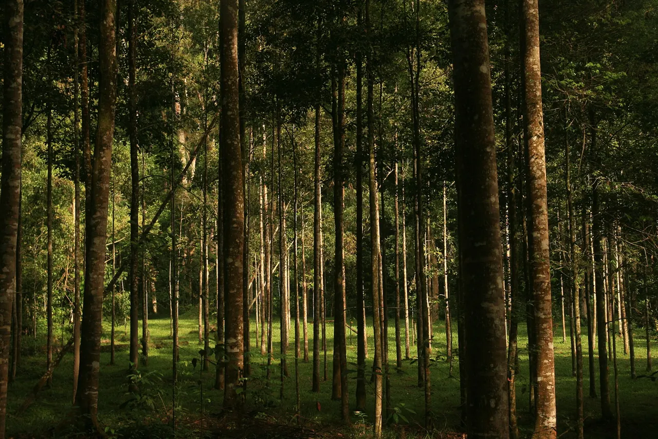
What that means under the trees. The forest is not one age. The oldest fields date from the late 1920s; the post-war plantings are a generation younger; and the last quarter came later still. A walk that crosses several fields is also a walk across decades of the experiment, and the canopy heights should, in principle, record that.
Entry, 1979 to 2016: the experiment becomes an institution
1979: fruit trees. ICOMOS dates the Fruit Tree Arboretum to 1979; the dossier says the 1970s. Either way it adds a third kind of planting — a collection of useful trees — to the trial fields and the botanical gardens.
The 1980s: stability. UNESCO's statement of integrity says the property's ecological stability was established by the 1980s and has remained consistent with the characteristics of natural tropical rainforest since. That is the Committee's own milestone for when the experiment turned into a forest.
1985–86: a statutory body. FRIM's own overview says it became "a full-fledged statutory body, governed by the Malaysian Forestry Research and Development Board (MFRDB) under the Ministry of Primary Industries, in 1985." The encyclopaedic history gives the formal inauguration as 5 April 1986.
1995: the Kepong Botanic Gardens. ICOMOS dates the gardens to 1995. They matter to visitors more than their date suggests: the Forest Skywalk stands there, and FRIM confines jogging to them.
2009 and 2015: national heritage. FRIM says it was designated a Heritage Site under the National Heritage Act 2005 in April 2009 and gazetted as National Heritage in January 2015. UNESCO's page lists that act among the property's legal protections, alongside the FRIM Act 2016, under which FRIM — a government agency now under the Ministry of Natural Resources and Environmental Sustainability — wholly owns and manages the property.
2016: fewer visitors. ICOMOS records that "in 2016, the number of visitors was reduced to 500,000 persons per year to ensure the recovery of soil and trails." It is the first entry in the notebook in which the pressure on the forest comes from people who came to admire it. It will not be the last.
Entry, undated: two canopy walkways
This entry has no year because the official sources give none. FRIM describes the current structure, the Forest Skywalk in the Kepong Botanic Gardens, as "FRIM's second canopy walkway". It says nothing on its visitor pages about the first, and none of the UNESCO documents checked mention either. The opening and closing dates of the earlier walkway circulate online; this guide found no official statement of them and leaves the gap open.
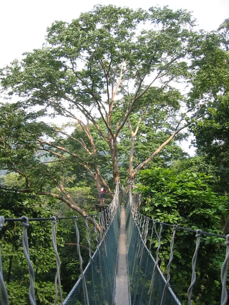
What FRIM does publish about the Skywalk is precise. Eleven towers and eight bridges, from 18 to 50 metres high, 250 metres long in total, with its highest point 141 metres above sea level. A 100-metre walk along an easy trail from the office brings you to it, and FRIM estimates 30 to 40 minutes for the loop. The minimum age is 7, and 13 for the 50-metre tower.
Hours: two versions on FRIM's own sites. The admission-fees page (updated 15 July 2026), the visitors' guide and the attractions page give Saturday to Thursday, 08:30 to 15:30. The dedicated Skywalk page and skywalk.frim.gov.my give two sessions, 08:30 to 12:30 and 14:30 to 15:30, "subject to weather conditions". They share the same start and finish; the difference is a two-hour midday gap in the second version. Planning for a morning slot satisfies both.
Closed on Fridays. Every FRIM page agrees on this. FRIM does not publish a reason for the closure; plan around its stated Friday rule.
FRIM's attractions page also lists a Forest Skywalk @ Night, along with night walks, camping and a high-ropes course. This guide did not verify their schedules or prices.
Why the walkway matters to the notebook. From the ground, a planted forest is a sequence of trunks. From 50 metres, it is a surface, and a surface is where the fields show: patches of different texture and height, the seam where one planting meets another, and in the distance the city whose industry cleared the ground in the first place. Take it as the one place the whole plan is visible.
Entry, 2013 to 2025: the criterion nobody nominated
Malaysia's tourism ministry says the nomination was in preparation from 2013. It reached the World Heritage Committee at its 47th session in Paris in July 2025, and the file that arrived there tells a more interesting story than the celebration that followed.
What Malaysia proposed. The dossier asked for inscription under criteria (ii) and (v). Criterion (ii) recognises an important interchange of human values in architecture, technology or landscape design; the nomination argued that the forest's layout reflected British and Malay influences. Criterion (v) recognises an outstanding example of traditional human settlement or land use; the nomination argued that restoring a tropical forest on mined land, by hand, without machinery or chemicals, was such an example.
What ICOMOS found. The International Council on Monuments and Sites, which evaluates cultural nominations, rejected both.
- On (ii), ICOMOS found "insufficient evidence to demonstrate that the nominated property exhibits an important interchange of human values in any of the spheres covered by criterion (ii)". The rubber-estate layout was real, but no documentation survived to show what had inspired it.
- On (v), ICOMOS said the nomination "gives an account of the damage done to the landscape and celebrates its remediation, rather than presenting an exemplary landscape". A restoration, in other words, is not a traditional way of using land.
Then ICOMOS proposed a criterion nobody had asked for. It suggested that the property could qualify under criterion (iv), as "an outstanding example of a designed forested landscape" testifying to "large-scale environmental rehabilitation at the beginning of the 20th century, at a time when ecological concerns started to emerge." It did not recommend inscription. It recommended that the nomination be referred back to Malaysia to rebuild the argument around (iv) with a wider historical context, to suspend quarrying concessions in the neighbouring Bukit Lagong Forest Reserve, to enlarge the buffer zone, and to clarify a disputed strip on the eastern boundary. It also judged the comparative analysis — which set FRIM beside the Bilar and Loboc man-made forest in the Philippines, Rio de Janeiro's Tijuca forest, Western Australia's jarrah forest and China's Saihanba — "not adequately articulated and … based on a focus that is too narrow".
What the Committee did. Decision 47 COM 8B.18 inscribed the property on 11 July 2025, under criterion (iv) only. Its Statement of Outstanding Universal Value calls FRIM "an outstanding example of one of the earliest large-scale re-creation of a tropical rain forest on severely devastated land" and describes criterion (iv) as met because the forest reflects "a change from exploitation of forest to total rehabilitation; from total deforestation to total restoration of a natural tropical rain forest."
That is the answer to the reference-list confusion. (ii) and (v) are what Malaysia asked for; (iv) is what the forest holds. The Committee's route — inscribing a nomination that its adviser had recommended for referral — is not unique that year: for a Vietnamese nomination the Committee likewise overrode an ICOMOS recommendation at the same session, told in Yên Tử: the word that was crossed out.
The conditions attached. The decision recommends that Malaysia protect the property's attributes in the southern buffer zone; strengthen protection and management; bring a conservation architect into monitoring; reduce the extent of "Zone 3"; create documentation archives for buildings and landscape; document the forest's biodiversity further; develop heritage-focused visitor management; involve Indigenous People more; and withhold quarry concessions in Bukit Lagong and remove quarrying there. It asks for revised maps and an implementation report by 1 December 2026, for examination at the 49th session.
Zone 3 needs a gloss. The management plan divides the property into three protection zones: Zone 1 for forest conservation, Zone 2 for building conservation and recreational and educational tourism, and Zone 3, "a controlled development area". ICOMOS thought Zone 3 far too large for the size of the property.
The buffer changed between evaluation and inscription. ICOMOS evaluated a buffer zone of 767 hectares. UNESCO's property page today gives 1,066. The documents checked here do not say precisely which land was added.
Where the forest sits on Malaysia's list. It is the country's sixth property and fourth cultural one, after Kinabalu Park and Gunung Mulu (both natural, 2000), Melaka and George Town (2008), the Lenggong Valley (2012) and the Niah Caves (2024) — and the first anywhere near the capital.
Entry, 2026: how to read a planted forest
No signboard will do this for you, and it is the difference between an hour at FRIM and an hour in any pleasant patch of green near a city. The method below follows from what the dossier says was planted and how. It is a reading guide, not a field map; FRIM's staff and guides know which field is which.
Expect mixtures, not monocultures. An earlier version of this guide told readers to look for single-species blocks. The record says otherwise: by 1932 "every plot of land had been planted with a mixture of many species". The fields were trials of many trees at once. A true single-species stand is the exception, and a documented one — like the wartime camphor at the end of the Coniferetum — is worth seeking out precisely because it breaks the pattern.
Look for the grid. The layout followed rubber-estate planning. A century of growth, death and natural infill blurs rows, but sighting along a stand at a low angle can bring a regular spacing back into view, the way old field systems surface in low sun.
Look for the seams. Where one field meets another, planted in a different year with a different mixture, the canopy height, the trunk sizes and the understorey can change along a line that nothing in nature would draw. From the Skywalk, those seams are easier to see than from the trail.
Look for the avenues. Jalan Foxworthy's mahogany, tembusu and merawan siput jantan were planted as an avenue from 1928, and a jelutong avenue runs elsewhere. Avenues are the most legible design in the property: straight, deliberate, and named.
Look for the absence of nurse trees. They were planted to shade the dipterocarps until the dipterocarps could shade themselves. Where the canopy is now dipterocarp, the method did what it was meant to do. The trees that made it possible are, by design, mostly not there to see.
Then look for what nobody planted. The ferns, palms, climbers and seedlings in the understorey arrived by wind, bird and bat. This is the real test. Planted trees surviving proves the planters were competent; a forest recruiting on its own proves the ground came back.
What the counts say — and who is counting. ICOMOS reports approximately 2,300 species of vascular plants including 855 tree species, and a refuge for 233 bird, 62 mammal, 82 reptile, 34 amphibian and 21 freshwater fish species, plus 324 butterflies. IUCN's comment gives about 800 tree species and counts 13 critically endangered, 25 endangered and 35 vulnerable plant species. UNESCO's statement of integrity goes furthest, saying the property's flora and fauna are "equivalent to that of natural tropical rain forests of Malaysia". Hold that last sentence carefully. The same decision asks Malaysia to document the forest's biodiversity further, and whether a restored forest is functionally equivalent to primary forest remains an open scientific question that a desk guide cannot close. A claim of that kind is only as strong as the record behind it; for a case where the record failed a famous claim entirely, see Gunung Padang.
Hold both readings at once — plantation and forest — and the place becomes remarkable. The transition between those two words is what a century bought.
After the listing: what changed at the gate
A World Heritage label on a site this close to a capital was always going to move visitor numbers, and the first figures are in.
Numbers. The Star, reporting on 1 August 2026, quotes FRIM's director-general, Datuk Dr Ismail Parlan, and gives average annual visitors before inscription of 100,000 to 159,000, and 270,849 visitors in 2025. He described "a remarkable increase in international visitors from Europe, the United States and Asia, particularly from China". Media Selangor, in June 2026, quoted deputy director-general (research) Norwati Muhammad saying numbers had grown and that visitors from China were now the largest foreign group.
A daily limit, as reported. The Star quotes the director-general saying FRIM limits access to its core heritage area to 400 visitors a day through a pre-booking and guided tour system, with about seventy licensed nature guides. Media Selangor also describes visits being "conducted as guided tours". This is the single most important practical change since the inscription — and it is not stated on FRIM's visitor pages, which, as checked on 29 September 2026, still describe gate admission without booking for individuals and group booking only for parties over ten. The two accounts may describe different parts of the site; the reports do not define "core heritage area". Until FRIM's own pages catch up, contact the Visitor Information Centre before going.
Money. Media Selangor reports that the Selangor state government allocated RM 300,000 to improve the visitor experience and strengthen conservation awareness. The same report mentions an avian wetlands area and the Denai Aromatica nature and herbal trail.
What UNESCO is waiting for. The Committee's report deadline is 1 December 2026. ICOMOS also said, on soil compaction and erosion, that "mountain biking should not be allowed within the nominated property", and flagged proposed visitor centres and museums as developments that could push visitor loads past capacity. A visitor arriving in late 2026 is arriving in the months when those questions are being answered on paper.
The rules are not park rules
FRIM's attractions page says it directly: FRIM is an R&D institution and "not a public recreational park". The rules follow from that.
The prohibited list runs to twenty-three items. Among them: littering, disturbing animals, feeding wildlife, fishing, hunting, collecting plants or animals, indecent dress, illegal activities, illegal parking, entering restricted areas, open burning, vandalism, reckless driving on nature trails, loud music, intoxicating drinks, occult practices, opening unauthorised trails, pets and drones. At a site where trees are experimental subjects with records against them, the collecting ban protects data as well as plants. The ban on cutting new trails protects the soil that the 2016 visitor reduction was meant to rest.
Activities are zoned. Jogging is allowed only in the Kepong Botanic Gardens, and FRIM discourages it when the Air Pollution Index exceeds 100. Photography is allowed in most areas but not near FRIM buildings, offices or staff quarters — these are workplaces and, for a hundred to two hundred families, homes. Family events and weddings are restricted to designated grounds.
Groups of more than ten must book at least three working days ahead and register at the Visitor Information Centre. This is the rule most likely to catch out an unplanned family or tour outing.
Liability sits with the visitor. FRIM's guide states that "FRIM is not liable for any damage, loss, or accident", and that operations depend on the weather.
None of this is onerous if you arrive expecting a laboratory. All of it is irritating if you arrive expecting a national park.
Field notes for the walk
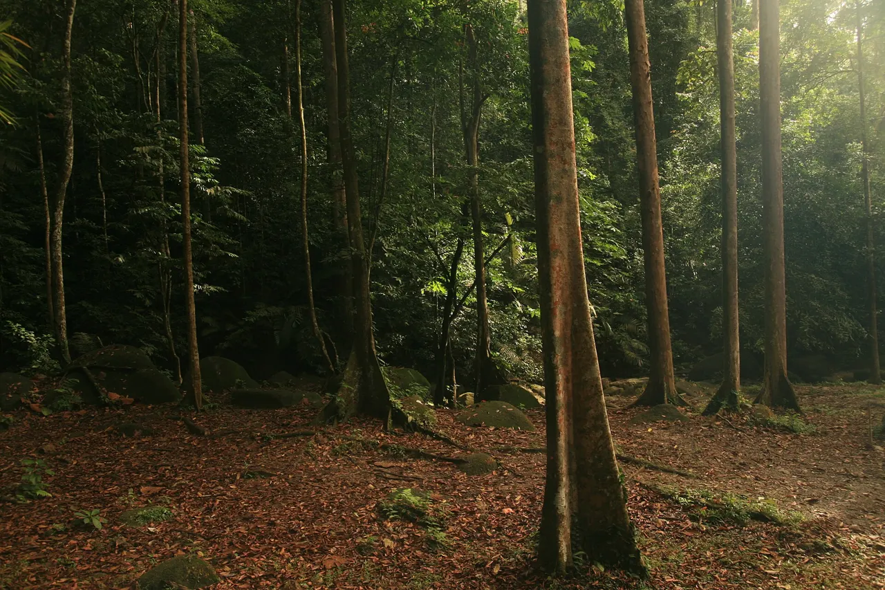
Sungai Kroh. FRIM's waterfall is a real stream, not an ornament. Water held in a forested catchment is part of the restoration result: stripped ground sheds rain, forested ground holds it.
The mining water. The ponds and lakes are, by the nomination's own account, remnants of mining. Read them as the oldest features on the site that people made.
The buildings, from outside. The 1929 Administration Building and the 1927 Villa Aromatica are part of the listing. Look at them as industrial heritage, but respect the photography ban around buildings.
Jalan Foxworthy. The avenue from the main gate is the design at its most readable, and it carries the founder's name.
The trails with names. Media Selangor names the Denai Aromatica herbal trail and an avian wetlands area; FRIM's attractions page lists trekking on its nature trails. Treat the choice of trail as a choice of which part of the experiment to walk through.
Wildlife. Feeding and disturbing animals are both prohibited. Keep food out of sight and bags closed.
Leeches. In wet tropical forest after rain, expect them. They are a nuisance, not a danger, and long socks deal with them.
The buffer. The property is 589 hectares; the buffer around it is 1,066. If you drive in past new building, you are crossing the part of the listing the Committee is most worried about.
A different forest history appears in our Bieszczady guide; compare the role of human decisions without treating the two landscapes as ecologically interchangeable.
When to go
Warm, humid conditions and rain are part of a visit to Kepong in any season. A calendar label cannot guarantee a dry trail or an operating Skywalk. Check the local forecast and FRIM's access notices before setting out.
After rain. Roots, slopes and walkways can be slippery. Ask staff about trail conditions and closures. Avoid the Sungai Kroh stream during or after heavy rain, and stop outdoor activity if thunder is heard.
Start early. The campus's published opening time is 06:00. An early start gives more flexibility before the day's heat, but check the booking requirements for the area you intend to enter. Historical planting crews worked from dawn to 10 a.m.; that is a detail of the forest's past, not a modern weather forecast.
Check the air as well as the sky. Haze is a condition to monitor, rather than a date to assume. FRIM discourages jogging when the Air Pollution Index exceeds 100. Check current air-quality information and follow staff advice.
Choose the day around the activity. FRIM lists the Skywalk as closed on Fridays. A Monday-to-Thursday morning fits that published schedule; availability and any required reservation still need confirming. On weekends and public holidays, leave more time for arrival and queues.
Getting to Kepong
Where. Kepong, Selangor, about 16 kilometres north-west of central Kuala Lumpur, inside the capital's commuter belt. It is the only Malaysian World Heritage property a visitor can fit into an ordinary day in the city.
By car. The simplest option, and the one the parking charge is designed for: RM 5 per car, RM 3 per motorbike.
By public transport. The Kepong area has rail and bus links into the Klang Valley network, and ride-hailing from central Kuala Lumpur is straightforward. The practical constraint is the ride back out; arrange it or check coverage before committing.
Inside the site. The campus is large. Driving between parking areas on the roads is normal; the nature trails are walking only.
Hours, as FRIM publishes them. Campus 06:00 to 19:00 daily, last entry 18:30. Weekday activity windows 06:00 to 07:30 and 08:30 to 19:00. Kepong Botanic Gardens Monday to Thursday 07:30 to 19:00, weekends and public holidays 07:00 to 19:00; FRIM's pages do not state garden hours for Friday. Office Monday to Friday, 08:00 to 17:00. Forest Skywalk Saturday to Thursday only, see the canopy entry above.
Accessibility. Campus roads, gardens and picnic areas are broadly manageable. The trails are forest trails, with roots, mud and gradient, and the Skywalk involves towers and stairs. Disabled visitors are admitted free.
The map shows an approximate pin for the FRIM gate; the Skywalk is in the botanic gardens section, not at the entrance.
What it costs
FRIM’s campus admission table was rechecked on 17 October 2026; the page itself shows an update date of 15 July 2026. The separately quoted Skywalk figures retain their earlier verification date and need confirmation before booking.
- Entry, Malaysian citizens: RM 1 per adult aged 13 and over; children 12 and under free; disabled visitors free.
- Entry, non-citizens: RM 5 per adult aged 13 and over; RM 1 for children aged 7 to 12; disabled visitors free.
- Vehicles: RM 5 per car, RM 3 per motorbike.
- Camera: RM 5 for an SLR or DSLR.
- Forest Skywalk, with MyKad: RM 15 adult, RM 10 senior, RM 8 student aged 7 to 17.
- Forest Skywalk, without MyKad: RM 40 adult, RM 40 senior, RM 25 student.
- 50-metre tower add-on: RM 5 with MyKad, RM 10 without; age 13 and over.
The Skywalk prices split by MyKad, Malaysia's identity card, rather than by nationality as such. A non-Malaysian couple arriving by car, both taking the Skywalk and the tower, with one DSLR between them, pays RM 10 entry, RM 5 parking, RM 80 Skywalk, RM 20 tower and RM 5 camera: RM 120.
No price has been published for the guided tours reported since the inscription. If a guide fee applies, it is not in these figures.
Booking and checking ahead
- The Forest Skywalk is booked online through skywalk.frim.gov.my or through the Visitor Information Centre. Sessions are weather-dependent.
- Groups of more than ten book at least three working days ahead and register at the Visitor Information Centre on arrival. This covers the campus, not just the Skywalk.
- The reported 400-a-day guided system. Because FRIM's pages and the press disagree, ask the Visitor Information Centre (03-6279 7592 / 7649, frim_enquiry@frim.gov.my) whether your visit needs a guided booking.
- No Skywalk on Fridays. Plan around it.
- Weather can close the Skywalk. Ask staff which activities are permitted in the current conditions. Do not make a stream or waterfall your fallback during or after heavy rain; postpone outdoor activity in thunderstorms.
Hidden Corners has no affiliate links or commercial relationships for this destination and names no operator.
Packing
Equatorial lowland forest, a working campus and a canopy structure with an age limit.
- Footwear with grip. Trails are mud and root, and wet more often than not.
- Long socks pulled over trouser cuffs, for leeches after rain.
- Light long trousers and sleeves for insects, and because indecent dress is on the prohibited list.
- A rain shell. Afternoon rain is the normal condition.
- More water than the short distances suggest.
- Insect repellent for shaded wet forest.
- Small ringgit notes and coins for entry, parking and the camera charge.
- A phone or small camera, unless you are happy to pay RM 5 for an SLR.
- Leave behind: drones and pets, both prohibited, and any intention of taking a seed, leaf or cutting home.
A morning in the planters' hours
Allow a morning for FRIM, with the route and arrival time agreed under its current visitor arrangements. Earlier walking can reduce heat exposure, but published campus hours do not establish permission to enter every forest trail. If the reported guided system applies to your visit, the guide's route replaces the order below.
Arrive at the time confirmed by FRIM or your booked guide. The campus opens. An early slot may suit birdwatching and walking, subject to the route that staff permit.
Early morning, an authorised trail. Follow the permitted or guided route with the field-pattern reading method in mind. Find one seam between fields; once you have, the rest reorganises itself.
08:30, the Skywalk, booked, in the first session if possible, Saturday to Thursday. Use the height to see the field pattern, not only the city.
Late morning, Sungai Kroh and Jalan Foxworthy. Walk the avenue back towards the gate and look at the Administration Building as part of the listing.
If the weather deteriorates, leave the exposed areas, and follow staff instructions. A rain shell is useful equipment, not permission to remain outdoors in a storm.
Further reading
- The ICOMOS evaluation and the nomination dossier. The primary record of this forest, and free. The dossier holds the planting method, the land's history and the wartime account; the evaluation holds the argument over criteria and the conditions. Both are linked from UNESCO's documents page for the property: whc.unesco.org/en/list/1734/documents. Useful because almost everything written about FRIM for visitors skips the part where the criteria changed.
- E. J. H. Corner, Wayside Trees of Malaya. A long-established reference to Malayan trees, reviewed in Nature in 1941 and reissued in later printings. Useful here for putting names to the avenue trees and the dipterocarp genera the dossier lists. The edition is unverified; this is an ordinary Amazon search.
- FRIM's own visitor pages. The authoritative source for fees, hours and rules, and the place any post-inscription booking change will eventually appear: visitors' guide · admission fees.
On tropical forest restoration more broadly, the question of whether restored forest becomes functionally equivalent to primary forest is active and contested. This guide has not surveyed that literature and does not recommend a single title from it.
For another way to read a designed landscape, explore Angkor Wat’s water and temple story. The common thread is attention to evidence, rather than a claim that the sites share one history.
Questions travellers ask
Which UNESCO criterion is FRIM listed under?
Criterion (iv) only, under Decision 47 COM 8B.18 of 11 July 2025. Malaysia had nominated it under (ii) and (v); ICOMOS found neither demonstrated and proposed (iv) instead.
Why is a rainforest listed as cultural rather than natural?
Because it was made. Criterion (iv) recognises it as a designed forested landscape: one of the earliest large-scale re-creations of a tropical rainforest, planted from 1926 on land ruined by tin mining.
How much does it cost?
RM 1 for Malaysian adults, RM 5 for non-citizen adults, RM 5 per car and RM 5 for an SLR. The Forest Skywalk is separate: RM 15 adult with MyKad, RM 40 without.
Is the Skywalk open on Fridays?
No. It runs Saturday to Thursday, 08:30 to 15:30, with FRIM's dedicated pages showing sessions of 08:30–12:30 and 14:30–15:30. Selangor's weekend is Saturday–Sunday, so the Friday closure is FRIM's own rule.
Do I need to book?
For the Skywalk and for groups of more than ten, yes. FRIM's director-general has been reported as saying the core heritage area is limited to 400 visitors a day through pre-booking and guided tours; FRIM's visitor pages do not yet say so. Check with the Visitor Information Centre.
What happened to FRIM in the Second World War?
The foreign scientists left; local staff stayed on duty and the resident community protected the forest. The only trees planted in those years were a stand of camphor and one tree by Office Pond.
Is it primary rainforest?
No. It is a planted forest on former mining land. UNESCO describes its diversity as equivalent to Malaysia's natural rainforests, while also asking for further biodiversity documentation.
Can I fly a drone?
No. Drones are on FRIM's prohibited list, as are pets, feeding wildlife and collecting plants.
The next entry is due in December
Read end to end, the notebook has a shape. A botanist and a deputy take over lalang and mine spoil. Two hundred labourers plant at dawn and weed monthly. The scientists leave in a war and the residents keep the fields. The fields close over; a quarter of the land is still bare in 1969; by the 1980s the forest is stable. The country nominates it for one reason, and the world lists it for another.
The entries are not finished. By 1 December 2026 Malaysia owes UNESCO revised maps and a report on the quarry at Bukit Lagong, the buffer, the zone set aside for development and the way visitors are handled. Whether a forest planted on tin spoil is truly equivalent to one that was never cut is still being measured.
What is already settled fits in a sentence. In 1926 someone planted a tree in Field 12 on ground that everyone had finished with, and wrote it down.
Sources
- UNESCO World Heritage Committee, Decision 47 COM 8B.18: inscription under criterion (iv), Statement of Outstanding Universal Value, recommendations and the 1 December 2026 reporting request — whc.unesco.org/en/decisions/8952
- UNESCO World Heritage Centre, property page 1734: criterion (iv), "designed forested landscape", 589 ha property, 1,066 ha buffer, integrity, authenticity and legal protection — whc.unesco.org/en/list/1734
- ICOMOS evaluation (2025): proposed criteria (ii) and (v) not demonstrated, suggestion of (iv), referral recommendation, establishment 1925–26, 161 species by 1927, workforce, rubber-estate layout, buildings, occupation, biodiversity counts, 2016 visitor reduction, zoning, comparative analysis, Orang Asli fruit harvest, 767 ha buffer — whc.unesco.org/document/222049
- IUCN comment on the nomination (2025): species counts, threatened plant species, durian harvest — whc.unesco.org/document/222051
- Nomination dossier (2025): land condition in 1926, Field 12, nurse trees, planting method, 372.2 ha by 1944 and 440.6 ha by 1969, Jalan Foxworthy trees, Dipterocarp Arboretum, Coniferetum, the occupation — whc.unesco.org/document/206096; executive summary (mining ponds) — whc.unesco.org/document/206097
- Ministry of Tourism, Arts and Culture Malaysia: inscription 11 July 2025 at the 47th session, Paris; sixth Malaysian site; nomination in preparation since 2013 — motac.gov.my
- FRIM, overview: statutory body 1985; heritage designation 2009 and national heritage gazette 2015 — frim.gov.my
- FRIM, admission fees (updated 15 July 2026): entry, vehicle and camera charges; hours — frim.gov.my
- FRIM, visitors' guide: campus hours, activity windows, prohibitions, zoning, API note, group booking, liability, Visitor Information Centre — frim.gov.my
- FRIM, attractions page: "not a public recreational park"; activity list — frim.gov.my
- FRIM, Forest Skywalk: specifications, sessions, ages, Friday closure, "second canopy walkway" — frim.gov.my and skywalk.frim.gov.my; ticket prices — skywalk.frim.gov.my/ticket.cfm
- FRIM, Sungai Kroh waterfall — frim.gov.my
- The Star, 1 August 2026: visitor numbers before and after inscription, 400-a-day core-area limit, guides — thestar.com.my
- Media Selangor, 16 June 2026: guided tours, RM 300,000 state allocation, Denai Aromatica, avian wetlands, Twin Towers view — mediaselangor.com
- Institutional history: Cubitt, Foxworthy, 42 ha by 1928 with nitrogen-fixing nurse trees, 154 ha by 1939, 220 ha by 1957, ~600 ha after 1962–64, first Malaysian director, inauguration 5 April 1986 — en.wikipedia.org
- Founding of Kuala Lumpur and the Ampang tin expedition — en.wikipedia.org
- Malaysian state weekends, including Johor's change on 1 January 2025 — en.wikipedia.org
- Malaysia's World Heritage properties with years and types — en.wikipedia.org
Photograph credits
- Frim Documentary 1 · Target360YT · 2016-11-28 03:06:57 · CC BY-SA 4.0. Resized and converted to WebP; the hero may be cropped by the layout. These adaptations remain available under their respective licences.
- Frim Documentary 2 · Target360YT · 2016-11-28 03:05:31 · CC BY-SA 4.0. Resized and converted to WebP; the hero may be cropped by the layout. These adaptations remain available under their respective licences.
- Frim Documentary 3 · User:Melancholia i · 5 August 2006 (according to Exif data) · Public domain. Resized and converted to WebP; the hero may be cropped by the layout. These adaptations remain available under their respective licences.
- Frim Documentary 4 · Dini syawalya · 2024-09-28 · CC BY-SA 4.0. Resized and converted to WebP; the hero may be cropped by the layout. These adaptations remain available under their respective licences.
- Frim Documentary 5 · Target360YT · 2016-11-28 03:18:42 · CC BY-SA 4.0. Resized and converted to WebP; the hero may be cropped by the layout. These adaptations remain available under their respective licences.
Packing graphics: AI-generated editorial illustrations. Portrait supplied by Sok Heng Oeun.
A closer look.
The place, its details and its setting in dated photographs. Historical views do not establish today’s access or visitor conditions.

Sok Heng Oeun
Sok Heng Oeun is the owner and editor of Hidden Corners. The Hidden Corners Editorial Team supports image preparation and editorial checks under his direction.
Sok Heng Oeun on Facebook ↗AI-assisted preparation · Editorial review by Sok Heng Oeun, 19 October 2026. This article does not claim a firsthand team visit.