
Fourteen forts, forty square kilometres
Fourteen fortified settlements have been mapped and test-excavated on an island of roughly forty square kilometres — one for every 2.9 square kilometres of ground, on a landmass you could cross in a morning, whose entire present population is 467 people. Distribute today's islanders across the ridge-top sites their ancestors built and you get thirty-three per fort.
That arithmetic is the subject. Rapa — Rapa Iti, the small Rapa, as distinct from Rapa Nui — is the southernmost inhabited island of French Polynesia, more than 500 kilometres from the nearest inhabited land at Raivavae and further still from its administrative centre at Tubuai. It is not large, it never held a large population, and it is covered in defensive architecture.
Fourteen is a strange number. One great fortress on a small island is a chiefdom. Two or three are a rivalry. Fourteen, with every large site on the highest points of the ridge around one bay, each in view of the others, is a landscape in which defence was not an exceptional measure but the ordinary condition of living somewhere.
This article is built around that count: what one of these structures physically is; where the number fourteen came from and how firm it is; Morongo Uta, the one site fully cleared and partly restored, and what came out of it; what fourteen fortifications imply about how many people were here and what they were fighting over; and the places where the specialists who did the work disagree with each other, sometimes inside the same book.
Nobody from Hidden Corners has been to Rapa. Almost nobody goes. What follows is desk research, drawn as far as possible from the excavators' own reports, which — unusually for a place this remote — are free to download. Where the sources conflict, the conflict is printed rather than resolved.
What a pare is
The Rapan word is pare, with compounds recorded in the ethnohistory: pare maunga, pare tamaki or pa tamaki — hill forts, fortified villages. English writing renders them all as "fort", which imports European expectations the archaeology does not support. The popular image — a stone castle on a peak — is wrong in almost every particular.
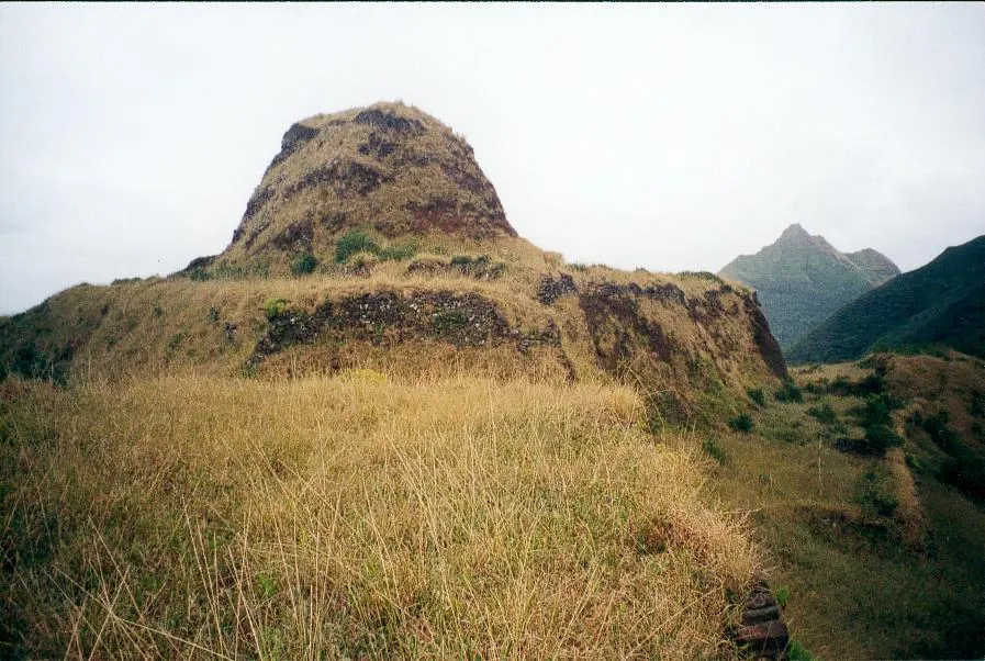
The tower. At the centre of a large pare stands a tower carved out of the soft ridgeline basalt rather than built up from imported stone: tall and triangular at Morongo Uta, elongated at Ororangi, oval at Kapitanga. On the flattened top at Morongo Uta, about ten metres by five, John Stokes found a stone-lined oven at the centre. The excavators read these flat-topped towers as chiefly habitation, and it is on that reading — one large tower, one chief — that the later count of competing polities rests.
The terraces. Radiating out and down from the tower are terrace units, dozens at the bigger sites, running along the main ridge and into the surrounding drainages. They were made by cutting directly into the ridgeline, the soft basalt moved to make flat surfaces: rectilinear where the ridge is broad, D-shaped where it steepens. Larger ones were held up by double interlocking masonry walls with a rubble core.
What the walls are not. The fortification report states it plainly: the terrace walls did not extend above the floor surface and were not designed to support a superstructure. They are revetments, holding up living platforms on which perishable timber houses stood. There is nothing to stand behind and shoot over. The dramatic stepped profile in every photograph of Morongo Uta is housing.
Where the defence actually is. In the ground. Deep fosses and associated walls cut through the ridgeline at chosen points, with steep precipices used as natural flanks: ditches cut into three ridges around the residential core at Potaketake, two fosses cutting off the only two viable entry points at Kapitanga. Some of these were dug after the terraces were already in place, which the excavators read as heightened aggression later in time: somebody looked at a settlement that existed and decided it needed to be harder to reach.
Storage. Stokes recorded large pits between 1.8 and 4.5 metres across, some as deep as 2.8 metres, matching a practice recorded ethnographically — lined with banana leaves, filled with crushed taro, sprinkled with water, covered with ti leaves and a layer of earth. Fermented taro keeps. A settlement provisioned like that can sit still, which is a military fact as much as a culinary one.
The masonry that dates itself. Dyke-stone facing — carefully fitted basalt blocks on towers and upper terraces — belongs mainly to components dating after about AD 1750. Tapitanga stands out for the general absence of it, and Ororangi appears to be the only site of AD 1750–1830 built without it — one of the threads the chronology hangs on.
Where the number fourteen comes from
Fourteen is not a count of what exists on Rapa. It is a count of what one field season investigated, and the difference matters.
The survey history is short and interrupted. John Stokes, working for the Bishop Museum before 1921, visited a number of pare; his notes were never published as the monograph they were meant to become. Katherine and William Scoresby Routledge stopped in 1921 looking for parallels to Easter Island and described eight fortifications in a ten-day visit. The Norwegian Archaeological Expedition of 1955–56 divided the island up: Ferdon surveyed Potaketake, Tapitanga and Kapitanga, Smith worked on stone structures and burials, Mulloy spent his time on Morongo Uta. Walczak made small excavations at Tangarutu Cave in 1997.
Then, between 1 July and 25 August 2002, a team led by Atholl Anderson, Douglas Kennett and Eric Conte mapped and tested fourteen hilltop fortifications and dug larger excavations at four. That is where the number comes from. Ten large sites, by area, terrace count and summit elevation:
- Tapitanga — 25,237 m², 42 terraces, 268 m
- Morongo Uta — 10,148 m², 89 terraces, 258 m
- Ruatara — 6,940 m², 16 terraces, 304 m
- Potaketake — 5,744 m², 30 terraces, 217 m
- Ororangi — 5,157 m², 43 terraces, 282 m
- Vairu — 4,213 m², 11 terraces, 369 m
- Pukutaketake — 3,975 m², 23 terraces, 381 m
- Kapitanga — 3,674 m², 11 terraces, 288 m
- Tevaitau — 3,666 m², 14 terraces, 262 m
- Noogurope — 3,040 m², 12 terraces, 608 m
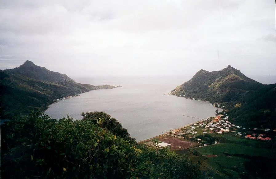
Four smaller sites were also examined: Ngapiri, Pukutai, Pukumia and Taua. All the larger ones stand on the highest points of the main ridge around Ha'urei Bay; from Noogurope, the report notes, every other fortification on the island is visible.
Now the caveat the report supplies itself and most retellings drop: "Additional fortified locations were also observed from a distance, but were not visited." The inventory is explicitly a sample. Fourteen is a floor, not a total, and the real number of pare on Rapa is unknown.
A second caution comes free with the literature: the same site is spelled Noogurope in the fortifications chapter and Noogurupe in the radiocarbon chapter, with Noogorupe turning up as well — several spellings inside one edited volume, and a fair measure of how thin the documentary layer over this island is.
What the list does establish is variation. Tapitanga is more than eight times the area of Noogurope. Morongo Uta has 89 terraces; Vairu and Kapitanga have eleven apiece. Noogurope sits at 608 metres, nearly three times the elevation of Potaketake. These are not fourteen copies of one design. They are settlements of very unequal size and situation — what competing polities of unequal strength look like, and not what a single coordinated building programme looks like.
Morongo Uta, the one that was dug
Of the fourteen, one has been excavated in full. Between 21 May and 18 June 1956 — twenty-eight days — William Mulloy and the Norwegian Archaeological Expedition cleared the vegetation from the entire 10,148 square metres of Morongo Uta and dug it. The method was of its period: talus and overburden stripped to roughly five or ten centimetres above the terrace surfaces, the last layer taken off with hand tools.
One limitation governs everything that can be said about the site. The excavated sediments were not screened for faunal material or smaller artefacts. Everything that would have gone through a sieve — fish bone, rat bone, shell, small flakes, seeds — was not recovered. Morongo Uta is the most thoroughly exposed pare on Rapa and simultaneously the one with the weakest environmental record, which is why the 2002 team's metre-square test pits elsewhere tell us more about diet than the full clearance of the largest site does.
What Mulloy did record is substantial. Eighty-nine terraces, totalling an estimated 5,406 square metres of prepared surface. Sixty whole or fragmentary basalt adzes and sixty whole or fragmentary poi pounders. Post moulds showing where timber uprights stood. Charred fragments of a fish net or netted bag in a midden within Enclosure 6 — perishable evidence that almost never survives in tropical Polynesia. And in Enclosure 18, three prismatic stones driven upright, which he read as a possible household shrine.
And a population estimate. From the number of terraces and hearths, and a conservative five people per household, Mulloy put Morongo Uta's occupancy at around 425 people.
Hold that against the census. The whole island today — both villages, the school, the clinic, the mairie — comes to 467. Mulloy's figure for one hilltop, out of at least fourteen, is 425. Even allowing for the imprecision of counting people from postholes, and for the near-certainty that the fourteen were not all fully occupied at once, that comparison is the most useful thing a reader can carry away about pre-contact Rapa.
Morongo Uta is also why most people have seen a photograph of Rapa at all, and that produces a distortion worth naming. It is the cleared site, the mapped site, the one with the legible stepped profile. It is not typical of the other thirteen, and its cleared appearance is a product of 1956 rather than 1756.
What the rubbish settled
For decades the argument ran in an abstract register. Were the pare genuine fortifications, or status architecture — chiefly display, monumentality for its own sake? The 2002 season answered most of it by the least glamorous method available: looking at what people threw away.
The test excavations were tiny: three one-metre squares at Tevaitau, a single one-metre square at Ororangi, one metre square plus a half-metre square at Tapitanga, two one-metre squares at Potaketake. That is the entire footprint of the digging that resolved a decades-old question about fourteen monumental sites.
They worked because of what small holes in well-chosen places contain. A hearth of three or four tabular stones set upright means somebody cooked there more than once. Stone-lined cooking pits mean the same at greater scale. Storage pits mean food kept on site, which means people stayed. Dark midden with charcoal, shell and bone means accumulated rubbish, which means time.
The animal bone does the rest: four hundred bones across ten vertebrate taxa, dominated by fish and within the fish by parrotfishes. Parrotfish are reef fish. Somebody carried them up two or three hundred metres of ridge to eat them at home. Candlenut fragments indicate lighting or processing; rat bone indicates the commensals that followed human settlement across the Pacific and are still, as the seabird counts show, a live problem here.
Set that beside the defensive engineering and neither body of evidence cancels the other. That is the finding. A place can be a home and a strongpoint at once, as most fortified settlements in history have been, and the long either/or was a question the sites were never going to answer because it assumed a distinction the builders did not make. The romantic version of archaeology is the moment of discovery; the actual mechanism is a metre-square hole, a sieve, a bag of fish bone and several years of somebody identifying it.
The arithmetic of people and taro
If fourteen forts is the question, the likeliest answer is agricultural. Rapa's irrigable ground is scarce, fixed and mapped, and one chapter of the 2012 volume does the sum explicitly.
The maximum prehistoric extent of pond-field taro on Rapa was 83.75 hectares — 2.21 per cent of the island. Everything else is ridge, cliff, scrub, forest and 650 metres of mountain. Just under half of those systems, 49.1 per cent, lay around Ha'urei Bay, and nearly a third of the island's total sat in the lowlands of the bay's north-western shore alone. The good land was concentrated, and everyone knew where it was.
From that the authors run a carrying-capacity model: taro yielding 26.67 tonnes per hectare per year, supplying about 80 per cent of the pre-contact diet, at roughly 4,947 person-hours of labour per hectare per year using stone tools. Assuming a fifth of the crop diverted — against drought, poor yields and losses in war — the maximum sustainable population comes out at 2,027. Vary the diversion and the range runs from 760 to 2,534.
Those figures sit close to the earliest outside estimates. Vancouver's people in 1791 thought there were about 1,500 inhabitants; Menzies suggested 3,000. Davies put it at upwards of 2,000 in 1826, by which time disease was already at work. Stokes calculated around 3,000 if every fortified and unfortified site were occupied simultaneously — a condition the radiocarbon suggests never obtained.
Three numbers define the problem. Two thousand people. Eighty-four hectares of the only ground that reliably feeds them. Fourteen or more fortified settlements built to sit above it.
The correlation the authors draw is direct: the earliest fortifications were positioned near the most suitable pond-field land, and the later proliferation of fortified communities paralleled the expansion of the pond-field systems themselves. Forts and taro terraces grew together. Communities fissioned, moved uphill, and took defensible ground overlooking the wet valley floors they depended on.
The social structure recorded at contact fits the same shape. Rapan society was divided among eighteen to twenty-two kopu — cognatic descent groups — each occupying a valley with its fishing waters, and each commanded by a hill fort. Each was headed by an ariki whose spiritual authority descended by primogeniture from the clan ancestor but whose practical authority depended on the consensus of family elders, the hui ragatira. Membership ran through both parents, which maximises the number of people with a plausible claim to a given patch of taro — not a neutral design feature when there are only eighty-four hectares of it.
One coda. Of those 83.75 prehistoric hectares, 3.73 are cultivated now: a decline of roughly 95 per cent in the island's productive irrigated ground.
Why there are fourteen and not one
Here the specialists stop agreeing, and a reader is better served by seeing the disagreement than by being handed a tidy date.
The Bayesian chronology chapter works from 65 AMS radiocarbon determinations. It concludes that Rapa was colonised most likely between AD 1100 and 1200, and that the first two fortifications — Noogurupe (its spelling) and Ruatara — were built between about AD 1300 and 1400, roughly two centuries after settlement. A first expansion follows between AD 1400 and 1650, in which Morongo Uta is established, with Ruatara in use as late as AD 1800. A final expansion in the late 1700s brings the total to at least ten fortifications plus smaller satellite refuges, and the sites were abandoned by about AD 1825, when the modern villages were established.
The fortifications chapter, in the same volume, works from thirty AMS dates from the sites themselves and names the same two first sites at the same date. The agroecology chapter does not: it names Morongo Uta and Ruatara as the earliest fortifications, established a hundred years after colonisation.
Against all three, the team's own earlier paper in Antiquity in 2006 reported a rockshelter occupied around AD 1200 with the first hill forts erected about three hundred years later, putting the earliest fortification near AD 1500 — a century or two later than the book they went on to publish. The volume's concluding chapter, while agreeing there was no colonisation before the twelfth century, concedes that "the age of onset of human colonisation still remains less precise than was expected."
We print the disagreement rather than averaging it, because averaging published dates is how a soft number becomes a hard one. What survives across every version is the shape: settlement, then an interval with no fortification, then the first pare, then slow accumulation, then a steep late acceleration in which most of the construction happens.
The explanation on offer. The concluding chapter is careful: "the most likely reasons for this increase were either direct population growth or indirect population pressure on resources, such as agricultural land." If the flat-topped towers were chiefly residences — an inference from ethnographic analogy, flagged as such — then ten competing chiefly polities existed on Rapa by the eighteenth century.
Where it gets genuinely uncertain. Three problems sit on the late phase, and none is resolved.
- The calibration curve. The radiocarbon chapter notes major fluctuations after about AD 1700, which makes recent dates hard to separate. The most intense period of fort-building is precisely the period the method resolves worst.
- The contact overlap. Vancouver sighted Rapa in December 1791; the building surge runs through the eighteenth century and the sites were abandoned by about AD 1825. The periods overlap, and the volume does not test European arrival as a driver — it attributes the surge to population pressure. Whether outside disruption contributed is an open question rather than a claim anyone has made.
- Sampling. Fourteen sites were tested; more were seen and not visited. A chronology of fourteen is a chronology of the sample.
The excavators are franker about this than their popularisers. "We are well aware," the concluding chapter says, "of the preliminary nature of our investigations on Rapa."
What popular coverage gets wrong
The mystery framing. Rapa's pare are routinely presented as enigmatic structures of unknown purpose, built by a vanished people for reasons nobody can determine. There is no mystery about what they were for. There are hearths in them, and ovens, and taro pits, and adze flakes, and the bones of the fish people ate, at every site tested, published in a peer-reviewed volume anyone can download free. Nor were the people vanished: their descendants live in Ahurei and Area.
The diffusionist inheritance. Rapa entered popular awareness through the Norwegian Archaeological Expedition, whose leader was committed to an account of Pacific settlement from the Americas that the discipline has since abandoned. The residue still attaches to the island in popular writing. The 2002 project describes a local sequence: settlement, agricultural intensification, competition for taro land, fortification. Nothing in it requires a voyage from South America.
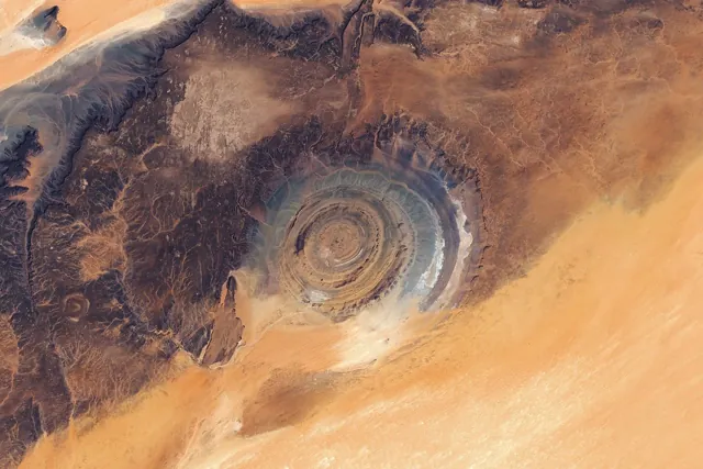
The oldest-fort claim. Secondary sources frequently name Morongo Uta as the oldest of the fourteen, dated to about AD 1450–1550 — including, at our check, the English Wikipedia article on the island. The two chapters built directly on the radiocarbon dates name Noogurope and Ruatara as the first, and place Morongo Uta in the expansion that follows; only the agroecology chapter puts Morongo Uta among the earliest. So the popular claim is not baseless so much as outvoted, two chapters to one. What is certain is that Morongo Uta is the largest excavated and the most restored, which is a different claim, and the two get conflated because the cleared site is the one with photographs — and a photograph is what most writing about a remote place is working from. A version of the same problem, with a satellite image standing in for the photograph, produced the durable popular story about the Richat Structure.
The island underneath the forts
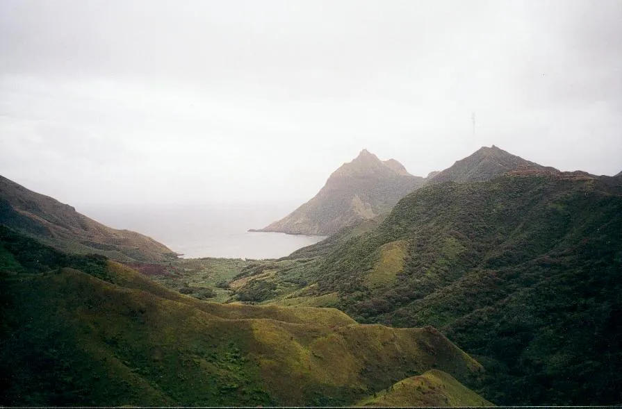
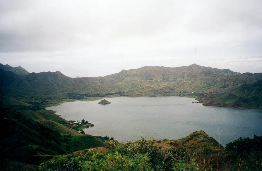
Rapa is a deeply eroded shield volcano, its earliest lavas dated between about 12 and 5 million years old and later activity around 5 to 4 million. The sea has broken into the crater on the north-eastern side, producing Ha'urei Bay — a drowned caldera roughly 2.5 kilometres across, the villages of Ahurei and Area facing each other across it and the fortified ridges standing around them both. Published areas vary between about 38 and 40.5 km²; "about forty" is as precise as the sources jointly allow. The high point, at 650 metres, is Mont Perau in French-language territorial sources and Mount Perahu in English ones.
The climate, and a warning about one source. Rapa is the coolest and wettest inhabited island in French Polynesia — the environment directorate calls its climate subtropical to sub-temperate rather than tropical — but the numbers need care. The Météo-France 1991–2020 normals, as tabulated on English Wikipedia, give an annual mean daily maximum of 23.2°C and mean daily minimum of 18.8°C, February the warmest month at 26.5°C and August the coolest at 20.5°C, with an August mean minimum of 15.9°C. The environment directorate gives a mean of 20.6°C with minima as low as 8.5°C. Those are compatible.
The Météo-France public normals page for Rapa, however, renders an annual mean maximum of 15.1°C and minimum of 5.2°C, 1,174 mm of rain, a record daily maximum of 13.5°C and a record low of −6.2°C in January. Those are internally inconsistent — a record maximum cannot be below the annual mean maximum, and −6.2°C in midsummer at 27°S is not credible — and they contradict every other tabulation of the same station. We take them to be a presentation fault and do not use them. Any guide quoting a mean maximum of 15°C for Rapa has copied the same error, and an earlier version of this article did so.
Rainfall is genuinely disputed, and the dispute is probably geographic. The tabulated Météo-France normals give 2,435.9 mm a year; the environment directorate gives 2,500 mm annually, reaching 3,800 mm. The first figure is most likely the instrumented coastal station and the higher one the uplands, where cloud piles against 650 metres of ridge. No source we could open says so explicitly, so that remains an inference rather than a resolution.
What those conditions produced is one of the most distinctive floras in the Pacific: 193 primary vascular plant species, at least 58 endemic to this one island — about 30 per cent, the highest rate of any island in French Polynesia — and three genera found nowhere else, Apostates, Metatrophis and Pacifigeron. Twenty-one plants are protected in category A under arrêté N°306/CM of 29 February 2008. Original vegetation now covers about 13 per cent of the island, roughly 5 km²; grazing animals introduced from 1867 are the principal threat, and goat damage has been recorded to the summit of Mont Perau at around 600 metres.
Offshore, a scientific review counted 112 coral species at Rapa out of 170 recorded for the whole of French Polynesia, with 250 molluscs and 383 coastal fish of which about a tenth are endemic. A large marine protection proposal for the Australs, Rahui Nui no Tuhaa Pae, grew out of municipal deliberations in 2014 and was presented publicly in 2016; it has not been adopted as proposed, and a 2020 move to seek UNESCO biosphere reserve status for the archipelago had not, at our check, produced a designation.
One hundred pairs, and falling
There is a second count on Rapa, and it is going the wrong way.
The Rapa shearwater, Puffinus myrtae, breeds nowhere else. A 2025 synthesis in Notornis by Withers and colleagues, drawing on fieldwork between 2017 and 2024 and on records back to the first specimen, collected in 1925, puts the total breeding population at fewer than 100 pairs, on the islets of Karapoo Koio, Karapoo Rahi and Tauturou and on Rapa itself. In 1974 Tauturou alone held an estimated 150 to 250 occupied burrows. The paper names the main cause of decline as Pacific rats attacking chicks and harassing adults during incubation.
The same paper records what is being done, which most coverage leaves out. Goats were removed from Tauturou and Karapoo Rahi in 2019, with further removal in 2021. Rat eradication was achieved on some islets, Tauturou among them, in November and December 2023. Those are recent, specific interventions against a known cause on small islands — the category of conservation action with the best record of working.
The other seabirds are in better shape: four to five thousand pairs of Murphy's petrel, about a thousand pairs each of Kermadec petrel, black-winged petrel and red-tailed tropicbird. It is the endemic that is nearly gone.
Set that against the rest of this article. Fourteen fortified settlements have stood on these ridges for six or seven centuries — through competition, contact, an eighty-five per cent population collapse and total abandonment — and remain legible enough to measure to the square metre. The seabird nesting on the islets below them has gone from a couple of hundred burrows on one islet to fewer than a hundred pairs in all within one human lifetime. An earthwork does not need a population to persist. A species does.
The language, and the council
The descendants of the people who built the pare are still here, still speaking a language of their own, and still — in a way that sits uneasily with French law — deciding among themselves who may plant where.
The language. Rapa has its own Eastern Polynesian language, not to be confused with Rapa Nui, to which it is only a distant relative. Mary Walworth's 2015 doctoral dissertation at the University of Hawai'i at Mānoa produced the first comprehensive linguistic description of it, and distinguishes three stages. Old Rapa, the indigenous language, is now very little spoken. Reo Rapa, the modern language most people use, has become heavily Tahitianised through long exposure to Tahitian. And a New Rapa is emerging — a variety the community is producing itself as it works to reclaim the old language. On an island of 467 people, a language with three named stages and its own revitalisation is not a footnote.
The council. Land on Rapa is not allocated the way land elsewhere in French Polynesia is. Two customary institutions run the island's resources, and both have been deliberately sustained in the modern era by the municipal council — the French communal authority using its own legitimacy to underwrite local practice.
The first is the Toohitu, a council of elders drawn to represent the different kopu — the same descent groups the ethnohistory records holding valleys and hill forts at European contact. Its function is to distribute land for houses and for cultivation. It ceased to exist in the mid-twentieth century and, in the anthropologist Christian Ghasarian's account, was re-established by the municipal council three decades ago.
The second is the fishing committee, sometimes called the Tomite rahui because it also administers the island's rāhui. Eight people sit on it, elected annually by the population, and previous members cannot be re-elected — a rotation rule that spreads the office across the community rather than concentrating it.
The rāhui. The prohibition covers the main bay between the two villages, some 800 metres wide and two kilometres long, plus the first three bays on each side. The limits are not marked, but every fisherman knows them. It is opened for a single collective fishing day, usually between Christmas and New Year, and can be lifted for an official visit, a wedding or a religious celebration. The pastor opens and closes it with prayer.
Enforcement is not policing. Compliance rests largely on the conviction, which Ghasarian records among Rapan fishermen, that a problem, an accident or a disease can strike those who take fish from the rāhui.
And the gap underneath it. Ghasarian is blunt about the legal position: "The customary system of collective management of the land of Rapa iti is a contradiction of French laws", because the French civil code is built on private rather than collective property. The arrangement holds because 467 people agree that it holds, and because the commune's elected representatives spend the authority the French state gives them on backing it. That is live governance, not folk survival, and the closest thing on the island to a working answer to the problem the pare were built to solve: who gets the limited thing, and how is that decided.
Eleven days at sea for ten hours ashore
Rapa has no airstrip. That single absence determines the population figure, the absence of a visitor economy, and every practical sentence below. The nearest inhabited island, Raivavae, is more than 500 kilometres away; Papeete, where the ship comes from, is much further.
The ship. Rapa is served by the Tuha'a Pae IV, a mixed cargo vessel running the Austral Islands out of Papeete. Not every sailing goes there. The operator distinguishes a Classic rotation of about 2,500 kilometres serving Rimatara, Rurutu, Tubuai and Raivavae from a longer Grand Voyage of about 3,000 kilometres that adds Rapa.
First, the obstacle. At our check on 30 September 2026, the operator's own prices page stated: "The Tuhaa Pae IV is not currently taking reservations from tourists." It gives no reason and no date. Everything below describes how the route works when passengers are carried; whether you can board this season is a question only the operator can answer.
What the published schedule shows. The shipping agent publishes the rotation, and reading it is more informative than any description of it. The schedule published at the end of September 2026, covering 30 September to 2 December, lists six voyages, and two call at Rapa: one leaving Papeete at 14:00 on Sunday 18 October and reaching Rapa, by way of Rimatara, Rurutu and Tubuai, at 06:00 on Saturday 24 October; the other leaving at 16:00 on Saturday 31 October and reaching Rapa, after four island calls, at 06:00 on Saturday 7 November. Both leave Rapa at 16:00 the same day.
Three numbers matter. A round voyage including Rapa takes about eleven days, Papeete to Papeete; a rotation without Rapa takes about a week. The open-ocean passage between Rapa and its nearest port of call runs to about a day and a half. And the call itself, on both sailings, is ten hours: alongside at six in the morning, away at four in the afternoon.
Eleven days at sea for ten hours ashore. That is the trip, in the operator's own published figures, and it is why this guide has no itinerary. You are ashore for a working day on an island of 467 people, and the schedule belongs to the freight.
How often. In that nine-week window, two Rapa calls a fortnight apart, and none in the other seven weeks. One window cannot show the pattern across a year, and reference sources that say every two or three months may or may not be right. The published schedule is the only thing worth consulting: it changes, and it is authoritative in a way no guide can be.
What "shore excursion" means here. The operator states that freight is the ship's main purpose, that time in port depends on how long cargo operations take, and that the vessel is generally in port from about nine to four. Its own description of the Rapa call mentions the village and artisan market and a short walk to a viewpoint and hilltop fort remains — a realistic picture of a working day ashore, not an expedition to fourteen sites.
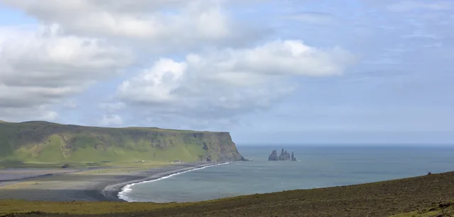
How to behave about it. A community of 467 people receiving a supply ship is not a destination absorbing tourists; it is a village with visitors in it for ten hours. Ask before photographing people or houses. Buy from the artisan market. Do not treat archaeological sites as a right of access — they stand on inhabited land whose allocation is decided by the Toohitu, and the route to any of them is local permission and local guiding, arranged locally. Access arrangements at visited sites change under pressure and repay careful reading even at places far easier to reach, as the shifting restrictions at Reynisfjara show.
Staying longer. Anything beyond a ship call means waiting for the next one on an island with no hotel infrastructure, which makes it a matter of arrangement with people who live there rather than a booking. We are not going to describe how to do that from a desk, because the answer involves other people's homes.
The map on this page shows the island and Ha'urei Bay for orientation. It shows no routes, and it does not establish that any site can be visited.
Which month, and why it barely matters
Season is a second-order consideration at Rapa; the rotation decides whether you can go at all. But the weather is not irrelevant, and it is not what most readers assume.
There is no dry season. The island takes somewhere around 2,400 mm of rain a year at the coast and more on the heights. Whenever you go ashore, expect it to be wet or to have been recently.
The southern summer, December to March, is the warm end, with February's mean daily maximum at 26.5°C. It is also the South Pacific cyclone season. Rapa lies far enough south to be less exposed than the Society Islands, but a cargo ship's timetable is weather-dependent in any case.
The southern winter, June to September, is the cool end and the rough end: August is coolest, at a mean maximum of 20.5°C and mean minimum of 15.9°C. Those are mild figures by European standards and cool by Polynesian ones. What makes winter uncomfortable at Rapa is not temperature but wind, persistent rain and the long open-ocean legs either side of the call.
The binding constraint remains the schedule — and, for now, whether the operator is carrying tourists at all. Consult the published rotation first, choose among the sailings that actually call at Rapa, and treat the weather as a tiebreaker.
The fare, and the catch
There is no admission charge to anything on Rapa and no tourism infrastructure to price. The cost is the voyage, and the operator does publish fares — with a caveat that outweighs them.
The published fares. The operator's prices page, checked on 30 September 2026, lists per-person fares for the Grand Tour "with Rapa" of €3,060 in a Grand Large cabin, €3,245 in a Vice-Admiral and €3,429 in an Admiral (US$3,369 to US$3,778). The Classic voyage without Rapa runs €2,348 to €2,620, so Rapa adds roughly €700 to €800 per person. Shore excursions are stated to be included. Children under four travel free, those aged four to seventeen at half price, and a third or fourth adult sharing a cabin receives a discount. Prices and discounts are, in the operator's words, subject to change and confirmed at the time of booking.
The catch. The same page states that the vessel "is not currently taking reservations from tourists". A published fare you cannot currently buy is still worth knowing, because it tells you the order of magnitude, but it is not an offer.
The rest is structural:
- Reaching Papeete will be a large item for most readers, and it is an international flight before any of the above begins.
- Ashore, there is very little to spend money on. That is a statement about the island, not about value. The artisan market is the exception, and the place where spending does the most good locally.
- Time is the real currency. Eleven days for ten hours ashore is the exchange rate.
There is no calculator on this page: the only figures are voyage fares that are not currently on sale.
It is a shipping enquiry, not a holiday purchase
The decision here is unusually simple and unusually consequential. You are asking a freight company whether you may travel on a working vessel.
- Ask first whether the vessel is carrying tourists at all. At our check it stated that it was not taking tourist reservations.
- Confirm that the sailing actually calls at Rapa. Most do not. Check the published rotation rather than a description of it.
- Confirm the scheduled hours alongside at Rapa, and understand that cargo operations, not the timetable, decide the real figure.
- Ask what happens if weather or freight changes the schedule, which on this route is normal rather than exceptional.
- Ask what each cabin class includes, including meals across an eleven-day passage.
- Ask honestly about seasickness on a working cargo vessel in southern ocean conditions; the passage to Rapa alone is about a day and a half of open water.
We carry no affiliate links or commercial relationships for this destination and have not travelled with any operator. The shipping company's own enquiry channel is the only route we can point to.
Packing for a wet island and a working ship
Three facts drive the kit: the island is wet and windy rather than hot, the vessel is a freighter, and there is no shop that will sell you what you forgot.
Rain, not heat. Around 2,400 mm a year at the coast and more above it means a genuinely waterproof shell rather than a packable showerproof layer. Mean daily maxima run from about 20.5°C in August to 26.5°C in February, so this is not cold-weather clothing — it is wet-weather clothing, which is a different purchase.
A warm layer anyway. Mean minima drop to around 16°C in the southern winter, and a fleece or wool mid-layer earns its space on deck at night and on an exposed ridge in wind.
Wind. This is exposed southern ocean country. A windproof outer and a hat that stays on matter more than most people expect, though you want sun protection too.
Footwear. Boots with grip for wet, steep, uneven ground. Any walking ashore will be on slopes that are damp most of the year.
Everything you need, brought with you. Medication in quantity, spare glasses, batteries, anything specific. Resupply is the ship you arrived on.
For the passage. Seasickness remedies started before you need them, a dry bag, earplugs and an eye mask for a working vessel, and enough to read for eleven days. Do not assume connectivity.
Cash. Pacific francs, small denominations, particularly for the artisan market. Do not assume card acceptance.
Biosecurity — the one that matters most. Check bags and boots for seeds, soil and insects before landing. Rats were eradicated on islets here in late 2023 and goats removed from others from 2019, on an island with 58 endemic plants and a seabird down to fewer than a hundred pairs. This is not a formality. It is the single most consequential thing a visitor controls.
An AI-drawn flat lay, clearly badged, accompanies this list. The written checklist is the authoritative version.
Where to read the evidence yourself
Unusually for a place this remote, the primary scholarship is free, and a reader who wants to check any number above can.
- Taking the High Ground: The archaeology of Rapa, a fortified island in remote East Polynesia, edited by Atholl Anderson and Douglas J. Kennett (ANU Press, Terra Australis 37, 2012). Fourteen chapters by thirteen authors, open access and downloadable chapter by chapter. The publisher's description notes that it includes descriptions of artefacts of perishable material, which it calls highly unusual in tropical Polynesian archaeology. Chapter 12 holds the fortification inventory and architecture, chapter 11 the Bayesian chronology, chapter 13 the agricultural carrying-capacity model, chapter 2 the ethnohistory. Publisher page.
- Christian Ghasarian, "Protection of natural resources through a sacred prohibition: The rahui on Rapa iti", chapter 7 of The Rahui: Legal pluralism in Polynesian traditional management of resources and territories (ANU Press). Also open access, and the source for the Toohitu, the fishing committee and the legal position of customary land management. Read this if the governance section interested you more than the archaeology. Read the chapter.
- Mary Walworth, The Language of Rapa Iti: Description of a Language in Change (PhD dissertation, University of Hawai'i at Mānoa, 2015). The first comprehensive linguistic description of Old Rapa, and the account of Reo Rapa and New Rapa used above. Openly available through the university repository. Repository record.
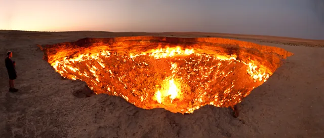
Also free: the fortifications chapter as a standalone PDF, the environment directorate's Rapa flora field guide, and the shipping agent's published vessel rotation, which is the only honest answer to "when can I go". For another place where a confident popular story outran the published evidence, see Darvaza.
Questions travellers ask
Can I fly to Rapa?
No. There is no airstrip. The only scheduled access is the Tuha'a Pae IV from Papeete, and only on the rotations that include Rapa.
Can I book the ship now?
At our check on 30 September 2026, the operator's prices page said the vessel was not currently taking reservations from tourists. Ask the operator directly.
How long does the voyage take?
On the published schedule for late 2026, a round voyage including Rapa runs about eleven days from Papeete and back; a rotation without Rapa takes about a week.
How long would I have ashore?
On both Rapa calls in the schedule we examined, the vessel arrived at 06:00 and left at 16:00 — ten hours. The operator states that cargo operations determine time in port, so treat the schedule as the plan rather than the promise.
What does it cost?
The operator publishes per-person fares for the voyage that includes Rapa of €3,060 to €3,429 depending on cabin, shore excursions included, subject to change — but was not taking tourist reservations when we checked.
Can I visit the forts?
The operator's description of a Rapa call mentions a short walk to hilltop fort remains. Anything beyond that is a matter of local permission and local guiding, arranged on the island. Land allocation on Rapa is decided by a council of elders, not a ticket office.
Which fort is the oldest?
On the two chapters of the 2012 volume built directly on the radiocarbon dates, Noogurope and Ruatara, at about AD 1300–1400. One other chapter names Morongo Uta and Ruatara, and Morongo Uta is often called the oldest in secondary sources. Morongo Uta is certainly the largest excavated and the most restored.
How many forts are there really?
Fourteen were mapped and tested in 2002. The report also notes fortified locations seen from a distance and not visited, so fourteen is a floor rather than a total.
Is it warm?
Milder than the rest of French Polynesia and much wetter. Annual mean daily maximum about 23°C, from 20.5°C in August to 26.5°C in February, with roughly 2,400 mm of rain at the coast. Pack for rain and wind, not for cold.
Were the forts really forts?
They were defended settlements. Every tested site produced hearths, ovens, storage pits and food remains, alongside fosses and ditches cut across the approaches. The old either/or between fortification and status architecture was the wrong question.
What fourteen cannot tell you
Return to the arithmetic. Fourteen fortified settlements on forty square kilometres, built above eighty-four hectares of irrigable taro ground, by a population the models put at around two thousand, organised into eighteen to twenty-two descent groups and, by the eighteenth century, perhaps ten competing chiefdoms.
The number carries a great deal. It rules out a single unified polity. It rules out the mystery framing, because you do not build fourteen of something for reasons nobody can guess at. It makes the agricultural explanation plausible, because the sites cluster where the taro is. And it makes Mulloy's estimate of 425 people on one hilltop, against 467 on the whole island today, the most vivid single comparison available.
But the count cannot do the work people want from it. It cannot say how many of the fourteen were occupied at once; the radiocarbon suggests never all of them. It cannot say whether the eighteenth-century surge was driven by internal competition, by the arrival of European ships and disease in the same decades, or by both, because the calibration curve is least helpful precisely there. It cannot weigh the deaths implied by the ditches against the epidemics that took roughly eighty-five per cent of the island in the eight years after 1826. And it cannot say how many pare there actually are, because some were seen from a ridge and never walked to.
The excavators said it themselves, and it is the right note to end on: they are well aware of the preliminary nature of their investigations on Rapa. Fourteen is not the answer. It is the best-attested number so far, on an island nobody can reach easily enough to check.
Sources
- Anderson, Kennett and Conte, "Archaeological research on Rapa Island, French Polynesia", ch. 1 of Taking the High Ground, ANU Press, Terra Australis 37, 2012 — PDF
- Anderson, "'Dwelling carelessly, quiet and secure': A brief ethnohistory of Rapa Island", ch. 2 — PDF
- Kennett, Culleton, Anderson and Southon, "A Bayesian AMS 14C chronology for colonisation and fortification of Rapa Island", ch. 11 — PDF
- Kennett and McClure, "The archaeology of Rapan fortifications", ch. 12 — PDF
- Bartruff, Kennett and Winterhalder, "Rapan agroecology and population estimates", ch. 13 — PDF
- Anderson, Kennett and Conte, "The prehistory of Rapa Island", ch. 14 — PDF
- Volume home page and full chapter list — press.anu.edu.au
- Kennett et al., "Prehistoric human impacts on Rapa, French Polynesia", Antiquity, 2006 — cambridge.org
- Ghasarian, "Protection of natural resources through a sacred prohibition: The rahui on Rapa iti", ch. 7 of The Rahui, ANU Press — press-files.anu.edu.au
- Walworth, The Language of Rapa Iti: Description of a Language in Change, PhD dissertation, University of Hawai'i at Mānoa, 2015 — scholarspace.manoa.hawaii.edu
- Withers et al., "Breeding seabird assemblage of Rapa, Austral Islands, Eastern Polynesia", Notornis 72(1): 23–32, 2025 — PDF
- SNATHP, published rotation of the Tuha'a Pae IV, checked 30 September 2026 — tapao.snathp.com
- Tuha'a Pae, voyage information and FAQ — tuhaapae.com; prices page, checked 30 September 2026 — tuhaapae.com/prices
- INSEE, legal populations of French Polynesian communes, 2022 census — insee.fr
- Météo-France Polynésie française, Rapa climate normals 1991–2020 — meteo.pf (see the caution in the climate section); tabulated normals, area and the oldest-fort claim as cited — en.wikipedia.org
- Direction de l'environnement de la Polynésie française, Rapa flora field guide — PDF
- Pew Charitable Trusts, scientific review of the Austral Islands — pew.org
- Martin and Combes, "Emerging Infectious Diseases and the Depopulation of French Polynesia in the 19th Century", Emerging Infectious Diseases 2(4), 1996 — cdc.gov
- CNES Géoimage, Rapa — cnes.fr
Photograph credits
- Rapa Haurei Bay · Sardon · Summer 2000 date QS:P,+2000-00-00T00:00:00Z/9,P4241,Q40720564 · CC BY 3.0. Resized and converted to WebP; framing may crop the hero. These adaptations remain available under their respective licences.
- Rapa Ridge · Sardon · Summer 2000 date QS:P,+2000-00-00T00:00:00Z/9,P4241,Q40720564 · CC BY 3.0. Resized and converted to WebP; framing may crop the hero. These adaptations remain available under their respective licences.
- Rapa Coast Cliffs · Sardon · Summer 2000 date QS:P,+2000-00-00T00:00:00Z/9,P4241,Q40720564 · CC BY 3.0. Resized and converted to WebP; framing may crop the hero. These adaptations remain available under their respective licences.
- Rapa Village · Sardon · Summer 2000 date QS:P,+2000-00-00T00:00:00Z/9,P4241,Q40720564 · CC BY 3.0. Resized and converted to WebP; framing may crop the hero. These adaptations remain available under their respective licences.
Portrait supplied by Sok Heng Oeun.
A closer look.
Dated photographs show the place, details and wider setting. They are not evidence of present access or conditions.

Sok Heng Oeun
Sok Heng Oeun is the owner and editor of Hidden Corners. The Hidden Corners Editorial Team supports image preparation and editorial checks under his direction.
Sok Heng Oeun on Facebook ↗Research and AI-assisted editorial preparation. Publication authorized by Sok Heng Oeun; an individual owner reading review is not recorded. This guide does not claim a firsthand team visit.

.jpg)
.jpg#Licensing)

