
Not astroblemes
That is not a summary. It is the second half of a paper title: Richat and Semsiyat Domes (Mauritania): Not Astroblemes, published in the Geological Society of America Bulletin in 1969 by Robert Dietz, Robert Fudali and William Cassidy. The abstract runs four sentences and does not hedge. The 38-kilometre Richat Dome, it says, had been widely regarded as a possible astrobleme — a fossil impact scar. "Our field examination of the structure and subsequent petrographic study of the critical rock types failed to reveal a single feature attributable to shock processes. We, therefore, dismiss an impact origin for this structure. It must, instead, be endogenic."
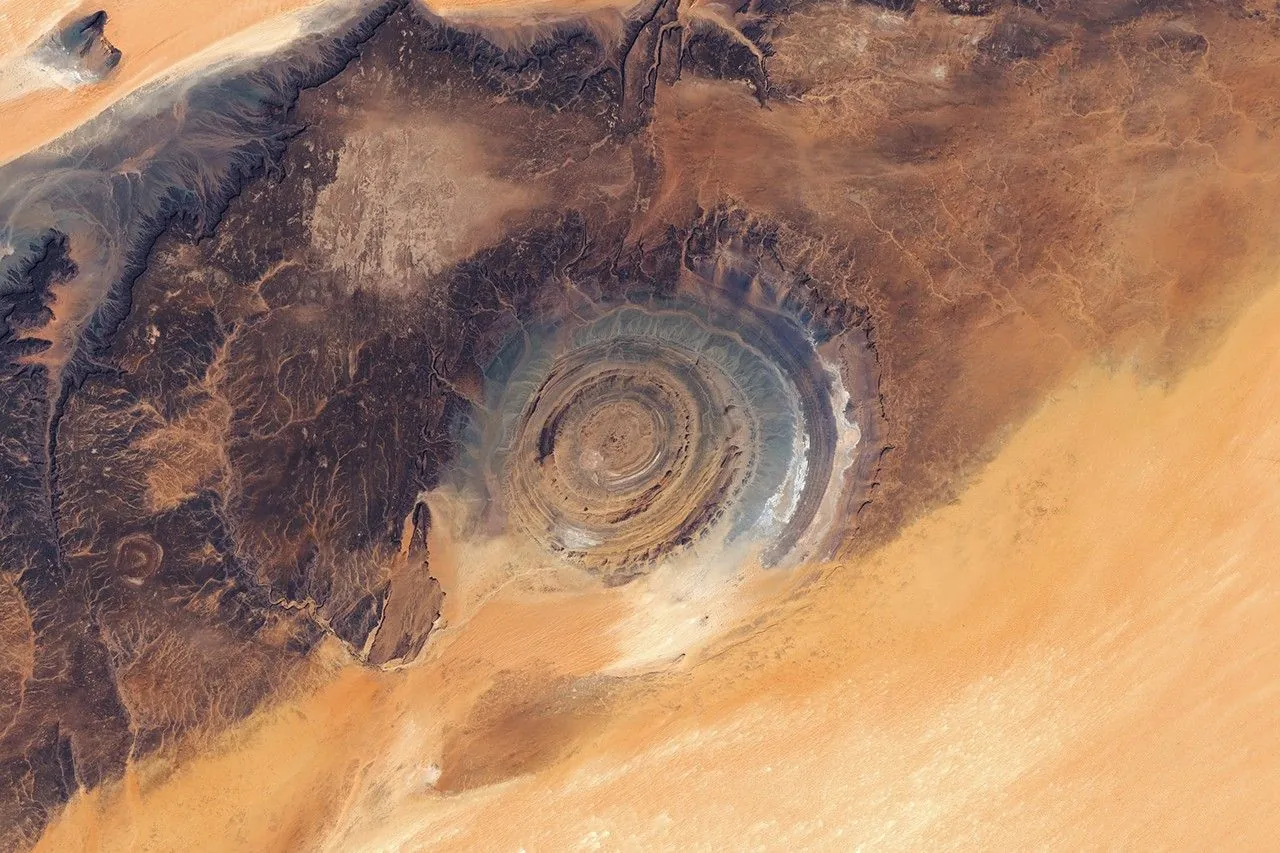
Endogenic means from within: made by the Earth, not delivered to it. Fifty-seven years later, the most common thing said about the Richat Structure in northern Mauritania — Guelb er Richat, the forty-kilometre bullseye of concentric ridges popularly called the Eye of the Sahara, and photographed from Gemini IV in 1965 — is still that it might be a meteorite crater, or that nobody has ever worked out what it is.
They worked it out. The International Union of Geological Sciences lists the Richat in its geological heritage inventory and disposes of the question in a clause: the impact hypothesis "has been disproved in favour of an intrusion theory."
This guide is built around that gap — not the landscape first and the science later, but the life cycle of a scientific error from end to end. Why an impact crater was a good guess. What tests were applied and what each would have shown had the guess been right. How the one piece of supporting mineralogy fell apart. What the structure actually is, and what a 2024 paper reopened. And then the part that is the real subject here: why the wrong answer outlived its correction by half a century, and where it is still living.
Nobody from Hidden Corners has been to Mauritania. This is desk research — the peer-reviewed literature, the IUGS inventory, NASA and ESA, the USGS, CNES, UNESCO, a French charter operator's published fare table, and the current travel advice of three governments, with check dates given.
What sits in the desert
Where. The Adrar plateaus of northern Mauritania, inside the Taoudeni Basin, at roughly 21°N and 11.5°W. The Mauritanian government's figure puts it about 45 kilometres north of Ouadâne, while the French space agency's Geoimage file shows Ouadâne at the south-western corner of the ring itself. Both can be true: the structure is forty kilometres wide, and one figure measures to its centre, the other to its edge.
What. A slightly elliptical set of concentric ridges: the eroded stump of a dome. Published diameters range from 38 kilometres in the 1969 paper, through the 40 used by NASA and CNES, to about 45 in the USGS survey done with Mauritania's mining ministry. CNES gives the central massif as roughly 20 kilometres across and the surrounding depression as about 10 wide. At that scale no single viewpoint on the ground takes it in, which is why NASA puts the visitor's problem so plainly: hard to recognise from the ground, obvious from space.
The name. CNES records that Richât derives from an Arabic word for feathers, after the plumed curves of the quartzite ridges; guelb is a hill or outcrop. Nothing in the local name refers to an eye, a crater or an impact. Those are all imports.
Getting there. Atar, then the Adrar circuit through Chinguetti to Ouadâne, then 4x4 on desert track. No visitor centre, no gate, no ticket, no published permit.
The security position. Not simple, and three advisories do not align. Read Location and access before anything else.
Why a crater was a good guess
It is easy, from here, to treat the impact hypothesis as credulity. It was not. It was a reasonable inference made by serious people at the moment when that inference was most likely to be right.
Between roughly 1955 and 1970, terrestrial impact geology went from a fringe interest to a discipline. The Meteor Crater argument was won. Shatter cones were established as a field criterion. The Sudbury Basin in Ontario, long read as igneous, was reinterpreted as an impact structure — by Robert Dietz, in a 1964 Journal of Geology paper titled Sudbury Structure as an Astrobleme. Large, ancient, deeply eroded circular features were being converted from volcanic to impact one after another, and the conversions were holding.
Against that background the Richat had four things going for it. It was circular and very large, the size range where the new impact basins were turning up. It sat in flat-lying sedimentary rock with no volcanic edifice anywhere near, so the obvious endogenic alternative looked weak. Its centre held a breccia — broken rock — which is what the floor of an eroded crater contains. And in 1964 a report placed coesite in samples from the structure: a high-pressure form of silica which, at the Earth's surface, essentially does not form except under shock.
Then, in June 1965, Ed White and James McDivitt photographed it from Gemini IV, and the image did what no map had. It made the circle obvious to anyone, at a glance, without training. The hypothesis acquired a picture.
That sequence matters for what follows. The impact reading was the professional reading, held by the people best placed to hold it, and it was tested by the discipline's most committed crater-hunter using his own preferred method. The correction came from inside.
The tests, and what each would have shown
An impact hypothesis is falsifiable unusually cleanly, because a hypervelocity impact does specific things to rock that nothing else at the Earth's surface does. It is worth taking the tests one at a time, because the Richat's case is closed not because one failed but because every one did.
Shatter cones. Conical fracture surfaces ribbed with striations radiating from an apex, produced when a shock wave passes through rock at roughly two to thirty gigapascals. They are the only diagnostic shock feature visible in the field without a microscope, they point back towards the source, and they concentrate beneath a crater floor and in the central uplift. Had the Richat been an impact structure eroded to its floor, its exposed centre is exactly where shatter cones should have been abundant. Dietz had been arguing since the late 1950s that shatter cones were the field criterion for recognising ancient impacts. He found none.
Planar deformation features. Under a petrographic microscope, quartz shocked above about ten gigapascals shows sets of dead-straight, closely spaced, glass-filled lamellae along specific crystal planes, in orientations that ordinary tectonic strain cannot reproduce. This is the workhorse of impact confirmation, and the Richat is close to an ideal recording medium for it: the host rocks are quartzitic sandstones and the central breccia is full of quartz-rich clasts in a quartz cement. The 1969 petrography of the critical rock types found nothing of the kind.
Impact melt. A large impact melts rock outright and leaves it as sheets, dykes and glassy bombs — chemically like the target rock rather than like any magma, and sitting inside the structure. Tenoumer, Mauritania's own confirmed crater 1.9 kilometres across, contains three distinct impact melt rock types; the argon-argon age of 1.57 ± 0.14 million years that dates the crater comes from that melt. The Richat contains gabbro, carbonatite and kimberlite: intrusive rocks with their own chemistry, emplaced from below, tens to hundreds of millions of years old. There is no melt sheet. A forty-kilometre crater without one would be extraordinary.
Ejecta and an overturned rim. An impact throws material out beyond the rim and flips the uppermost beds backwards as it goes, producing inverted stratigraphy — one of the surest large-scale signs. At the Richat the beds dip outward at ten to twenty degrees, in order, undisturbed, with no overturned flap and no ejecta blanket, while inside the central breccia the fragments have moved centimetres to metres. A crater this size would have spread debris far beyond its rim.
Coesite. The mineralogical test, and the only one that ever returned a positive. Coesite is a dense polymorph of silica forming above about two gigapascals; in sandstone at the Earth's surface its presence is close to diagnostic. The 1964 report was the single piece of hard evidence the hypothesis had, and its collapse is a better story than its existence.
One modern test can be added. Large impact structures generally sit over a negative gravity anomaly, because the rock beneath has been shattered and is less dense. A 2021 study in the Arabian Journal of Geosciences combining airborne magnetics with satellite gravity over the Richat found the opposite: two circular magnetic anomalies over the gabbro bodies, an intensely altered central zone, and a substantial mafic body at depth beneath the whole structure. That is the fingerprint of something intruded, not something excavated.
How the coesite claim came apart
The 1964 identification did not survive contact with a second laboratory. Robert Fudali — one of the three authors of the field paper — published the result in Science in the same year as the field study, under a title as flat as the other one: Coesite from the Richat Dome, Mauritania: A Misidentification. The mineral was barite, and the rock it sat in was a tectonic breccia rather than a shock breccia.
Two things about that are worth dwelling on. The first is how ordinary the error was: a determination at the edge of a method's resolution that a better method overturned. Not fraud, not stupidity — what a scientific mistake usually looks like from the inside. The second is the completeness of the correction. The positive evidence was overturned and the negative field evidence published in the same year, by overlapping authors, in two of the field's leading journals. As corrections go it was about as thorough as the system is capable of.
There is a nuance the bare list of tests can hide, and Mauritania's other crater supplies it. Aouelloul, 400 metres across and roughly three million years old, was re-examined in 2024 in the Journal of African Earth Sciences by Ould Mohamed Navee and colleagues. They found deformation lamellae in a number of quartz grains — but tectonic lamellae, not shock lamellae — and no evidence of shock metamorphism at all. Aouelloul is a confirmed impact crater anyway, because the impact glass around its rim carries a nickel-iron component that is not terrestrial.
So the absence of one indicator does not close a case, and small craters are genuinely hard to confirm. What closes the Richat's case is the combination: no shatter cones, no planar deformation features, no impact melt, no ejecta, no overturned rim, no coesite, no negative gravity anomaly — and, on the other side of the ledger, a full alkaline igneous complex that no impact could have delivered. Every line points the same way, and has done since before the moon landings.
What the structure actually is
The modern account came out of a Quebec-led field programme. Matton, Jébrak and Lee, in Geology in 2005, described the Richat as the superficial expression of a Cretaceous alkaline complex with an exceptionally well preserved hydrothermal karst filling; Matton and Jébrak developed it at length in the Journal of African Earth Sciences in 2014. Two mechanisms are stacked on top of each other, and between them they explain why a circle seen from orbit is weak evidence of anything.
A dome, planed flat. Start with flat rock: the Taoudeni sequence here alternates Late Proterozoic to Lower Palaeozoic quartzitic sandstones that resist abrasion with mudstones that do not. Push it up from below — an intrusion does not need to reach the surface to deform the cover, only to inflate, and because the push is roughly radial the beds tilt away from the centre in every direction. Then take the top off. Erosion in a hyper-arid setting works by abrasion and by stripping weathered fines, fastest on the weakest material. Planing the arch flat cuts down through it, exposing successively deeper layers inward, and every layer's outcrop trace is a ring, because that is what a sliced dome looks like in plan. Hard sandstones stand as cuestas, steep scarp facing inward, gentle dip slope running outward; mudstones strip into corridors. Repeat for each competent bed and you have nested rings. They are not the rim of anything that landed. They are the cut edges of layers bent upward and then shaved level. A bullseye is what a dome looks like after you remove the dome.
Karst, driven from below. Doming fractures rock, fracturing makes it permeable, and a cooling alkaline intrusion supplies hot, chemically aggressive fluid. Where that fluid met soluble carbonate it dissolved cavities; the cavities grew, the roofs failed, the debris fell in — the ordinary positive-feedback loop of karst, powered by heat from beneath rather than rainwater from above. The result sits at the centre of the bullseye: a polymictic breccia roughly three kilometres across and up to forty metres thick, white to dark grey, mixing cherty material, quartz-rich sandstone, chert nodules and silicified stromatolitic limestone, all welded by microcrystalline quartz precipitated from the same fluids. The IUGS entry describes the centre as a limestone–dolomite shelf enclosing a kilometre-scale siliceous mega-breccia. That is why the clasts have barely travelled, why the mass is cemented rather than loose, and why neoformed potassium feldspar grew in the voids and could later be dated.
The igneous inventory. Two narrow gabbroic bodies form concentric rings: the outer at Tin Jouker, seven to eight kilometres from the centre and about 70 metres wide, the inner at Guelb Richat about three kilometres out and around 30 metres wide. There is a carbonatite dyke swarm in the southern and western sectors — sources differ on its scale, Matton and Jébrak reporting more than sixty dykes mostly a third of a metre to a metre and a half thick, while the USGS survey and other compilations map thirty-two dykes and sills one to four metres wide and up to 300 metres long. There is a kimberlite plug and sills in the north, alkaline rocks cutting the inner ring, an altered diatreme, rhyolitic lavas and tuffs, and analcimolites more than three-quarters analcime. Nothing in that list is something an impact deposits.
The dates. Apatite fission-track on a carbonatite gives 99 ± 5 million years; argon-argon on the neoformed feldspar gives 98.2 ± 2.6 million; the IUGS entry records carbonatitic ages of 85 ± 5 and 99 ± 5 million, and other compilations a 94-to-104-million-year range. The alkaline event is mid-Cretaceous, and the numbers cluster tightly. It is one node in what Matton and Jébrak called the Cretaceous Peri-Atlantic Alkaline Pulse — a scatter of alkaline and carbonatitic centres around the young Atlantic, driven either by a deep mantle plume or by shallow lithospheric break-up. That question was the title of their 2009 Tectonophysics paper and it is not settled.
The 2024 re-dating
In June 2024, five authors published How old is the Eye of Africa? A polyphase history for the igneous Richat Structure, Mauritania in Lithos. El Houssein Abdeina of the University of Nouakchott Al-Aasriya, Fred Jourdan at Curtin University, Gilles Chazot and Bernard Le Gall at Brest and Hervé Bertrand at the ENS in Lyon reported the first plagioclase argon-argon ages from the two gabbro bodies, and the result pulled the timeline apart.
Neither sample gave a clean age. The outer gabbro produced a tilde-shaped release spectrum, low-temperature steps hovering near 200 million years and high-temperature steps converging on 225 to 230 million. The inner gabbro carried excess argon so badly that apparent ages ran from 220 million years to more than 500 — geologically impossible for the rock in question. Rather than discard the data the authors modelled it, testing alteration of 230-million-year-old plagioclase at around 100 million years, crystallisation at about 201.5 million with a small excess-argon component, and a combination. All three converge on the same window: the tholeiitic gabbro was intruded somewhere between about 230 and 200 million years ago. Triassic, not Cretaceous.
That gives the Richat a two-stage igneous history separated by roughly a hundred million years. First, gabbro emplaced during the Central Atlantic Magmatic Province, the enormous pulse of basaltic magmatism that accompanied the break-up of Pangaea and peaked around 201 million years ago — the geochemistry supports it, the outer gabbros matching the Prevalent CAMP group and the inner ones the Tiourjdal group, both well represented in north-west Africa. Then, a hundred million years later, a separate alkaline and carbonatitic intrusion that domed the gabbros along with their country rock, drove the hydrothermal system and produced the carbonatites and the kimberlite. Erosion did the rest.
The reframing carries a structural sting. If the gabbros belong to the CAMP, they are probably not ring dykes: ring-dyke geometries are not documented in that system, whereas concordant sills are ubiquitous in it, and the authors state their position plainly: the Richat gabbros correspond to two CAMP sills intruded conformably into the flat-lying sedimentary sequence. On that reading the two "rings" are flat sheets later bent into a dome and sliced by erosion, so their outcrop traces are circles for exactly the same reason the sandstone ridges are. The geophysical synthesis the USGS produced with Mauritania's Ministry of Petroleum, Energy and Mines is consistent with it, attributing positive magnetic anomalies over the Taoudeni Basin most likely to Jurassic dolerite sills and feeders within the sedimentary section.
It is an argument made under an explicit handicap, and the paper says so: the sand cover precludes unambiguous contact observations. Professional geologists standing on the outcrop could not see enough of the contacts to settle whether they were looking at a dyke or a sill. What remains open is therefore real and specific — the intrusive geometry of the gabbros, the timing of the doming, and the composition of the intrusion beneath the centre, which nobody has ever sampled. Three questions, all answerable in principle by more fieldwork. That is what an unfinished problem looks like.
Why the wrong answer outlived the correction
Here is the strange part. The correction was fast, total and published in the right places in 1969. It came from the discipline's leading impact advocate. The one mineral claim in the hypothesis's favour was shown to be a misidentification the same year. And yet "meteorite crater" remained the default public description for the next half-century, and the belief that the origin is unresolved is still where most people start.
It is worth being precise about where the error actually lives now, because the honest answer is not the expected one, and it has changed recently.
Not in the institutional captions. NASA's Earth Observatory describes the Richat as a deeply eroded geologic dome formed by the uplift of rock above an underground intrusion of igneous material, and names the cuestas. ESA's image caption states that it is neither an impact crater nor a volcanic crater but an eroded dome. The IUGS records the hypothesis as disproved. Checked in September 2026, the space agencies and the geological bodies are all correct, and several have been for years.
Not, mostly, in the body text either. This was the surprise of checking. BBC Sky at Night Magazine states flatly that the Eye of the Sahara "isn't an impact structure". A Discovery UK page from March 2026, filed under "mysteries" and built around the Atlantis theory, sets out the negative evidence accurately — no shocked quartz, no high-pressure minerals, no traces of melted rock — and describes the Atlantis reading as internet-era speculation rather than a serious hypothesis. Somewhere in the last decade, the paragraph caught up with the literature.
It lives in the headline. That same Discovery UK page is titled The Eye of the Sahara: Richat Structure and the Atlantis Mystery. A search for the structure in September 2026 returned it alongside Could the 'Eye of the Sahara' Be the Lost City of Atlantis? and Richat Structure Mystery — Atlantis or Natural Wonder?. Our reading of the mechanism is economics rather than conspiracy: a headline is chosen for the click and a paragraph written for the record, and only one of those two is what most readers retain. Correcting the paragraph costs a publisher nothing. Correcting the headline costs traffic. So the correction propagates through the part of the page nobody has to read, and the error persists in the part everybody sees.
And it lives in the question. A refuted hypothesis survives in the shape of what people ask. The demand around the Richat is still organised around whether it is a crater, whether it is being excavated, and what the mystery is — which means a reader arriving at an accurate page arrives with the wrong question already formed, and the accurate answer reads as evasion. "It is an eroded dome" sounds like a refusal to say what it really is.
Underneath all of it is the picture. The Richat photographs like a bullseye, and a bullseye is a picture of a target — of something hit. The image does not illustrate the impact hypothesis so much as argue for it, wordlessly, every time it is reproduced. No caption outruns a shape that makes its own case. Which is worth generalising, because it applies to every circular thing anyone will ever show you from orbit: circular is cheap. A 2024 survey by Ould Mohamed Navee, Baratoux, Chennaoui Aoudjehane, Si Mhamdi and Raji searched Mauritanian satellite imagery systematically and logged fifty new circular structures between 60 metres and 7.5 kilometres across, on top of four already known. They narrowed the 54 to six with a possible impact origin that deserve further investigation, and proposed ordinary origins — magmatic, tectonic, erosional — for most of the rest. Domes, salt structures, collapsed karst, volcanic vents, folded strata weathering unevenly: all round, none of them craters. Shape is a reason to go and look. It is never a finding.
Reading the outcrops: intrusion or impact, on the ground
This is the chapter that makes the trip worth making rather than merely worth correcting. You cannot see the bullseye from inside it — at forty kilometres across the shape is simply not perceptible, and no amount of climbing fixes that. What you can do is read the evidence directly, in the order the 1969 team read it. Four things are visible, and each of them discriminates.
The dip of the beds, and which way the scarp faces. Every hard sandstone ridge is a cuesta: steep face on the inward side, gentle slope running away from the centre. That asymmetry is the most informative thing in the landscape. Outward dip in every direction means the layers were arched up from below. An impact crater's rim shows the opposite — beds tilted inward towards the cavity, and at the outer edge an overturned flap where the uppermost layers have been flipped backwards onto themselves. There is no overturned flap here. Once you can read the asymmetry, every ridge tells you which way the centre lies — a way of orienting yourself in the geology, not a substitute for a guide.
The corridors between the ridges. The flat ground separating one ridge from the next is where a mudstone bed has been stripped out. Walking from ridge to corridor is walking from a resistant bed to a weak one: the whole erosional mechanism in two steps. Note what it implies. The rings are a property of the rock, alternating hard and soft, not of a single event. An impact structure's concentric rings are faults and slump terraces, and they cut across bedding rather than following it.
The breccia at the centre. The genuinely unusual rock, and the one that most repays close looking: a cemented mass of angular fragments, silica-welded, pale to dark grey, mixing cherty material, quartz sandstone, chert nodules and silicified stromatolitic limestone. The diagnostic detail is how far the pieces have moved — centimetres to metres. Collapse breccia is local; the roof falls into the hole beneath it and the fragments stay near where they started. Impact breccia is violently mixed, carries clasts from levels they could never have reached by falling, and is threaded with melt. Look for melt. There is none.
The dark rock. Gabbro, carbonatite dykes and the kimberlite show as darker material cutting across or lying within the pale sedimentary sequence. The gabbro bodies are only tens of metres wide, so they read as lines rather than masses. This is where to remember that the professionals could not settle it either: whether those lines are dykes cutting across the beds or sills lying along them is exactly what the 2024 paper could not resolve, because sand cover prevents a clean view of the contacts. Find an unambiguous contact and you are looking at the outcrop that would settle a live argument in the literature.
What to expect, honestly. Sand, a great deal of it, over most of what you want to see. Low relief, and long flat distances between the features that matter. The Richat does not perform. What it offers instead is that a dome opened and laid flat is a cross-section — rock from different depths, walkable in an afternoon, in the order it was laid down. That is a rare thing to be able to do on foot, and it is why the structure is on the IUGS heritage list.
Semsiyat: the dome nobody looks for
The Richat has a neighbour, and almost nobody photographs it.
The Semsiyat dome lies about 50 kilometres west-south-west. The USGS survey conducted with Mauritania's Ministry of Petroleum, Energy and Mines describes it as smaller and less well exposed than the Richat but structurally similar to the Richat's core zone. It has been in the literature from the beginning — it is in the title of the 1969 paper, and Dietz, Fudali and Cassidy extended their verdict to it in the abstract's last sentence: "the same conclusion applies to the much smaller, associated, Semsiyat Dome."
That pairing did real work in the original argument, and it still does. Two domes of the same kind, close together, in the same sedimentary basin, is a pattern. Impacts do not arrive in tidy local pairs; magmatic provinces produce clusters of intrusions as a matter of course. A second, smaller structure of the same character 50 kilometres away was always evidence that whatever made the Richat was a regional process operating from beneath — and the deep mafic body found under the Richat in 2021, along with the attribution of the basin's magnetic anomalies to sills and feeders in the sedimentary section, fits the same picture.
Then comes the turn. In 2024 the systematic satellite survey of Mauritanian circular structures put Semsiyat back on the list of candidates worth investigating for an impact origin. The reasoning is careful and, read against this article's subject, slightly delicious. Dietz and his colleagues rejected Semsiyat partly on its own evidence — chert breccia from its innermost area showing no indication of shock — and partly on proximity: it is next to the Richat, and the Richat is not an impact. The second argument, the 2024 authors observe, is not sufficient. Being near a dome does not make you a dome. Semsiyat is much smaller, has had little scientific attention since the 1960s, and what it is remains, in their assessment, unsettled — so they put it back on the list.
So the Adrar holds two circular structures. One is world-famous, searched for under thirty-odd spellings, and has been definitively explained since 1969. The other is 50 kilometres away, has no popular name, appears in almost no imagery, and is a genuinely open question in the current literature. That is this article's whole argument, laid out in one landscape.
Ouadâne, Chinguetti, and erosion you can watch
The Richat is not the reason most people are in the Adrar, and it should not be the only reason for you.
The route from Atar runs through Chinguetti and on to Ouadâne, both components of the World Heritage property inscribed by UNESCO in 1996 as the Ancient Ksour of Ouadane, Chinguetti, Tichitt and Oualata, under criteria (iii), (iv) and (v). These are caravan towns founded in the eleventh and twelfth centuries — courtyard houses along narrow lanes around mosques with square minarets, built when this was a trade corridor rather than a periphery. Chinguetti holds more than a dozen libraries containing thousands of manuscripts, among them some of West Africa's oldest Qur'anic texts, on subjects from law to mathematics. Both towns are much diminished: CNES cites a 2000 census of about 3,700 people at Ouadâne and a thousand more at Chinguetti, against some 20,000 at Chinguetti in its prime.
They are also being buried. An Associated Press report from February 2025 describes sand burying Chinguetti's homes and streets, and quotes a community leader: "There are places that I walk now that I remember being the roofs of houses when I was a kid." A retired teacher's own measurements, cited in the same report, put the town's average annual rainfall over the past decade at about 2.5 centimetres. Green belts of trees have been proposed and tried; the report finds little success so far, because taproots take years to reach groundwater.
That juxtaposition is the honest reason to treat the two as one trip, and it is not a metaphor. The Richat is erosion finished — a hundred million years of it, resolved into a shape only legible from orbit. Chinguetti is the same set of processes running now, fast enough to perceive within a lifetime, with people still living inside it.
One note on conduct. Mauritania is a conservative Islamic republic and these are working towns with residents, mosques and private libraries, not open-air exhibits. Dress modestly, ask before photographing people or houses, and take direction from your guide on the mosques and the manuscript collections, which are generally seen by arrangement rather than by walking in.
When to go
The season is set by heat and by flights, in that order.
The charter window. Point Afrique, the French operator that sells the Atar charter, advertises Saturday flights from Paris Charles de Gaulle between October and March, operated by ASL Airlines on a Boeing 737-800; the fare table, rechecked on 30 September 2026, lists dates from 19 December 2026 to 6 March 2027. The Mauritanian press reported that the 2025–26 season ran to twelve flights, the last arriving at Atar on 7 March 2026 with 26 passengers and leaving with 113. Daytime temperatures in this window are manageable, and nights in deep desert are genuinely cold.
April to October. French official advice records that this period is particularly hot and that temperatures sometimes rise above 40°C. There are no charters; access means the long road from Nouakchott. For a landscape with no shade, no water and no infrastructure, that is a serious proposition rather than an inconvenient one.
The shoulders are short and unreliable. Late November and early April can work, but the logistics change completely once the direct flights stop.
Two constants: the day-to-night temperature range is easy to underestimate, and the season is very short. The regional press counted 1,344 tourists in the Adrar across the whole of the last charter season — a three-month window — which is why guides, vehicles and seats are finite and worth arranging early.
Location and access: read this before anything else
Three governments, three maps, and they do not align. What follows is a reading of published advisories as they stood in late September 2026 (the UK and French texts rechecked on 30 September). Advisories change, their boundaries are drawn in words rather than on maps, and the live text should be checked rather than taken on trust from any guide, including this one.
The United Kingdom. The FCDO's regional risk page, last updated 24 March 2026, advises against all travel to eastern Mauritania — areas east of a line drawn between but excluding Kankossa, Akhreijit, Ghallaouia, Zouerat and Fderîck, and onwards west to the border with Western Sahara — and to areas within 25 km of the Malian border. Separately it advises against all but essential travel to a longer list including Adrar and Tagant provinces west of that line, with specific exclusions including the town of Ouadane. Read literally, that exclusion covers Ouadâne itself and not the desert to its north, which would place the Richat inside the all-but-essential area. That is our reading of a published boundary, not a quotation, and it is exactly the sort of thing to check against the live text and map. The FCDO's separate safety and security page, rechecked on 30 September 2026, supplies the operative instruction: "You should travel in a convoy with an experienced guide if leaving urban areas, including to the tourist sites of Chinguetti and Tichit." It also advises a four-wheel-drive vehicle, no night driving, a maintenance check beforehand, and enough water and fuel for long journeys.
The United States. Mauritania is at Level 3, Reconsider Travel, in an advisory issued on 18 August 2026, with the page showing a further update on 3 September 2026. Its off-limits areas are everything north of the Tropic of Cancer, everything within 60 miles of the Mali and Algeria borders, and areas marked off-limits by the Mauritanian military. The Richat, at roughly 21°N and 11.5°W, sits south of the Tropic — which runs at about 23°26′N — and well away from both borders, so it falls outside the named geographic areas. The military-designated category is not published as a map and cannot be checked from a desk.
France. The French advice carries the date line "Dernière actualisation le 8/04/2024, toujours en vigueur le 18/07/2024" — last updated 8 April 2024 and still in force as of 18 July 2024. That is considerably older than the UK and US texts, and worth weighing accordingly. It puts in the red zone the ground north of Zouérate, east of a Ghallaouia–Akhrejit line, north-east of a Zouérate–Ghallaouia line, south-east of an Akhrejit–Kankossa line, and the strip along the Malian border. Its orange zone covers, among other areas, the ground north of a Choum–Aghouedir line. The remainder is under reinforced vigilance. Whether the Richat falls north or south of the Choum–Aghouedir line is not something we can determine from a text description of a line between two settlements, and we are not going to guess; that is a question for the French embassy or a local operator.
What France adds matters more than the colours. It advises convoys of at least two vehicles and experienced guides, and — at road checkpoints — careful declaration of the travellers' identities, telephone contacts, the vehicle registration and the precise planned itinerary. Taken with the FCDO's convoy instruction, that is two governments independently stating the same three requirements: a guide, a second vehicle, a declared itinerary.
What it adds up to. The Richat is not inside any government's do-not-travel zone that we could identify, and on a literal reading of the FCDO's wording it is inside an all-but-essential area. It is not prohibited; it is discouraged with conditions attached, and the conditions are the operative part.
Against that, the region is being deliberately reopened. Al Jazeera reported in June 2026 that there has been no attack on tourists in Mauritania since 2011; the turning point was the killing of four French tourists near Aleg on Christmas Eve 2007, after which the trade collapsed and the Dakar Rally left for good. The same report records that cutting the visa fee from €120 to €40 preceded a 166% rise in arrivals between 2018 and 2019, and puts recent numbers at roughly 7,000 a year against a historical figure nearer 30,000. CNES dates the first Paris–Atar direct flights to the winter of 1996–97 and the restart of the circuit to March 2017, when France changed the colours on its advisory map for the Adrar.
The practical route. An e-visa before departure, then Atar — by charter in season or the long road from Nouakchott — then the Adrar circuit through Chinguetti to Ouadâne, then north on desert track by 4x4. No visitor centre, no gate, no ticket, no published permit. For another destination where the access rules rather than the landscape are what has actually changed, see Reynisfjara.
That may change, and the idea is not new. Mauritania's environment ministry has announced a protected natural area at Guelb Richât in the Ouadâne district, framed under the country's Convention on Biological Diversity commitments, with an ecotourism training workshop held there in 2026 and consultations on joint management; a Council of Ministers decree protecting the site has also been reported. We could not fetch any of those primary pages directly and have not seen the decree text. What can be verified is that the proposal has a long history: in 2008 the European Commission's delegation in Mauritania commissioned terms of reference for a study identifying a community-managed protected area around Guelb Er Richât of roughly 19,000 km², including the town of Ouadâne, following feasibility and biological surveys funded in 2007. Eighteen years later it is being announced again. Assume the rules may change and ask locally what applies.
The iron-ore train. SNIM's line runs more than 700 kilometres from Zouérat to Nouadhibou, and in November 2025 the African Development Bank and EIB Global committed US$275 million to rehabilitate it and add 42 kilometres of track. It does not pass the Richat and is not a way around the advisories: France advises formally against travel north of Zouérat and against the border strip from Nouadhibou to Zouérat except for imperative reasons, and the UK draws its all-travel line through the same town. Correction: an earlier version of this guide said riding the ore wagons was forbidden. The French advisory does not say that. It says the SNIM train carries vehicles and, "although it is not at all suited to it", passengers — a warning about suitability, not a ban.
The map on this page shows the structure's position for orientation only. It shows no route, does not establish that any track is passable or permitted, and must not be used for navigation in a landscape with no ground-level landmarks.
Budget: no ticket, and one published price
There is no admission charge and no gate to charge one at. What a Richat trip costs is what it costs to be in the Mauritanian Adrar with a vehicle and a guide.
One component has a published price: the charter. Point Afrique's fare table for the 2026–27 season, rechecked on 30 September 2026, lists most Saturday one-way fares from Paris CDG to Atar at €430, with €450 on 26 December 2026 and 13 and 20 February 2027, €440 on 6 and 27 February, and €310 on 6 March; Atar–Paris fares run from €288 to €438, most dates between €408 and €418. Taxes are stated as included, baggage as 20 kg checked and 5 kg cabin. Those are the operator's own published figures on the date checked, not a quote we obtained, and charter fares move.
The rest is unpriced here, deliberately:
- The e-visa. Al Jazeera's reporting puts the fee at €40 after a reduction from €120 before 2019; rates change, so check the current official figure rather than relying on that.
- Vehicle, driver and guide, per party per day — the dominant cost, and the one that rewards sharing. Two governments advising a convoy of at least two vehicles has a direct budget consequence: the second vehicle is not optional padding on an invoice.
- Fuel, which over Adrar distances is significant.
- Accommodation in Atar, Chinguetti and Ouadâne, mostly small auberges, plus desert camping.
We are not quoting figures for those, because we have no verified current quotes and the range between a shared package and a privately arranged expedition is very wide.
One thing worth knowing about the economics: about 1,300 tourists reached the Adrar in the whole of the last charter season, and that small number supports guides, drivers, cooks and auberges across a whole province. The marginal value of your spending is unusually high, and who you book through determines a great deal about where it lands. There is no calculator on this page, because there is no official price to put in one.
Arranging it
This is a guided, vehicle-based trip in a country where two governments attach the same conditions to how you travel. The choice of operator is a safety decision as much as a commercial one.
- Is the itinerary declared and fixed? French advice is to declare a precise planned itinerary at checkpoints — so an operator offering to improvise is not offering flexibility, they are offering a problem.
- How many vehicles? A convoy of at least two is what France advises and what the FCDO instructs for leaving urban areas.
- Who is the guide, and what is their experience in the Adrar specifically?
- What is the water, fuel and breakdown plan for the leg north of Ouadâne?
- Does the itinerary include Chinguetti and Ouadâne properly, or treat them as photo stops?
- Is the charter seat included, and what happens if the season's schedule changes?
- Has anything changed about access since the protected-area announcement?
We carry no affiliate links or commercial relationships for this destination, have tested no operator, and recommend none. The advisories linked in the sources are free, current and more authoritative than any operator's reassurance.
Packing for hyper-arid desert
The conditions are the least forgiving in this collection: no shade, no water, very large day-to-night swings, and no resupply between Ouadâne and the structure.
Documents. Passport, printed e-visa confirmation, and a copy of the declared itinerary — you will be presenting details at checkpoints, and having them written down speeds a slow process. Vehicle registration is part of what gets declared; that is your operator's job, but knowing it happens helps.
Water. More than the itinerary specifies, carried in the vehicle, plus a personal bottle you keep with you. There is none at the Richat.
Sun as a system. Full cover rather than exposed skin: long-sleeved light shirt, long trousers, brimmed hat or head wrap, sunglasses that cut glare off pale rock, sunscreen for what remains. The local chèche is genuinely the best head covering here, for sun and for blown sand — buy one locally if you want one, and note it is practical dress, not costume.
Cold nights. Insulated jacket, warm hat and a proper sleeping system for desert camping. A hot-country packing list that stops at sun protection will leave you cold after dark.
Sand. Dust protection for cameras and electronics, sealable bags, lens cloths, a scarf or buff for the wind. Fine sand reaches lens mechanisms and zips.
A hand lens. Ten-power, and the cheapest useful thing you can carry here. This is the one destination in this collection where you can genuinely examine the evidence yourself: the cement in the breccia, the angularity of the clasts, the grain of the quartzite.
Footwear. Closed shoes with grip for rock and loose ground. Sandals are for camp.
Cash in ouguiya, small denominations; do not assume cards outside Nouakchott. Modest clothing for the towns, which is both a courtesy and the same thing that protects you from the sun.
What no kit does. None of it substitutes for a guide and a second vehicle, and none of it makes a landscape without landmarks navigable. The kit list solves the small problems; the convoy solves the large one.
Use the written checklist with a current itinerary and the guide's route advice; a packing diagram cannot show the condition of a remote desert track.
Further reading
The primary geology here is unusually accessible, and worth going to directly.
- Judith Scheele, Shifting Sands: A Human History of the Sahara (Basic Books, June 2025, 368 pp., ISBN 9781541607118). The publisher describes a detailed and often gritty picture of a fragile world across 3.2 million square miles, from the Roman Empire through colonialism to contemporary geopolitics, presenting the Sahara as a differentiated, inhabited space rather than an empty one. The right corrective for a landscape usually written about as a void with a curiosity in the middle. Recommended from the publisher's description; we have not read it.
- Eamonn Gearon, The Sahara: A Cultural History (Oxford University Press / Signal Books, November 2011, 288 pp., ISBN 9780199861958, Landscapes of the Imagination series). The publisher's description covers the desert from Egypt and Sudan east to the Atlantic coasts of Morocco and Mauritania, across eleven modern nations, with chapters on conquest, on legendary cities and myths, and on how the Sahara has been represented in art, literature and film. Useful precisely because the Richat's popular story is a chapter in that history of representation.
- The Richat literature itself. Not a book, but the actual argument, and short enough to read: Dietz, Fudali and Cassidy in the GSA Bulletin (1969) for the refutation; Matton, Jébrak and Lee in Geology (2005) and Matton and Jébrak in the Journal of African Earth Sciences (2014) for the karst-collapse reading; Abdeina, Jourdan, Chazot, Bertrand and Le Gall in Lithos (2024) for the reopened chronology, which is available open access. Abstracts alone will tell you more than any popular account.
Free and current: the IUGS geoheritage entry, which records the impact hypothesis as disproved, and NASA's Earth Observatory, whose Landsat imagery of the structure dates from March 2026.
For another landscape whose popular story outran the evidence, see Rapa Iti. For a place whose official record contradicts itself, see Darvaza.
Questions travellers ask
Is the Eye of the Sahara a meteorite crater?
No. Field and petrographic examination published in 1969 found no shock features at all, and the one mineral claim in its favour was shown the same year to be a misidentification. The IUGS geoheritage inventory records the impact hypothesis as disproved in favour of an intrusion theory.
Then what is it?
An eroded dome over an alkaline igneous complex. Sandstone and mudstone layers were arched upward by intrusions and then planed flat, so each layer crops out as a ring. The centre is a collapsed karst breccia, silicified by the hot fluids the intrusion drove.
Is anything still being argued about?
Three things, all specific: whether the gabbro bodies are ring dykes or sills, when the doming happened, and what the intrusion beneath the centre is made of, since nobody has sampled it. A 2024 paper in Lithos set out all three.
Is it safe to visit?
Not a simple question. The US places Mauritania at Level 3 but the Richat outside its named off-limits areas; on a literal reading of the FCDO's boundaries the structure sits inside an area to which the UK advises against all but essential travel. Both the UK and France advise convoy travel with an experienced guide outside urban areas. Read all three yourself.
Can I see the shape from the ground?
No. It is about forty kilometres across, far too large to take in from any point inside it. NASA notes it is hard to recognise from the ground and obvious from space. What you see on the ground are ridges, corridors and outcrops — a different and more informative thing.
Is there an entrance fee?
No, and no gate, ticket or published permit as of September 2026. A protected area has been announced, so ask locally what currently applies.
What is the Semsiyat dome?
A smaller, less well exposed circular structure about 50 kilometres west-south-west of the Richat, dismissed as an impact structure alongside it in 1969 and returned to the candidate list by a 2024 satellite survey that judged the original proximity argument insufficient. It is the genuinely open question in this landscape.
Can I get there on the iron-ore train?
No. The line runs between Nouadhibou and Zouérat and does not pass the Richat, and its northern end borders ground that France and the UK both advise against. French advice notes the train carries passengers although it is not at all suited to doing so.
Open is not the same as popular
The Richat's impact hypothesis was a good hypothesis. It was proposed by competent people for sound reasons, tested rigorously by the person with the strongest professional incentive to confirm it, and refuted on every available line of evidence within a single year. That is not a failure of science. It is the thing working exactly as intended.
What failed is downstream, and it is a failure of transmission rather than of method. A refutation is a one-off event in two journals. A picture is published for ever. Fifty-seven years on, the correction has reached the body text of most pages about the place, has not reached their headlines, and has certainly not reached the question people arrive with.
Which leaves the distinction this whole article turns on. A hypothesis being open means specialists disagree and the evidence does not yet decide: whether the gabbros are sills or dykes, when the doming occurred, what lies unsampled beneath the centre, whether Semsiyat is what its larger neighbour is. A hypothesis being popular means a lot of people are asking about it. These are unrelated properties, and at the Richat they are exact opposites — the famous question is closed, the closed question stays famous, and fifty kilometres west-south-west an actually unresolved structure attracts no attention at all, largely because it does not photograph as well.
Go for the cross-section. A dome opened and laid flat lets you walk across rock from different depths in an afternoon instead of drilling for it, and the evidence that settled the argument in 1969 — the outward dip, the absent overturned rim, clasts that went nowhere, no melt — is still lying there in the open, checkable by anyone who knows what to look at. That is a better reason to make a difficult journey than a mystery, and it has the advantage of being true.
Sources
- Dietz, Fudali and Cassidy, Richat and Semsiyat Domes (Mauritania): Not Astroblemes, Geological Society of America Bulletin 80(7), 1367, 1969 — doi.org
- Fudali, Coesite from the Richat Dome, Mauritania: A Misidentification, Science 166(3902), 228, 1969 — doi.org
- French, Traces of Catastrophe: A Handbook of Shock-Metamorphic Effects in Terrestrial Meteorite Impact Structures, LPI Contribution 954, 1998 (general reference for shock pressures and diagnostic criteria) — lpi.usra.edu
- Dietz, Sudbury Structure as an Astrobleme, Journal of Geology 72(4), 1964 — doi.org
- Schultze et al., Tenoumer impact crater, Mauritania: Impact melt genesis from a lithologically diverse target, Meteoritics & Planetary Science, 2016 — doi.org
- Geophysical modelling of the deep structure of the Richat magmatic intrusion (northern Mauritania): insights into its kinematics of emplacement, Arabian Journal of Geosciences, 2021 — doi.org
- Matton, Jébrak and Lee, Resolving the Richat enigma: doming and hydrothermal karstification above an alkaline complex, Geology, 2005 — doi.org
- Matton and Jébrak, The "eye of Africa" (Richat dome, Mauritania): an isolated Cretaceous alkaline–hydrothermal complex, Journal of African Earth Sciences 97, 109–124, 2014 — doi.org
- Abdeina, Jourdan, Chazot, Bertrand and Le Gall, How old is the Eye of Africa? A polyphase history for the igneous Richat Structure, Mauritania, Lithos 482–483, 107698, 2024 — doi.org; open-access copy at archimer.ifremer.fr
- Ould Mohamed Navee, Baratoux, Chennaoui Aoudjehane, Si Mhamdi and Raji, Systematic search of circular structures using satellite imagery to identify potential new impact structures in Mauritania, Journal of African Earth Sciences 216, 105303, 2024 — doi.org
- Ould Mohamed Navee, Chennaoui Aoudjehane, Baratoux, Ferrière, Ould Sabar and Si Mhamdi, Aouelloul impact crater, Mauritania: new structural, lithological and petrographic data, Journal of African Earth Sciences 214, 105210, 2024 — doi.org
- Matton and Jébrak, The Cretaceous Peri-Atlantic Alkaline Pulse, Tectonophysics, 2009 — doi.org
- IUGS, Richat Structure: a Cretaceous alkaline complex — iugs-geoheritage.org
- NASA Earth Observatory, Eyeing the Richat Structure (Landsat 8/9 OLI, March 2026) — science.nasa.gov
- ESA, Richat structure, Mauritania, April 2026 — esa.int
- CNES Geoimage, Mauritanie — le Guelb er Richât et l'oasis de Ouadane dans le massif de l'Adrar — cnes.fr
- USGS with Mauritania's Ministry of Petroleum, Energy and Mines: carbonatites and rare earth elements chapter — pubs.usgs.gov; geophysics chapter — pubs.usgs.gov
- UK FCDO, Mauritania regional risks, updated 24 March 2026 — gov.uk; safety and security, rechecked 30 September 2026 — gov.uk
- US Department of State, Mauritania travel advisory, Level 3, issued 18 August 2026 — travel.state.gov
- France Diplomatie, Mauritanie — conseils aux voyageurs (dernière actualisation 8 avril 2024, en vigueur au 18 juillet 2024) — diplomatie.gouv.fr
- BBC Sky at Night Magazine, Richat Structure, Eye of the Sahara — skyatnightmagazine.com; Discovery UK, The Eye of the Sahara: Richat Structure and the Atlantis Mystery, 26 March 2026 — discoveryuk.com
- Point Afrique, vols Atar, 2026–27 fare table rechecked 30 September 2026 —point-afrique.com
- Journal Tahalil, last charter flight of the 2025–26 Atar season, 8 March 2026 — journaltahalil.com
- UNESCO, Ancient Ksour of Ouadane, Chinguetti, Tichitt and Oualata — whc.unesco.org
- Associated Press, An encroaching desert threatens to swallow Mauritania's homes and history, February 2025 — euronews.com
- Al Jazeera, Mauritania attempts to revive tourism, 14 June 2026 — aljazeera.com
- European Commission delegation in Mauritania, terms of reference for an identification study for a protected area around Guelb Er Richât, 2008 — devex.com
- Basic Books / Hachette, Shifting Sands by Judith Scheele — hachettebookgroup.com; Oxford University Press, The Sahara by Eamonn Gearon — global.oup.com
Photograph credits
- Richat Orbital Nasa · NASA Earth Observatory/Lauren Dauphin · 6 March 2026 · Public domain. Resized and converted to WebP; framing may crop the hero. These adaptations remain available under their respective licences.
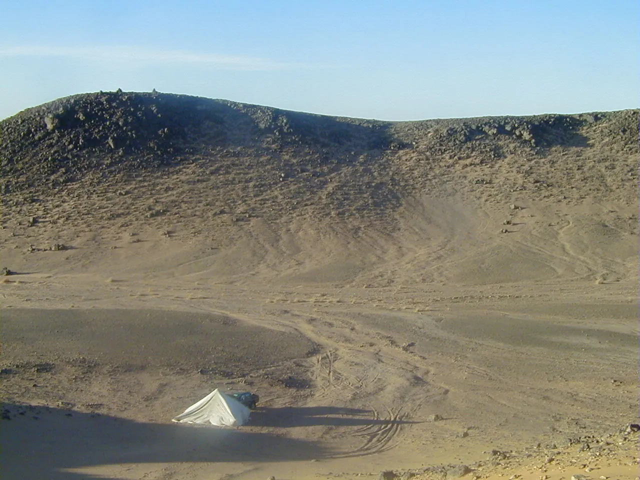
- Richat Ground · Michel Jebrak · 6 March 2002, 02:50:21 · CC BY-SA 4.0. Resized and converted to WebP; framing may crop the hero. These adaptations remain available under their respective licences.
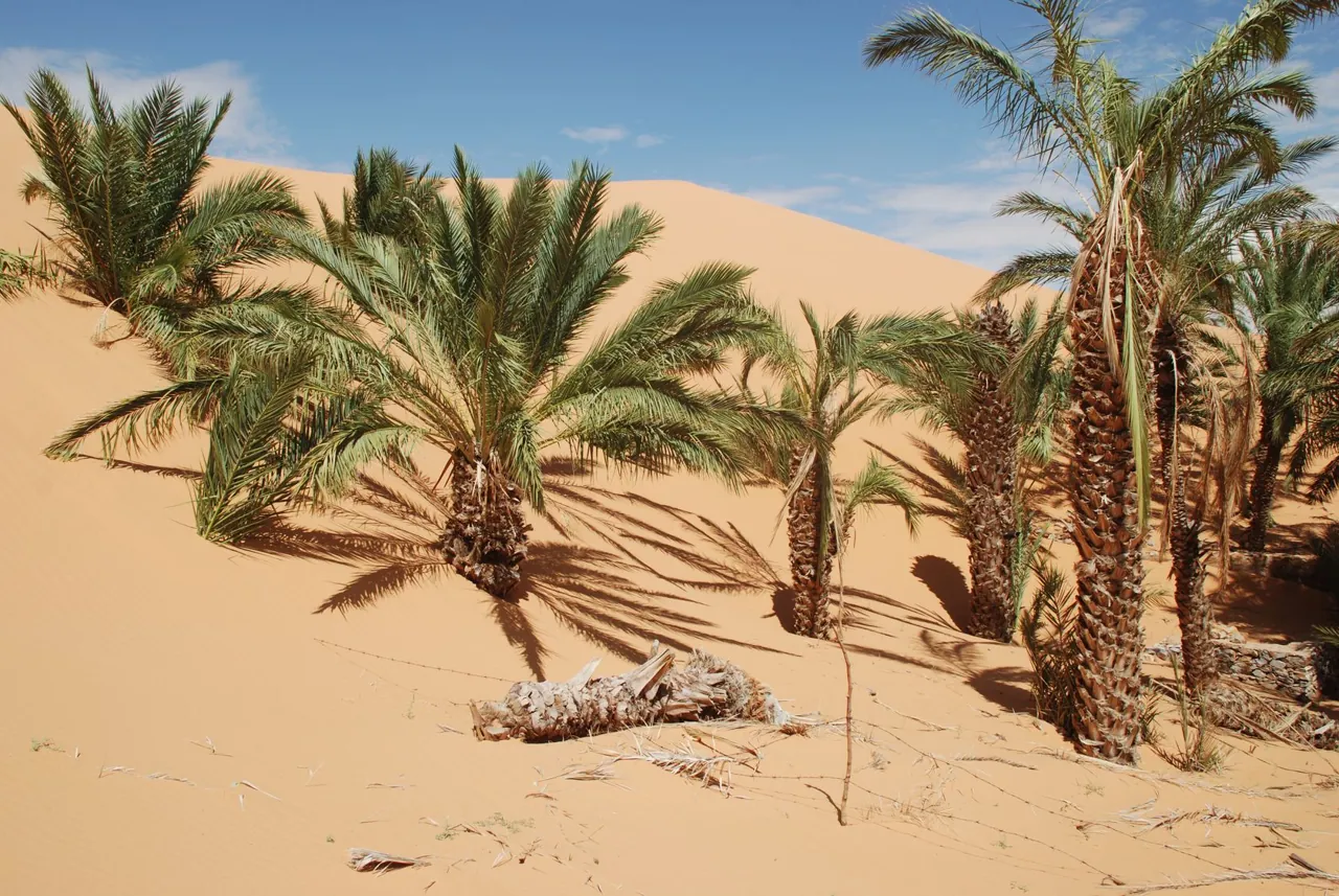
- Richat Chinguetti · Bertramz · October 2010 · CC BY-SA 3.0. Resized and converted to WebP; framing may crop the hero. These adaptations remain available under their respective licences.
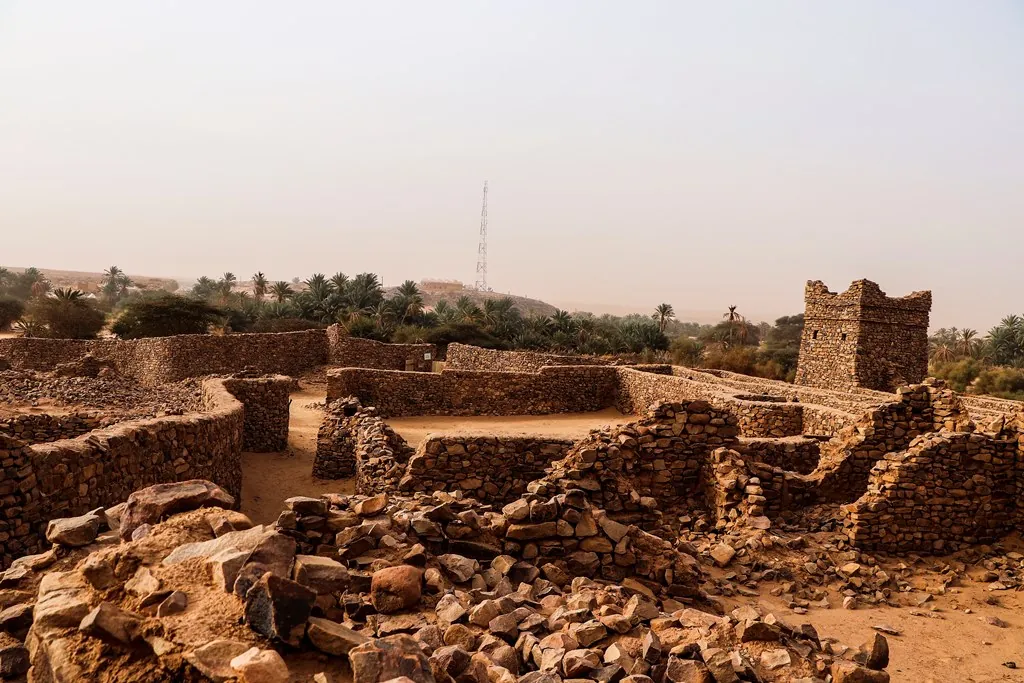
- Richat Ouadane · Clemens Schmillen · 1 January 2020 · CC BY-SA 4.0. Resized and converted to WebP; framing may crop the hero. These adaptations remain available under their respective licences.
Portrait supplied by Sok Heng Oeun.
A closer look.
Dated photographs show the place, details and wider setting. They are not evidence of present access or conditions.

Sok Heng Oeun
Sok Heng Oeun is the owner and editor of Hidden Corners. The Hidden Corners Editorial Team supports image preparation and editorial checks under his direction.
Sok Heng Oeun on Facebook ↗Research and AI-assisted editorial preparation. Publication authorized by Sok Heng Oeun; an individual owner reading review is not recorded. This guide does not claim a firsthand team visit.
.jpg)
.jpg#Licensing)


