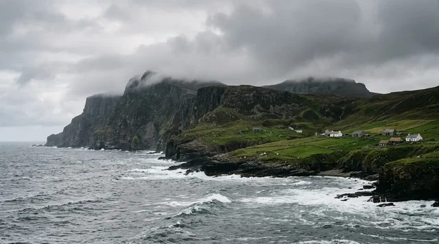
AI illustration
 Written and edited by
 The document that closes Minami-Iōtō is two pages long, was issued in Tokyo on 2 June 1983, and is numbered Environment Agency Notice No. 32. It designates a restricted entry district under the Nature Conservation Law, and where the notice should describe the district's boundaries it says only this: 南硫黄島原生自然環境保全地域の全域 — the entire wilderness conservation area. There is no fence, no garrison and no gate. There is a sentence.
Silence Index — D-198
Effectively unvisited
Ranks 13 of 99 scored dossiers — quieter than 88% of the others we have scored. A low score is not a warning; it describes who else will be standing next to you.
How the total is weighted. These are the fixed weights of the four inputs, the same on every dossier — not this place’s scores. We do not publish per-input bars, because the per-input values were never recorded article by article and inventing four plausible numbers that sum to the total would be a fabrication dressed as a chart.
This dossier was scored before 2 September 2026, when the fourth input became night darkness. It keeps the input it was reasoned with until it is re-scored at its next source re-check; the methodology page records the change.
The index is a desk instrument scored by this publication, not a field measurement. How it is calculated, and where it fails.
What this dossier is built from
Nobody from this publication has stood on Minami-Iōtō, and nobody from this publication is going to. That is not a confession of laziness. It is the finding. What follows is desk research assembled from the Ministry of the Environment's own designation notices, read in Japanese; the text of the Nature Conservation Law and its enforcement ordinance as published by the Japanese government's e-Gov legal database; the Tokyo Metropolitan Government's page on the island; Tokyo Metropolitan University's press releases on the surveys of 2007 and 2017; a 2025 paper in Oecologia; UNESCO's World Heritage file and the IUCN evaluation behind it; the Japan Meteorological Agency's list of active volcanoes; the Japan Coast Guard's marine volcano database; the Forestry Agency's Ogasawara office; the Ministry of Health, Labour and Welfare's war-dead programme; and the published sailing timetable of the only ship that goes anywhere near.
We have written it as a route guide, because that is the honest shape for it. It gets about a third of the way and then stops. The place where it stops is not a coastline. It is a notice.
The instrument
Three separate legal layers sit on this island, and only one of them actually shuts it. Getting them in the right order is most of the work.
The first is cultural. In 1972 the island was designated a national natural monument — a 天然保護区域, a natural protection area — under the Cultural Properties Protection Act. The Tokyo Metropolitan Government states the year on its own page. That designation protects the island's contents. It does not, by itself, keep anybody off it.
The second is conservation. On 17 May 1975 the Environment Agency issued Notice No. 31, designating 南硫黄島原生自然環境保全地域 — the Minami-Iōtō Wilderness Conservation Area — under Article 14, paragraph 1 of the Nature Conservation Law, Act No. 85 of 22 June 1972. The notice records the area as national forest land in compartment 38 of the Ogasawara working district, in Ogasawara Village, Tokyo. It is one of only five such areas in the whole of Japan; the others are Onnebetsu-dake, the headwaters of the Tokachi, the headwaters of the Ōi, and Yakushima. Together they amount to 5,631 hectares, all of it state-owned national forest.
The qualifying threshold matters here. Article 1 of the enforcement ordinance sets the minimum area for a wilderness conservation area at 1,000 hectares — 「ただし、その周囲が海面に接している区域については、 三百ヘクタールとする」, except that for an area whose perimeter meets the sea, the figure is 300 hectares. Minami-Iōtō cleared that bar with 67 hectares to spare. The law also requires such an area to be state or public land and to sit outside a national park. Ogasawara National Park had been designated on 16 October 1972, covering 6,629 hectares of the Chichijima, Hahajima and Mukojima groups, Nishinoshima and Kita-Iōtō. Minami-Iōtō was left out of it. The Tokyo page notes the exclusion in a parenthesis: 国立公園区域除外. The island was kept out of the softer regime so that the harder one could be applied.
The same day, Notice No. 32 of 1975 set the conservation plan, and it contains the only piece of lyricism in the whole file: the island lies 60 kilometres south of Iwo Jima, 「円錘形をなし、海岸から 直ちに急峻な918メートルの山となって小笠原諸島中の最高峰を形づくっている」 — conical, rising immediately from the shore into a precipitous 918-metre mountain, the highest peak in the Ogasawara Islands.
The sentence that closes it
The third layer is the one that matters, and it is eight years later. On 2 June 1983 the Environment Agency issued a second Notice No. 32, this one under Article 19, paragraph 1 of the Nature Conservation Law. It created the 南硫黄島立入制限地区, the Minami-Iōtō Restricted Entry District. Its stated extent is 南硫黄島原生自然環境保全地域の全域 — the entire wilderness conservation area. Not the summit. Not the seabird cliffs. All of it.
Article 19, paragraph 3 is four words long in the operative clause and admits of no argument: 何人も、立入制限地区に立ち入つてはならない — no person shall enter a restricted entry district. Five exceptions follow: entry to carry out an act permitted under the proviso to Article 17, paragraph 1; emergency measures in a disaster; execution of the conservation works for the area; ordinary management or minor acts prescribed by ministerial ordinance that do not impede conservation; and entry permitted by the Minister of the Environment on a finding of unavoidable circumstances.
The proviso to Article 17, paragraph 1 is the door everybody actually uses, and it is worth reading in full because it is narrower than it sounds: 「ただし、環境大臣が学術研究その他公益上の事由により特に必要と認めて許可した場合又は非常災害のために 必要な応急措置として行う場合は、この限りでない。」 Except, that is, where the Minister of the Environment has recognised it to be specially necessary on grounds of academic research or other public interest and has granted permission, or where the act is an emergency measure required by a disaster.
Three things follow from that wording. The authorising officer is a cabinet minister, not a park warden, a village office or a coastguard. The test is not that you have a good reason but that the Minister finds it specially necessary. And the qualifying grounds are academic research or public interest. There is no tourism limb. There is no adventure limb. A well-funded private expedition with excellent intentions does not fit the clause, and the clause is the only way in.
What popular coverage gets wrong
Two errors circulate, and they travel together. The first is that Minami-Iōtō is "Japan's last unexplored island" where "no human has ever set foot". The second is that it is off-limits for the same reason as Iwo Jima — a Self-Defence Force airfield and the continuing recovery of war dead. Both appear throughout English-language island content, in listicles, in video essays, in the sort of aggregated travel writing that never opens a Japanese-language document.
Take them in turn. Human feet have been on the island in living memory and the state published the dates. The Environment Agency landed a survey in 1982. The Tokyo Metropolitan Government landed a second in June 2007, jointly with what was then Tokyo Metropolitan University, expressly to establish the island's value for the World Heritage nomination — a gap of twenty-five years, which the Tokyo page states plainly. A third landed on 13 June 2017 and left on 28 June, sixteen days, jointly with the university and the national broadcaster NHK. What is true, and what the Tokyo page actually says, is something narrower and more interesting: 「小笠原で唯一、人為の影響を受けていない島です」 — the only island in the Ogasawara group not affected by human activity. Never settled is not the same as never visited, and rationed is not the same as forbidden.
The Iwo Jima conflation is the more careless error, because the two islands are administered by different ministries for different reasons under different statutes. Iwo Jima — Iōtō — is a defence and bereavement matter: the Ministry of Health, Labour and Welfare runs organised memorial visits there, two in the 2024 financial year, on 18–19 November and 27–28 January, with 100 places each, as part of a war-dead programme whose national ledger stood at roughly 2.4 million dead overseas and about 1.12 million sets of remains still unrecovered as at 31 March 2026. Minami-Iōtō has no airfield, no garrison, no graves and no pilgrimage. It is 60 kilometres further south and it is closed by a nature notice signed at the Environment Agency. Nothing about it is a defence matter.
Three landings in forty-four years
The 2017 expedition is the best-documented of the three, and its shape tells you what the permission regime actually buys. Sixteen days. Plants, birds, insects and land snails, plus four fields nobody had ever surveyed there — land crustaceans, soil fauna, fungi, and lichens and bryophytes. Everything beyond the routes the climbers could reach was recorded by drone. That is the operative admission in the whole file: a national broadcaster, a university and a metropolitan government, holding a ministerial permission, still could not physically get to large parts of a 916-metre cone and flew cameras at it instead.
What came back was not thin. A Liparis orchid was collected — either an undescribed species or the ghost recorded once in 1982, the first specimen in seventy-nine years. Drone photography confirmed Japan's first known breeding colony of red-footed booby. Three land snails new to the island, one of them an undescribed species with a shell about two millimetres long. And a single specimen of the endemic weevil Minami-iō-suji-hime-kata-zōmushi, previously known from one individual.
The science has gone on producing long after the ship left. In May 2025 a team led by Nozomu Sato published in Oecologia a study of the island's material cycle, using stable nitrogen isotopes in plants, herbivorous insects, predatory lizards and birds, decomposer flies, land crabs and seabirds collected between sea level and 900 metres. Their finding is that seabirds and land crabs together carry marine nitrogen up the whole cone, and that on Minami-Iōtō the food niches of predators overlap by at most 14 per cent, against 53 per cent on islands whose seabirds are gone. The comparison sites supply the grim half: marine nitrogen persists for about fifty years after a seabird colony dies, and has largely washed out after a hundred and fifty. The island is not being preserved as a curiosity. It is being kept as the control sample for every damaged island in the archipelago.
The route, written out until it stops
Here is the part of the guide that can be written. From Tokyo, Takeshiba pier. The Ogasawara Maru, operated by Ogasawara Kaiun, sails at 11:00 and reaches Futami on Chichijima at about 11:00 the following day — roughly twenty-four hours, on a cycle that in the published 2026 timetable runs three or four round trips a month, with extra sailings in high summer. One-way adult fares in the 2026 tariff run from about ¥28,610 for a second-class Japanese-style room in November to ¥106,550 for a special suite in August. There is no airport. That ship is the route.
Chichijima is a real place with a weather station: annual mean temperature 23.4°C, annual precipitation 1,296.1 mm on the Japan Meteorological Agency's normals. From there the guide continues for exactly one more sentence. Minami-Iōtō is about 330 kilometres further south.
And then it stops, four times over. There is no scheduled service of any kind to the Volcano Islands for a civilian. There is no harbour, no jetty and no sheltered anchorage on Minami-Iōtō; the 1975 conservation plan describes a cone rising precipitously straight out of the sea, which is a polite way of saying there is nowhere to put a boat. There is no beach to land on and no fresh water to drink when you get there. Above the surf line the island is a 916-metre wall of vegetation — dwarf forest on the flanks, a cloud-wrapped moss forest with tree ferns near the summit, the whole of it a natural monument you may not cut. The Oecologia authors note in passing that aircraft landings are prohibited.
All four of those are real. None of them is the reason. The reason is a sentence written in 1983, and it would still be the reason if somebody built a pier.
The island cannot agree on its own size
Three arms of the Japanese state publish three different areas for this island, and we are not going to average them.
- 367 hectares — the 1983 restricted entry district notice, and the Environment Ministry's own tabulation of wilderness conservation areas as at 31 March 2026, which also records the land as state-owned national forest.
- 355 hectares — the Environment Ministry's World Heritage pages, in a table headed 「世界遺産登録区域内の保護地域の面積」, the area of protected land within the inscribed property.
- 354 hectares — the Tokyo Metropolitan Government's page on the island, given alongside the 7.5-kilometre circumference and the 916-metre height.
The 355 figure is at least explicable: it is scoped to the World Heritage boundary, not to the designation. The 354 is not. We could not establish what the Tokyo figure measures, or reconcile it with the notice, and the national mapping agency's island area tables — the obvious tie-breaker — were unreadable to us for technical reasons set out in the method note. The height disagrees too: 918 metres in the 1975 conservation plan, 916 metres at Tokyo. Both are printed above. Neither is ours.
A dead mountain in a live neighbourhood
One more correction, since it is usually got wrong in the other direction. The Japan Meteorological Agency defines an active volcano as one that has erupted in roughly the past ten thousand years or shows current fumarolic activity, and lists 111 of them. Going through the Izu-Ogasawara section — Izu-Ōshima, Toshima, Niijima, Kōzushima, Miyakejima, Mikurajima, Hachijōjima, Aogashima, the Bayonnaise Rocks, Sumisujima, Izu-Torishima, Sōfugan, Nishinoshima, Kaikata Seamount, Kaitoku Seamount, Funka Asane, Iōtō, Kita-Fukutoku Bank, Fukutoku-Oka-no-Ba, Minami-Hiyoshi Seamount, Nikkō Seamount — one name is not there. Minami-Iōtō is not on the Japan Meteorological Agency's list of active volcanoes. Neither is Kita-Iōtō.
Its neighbours emphatically are. Fukutoku-Oka-no-Ba lies about five kilometres north-east, a submarine edifice whose summit the Japan Coast Guard puts at 24°17.1′N, 141°28.9′E and 25 metres below the surface. In August 2021 it threw an eruption column observed from an aircraft 90 kilometres away, built a horseshoe-shaped island about a kilometre across within two days, and spread rafts of floating pumice some 60 kilometres to the north-west. Iōtō itself last erupted in 2025. Nishinoshima, further north, has been erupting on and off since 1973 and was still doing so in 2026. Minami-Iōtō sits in the middle of all that and does nothing. Its stillness is precisely why the vegetation is old enough to be worth a statute.
Why the Silence Index is 89
Remoteness is close to maximal: 330 kilometres beyond an island that is itself a day at sea from the capital, with no airstrip and no anchorage. Access friction is, as far as we can establish, the highest in Japan — a blanket statutory prohibition covering 100 per cent of the land, liftable only by a cabinet minister on a public-interest test. Visitor volume is three organised landings in forty-four years, which rounds to nothing.
For the fourth input we have used unresolved questions rather than night darkness, because the darkness here is trivially total and the questions are not. There are undescribed species on the island right now that have been collected but not named; there is a summit nobody in our sources claims to have stood on; there is a penalty clause we could not read; and there is an area figure the state publishes three ways.
So why not 94? Because this island is not obscure. It is a component of a World Heritage property inscribed in 2011 under criterion (ix), it was filmed for national television, and its nitrogen cycle is described in an international journal. Legal closure and scientific silence are different things, and Minami-Iōtō has only the first. A place that is unreachable but thoroughly written up is not the quietest thing in this archive. It is merely the most firmly shut.
What is not settled
We could not find any announcement of a fourth survey. The rhythm — 1982, 2007, 2017 — invites the guess that 2027 is next, and we are not going to make it: there is nothing in the Environment Ministry's pages, nothing in the Kantō Regional Environment Office's procurement notices, and nothing on the university's news feed. If a 2027 expedition is being planned, it is being planned somewhere we could not read.
Nor could we read the penalty. The Nature Conservation Law's Chapter 8 runs from Article 53 to Article 59, and the government's own legal database returned the statute truncated at Article 31 every time we asked. So we know exactly what you are forbidden to do and by whom, and we cannot tell you what happens if you do it. That is an unsatisfying place to end a route guide, and it is the true one.
What we can say is that the refusal is not arbitrary. This is the one island in the group where nothing introduced has taken hold, where the seabirds still carry the sea up the mountain, and where the numbers that everyone else's restoration work is measured against are generated. The state has decided that the scientific value of leaving it alone exceeds the value of anyone seeing it, and has written that decision down in a form that admits of no exception for enthusiasm. We think that is the right call. We would like to go, and we are not going, and those two sentences are not in tension.
Corner Codex — D-198
- Place
- Minami-Iōtō (南硫黄島), Ogasawara Village, Tokyo Metropolis, Japan
- Coordinates
- 24°14′02″N, 141°27′49″E, as published in Oecologia (2025)
- Height
- 916 m (Tokyo Metropolitan Government) or 918 m (1975 conservation plan notice)
- Area
- 367 ha (1975 designation), 355 ha (Environment Ministry), 354 ha (Tokyo). Unreconciled
- Circumference
- About 7.5 km
- Distance from Chichijima
- About 330 km south; Chichijima is itself 24 hours by sea from Tokyo
- Natural monument
- Designated under the Cultural Properties Protection Act, 1972
- Wilderness area
- Environment Agency Notice No. 31, 17 May 1975 — one of only five in Japan
- The closure
- Environment Agency Notice No. 32, 2 June 1983 — the whole island a 立入制限地区
- Landings on record
- 1982, 2007 and 13–28 June 2017. Three in forty-four years
- World Heritage
- Component of the Ogasawara Islands, inscribed 2011 under criterion (ix), ref 1362
- Active volcano?
- Not on the Japan Meteorological Agency's list of 111 active volcanoes
- Silence Index
- 89 / 100
The Traveler's Panel · checked
Changing information. Prices, permits, seasons and road access change, sometimes at short notice. Everything here is a starting point for your own confirmation — not a quote, and not a guarantee. Verify with the operator and the relevant official body before you book.
| What shuts it | Environment Agency Notice No. 32, 2 June 1983, under the Nature Conservation Law |
| Extent of the closure | 南硫黄島原生自然環境保全地域の全域 — 100% of the land |
| The rule | Article 19(3): no person shall enter a restricted entry district |
| The only door | Article 17(1) proviso — ministerial permission for academic research or public interest |
| Who decides | The Minister of the Environment. Not a warden, not a village office, not the Coast Guard |
| Landings on record | 1982, 2007, 13–28 June 2017 |
| Not a defence matter | No airfield, no garrison, no war graves. That is Iwo Jima, 60 km north |
| Nearest scheduled transport | Ogasawara Maru, Tokyo Takeshiba to Chichijima, about 24 hours |
Getting there — There is no gateway. The nearest lawful ground is Chichijima, about 330 km north
- There is no route. What exists instead is a permission machinery, and it is worth understanding because it is the whole story. Under Article 19, paragraph 3 of the Nature Conservation Law, no person may enter a restricted entry district. Environment Agency Notice No. 32 of 2 June 1983 makes the whole of Minami-Iōtō one. There is no zoning, no shoulder season and no buffer where the rule relaxes.
- The exception that has actually been used three times is the proviso to Article 17, paragraph 1: an act may be done where the Minister of the Environment recognises it to be specially necessary on grounds of academic research or other public interest and grants permission. Read the test carefully. The decision-maker is a cabinet minister. The standard is specially necessary, not reasonable. The grounds are research or public interest, and there is no limb for tourism, adventure or documentary access obtained privately.
- In practice the permissions have gone to institutional consortia with a published scientific programme: the Environment Agency itself in 1982; the Tokyo Metropolitan Government with what was then Tokyo Metropolitan University in June 2007, expressly to build the evidence base for the World Heritage nomination; and the same two bodies with the national broadcaster NHK for sixteen days in June 2017. An individual does not assemble that. A university department might, over years, with a metropolitan government behind it.
- Assume, too, that permission is the easy part. There is no harbour, no jetty and no sheltered anchorage; the 1975 conservation plan describes a cone rising precipitously straight out of the sea. There is no beach and no fresh water. Aircraft landings are prohibited. The 2017 team, fully authorised and fully funded, still surveyed most of the island by drone because they could not physically get to it.
- If you want to see the Volcano Islands at all, the honest answer is that you cannot, and the nearest thing on offer is the Ogasawara Maru to Chichijima — twenty-four hours from Takeshiba pier in Tokyo, three or four round trips a month on the published 2026 schedule. Chichijima is a World Heritage component in its own right and it is where the ecological restoration work that Minami-Iōtō serves as the control sample for is actually done.
Indicative costs — verify before booking
| What it costs | Nobody should be pricing this. There is no lawful way in for a visitor, at any price |
| The nearest priced thing | Ogasawara Maru, Tokyo to Chichijima, one way adult: about ¥28,610 (second-class Japanese-style room, November) to ¥106,550 (special suite, August) |
| Permit fee | There is no fee, because there is no application a member of the public can make. The instrument is a ministerial permission, not a ticket |
| Charter | Do not. Approaching by private vessel does not change Article 19(3), and we could not establish the penalty, which is not the same as there not being one |
| What we will not quote | Any figure from an operator offering to get you near Minami-Iōtō. We found no lawful basis on which such a trip could land |
What to pack
- Nothing. This is the one entry in the archive where the packing list is empty on purpose.
- If you are going to Chichijima instead: the Japan Meteorological Agency's normals for the island are 23.4°C annual mean and 1,296.1 mm of rain a year, which is subtropical and wet rather than hot and dry.
- For the twenty-four-hour crossing, whatever you need to sleep in a shared room at sea. The cheapest classes on the Ogasawara Maru are exactly what they sound like.
- Boot-cleaning discipline and sealed bags for anything that has been in soil elsewhere. The whole conservation case for this archipelago is about what arrives on people.
- A reading copy of the notice, if you want the trip to make sense. It is two pages, it is public, and it is the most interesting document about the island.
Where to stay
There is nowhere to stay and there never has been. Minami-Iōtō has never been settled — the Tokyo Metropolitan Government attributes that to the severity of the terrain and the environment rather than to any prohibition, and the prohibition came much later — and it has no structure, no water source and no ground flat enough to be worth the argument. The practical base for anyone drawn to this part of the world is Chichijima, twenty-four hours south of Takeshiba pier on the Ogasawara Maru and about 330 kilometres north of the island itself, where accommodation, a visitor centre and the World Heritage Centre are concentrated around Futami. Hahajima, reached by a second ship, is quieter. Neither will get you closer to Minami-Iōtō than a horizon, and we would gently suggest that this is the correct outcome: the island's value is precisely that it is the one place in the archipelago where nobody sleeps.
Safety & responsible travel
- Do not repeat the claim that no human has ever set foot on Minami-Iōtō. Three landings are on the public record and the state published all three dates.
- Do not repeat the claim that it is closed because of the Self-Defence Forces or war-dead recovery. That is Iwo Jima, a different island 60 kilometres north, under a different ministry.
- Do not treat the closure as a challenge. The reason for it is that this is the only island in the group where nothing introduced has established itself, and it is the reference against which restoration everywhere else in Ogasawara is measured. One rat would end that.
- If you are on Chichijima or Hahajima, follow the guided-route and induction rules that apply there. The Forestry Agency's Ogasawara office runs a permit-and-guide regime on restricted forest routes, and it exists for the same reason the notice does.
- Cite the instrument, not the legend. Environment Agency Notice No. 32 of 2 June 1983 is a public document with a URL, and it settles in one line what a great deal of English-language writing about this island gets wrong.
Nearby, and quieter
The neighbourhood is more active than the island is. Fukutoku-Oka-no-Ba lies about five kilometres north-east, a submarine volcano whose summit the Japan Coast Guard puts 25 metres below the surface; in August 2021 it built a horseshoe-shaped island roughly a kilometre across in two days and scattered pumice sixty kilometres north-west. Iwo Jima — Iōtō — is 60 kilometres north, still rising, with an eruption logged on 1 and 2 September 2025 and a shoreline that Captain Cook's surveying crew landed on in 1779 now sitting 40 metres above the sea. North again is Kita-Iōtō, inside Ogasawara National Park, with the submarine vent Funka Asane four kilometres off it. Further north still, Nishinoshima has been erupting on and off since 1973 and was doing so again in 2026. The inhabited Ogasawara Islands — Chichijima and Hahajima, the Mukojima group — are the part of the World Heritage property you can actually walk on, under a route and guide regime run by the Forestry Agency's Ogasawara Ecosystem Conservation Centre across 5,579 hectares of protected forest.
Getting there, in order
- 1Minami-Iōtō
- 2Iōtō (Iwo Jima)
- 3Fukutoku-Oka-no-Ba
- 4Funka Asane
Each leg is a separate booking and a separate chance to be weathered out. Build spare days into the chain, not onto the end of it.
Where it is
Minami-Iōtō, Volcano Islands, Ogasawara Village, Tokyo · 24.2339°N 141.4636°E · Open in Google Maps · OpenStreetMap
Key locations
- Minami-Iōtō — 24°14′02″N 141°27′49″E as published in Oecologia (2025); entire island a restricted entry district since 1983
24.2339°N 141.4636°E - Fukutoku-Oka-no-Ba — submarine volcano about 5 km north-east; built an ephemeral island in August 2021
24.2850°N 141.4810°E - Iōtō (Iwo Jima) — 60 km north; the island Minami-Iōtō is constantly confused with. Last erupted 1–2 September 2025
24.7503°N 141.2892°E - Funka Asane — submarine vent about 4 km north-west of Kita-Iōtō, the northernmost of the Volcano Islands
25.4550°N 141.2386°E - Nishinoshima — Coast Guard pre-2013 position; a World Heritage component that has been erupting on and off since 1973
27.2469°N 140.8744°E - Izu-Torishima — 394 m island on the same arc, roughly halfway back toward the Izu group
30.4840°N 140.3030°E
Coordinates are for orientation and are accurate to roughly the width of the feature named, not to a doorway. Several of these points are inside protected areas or need a permit, a guide or a boat — read the access notes above before you plan a route to any of them.
Sources & further reading — checked
- Ministry of the Environment — 南硫黄島原生自然環境保全地域 designation notices (PDF: Environment Agency Notices No. 31 and No. 32 of 17 May 1975 and No. 32 of 2 June 1983). The three governing instruments: the 1975 designation under Article 14(1) covering national forest compartment 38 in Ogasawara Village; the conservation plan describing a precipitous 918-metre cone 60 km south of Iwo Jima; and the 1983 restricted entry district under Article 19(1), whose extent is given as 南硫黄島原生自然環境保全地域の全域, 367 ha, all state land
- e-Gov law database (Digital Agency, Japan) — 自然環境保全法, Act No. 85 of 22 June 1972, full text. Article 14(1) on designating wilderness conservation areas; Article 17(1) and its proviso permitting acts where the Minister of the Environment recognises them specially necessary for academic research or other public interest; and Article 19, whose paragraph 3 provides that no person shall enter a restricted entry district, subject to five listed exceptions
- e-Gov law database — 自然環境保全法施行令, Cabinet Order No. 38 of 31 March 1973. Article 1, setting the minimum area for a wilderness conservation area under Article 14(1) of the Act at 1,000 hectares, with an express exception of 300 hectares for an area whose perimeter meets the sea — the threshold Minami-Iōtō's 367 hectares clears
- Tokyo Metropolitan Government, Bureau of the Environment — 南硫黄島自然環境調査について. Area 354 ha, circumference about 7.5 km, height 916 m, about 330 km from Chichijima; natural monument in 1972 and wilderness area in 1975 with the national park expressly excluded; forest ecosystem protection area in 2007; and the 1982, June 2007 and June 2017 survey sequence
- Tokyo Metropolitan University — 世界自然遺産の小笠原諸島南硫黄島で10年ぶりの自然環境調査の結果について (12 September 2017). The joint Tokyo Metropolitan University, Tokyo Metropolitan Government and NHK survey of 13–28 June 2017; the statement that entry is prohibited under the Nature Conservation Law and the island is a natural monument under the Cultural Properties Protection Act; and drone survey of everything off the climbable routes
- Tokyo Metropolitan University — press release PDF on the 2017 Minami-Iōtō survey (12 September 2017). The findings in detail: a Liparis orchid, the first collection in 79 years; Japan's first confirmed red-footed booby breeding colony, photographed by drone; three land snails new to the island including an undescribed species about 2 mm across; and a single specimen of the endemic weevil Minami-iō-suji-hime-kata-zōmushi
- Ministry of the Environment — 自然環境保全地域等の指定状況 (原生自然環境保全地域), data table PDF. As at 31 March 2026: five wilderness conservation areas totalling 5,631 ha, all state-owned national forest; Minami-Iōtō at 367 ha in Ogasawara Village, Tokyo, designated 17 May 1975, characterised by tree ferns, cloud forest, tropical and subtropical vegetation, marine erosion landforms and seabirds
- Ministry of the Environment — 原生自然環境保全地域の指定状況 (feature page). The five areas with designation dates and areas — Onnebetsu-dake 1,895 ha, Tokachi headwaters 1,035 ha, Minami-Iōtō 367 ha, Ōi headwaters 1,115 ha, Yakushima 1,219 ha — and the note that only Minami-Iōtō carries a restricted entry district designation
- Ministry of the Environment — 自然環境保全地域とは (about page). The criteria for a wilderness conservation area: land maintaining its original condition unaffected by human activity, 1,000 ha or more and 300 ha or more for islands, and the definition of a restricted entry district as ground where entry is prohibited in principle and permitted only by the Minister
- Ministry of the Environment — 自然環境保全法の体系 (law overview page). The statutory family: the Act of 22 June 1972 as last amended 1 July 2024, the Cabinet Order of 31 March 1973, the ministerial rule of 9 November 1973 and the basic policy of 19 March 2020; and the requirement that a wilderness area be state or public land outside a national park
- Ministry of the Environment — 原生自然環境保全地域 top page. The list of Japan's five wilderness conservation areas — Onnebetsu-dake, the Tokachi headwaters, Minami-Iōtō, the Ōi headwaters and Yakushima — establishing how small a category this island belongs to
- Ministry of the Environment — 小笠原諸島世界自然遺産 保護管理 (protection and management). The table headed 世界遺産登録区域内の保護地域の面積, giving Ogasawara National Park special protection districts 4,934 ha, special areas 996 ha and the Minami-Iōtō wilderness conservation area 355 ha — the second of this dossier's three published areas, scoped to the inscribed property
- Ministry of the Environment — 小笠原諸島世界自然遺産 世界遺産地域の紹介. The six component areas of the inscribed property — the Mukojima, Chichijima and Hahajima groups, Kita-Iōtō, Minami-Iōtō and Nishinoshima — totalling approximately 7,900 hectares
- Ministry of the Environment — 小笠原諸島世界自然遺産 関連リンク集. The Ministry's own register of the bodies that administer the archipelago — the Kantō Regional Environment Office, the Forestry Agency's Ogasawara Ecosystem Conservation Centre, the Tokyo Metropolitan Government and Ogasawara Village — none of them a defence agency
- Ministry of the Environment — 小笠原国立公園 公園紹介. Ogasawara National Park designated 16 October 1972 with a land area of 6,629 ha, covering the Chichijima and Hahajima groups, Mukojima, Nishinoshima and Kita-Iōtō — and not Minami-Iōtō, which the Nature Conservation Law requires to sit outside a national park
- UNESCO World Heritage Centre — Ogasawara Islands (ref 1362). Inscription in 2011 under criterion (ix); a serial property of 7,939 ha comprising 6,358 ha of land and 1,581 ha of sea, with Ogasawara National Park as a functional buffer; five legally designated protected-area categories managed by three national agencies; and Minami-Iwoto named as a component of the Kazan group
- UNESCO World Heritage Committee — Decision 35 COM 8B.11, Ogasawara Islands (Japan). The inscription decision under criterion (ix) for ongoing evolutionary processes in an oceanic island ecosystem, with requests to Japan on invasive alien species and prior environmental impact assessment, and encouragement on marine protection, climate monitoring and tourism management
- UNESCO / IUCN — Advisory Body Evaluation of the Ogasawara Islands nomination (2011). The IUCN evaluation naming Kita-iwoto and Minami-iwoto of the Kazan group among the components and confirming the 7,939 ha total, while giving no component-level area, protection or access detail for Minami-Iōtō itself — the gap this dossier had to fill from Japanese instruments
- UNESCO World Heritage Centre — Ogasawara Islands document register. The full documentary record for the property: the 2011 nomination file, the IUCN evaluation, the inscribed-property map, Decision 35 COM 8B.11 and the 2023 Periodic Reporting Cycle 3 Section II return — with no state of conservation report listed
- Springer / Oecologia — Sato, Nakashita, Sasaki, Kato, Karube, Mori and Kawakami, 'The distinctive material cycle associated with seabirds and land crabs on a pristine oceanic island: a case study of Minamiiwoto, Ogasawara Islands, subtropical Japan' (22 May 2025). The published coordinates 24°14′02″N, 141°27′49″E; sampling from sea level to 900 m in June of 2007, 2016 and 2017; predator food-niche overlap of at most 14% on Minami-Iōtō against 53% on disturbed islands; and the statement that aircraft landings on the island are prohibited
- Tokyo Metropolitan University — 鳥は海から陸に肥料を運び、肥料は150年で流れ去る (2 June 2025). The plain-language account of the Oecologia paper: marine-derived nitrogen carried inland by seabirds, holding steady for about 50 years after a colony is lost and falling away sharply by 150 years, with the research team drawn from five Japanese institutions
- Tokyo Metropolitan University — press release PDF, seabird nitrogen study (2 June 2025). The comparison design: Minami-Iōtō as the undisturbed reference, Kita-Iōtō as the site whose seabirds went 50-plus years ago, and Chichijima and Hahajima at 150-plus years; and the role of land crabs in carrying nutrients from the shore to the summit
- Ogasawara Kaiun Co. Ltd — official site, Ogasawara Maru service. The operator's own statement of the route: Tokyo Takeshiba to the Ogasawara Islands, 片道24時間 — twenty-four hours one way — worked by the Ogasawara Maru, with the Hahajima Maru on the inner leg, and reservations through the operator's own system
- Ogasawara Kaiun Co. Ltd — 運航スケジュール・運賃 (schedule and fares). Departure from Tokyo at 11:00 and arrival at Futami, Chichijima at about 11:00 the next day; 2026 one-way adult fares from ¥28,610 for a second-class Japanese-style room in November to ¥106,550 for a special suite in August
- Ogasawara Kaiun Co. Ltd — 2026 sailing timetable (PDF). The published January to December 2026 schedule: a repeating cycle of three or four round trips a month, departing Tokyo at 11:00 and returning from Chichijima at 15:00, with additional summer sailings and the Salvia Maru substituting on certain May dates
- Japan Meteorological Agency — 活火山とは (definition of an active volcano). The definition used throughout this dossier: a volcano that has erupted within roughly the past 10,000 years or that shows current fumarolic activity, and the count of 111 such volcanoes in Japan
- Japan Meteorological Agency — 日本活火山総覧 / 活火山一覧 (list of active volcanoes). The complete Izu-Ogasawara section, running from Izu-Ōshima through Nishinoshima, Kaikata Seamount, Kaitoku Seamount, Funka Asane, Iōtō, Kita-Fukutoku Bank, Fukutoku-Oka-no-Ba and Minami-Hiyoshi Seamount to Nikkō Seamount — with neither Minami-Iōtō nor Kita-Iōtō present
- Japan Coast Guard, Hydrographic and Oceanographic Department — 海域火山データベース, 福徳岡ノ場・南硫黄島. Fukutoku-Oka-no-Ba at 24°17.1′N, 141°28.9′E with a summit 25 m below the surface; the August 2021 eruption observed from an aircraft 90 km away, the horseshoe-shaped island about 1 km across by 15 August, and pumice rafts extending roughly 60 km north-west
- Japan Coast Guard, Hydrographic and Oceanographic Department — 海域火山データベース index. The Coast Guard's register of monitored marine volcanoes for the Izu-Ogasawara arc, in which Minami-Iōtō appears only as part of the combined Fukutoku-Oka-no-Ba entry and has no monitoring file of its own
- Japan Coast Guard, Hydrographic and Oceanographic Department — 海域火山データベース, 西之島. Nishinoshima at 27°14′49″N, 140°52′28″E in its pre-2013 position, with an activity record of eruptions from 1973 through to April 2026 — the nearest comparison for how restless the rest of this arc remains
- Smithsonian Institution, Global Volcanism Program — Ioto (volcano number 284120). Iwo Jima's summit at 172 m, coordinates 24.7503°N, 141.2892°E, a last eruption on 1–2 September 2025, and continuing resurgent uplift that has raised a shoreline landed on by Captain Cook's surveying crew in 1779 to 40 m above the sea
- Smithsonian Institution, Global Volcanism Program — Fukutoku-Oka-no-Ba (volcano number 284130). The submarine volcano approximately 5 km north-east of Minami-Ioto, summit 29 m below sea level at 24.285°N, 141.481°E, which produced the ephemeral island Shin-Iwo-jima in 1904 and another roughly 1 km across in August 2021
- Smithsonian Institution, Global Volcanism Program — Funka Asane (volcano number 284110). The submarine edifice about 4 km north-west of Kita-Ioto at 25.455°N, 141.2386°E, with discoloured water observed sixteen times between 1982 and 2007 and a 2022 eruption plume reaching 5.5 km — and the note that Kita-Ioto itself has no recorded eruptions
- Smithsonian Institution, Global Volcanism Program — volcanoes of Japan listing. The Global Volcanism Program's country listing, which carries Ioto at number 284120 but no separate entry for Minami-Ioto — corroborating, from a second and independent register, that the island is not treated as an active volcano
- Forestry Agency, Kantō Regional Forest Office — 小笠原諸島森林生態系保護地域 / Ogasawara Ecosystem Conservation Centre. The 5,579-hectare Ogasawara Islands Forest Ecosystem Protection Area, most of which was brought inside the World Heritage property in 2010; Minami-Iōtō listed under the Volcano Islands within the office's jurisdiction; and the permit-and-guide regime on restricted routes elsewhere
- Japan Meteorological Agency — climate normals for 父島 (Chichijima) observation station. The gateway island's published normals: an annual mean temperature of 23.4°C and annual precipitation of 1,296.1 mm — the only long-run instrumental climate record anywhere near Minami-Iōtō, and 330 km north of it
- Japan Meteorological Agency — 地上気象観測地点一覧 (surface observation station index). The national station index, confirming that within Ogasawara Village the Agency operates observatories at Chichijima and Minamitorishima only — there is no instrument of any kind on Minami-Iōtō
- Ministry of Health, Labour and Welfare — 戦没者遺骨収集事業 (war dead remains recovery). The programme that actually governs access to Iwo Jima: memorial visits to Iōtō on 18–19 November and 27–28 January in the 2024 financial year, 100 places each, within a national ledger of about 2.4 million dead overseas and roughly 1.12 million sets of remains unrecovered as at 31 March 2026
- Ministry of Health, Labour and Welfare — 戦没者遺骨収集 policy top page. The framing that separates Iwo Jima from Minami-Iōtō: 海外戦没者(硫黄島、沖縄を含む) — overseas war dead including Iwo Jima and Okinawa — and an intensive recovery period extended to the 2032 financial year by a revision of June 2023
- Kantō Regional Environment Office, Ministry of the Environment — 調達情報 (procurement notices). The office that would have to commission a fourth Minami-Iōtō expedition: its current notices carry only a refurbishment contract for the Ogasawara World Heritage Centre and no survey tender — the basis for this dossier's refusal to predict a 2027 landing
Official and scientific bodies are the authority for safety, regulatory and scientific claims. Commercial operators are used only for practical detail such as tour length, meeting points and indicative pricing — never for a safety or scientific statement.
How this was made
Desk research. Compiled from official bodies, scientific and conservation sources, established journalism and licensed operators. Not based on a personal visit.
Editor’s method note — what we checked, corrected and could not verify
- Desk research only. Nobody from this publication has been to Minami-Iōtō, and under Environment Agency Notice No. 32 of 2 June 1983 nobody from this publication lawfully could.
- Every URL cited was opened and read before citation. Sources that could not be opened are listed below and are cited nowhere in the piece.
- Japanese-language instruments were read in the original. Where the Japanese is load-bearing — the extent clause of the 1983 notice, Article 19(3), the proviso to Article 17(1), Article 1 of the enforcement ordinance, the 918-metre sentence in the 1975 conservation plan — we print the Japanese and our translation together so the reader can check us.
- The area is published three ways by three arms of the same state and we print all three: 367 ha in the 1983 notice and in the Environment Ministry's designation table as at 31 March 2026; 355 ha in the Ministry's World Heritage table, which is expressly scoped to protected land inside the inscribed property; and 354 ha on the Tokyo Metropolitan Government's page. The 355 figure is explicable by its scope. The 354 is not, and we did not resolve it.
- The height is published two ways and we print both: 918 metres in the 1975 conservation plan notice, 916 metres at the Tokyo Metropolitan Government. We did not average them and we have no independent survey.
- We state that the island is not on the Japan Meteorological Agency's list of 111 active volcanoes on the basis of reading the full Izu-Ogasawara section of that list, in which twenty-one volcanoes are named and Minami-Iōtō is not among them. The Smithsonian Global Volcanism Program's Japan listing likewise carries no separate entry for it. That is an absence from two registers, not a positive finding of dormancy.
- The panel's coordinate for the island, 24°14′02″N 141°27′49″E, is the figure published in the 2025 Oecologia paper. Chichijima is deliberately not pinned on the map: it is the only gateway that matters and we could not obtain an official coordinate for it from any source we could open. The remaining pins are Japan Coast Guard or Global Volcanism Program positions for the surrounding volcanoes.
- We do not repeat the claim that no human has set foot on Minami-Iōtō. Three organised landings are on the public record — the Environment Agency in 1982, Tokyo and Tokyo Metropolitan University in June 2007, and Tokyo, the university and NHK from 13 to 28 June 2017. What the Tokyo page actually claims is narrower: that it is the only island in the Ogasawara group unaffected by human activity.
- We separate Minami-Iōtō from Iwo Jima throughout. Iwo Jima's access regime is a defence and war-dead matter administered in part by the Ministry of Health, Labour and Welfare, which runs memorial visits with published dates and place counts. Minami-Iōtō's is a nature notice issued by the Environment Agency. No source we opened connects the second island to any defence instrument.
- Sources we could not read, and therefore did not cite: the Geospatial Information Authority of Japan's island area tables, whose server rejected our requests with a TLS legacy-renegotiation failure — this is why the 354-hectare figure remains unreconciled; Chapter 8 of the Nature Conservation Law, Articles 53 to 59, which the e-Gov legal database returned truncated at Article 31 on every attempt, leaving the penalty for unlawful entry unstated in this dossier; the Ogasawara Village official site and the Tokyo Metropolitan Government's Ogasawara Branch Office, both 403; the Tokyo Metropolitan Government's press release archive, 403; the Tokyo Statistical Yearbook, 403; Tokyo Metropolitan University's institutional repository and its Ogasawara Research Committee pages, both robots-disallowed, which is why the Ogasawara Research journal's 2017 survey papers are not cited; CiNii Research, robots-disallowed; the UNESCO nomination file for ref 1362, which at 189 MB exceeded our fetch limit; the UNESCO state of conservation listing, robots-disallowed; the Japanese Law Translation search, 403; and the Cultural Heritage Online database, which returned no result for the island.
- Things we could not verify: what the Tokyo Metropolitan Government's 354-hectare figure measures, or how it relates to the 367 hectares in the notice; whether the summit is 916 or 918 metres; the penalty for entering the restricted district, Chapter 8 of the Act being unreadable to us; whether a fourth survey is planned for 2027, no announcement appearing in the Environment Ministry's pages, the Kantō Regional Environment Office's procurement notices or the university's news feed; whether anyone has stood on the summit itself, the 2017 team having flown drones over what they could not reach; what the June 2016 sampling referred to in the Oecologia methods actually was, and whether it involved a landing on Minami-Iōtō or only on the comparison islands; the exact date and terms of the 1972 natural monument designation, which we have only at the year level from the Tokyo page; how many permissions have ever been granted under Article 17(1) or Article 19(3); whether the Japan Coast Guard maintains any navigational restriction in the surrounding waters, none appearing in the marine volcano database and no negative statement being available either; and the distance from Tokyo to Chichijima in kilometres, the operator publishing only a sailing time.
AI is used to draft this text, and a human checks it. Every figure, date and quotation above was verified by Tony Hall against the source cited for it in the reference list; where sources disagree, the disagreement is shown rather than resolved, and where a claim could not be confirmed it is either marked unverified or left out. The illustrations are AI-created and labelled as such — no photograph on this site is presented as a record of a real place. Full disclosure · Editorial policy.
Access details change — recheck before you travel. Found an error? Tell us — corrections are dated and shown in place.