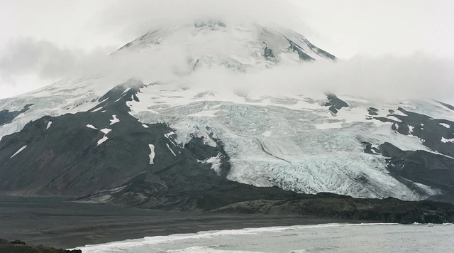
AI illustration
 Written and edited by
 On page 43 of its evaluation of nomination 1174, ICOMOS records that Colombia proposed the rock art of La Lindosa to the World Heritage Committee “in an effort to prevent visitors from entering Chiribiquete and its buffer zone”. Seven pages earlier the same report notes that Chiribiquete’s shelters are visited today by people living in voluntary isolation who probably still paint their walls. The famous rock art is not open, and the photographs that circulate under its name were almost all taken somewhere else.
Silence Index — D-169
Effectively unvisited
Ranks 16 of 99 scored dossiers — quieter than 85% of the others we have scored. A low score is not a warning; it describes who else will be standing next to you.
How the total is weighted. These are the fixed weights of the four inputs, the same on every dossier — not this place’s scores. We do not publish per-input bars, because the per-input values were never recorded article by article and inventing four plausible numbers that sum to the total would be a fabrication dressed as a chart.
This dossier was scored before 2 September 2026, when the fourth input became night darkness. It keeps the input it was reasoned with until it is re-scored at its next source re-check; the methodology page records the change.
The index is a desk instrument scored by this publication, not a field measurement. How it is calculated, and where it fails.
What this dossier is built from
Nobody from this publication has been to Chiribiquete. Nobody from this publication could go: there is no lawful visitor route into the property, and we say so at the outset because the rest of this piece depends on it being true.
What follows is built around a single document. In March 2018 the International Council on Monuments and Sites, the advisory body that evaluates cultural nominations for the World Heritage Committee, filed its report on nomination 1174, Chiribiquete National Park — "The Maloca of the Jaguar". It runs to a few dozen pages of the flattest institutional prose imaginable. It is also, read carefully, a record of a substitution. We have walked through it paragraph by paragraph and checked each of its claims against Colombia's own resolutions, the parallel IUCN evaluation, the State Party's 2023 periodic report, the park service's current public pages, and the itineraries of the operators licensed to sell the only aerial access that has ever existed.
An evaluation report is written to be read against a claim. This one quietly documents something the claim does not mention.
Page 36: the count, and the sentence underneath it
The brief description opens with arithmetic. "75,234 paintings have been identified on the walls of 60 rock shelters at the foot of tepuis." The scenes are of hunting, battles, dances and ceremonies involving shamans, linked, in the report's careful phrasing, to a "purported jaguar cult" in which the animal is a symbol of power and fertility. That is where the park's subtitle comes from.
Then comes the sentence that reframes everything above it. Chiribiquete, the report states, "is today visited by voluntarily isolated indigenous groups who probably still paint the shelter walls." The evidence given is specific and recent: the scientific expeditions of 2015 and 2016 found very recent cave paintings, ritual burners and human footprints, clearly of indigenous origin.
Sit with what that does to the category. A rock art site is normally an archaeological object — finished, closed, datable, available for study. The document is saying that this one may not be. Some part of that 75,234 may not be a record of a practice. It may be the practice. The Committee's own statement of Outstanding Universal Value adopts the point, citing "the chronological depth and persistence up to the present-day of the purported frequentation of the sites by isolated communities."
Everything else in the file follows from that, including the closure. If people are still painting those walls, then the walls are not a monument with a visitor problem. They are somebody's occupied territory with a visitor problem, and the two are governed by entirely different law.
Page 41: the aircraft rented at Villavicencio
Under factors affecting the property, ICOMOS lists the ordinary catalogue of Amazonian pressure: conversion of forest to pasture for extensive cattle rearing, illegal alluvial mining, coca growing, subsistence agriculture, hydrocarbon exploration, mining permits, and a projected stretch of the Marginal de la Selva trunk road. Almost all of it sits in or near the buffer zone.
Then one line about people. "Tourists occasionally visit the protected area without official authorisation, either by air (aircraft or helicopters rented at Villavicencio and San José del Guaviare) or by river."
Note what that sentence assumes. It assumes a reader who might not know that unauthorised visitors were already arriving in 2017, by charter, from two named cities, before any inscription existed to attract them. It is recorded once, without emphasis, and never returned to. The IUCN evaluation running alongside it is blunter about the stakes: tourism and scientific expeditions both threaten groups in voluntary isolation, and "any contact of any kind to these people will represent a violation of their rights." IUCN adds the practical horror underneath the legal one, the transmission of pathogens, noting that there are many examples of indigenous peoples that have almost disappeared that way.
Page 43: the substitution, in the file
The management section gives the position in nine words. "Tourism, including eco-tourism, is not currently authorised inside the property." Permitted activity inside the boundary is protection, research and monitoring. Nothing else.
The next sentence is the one this dossier exists for. "As part of its tourism strategy, the State Party has proposed the site of La Lindosa in the north, in an effort to prevent visitors from entering Chiribiquete and its buffer zone."
That is not a travel writer's inference. It is the State Party's declared strategy, recorded by an advisory body in a report to an intergovernmental committee. Colombia told UNESCO, in writing, that it was developing a different rock art site as a decoy.
The decoy is real, and good, and legally distinct. On 30 May 2018 the Colombian Institute of Anthropology and History declared the Serranía de La Lindosa a protected archaeological area: 893 hectares across eight zones in the municipality of San José del Guaviare, including the veredas of Cerro Azul, Nuevo Tolima, Raudal del Guayabero, La Pizarra, Los Alpes, Las Brisas and El Tigre. ICANH describes La Lindosa as directly connected to Chiribiquete, and elsewhere, with disarming candour, as Chiribiquete's "zona amortiguadora y sitio de visita" — buffer zone and visiting place. At Cerro Azul alone, sixteen large painted panels carry thousands of images, mostly in red ochre; a 2024 study in the journal Arts catalogued 3,223 motifs across just six of them.
What popular coverage gets wrong
The version in circulation runs roughly as follows. Chiribiquete is the Sistine Chapel of the Amazon. It holds 75,000 ancient paintings, some twenty thousand years old. You can see them on a flyover, or on a guided trip out of San José del Guaviare.
Three of those four claims fail against the record, and the fourth is contested by ICOMOS itself.
Take the photographs first, because they do most of the work. The rock art images that accompany almost every popular account of Chiribiquete — the ochre handprints, the running deer, the ranked human figures at arm's length from the lens — are overwhelmingly from Cerro Azul and the other La Lindosa panels. They have to be. La Lindosa is reachable by road and river from San José del Guaviare; Chiribiquete's shelters are not reachable at all. Colombia's own national tourism portal demonstrates the conflation cleanly: its San José del Guaviare page tells the reader that "it is estimated that there are over 75,000 rock images", the Chiribiquete figure, and then, a few lines later, "to see paintings that are twelve thousand years old, visit the Cerro Azul." The first number belongs to a closed park. The second invitation belongs to a different massif.
Licensed operators do the same thing more honestly, because they have to itemise it. One authorised operator's three-day Chiribiquete package pairs a minimum two-hour Cessna overflight with ground visits to the pictographs of Nuevo Tolima and the Ciudad de Piedra at La Lindosa. The flight sells landforms: Cerro Campana, Cerro del Castillo, the Pozo Rojo waterfall, the Río Cuñare, the giant pothole called El Estadio. The rock art in the brochure is La Lindosa's rock art. The product is the substitution, sold as a single week.
On the age claim, ICOMOS is the sceptic. The nomination rested a great deal on a date of around 20,000 BCE from the shelter called Abrigo del Arco II. The evaluation replies that "doubt may surround this single dating, particularly in view of the risks of disturbance of the archaeological context", that the date "still needs to be confirmed by other datings", and that "the chronological attribution of the paintings and the assertion of a continuous cave art sequence have not been satisfactorily demonstrated." At La Lindosa, meanwhile, direct dating of the painted images has not succeeded at all; the ages that circulate there come from ochre and painted fragments in excavated deposits, running from about 11,540 years before present to roughly five centuries ago.
The overflight, and the honest limit of this argument
We flagged one risk before we started: that access policy might have moved since 2018 and made the closure less absolute than the evaluation implies. It did move, and the argument narrows accordingly.
On 28 December 2018, five months after inscription, Parques Nacionales issued Resolución 0544, "por la cual se reglamentan los sobrevuelos para el disfrute de escenarios paisajísticos" — regulating overflights for the enjoyment of scenic landscapes. Resolución 0154 of 28 May 2019 repealed and replaced it. Twenty operators were listed in March 2019; the park's own page later carried eighteen. Flights left from the Jorge Enrique González airport at San José del Guaviare between 8am and 3pm, two a week, in January, Holy Week, June, July, October and December, along a single approved corridor, for a maximum of three hours. Aircraft were capped at 5,700 kg and twelve passengers. Helicopters were excluded. Minimum altitude was 2,200 feet above the terrain. Satellite trackers were mandatory. Landing inside the protected area was prohibited except in emergency.
So: a lawful way to be above Chiribiquete has existed. That is a real qualification and we make it plainly. But three things keep it from touching the argument. Flights "bajo ninguna circunstancia podrán realizarse sobre la zona intangible" — under no circumstances over the intangible zone where isolated peoples are presumed to be, which is the zone the shelters sit in. Nobody has ever been permitted to land. And at 2,200 feet, over unbroken canopy, a painted overhang at the foot of a tepui is not a visible object. The overflight was always a landscape product, and the resolution said so in its title.
As of 2026 it does not appear to be running. The park service's current page for Serranía de Chiribiquete lists the site's status as Cerrado and states that "el parque no tiene vocación ecoturística y no se promueve su visita" — the park has no ecotourism vocation and its visitation is not promoted. Overflights are not mentioned on it at all; the pages describing them survive only on the archived portal. One licensed operator's current itinerary document states outright that the park is closed to overflights with no reopening date announced. We could not find a resolution suspending them, and we do not claim one exists.
What the evaluators could not check
The file is unusually frank about its own limits, which is the quality that makes it worth reading closely.
- The archaeological investigations cover roughly 10% to 15% of the nominated property. The other 85% or so is inference.
- Some rock art sites "have only been studied by aerial survey, because of access difficulties." ICOMOS observes that it is necessary to know whether the sites inspected by helicopter have subsequently been studied on the ground, and does not report an answer.
- "ICOMOS considers that the photographic documentation, as it stands, is inadequate as a rock art inventory."
- The count itself has moved fast. Between 2004 and 2018 the documented shelters rose from 43 to 60 and the paintings from about 20,000 to 75,234. Colombia's own executive summary of the nomination, filed in the same cycle, says "over 50 rocky shelters" and "over 70,000 pictograms". ICANH's own announcement says more than 50 panels and approximately 70,000 paintings. We print all three and name all three; the precise 75,234 is ICOMOS's figure and the one the Committee adopted.
- The 2004 evaluation round is its own small comedy of access. IUCN records that a field mission was not possible for security reasons, and that a later mission did not visit the park but only carried out an overflight by helicopter.
A World Heritage site was inscribed for 75,234 objects, most of which the evaluators had not seen, in a property they could not enter, on the strength of photographs they described as an inadequate inventory. This is not a scandal. It is what evaluating a genuinely closed place looks like, and the report's willingness to write it down is the reason we trust the rest of it.
The prediction the document made about itself
Near the end of the evaluation ICOMOS sets down a conditional. "If the inscription of the nominated property gave rise to an increase in tourist numbers, negative collateral effects would be possible for non-contacted indigenous groups."
Colombia's own periodic report to UNESCO, filed in the third reporting cycle in 2023, answers it. There is no tourism allowed inside the property and it is important to strictly control any tourism access; annual visitors, zero; Chiribiquete is not open to tourism. And then: after World Heritage inscription, illegal tourism increased, which is why Parques Nacionales issued Resolution 154 of 2019 with the national aeronautical authority to regulate overflights. The regulated overflight was not an opening. It was a response to people already flying.
The same report gives the resourcing. Chiribiquete has 39 workers where the minimum required is 118. The share of the national environmental budget going to Parques Nacionales fell from 16% to 8.7% in two years. ICOMOS had recorded a total management budget of US$157,480 for 2016 — on our own arithmetic, against the inscribed 2,782,354 hectares, about 5.7 US cents per hectare per year. Colombia lists illegal armed groups exercising territorial control by force and promoting deforestation as the first threat, and unregulated tourism after inscription as a significant threat to indigenous peoples in isolation, in that order.
The boundary that stopped four days short
One last piece of filing. The property was inscribed on 6 July 2018 at 2,782,354 hectares — the boundary set by Resolución 1038 of 21 August 2013. On 10 July 2018, four days later, Resolución 1256 enlarged the park to 4,268,095 hectares. ICANH puts the addition at 1,486,676 hectares; the difference between the two published totals is 1,485,741. We have not reconciled the 935-hectare gap and print both figures as published.
The consequence is durable. Colombia's largest national park is roughly 1.49 million hectares bigger than the World Heritage property inside it, and the map UNESCO publishes is the smaller one. Meanwhile the deforestation is not theoretical: the Monitoring of the Andean Amazon Project, working from IDEAM and University of Maryland data, put clearing inside the park at more than 6,000 hectares by early 2022 and over 7,100 hectares since the 2018 expansion, with 525 hectares in 2024–25 concentrated in the Camuya, El Palmar and northern sectors, driven by roads, cattle and coca.
Why the Silence Index is 88
Remoteness is close to maximal: sandstone tepuis in interfluvial Amazon forest, no roads to the shelters, rivers that do not go where the art is. Access friction is absolute in the strict sense — there is no permit a visitor can apply for, because visiting is not a category the management regime recognises. Even research entry requires coordination between the park service, ICANH and the Ministry of the Interior, under a decree of 17 July 2018 that establishes that isolated peoples "en ningún caso podrán ser intervenidos o despojados de sus territorios". Authorised visitor volume is zero and has always been zero.
The fourth input we weigh here is unresolved questions, and they are unusually heavy: 85% of the property unsurveyed, a keystone date the evaluators declined to accept, an inventory that has tripled in fourteen years, no state of conservation report ever submitted to the Committee in eight years of inscription, and an art tradition that may not have stopped. What holds the score off the ceiling is that a legal aerial corridor was drawn, twenty operators were licensed to sell it, and the file itself records charter aircraft arriving without authorisation from two named airports. A place with a published flight corridor and a documented trespass problem is not perfectly silent, however completely it is closed.
The reason the report is written the way it is
Read as a travel question, the file is disappointing: the most extraordinary rock art assemblage in the Americas, and no way in. Read as what it is, it is doing something more careful. The Committee's final recommendation to Colombia, paragraph 6(f) of Decision 42 COM 8B.12, asks the State Party to "strictly apply the preventive measures in place so as to prevent possible contact between non-indigenous local communities or other external agents and the members of isolated uncontacted communities". That is the operative sentence of the whole inscription. Everything else — the count, the criteria, the buffer zone, the decoy at La Lindosa — is machinery built to make it hold.
Which leaves the finding on page 36 sitting where it started, and it is worth stating one final time in plain words. If people living in voluntary isolation are still visiting those shelters and still marking them, then Chiribiquete's paintings are not a closed archive awaiting the right permit. They are a living thing belonging to people who have chosen not to meet us, and the correct response to a living thing that has declined an introduction is to leave it alone. Colombia built an alternative destination and told UNESCO exactly why. The most useful thing any of us can do with that information is take the substitution seriously and go to the other place.
Corner Codex — D-169
- Place
- Serranía de Chiribiquete, Caquetá and Guaviare departments, Colombia
- Coordinates on the inscription
- N0° 31' 31", W72° 47' 50" — a centroid, not a site
- Inscribed
- 6 July 2018, criteria (iii), (ix) and (x); nomination file 1174
- Inscribed area
- 2,782,354 ha — the 2013 park boundary, not the current one
- Buffer zone
- 3,989,682.82 ha, almost entirely indigenous reserve and forest reserve
- Park area today
- 4,268,095 ha, after Resolución 1256 of 10 July 2018
- Rock art on the record
- 75,234 paintings on 60 rock shelters at the foot of tepuis
- The same count in 2004
- About 20,000 paintings on 43 sites
- Archaeologically investigated
- Roughly 10% to 15% of the nominated property
- Tourism
- Not authorised inside the property. Park status today: Cerrado
- Overflights
- Regulated 2018, re-regulated 2019, not currently offered
- What is offered instead
- La Lindosa, 893 ha of protected archaeology near San José del Guaviare
- Silence Index
- 88 / 100
The Traveler's Panel · checked
Changing information. Prices, permits, seasons and road access change, sometimes at short notice. Everything here is a starting point for your own confirmation — not a quote, and not a guarantee. Verify with the operator and the relevant official body before you book.
| Can you visit? | No. Tourism, including eco-tourism, is not authorised inside the property |
| Official status | Cerrado. 'El parque no tiene vocación ecoturística y no se promueve su visita' |
| Authorised visitors in 2023 | Zero, per Colombia's own periodic report to UNESCO |
| Overflights | Regulated 2018 and 2019; a single corridor at 2,200 ft; not currently offered |
| Landing | Prohibited inside the protected area except in emergency |
| The intangible zone | No overflight of it under any circumstance. The shelters lie within it |
| Where the photographs come from | Cerro Azul and the La Lindosa panels, 893 ha near San José del Guaviare |
| Why | Colombia told UNESCO it developed La Lindosa to keep visitors out of Chiribiquete |
Getting there — There is no gateway. The nearest lawful destination is San José del Guaviare, and it is a different archaeological site
- This entry describes permit machinery, not a route, because there is no route. Chiribiquete is not a place with difficult access. It is a place where visiting is not a category the management regime recognises: the permitted activities inside the boundary are protection, research and monitoring, and nothing else.
- Even scientific and academic entry is not a single application. The park service's own page states that it must be coordinated between Parques Nacionales Naturales de Colombia, the Colombian Institute of Anthropology and History, and the Ministry of the Interior — the last of these because of Decreto 1232 of 17 July 2018, which governs prevention and protection for indigenous peoples in isolation and provides that they may in no case be intervened upon or dispossessed of their territories.
- The one aerial regime that has existed is documented and narrow. Resolución 0544 of 28 December 2018, replaced by Resolución 0154 of 28 May 2019, permitted scenic overflights from the Jorge Enrique González airport at San José del Guaviare between 8am and 3pm, two a week, in January, Holy Week, June, July, October and December, along one approved corridor, for up to three hours, in aircraft of no more than 5,700 kg and twelve passengers, with satellite tracking, at no less than 2,200 feet above the terrain. Helicopters were excluded. Landing inside the protected area was prohibited.
- The regime's most important clause is the exclusion. Overflights may under no circumstance be made over the intangible zone, the area where people living in voluntary isolation are presumed to be — which is the part of the property the rock shelters are in. The flight was sold on tepuis, waterfalls and rivers, and its founding resolution says so in its title: sobrevuelos para el disfrute de escenarios paisajísticos.
- None of this appears to be available in 2026. The park service's current official page carries no overflight offer and gives the park's status as closed; the surviving overflight pages are on the archived portal. A licensed operator's own current itinerary document states that the park is closed to overflights with no reopening date announced. Anyone told otherwise should ask to see the resolution and the operator's REPSE registration before money changes hands.
- The honest instruction is the simple one. If you want to stand in front of Amazonian rock art in Colombia, go to the Serranía de La Lindosa near San José del Guaviare, which is protected, staffed, guided, lawful, and extraordinary, and which the Colombian state developed for exactly this purpose. Do not charter an aircraft to look at the other place.
Indicative costs — verify before booking
| What it costs to visit Chiribiquete | Nobody should be pricing this. There is no lawful way in for a visitor, and the reason is the protection of people who have declined contact |
| The overflight, when it ran | COP$3,890,000 for a three-day, two-night package from San José del Guaviare with a minimum two-hour Cessna flight, per one authorised operator's own document. Not currently on offer |
| What that price actually bought | Landforms. Cerro Campana, Cerro del Castillo, the Pozo Rojo waterfall, the Río Cuñare and El Estadio. The rock art in the same package was La Lindosa's, on the ground |
| La Lindosa | Guided access to the protected archaeological area is arranged locally at San José del Guaviare. We have not found an official published tariff and will not quote operator prices |
| What the state spends | US$157,480 on managing the property in 2016, per ICOMOS — about 5.7 US cents a hectare on our own arithmetic. 39 staff against a stated minimum of 118, per the 2023 periodic report |
What to pack
- Nothing, for Chiribiquete. This is not a coy answer. There is no packing list for a place you cannot lawfully enter, and producing one would be the first step in pretending otherwise.
- For La Lindosa, the ordinary equatorial lowland kit: heat, humidity, sun, biting insects, sudden rain, and rock scrambles that are slick when wet.
- A long lens and the discipline to use it. The panels at Cerro Azul are large, high and fragile, and the correct distance from a painted surface is further away than feels natural.
- Cash. Guaviare's tourism economy is small, local and largely uncarded, and the guiding is done by people who live there.
- Scepticism about any itinerary that promises Chiribiquete's rock art. Ask which serranía, which vereda, and under whose resolution.
Where to stay
There is nowhere to stay in Chiribiquete, and that is a legal fact rather than an infrastructural one — no lodge, no ranger station open to guests, no permitted camp, no concession. The practical base for everything discussed here is San José del Guaviare, the departmental seat of about 52,800 people at 2.568°N, 72.640°W, which has the airport every authorised overflight departed from, the hotel stock the operators' packages use, and the road and river access to the eight protected zones of the Serranía de La Lindosa. It is also, and this is the whole point of the dossier, the town where the substitution physically happens: visitors arrive intending Chiribiquete, are told that Chiribiquete is closed, and are taken to Cerro Azul and the Ciudad de Piedra instead, which is exactly what Colombia told UNESCO it had built the place to do. The other municipalities the park service lists as containing the park — Calamar and Miraflores in Guaviare, Solano, San Vicente del Caguán and Cartagena del Chairá in Caquetá — are working frontier towns with no visitor provision for the park and, in several cases, a serious armed-group presence that Colombia itself names as the property's leading threat.
Safety & responsible travel
- Do not attempt to enter the property, and do not charter an aircraft or a boat to approach it. The ICOMOS evaluation records that this already happens, from Villavicencio and San José del Guaviare. It is unlawful, and the risk it creates is not to you.
- Do not treat the closure as an obstacle with a workaround. IUCN's evaluation states that any contact of any kind with the peoples living in isolation would violate their rights, and records pathogen transmission as the mechanism by which indigenous peoples have almost disappeared elsewhere. Decision 42 COM 8B.12 asks Colombia to prevent precisely that contact.
- Do not speculate publicly about who these communities are, where they are, or how many. The primary record does not say, and a reason it does not say is that publishing it would be dangerous.
- Caption honestly. If your photograph is from Cerro Azul or another La Lindosa panel, say so. The mislabelling of these images is the single largest reason the public believes Chiribiquete is open, and correcting it costs a caption.
- Spend the money in Guaviare rather than in Bogotá. La Lindosa exists as a visitable site partly so that a local tourism economy has something lawful to sell, and that only works if visitors actually go and actually pay guides.
- If you care about the property itself, the useful pressure is unglamorous: deforestation inside the park has exceeded 7,100 hectares since 2018, driven by roads, cattle and coca, while the park service's budget share fell from 16% to 8.7% in two years.
Nearby, and quieter
The honest answer to 'what else is there' is that Guaviare is the answer, and it is a good one. The Serranía de La Lindosa's protected archaeological area covers 893 hectares across eight zones, and at Cerro Azul alone sixteen large painted panels hold thousands of images in red ochre; a 2024 study in the journal Arts catalogued 3,223 motifs across six panels. The Raudal del Guayabero, on the river at roughly 2°36'38"N, 72°48'9"W, carries its own painted rock and is one of the eight declared zones. The Ciudad de Piedra is a sandstone labyrinth of the same formation. All of this is genuinely of the same cultural world as Chiribiquete — ICANH says La Lindosa is directly connected to it, and the Chiribiquete boundary lies less than 100 kilometres to the south — and all of it is open, guided and lawful. Further afield, the departmental capitals of Meta and Caquetá are the transit points; Villavicencio, at 4.132°N, 73.626°W, is the larger of the two and the other city the ICOMOS evaluation names as a source of charter aircraft flown into the park without authorisation, which is a reason to know its name rather than a suggestion.
Getting there, in order
- 1Serranía de Chiribiquete (inscription centroid)
- 2San José del Guaviare
- 3Río Guayabero at San José del Guaviare
- 4Guayabero La Carpa
Each leg is a separate booking and a separate chance to be weathered out. Build spare days into the chain, not onto the end of it.
Where it is
Serranía de Chiribiquete, Caquetá and Guaviare, Colombia · 0.5253°N 72.7972°W · Open in Google Maps · OpenStreetMap
Key locations
- Serranía de Chiribiquete (inscription centroid) — the coordinate UNESCO publishes for property 1174; a centroid, not a site
0.5253°N 72.7972°W - San José del Guaviare — departure airport for every authorised overflight; base for La Lindosa
2.5680°N 72.6397°W - Río Guayabero at San José del Guaviare — verified waypoint for the La Lindosa area; Raudal del Guayabero is one of the eight declared zones
2.6106°N 72.8025°W - Guayabero La Carpa — settlement on the Guayabero west of San José del Guaviare
2.4569°N 72.9625°W - Calamar, Guaviare — one of six municipalities the park service lists as containing the park
1.9596°N 72.6531°W - Miraflores, Guaviare — south-eastern park municipality; also holds the only Guaviare gazetteer entry named Cerro Azul, which is not the rock art site
1.3098°N 72.0419°W - Cartagena del Chairá, Caquetá — the western, Caquetá-side municipal seat
1.3347°N 74.8428°W - Villavicencio, Meta — named in the ICOMOS evaluation as a source of aircraft rented for unauthorised visits
4.1324°N 73.6256°W
Coordinates are for orientation and are accurate to roughly the width of the feature named, not to a doorway. Several of these points are inside protected areas or need a permit, a guide or a boat — read the access notes above before you plan a route to any of them.
Sources & further reading — checked
- UNESCO / ICOMOS — 'Chiribiquete National Park (Colombia) No 1174', Advisory Body Evaluation (March 2018). The spine of this dossier. 75,234 paintings on 60 rock shelters at the foot of tepuis (p.36); the site 'is today visited by voluntarily isolated indigenous groups who probably still paint the shelter walls', with recent paintings, ritual burners and human footprints found on the 2015 and 2016 expeditions (pp.36–37); unauthorised tourist arrivals by aircraft or helicopter rented at Villavicencio and San José del Guaviare, or by river (p.41); 'Tourism, including eco-tourism, is not currently authorised inside the property' and La Lindosa proposed 'in an effort to prevent visitors from entering Chiribiquete and its buffer zone' (p.43); archaeological investigation covering roughly 10–15% of the property; some sites studied only by aerial survey; photographic documentation 'inadequate as a rock art inventory'; doubt over the single c.20,000 BCE date from Abrigo del Arco II; the rise from 43 sites and c.20,000 paintings in 2004; a 2016 management budget of US$157,480; the joint ICOMOS/IUCN mission of 8–16 October 2017; and the warning that inscription-driven visitor growth could have negative collateral effects for non-contacted groups
- UNESCO World Heritage Centre — Decision 42 COM 8B.12, Chiribiquete National Park – 'The Maloca of the Jaguar' (Manama, 2018). Inscription under criteria (iii), (ix) and (x) at 2,782,354 ha; and the six lettered requests to Colombia, including 6(f), to 'strictly apply the preventive measures in place so as to prevent possible contact between non-indigenous local communities or other external agents and the members of isolated uncontacted communities'
- UNESCO World Heritage Centre — Chiribiquete National Park – 'The Maloca of the Jaguar', property 1174. The inscribed area of 2,782,354 ha with a 3,989,682.82 ha buffer zone; the coordinate N0°31'31" W72°47'50"; and the criterion (iii) statement citing 'the chronological depth and persistence up to the present-day of the purported frequentation of the sites by isolated communities', with no tourism permitted inside the property
- UNESCO World Heritage Centre — Chiribiquete, Documents. The complete documentary record for property 1174: nomination text, annexes, maps, management plan and executive summary (2018), both advisory body evaluations, the map of the inscribed property, Decision 42 COM 8B.12, and a single later item — Periodic Reporting Cycle 3, Section II (2023). No state of conservation report appears
- Government of Colombia / UNESCO — Periodic Reporting Cycle 3, Section II: Chiribiquete National Park (2023). The State Party's own answers: 'There is no tourism allowed inside the property'; zero annual visitors; that illegal tourism increased after World Heritage inscription, prompting Resolution 154 of 2019 with the national aeronautical authority to regulate overflights; 39 workers against a stated minimum of 118; the Parques Nacionales share of the environmental budget falling from 16% to 8.7% in two years; illegal armed groups promoting deforestation as the leading threat; and archaeological sites believed to be accessed even today by uncontacted groups
- UNESCO / IUCN — 'Chiribiquete National Park (Colombia)', Advisory Body Evaluation (2018). The natural-heritage half of the file: recommendation under criteria (ix) and (x) but not (viii); 2,939 recorded species including 1,801 vascular plants, 492 birds and 82 mammals; 'At present, there is no tourism allowed inside the property and it is important to strictly control any tourism access'; the statement that any contact of any kind with isolated peoples would violate their rights, and the risk of pathogen transmission; the 2013 expansion from 1.3 to 2.78 million ha; an estimated 3,485 people in the buffer zone; and the record that the 2004 evaluation round managed only a helicopter overflight rather than a site visit
- UNESCO World Heritage Centre — Chiribiquete, Maps. A single published map, 'Map of the Inscribed Property' (2018), carrying the 2,782,354 ha inscribed area and the 3,989,682.82 ha buffer — the smaller, 2013-derived boundary rather than the enlarged park
- UNESCO World Heritage Centre — Chiribiquete, Gallery. Twelve official images, credited chiefly to Jorge Mario Álvarez Arango with one to Steve Winter, including close-range rock art photographs alongside aerial views of tepuis and waterfalls — the small body of imagery that legitimately depicts the inscribed property
- UNESCO World Heritage Centre — Colombia, State Party documents. The comparison that makes the silence visible: Los Katíos, Cartagena, San Agustín and Qhapaq Ñan all carry runs of state of conservation reports, some to 2025, while Chiribiquete's only entry after 2018 is its inscription decision
- Colombia, nomination 1174 — Executive Summary of the nomination file (2017). The State Party's own summary: 2,782,354 ha, the largest protected area in Colombia; declaration in 1989 at about 1.3 million ha and expansion in August 2013; nomination under criteria (iii), (viii), (ix) and (x); a buffer zone composed entirely of indigenous reserves and the Amazon Forest Reserve; the Tunia, Apaporis, Luisa, Cuemaní, Tajisa and Yarí rivers; and a rock art count given as 'over 50 rocky shelters' with 'over 70,000 pictograms' — different from the ICOMOS figures
- Parques Nacionales Naturales de Colombia — Parque Nacional Natural Serranía de Chiribiquete (official park page, updated 1 July 2026). The current official position: park status 'Cerrado'; 'El parque no tiene vocación ecoturística y no se promueve su visita'; a total extension of 4,268,095 ha across Solano, San Vicente del Caguán, Cartagena del Chairá, Calamar, San José del Guaviare and Miraflores; activity limited to monitoring, knowledge generation and environmental authority; and academic entry requiring coordination with the park service, ICANH and the Interior Ministry. No mention of overflights
- Parques Nacionales Naturales de Colombia — Resolución 0544 of 28 December 2018, 'Por la cual se reglamentan los sobrevuelos para el disfrute de escenarios paisajísticos en el Parque Nacional Natural Serranía de Chiribiquete'. The first overflight regulation: scenic overflights only; minimum altitude 2,200 feet above the terrain; aircraft to 5,700 kg and twelve passengers, piston or turboprop, helicopters excluded; entry 8am–3pm from San José del Guaviare; satellite tracking mandatory; landing inside the protected area prohibited except in emergency; and flights that 'bajo ninguna circunstancia podrán realizarse sobre la zona intangible del área protegida'
- Parques Nacionales Naturales de Colombia — Marco normativo, Parque Nacional Natural Chiribiquete. The full legal chain: Acuerdo 0045 and Resolución 120 of 21 September 1989 declaring the park; Resolución 1038 of 21 August 2013 and Resolución 1256 of 10 July 2018 enlarging it; Resolución 0334 of 4 September 2018 adopting the management plan; Resolución 0544 of 28 December 2018 regulating overflights; and Resolución 0154 of 28 May 2019 repealing 0544 and modifying the overflight rules
- Parques Nacionales Naturales de Colombia — 'Sobrevuelos', PNN Serranía de Chiribiquete (archived portal). The operating rules as published: eighteen authorised operators; flights in January, Semana Santa, June, July, October and December; two per week; a maximum of three hours; a single defined and approved corridor; departure and landing at the Jorge Enrique González airport in San José del Guaviare; and Resolución 154 of 28 May 2019 as the governing instrument, agreed with AEROCIVIL, the Colombian Air Force and cultural authorities
- Parques Nacionales Naturales de Colombia — 'Definidos operadores turísticos autorizados para ofrecer sobrevuelos en el Parque Nacional Natural Serranía de Chiribiquete' (18 March 2019). The list of twenty operators agreed at an informational meeting of 11 March 2019 — including Aviatur, Colombia Oculta, Destino Guaviare, Ecoglobal Expeditions, Nukak Travel and Metropolitan Touring — with flights to begin in June and only in the months set by the park service
- Parques Nacionales Naturales de Colombia — 'Proyecto de Resolución: reglamentación de los sobrevuelos… en el Parque Nacional Natural Serranía de Chiribiquete', public consultation (2 October 2018). The fifteen-day comment window closing 16 October 2018 on the draft overflight resolution, establishing that the rule was drafted within three months of inscription; the page itself carries no justification text, which sits in annexed technical documents
- Ministerio de Ambiente y Desarrollo Sostenible (Colombia) — 'Gobierno Nacional anuncia el inicio de los primeros sobrevuelos en el Parque Nacional Natural Serranía de Chiribiquete' (7 June 2019). The ministry's own announcement naming Resolución 154 of 28 May 2019; a single approved corridor, three hours maximum, two flights weekly, six operating periods a year, departing San José del Guaviare; Minister Ricardo Lozano and parks director Julia Miranda; and the stated purpose of guaranteeing protection of ecosystems and especially of indigenous peoples in voluntary isolation
- Ministerio de Relaciones Exteriores de Colombia (normograma) — Decreto 1232 de 2018, 17 July 2018. The protection regime for peoples in isolation: the definition of pueblos que 'en ejercicio de su autodeterminación, se mantienen en aislamiento y evitan contacto permanente o regular'; the principle of autodeterminación y no contacto; Article 2.5.2.2.4.6 that they 'en ningún caso podrán ser intervenidos o despojados de sus territorios'; entry permitted only in defined emergencies; and the national commission and local committees created to enforce it
- Instituto Colombiano de Antropología e Historia (ICANH) — 'La Lindosa, nueva Área arqueológica de Colombia'. The declaration of the Serranía de La Lindosa as a protected archaeological area covering 893 hectares across eight zones in San José del Guaviare — the veredas La Pizarra, Nuevo Tolima, Cerro Azul, Los Alpes, Raudal del Guayabero, Las Brisas and El Tigre de la Lindosa — with a management plan built on safeguarding, community participation and sustainable tourism, and the statement that La Lindosa 'está directamente conectada con Chiribiquete'
- Instituto Colombiano de Antropología e Historia (ICANH) — 'Chiribiquete se amplía a 4.268.095 hectáreas y es declarado como Patrimonio Mixto de la Humanidad por la Unesco'. Inscription on 6 July 2018 at the 42nd session in Manama; the park enlarged to 4,268,095 ha with 1,486,676 ha added; 'más de 50 paneles' and 'aproximadamente 70.000 pinturas'; and the explicit statement that ecotourism inside the park 'no está permitido de acuerdo con la zonificación actual', with tourism directed instead to the eight protected archaeological zones of La Lindosa
- Instituto Colombiano de Antropología e Historia (ICANH) — 'El ICANH promueve el valor cultural del Área arqueológica protegida La Lindosa en contextos internacionales'. ICANH describing Cerro Azul as 'una de las ocho zonas que hacen parte del AAP Serranía La Lindosa', and describing La Lindosa's function relative to Chiribiquete as buffer zone and visiting place — the substitution stated by the archaeological authority itself
- Hampson, Iriarte and Aceituno — 'A World of Knowledge: Rock Art, Ritual, and Indigenous Belief at Serranía De La Lindosa in the Colombian Amazon', Arts 13(4), article 135 (2024). Peer-reviewed and open access: sixteen large painted panels at Cerro Azul with thousands of images mostly in red ochre; 3,223 motifs catalogued across six analysed panels; hundreds of panels across the hill chains; ochre tablets dated to c.11.54 ka cal BP and painted fragments from c.10.28 ka cal BP to about 500 years ago, with direct dating of the parietal images not yet achieved; and the observation that uncontacted groups in Chiribiquete, whose boundary lies less than 100 km to the south, may still be creating rock art
- MAAP (Monitoring of the Andean Amazon Project) — MAAP #224, 'Illegal Deforestation in the Colombian Amazon – Chiribiquete National Park & Llanos del Yarí – Yaguará II Indigenous Reserve' (6 April 2025). 525 hectares cleared inside the park in 2024–25, concentrated in the Camuya (198 ha), El Palmar (179 ha) and northern (148 ha) sectors, and over 7,100 hectares since the 2018 expansion; drivers given as road infrastructure, extensive livestock farming, pasture expansion, land grabbing and coca; analysis built on IDEAM and University of Maryland / Global Forest Watch data
- MAAP (Monitoring of the Andean Amazon Project) — MAAP #152, 'Major Deforestation Continues in Chiribiquete National Park (Colombian Amazon)' (15 March 2022). More than 2,000 hectares cleared across seven deforestation fronts within the park between September 2021 and February 2022, and more than 6,000 hectares since the 2018 expansion, concentrated in the western and northern sectors and associated with the Tunia–Ajaju and Cachicamo–Tunia roads
- ProColombia / Colombia Travel (official national tourism portal) — San José del Guaviare. The conflation in an official state channel: the page markets Cerro Azul in the Serranía La Lindosa, the Stone City, the Orion Door and Chiribiquete together, states that 'it is estimated that there are over 75,000 rock images' — the Chiribiquete figure — and then instructs the reader that 'to see paintings that are twelve thousand years old, visit the Cerro Azul'
- Ecoglobal Expeditions (operator listed as authorised by Parques Nacionales) — 'Sobrevuelo a la Serranía de Chiribiquete (Guaviare), 3 días', itinerary document. A licensed operator's own paperwork: COP$3,890,000 from San José del Guaviare for three days and two nights, with a minimum two-hour Cessna overflight from the Jorge E. González airport covering Cerro Campana, Cerro del Castillo, the Cascada de Pozo Rojo, the Río Cuñare and El Estadio, plus ground visits to the pictographs of Nuevo Tolima and the Ciudad de Piedra at La Lindosa — and the statement that the park is currently closed to overflights with no reopening date announced
- Colombia Oculta (operator listed as authorised by Parques Nacionales) — 'Sobrevuelo a la Serranía del Chiribiquete desde San José del Guaviare'. A one-day product: 6am muster at San José del Guaviare airport, a National Parks briefing, one hour of overflight, no landing and no ground access, with park entry fees and flight authorisation included, minimum two months' notice — and no claim anywhere that rock art is visible from the aircraft
- GeoNames gazetteer — San José del Guaviare, Guaviare, Colombia. The seat of the first-order administrative division at 2.56799°N, 72.63972°W, population 52,815 — the airport of departure for every authorised overflight and one of the two cities ICOMOS names as a source of unauthorised charters
- GeoNames gazetteer — Villavicencio, Meta, Colombia. Villavicencio at 4.13238°N, 73.62564°W, population 321,717 — the other city named in the ICOMOS evaluation as a place aircraft and helicopters are rented for unauthorised visits
- GeoNames gazetteer — Calamar, Guaviare, Colombia. Calamar at 1.959598°N, 72.653147°W, population 3,745 — one of the six municipalities the park service lists as containing the park, and distinct from the Calamar in Bolívar
- GeoNames gazetteer — Miraflores, Guaviare, Colombia. Miraflores at 1.309798°N, 72.041898°W, population 11,311 — the south-eastern municipality of the six, and also the location of the only Guaviare gazetteer entry named Cerro Azul, which is not the rock art site of that name
- GeoNames gazetteer — Cartagena del Chairá, Caquetá, Colombia. The municipal seat at 1°20'5"N, 74°50'34"W, population 7,586, with the wider municipality entry at 0°51'8"N, 74°36'21"W and population 28,678 — the western, Caquetá approach to the park
- GeoNames gazetteer — Guayabero, Guaviare and Meta, Colombia. The Río Guayabero entry nearest San José del Guaviare at 2°36'38"N, 72°48'9"W, used here as the verified waypoint for the La Lindosa area, together with Guayabero La Carpa at 2°27'25"N, 72°57'45"W
- GeoNames gazetteer — Cerro Azul entries, Colombia. The single Guaviare entry for Cerro Azul, GeoNames ID 3830387, is a hill in the municipality of Miraflores at 1°16'9"N, 72°36'37"W — roughly 150 km from the rock art site of the same name in San José del Guaviare municipality, which has no gazetteer entry. The basis for this dossier's refusal to publish a coordinate for Cerro Azul
Official and scientific bodies are the authority for safety, regulatory and scientific claims. Commercial operators are used only for practical detail such as tour length, meeting points and indicative pricing — never for a safety or scientific statement.
How this was made
Desk research. Compiled from official bodies, scientific and conservation sources, established journalism and licensed operators. Not based on a personal visit.
Editor’s method note — what we checked, corrected and could not verify
- Desk research only. Nobody from this publication has been to Chiribiquete or to La Lindosa, and nobody from this publication could lawfully have visited the property: tourism inside it is not authorised and the park service currently lists the site as closed.
- The dossier is deliberately built around one document — the ICOMOS advisory body evaluation of nomination 1174, filed in March 2018 — and every claim taken from it has been checked against at least one other primary record: the parallel IUCN evaluation, the Committee's decision, Colombia's own executive summary and 2023 periodic report, the park service's resolutions, or ICANH's announcements.
- Every URL cited was opened and read before citation. Sources that could not be opened are listed at the end of this note and are cited nowhere in the piece.
- Quotations from the ICOMOS evaluation are reproduced as printed, with the page references the document carries: the 75,234 figure and the sentence on voluntarily isolated groups at pp.36–37, unauthorised air and river access at p.41, and the tourism and La Lindosa passages at p.43.
- Where the record disagrees with itself we print every figure and name its source. The rock art count is 75,234 paintings on 60 shelters in the ICOMOS evaluation and in the Committee's decision; 'over 70,000 pictograms' on 'over 50 rocky shelters' in Colombia's own executive summary of the nomination; and 'más de 50 paneles' with 'aproximadamente 70.000 pinturas' in ICANH's announcement. We do not average them and we do not silently prefer one.
- The same rule applies to the area arithmetic. ICANH states that 1,486,676 hectares were added by the 2018 expansion; the difference between the published inscribed area of 2,782,354 ha and the published park area of 4,268,095 ha is 1,485,741 ha. The 935-hectare gap is unreconciled and both figures are printed as published.
- On overflights, we flagged before starting that access policy might have moved since 2018, and it had. We therefore state the aerial regime in full rather than minimising it: Resolución 0544 of 28 December 2018, replaced by Resolución 0154 of 28 May 2019, with a single corridor, twenty then eighteen licensed operators, two flights a week in six named periods, a 2,200-foot floor, no landing, and an absolute prohibition on flying over the intangible zone.
- That overflights do not appear to be running in 2026 is stated as an inference from two documents and not as a legal fact: the park service's current official page carries no overflight offer and lists the park's status as Cerrado, and a licensed operator's own current itinerary states the park is closed to overflights with no reopening date announced. We could not locate any resolution suspending them and do not assert that one exists.
- The figure of about 5.7 US cents per hectare per year is our own arithmetic, dividing the US$157,480 management budget ICOMOS records for 2016 by the inscribed area of 2,782,354 hectares. It is labelled as our arithmetic in the body. It excludes the separately reported Visión Amazonía funding and is not a current figure.
- This dossier concerns people living in voluntary isolation. We have not named any group, speculated about their number, movements, language or identity, or reproduced any claim about them that the primary sources do not make. We have not published a coordinate for any rock shelter, and we do not publish one for Cerro Azul either: the only GeoNames entry of that name in Guaviare is a hill in Miraflores municipality, roughly 150 km from the rock art site, and we would rather print nothing than print the wrong hill.
- Sources we could not read, and therefore did not cite: the full State Party nomination text at whc.unesco.org/document/160558, which exceeded our fetch size limit and which we would otherwise have read against the evaluation as commissioned; the UNESCO state of conservation listing for property 1174, robots-disallowed; SUIN-Juriscol's record of the 2019 resolution, robots-disallowed; the Función Pública gestor normativo copy of Decreto 1232 de 2018, robots-disallowed, which is why the foreign ministry's normograma copy is cited instead; the Quaternary Science Reviews and Quaternary International papers on the peopling of La Lindosa, both robots-disallowed at ScienceDirect; and direct retrieval of UNESCO documents outside the browser, which our egress policy refused.
- Things we could not verify: whether the licensed overflights have been formally suspended or have simply lapsed, no instrument having been found either way; how many people have flown the corridor since June 2019, no figure being published by the park service or the aeronautical authority; how many unauthorised entries by air or river have occurred, the ICOMOS evaluation saying only that they happen; whether the rock art sites recorded by helicopter have since been examined on the ground, a question ICOMOS asked and we could not find answered; the date of the Abrigo del Arco II paintings, which ICOMOS declined to accept at around 20,000 BCE and which no confirming series has been published for; how much of the 75,234 total is recent work by people living in isolation, which no source estimates and which we will not estimate; annual visitor numbers at La Lindosa, no official Guaviare tourism series being available to us; whether any state of conservation report on Chiribiquete has been submitted to the Committee since 2018, none appearing in the record; and the current management budget and staffing, the most recent figures we have being 2016 and 2023 respectively.
AI is used to draft this text, and a human checks it. Every figure, date and quotation above was verified by Tony Hall against the source cited for it in the reference list; where sources disagree, the disagreement is shown rather than resolved, and where a claim could not be confirmed it is either marked unverified or left out. The illustrations are AI-created and labelled as such — no photograph on this site is presented as a record of a real place. Full disclosure · Editorial policy.
Access details change — recheck before you travel. Found an error? Tell us — corrections are dated and shown in place.