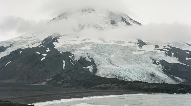
AI illustration
 Written and edited by
 Tritium in the deep water of Clipperton's lagoon measures 0.03 to 0.06 tritium units. Ocean surface water carries about 0.8. The difference means the water at the bottom of this lagoon has not touched the atmosphere since the coral ring closed over the last passes in the middle of the nineteenth century. It is dead seawater, sealed under a lid of rain, and it has not turned over since.
Silence Index — D-046
Effectively unvisited
Ranks 16 of 99 scored dossiers — quieter than 85% of the others we have scored. A low score is not a warning; it describes who else will be standing next to you.
How the total is weighted. These are the fixed weights of the four inputs, the same on every dossier — not this place’s scores. We do not publish per-input bars, because the per-input values were never recorded article by article and inventing four plausible numbers that sum to the total would be a fabrication dressed as a chart.
The index is a desk instrument scored by this publication, not a field measurement. How it is calculated, and where it fails.
This is a desk-researched dossier. Nobody from this publication has been to Clipperton, and going without written authorisation from a French government minister now carries a year in prison. It is built from Légifrance and the French Ministry for Overseas, the United Nations Reports of International Arbitral Awards, the French Senate's published questions and government replies, the public consultation record for the 2016 protection order, INSEE, the Ifremer archive, peer-reviewed oceanography and reef ecology, and the Key Biodiversity Areas database.
The atoll is a coral ring in open ocean, 1,080 kilometres south-west of Mexico and about 950 kilometres from the nearest land at Isla Socorro. Its emergent surface is 1.70 square kilometres and the whole feature, lagoon included, is about 8.9. The circumference is 11.8 kilometres. The only relief is Rocher Clipperton, a volcanic remnant 29 metres high on the south-eastern rim — the only rock, on an atoll otherwise made entirely of coral rubble and sand.
The closure, and what it did
Atolls normally have passes: gaps in the reef where water moves between lagoon and ocean on the tide. Clipperton had two. They closed, and the date is one of the few facts here where two published sources disagree.
The tritium study archived by Ifremer states that two entrances existed in 1839 and that by November 1858 the coral ring was continuous, most likely because storms threw sand and coral rubble across shallow openings. The Coral Reefs paper describing the lagoon's present state gives the closure as occurring between 1839 and 1849. We print both. What neither disputes is that the ring was closed by the middle of the nineteenth century and was still closed when it was resurveyed in 2005.
What that produced is a meromictic lake: one that is permanently stratified and never mixes from top to bottom. The mechanism is simple and depends entirely on latitude. Clipperton sits in a band where rainfall exceeds evaporation, so a lens of fresh water accumulates on the surface and stays there, too light to sink. Most closed atoll lagoons in drier latitudes do the opposite — they evaporate, concentrate and turn hypersaline.
The result is two water bodies stacked in one basin. The upper layer, from the surface to about ten metres, is brackish and oxygenated, with a salinity of about 5.4 measured in 2005 against 4.4 in 1980. Below roughly twenty metres the water carries near-oceanic salinity of about 34.0, is completely anoxic, and holds hydrogen sulphide. Between them sits a density gradient sharp enough to support a temperature inversion of up to 1.6°C — the deeper water warmer than the water above it, which cannot happen in a body that mixes.
How they know the deep water is old
Tritium is the tool, and it works because of the atmospheric nuclear tests of the 1950s and 1960s. Those tests loaded the atmosphere with tritium, which entered the surface ocean and has been decaying since with a half-life of about 12.3 years. Any water that has been in contact with the atmosphere in the last seventy years carries a measurable signature. Water that has not, does not.
Clipperton's surface layer measures 0.81 ± 0.03 TU and is well mixed and homogeneous — normal modern rainwater. At twenty metres the reading falls to 0.06 ± 0.05 TU, and at twenty-five metres to 0.03 ± 0.05 TU. That is indistinguishable from zero. An intermediate sample at twenty metres in a different part of the lagoon gave 0.26, which is the fingerprint of local mixing rather than of ventilation.
The conclusion the authors draw is that the deep layer is a remnant of the ocean water that was in the lagoon when it closed, and that it has been effectively isolated since — roughly a century and a half of no contact with the air above it.
That raises the obvious question of how it stays there. Sealed water bodies do leak, and a coral atoll rim is porous limestone, not concrete. The paper models the exchange three ways. Vertical diffusion alone gives coefficients of 2.5 to 5.0 × 10⁻⁹ square metres per second. Sinking plumes of denser water are compatible with the observed salinity and isotope pattern. Horizontal exchange through the limestone, modelled with Darcy's law and a hydraulic conductivity that falls from about 180 metres a day at the surface to 0.6 metres a day at twenty metres depth, gives ventilation times of the order of 2,000 years for one deep basin and 10,000 for another.
Those are wide bounds and the authors do not pretend otherwise. The honest summary is that the tritium says the deep water is old, the salt-expulsion model says the rim is leakier than the tritium alone would suggest, and nobody has reconciled the two. That disagreement is the most interesting open question about this lagoon and it is not close to settled.
One further finding is worth stating because it cuts against the expectation of a system in flux. Comparing the 2005 survey with the previous French expedition in 1980, the physical structure of the lagoon had not changed significantly across twenty-five years. The phytoplankton community had changed considerably. The plumbing is stable; the biology is not.
What popular coverage gets wrong
Almost every reference work, atlas and travel page still says that Clipperton is administered by the High Commissioner of the Republic in French Polynesia. It has not been for nearly twenty years, and the current position is not a technicality — it determines whether landing on the atoll is a formality or a criminal offence.
The sequence, from Légifrance and INSEE, is this. A law of 21 February 2007 detached the island from French Polynesia and placed it under the direct authority of the Government; INSEE assigned it its own territorial code, 98-9, effective 23 February 2007. Then a law of 21 February 2022 inserted a new Title II into the 1955 statute that had governed it alongside the French Southern and Antarctic Lands. Under those articles the island may also be called La Passion-Clipperton; the Minister for Overseas administers it directly, exercising all administrative functions, maintaining public order, protecting the ecological balance and issuing regulations; a consultative council assists, its composition set by a decree of 13 December 2023.
And, most consequentially: no landing, mooring or activity is permitted without ministerial authorisation, except in an emergency involving human life or the safety of a vessel or aircraft. Unauthorised access carries one year of imprisonment and a €300,000 fine, with possible confiscation of the vessel or aircraft used. The ministry's own page adds that a decree of November 2025 sets out the documentation now required for mooring, landing and stay permits.
The second thing routinely garbled is the sovereignty history. The popular version has France winning Clipperton in 1931 because Mexico abandoned it. The award reasons the other way round. Mexico and France signed a compromis in Mexico City on 2 March 1909 and referred the dispute to Victor Emmanuel III, King of Italy, who issued his award on 28 January 1931. He found that the island was territorium nullius when Lieutenant Victor Le Coat de Kerwéguen proclaimed French sovereignty on 17 November 1858 from the merchant vessel L'Amiral, because Mexico had never actually exercised sovereignty there despite its historical assertions; that the French declaration was a clear and precise manifestation of intent; and that for genuinely uninhabited territory, occupation is complete once the claiming state has the place at its disposal, without a requirement of settlement. France had therefore held sovereignty since 1858 and had not subsequently lost it by abandonment.
A small discrepancy inside the French record is worth flagging. The arbitral award names Lieutenant Le Coat de Kerwéguen as the officer who made the 1858 proclamation; the Ministry for Overseas page attributes the act to Admiral Baudin. We follow the award, which is the adjudicated document, and note the ministry's version rather than quietly dropping it.
The third error is about the lagoon itself, and it has been repeated on the floor of the French National Assembly. A written question tabled in January 2019 described Clipperton as holding the only freshwater lagoon in the world. It is not fresh — the surface layer measured 5.4 in salinity in 2005, which is brackish, and everything below twenty metres is at full ocean strength. Nor is it unique; meromictic lakes exist in many settings. What is genuinely unusual is the combination: a marine basin sealed by coral, capped by rain because of where it sits in the rainfall belt, holding relict seawater underneath. That is a better fact than the wrong one it gets replaced by.
The protection that exists on paper
In late 2016 France put the territorial waters of Clipperton under an arrêté de protection de biotope, consulted on publicly between 20 October and 10 November that year and made by decree on 23 November. It covers 1,611 square kilometres within twelve nautical miles, names 27 species of fish and corals, and prohibits the abandonment or deposit of waste of any kind, anchoring, beaching, diving and the extraction or prospecting of minerals. Fishing was prohibited from January 2017. In December 2025 the area was raised to strong protection zone status.
What that protection amounts to in practice was set out with unusual candour in a French government reply to a Senate question in 2024. Because of the island's administrative status, the marine protected area has neither a management plan nor dedicated funding. Enforcement is a French Navy patrol of the roughly 400,000-square-kilometre exclusive economic zone at least once a year, plus remote monitoring — the Maritime Information Fusion Centre in French Polynesia ran 172 radiometric analyses in 2023 looking for unlicensed vessels. In 2023 and 2024, fifteen licensed Mexican fishing vessels worked the EEZ for a combined 89 fishing days; three were approached in 2023 and two physically inspected in 2024. A bird protection charity was given €30,000 for a feasibility study on eradicating rodents.
The Ministry for Overseas gives the EEZ as 436,000 square kilometres; the government's Senate reply says approximately 400,000; a deputy's question in the National Assembly used 440,000. All three are French official or parliamentary figures, which is a reasonable indication of how much attention this territory receives.
A more recent exchange shows what the protection is up against. In January 2026 a deputy asked the government about the atoll's ecological condition, and the Ministry for Overseas replied in March. Its answer confirmed that Clipperton holds the largest masked booby colony in the world, that rats introduced by shipwrecks in the late 1990s and early 2000s have driven ecosystem collapse, that the crab population — the animal that regulates the vegetation — has crashed, and that the conservation status of the atoll's birds is unfavourable. The bird protection league's feasibility mission went out in November 2025 and its recommendations were still under examination. No timetable for a decision on eradicating the rats was given.
What lives there
The atoll is a globally recognised Key Biodiversity Area, identified in 2012 under criteria B1 and D1a, over 8.81 square kilometres running from sea level to 29 metres. Its trigger species are seabirds: masked boobies, brown boobies and sooty terns.
The seabird history is a cautionary one, and it has now run twice. By 1958 feral pigs had reduced the colony to about 150 masked boobies and 500 brown boobies. The pigs were removed that year and the boobies recovered so completely that the French government now describes Clipperton as holding the largest masked booby colony in the world. Then rats arrived — black and Polynesian — carried in on shipwrecks in the late 1990s and early 2000s, and the colony is in trouble again. The Key Biodiversity Areas assessment names invasive species as the greatest threat to seabirds globally, with predation and structural change to large-bodied colonies the specific risks here, and the database records only 0.34% of the site as covered by protected areas, because the 2016 order covers the sea and not the land.
There is a plastic problem on top of that. Researchers from the Tara Pacific expedition recorded masked boobies building nests out of plastic debris, and the French government's own response to a 2019 parliamentary question describes a pyrotechnic decontamination mission run between 2016 and 2018 to deal with Second World War munitions, combined with beach cleaning. Debris arrives on this atoll from a whole ocean and nobody lives there to pick it up.
The land vegetation is almost entirely introduced. A French government survey found fifteen plant species as of 2015, of which eleven — 73% — were introduced and four indigenous, with no endemics at all, and vegetation covering roughly 46.5% of the emergent land. Coconut palms, planted, are the tallest thing growing.
The sea is the opposite. A March 2016 expedition surveying from the surface to beyond 1,000 metres recorded 96 fish taxa from 41 families, including 15 new records for the atoll and 8 families not previously recorded there, and 4 of the 7 known endemic fish species. Live coral cover ran around 50% and fish biomass above 3 tonnes per hectare, which is high anywhere and remarkable for a single isolated reef. Clipperton holds the largest single coral reef in the tropical eastern Pacific, at about 3.7 square kilometres, and functions as a stepping stone for dispersal between Oceania and the Americas.
Why the Silence Index is 88
Access friction is close to maximal: no airstrip, no harbour, no anchorage inside a closed lagoon, around a thousand kilometres of open ocean from anywhere, and a legal regime under which arriving without a minister's signature is a criminal offence. Night darkness is total; there is no permanent light source on the atoll and nothing within hundreds of kilometres.
What keeps it out of the nineties is that this is not an unvisited place. Licensed foreign fishing vessels work the exclusive economic zone for weeks at a time. Yachts and scientific expeditions reach it. A French Navy ship comes at least annually. And the acoustic floor of a seabird colony on an exposed reef in permanent Pacific swell is not low. Clipperton is unpeopled rather than unfound.
The question underneath
The framing that makes Clipperton more than a curiosity is that reef rims are dynamic and passes close. Storms move rubble. Sea level rises and falls. On long enough timescales, other atoll lagoons will do what this one did, and whether they turn meromictic or hypersaline is decided by nothing more complicated than whether it rains more than it evaporates at that latitude.
Clipperton is the only well-studied example of a lagoon that has run the freshwater version of the experiment for a century and a half. Two published measurements twenty-five years apart show its physics essentially unchanged and its plankton community substantially different. That is a strange result to sit with: a system whose structure is stable and whose contents are not.
The thing we would most like published, and could not find, is a pH profile. The deep layer is anoxic and sulphidic, and divers who have been in it describe the water as corrosive to skin, but we found no measured acidity in any source we were able to open. For a lagoon whose whole interest is its chemistry, that is a conspicuous gap, and we would rather record it than fill it with a plausible number.
Corner Codex — D-046
- Place
- Île de la Passion-Clipperton, eastern Pacific, French state territory
- Coordinates
- 10.2833°N, 109.2167°W — 1,080 km south-west of Mexico
- Land area
- 1.70 km² emergent; about 8.9 km² including the lagoon
- Highest point
- Rocher Clipperton, 29 m — the only rock on the atoll
- Reef ring closed
- November 1858 by one account, 1839–1849 by another. It is still closed
- Surface layer
- 0–10 m, brackish, salinity about 5.4 in 2005 against 4.4 in 1980, oxygenated
- Deep layer
- Below about 20 m, salinity 34.0, anoxic, with hydrogen sulphide
- Tritium, deep layer
- 0.03–0.06 TU — relict seawater trapped at closure
- Modelled ventilation
- About 2,000 to 10,000 years through the limestone rim
- EEZ
- About 436,000 km², patrolled at least once a year
- Landing
- Ministerial authorisation required. One year in prison and €300,000 without it
- Silence Index
- 88 / 100
The Traveler's Panel · checked
Changing information. Prices, permits, seasons and road access change, sometimes at short notice. Everything here is a starting point for your own confirmation — not a quote, and not a guarantee. Verify with the operator and the relevant official body before you book.
| Can you land | Only with written authorisation from the French Minister for Overseas |
| If you do not | One year imprisonment and a €300,000 fine, plus possible confiscation of the vessel |
| Who governs it | The Minister for Overseas, directly. Not French Polynesia, since 2007 |
| The lagoon | Closed since the mid-nineteenth century. Fresh above, dead seawater below |
| Do not swim deep | Below about 20 m the lagoon is anoxic and carries hydrogen sulphide |
| Enforcement | At least one French Navy patrol of the EEZ a year, plus satellite monitoring |
Getting there — Acapulco or Isla Socorro → about 1,000 km of open Pacific by vessel → authorised landing only
- There is no airstrip, no harbour and no anchorage inside the lagoon, which has no pass. Everything arrives by sea and lands through surf on an exposed coral rim.
- Authorisation must be obtained in advance from the Minister for Overseas. A decree of November 2025 sets out the documentation required for mooring, landing and stay permits.
- The nearest land is Isla Socorro in Mexico's Revillagigedo group, about 950 km north-east. The nearest mainland port is on the Mexican Pacific coast, about 1,280 km away. The nearest French territory is the Marquesas, about 4,000 km south.
- The region averages about 3.9 tropical cyclones a year passing within 500 km, which is the main constraint on when a crossing is attempted.
- The only routine visitors are French Navy patrols and licensed foreign fishing vessels working the exclusive economic zone. Neither carries passengers.
Indicative costs — verify before booking
| Authorisation | Free to apply for; granted essentially only for scientific programmes |
| Landing without it | One year in prison and €300,000, under articles 13 to 15 of the 1955 statute |
| Getting there | Private or chartered vessel. There is no commercial route at any price |
| Marine protection | The 2016 biotope order has no management plan and no dedicated funding |
| Note | No operator sells trips here. Occasional yacht and amateur radio expeditions arrange their own permits |
What to pack
- Everything, including water. There is no fresh surface water fit to drink and no supply of any kind on the atoll.
- Full self-sufficiency in medical terms. The nearest help is a thousand kilometres away and the navy comes once a year.
- Biosecurity discipline. Rats are already established and are the named threat to the seabird colonies; adding anything else would be irreversible.
- Nothing that requires anchoring inside the lagoon. Anchoring and beaching are both prohibited under the 2016 protection order.
- Sun and salt protection at open-ocean intensity. The highest point on the atoll is 29 metres and there is no natural shade beyond planted coconut palms.
Where to stay
There is nowhere to stay. Clipperton has been uninhabited since the Mexican garrison was removed early in the twentieth century, has no building in use, no fresh water supply and no shelter, and the lagoon offers no anchorage because it has no entrance. Visiting expeditions camp on the rim or live aboard. The nearest inhabited land is Isla Socorro, about 950 kilometres away, which holds a small Mexican naval station; the nearest place with hotels is on the Mexican mainland, more than a thousand kilometres north-east. Anyone going is bringing a month of everything with them.
Safety & responsible travel
- Do not describe Clipperton as administered by French Polynesia. It has been under direct government authority since 2007 and under the Minister for Overseas since 2022, and the difference is the difference between a formality and a criminal record.
- Do not repeat the sovereignty story as France winning an abandoned island. The 1931 award found the island was territorium nullius in 1858 because Mexico had never exercised actual sovereignty there, and that France had not abandoned it since.
- Do not enter the deep layer of the lagoon. It is anoxic and sulphidic, and it is the only known body of relict nineteenth-century seawater of its kind.
- Take everything out. The 2016 order prohibits the abandonment or deposit of waste of any kind in the territorial waters, and the atoll's debris record is already substantial.
- Report any unlicensed fishing activity you observe. Enforcement is one navy patrol a year and satellite analysis, and the government has said publicly that there is no management plan and no dedicated funding.
Nearby, and quieter
Nothing is nearby in any useful sense. Isla Socorro and the Revillagigedo archipelago, about 950 kilometres north-east, are a Mexican biosphere reserve and UNESCO World Heritage site with their own strict access rules and are the closest comparable destination. The Mexican Pacific coast around Acapulco is the usual departure point. The Marquesas, about 4,000 kilometres south, are the nearest French territory, which is why Clipperton was administered from Papeete until 2007 and why so many sources still say it is. In oceanographic terms Clipperton's nearest relatives are the closed lagoons of other atolls, none of which has been studied on anything like the same timescale.
Getting there, in order
- 1Acapulco or Isla Socorro
- 2about 1,000 km of open Pacific by vessel
- 3authorised landing only
Each leg is a separate booking and a separate chance to be weathered out. Build spare days into the chain, not onto the end of it.
Where it is
Île de la Passion-Clipperton, eastern Pacific · 10.2833°N 109.2167°W · Open in Google Maps · OpenStreetMap
Key locations
- Île de la Passion-Clipperton — the atoll and its closed lagoon, 1.70 square kilometres of emergent coral
10.2833°N 109.2167°W - Isla Socorro, Mexico — the nearest land, about 950 km north-east, in the Revillagigedo archipelago
18.7948°N 110.9713°W - Acapulco de Juárez, Mexico — the usual mainland departure port, about 1,280 km from the atoll
16.8494°N 99.9089°W - Taiohae, Nuku Hiva — the nearest French settlement, about 4,000 km south in the Marquesas
8.9108°S 140.0997°W
Coordinates are for orientation and are accurate to roughly the width of the feature named, not to a doorway. Several of these points are inside protected areas or need a permit, a guide or a boat — read the access notes above before you plan a route to any of them.
Sources & further reading — checked
- Charpy et al. — Clipperton, a possible future for atoll lagoons, Coral Reefs 29 (2010). The reef rim closing between 1839 and 1849 and still closed in 2005; the oxygenated brackish upper layer at 0–10 m and the anoxic saline layer below 20 m; the temperature inversion of up to 1.6°C; the explicit classification of the lagoon as meromictic; the positive precipitation–evaporation budget as the cause; and the finding that physical characteristics had not changed significantly since 1980 while phytoplankton composition had
- Ifremer Archimer — Clipperton lagoon hydrology from tritium. Two entrances present in 1839 and a continuous coral ring by November 1858; surface tritium of 0.81 ± 0.03 TU against 0.06 ± 0.05 at −20 m and 0.03 ± 0.05 at −25 m; the identification of the deep layer as relict oceanic water isolated about 150 years ago; surface salinity of 5.4 ± 0.2 in 2005 against 4.4 ± 0.2 in 1980 and deep salinity of 34.0 ± 0.1; vertical diffusion coefficients of 2.5–5.0 × 10⁻⁹ m²/s; and the Darcy-law rim model giving ventilation times of about 2,000 to 10,000 years
- Légifrance — Loi n° 55-1052 du 6 août 1955, Titre II: Statut de l'Île de la Passion-Clipperton (articles 9 à 16). The operative statute: the alternative name La Passion-Clipperton (art. 9); administration by the Minister for Overseas exercising all administrative functions, public order and ecological protection (art. 11); the consultative council (art. 12); the requirement of ministerial authorisation for any landing, mooring or activity except in emergency (art. 13); and penalties of one year imprisonment and €300,000 with confiscation of vessel or aircraft (arts. 14–15)
- Légifrance — Loi n° 55-1052 du 6 août 1955 (consolidated text). The consolidated statute as modified by LOI n° 2022-217 of 21 February 2022, confirming that the island is placed under the direct authority of the Government and that the Minister for Overseas is charged with its administration, with articles 9–16 created on 23 February 2022
- Légifrance — Décret n° 2023-1182 du 13 décembre 2023 relatif à l'administration de l'île de La Passion-Clipperton. The decree establishing the consultative council's operating rules, including quorum, remote participation and majority voting with a casting vote for the president
- Ministère chargé des Outre-Mer — Île de la Passion-Clipperton. Official French figures: 1.7 km² of territory, an EEZ of 436,000 km², about 4,000 km from Hiva Oa and nearly 11,000 km from Paris; the 1711 discovery by Martin de Chassiron and Michel Du Bocage; the 17 November 1858 claim, attributed here to Admiral Baudin; the 28 January 1931 arbitration by Victor Emmanuel III; administration by the overseas minister; and the November 2025 decree setting the documentation required for mooring, landing and stay permits
- United Nations, Reports of International Arbitral Awards — Clipperton Island Arbitration (Mexico v France), 28 January 1931. The compromis of 2 March 1909 signed in Mexico City; the arbitrator Victor Emmanuel III of Italy; the finding that the island was territorium nullius in 1858 because Mexico had never exercised actual sovereignty; the 17 November 1858 proclamation by Lieutenant Victor Le Coat de Kerwéguen aboard L'Amiral; the doctrine that occupation of uninhabited territory is complete on the claiming state reducing it to its disposition; and the conclusion that France held sovereignty from 1858 without subsequent abandonment
- INSEE — Codification des collectivités et territoires français d'outre-mer. The territorial code 98-9 assigned to Île de la Passion-Clipperton with effect from 23 February 2007 under Law n° 2007-224 of 21 February 2007, which separated it from French Polynesia and placed it under direct government authority; and the renaming under Law n° 2022-217 of 21 February 2022
- Sénat — Question écrite n° 01144 (2024), Protection de l'aire marine protégée de l'île de La Passion-Clipperton, with government reply. The government's own admission that the marine protected area has neither a management plan nor dedicated funding; at least one annual French Navy patrol of the roughly 400,000 km² EEZ; 172 radiometric analyses by the Maritime Information Fusion Centre in French Polynesia in 2023; fifteen licensed Mexican fishing vessels working 89 fishing days across 2023–24 with three approached and two inspected; the requirement of prior authorisation for all access, limited to scientific programmes; and €30,000 for a rodent eradication feasibility study
- Consultations publiques, Ministère de la Transition écologique — Projet d'arrêté instituant une zone de protection de biotope dans les eaux territoriales de l'île de Clipperton. The public consultation of 20 October to 10 November 2016; the prohibition on anchoring, beaching, abandonment or deposit of waste of any kind, and mineral extraction and prospecting; and the justification that prior protection under the Inter-American Tropical Tuna Commission was only partial
- Friedlander et al. — Marine biodiversity from zero to a thousand meters at Clipperton Atoll, PeerJ 7 (2019). Land area of 1.7 km² and total area of 8.9 km²; circumference 11.8 km; 3.7 km² of coral-reef habitat, the largest single coral reef in the tropical eastern Pacific; the highly eutrophic brackish lagoon with no outlet; the March 2016 expedition; 96 fish taxa from 41 families with 15 new records and 8 new families; 4 of 7 known endemic fish observed; about 50% live coral cover and fish biomass above 3 t/ha; and the 12-nautical-mile no-take reserve established in November 2016
- PubMed Central mirror — Marine biodiversity from zero to a thousand meters at Clipperton Atoll. The same study's detail on depth distribution — 70% of invertebrate taxa in the top 400 m, decapods from 100 to 1,497 m, black corals from 58 to 967 m — and on Clipperton's role as a dispersal stepping stone between Oceania and the Americas
- Key Biodiversity Areas — Clipperton factsheet. The 8.81 km² site running from sea level to 29 m; identification as a global KBA in 2012 under criteria B1 and D1a; masked boobies, brown boobies and sooty terns as trigger species; the collapse to about 150 masked and 500 brown boobies by 1958 under feral pigs and their removal that year; the presence of black and Polynesian rats; and only 0.34% of the site covered by protected areas
- Ministère de l'Agriculture, France — Tome 9, Clipperton, l'île de la Passion. The atoll as the only one in the north-eastern Pacific, with 9 km² total and 1.70 km² emergent; distances of about 950 km to Socorro, 1,280 km to the Mexican coast and 4,000 km to Nuku Hiva; the interior lagoon without a pass; nutrient-poor calcareous soil, high salinity and humidity and strong evaporation; about 3.9 tropical cyclones a year within 500 km; and fifteen plant species as of 2015 of which eleven are introduced and four indigenous, with no endemics and vegetation on about 46.5% of emergent land
- GeoNames — Clipperton Island and Rocher Clipperton. Coordinates 10°17'0″N, 109°13'0″W for the atoll and for Rocher Clipperton, the volcanic remnant that is the atoll's only rock
- GeoNames — Isla Socorro, Revillagigedo, Mexico. Coordinates 18°47'41″N, 110°58'16″W for the nearest land to Clipperton
- GeoNames — Acapulco de Juárez, Guerrero, Mexico. Coordinates 16°50'57″N, 99°54'32″W for the mainland port most often used as the departure point for voyages to the atoll
- GeoNames — Nuku Hiva and Taiohae, Marquesas Islands. Coordinates 8°51'5″S, 140°10'45″W for Nuku Hiva and 8°54'39″S, 140°5'59″W for Taiohae, establishing the distance to the nearest French territory
- Assemblée nationale — Question écrite n° 12309 (January 2026) with government reply (March 2026), Situation écologique critique de l'atoll français de Clipperton. The government's statement that Clipperton hosts the largest masked booby colony in the world, with the question putting it at about 70% of the global population; rats introduced by shipwrecks in the late 1990s and early 2000s; the collapse of the crab population and the unfavourable conservation status of the atoll's birds; the elevation of the marine protected area to strong protection zone status in December 2025; the LPO field mission of November 2025 whose recommendations were still under examination; and the absence of any timetable for a rat eradication decision
- Assemblée nationale — Question écrite n° 15677 (January 2019) with government reply (September 2019), Situation environnementale de l'île de Clipperton. The decree of 23 November 2016 creating a marine protected area of 1,611 km² within twelve nautical miles, protecting 27 species of fish and corals and prohibiting waste disposal, anchoring, diving and material extraction; the 2016–2018 pyrotechnic decontamination of Second World War munitions with beach cleaning; the Tara Pacific observation of masked boobies building nests from plastic debris; the deputy's EEZ figure of 440,000 km²; and the deputy's incorrect description of the lagoon as the world's only freshwater lagoon
- Sénat — Proposition de loi portant statut de l'île de Clipperton (PPL16-150). The bill adopted by the National Assembly on 24 November 2016 that became the framework later enacted: the renaming to include La Passion-Clipperton, the new Title II of the 1955 law, administration by the Minister for Overseas with a superior administrator, the consultative council, the article 13 authorisation requirement for mooring, landing or any activity except in emergency, and the penalties of one year and €300,000 with confiscation
Official and scientific bodies are the authority for safety, regulatory and scientific claims. Commercial operators are used only for practical detail such as tour length, meeting points and indicative pricing — never for a safety or scientific statement.
How this was made
Desk research. Compiled from official bodies, scientific and conservation sources, established journalism and licensed operators. Not based on a personal visit.
Editor’s method note — what we checked, corrected and could not verify
- Desk research only. Nobody from this publication has been to Clipperton, and under the 2022 statute nobody could go without a minister's written authorisation.
- We correct the brief on the closure date. The brief states the rim closed around 1858. The Ifremer tritium study supports that, giving two entrances in 1839 and a continuous ring by November 1858; the Coral Reefs paper gives 1839 to 1849. Both are peer-reviewed and we print both rather than choosing.
- We add a correction the brief does not contain, and it is the most important one here. The administrative status changed in 2007 and again in 2022, and most reference material still describes Clipperton as administered from French Polynesia. It is administered directly by the Minister for Overseas, and unauthorised landing is a criminal offence carrying a year in prison and a €300,000 fine.
- On the 1858 claim, the arbitral award names Lieutenant Victor Le Coat de Kerwéguen; the French Ministry for Overseas page attributes the act to Admiral Baudin. We follow the adjudicated document and name the discrepancy rather than suppressing it.
- The EEZ figure differs between official French sources: 436,000 km² from the Ministry for Overseas, approximately 400,000 km² in the government's Senate reply. Both are printed.
- The brief describes the deep layer as acidic as well as anoxic. We could not verify that. The published record establishes anoxia, near-oceanic salinity and hydrogen sulphide, and divers' descriptions of the water as corrosive to skin appear in the acknowledgements rather than the data. We found no measured pH profile and have not asserted one.
- Coordinates are from GeoNames for Clipperton, Socorro, Acapulco and the Marquesas. We give no point inside the lagoon: the published sampling stations are named descriptively rather than by coordinate and we would be guessing.
- Things we could not verify: a measured pH for the lagoon's deep layer; the full text of the November 2025 decree on landing permits, which the ministry page references but does not reproduce; the outcome of the LPO rodent eradication feasibility mission of November 2025, whose recommendations the government said in March 2026 were still under examination; whether the 1917 Mexican garrison and lighthouse-keeper story, which circulates widely, rests on any primary source, since we found none and have therefore left it out entirely; the exact present-day seabird counts, as opposed to the 1958 low point; the INPN record for the 2016 biotope protection order, which returned a server error on every attempt; and whether any lagoon survey has been carried out since 2005.
AI is used to draft this text, and a human checks it. Every figure, date and quotation above was verified by Tony Hall against the source cited for it in the reference list; where sources disagree, the disagreement is shown rather than resolved, and where a claim could not be confirmed it is either marked unverified or left out. The illustrations are AI-created and labelled as such — no photograph on this site is presented as a record of a real place. Full disclosure · Editorial policy.
Access details change — recheck before you travel. Found an error? Tell us — corrections are dated and shown in place.