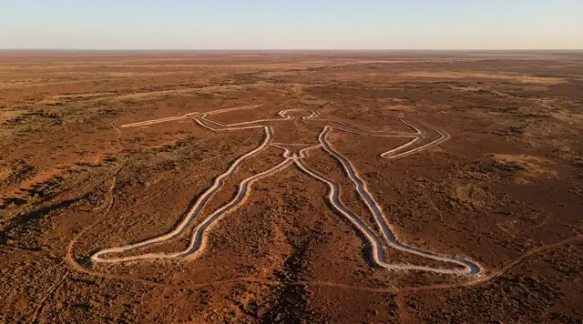
AI illustration
 Written and edited by
 On a chart, a doubtful island carries a qualifier: ED, existence doubtful, a printed admission that somebody once reported something and nobody has confirmed it since. When Sandy Island was digitised into a coastline file, that qualifier had nowhere to go. What crossed into the digital record was a shape with a boundary and no memory of where it came from. This dossier is about the note that should have travelled with it.
Silence Index — D-177
Effectively unvisited
Ranks 25 of 99 scored dossiers — quieter than 76% of the others we have scored. A low score is not a warning; it describes who else will be standing next to you.
How the total is weighted. These are the fixed weights of the four inputs, the same on every dossier — not this place’s scores. We do not publish per-input bars, because the per-input values were never recorded article by article and inventing four plausible numbers that sum to the total would be a fabrication dressed as a chart.
This dossier was scored before 2 September 2026, when the fourth input became night darkness. It keeps the input it was reasoned with until it is re-scored at its next source re-check; the methodology page records the change.
The index is a desk instrument scored by this publication, not a field measurement. How it is calculated, and where it fails.
What this dossier is built from
Nobody from this publication has been to 19°14'S, 159°57'E, and there is nothing there to go to. This is desk research, assembled from GEBCO's own errata and grid documentation; the Eos obituary written by the scientists who sailed across the position; CSIRO's voyage record for that cruise; the 1990 paper in the International Hydrographic Review that describes how the World Vector Shoreline was actually built; NOAA's datasheet for that file; the Generic Mapping Tools documentation for GSHHG; IHO publications B-6 and S-44 and two working papers on the meaning of "existence doubtful"; the UK Hydrographic Office's archive register and its current process for receiving reports from mariners; the finding aid for the SHOM records held by the Service historique de la Défense; a whaling voyage database compiled from Australian colonial port records; UNAM's report on a comparable Mexican case; two United States court judgments and a statute; and the gazetteers.
It is not a story about an island. There was never an island. It is a story about a single missing sentence — the one that would say which chart the coordinate came from, and who moved it.
The shape of the gap
GEBCO's errata sheet for the GEBCO_08 grid contains the admission, and it is worth reading slowly, because almost every published account of this affair skates over it. "At some point in time the position of the island shown on a particular chart was digitised and became part of a digital data base known as the World Vector Shoreline (WVS)."
Which chart. At what point in time. By whom, on whose instruction, working from which edition, with what authority to decide that a feature two hydrographic offices had already struck out should be carried forward as land. None of that is in the errata, because none of it is anywhere. The sentence is not evasive. It is precise about the limit of what GEBCO knows, and what GEBCO knows is that the transfer happened and that no record of it survives.
That is the subject here, and we are going to hold to it. We will not guess at the chart. We will not guess at the year. Where the record stops, this dossier stops.
What the record does hold
A good deal, as it turns out, and all of it in the wrong direction — every documented act in this story is an act of removal.
Maria Seton, Simon Williams and Sabin Zahirovic of the University of Sydney's EarthByte Group, with Steven Micklethwaite of the University of Western Australia, published the account in Eos on 9 April 2013, under the title "Obituary: Sandy Island (1876–2012)". Their vessel was RV Southern Surveyor on voyage SS2012_V06, the Eastern Coral Sea Tectonics cruise, which CSIRO's own record puts at 24.88 days, Cairns to Brisbane, departing 26 October 2012 and arriving 20 November. The ship carried a Kongsberg EM300 swath mapper. It passed about five kilometres south of the charted island.
The paper records that the French hydrographic service, SHOM, removed Sandy Island from its charts in 1974, and the Australian Hydrographic Service removed it in 1985. Both offices, in other words, had settled the question before the World Wide Web existed. The depths are worth printing in full, because three figures circulate and they are not the same measurement. Seton told CBC that the ship's own navigation charts showed about 1,400 metres. The ECOSAT transect minimum was around 1,300 metres. The Australian survey data give a range of 1,488 to 2,353 metres for the immediate area. We are not going to average those; the first is what a bridge officer saw on a paper chart, the second is a single ship track, the third is a survey compilation.
The oldest trace anyone has produced is a British Admiralty chart of the Pacific Ocean, first compiled in 1875 and issued in a 1908 edition, found in the Auckland Museum's collection by its pictorial librarian, Shaun Higgins, and reported at the time. The chart shows the island at more than thirty kilometres long and attributes it to a voyage of a vessel called Velocity in 1876. The chart also carries its own warning: "Caution is necessary while navigating among the low lying islands of the Pacific Ocean… The relative position of many dangers may therefore not be exactly given."
Note the chronology, because it is not tidy. A chart compiled in 1875 cannot originate an 1876 report. The 1876 attribution reached that sheet in a later correction cycle, and the record of that correction is a separate document that nobody has produced either.
What popular coverage gets wrong
Three wrong versions circulate, and they circulate in identifiable places: map-trivia writing, phantom-island listicles, and the residue of the November 2012 news cycle, which was framed almost entirely around a single search company.
The first is that Google invented it. Google did not. The island had been on paper charts for a century and in a United States military coastline file for decades before Google Earth existed. Seton's own account of the moment is the clearest correction available: "We became suspicious when the navigation charts used by the ship showed a depth of 1,400 metres in an area where our scientific maps and Google Earth showed the existence of a large island." The nautical charts were right. It was the scientific data products that were wrong — and they were wrong because they had all drunk from the same well.
The second is that it was a deliberate cartographic "copyright trap", a nautical trap street planted to catch copiers. Mike Prince, then director of charting services at the Australian Hydrographic Service, dismissed this in 2012, on the plain ground that chartmakers do not booby-trap work on which lives depend. The documentary position is firmer still. The World Vector Shoreline was produced by the Defense Mapping Agency and its successors, agencies of the United States federal government, and 17 U.S.C. § 105 provides that "Copyright protection under this title is not available for any work of the United States Government." A trap protects a copyright. There was no copyright to protect. The American case law on traps is thinner than the legend allows: in Feist the Supreme Court held that "Facts are never original", and in Nester's Map & Guide a district court found false entries protectable not for being false but for the originality of their selection. Neither describes anything that happened here.
The third is that scientists "undiscovered an island" in 2012. They confirmed open water at a position two national hydrographic offices had already cleared, in 1974 and in 1985. What they actually discovered was a fault in the plumbing between charts and global data products, and the fault is the finding.
How a coordinate loses its doubt
Charts are unusually honest documents. The IHO's working papers on the subject define "existence doubtful" as, in one proposed formulation, "An object, dangerous to navigation, which is shown on a chart, the existence of which has come into question, but which has not been adequately disproven" — distinct from PA, position approximate; from PD, position doubtful, used where a feature "has been reported in various positions and not confirmed in any of them"; and from Rep, reported but unconfirmed. A charted danger can therefore carry, in two letters, the entire epistemic status of the report behind it.
Now consider what the World Vector Shoreline actually was. The definitive account is Soluri and Woodson's paper in the International Hydrographic Review of January 1990. WVS was not, in the main, traced from charts by hand. It was converted from existing Digital Landmass Blanking data, which the authors describe as "divided into land/water matrices (raster data) spaced at 3 by 3 arc-second intervals", themselves derived from Joint Operations Graphics and coastal nautical charts. Where that coverage was missing, the fallback was "the best available hardcopy sources at the preferred scale of 1:250,000". The accuracy specification was that "90 percent of all identifiable shoreline features are to be located within 500 meters… circular error of their true geographic position".
A three-arc-second land/water matrix has exactly two states. There is no cell value for "reported in 1876 and never confirmed". The doubt was not suppressed or overruled; there was no field to put it in. And the paper describes no retention of source-chart identity per feature — the cell headers carry an identification number, an origin and a type code, and nothing about where the line came from. The provenance note was not lost in transit. There was never a place to write it.
The chain, link by link
From WVS the shape propagated by ordinary, documented, entirely respectable means. The Generic Mapping Tools documentation for GSHHG states the design decision without embarrassment: "We decided to use the WVS whenever possible and supplement it with WDB data." SRTM30_PLUS, the Scripps product behind Becker and Sandwell's 30-arc-second global grid, supplied land elevations. GEBCO's own documentation confirms that in the GEBCO_08 grid "the land data are based on the 1-km averages of topography derived from version 2.0 of the US Geological Survey SRTM30 gridded digital elevation model data product", and — this is the telling absence — says nothing whatever about which shoreline dataset defined the land/sea boundary. GEBCO's errata puts the consequence plainly: "through WVS Sandy Island lived on."
Everything downstream inherited it, including the shoreline layer Google Earth uses to decide where land stops, which is why the island rendered as a black polygon: land with no imagery behind it.
There is one more detail in the GEBCO errata that deserves to be kept apart from the rest. "Gravity anomalies, detected with radar satellites, suggest that there is a mountain rising from the seafloor in the region of Sandy Island", which "apparently does not rise enough to discolour the sea water". The Eos authors are more specific and more deflating: an 80-milligal gravity high lies to the west of the charted position, and is not pronounced over it. There is real geology in that part of the Coral Sea. It is not under the polygon.
Where the missing note should be filed
This is answerable, and it is the most useful thing this dossier can do.
An 1876 report from a merchant or whaling master would not be in the Royal Navy's remark books: the UKHO's own information asset register puts that series at 1760 to 1853, 114 volumes containing roughly 5,000 remark books, and it closes twenty-three years too early. The series that do cover 1876 are the surveyors' letters, 1866 to 1913, and the journal of engraving ledgers, 1861 to 1910, thirty-one volumes recording chart corrections and modifications. If a document exists that put Velocity's island onto an Admiralty plate, an engraving ledger is where that act would have been booked. The archive is at Taunton, consulted by appointment.
The 1974 French deletion has an equally definite address. The SHOM records at the Service historique de la Défense at Brest run to 126 linear metres under reference MB 3 W, covering 1938 to 2011, and include the files of the Mission océanographique du Pacifique, originally held at Nouméa and Papeete, at cotes 3 W 1045–1086, 1113–1125 and 1149–1165. Correspondence in that fonds carries a fifty-year restriction, which for a 1974 file has now expired.
We must be exact about what we are claiming, because the temptation to overclaim here is considerable. We have not established that no record of the Velocity's 1876 report survives. We have established that no published account of this affair cites one, and that we have not consulted the physical holdings at Taunton or Brest. If a hydrographic note or an engraving-ledger entry turns up, the gap narrows sharply and this piece becomes a smaller argument — about database provenance rather than about a vanished record.
A candidate, and what it does not settle
The Australian Colonial Whaling database, built from Mark Howard's lists out of colonial port records, newspapers, surviving logbooks and Susan Chamberlain's 1988 doctoral thesis on the Hobart whaling industry, holds a vessel of the right name in the right water at the right time. Velocity, a brig of 138 tons, built in the United Kingdom in 1827, registered at Hobart, six whaling voyages between 1869 and 1877. The voyages of 1875–76 and 1876–77, both under master James William Robinson, are recorded as working the Coral Sea and the Solomons.
That is a candidate. It is not a confirmation, and we are not going to dress it as one. The database records grounds, not positions; it holds no sighting, no bearing, no depth, no note of land. What it establishes is narrower and still worth having: an 1876 Coral Sea report from a vessel of that name is not implausible, and there is a documentary trail — port records, newspapers, possibly a surviving logbook — that a maritime historian could follow. Nobody, as far as we can find, has followed it.
What a provenance trail normally looks like
It is worth establishing that the absence here is genuinely unusual, because a reader could reasonably assume that nineteenth-century data is simply always like this. It is not.
The modern regime is exacting to the point of tedium. To place a name on the seafloor in the GEBCO Gazetteer, IHO-IOC publication B-6 requires a proposal carrying "Discovery Date" and "Discoverer (Individual, Ship)", "Chart / Map References", "Supporting Survey Data, including Track Controls", the date of survey, the survey ship, the sounding equipment by brand and model, the positioning system, the estimated horizontal accuracy and the survey track spacing. IHO S-44, the survey standard, states the principle directly: "To allow a comprehensive assessment of the quality of survey data it is necessary to record or document certain information together with the survey data." The UKHO's current Hydrographic Note process runs on the same logic — a form, an addressee at Taunton, and an acknowledgement of receipt.
And when a phantom is properly investigated, the file is thick. In 2009 the Mexican Chamber of Deputies' marine commission asked UNAM to determine whether Isla Bermeja existed. Seven university entities took part. The university ship Justo Sierra sailed forty hours from Tuxpan, sounded to 1,472 metres, and flew an aerial survey over 10,488 square kilometres at 22°33'N, 91°22'W. UNAM published the negative result on 23 June 2009 as Boletín UNAM-DGCS-374. A commissioning body, a vessel, a method, a coordinate, a date, a conclusion. That is what the record looks like when somebody keeps it.
Why the Silence Index is 86
Physical remoteness scores near the ceiling: roughly 500 kilometres north-west of New Caledonia, in water between one and two and a half kilometres deep, with the nearest land the Chesterfield reefs some way to the south-west. Visitor volume is as close to zero as this archive measures — there is nothing to arrive at. Access friction is the input that pulls the number down rather than up: no permit is required to sail over open ocean, and yachts cross the Coral Sea every year. The barrier is a boat and a fortnight, not a bureaucracy.
The fourth input we are reasoning about is unresolved questions, and it is high but not absolute. The physical question is closed: the water has been sounded and there is no island. What remains open is archival, and archival questions can be answered by somebody with a reader's ticket. That is a different order of silence from a place nobody can reach. Eighty-six, not ninety-four.
What is there now
The grid was corrected. GEBCO's documentation records that the spurious feature was removed for the GEBCO_2014 grid using survey data. In the errata index, Sandy Island sits in a list beside a grid pattern in the southern North Sea, a line of discontinuity along 0°E, anomalous deeps off Vigo and an extra strip of land near Norfolk Island — an island the size of Manhattan filed among gridding artefacts, which is, on reflection, the correct classification.
The afterlife is not quite over. A gazetteer search for the position still returns "Sandy Island, New Caledonia", feature type isle, at 19.2185°S, 159.9232°E — served from an encyclopaedia layer rather than from the gazetteer proper, but returned all the same, with coordinates, to anyone who asks. The name is not even unique: NGA's Sailing Directions for the Pacific Islands carry a real Sandy Island at Oeno Atoll, 23°56'S, 130°44'W, quietly eroding at its northern end.
What sits at 19°14'S, 159°57'E is water about 1,300 metres deep, inside the outer bounds of the New Caledonian exclusive economic zone, a few hundred kilometres from the Chesterfield-Bellona reserves that the New Caledonian government classified by arrêté in August 2018 and extended by arrêté n°2955-GNC in October 2023. The Coral Sea Natural Park around it is registered at 1,292,967 square kilometres.
The Eos authors offered one gentle speculation — that Velocity may have met a raft of floating pumice and taken it for land. It is a reasonable guess, no evidence has been produced for it, and it is not the finding. The finding is that a coordinate travelled for something like a century through charts, a raster matrix, a vector file, a shoreline database, an elevation model, a bathymetric grid and a consumer globe, and at not one of those transfers did anybody write down where it had come from. The island was never the thing that went missing.
Corner Codex — D-177
- Charted position
- 19° 14' S, 159° 57' E — the coordinates in GEBCO's own errata list
- What is there
- Open water. No land, no reef, no shoal
- Charted length
- About 25 km. One 1908 chart showed it more than 30 km long
- Depth, three figures
- c. 1,300 m on the 2012 transect; c. 1,400 m on the ship's chart; 1,488–2,353 m in Australian survey data
- Deleted by SHOM
- 1974
- Deleted by the Australian Hydrographic Service
- 1985
- Oldest trace anyone has produced
- A British Admiralty chart of 1908, compiled 1875
- Attributed report
- The whaling ship Velocity, 1876. The report itself has never been produced
- Survived deletion as
- A polygon in the World Vector Shoreline, a US military coastline file
- Crossed by
- RV Southern Surveyor, voyage SS2012_V06, Cairns 26 Oct – Brisbane 20 Nov 2012
- Removed from GEBCO
- GEBCO_2014 grid; the 30 arc-second GEBCO_08 grid carried it to the end
- Jurisdiction
- Within the bounds of the New Caledonian EEZ (France); we could not verify the precise limit
- Silence Index
- 86 / 100
The Traveler's Panel · checked
Changing information. Prices, permits, seasons and road access change, sometimes at short notice. Everything here is a starting point for your own confirmation — not a quote, and not a guarantee. Verify with the operator and the relevant official body before you book.
| What is at the coordinates | Water. Roughly 1,300 m of it, on the 2012 transect |
| Position | 19° 14' S, 159° 57' E, as given in GEBCO's errata |
| Nearest named land | Îles Chesterfield, 20°00'S 159°00'E, about 200 nm west of Grande Terre |
| Nearest port of any size | Nouméa, 22.274°S 166.449°E — some 700 km away by sea |
| Deleted from charts | SHOM 1974; Australian Hydrographic Service 1985 |
| Deleted from the global grid | GEBCO_2014. GEBCO_08 carried it until then |
| Still returned by a gazetteer search | Yes — 19.2185°S 159.9232°E, from an encyclopaedia layer |
| Permit required | None. There is also nothing to permit |
Getting there — There is no gateway. The position is open ocean roughly 500 km north-west of New Caledonia
- This is the one entry in this archive where the practical section has to begin by refusing the question. There is no route, because there is no destination. The coordinates 19°14'S, 159°57'E describe a patch of the Coral Sea with between 1,300 and 2,400 metres of water under it, no reef, no shoal, no drying rock and no navigational hazard of any kind. A vessel that sails over it will notice nothing whatever.
- If you nevertheless want to know what crossing it involves: the position lies roughly 500 kilometres north-west of New Caledonia, in the open sea between the Chesterfield plateau and the deep water toward Lansdowne Bank. Nouméa is the nearest port with facilities. Cairns and Brisbane, the ports at either end of the 2012 research voyage, are around a thousand nautical miles away on the Australian side. Nothing about this is a day trip.
- No permit is needed for the water itself. That is worth stating clearly, because much of the surrounding sea is not so simple: the Chesterfield-Bellona reserves were classified by arrêté of 14 August 2018 and extended by arrêté n°2955-GNC of 18 October 2023, and access to a réserve intégrale is prohibited without authorisation from the New Caledonian government. The phantom's position is not in one of those zones, but a Coral Sea passage plan can easily clip one.
- The genuinely useful journey, if you have an interest in this story, is to an archive rather than to a sea area. The UK Hydrographic Office archive at Taunton is consulted by appointment through its Archive Services Manager and holds the surveyors' letters for 1866–1913 and the journal of engraving ledgers for 1861–1910. The Service historique de la Défense at Brest holds SHOM's Pacific mission files under MB 3 W, including material transferred from Nouméa and Papeete, consultable in the reading room subject to statutory delays that have now run out for anything of 1974.
- The Auckland Museum's research library holds the 1908 chart edition on which the whole attribution rests. Nobody appears to have published a full description of that sheet — its number, its correction history, or what qualifier if any it printed beside the island. That is a half-day's work for somebody who can get to Auckland, and it would settle more of this than another sounding ever will.
Indicative costs — verify before booking
| What it costs | Nothing should be priced here. There is nothing to visit — the coordinates are open water |
| What we will not quote | Charter rates to cross a position where nothing is. Any operator selling this as a destination is selling a story, not a place |
| The real cost of settling it | Two archive appointments and a reader's ticket. Taunton, Brest, and the Auckland Museum research library |
| Chart corrections | Free. Hydrographic Notes are submitted to the UKHO on form H102 at no charge |
| What the 2012 answer cost | A 24.88-day national-facility research voyage that was not looking for this and found it in passing |
What to pack
- Nothing. This is the honest answer, and it is the point of the entry.
- If you are working the archives instead: a camera, a pencil, and the reference codes — MB 3 W/1 to MB 3 W/1189 at Brest, cotes 3 W 1045–1086, 1113–1125 and 1149–1165 for the Pacific mission.
- Enough French to read a nineteenth- and twentieth-century hydrographic correspondence file, or the budget for somebody who can.
- The discipline to write down where every figure came from. That is the whole moral of the story and it costs nothing to apply.
Where to stay
There is nowhere to stay, and that is not a figure of speech. The nearest habitable land to the charted position is the Chesterfield group, roughly 200 nautical miles west of Grande Terre, and those islets are now inside reserves where landing is prohibited without government authorisation — 6,600 km² of réserve intégrale and 17,400 km² of réserve naturelle within a plateau complex of about 24,000 km², holding a green turtle nesting population estimated at some 17,000 females. Anyone in the vicinity is aboard their own vessel, on passage, and the practical accommodation question is watch-keeping rather than beds. Nouméa, at 22.274°S 166.449°E with a population around 93,000, is the only place within reach that has hotels, a chandlery and an airport, and it is the better part of a week's sailing away. Cairns and Brisbane serve the Australian approach and were the two ends of the research voyage that settled the matter. Our honest recommendation for anyone drawn to this story is to book a reading room instead: Taunton, Brest and Auckland between them hold more of the unanswered questions than the Coral Sea does.
Safety & responsible travel
- Do not repeat the copyright-trap theory. The Australian Hydrographic Service's own charting director rejected it in 2012, and the shoreline file at the root of the error was a United States government work, which under 17 U.S.C. § 105 carries no copyright to protect.
- Do not credit or blame Google. The island was on paper charts for a century and in a military coastline database for decades before Google Earth existed, and the nautical charts aboard the ship were correct on the day.
- If you find the Velocity's report, or the chart that was digitised, publish the reference and not just the conclusion. The failure this whole affair documents is the failure to record where a fact came from.
- Report what you actually see at sea. The Hydrographic Note process exists, it is free, and the UKHO acknowledges receipt — which is more provenance than this island ever had.
- Be careful with the surrounding reserves. Chesterfield and Bellona are now largely classified as réserves intégrales, where access is prohibited without authorisation, and their coral, turtle and seabird colonies are the reason.
Nearby, and quieter
The Coral Sea around the phantom is emphatically not empty, which is part of why the error survived so long — a passing navigator had no reason to expect nothing. The Chesterfield and Bellona plateaus lie to the south-west, about 24,000 km² of reef and cay described by the New Caledonian government as a coral sanctuary, with humpback whales, sharks and one of the largest green turtle rookeries in the region; Bellona has been a réserve intégrale in full since 1 January 2024. Lansdowne Bank sits to the south-east at about 20.583°S, 160.5°E. The whole expanse is administered as the Parc naturel de la mer de Corail, registered on the world database of protected areas at 1,292,967 km², within which some 130,000 km² now carries reserve status following the 2023 arrêté. Real geology exists near the charted position too: satellite radar detects a gravity anomaly high of about 80 milligals, though the Eos authors are careful to place it to the west and to note that it is not pronounced over the island's position. And for the collector of coincidences, NGA's Sailing Directions record a genuine Sandy Island four thousand kilometres east, at Oeno Atoll in the Pitcairn group, where it is slowly eroding at its northern end.
Getting there, in order
- 1Nouméa
- 2Charted position of Sandy Island
- 3Position still returned by gazetteer search
- 4Îles Chesterfield
Each leg is a separate booking and a separate chance to be weathered out. Build spare days into the chain, not onto the end of it.
Where it is
Charted position of Sandy Island, Coral Sea, north-west of New Caledonia · 19.2333°S 159.9500°E · Open in Google Maps · OpenStreetMap
Key locations
- Charted position of Sandy Island — 19°14'S 159°57'E, the coordinates in GEBCO's own errata. Open water
19.2333°S 159.9500°E - Position still returned by gazetteer search — served from an encyclopaedia layer, feature type 'isle', fourteen years after deletion
19.2185°S 159.9232°E - Îles Chesterfield — the nearest named land; réserve intégrale and réserve naturelle since August 2018
20.0000°S 159.0000°E - Lansdowne Bank — submarine bank to the south-east; coordinate from the same gazetteer search
20.5833°S 160.5000°E - Nouméa — capital of New Caledonia and the nearest port of any size, population 93,060
22.2741°S 166.4488°E - Cairns — where RV Southern Surveyor sailed on voyage SS2012_V06, 26 October 2012
16.9237°S 145.7661°E - Brisbane — where the voyage ended on 20 November 2012, two days before the story broke
27.4679°S 153.0281°E
Coordinates are for orientation and are accurate to roughly the width of the feature named, not to a doorway. Several of these points are inside protected areas or need a permit, a guide or a boat — read the access notes above before you plan a route to any of them.
Sources & further reading — checked
- GEBCO / British Oceanographic Data Centre — 'GEBCO_08 Grid errata information – “Sandy Island”'. The central admission: 'At some point in time the position of the island shown on a particular chart was digitised and became part of a digital data base known as the World Vector Shoreline (WVS)'; that a Sandy Island appears on maps 'since the 18th century'; that 'through WVS Sandy Island lived on'; and the gravity-anomaly note. No chart is named and no date is given
- British Oceanographic Data Centre — 'Errata information for the GEBCO_08 Grid'. The coordinates used throughout this dossier: 'A scientific research cruise between Australia and New Caledonia has reported that Sandy Island (19° 14'S, 159° 57'E) does not exist', reported in version 20100927 and earlier and fixed in GEBCO_2014 — listed among grid patterns in the North Sea, anomalous deeps off Vigo and spurious land near Norfolk Island
- GEBCO / BODC — 'The GEBCO_08 Grid' documentation. A 30 arc-second continuous terrain model in which 'the land data are based on the 1-km averages of topography derived from version 2.0 of the US Geological Survey SRTM30 gridded digital elevation model data product', built on SRTM30_PLUS version 5.0 released September 2008 — and carrying no statement at all about which shoreline dataset defines the land/sea boundary
- GEBCO / BODC — 'The GEBCO_2014 Grid' (BODC document 301801). Version 20150318; the record that the spurious Sandy Island 'shown in some digital data sets, including the GEBCO_08 Grid, did not exist' and was removed using survey data; and the same SRTM30 version 2.0 land-elevation basis
- Seton, M., Williams, S., Zahirovic, S. and Micklethwaite, S. — 'Obituary: Sandy Island (1876–2012)', Eos, Transactions AGU, Vol. 94, No. 15, 9 April 2013, pp. 141–148. The scientific account: position 'approximately 500 kilometers northwest of New Caledonia at around 19°S, 160°E'; the ECOSAT voyage; minimum depths 'ranging from 1488 to 2353 meters below sea level'; a gravity high of 80 milligals to the west and not pronounced over the position; SHOM deletion in 1974 and AHS deletion in 1985; the 1876 Velocity report and 'a British admiralty chart from 1908', which the paper does not identify by number
- CSIRO Marine National Facility — Data Trawler survey record SS2012_V06. The voyage as logged: 26 October 2012 08:00 UTC to 20 November 2012 05:00 UTC, 24.88 days, Cairns to Brisbane, chief scientist Maria Seton of the University of Sydney, survey region 27°26.9'S–11°14.2'S and 145°46.8'E–164°34.2'E, with an EM300 multibeam echosounder
- CSIRO Marine National Facility — voyage plan, RV Southern Surveyor programme SS2012_V06. 'Mobilise Cairns 0800hrs, Friday 26 October, 2012' to 'Arrive Brisbane 0800hrs, Tuesday 20 November, 2012'; the Kongsberg EM300 swath mapper; the three tectonic objectives; and no mention anywhere in the plan of Sandy Island, the Chesterfield Islands or Nereus Reef
- Soluri, E.A. and Woodson, V.A. — 'World Vector Shoreline', International Hydrographic Review, Monaco, Vol. LXVII(1), January 1990. How WVS was actually made: converted from Digital Landmass Blanking data 'divided into land/water matrices (raster data) spaced at 3 by 3 arc-second intervals' derived from Joint Operations Graphics and coastal nautical charts; hardcopy fallback 'at the preferred scale of 1:250,000'; the 500 m circular-error specification at 90 percent; and cell headers carrying an identification number, origin and type code but no source attribution
- NOAA Shoreline Website — datasheet, 'NGA World Vector Shoreline (WVS)'. WVS derived from DLMB data 'derived primarily from the Joint Operations Graphics and coastal nautical charts'; the '90% of shoreline features be within 500-meter circular error' specification; WVS Plus processed in 1995 under specification MIL-PRF-89012A dated 24 August 1999; producing agency NIMA, now NGA; and no currency statement or stated limitation on use
- Generic Mapping Tools — GSHHG dataset documentation (GMT 6.0). The design decision that carried the error onward: 'We decided to use the WVS whenever possible and supplement it with WDB data'; attribution to Wessel and Smith (1996); the five resolution levels; and the acknowledgement that GSHHG 'is based on relatively old datasets'
- Scripps Institution of Oceanography — SRTM30_PLUS. The 30 arc-second global elevation and bathymetry product used by GEBCO_08, credited to Becker, Sandwell, Smith and colleagues in Marine Geodesy 32(4), 355–371 (2009) — and carrying no statement on this page about how its land mask or shoreline was defined
- IHO-IOC — Publication B-6, 'Standardization of Undersea Feature Names', 4th edition (2019). The provenance a seafloor name must now carry: 'Discovery Date' and 'Discoverer (Individual, Ship)', 'Chart / Map References', 'Supporting Survey Data, including Track Controls', date of survey, survey ship, sounding equipment, positioning system, estimated horizontal accuracy and survey track spacing; and that selected names 'shall… be supported by valid evidence'
- GEBCO — Gazetteer of Undersea Feature Names. The gazetteer as 'a digital gazetteer of the names of features on the seafloor', maintained by SCUFN, hosted with the IHO DCDB at NOAA's NCEI, holding names, generic feature type and geographic position, with proposals made on the B-6 form
- IHO Nautical Cartography Working Group — paper NCWG4-06.15A, 'Existence Doubtful', 4th NCWG meeting, The Hague, 6–9 November 2018 (United States / NOAA). The proposed definition of ED — 'An object, dangerous to navigation, which is shown on a chart, the existence of which has come into question, but which has not been adequately disproven' — and the distinctions from PA, PD and Rep, including PD for a feature 'reported in various positions and not confirmed in any of them'
- IHO Chart Standardization and Paper Chart Working Group — paper CSPCWG10-09.2A, 'Existence Doubtful (ED)', 10th meeting, Wellington, 21–24 January 2014. The older S-32 definition, 'Of uncertain existence… to indicate the possible existence of a rock, shoal, etc., the actual existence of which has not been established'; the proposal to make ED obsolescent in favour of 'Rep'; and the argument that ED 'is no longer useful and could be misunderstood'
- International Hydrographic Organization — S-44, Standards for Hydrographic Surveys, 5th edition, February 2008. The four survey orders, with Order 2 'intended for those areas where the depth of water is such that a general depiction of the seabed is considered adequate'; and the provenance principle quoted in this dossier: 'To allow a comprehensive assessment of the quality of survey data it is necessary to record or document certain information together with the survey data', with a minimum metadata list covering purpose, date, area, equipment, platform, datum, calibration and uncertainties
- UK Hydrographic Office — UKHO Archive Information Asset Register (GOV.UK guidance). The series that decide where an 1876 report could and could not be: remark books covering 1760–1853, '114 volumes containg approx. 5000 remark books'; surveyors' letters 1818–1873 and 1866–1913; and journal of engraving ledgers 1861–1910, 31 volumes, documenting chart corrections. Consultation is by appointment through the Archive Services Manager at Taunton
- UK Hydrographic Office / ADMIRALTY — 'Submit Hydrographic Notes'. The modern reporting machinery: forms H102, H102A and H102B; submission to the Source Data Receipt office at Taunton; the scope covering 'new or suspected dangers'; and the undertaking that 'Once we've received and processed your data, we'll acknowledge receipt of it by post or email'
- Service historique de la Défense — Fonds du Service hydrographique et océanographique de la Marine (SHOM) à Brest et dans le Pacifique, 1938–2011, MB 3 W/1 – MB 3 W/1189. 126 linear metres of SHOM records including the Mission océanographique du Pacifique files originally held at Nouméa and Papeete, at cotes 3 W 1045–1086, 1113–1125 and 1149–1165 — the holdings in which any file on the 1974 French deletion would sit. Correspondence carries a 50-year restriction
- Service historique de la Défense — répertoire FRSHD_REP_MB3W, finding aid to the SHOM fonds. SHOM's descent from the Dépôt des cartes et plans de la marine of 1720; the five sections of the fonds; the Pacific mission series covering New Caledonia and French Polynesia 1948–2011 with correspondence, logbooks and 'dossiers d'affaires'; and consultation in the reading room subject to statutory communicability delays
- Whaling History — Australian Colonial Whaling Ship Voyages, database description. A database of 'the voyages made in the nineteenth century by the whaling vessels that were owned, registered or based in Australian ports', built from six lists compiled by Mark Howard drawing on Sydney and Hobart arrivals and departures records, contemporary newspapers, surviving logbooks, port records and Susan Chamberlain's unpublished 1988 PhD thesis 'The Hobart whaling industry 1830 to 1900'
- Whaling History — search results for the vessel 'Velocity'. The candidate vessel: Velocity, brig, 138 tons, built in the United Kingdom in 1827, port of Hobart, six whaling voyages 1869–1877, including 1875-03-10 to 1876-03-10 and 1876-04-12 to 1877-03-20, both under master James William Robinson, with grounds recorded in the Coral Sea and Solomon Islands. No sighting, position or depth is recorded
- Universidad Nacional Autónoma de México — Boletín UNAM-DGCS-374, 23 June 2009, 'Concluye la UNAM que no existe la Isla Bermeja'. The contrast case: a search commissioned by the Chamber of Deputies' marine commission in November 2008, carried out by seven university entities aboard the vessel Justo Sierra on a 40-hour voyage from Tuxpan, sounding to 1,472 m and flying an aerial survey over 10,488 km² at 22°33'N, 91°22'W, concluding that the island 'no existe'
- National Geospatial-Intelligence Agency — Pub. 126, Sailing Directions (Enroute), Pacific Islands, 13th edition, 2025. The standing caution that 'the date of the surveys used must be taken into account' and that surveys with a vertical echo sounder 'do not always detect all shoals in coral reef waters'; and a real Sandy Island at Oeno Atoll, 23°56'S, 130°44'W, eroding at its northern end
- Gouvernement de la Nouvelle-Calédonie, Parc naturel de la mer de Corail — 'Les classements en réserve'. The arrêté of 14 August 2018, effective 16 August, classifying about 28,000 km² — 7,000 km² of réserves intégrales and 21,000 km² of réserves naturelles — and arrêté n°2955-GNC of 18 October 2023, effective 1 January 2024, extending protection to about 130,000 km², upgrading Bellona and the Entrecasteaux atolls to réserve intégrale
- Gouvernement de la Nouvelle-Calédonie, Parc naturel de la mer de Corail — 'Chesterfield et Bellona'. The nearest substantial land to the charted position: plateaus lying '200 milles nautiques à l'ouest de la Grande-Terre', about 24,000 km² in total, of which 6,600 km² is réserve intégrale and 17,400 km² réserve naturelle; access to integral reserves prohibited without government authorisation
- Protected Planet (UNEP-WCMC / IUCN) — Natural Park of the Coral Sea, New Caledonia, site 555577562. The registered reported area of the Natural Park of the Coral Sea, 1,292,967.0 km², recorded as a marine and coastal protected area in New Caledonia
- Flanders Marine Institute, Marine Regions — New Caledonian Exclusive Economic Zone (MRGID 8312). The EEZ bounding limits used in this dossier: latitude 26°12'5.2"S to 14°47'15.1"S and longitude 156°15'20"E to 170°33'12.6"E, from Maritime Boundaries Geodatabase version 12 (2023). A bounding box is not a boundary, which is why we state only that the position falls within these outer bounds
- GeoNames gazetteer — Îles Chesterfield, New Caledonia. The single gazetteer entry for the group, at 20°00'S, 159°00'E, with alternative names Chesterfield Archipelago, Chesterfield Reefs and Récifs et Îles Chesterfield — the nearest named land feature to the charted position
- GeoNames gazetteer — search for 'Nereus Reef'. That no gazetteer record exists for Nereus Reef; and that the search still returns 'Sandy Island, New Caledonia', feature type isle, at 19.2185°S, 159.9232°E, served from an encyclopaedia layer rather than the gazetteer proper — together with Lansdowne Bank at 20.5833°S, 160.5°E
- GeoNames gazetteer — Nouméa, New Caledonia. Nouméa at 22.27407°S, 166.44884°E, population 93,060, capital of the territory and the nearest port of any size to the charted position
- GeoNames gazetteer — Cairns, Queensland. Cairns at 16.92366°S, 145.76613°E, population 153,075 — the port from which SS2012_V06 sailed on 26 October 2012
- GeoNames gazetteer — Brisbane, Queensland. Brisbane at 27.4679357°S, 153.028092°E, population 2,780,063 — where SS2012_V06 docked on 20 November 2012, two days before the story reached the international press
- Office of the Law Revision Counsel, US House of Representatives — 17 U.S.C. § 105, Subject matter of copyright: United States Government works. The statutory basis for dismissing the copyright-trap theory: 'Copyright protection under this title is not available for any work of the United States Government', a work of the US Government being one 'prepared by an officer or employee of the United States Government as part of that person's official duties' — which is what the Defense Mapping Agency's shoreline file was
- Supreme Court of the United States — Feist Publications, Inc. v. Rural Telephone Service Co., 499 U.S. 340 (1991), decided 27 March 1991. The leading authority on facts and compilations: Rural's four fictitious listings proved copying, and the Court held that 'Facts are never original, so the compilation author can claim originality, if at all, only in the way the facts are presented', finding 'nothing remotely creative' in alphabetical arrangement
- US District Court, Eastern District of New York — Nester's Map & Guide Corp. v. Hagstrom Map Co., 796 F. Supp. 729 (E.D.N.Y. 1992), Nickerson J., 30 June 1992. The nuance the trap-street legend usually omits: the court held that Nester's deliberately inexact address numbers 'may be copyrightable not because the statements are fictional but because of the originality in selecting and assigning them to particular cross streets'
- The Register — 'Sandy Island “seen” in 1908 chart' (25 November 2012). Cited only for what a news report alone can source: the identification by Auckland Museum pictorial librarian Shaun Higgins of a 1908 edition of an 1875 Pacific chart showing the island at more than 30 km long and attributing it to Velocity in 1876; the chart's own caution that 'The relative position of many dangers may therefore not be exactly given'; and the open question of whether Velocity's logs survive
- NBC News — 'Google's Phantom Island May Have 19th-Century Roots' (2012). Cited for an interview only: Mike Prince, director of charting services at the Australian Hydrographic Service, rejecting the copyright-trap theory on the ground that chart authors did not booby-trap work whose reliability mariners depend on
- CBC News — 'South Pacific island is missing, scientists say' (corrected 22 November 2012). Cited for a quotation only: Seton's account that 'We became suspicious when the navigation charts used by the ship showed a depth of 1,400 metres in an area where our scientific maps and Google Earth showed the existence of a large island', and Steven Micklethwaite's remark on sailing through it
Official and scientific bodies are the authority for safety, regulatory and scientific claims. Commercial operators are used only for practical detail such as tour length, meeting points and indicative pricing — never for a safety or scientific statement.
How this was made
Desk research. Compiled from official bodies, scientific and conservation sources, established journalism and licensed operators. Not based on a personal visit.
Editor’s method note — what we checked, corrected and could not verify
- Desk research only. Nobody from this publication has been to the Coral Sea, and in this case there is nothing at the position to have visited. The hero image is AI-created.
- Every URL cited was opened and read before citation. Sources that could not be opened are listed further down this note and are cited nowhere in the piece.
- The device of this dossier is deliberate. The subject is the absence of a provenance record, not the phantom itself, and we have refused throughout to fill that absence with plausible reconstruction. We do not name the chart that was digitised, because no source names it. We do not date the digitisation, because no source dates it. We have also kept out the word this story is usually filed under. A missing administrative record is a gap in a filing system, and calling it anything grander flatters it.
- The central quotation is GEBCO's own: 'At some point in time the position of the island shown on a particular chart was digitised and became part of a digital data base known as the World Vector Shoreline (WVS).' We have treated that as an admission of the limit of institutional knowledge rather than as evasion, because the rest of the errata is specific where it can be.
- Depths: three different figures are in circulation and we print all three and name all three. Seton, quoted by CBC, gives about 1,400 m as what the ship's navigation chart showed. The ECOSAT transect minimum is reported at about 1,300 m. The Eos paper gives 1,488 to 2,353 m for the immediate area from Australian survey data. These are different kinds of measurement and we have not averaged them.
- Dates of the crossing: the Eos paper places the transit in October 2012; CSIRO's voyage record has the ship leaving Cairns on 26 October and docking in Brisbane on 20 November 2012; the story broke in the international press on about 22 November. No source we opened gives the date the ship actually crossed the position, so we do not state one.
- Age of the phantom: GEBCO's errata says a Sandy Island has appeared on maps of many countries 'since the 18th century'; the Eos obituary titles it 1876–2012. Both are cited. Neither produces a document for its starting point, and we have not reconciled them.
- The Hobart brig Velocity found in the Australian Colonial Whaling database is presented as a candidate and nothing more. The database records grounds, not positions, and holds no sighting. We have not established that this is the vessel named on the 1908 chart.
- On jurisdiction we state only what the data supports. The charted position falls within the outer bounding coordinates of the New Caledonian EEZ as published by Marine Regions, but a bounding box is not a boundary and we did not obtain the boundary geometry itself. We make no claim about who has rights over that water.
- Sources we could not read, and therefore did not cite: the publisher's page and PDF for the Eos article at agupubs.onlinelibrary.wiley.com, both 403, which is why the authors' own institutional copy at EarthByte is cited instead; the USGS SRTM30_PLUS FAQ page at pubs.usgs.gov, 403; the UKHO H102 form itself, which returned as binary and could not be parsed; the NCEI GEBCO undersea feature names map application, 404; and two Whaling History voyage-search URLs that returned 404, the results being reached instead through the site-wide search. Direct file retrieval was blocked at the network layer throughout, so every document was read through a fetching service rather than downloaded.
- Things we could not verify: which chart was digitised into the World Vector Shoreline, or in what year, or by whom, this being the subject of the dossier; whether any record of the Velocity's 1876 report survives in the UK Hydrographic Office archive at Taunton or in the SHOM fonds at Brest — we have established only that no published account cites one, and we have not consulted either archive in person; whether the Hobart brig Velocity of 1875–77 is the vessel named on the chart; the number and full title of the 1908 British Admiralty chart, which the Eos paper does not give and no other source we opened supplies; the date on which the Southern Surveyor actually crossed the position; whether the feature was marked 'existence doubtful' on the particular chart that was digitised, which would determine whether a qualifier was discarded or was never there; the internal SHOM and Australian Hydrographic Service files that record the 1974 and 1985 deletions and the evidence relied on; whether the position lies inside the New Caledonian EEZ proper rather than merely within its bounding box; and the pumice-raft explanation, for which no evidence has been published by anyone.
AI is used to draft this text, and a human checks it. Every figure, date and quotation above was verified by Tony Hall against the source cited for it in the reference list; where sources disagree, the disagreement is shown rather than resolved, and where a claim could not be confirmed it is either marked unverified or left out. The illustrations are AI-created and labelled as such — no photograph on this site is presented as a record of a real place. Full disclosure · Editorial policy.
Access details change — recheck before you travel. Found an error? Tell us — corrections are dated and shown in place.