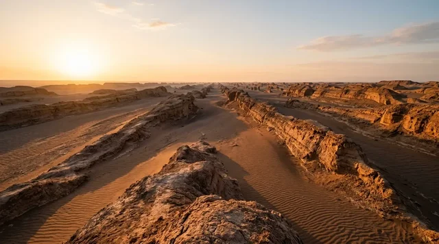
AI illustration
 Written and edited by
 On 13 February 1958 Egypt formally proposed exchanging its territory south of the 22nd parallel for the two Sudanese-administered areas north of it. That single note contains the whole logic of Bir Tawil. It is not unclaimed because nobody wants it. It is unclaimed because claiming it means conceding the other state's line on the piece with the coastline.
Silence Index — D-056
Effectively unvisited
Ranks 4 of 99 scored dossiers — quieter than 97% of the others we have scored. A low score is not a warning; it describes who else will be standing next to you.
How the total is weighted. These are the fixed weights of the four inputs, the same on every dossier — not this place’s scores. We do not publish per-input bars, because the per-input values were never recorded article by article and inventing four plausible numbers that sum to the total would be a fabrication dressed as a chart.
This dossier was scored before 2 September 2026, when the fourth input became night darkness. It keeps the input it was reasoned with until it is re-scored at its next source re-check; the methodology page records the change.
The index is a desk instrument scored by this publication, not a field measurement. How it is calculated, and where it fails.
This is a desk-researched dossier. Nobody from this publication has been to Bir Tawil, and this piece deliberately offers no route, no guide and no encouragement to go: the surrounding desert is worked by armed gold prospectors and patrolled by two militaries, and the territory sits inside a live disagreement between two states. It is built from the United States Department of State's International Boundary Study for the Sudan–Egypt boundary, letters filed by both governments with the UN Security Council, contemporary reporting of the 1958 crisis, international-law commentary, one academic paper on the Ababda, long-form journalism from the ground, and the GeoNames gazetteer. Neither government's position is treated here as settled fact; both are quoted as positions.
The two lines, precisely
The Anglo-Egyptian Agreement of 19 January 1899 defined the political boundary in a single clause. The word Soudan in this Agreement, it says, means all the territories south of the 22nd parallel of latitude. That is the line Egypt holds to, and it is a line of latitude — a mathematical abstraction laid across a desert without reference to who lived in it.
Three years later the administration caught up with the geography. An arrêté issued on 25 July 1902 by the Egyptian Minister of the Interior, brought into force by decree on 4 November 1902, established a separate administrative boundary. The State Department's boundary study states its purpose without embellishment: to facilitate the administration of nomadic tribes along the international boundary and to retain the continuity of certain tribal areas. Its western segment ran as a straight line between Jebel Bartazuga, south of the 22nd parallel, and Korosko near the Nile to the north; a further modification on 22 June 1907 cut that back so it extended only as far as the 22nd parallel.
The 1902 arrangement named the communities. The Bisharin Bedouins went under the administration of the Sudanese Government, the Ababda Bedouins under the administration of the Egyptian Government — with the exception of the Melikabe-Kibli tribe, with the well at Bir Bekhwat, which went to Sudan. Two other adjustments happened around the same period: the Wadi Halfa salient, an area running about 38 miles along the boundary and just under eight miles wide at the parallel, was placed under Sudanese administration by a decree of 26 March 1899 to serve a railhead; and the Suakin enclave was transferred on 10 July 1899.
The result is two lines that cross. Between them they cut out two areas of opposite character. North of the parallel but administered from Sudan under the 1902 arrangement: the Hala'ib area, around 20,000 square kilometres, with a Red Sea coastline, several villages, mineral and petroleum interest, and a population in the region of 27,000. South of the parallel but administered from Egypt under the same arrangement: Bir Tawil, an isosceles trapezium of empty Nubian desert with no coast and no permanent inhabitants.
Why neither state will take it
The mechanism is simple and it is documented rather than inferred.
Egypt's position is that the 1899 political line governs: everything north of 22° N is Egyptian. That position gives Egypt Hala'ib. It also gives Sudan Bir Tawil, which lies south of the parallel. Sudan's position is that the 1902 and subsequent administrative arrangements govern. That position gives Sudan Hala'ib. It also gives Egypt Bir Tawil, which the 1902 line placed under Egyptian administration for the Ababda. Each state's own preferred line assigns Bir Tawil to the other. To claim it, a government would have to argue from the line that hands away the territory with the coast, the population and the minerals.
The clearest evidence that both capitals understand this comes from 1958, and it is worth setting out because it is the only occasion on which the trade was made explicit. On 1 February 1958 Egypt sent a note objecting to Sudanese election arrangements north of the parallel. On 13 February it sent a second note proposing an exchange of Egyptian territory south of the parallel for the two Sudanese-administered areas north of it. On 16 February it announced it would send officials to conduct the United Arab Republic plebiscite in the disputed zones. Sudan, having noted Egyptian troop movements on 9 February, deployed to Hala'ib.
On 20 February 1958 Sudan's Permanent Representative, Yacoub Osman, filed a letter with the Security Council reporting massed concentrations of Egyptian troops moving towards the Sudanese frontiers, and setting out that Egypt claimed the north-eastern part of Sudan north of latitude 22 and the region north of Wadi Halfa comprising Saras, Debeira and Faras. Sudan's argument was that these territories belong to the Sudan by virtue of agreements and treaties concluded between the Egyptian Government and the Sudan Government in 1902 and 1904, that the inhabitants held Sudanese nationality and had voted in Sudanese elections. Prime Minister Abdulla Khalil called Egypt's position an unwarranted and unlawful attitude which constitutes a breach of Sudanese sovereignty. The Council convened on 21 February. Egypt announced the same day that it would postpone the matter until after the Sudanese elections; its forces withdrew from Abu Ramada on 25 February and detained officials were released on 28 February.
Egypt's own formal case, filed by the State Department's account on 1 February 1958, was that the areas north of the parallel were never part of the Sudan but were actually under Egyptian sovereignty. Sudan's reply was that Egypt had not protested elections there across roughly fifty years.
What has happened since
The dispute over Hala'ib has stayed live and it should be described carefully, because two governments hold opposed positions on it and neither has conceded.
Sudan granted petroleum exploration rights in the area to a Canadian company in 1992; Egypt objected and the company withdrew. After the assassination attempt on President Mubarak in Addis Ababa in 1995, Egypt moved to force Sudanese personnel out of Hala'ib; Sudanese forces withdrew altogether by 2000. Egypt has administered the area since, treating Hala'ib as a city and holding parliamentary elections there — reported in 2014, and with electoral districts created for the 2015 and 2018 votes.
Sudan has never accepted this and has kept the file open procedurally. It has repeatedly asked that the item remain on the Security Council's agenda; an Egyptian source described the renewal in 2021 as a routine procedure to preserve the right and keep it on the council's agenda, on a three-year cycle. In 2016 Sudan's foreign ministry called for direct negotiations or international arbitration, its foreign minister saying the disagreement cannot be resolved by imposing a fait accompli. Egypt declined both. Its spokesman that April said Hala'ib and Shalateen are Egyptian territory and they fall under Egyptian sovereignty; in 2014 another spokesman said Egyptian lands are not subject to retail and Egypt has full sovereignty over its territory.
The two governments' most formal statements are in the Security Council record. Egypt's letter of 13 November 2017 states that all the areas north of the 22nd parallel of latitude are Egyptian lands that are part of the national territory and calls Sudan's allegations completely baseless. Egypt's letter of 13 January 2021, S/2021/44, reaffirms Egyptian sovereignty over the Hala'ib and Shalatin triangle in response to a Sudanese communication of 4 January 2021. Neither government has submitted the boundary to a binding third-party process.
What popular coverage gets wrong
Bir Tawil is one of the most misdescribed places on Earth, and the errors are consistent enough to list.
"The last unclaimed land on Earth." This is the framing that carries the story through listicles, YouTube geography channels, adventure-travel operators and, in 2014 and 2015, international news desks. It survives only by conflating two different things: nobody has claimed it, and nobody could claim it. The first is true and the second is not. Both states have fully articulated legal positions on the boundary that produces it. As the international lawyer Chris Borgen put it in 2014, Bir Tawil is better understood as part of a territorial dispute in suspension — Schrödinger's cat rather than empty space.
"Terra nullius, so anyone can take it." In June 2014 an American citizen planted a flag and declared a kingdom, a stunt that generated a Disney film deal and a great deal of commentary. Borgen's analysis of why it fails is the useful one: governmental control of territory sufficient for acquisition is rarely achieved by individuals lacking a previous political organisation; planting a flag is not effective occupation; for habitable terrain, settlement is probably required; and statehood requires a defined territory, a permanent population, a government and the capacity to conduct international relations. Neither Egypt's nor Sudan's Washington embassy responded to press requests for comment. The doctrinal background matters too: the International Court of Justice, in its advisory opinion of 16 October 1975, answered in the negative the question of whether Western Sahara was terra nullius at the time of colonisation. The doctrine has been in retreat for half a century.
"It's empty." It is uninhabited year-round; it is not unused. The Ababda and Bisharin have carried goods, grazed animals and camped within these sands, and one of the few journalists to have crossed it — Jack Shenker, writing in the Guardian in March 2016 after a forty-hour drive from Abu Hamed — was explicit that failing to speak to any of them was a failure of the reporting rather than an absence of people. The surrounding Nubian desert carries artisanal gold prospecting, with armed gangs preying on the prospectors and military patrols keeping order with limited success. Wadi Allaqi, immediately north across the parallel on the Egyptian side, was designated a UNESCO biosphere reserve in 1993 precisely because non-sedentary inhabitants use it for transhumance, charcoal, medicinal plants, quarrying and small-scale cultivation.
"About 800 square miles." This figure is repeated almost universally and it may well be right, but it is not established. Al Jazeera gives 2,060 km²; Time gives approximately 800 square miles, which is 2,072 km²; the Guardian gives 800 square miles; and an academic treatment by Dean Karalekas gives 1,290 km². We could not find a governmental or cartographic authority publishing a figure at all, which is unsurprising: an area can only be computed from a boundary, and the boundary is the thing in dispute.
Why the Silence Index is 92
There is no settlement, no road, no service, no water and no administration on the ground. Access friction is effectively total: the practical routes in run through Egyptian or Sudanese military checkpoints, and the one recent published crossing took forty hours of driving from the nearest town on the Nile. Footfall is a handful of people a year at most, and several of those have gone in order to plant something. The acoustic floor is that of open Nubian desert, and night darkness is complete — the nearest lit settlements are Aswan, more than 250 km north, and Wadi Halfa, on the Nile to the west. What stops this reaching the mid-nineties is that the surrounding desert is neither empty nor quiet in the way the maps imply: gold prospecting, armed groups and vehicle traffic are documented across the region, and the quadrilateral is crossed rather than sealed.
The better question
The stunts are the least interesting thing here and they have consumed most of the attention. What is genuinely unusual about Bir Tawil is that it is a place produced by two states each declining something in order to keep the option of something larger — a negative space created by strategy rather than neglect. Egypt put the trade on paper in February 1958 and Sudan refused it. Sudan has kept a complaint alive at the Security Council for the better part of seventy years by renewing it on a three-year clock. Egypt has held Hala'ib on the ground since the mid-1990s and holds elections there.
The Ababda, meanwhile, have used this ground since long before either line was drawn, and one of the few academic treatments of the territory argues from the UN Declaration on the Rights of Indigenous Peoples and ILO Convention 169 that theirs is the claim with the strongest foundation. It has no state behind it, which is why nobody has made a film about it.
A territory that two governments are each refusing on purpose is not unclaimed. It is claimed by subtraction, and the subtraction is the argument.
Corner Codex — D-056
- Place
- A quadrilateral south of the 22nd parallel, Egypt–Sudan boundary
- The political line
- 22° N, fixed by the Anglo-Egyptian Agreement of 19 January 1899
- The administrative line
- Arrêté of 25 July 1902, brought into force by decree of 4 November 1902
- Purpose of the 1902 line
- To keep nomadic tribal areas continuous across the boundary
- Who got which
- Bisharin under Sudanese administration; Ababda under Egyptian
- Area of Bir Tawil
- Quoted from 1,290 km² to about 2,072 km² — no figure is agreed
- Hala'ib Triangle
- About 20,000 km², Red Sea coast, population around 27,000
- Boundary lengths
- 792 miles of international boundary; 222 miles of administrative boundary
- Egypt's position
- All territory north of 22° N is Egyptian — S/2017/953, 13 November 2017
- Sudan's position
- The 1902 and 1904 arrangements govern — S/3963, 20 February 1958
- Live diplomacy
- Sudan renews its Security Council complaint roughly every three years
- Silence Index
- 92 / 100
The Traveler's Panel · checked
Changing information. Prices, permits, seasons and road access change, sometimes at short notice. Everything here is a starting point for your own confirmation — not a quote, and not a guarantee. Verify with the operator and the relevant official body before you book.
| Legal status | Unclaimed by both Egypt and Sudan — deliberately, not by oversight |
| Why | Each state's preferred boundary line assigns Bir Tawil to the other |
| The larger prize | Hala'ib, about 20,000 km², with a Red Sea coast and roughly 27,000 people |
| Who administers Hala'ib | Egypt, on the ground, since Sudanese forces withdrew by 2000 |
| Sudan's position | Kept alive at the Security Council on an approximately three-year cycle |
| Visiting | Not advised, not covered here, and not lawful to arrange without state consent |
Getting there — No sanctioned route exists. The only recent published crossing ran Abu Hamed → Nubian Desert → Bir Tawil, about forty hours by vehicle
- This dossier does not tell you how to get to Bir Tawil, and that is a considered position rather than an omission. Any approach crosses Egyptian or Sudanese territory and passes military checkpoints, and the surrounding Nubian desert carries documented artisanal gold prospecting and armed groups preying on prospectors.
- The only recent published crossing we could find took about forty hours of driving from Abu Hamed on the Nile, with no fresh water anywhere in the territory and dust storms reducing visibility to near zero.
- Nothing about the territory's unclaimed status makes entry lawful without the consent of the state whose ground you cross to reach it. There is no border post to present yourself at, which is the opposite of a permission.
- Both governments' positions on this boundary are live at the UN Security Council. Travel that is framed as a claim, a flag-planting or a micronation exercise is a diplomatic problem for other people, not an adventure.
- Anyone with a legitimate reason to be in the southern Eastern Desert — research, survey, journalism — should be arranging it through the relevant national authorities, and should check both governments' current travel restrictions independently.
Indicative costs — verify before booking
| Entry fee | None. There is no administration to charge one |
| Practical cost | A multi-day desert expedition with full self-sufficiency in water and fuel |
| Honest note | Nobody should be pricing this. There is no visitor economy, no permit regime and no authority to grant permission |
What to pack
- This section is normally advice. Here it is a caution: there is no water in Bir Tawil, no settlement, no fuel and no rescue.
- If you are in the wider region legitimately, carry the documentation of whichever national authority authorised you, and expect to produce it repeatedly.
- Nothing that reads as a claim — no flags, no plaques, no markers. Several people have left such things and every one of them made the reporting worse.
- Local knowledge over navigation equipment. The Ababda and Bisharin have crossed this ground for a very long time and are not a colourful detail.
Where to stay
There is nowhere to stay in Bir Tawil, and that is not a gap in the research. The territory has no permanent inhabitants, no structure, no well in use that we could confirm and no administration of any kind. The nearest towns are on the Nile — Wadi Halfa and Abu Hamed in Sudan, Aswan far to the north in Egypt — or on the Red Sea coast at Shalateen and Hala'ib, both of which are Egyptian-administered and sit inside the disputed zone this dossier is actually about. Anyone in the region legitimately is staying in one of those places, under the authority of one of these two governments, and should be clear about which.
Safety & responsible travel
- Do not call it the last unclaimed land on Earth. Both states have articulated legal positions on the boundary that creates it, and the Hala'ib Triangle — not Bir Tawil — is what those positions are actually about.
- Do not describe it as empty. It is uninhabited year-round and used seasonally, and the people who use it were largely absent from the coverage that made it famous.
- Do not treat the micronation claims as the story. They are a symptom of how the place has been written about, and they attract exactly the attention that keeps the real dispute out of view.
- Be careful with Hala'ib. Two governments hold opposed positions and one of them administers the ground. Repeating either as settled fact is taking a side in a live inter-state dispute.
- If you write about it, cite the 1899 Agreement and the 1902 arrêté directly. Both are described precisely in a public US State Department boundary study that almost nobody covering this story appears to have opened.
Nearby, and quieter
Everything of consequence near Bir Tawil is contested or protected. The Hala'ib Triangle, on the Red Sea coast to the east, is the territory the whole dispute concerns — administered by Egypt, claimed by Sudan, and closed in practice. Wadi Allaqi, north across the 22nd parallel in Egypt, has been a UNESCO biosphere reserve since 1993 and is used for transhumance by the same communities that cross Bir Tawil. Lake Nasser lies beyond it, and the Wadi Halfa salient — the other anomaly the 1899 and 1902 instruments produced — sits on the Nile to the west. None of these is a destination in the ordinary sense and several of them are restricted.
Getting there, in order
- 1No sanctioned route exists. The only recent published crossing ran Abu Hamed
- 2Nubian Desert
- 3Bir Tawil, about forty hours by vehicle
Each leg is a separate booking and a separate chance to be weathered out. Build spare days into the chain, not onto the end of it.
Where it is
Bir Tawil and the Egypt–Sudan boundary zone · 21.9500°N 33.6500°E · Open in Google Maps · OpenStreetMap
Key locations
- Hala'ib — the Red Sea town at the centre of the dispute, administered by Egypt
22.2227°N 36.6468°E - Shalateen — the Egyptian administrative centre for the southern Eastern Desert
23.1323°N 35.5909°E - Wadi Halfa — the Sudanese town below the salient placed under Sudanese administration in 1899
21.7957°N 31.3712°E - Abu Hamed — the Nile town from which the only recent published crossing set out
19.5333°N 33.3167°E - Aswan — the nearest large Egyptian city and the historical administrative base of the Ababda
24.0908°N 32.8994°E
Coordinates are for orientation and are accurate to roughly the width of the feature named, not to a doorway. Several of these points are inside protected areas or need a permit, a guide or a boat — read the access notes above before you plan a route to any of them.
Sources & further reading — checked
- US Department of State — International Boundary Study No. 18, Sudan–Egypt (27 July 1962). The 19 January 1899 Agreement defining 'the Soudan' as all territories south of the 22nd parallel; the administrative boundary by arrêté of 25 July 1902 and decree of 4 November 1902 and its stated purpose of retaining tribal continuity; the western segment from Jebel Bartazuga to Korosko and its 22 June 1907 modification; the Bisharin under Sudanese and Ababda under Egyptian administration with the Melikabe-Kibli exception at Bir Bekhwat; the Wadi Halfa salient of 26 March 1899; the Suakin transfer of 10 July 1899; 792 miles of international and 222 miles of administrative boundary; and Egypt's formal 1 February 1958 demand with Sudan's reply
- UN Security Council — S/3963, letter from the Representative of Sudan, 20 February 1958. Sudan's contemporaneous account: massed concentrations of Egyptian troops moving towards the Sudanese frontiers; Egypt's claim to the north-eastern part of Sudan north of latitude 22 and to the Saras, Debeira and Faras region; Sudan's reliance on the 1902 and 1904 agreements; and Prime Minister Abdulla Khalil's statement
- Keesing's Contemporary Archives — Egyptian claim to Sudanese-administered areas north of the 22nd parallel (1958), via Stanford. The day-by-day sequence of the February 1958 crisis, including Egypt's 13 February note proposing an exchange of Egyptian territory south of the parallel for the two Sudanese-administered areas north of it, the 21 February Security Council session, and the 25 and 28 February withdrawals and releases
- UN Security Council — S/2017/953, letter from the Permanent Representative of Egypt, 13 November 2017. Egypt's formal position that all areas north of the 22nd parallel are Egyptian lands that are part of the national territory, that Sudan's allegations are completely baseless, and that Egypt reserves the right to take all measures required to protect its interests
- UN Digital Library — S/2021/44, letter from the Permanent Representative of Egypt, 13 January 2021. Egypt's reaffirmation of sovereignty over the Hala'ib and Shalatin triangle, filed in response to a Sudanese communication of 4 January 2021 (S/2021/6)
- Sovereign Limits — Egypt–Sudan land boundary. That 32% of the boundary's length is in dispute across three zones — Wadi Halfa, Bir Tawil and the Hala'ib Triangle; the 19 January 1899 and 4 November 1902 instruments; Egyptian de facto control of Hala'ib since 1992; and Bir Tawil unclaimed by both states
- Chris Borgen — Opinio Juris, 16 July 2014. The international-law analysis of why a private flag-planting claim fails: that governmental control sufficient for acquisition is rarely achieved by individuals lacking previous political organisation, that settlement is probably required for habitable terrain, the four customary criteria for statehood, and the characterisation of Bir Tawil as a territorial dispute in suspension rather than genuine terra nullius
- International Court of Justice — Western Sahara, Advisory Opinion of 16 October 1975. That the Court answered in the negative the question whether Western Sahara was terra nullius at the time of Spanish colonisation — the doctrinal background against which modern private claims to 'unclaimed' land are assessed
- E-International Relations — The Princess of No Man's Land: Bir Tawil and the geographical imagination (2014). The argument that the non-claim is a calculated 'unclaiming' driven by the value of the Hala'ib Triangle, and the critique of no-man's-land narratives that erase Ababda stewardship of the ground
- Jack Shenker — Welcome to the Land That No Country Wants, The Guardian, 3 March 2016. First-hand reporting from the territory: uninhabited year-round, flat sand and rock, no fresh water; Ababda and Bisharin carrying goods, grazing and camping within the sands; artisanal gold prospecting in the surrounding Nubian desert with armed gangs preying on prospectors; military patrols with limited success; and the forty-hour drive from Abu Hamed
- Dean Karalekas — Navigating Terra Nullius: The Ababda and the Case for Indigenous Land Rights in Bir Tawil (2020). The 1,290 km² area figure and the description of Bir Tawil as an isosceles trapezium; the Hala'ib population of roughly 27,000; the argument for continuous Ababda occupancy since at least Roman times; and the indigenous-rights case built on UNDRIP Article 26 and ILO Convention 169
- Al Jazeera — Creating the Kingdom of North Sudan, 11 May 2015. The flag-planting of 16 June 2014; the 2,060 km² area figure; that both the Egyptian and Sudanese embassies in Washington acknowledged but did not respond to requests for comment; and academic commentary from Noam Leshem, Paul Nugent and Alex de Waal
- Time — Man Plants Flag on Unclaimed African Land So Daughter Can Be Princess (2014). The approximately 800 square mile area figure, and the description of Bir Tawil as land unclaimed after a discrepancy in borders drawn in 1899 and 1902
- Foreign Policy — Even in the Fake Kingdom of North Sudan, Disney Princesses Are White (2015). The criticism of the claim as modern-day colonialism, the Disney film deal, and the statement that neither Sudan nor Egypt has legally recognised the purported state
- Sudan Tribune — Egypt asserts sovereignty over disputed Halayeb, 18 April 2016. Egyptian foreign ministry spokesman Ahmed Abu Zaid's statement that Halayeb and Shalateen are Egyptian territory under Egyptian sovereignty; Sudan's call through Foreign Minister Ibrahim Ghandour for direct negotiations or international arbitration and his statement that the dispute cannot be resolved by imposing a fait accompli; and Egypt's refusal of both
- Ahram Online — Egypt reiterates full sovereignty over Halayeb border land with Sudan (2014). Foreign ministry spokesman Badr Abdelatty's 10 September 2014 statement that Egyptian lands are not subject to retail and that Egypt has full sovereignty over its territory, made in response to Sudan's inclusion of Halayeb in its electoral districts
- Egypt Independent — What to know about Halayeb and Shalateen. The Hala'ib area given as about 20,000 km² on the Red Sea; the 1899 line at 22° N and the 1902 administrative adjustment for Sudanese tribes; the January 1958 origin of the modern dispute; the 1992 Canadian oil concession and its withdrawal; the 1995 expulsion of Sudanese forces after the Addis Ababa assassination attempt; the 2000 Sudanese withdrawal; and Egypt designating Halayeb a city and holding elections there
- Egypt Independent — Sudan renews UN Security Council complaint against Egypt over Halayeb (24 February 2021). That Sudan's complaint dates from 20 February 1958 and that renewal every three years is described as a routine procedure to preserve the right and keep it on the Council's agenda
- Daily News Egypt — Sudan appeals to UN Security Council over Halayeb (19 January 2020). Sudan's January 2020 request that the item remain on the Council agenda; Egypt's rejection of international arbitration and its reliance on the 1899 Anglo-Egyptian line along the 22nd parallel; and Egypt's creation of electoral districts in Halayeb for the 2015 and 2018 elections
- Middle East Eye — Sudan turns to UN over territory dispute with Egypt. Sudan's 9 January 2018 complaint demanding Egypt relinquish control, Egypt's rejection of the 2016 request for negotiations or arbitration, and the recall of Sudan's ambassador
- UNESCO Man and the Biosphere Programme — Wadi Allaqi Biosphere Reserve, Egypt. Designation in 1993 of the reserve immediately north of the boundary in Egypt's southern Eastern Desert, and the recorded use of it by non-sedentary inhabitants for livestock transhumance, charcoal production, medicinal plant collection, quarrying and small-scale cultivation
- GeoNames — Hala'ib, Red Sea, Egypt. Coordinates for Hala'ib and a recorded population of approximately 27,000, listed under Egypt's Red Sea governorate
- GeoNames — Shalatin, Red Sea, Egypt. Coordinates for Shalateen, the Egyptian administrative centre for the southern Eastern Desert, with a recorded population of about 12,400
- GeoNames — Wadi Halfa, Northern State, Sudan. Coordinates and population for Wadi Halfa, the Sudanese town below the salient placed under Sudanese administration in 1899
- GeoNames — Abu Hamed, River Nile, Sudan. Coordinates for Abu Hamed, the Nile town from which the only recent published crossing of Bir Tawil departed
- GeoNames — Aswan, Egypt. Coordinates and population for Aswan, the nearest large Egyptian city north of the territory and the historical administrative base of the Ababda
- CIA — The World Factbook discontinuation notice. That The World Factbook, a source routinely cited for the Egypt–Sudan boundary dispute, was discontinued on 4 February 2026 and its country pages are no longer available
Official and scientific bodies are the authority for safety, regulatory and scientific claims. Commercial operators are used only for practical detail such as tour length, meeting points and indicative pricing — never for a safety or scientific statement.
How this was made
Desk research. Compiled from official bodies, scientific and conservation sources, established journalism and licensed operators. Not based on a personal visit.
Editor’s method note — what we checked, corrected and could not verify
- Desk research only. Nobody from this publication has been to Bir Tawil, and this dossier gives no route, no operator and no access advice.
- This is a live disagreement between two states. Egyptian and Sudanese positions are quoted as positions from each government's own filings with the UN Security Council and from named spokesmen, not adjudicated. We take no view on where the boundary should run.
- We corrected the brief's framing of the 1902 change. It was not a single redrawing: an arrêté of 25 July 1902 was brought into force by decree on 4 November 1902 and modified again on 22 June 1907, and separate 1899 instruments dealt with the Wadi Halfa salient and the Suakin enclave.
- The brief gave Bir Tawil as roughly 2,070 km². We could not confirm that from any governmental or cartographic authority. Published figures range from 1,290 km² (Karalekas) to about 2,072 km² (Time, the Guardian), with Al Jazeera at 2,060 km². We print the range and explain why an agreed figure is unlikely to exist while the boundary is disputed.
- The most important document we added to the brief is the Egyptian note of 13 February 1958 proposing an exchange of territory south of the parallel for the areas north of it. That puts the trade the whole dossier describes on the diplomatic record rather than leaving it as an inference.
- The date of the 2014 flag-planting is reported inconsistently — Al Jazeera gives 16 June 2014; Time's coverage attaches the act to a July date. We use June and flag the discrepancy rather than picking one.
- The Egyptian State Information Service's own statement rejecting Sudan's claims was robots-blocked and could not be read; we substitute Egypt's Security Council filings, which are stronger sources anyway. The ICJ case page for the Western Sahara advisory opinion carries the holding but not the full reasoning, and we cite only the holding.
- Things we could not verify: any official area figure for Bir Tawil from either government; the current coordinates of the 1902 administrative line as either state now plots it; whether Sudan's Security Council complaint stands renewed as of August 2026; the text of Sudan's letter S/2021/6 of 4 January 2021, which we could reach only through Egypt's reply; the current population of Hala'ib and Shalateen from an Egyptian census source rather than a gazetteer; whether any gold concession has ever been granted inside the Bir Tawil quadrilateral by either state; the present scale and location of artisanal mining there, which we have only from 2016 reporting; and any gazetteer entry for the well of Bir Tawil itself, which we searched for and did not find.
AI is used to draft this text, and a human checks it. Every figure, date and quotation above was verified by Tony Hall against the source cited for it in the reference list; where sources disagree, the disagreement is shown rather than resolved, and where a claim could not be confirmed it is either marked unverified or left out. The illustrations are AI-created and labelled as such — no photograph on this site is presented as a record of a real place. Full disclosure · Editorial policy.
Access details change — recheck before you travel. Found an error? Tell us — corrections are dated and shown in place.