AI illustration
 Edited by
 The Lut Desert is the hottest place on Earth and it holds no heat record. Both statements are true. The gap between them is not a technicality or a bureaucratic oversight — it is the entire subject, and it comes down to a single question: what, exactly, are you pointing your instrument at?
Two numbers that cannot be compared
This is a desk-researched dossier; nobody from this publication has been to the Lut, and under current advisories nobody sensibly could. It is built from NASA, the World Meteorological Organization, UNESCO and IUCN, the peer-reviewed remote-sensing and geomorphology literature, and government travel advice.
The figure that made the Lut famous is 80.8 °C. It comes from a 2021 paper in the Bulletin of the American Meteorological Society by Zhao, Norouzi, Azarderakhsh and AghaKouchak, which analysed eighteen years of data — 4 July 2002 to 31 December 2019 — from the MODIS instrument aboard NASA's Aqua satellite. Their sentence is worth quoting exactly: the world's highest land surface temperature of 80.8 °C, observed in the Lut Desert in Iran and the Sonoran Desert in Mexico, is over ten degrees above the previous global record of 70.7 °C observed in 2005. An earlier paper by the same group independently recorded 80.83 °C and dated it to 2018.
The other figure is 56.7 °C, recorded at Furnace Creek in Death Valley on 10 July 1913. That is the World Meteorological Organization's official world record air temperature, and it is the number that appears whenever anyone asks where the hottest place on Earth is.
These two numbers measure different physical quantities and are not on the same scale.
A satellite measures land surface temperature — the radiative temperature of the ground itself, averaged across a one-kilometre grid cell. A weather station measures air temperature, in a ventilated screen roughly a metre and a half above the ground. The 2011 study that established the earlier record put the divergence plainly: because air is such a poor heat conductor, the radiometric land surface temperature in midsummer can be 30 to 50 °C higher than the air temperature. NASA's version is more human — if you have ever walked barefoot across hot sand or pavement, you know the difference; the surface beneath your feet feels much hotter than the air around your head.
 AI illustration
Why the Lut can never win
The reason the Lut holds no air-temperature record is almost comically simple. There is no weather station there.
The 2011 paper says why: the hottest places on Earth are climatically harsh and so remote that access for routine measurements and maintenance of a weather station is impractical. NASA puts it more bluntly still — the majority of Earth's hottest spots are simply not being directly measured by ground-based instruments.
So the record book is not a map of where it is hottest. It is a map of where somebody was standing with a thermometer, maintained, calibrated and certified, for long enough to matter. The Lut is disqualified by the very quality that makes it extreme.
And the satellites are unambiguous about which ground is hottest. Over the seven years of the 2011 study, the Lut was the hottest surface on Earth in five of them — 2004, 2005, 2006, 2007 and 2009 — and it has the largest contiguous area of surface temperatures above 65 °C of anywhere on the planet. Death Valley's maximum land surface temperature over the same period was 62.7 °C, about eight degrees cooler.
The record that may not survive
Here is the turn in this story, and it is recent.
In September 2025, a peer-reviewed paper in the same Bulletin — Spencer, Christy and Reid — reconstructed the true maximum at Greenland Ranch on 10 July 1913 at roughly 120 °F, about 48.9 °C, some fourteen degrees below the certified figure. The authors call the discrepancy far outside the expected margin of error and recommend that the Greenland Ranch heat record be rescinded. The WMO's Rapporteur of Weather and Climate Extremes, Randy Cerveny, responded that the organisation would be in contact with the relevant bodies to determine the logistics of national and global evaluation of that record, given the purported new evidence.
This is not a fringe challenge, and the WMO has form. On 13 September 2012 it struck down Libya's 58 °C reading from El Azizia in 1922 after an investigation found a new and inexperienced observer, untrained in the use of an unsuitable replacement instrument that could easily be misread, had improperly recorded the observation — in error by about 7 °C. Among the five faults identified was an observation site over asphalt-like material unrepresentative of native desert soil.
So the position in 2026 is this. The satellite figure has itself moved once, from 70.7 °C to 80.8 °C, on better data and a longer record. The official air-temperature record is under formal challenge by a published paper. Behind both sits a set of verified modern readings that are far lower and far more solid: 53.9 °C at Mitribah, Kuwait on 21 July 2016 and 53.7 °C at Turbat, Pakistan on 28 May 2017, the latter evaluation being the first ever to require two sensors to be independently calibrated and simultaneously compared.
It is worth noting what the Lut is not competing for. The Danakil Depression, which we cover separately, holds the record for the hottest inhabited place — a different claim entirely, and one that depends on people being there to endure it. The Lut's distinction is the opposite: the ground is hottest where nobody is.
None of this is a scandal. It is what measurement looks like when you watch it closely enough. The "hottest place on Earth" is not a fact about the world; it is a running assessment, and the Lut's role in it is to be the place the instruments agree about and the record book cannot reach.
Why the ground gets that hot
The physics is specific, and the Lut satisfies every condition at once.
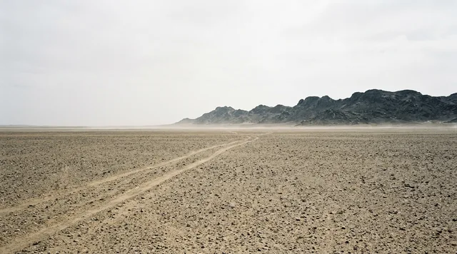
The remote-sensing account: the most extreme maximum temperatures occur at bare-soil surfaces under full solar illumination and low wind speed, where the soil is dry and has a very low albedo and low thermal conductivity. NASA's summary is that a surface should absorb most light and reflect little, and should not conduct heat well — rocky deserts offer the perfect combination — and that the hottest temperatures were observed at locations without vegetation.
The Lut supplies the dark surface literally. The Gandom Beryan lava flow has been dated to 2.35 ± 0.22 million years, and marks the onset of wind erosion in the basin. Over it lie vast areas of closely packed rock fragments — desert pavement — with almost no reflectivity.
Then the basin. The 2021 paper attributes the Lut's exceptionalism to its mountain-surrounded terrain, which limits air movement and enhances heat trapping, together with its heat-absorbing blackened sand. The floor sits at 117 metres above sea level, and the surrounding ranges cast a rain shadow that keeps the whole region hyper-arid. Dark rock, still air, no water, no plants, full sun. A hotplate, with a lid.
The kaluts
The landform the Lut is inscribed for is younger than the lava and stranger than the heat.
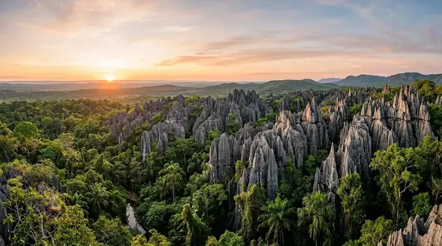
During the Pliocene the site of the yardangs was a lake. It dried; the sediments — silt, clay and silty clay interbedded with salt and gypsum, formally the Lut Formation — were first channelled by rills and gullies, then carved by a wind with a name and a schedule: the Sistan, which blows continuously for 120 days.
The result is a field of parallel ridges and corridors — kaluts — running for kilometres. Their height is genuinely disputed. UNESCO's inscription text gives yardangs some reaching 155 metres high with ridges extending over 40 kilometres. The IUGS geoheritage listing and Iranian geomorphologists claim the highest yardangs in the world at more than 225 metres. We are not going to arbitrate between a World Heritage citation and a geological union; if you see a single confident figure quoted anywhere, it has picked a side without telling you.
The Lut is also a machine for moving material. Long-term erosion has excavated on the order of 1,500 km³ of sediment since the early Quaternary, at roughly 0.1 mm a year, with an estimated 2.2 million cubic metres a year currently leaving as atmospheric dust. What the wind does not export it piles up: the Rig-e Yalan sand sea covers over 13,000 km², with giant transverse dunes over 100 metres high and wavelengths above two kilometres.
It is not sterile
The claim that nothing lives in the Lut is repeated constantly and we could find no primary source for it. The evidence points the other way.
In 2018 researchers isolated radiation-resistant, desiccation-tolerant bacteria from soil and surface sand at Gandom Beryan hill — the black lava outcrop at the heart of the hot zone. Two strains, a Modestobacter and a Maritalea, survived ionising radiation doses of between 2 and 4 kGy and were recoverable after eight weeks of desiccation. It was the first report of a radiation-resistant Maritalea. A 2022 review synthesised the wider picture — halophilic archaea, actinomycetes, Deinococcus species — and treated hyperarid sterility as an assumption the evidence does not support. In 2024 a new diatom genus, Lutophila, was described from hypersaline pools and a saline river in the central Lut depression.
Meanwhile the first Iranian field measurement, taken in July 2022, recorded a maximum surface temperature of 73.5 °C — real, and lower than the satellite figure, which is exactly what you would expect from a point reading on a single day against an eighteen-year maximum across a one-kilometre cell.
Why the Silence Index is 92
The Lut posts the highest access-friction score in our archive short of Socotra, and for reasons no ticket price can fix: geopolitics at the border and physics at the surface. Footfall across the core zone is effectively zero for most of the year, and the summer interior repels human presence outright. The acoustic floor is the profound silence of a place with no vegetation to rustle and no animals to call. The unresolved column is full: how hot the hottest year will be, how far life persists at the surface extremes, how tall the kaluts actually are, and when the world will be able to look at any of it again. It falls short of the maximum only because the fundamentals of a visit — a road, a gateway town, licensed guides — exist and have worked before.
 AI illustration
The management problem nobody sees
IUCN rated the site's conservation outlook Good in 2017 and again in 2020. In 2025 it was downgraded to Good with some concerns. Natural processes in the harsh desert environment will, the assessment says, effectively maintain World Heritage values over most of the site for the foreseeable future — but insufficient funding, a shortage of staff, illegal activities including mining exploration, rural and urban development pressure, and illegal off-roading all require greater attention.
Underneath that sits an administrative tangle. Responsibility is split between the Forests, Range and Watershed Management Organization, the Department of Environment, and the cultural heritage authority, and the UNEP-WCMC datasheet records the flat observation that it is unclear as to which organisation has authority. Twenty personnel were based at the Shafiabad office. Recorded visitors had already risen from about 57,000 in 2010 to about 77,500 in 2013 — this was not an unvisited place before the advisories closed it.
One last detail, and it is the dossier in miniature: UNESCO's own page for the Lut Desert still cites the superseded figure of 70.7 °C. The World Heritage listing for the hottest surface on Earth has not been updated to the number that made it famous.
Corner Codex — D-016
- Place
- Dasht-e Lut, spanning Kerman, Sistan-Baluchestan and South Khorasan, southeast Iran
- Coordinates
- 30.6°N, 57.9°E — the World Heritage property centred near 30°12′N 58°50′E
- Status
- UNESCO World Heritage 2016, criteria (vii) and (viii). Property 2,278,015 ha
- Highest land surface temperature
- 80.8 °C, from 18 years of MODIS data — tied with Mexico's Sonoran Desert
- Highest air temperature
- Not recorded. There is no weather station in the Lut
- The official world record
- 56.7 °C, Furnace Creek, Death Valley, 10 July 1913 — now formally challenged
- Basin floor
- 117 m above sea level, ringed by mountains
- Silence Index
- 92 / 100
- Advisories
- The UK advises against all travel to Iran. The US advisory is Level 4: Do Not Travel
Silence Index
A legacy editorial rating based on desk research. It is not an acoustic measurement or a safety rating.
Earlier and later dossiers used different fourth inputs. Individual input scores were not recorded, so these totals cannot be independently reproduced or used for precise comparisons between places.
The Traveler's Panel · checked
Changing information. Prices, permits, seasons and road access change, sometimes at short notice. Everything here is a starting point for your own confirmation — not a quote, and not a guarantee. Verify with the operator and the relevant official body before you book.
| Can you go | No. Both the UK and US advise against all travel to Iran |
| Season, when open | November to March. Summer is not survivable in the interior |
| Base | Kerman, with Shahdad as the desert gateway |
| Vehicle | 4WD mandatory for the off-road sections |
| Guides | Licensed Iranian operators only; the route crosses a restricted zone |
| Nearest facilities | A seasonal desert camp near Shafiabad — arbours, electricity, WCs |
Getting there — the route, for the record
- Kerman is the historic base: a provincial capital at altitude, with the bazaars and caravanserais, and in open years the guides.
- The road to Shahdad crosses the Sirch pass and drops nearly two kilometres of elevation into the desert basin. The temperature climbs with every switchback down.
- From Shahdad, graded tracks reach the edge of the kaluts — roughly 45 km out. Operators time arrivals for late afternoon, when the ridges throw shadows and the ground begins to release its heat.
- Overnight camps sit at the field's margins. Deeper crossings toward the eastern dunes are genuine expeditions with support vehicles.
- All of it, at present, sits behind your government's travel advice. Start there, not with a booking site.
Indicative costs — verify before booking
| Two-day guided off-road trip | From about €266 including an English-speaking guide, in open years |
| Vehicle | 4WD is not optional for the off-road sections and is priced accordingly |
| Visa | Requires an organised tour or an in-country sponsor — there is no independent route |
| Insurance | Assume void. Sanctions and advisories make ordinary policies inapplicable |
| The real cost | Consular support does not exist. The FCDO states that no face-to-face consular assistance will be possible in an emergency |
What to pack
- More water than you believe you need, and the discipline to drink it on a schedule.
- Full sun cover — long sleeves, head covering, high-factor protection. Shade does not occur naturally in the kaluts.
- Warm layers for the night. A cloudless desert at altitude loses its heat fast.
- Dust protection for cameras and lenses. This basin exports over two million cubic metres of dust a year.
- A satellite messenger if you can carry one legally. Mobile coverage ends well before the kaluts do.
Where to stay
Kerman has the range — restored caravanserai hotels in the old city, ordinary business hotels near the centre, and the guesthouses that in open years handled desert trips. Shahdad is a small town rather than a resort, and functions as the last place with fuel, water and a phone signal. In the desert itself there is one established camp near Shafiabad, offering around forty shaded arbours with electricity and toilets, closed seasonally. Nothing beyond it is accommodation in any recognisable sense.
Safety & responsible travel
- Do not drive off the established tracks. Illegal off-roading is named by IUCN as an active threat to the property, and yardang surfaces do not recover on any human timescale.
- The kaluts are a geological archive, not scenery. Take nothing — the Lut Formation's salt and gypsum layers are the record of the lake that made them.
- Do not repeat the claim that nothing lives here. It is unsourced, and researchers have isolated bacteria from the hottest ground on the planet.
- Respect the restricted-zone rules absolutely. The route passes through controlled areas inside a World Heritage property in a country where a misunderstanding is not a small matter.
- Do not travel against your government's advice on the strength of a travel article, including this one.
Nearby, and quieter
Kerman's own set pieces stand independent of the desert: the Ganjali Khan complex with its bathhouse and bazaar, and the Shazdeh Garden at Mahan — a Persian garden running down a slope in the middle of arid ground, which is its own commentary on this landscape. Rayen citadel gives an idea of what Bam looked like before the 2003 earthquake. All of them sit inside the same advisory.
Getting there, in order
- 1Lut Desert World Heritage property (centre)
- 2Kerman International Airport
- 3Shahdād
- 4Kerman
Each leg is a separate booking and a separate chance to be weathered out. Build spare days into the chain, not onto the end of it.
Where it is
Iran · 30.6000°N 57.9000°E · Open in Google Maps · OpenStreetMap
Key locations
- Lut Desert World Heritage property (centre) — the point UNESCO gives for the 2.28 million-hectare inscribed property
30.2161°N 58.8389°E - Shahdād — the desert gateway; graded tracks reach the kaluts about 45 km out
30.4172°N 57.7067°E - Kerman — the provincial base, and where the licensed operators are in open years
30.2831°N 57.0786°E - Kerman International Airport — the nearest airport, at 1,749 m before the drop over the Sirch pass
30.2744°N 56.9511°E - Gandom Beryan — the black lava plateau where the radiation-resistant bacteria were isolated
31.3430°N 57.5170°E
Coordinates are for orientation and are accurate to roughly the width of the feature named, not to a doorway. Several of these points are inside protected areas or need a permit, a guide or a boat — read the access notes above before you plan a route to any of them.
Sources & further reading — checked
- Zhao, Norouzi, Azarderakhsh & AghaKouchak — Global Patterns of Hottest, Coldest and Extreme Diurnal Variability on Earth (BAMS, 2021). The 80.8 °C figure for the Lut and the Sonoran Desert, over ten degrees above the previous 70.7 °C record; the underlying Aqua/MODIS MYD11A1 dataset from 4 July 2002 to 31 December 2019; and the attribution to mountain-surrounded terrain and heat-absorbing dark sand
- Mildrexler, Zhao & Running — Satellite Finds Highest Land Skin Temperatures on Earth (BAMS, 2011). The superseded 70.7 °C record from 2005; the Lut as hottest on Earth in five of seven years; the largest contiguous area above 65 °C anywhere; Death Valley's 62.7 °C maximum; the 30–50 °C divergence between surface and air temperature; and the remoteness that makes weather stations impractical
- NASA Earth Observatory — Where Is the Hottest Place on Earth?. The barefoot-on-pavement explanation of surface versus air temperature, the albedo and thermal conductivity conditions for extreme surface heat, and the observation that the majority of Earth's hottest spots are not directly measured by ground instruments
- NASA Earth Observatory — Iran's Lut Desert. The Lut and Sonoran tie from 18 years of MODIS data, and the rain shadow cast by the surrounding mountains
- NASA MODIS Science Team — Azarderakhsh et al., IEEE Geoscience and Remote Sensing Letters. The independent record of 80.83 °C dated to 2018, and diurnal swings of roughly 71 °C
- World Meteorological Organization — WMO is monitoring potential new temperature records. The official world record air temperature of 56.7 °C at Furnace Creek, Death Valley, on 10 July 1913
- American Meteorological Society — Global Record in Question: Could Death Valley lose its claim?. The 2025 BAMS paper by Spencer, Christy and Reid reconstructing the 1913 maximum at roughly 120 °F, calling the discrepancy far outside the expected margin of error and recommending the record be rescinded, and the WMO Rapporteur's response
- World Meteorological Organization — WMO Archive of Weather and Climate Extremes. The 2012 invalidation of the 58 °C El Azizia record, the five faults identified including an inexperienced observer with an unsuitable instrument and an observation site over asphalt-like material, and the ad-hoc committee process by which records are adjudicated
- World Meteorological Organization — WMO verifies 3rd and 4th hottest temperature recorded. 53.9 °C at Mitribah, Kuwait on 21 July 2016 and 53.7 °C at Turbat, Pakistan on 28 May 2017, and the first evaluation to require two independently calibrated sensors compared simultaneously
- UNESCO World Heritage Centre — Lut Desert. Inscription in 2016 under criteria (vii) and (viii); property area 2,278,015 ha; the yardang citation of some reaching 155 metres with ridges over 40 km; and the listing's continued use of the superseded 70.7 °C figure
- IUGS Geoheritage Sites — Yardang (Kalut) in the Lut Desert. The Pliocene lake origin of the yardang substrate, the Lut Formation of silt, clay, salt and gypsum, the 120-day Sistan wind as the carving agent, and the competing claim of yardangs over 225 metres high
- Chanteloube et al. — Source-to-Sink Aeolian Fluxes From Arid Landscape Dynamics in the Lut Desert (Geophysical Research Letters, 2022). The Gandom Beryan lava flow dated to 2.35 ± 0.22 million years; excavated sediment volumes of about 1,500 km³ since the early Quaternary at roughly 0.1 mm/yr; the 2.2 million m³/yr lost as atmospheric dust; and the Rig-e Yalan sand sea of over 13,000 km²
- IUCN — World Heritage Outlook: Lut Desert. The downgrade from 'Good' in 2017 and 2020 to 'Good with some concerns' in 2025, citing insufficient funding, staff shortage, illegal mining exploration, development pressure and illegal off-roading
- UNEP-WCMC — World Heritage Datasheet: Lut Desert. The split of management responsibility across three Iranian agencies and the note that it is unclear which organisation has authority; twenty personnel at the Shafiabad office; and recorded visitors rising from about 57,000 in 2010 to about 77,500 in 2013
- Shirsalimian et al. — Isolation of radiation-resistant and desiccation-tolerant bacteria from Gandom Beryan hill (Microbiology, 2018). Modestobacter sp. A2 and Maritalea sp. B9 isolated from the hottest zone, surviving 2–4 kGy and recoverable after eight weeks of desiccation — the first report of a radiation-resistant Maritalea
- Kheiri et al. — Lutophila gen. nov., a new diatom genus from the Lut Desert (Phytotaxa, 2024). The description of a new diatom genus from hypersaline pools and a saline river in the central Lut depression
- Tehran Times — Lut Desert offers untapped potential for science, geotourism. The first Iranian field measurement in July 2022 recording a maximum surface temperature of 73.5 °C
- UK Foreign, Commonwealth & Development Office — Iran travel advice. The advice against all travel to Iran, updated 22 July 2026, and the statement that no face-to-face consular assistance will be possible in an emergency
- US Department of State — Iran Travel Advisory, Level 4. The 5 December 2025 advisory: do not travel to Iran for any reason, and US citizens in Iran should leave immediately
Official and scientific bodies are the authority for safety, regulatory and scientific claims. Commercial operators are used only for practical detail such as tour length, meeting points and indicative pricing — never for a safety or scientific statement.
How this was made
Desk research. Compiled from official bodies, scientific and conservation sources, established journalism and licensed operators. Not based on a personal visit.
Editor’s method note — what we checked, corrected and could not verify
- Desk research only. No one from this publication has been to the Lut.
- We distinguish throughout between land surface temperature, which satellites measure, and air temperature, which the WMO certifies. Any article that compares 80.8 °C with 56.7 °C without that distinction is comparing two different quantities.
- Kalut height is genuinely unresolved between UNESCO's 155 m and the IUGS figure of over 225 m. We give both and arbitrate neither.
- We could not verify which desert reached 80.8 °C in which year. The accessible text places the maxima in 2018 and 2019 without attributing a year to each site.
- No verified air-temperature observation from inside the property exists. The 73.5 °C figure reported from July 2022 is a surface measurement and we could not trace it to a published paper.
- Coordinates for the key locations come from UNESCO's property record, the Smithsonian Global Volcanism Program for Gandom Beryan, and the GeoNames gazetteer for Kerman and Shahdād. Two places named in the dossier are left off because no gazetteer we could open holds them: the Shafiabad ranger office and camp, and the kalut viewing area itself, which is described only as a distance along a track from Shahdād.
- Things we could not verify: the height of the kaluts, which UNESCO gives as 155 m and the IUGS as over 225 m; which of the two deserts reached 80.8 °C in which of 2018 and 2019; any air-temperature observation taken inside the property; the published source of the 73.5 °C surface figure reported for July 2022; a gazetteer position for the Shafiabad ranger office and camp; and a gazetteer position for the kalut viewing area, which is described only as a distance along a track from Shahdād.
AI is used to draft this text, and a human checks it. Tony Hall is responsible for editorial verification against the reference list. Our standard is to distinguish documented facts, disputed accounts and claims we could not verify. Errors can remain; readers can report them through the corrections page. The illustrations are AI-created and labelled as such — no photograph on this site is presented as a record of a real place. Full disclosure · Editorial policy.
Access details change — recheck before you travel. Found an error? Tell us — corrections are dated and shown in place.