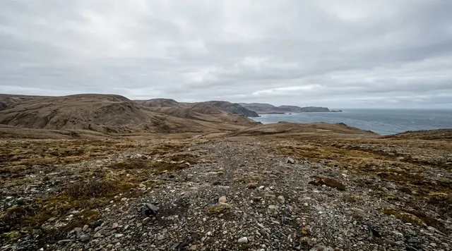
AI illustration
 Edited by
 There are islands that disappear in fog, and then there is Lítla Dímun, which seems to manufacture a cloud for itself. South of Sandoy and north-east of Suðuroy, a dark basalt mass rises straight out of the Atlantic to 413 metres. Moist air climbs its face, cools and sometimes folds into a white cap so neat that the summit appears to be wearing weather. Beneath it are eighty-two hectares of grass, several hundred sheep, nesting birds, a small hut—and no permanent human resident.
The photograph makes Lítla Dímun look like a lost kingdom. The facts make it stranger. It is the smallest of the Faroes' main islands and the only one uninhabited by people; it is also private property divided among many owners, principally connected with Hvalba. High coastal cliffs encircle it and there is only one practical line of ascent. No public ferry calls, no harbour receives visitors and no path begins conveniently at sea level. The right question is therefore not ‘How do I get onto it?’ but ‘What does it mean to encounter a place whose refusal of easy access is still intact?’
First, the cloud is not permanent
Lítla Dímun's famous hat is a cap cloud: a local expression of ordinary mountain meteorology made theatrical by the island's isolation. Moist maritime air is forced upward by the steep rock, expands as pressure falls and cools toward saturation. If wind, humidity and stability align, cloud forms over the summit while the surrounding sky—and sometimes the entire lower island—remains clear. As the air descends on the lee side it can warm again, leaving a cloud that appears pinned to one object.
It is often called lenticular in captions, but a perfectly classified cloud matters less than the mechanism and the honesty: Lítla Dímun does not always have one. On a dry or differently structured day the summit is bare; in poor weather the whole island can vanish. ‘The island under a permanent cloud’ is the dossier's poetic title, not a forecast. Hiddencorners will not promise a phenomenon that depends on moving air.
That uncertainty improves the view. You begin looking not only at the island but at pressure, wind direction and the height at which grey condenses into white. A place that cannot be booked teaches attention before it teaches arrival.
The cloud is not permanent. The island's talent for making weather visible is.
 AI illustration
Eighty-two hectares with one way up
Denmark's national encyclopaedia records an island only 82 hectares in area, almost round in plan, yet 413 metres high. Those numbers explain its proportions: this is less a small island with a hill than a mountain whose shoreline has been cut away. High, steep sea cliffs surround it, and the same source identifies only one place where ascent is possible.
Possible does not mean public, simple or safe. A boat must first hold near rock without a protective harbour. People and equipment then transfer in swell. The established line through the cliff band is steep enough that ropes and local technique are part of its working history. Above the obstacle, grass tilts toward edges that may be hidden by cloud. A retreat must repeat the exposure in reverse, and the sea may have changed while everyone was ashore.
The owners maintain a hut in the mountainside where they can stay during sheep work. Its existence is easy to romanticise, but it is not visitor infrastructure. It is a practical shelter created for the people responsible for animals and land at an address where a missed weather window matters.
On most islands, the harbour is where risk ends. On Lítla Dímun, the absence of a harbour is where the island begins.
The owners, the sheep and the wrong meaning of empty
Lítla Dímun has been privately owned since the nineteenth century and is now divided among many owners. The arrangement is communal in practice: sheep husbandry on steep Faroese land needs collective labour, particularly when animals are gathered. The official Faroe Islands gateway describes that wider tradition as work in which families and communities come together because one person cannot do it alone.
A few hundred sheep graze the island — Trap Færøerne, the Faroese national reference, puts the flock at 280 and records that the autumn sale proceeds go into Lítla Dímun's common purse. They are not the animals that made the island famous in zoological history. A distinctive small, dark, short-woolled and unusually wild population survived here into the nineteenth century and was then deliberately shot out. The Faroese government's account says what was thought to be the last of it was killed in 1860.
Two details in that story are routinely garbled, and one of them we had wrong ourselves. The three stuffed specimens at the National Museum are not the 1860 animals: a 2025 study in BMC Genomic Data dates them to 1844, sixteen years earlier. And the animals' identity is contested. The Faroese government calls them the original Norse breed; the account derived from Ryder's work describes a feral population, resembling Soay sheep, probably descended from the earliest sheep brought into northern Europe. Those are different claims about what was lost, and no source we opened settles between them.
What the genetics does establish cuts against the neat version. The same 2025 study finds that present-day Faroese sheep hold an unbroken genetic link to the pre-1600 population rather than descending mainly from later Icelandic, Shetland and Orkney imports. What was exterminated on Lítla Dímun was a distinct island population, not the archipelago's whole ancestry. Today's sheep belong to the hardy Faroese domestic tradition, and that tradition is older than the extermination.
This changes the ethics of the word uninhabited. No one has a permanent house here, but the island is neither abandoned nor without claims. It is pasture, responsibility, shared history, bird habitat and private land. A traveller who sees ‘nobody lives there’ as an opening has misunderstood the place before leaving shore.
Uninhabited is a census fact. It is not a synonym for ownerless, unused or waiting.
Dímun before the itinerary
Even the name resists a clean translation. Lítla is the smaller; nearby Stóra Dímun is the larger. Lex notes that Dímun may be Celtic in origin, possibly meaning ‘two peaks’. The uncertainty is worth preserving. Island names can outlive the languages that first shaped them, carrying a fragment without supplying a key.
The medieval Færeyinga saga already treats Little Dímun as uninhabited and places it within the violent political world of early Faroese chieftains. A saga is literature, not a modern land register, but its inclusion shows that the island was never outside human imagination. People knew it, used it, feared its access and folded it into stories long before a travel photograph made the cloud famous.
That older presence should quiet the language of discovery. Lítla Dímun is hidden only from easy consumption. It was not hidden from the Hvalba families who secured and worked it, from the crews who learned its landing, or from generations who could identify its silhouette before cloud revealed the summit.
A place can be difficult for visitors and still be thoroughly known.
 AI illustration
The rare day the island says yes
Occasional owner-approved or community-organised trips have put non-owners ashore when sea, wind, cloud, crew and land work all align. Their rarity is the point. They are not a scheduled attraction with an entitlement to completion. An announcement does not overrule a changed forecast, and payment does not purchase a dangerous landing.
If a legitimate Faroese organiser publicly offers such a day, verify who has granted access, what experience the boat crew has and exactly what the fitness requirement means. Expect a wet transfer, steep assisted movement and cancellation even at the last moment. Follow instructions without negotiation. Do not contact owners repeatedly, approach in a private boat or ask a skipper to ‘just try’ because your dates are fixed.
For almost everyone, the more truthful encounter is offshore. The M/F Smyril connects Tórshavn and Suðuroy in about two hours and five minutes on its published route. In usable visibility, the crossing can give a moving view of the Dímun islands; exact sight lines and deck side depend on route, weather and operational conditions, so ask crew without obstructing working areas. Northern Suðuroy also offers distant land-based views when cloud permits.
Access here is an event produced by consent and weather, not a product kept in stock.
How to photograph a place without entering it
A long lens from a lawful ferry deck does more than solve the distance. It preserves the relationship that gives Lítla Dímun its power: a complete island, a complete cliff and a cloud with enough sky around it to be understood. The urge to launch a drone often comes from believing proximity automatically creates a better picture. Here it can instead introduce aircraft risk, livestock disturbance, bird disturbance and conflict with private ownership.
Faroese drone rules apply throughout the archipelago, and the official guidance instructs pilots to check the current geographic zones before every flight. Compliance with aviation law would still not create permission to launch from private land, disturb animals or treat Lítla Dímun as a target. For this dossier the practical recommendation is simpler: leave the drone packed.
Make the weather part of the frame. Photograph the cloud forming, breaking or failing to appear. Record the ferry rail or the scale of neighbouring sea. An honest image can admit that the photographer remained outside—and that remaining outside was the knowledge the island gave.
Distance is not what is missing from the photograph. On Lítla Dímun, distance is the subject.
Hiddencorners position
Hiddencorners does not recommend an independent landing, speculative charter or unauthorised climb on Lítla Dímun. The island is private working land with a single difficult ascent, no public harbour and real exposure to Atlantic conditions. The default visit is a view—from the Smyril ferry, northern Suðuroy or another lawful public position. If a genuine owner-approved excursion is announced, access remains conditional on the organiser, landowners and weather right up to the attempt. Refusal is not a failure of hospitality. It is the system that has kept this small place from becoming a consumable summit.
Why the Silence Index is 93
A score of 93 reflects physical visitation, not internet fame. There is no permanent population, public pier, regular visitor boat, café, marked tourist ascent or accommodation. Most days in most years, the only people with practical reason to land are those responsible for sheep and land. Cloud can erase visibility; swell can erase the landing; wind can erase the idea of climbing.
It stops short of the very top because Lítla Dímun is visible from inhabited islands and a principal inter-island ferry, appears frequently in Faroese imagery and occasionally admits organised groups. Its silhouette is not unknown. The silence lies in the gap between recognising it and standing on it.
Corner Codex — D-020
- Place
- Lítla Dímun, Faroe Islands
- Coordinates
- Approx. 61.64°N, 6.71°W; 82 ha; summit 413 m
- Getting there
- View from M/F Smyril on the Tórshavn–Suðuroy route or from lawful northern-Suðuroy viewpoints; land only through an explicitly owner-approved Faroese organiser
- Rules
- Private working island. No independent landing or ascent. Any drone operation must meet current Faroese aviation rules plus landowner, wildlife and launch-site permissions; Hiddencorners recommends no drone here
- Season
- Longer light from May to August improves viewing opportunities, but no month guarantees cloud, clear visibility or a safe close approach
- Silence Index
- 93 / 100
- Still open
- Can a travel culture accept that seeing a place clearly may be a complete encounter—even when the shore is never touched?
Silence Index
A legacy editorial rating based on desk research. It is not an acoustic measurement or a safety rating.
Earlier and later dossiers used different fourth inputs. Individual input scores were not recorded, so these totals cannot be independently reproduced or used for precise comparisons between places.
The Traveler's Panel · checked
Changing information. Prices, permits, seasons and road access change, sometimes at short notice. Everything here is a starting point for your own confirmation — not a quote, and not a guarantee. Verify with the operator and the relevant official body before you book.
| Status | Privately owned, uninhabited working island; no routine visitor service |
| Scale | 82 hectares; summit 413 m; high cliffs with one practical ascent line |
| Reliable encounter | Daylight view from the public Smyril ferry or northern Suðuroy |
| Smyril crossing | Tórshavn–Suðuroy: about 2 hr 05 min on the current official timetable |
| Landing | Only through a clearly authorised local event; highly weather-dependent and cancellable |
| Facilities | None for visitors: no harbour, toilet, shop, shelter or marked public trail |
| Main hazards | Open-water transfer, swell, falling rock, steep assisted ascent, hidden cliff edges, fog and violent wind |
| Best ethical choice | Plan to view only; regard any legitimate landing as an unexpected exception |
Getting there
- Book or buy the current M/F Smyril passage between Tórshavn and Suðuroy using Strandfaraskip Landsins. Recheck operational notices on the day.
- Choose a sailing with useful daylight and a forecast offering offshore visibility. A clear capital does not guarantee a clear Dímun passage.
- Once aboard, ask crew politely which public deck may offer a view. Never enter vehicle, cargo or crew-only areas for a photograph.
- Use a weather-sealed long lens or binoculars. Keep straps secure in wind and do not lean equipment beyond the rail.
- For a land view, stay in registered accommodation on Suðuroy and ask a host for a lawful public viewpoint appropriate to that day's wind and cloud.
- If an owner-approved excursion is announced, verify organiser identity, land permission, equipment, insurance, fitness threshold and cancellation policy directly. Do not make onward travel depend on it.
- If the organiser cancels or the island remains hidden, do not seek a substitute private approach. The cancelled landing is accurate information about the place.
Indicative costs — verify before booking
| Smyril foot passenger | Use the current Strandfaraskip Landsins fare page or booking system; schedules and special-event operations change |
| Suðuroy bus connection | Check current routes 700/701 and any ferry-linked changes |
| Owner-approved island day | No dependable public annual schedule or standard price; use only the named authorised organiser |
| Viewing from public land | Free, provided the position is genuinely public and no local access fee applies |
| Verify | Prices and availability change. Confirm current details directly before booking. |
What to pack
- Windproof waterproof shell, warm mid-layer, hat and gloves—even in summer
- Binoculars or a weather-sealed long lens; microfiber cloth for salt spray
- Secure camera strap and a dry bag for the ferry deck
- Motion-sickness medication if appropriate, taken according to medical advice
- Offline transport details, charged phone and power bank
- For an authorised landing only: every item specified by the organiser, with no substitutions
- Curiosity without a drone—the lightest and least disruptive equipment choice here
Where to stay
There is nowhere to stay on Lítla Dímun and its owners' working hut is not visitor accommodation. Tórshavn is the easiest base for the Smyril terminal and gives flexibility after a poor-visibility sailing. A night or two on Suðuroy creates a better relationship to the island: local hosts can advise on public viewpoints, weather and bus connections, and spending remains in the community that has historical ties to Lítla Dímun. Book registered accommodation rather than treating roadside pull-offs or farmland as informal campsites.
Safety & responsible travel
- Do not arrange an unauthorised landing, climb or private-boat approach. There is no harbour and only one practical ascent through the cliffs.
- Do not pressure a skipper or organiser after cancellation. Sea-state judgement belongs to the crew; land access belongs to the owners.
- Remain in public passenger areas on Smyril and follow crew instructions during rough weather.
- Keep off private fields on Suðuroy when seeking viewpoints. Ask locally and close every gate.
- Avoid drone use: legality, land permission, birds, sheep and high-wind control are separate issues, not one checkbox.
- Never use the dossier's AI illustrations to judge cloud base, cliff condition, landing water or route exposure.
- Treat sheep gathering and owner visits as work, not a show. Photograph people only with clear permission.
Nearby, and quieter
Hvalba and Sandvík on northern Suðuroy offer a lived landscape of basalt, grazing and Atlantic weather without requiring access to Lítla Dímun. Marked or locally approved walks can explain the same relationship between sheep and steep land. The Smyril passage also reveals Stóra Dímun, the larger inhabited counterpart, and that one can actually be visited: Atlantic Airways runs a helicopter day-trip to it on Thursdays from 4 June to 27 August 2026, about two hours for DKK 3,000, landing on an island that has neither road nor harbour. It is the closest thing to a scheduled Dímun landing that exists, and it is not Lítla Dímun. In Tórshavn, the National Museum provides the essential afterword—the preserved old Lítla Dímun sheep turn a distant silhouette into a specific story of domestication, extinction and memory.
Where it is
Faroe Islands · 61.6400°N 6.7100°W · Open in Google Maps · OpenStreetMap
Key locations
- Lítla Dímun — the island itself: 82 hectares, 413 m, one ascent line, no harbour
61.6315°N 6.7075°W - Stóra Dímun — the larger Dímun the name distinguishes it from
61.6922°N 6.7556°W - Hvalba — the Suðuroy village most of the island's owners are connected with
61.6024°N 6.9606°W - Sandvík — northernmost Suðuroy village, for a land-based view when cloud allows
61.6328°N 6.9246°W - Tórshavn harbour — where the M/F Smyril leaves for the two-hour Suðuroy crossing
62.0073°N 6.7645°W - Krambatangi — the Suðuroy ferry terminal at the other end of that crossing
61.5480°N 6.8169°W
Coordinates are for orientation and are accurate to roughly the width of the feature named, not to a doorway. Several of these points are inside protected areas or need a permit, a guide or a boat — read the access notes above before you plan a route to any of them.
Sources & further reading — checked
- Trap Færøerne — Lítla Dímun. The Faroese national topographic reference: an uninhabited island of 0.82 km²; formerly Crown leasehold land sold at auction in 1850 to the inhabitants of Hvalba; a flock of 280 sheep sold at auction each autumn into Lítla Dímun's common purse; and a small shelter built for use during sheep-driving and bird-catching.
- Lex, Denmark's National Encyclopaedia — Lítla Dímun. 82-hectare area, 413-metre height, high steep coastal cliffs, the statement that ascent is possible at only one place, private ownership since 1850, the mountainside hut used during sheep gathering, a few hundred sheep, and the cautious note that Dímun may be Celtic and may mean 'two peaks'; last modified 26 March 2026.
- Kringvarp Føroya — Lítla Dímun: gimsteinurin í sjónum. Faroese public-service documentary, edited 2014 and broadcast 5 February 2015: the purchase from the Crown at auction on 24 August 1850 by people from Hvalba, the subsequent harvesting of seals, birds and eggs, and first-hand accounts of falls and of parties stranded by weather.
- Færeyinga saga — Saga Database text. Chapter 7 describes the smaller Dímun as uninhabited — 'hún er óbyggð' — and used for pasturing livestock intended for slaughter. Used only as a medieval literary source for the island's long presence in Faroese imagination, not as evidence of modern access or ownership.
- Strandfaraskip Landsins — Route 7 Suðuroy–Tórshavn. The national ferry operator's own page for the M/F Smyril on route 7, giving the crossing as 2 hr 05 min, with the current departure pattern and operational notices.
- Atlantic Airways — Dímun Island Adventure. The only scheduled commercial landing on either Dímun: a helicopter visit to Stóra Dímun, not Lítla Dímun, at DKK 3,000 per person, Thursdays between 4 June and 27 August 2026, about 120 minutes, subject to postponement for weather and to the helicopter's prior search-and-rescue obligations.
- Visit Faroe Islands — Dímun Island Adventure listing. The destination organisation's description of the same trip: Stóra Dímun reached only by helicopter because it has neither roads nor harbour, a guided walk with the resident farming family, and views across to Lítla Dímun without landing on it.
- American Meteorological Society — Glossary of Meteorology, 'cap cloud'. The formal definition this dossier relies on: an approximately stationary or standing cloud on or hovering above an isolated mountain peak, formed by cooling and condensation in moist air forced up over the peak.
- American Meteorological Society — Glossary of Meteorology, 'orographic lifting'. Ascending airflow caused by mountains, through direct deflection of horizontal flow and through daytime surface heating, with the note that orographic fog or cloud may form where the rising air is moist enough.
- WMO International Cloud Atlas — orographic influence on the windward side. The mechanism in the World Meteorological Organization's own words: air forced to rise over terrain, and for isolated mountains an orographic cloud forming as a collar around the peak or a cap covering it, producing little or no precipitation, while cloud thins and dissipates in the descending air on the lee side.
- WMO International Cloud Atlas — cloud species lenticularis. Lenticularis defined as lens- or almond-shaped clouds with well-defined outlines, applied to Cirrocumulus, Altocumulus and Stratocumulus, appearing most often in formations of orographic origin but not exclusively so — the basis for this dossier's caution about the word.
- Met Office — unusual cloud formations. The UK national weather service on lenticular cloud: air blowing across high ground sets up a train of standing waves downstream, and cloud forms and reforms in the wave crests, which is why it appears fixed relative to the terrain while the air itself keeps moving through.
- Met Office — the foehn effect. The four mechanisms that warm and dry air on the lee side of a barrier — condensation and precipitation upstream, draw-down of higher air, turbulent mixing and radiative warming — which is why a cap can appear pinned to the windward summit and dissolve immediately downwind.
- Houze — Orographic effects on precipitating clouds, Reviews of Geophysics 50 (2012). The peer-reviewed treatment of why upslope flow is not simple: the nondimensional ratio U/Nh determines whether oncoming air rises over terrain or is blocked and dammed in front of it, which is the reason a cap cloud forms on some days and not others in apparently similar weather.
- Faroe Islands official gateway — The Sheep Islands. The Faroese government's own account of the small hardy breed and of collective seasonal husbandry in which whole families and communities take part; and the statement that what is thought to have been the last of the original Norse breed was shot in 1860 on Lítla Dímun, with three stuffed specimens at the National Museum.
- Faroese sheep expand overall global ovine genetic diversity — BMC Genomic Data 26 (April 2025). Peer-reviewed correction of the museum detail: the three National Museum specimens were shot in 1844, while the last known animal was shot on Lítla Dímun around 1860. Also finds present-day Faroese sheep hold an unbroken genetic link to the pre-1600 population and occupy a peripheral position among North Atlantic short-tailed breeds.
- Government of the Faroe Islands — The Sheep Islands. The official account of how the population ended: what is thought to have been the last of the original Norse breed was shot on Lítla Dímun in 1860, the animals are described as having been particularly wild, and three stuffed specimens remain at the National Museum of the Faroe Islands. Note the source says wild and shot, not feral and farmed — we have followed its wording.
- Hansen, Gerðinum, Våge and Mikalsen — Faroese sheep expand overall global ovine genetic diversity, BMC Genomic Data (2025). The peer-reviewed position, which is more cautious than the popular one: the last known animal was shot at Lítla Dímun around 1860, Svabo described the island's animals as a separate sheep species while noting the harsh conditions, and three animals shot there in 1844 are held by the Faroese National Museum. The paper declines to classify the population as feral rather than an isolated domestic stock, and neither do we.
- Vágar Airport — official drone-flying information. European drone regulation plus the Faroese order on drones: a 120-metre ceiling, visual line of sight, a 5 km buffer from Vágar airport and 2 km from helicopter landing sites, restrictions over protected areas and whale drives, and the interactive zone map at dronusonur.fo.
- Visit Faroe Islands — drone guidance. The visitor-facing instruction to check the official drone map before every flight, together with the explicit caveat that the map may not show every place where flying is prohibited or unsuitable and that the pilot remains responsible regardless.
Official and scientific bodies are the authority for safety, regulatory and scientific claims. Commercial operators are used only for practical detail such as tour length, meeting points and indicative pricing — never for a safety or scientific statement.
Corrections to this dossier
This article has been corrected. The changes are listed here, dated, and also in the site-wide corrections log.
- — An earlier version said about 200 sheep are lowered by rope in nets. Two Faroese authorities give 280 and describe the sheep being driven in and sold at auction. The rope-and-net claim is withdrawn; where the sources still disagree on the count, both are now printed.
How this was made
Desk research. Compiled from official bodies, scientific and conservation sources, established journalism and licensed operators. Not based on a personal visit.
Editor’s method note — what we checked, corrected and could not verify
- Desk research only. Nobody from this publication has been to the Faroe Islands, and nobody from any publication lands on Lítla Dímun without the owners' consent. Everything here was assembled from Faroese and Danish reference works, the national ferry and helicopter operators, the Faroese government's own material, peer-reviewed genetics, and the standard meteorological authorities.
- This audit tripled the source list, from seven to twenty. The original seven all still load and all still support what was claimed of them; the problem was not error but thinness, particularly on the two claims the article is named for.
- The cloud. We had asserted the cap-cloud mechanism without citing a meteorological authority for any part of it. It is now grounded in the American Meteorological Society's definitions of cap cloud and orographic lifting, the WMO International Cloud Atlas on windward orographic influence — which describes exactly this, an orographic cloud forming as a cap covering an isolated peak — the Met Office on lenticular standing waves and on the foehn effect, and Houze's 2012 review in Reviews of Geophysics for why the same island produces a cap on one day and nothing on the next. The article's existing refusal to promise the cloud stands, and now rests on something.
- 'Lenticular' remains the wrong word used carefully. The WMO applies lenticularis to Cirrocumulus, Altocumulus and Stratocumulus, and notes it is common in orographic formations but not confined to them. A cloud sitting on a summit is a cap cloud; the two are related but not synonyms, and popular captions conflate them.
- Ownership and status are now sourced to Faroese authorities rather than to travel copy. Trap Færøerne — the Faroese national topographic reference — gives the island as uninhabited, 0.82 km², sold at auction in 1850 out of Crown leasehold to the inhabitants of Hvalba, carrying 280 sheep whose autumn sale proceeds go to a common purse. Kringvarp Føroya's documentary dates that auction precisely, to 24 August 1850. We follow the Faroese and Danish sources on 1850; the English encyclopaedia entry that circulates most widely says 1852, and we have not been able to reconcile the two, so we print the disagreement rather than resolve it.
- The sheep-breed history has been corrected. The Faroese government's page says the last of the original Norse breed was shot in 1860 and that three stuffed specimens are at the National Museum, which reads as though the museum animals are the 1860 ones. The 2025 genetics paper in BMC Genomic Data states that the three museum specimens were shot in 1844, sixteen years earlier. We have amended the body accordingly. The characterisation also differs between sources: the Faroese government calls the animals the original Norse breed, while the Ryder-derived account describes a feral population, small, black and short-woolled, resembling Soay sheep. We give both and pick neither. The same paper also complicates the tidy version of the story: it finds present-day Faroese sheep hold an unbroken genetic link to the pre-1600 population, so what was shot out on Lítla Dímun was a distinct island population rather than the archipelago's whole ancestry.
- The single-ascent claim and the near-impossibility of landing rest on Lex and Trap Færøerne, which are authoritative on both, and on the hut built for use during sheep-driving. The often-repeated detail that the animals are tied, netted five at a time and lowered by rope to skiffs has been removed from this dossier: we could not find it in any Faroese authority, and the two Faroese and Danish reference works we can open describe the sheep being driven in and sold at auction, with the flock at 280 rather than the roughly 200 given in the English encyclopaedia entry we previously cited.
- We checked whether any commercial landing on Lítla Dímun exists and found none. Atlantic Airways runs a Dímun Island Adventure, but it lands on Stóra Dímun — the inhabited neighbour — by helicopter, Thursdays from 4 June to 27 August 2026 at DKK 3,000, and it is explicitly subordinate to the aircraft's search-and-rescue duties. Nothing scheduled goes ashore on Lítla Dímun.
- Things we could not verify: whether owner-approved landings on Lítla Dímun were offered at all in 2025 or 2026, which the dossier treats as a rare exception and which we could not confirm has recently happened; the current number of sheep, given as 280 by Trap Færøerne, 'a few hundred' by Lex and about 200 by Wikipedia's account of the gathering; the summit height, 413 m in Lex and 414 m in Wikipedia; whether ownership passed to Hvalba alone or to Hvalba and Sandvík together; the auction year, 1850 in three sources and 1852 in one; how many owners the island now has, which no source we opened states; whether the Faroese National Museum currently has the three 1844 specimens on display, since its English pages do not mention them; and any measured frequency for the cap cloud itself — no source we found reports how often Lítla Dímun is capped, which is precisely why the article's title is described in the text as poetic rather than predictive.
- Coordinates for the key locations are all from GeoNames. Krambatangi is recorded there as a meteorological station rather than as the ferry terminal, so it fixes the headland the terminal sits on rather than the berth. There is no coordinate for the single ascent line or for the owners' hut on the mountainside, and we have not invented one.
AI is used to draft this text, and a human checks it. Tony Hall is responsible for editorial verification against the reference list. Our standard is to distinguish documented facts, disputed accounts and claims we could not verify. Errors can remain; readers can report them through the corrections page. The illustrations are AI-created and labelled as such — no photograph on this site is presented as a record of a real place. Full disclosure · Editorial policy.
Access details change — recheck before you travel. Found an error? Tell us — corrections are dated and shown in place.