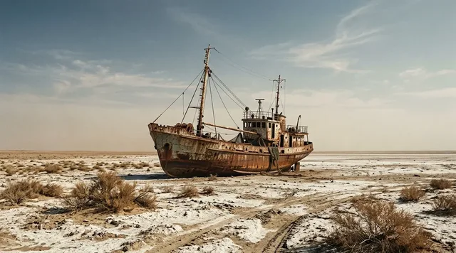
AI illustration
 Edited by
 Anholt sits more than forty kilometres from Jutland, a low interruption in the Kattegat reached by a ferry that takes roughly three hours. East of the village, road logic gives way to Ørkenen—the Desert—where grey lichen, juniper, crowberry, dune and raised seabed cover most of the island. The name promises emptiness. The living surface demands restraint.
Ørkenen is not a climatic desert and not a blank field of sand. Danish conservation material classifies it as lichen heath and grey dune: among the country's most nutrient-poor habitats, created through post-glacial uplift, wind, salt and centuries of tree cutting. About 85 percent of Anholt belongs to this eastern dune landscape. The responsible journey is made on foot, with enough time to reach the 1785 lighthouse without entering Totten, the protected seal point beyond it.
A desert that is really raised seabed
Anholt is built from two different geological stories. The higher western hills are the eroded remnant of a glacial landscape. Ørkenen to the east is younger: a post-glacial beach-ridge plain formed as sand and gravel accumulated and land rose from the sea. Danish conservation records describe ancient shore ridges still legible beneath the dunes, with some active wandering dunes moving across them.
The official Natura 2000 account says Ørkenen occupies about 85 percent of the island's land. It is not uniform. Dry flats alternate with stone ridges, dune hollows, boggy patches, birch groves and small willow stands. Juniper makes dark islands in a pale surface; crowberry, marram and lichens hold ground that looks bare only from a distance.
Calling this a desert is useful only if it slows the eye. Ørkenen is a place name, not a climate category. The local island guide notes that it was once called Skoven—the Wood—and that the protected landscape now contains up to roughly 280 lichen species. Many obtain nutrients from the air and flourish here because pollution and acidification are limited. The apparent emptiness is biological density at ankle height.
Anholt's desert begins where the landscape becomes too small and slow for a hurried eye.
 AI illustration
The lighthouse helped remove the forest
Medieval Ørkenen was not the open heath seen today. Pine was cut for household fuel, tar and the fire that marked Anholt's eastern end before modern optics. By the nineteenth century the wooded name had outlived the trees. Wind worked the exposed sand into dunes while salt and poor soil selected for low vegetation.
The openness is therefore neither untouched wilderness nor simple damage. It is a cultural landscape that now shelters rare natural communities. Later planting introduced mountain pine around summer-house areas and plantations; seed spread back into the heath. By the 1990s about a quarter of Ørkenen was becoming pine scrub, so public authorities and EU funding supported large-scale clearance in 1995–96. Hand removal of young self-seeded pines continues as conservation work.
Anholt lighthouse stands inside that history. The present tower dates from 1785, and the circular casemate at its foot recalls the British occupation during the Napoleonic Wars. The lighthouse is a destination, a navigation mark and a reminder that the eastern landscape was shaped partly to keep a flame visible from the Kattegat. Treat the private buildings around Fyrgården as homes and working property, not an open museum.
The lighthouse did not merely watch the desert; its need for fuel helped make the desert visible.
Three hours of water and one reserved seat
The ordinary route begins at Grenaa. In the 2026 summer timetable the crossing from Grenaa is listed at about two hours forty-five minutes, with the return around three hours; many non-peak journeys take closer to three hours or a little more. The official sailing list is revised through the season rather than fixed at the start of it — the current version moves a Grenaa departure from 12:00 to 15:00 on 27 August and adds sailings on 5 September, and carries a standing note that departures may change for special trips to the Anholt offshore wind farm. Do not copy a departure time into an itinerary weeks in advance.
Passenger reservations are required all year, and a ticket is valid only for the booked sailing. The operator asks passengers to appear thirty minutes early during the main summer period and holidays, and fifteen minutes early during the rest of the year. Bicycles and pushchairs have their own arrival requirement. Missing it can cancel the reservation, which matters when the next sailing is not that afternoon.
The 2026 base fare page lists DKK 101 each way or DKK 202 return for an adult, and DKK 49 or 99 for a child aged four to twelve. Add the temporary fuel surcharge — DKK 40 for adults and DKK 20 for children on each single ticket — which appears on the operator's Danish price page but not on its English one, so a reader working in English will meet it at the till rather than on the screen. Bicycles and other equipment are charged separately, at DKK 93 return for a bicycle and DKK 650 for a canoe or kayak. Ordinary visitor cars cannot simply be booked: vehicle reservations are restricted to residents, commercial work and registered disability vehicles. That rule is not an inconvenience to evade. It is a strong signal to leave the mainland vehicle in Grenaa and travel lightly.
The ferry is not a bridge with a timetable; it is the first boundary of island life.
The lighthouse walk is nearly twenty kilometres
Anholt's map is deceptive because the island is only about ten kilometres long. A recognised journey from the western edge of Ørkenen to the lighthouse and back can approach twenty kilometres, much of it over loose sand, gravel and exposed heath. Fredninger.dk describes the route as unexpectedly long and strenuous. There is little shade and the wide sky amplifies sun, wind and dehydration.
There are no conventional waymarked hiking trails throughout Ørkenen. Several tracks lead east, and the old rescue route from Flyvepladsvej is marked by oak posts. The lighthouse and western radar tower help orientation in clear conditions, but neither replaces an offline map, compass awareness or a turn-around time. Sea mist and low cloud can erase the useful horizon quickly.
Carry the day's water, food, wind protection, sun protection and a charged phone; do not count on refreshments or toilets at the far point. Check whether lighthouse-area facilities are actually open before leaving. A loop using a beach may look elegant on a screen, yet tide, wind, soft sand and protected bird areas can change its difficulty. Ask locally which return line is appropriate that day.
The tower looks close for hours because a flat island has no scale bar.
Permission to walk is not permission to wear it out
Local guidance allows broad access on foot outside livestock enclosures and private property, but the lichen surface makes simple slogans dangerous. A light occasional footfall can be tolerated. When many people repeat the same shortcut, lichens die and loose sand appears. A pale scar can persist far longer than the moment saved by cutting a corner.
Use durable existing tracks where they are present, keep groups compact without marching shoulder-to-shoulder over vegetation, and follow the current island map and signs when they direct movement. Do not build cairns, collect lichen, move stones or scrape names into the dark coating known as desert varnish. The safest principle is to leave no new line that the next visitor might mistake for a route.
Cycling deserves a separate warning. The conservation history allows bicycles on limited durable lines such as the rescue road and parts of the beach, while local guidance stresses that cycling—and especially mountain biking—damages the heath. Park or walk the bicycle when entering the protected interior unless current signage explicitly permits the chosen line. All tourist motor traffic is forbidden in Ørkenen, and motor driving requires a specific work or emergency basis.
A legal right to cross fragile ground carries a duty not to turn one crossing into a trail.
 AI illustration
Totten is a boundary, not a final viewpoint
The eastern point called Totten is one of Denmark's important seal resting and breeding areas. Harbour and grey seals use the sandbanks around the tip, while birds concentrate on the same exposed shore. The sanctuary exists so animals can rest, nurse and breed without having to enter the water each time a person approaches.
There is no visitor achievement in reaching the last grain of sand. Observe only from the authorised side of the closure and obey every current sign, fence and seasonal instruction. Keep dogs away, do not launch a drone, and never walk around a marker along the waterline. A telephoto lens or binoculars is the ethical substitute for proximity.
Read behaviour rather than counting metres alone. Heads lifting, groups tightening or seals moving toward water show that pressure is already too high. Leave before displacement begins. The sanctuary succeeds when wildlife can ignore the visitor; a close image produced by disturbance records a failed encounter, however dramatic the photograph.
At Totten, the respectful journey ends before the island does.
A village of 140 can become a town of 6,000
Anholt is remote without being undiscovered. The island's community vision describes roughly 140 year-round residents and 5,000–6,000 people on busy summer days. Harbour, beach bars, holiday houses and the main road can feel like a compact resort in July. The great eastern landscape absorbs walkers, but the ferry and limited beds concentrate everyone at the same gateways.
That contrast shapes the Silence Index. Outside school holidays, the sea crossing and small population create genuine separation. In peak weeks, silence depends on starting early, staying overnight and moving beyond the western social zone without treating private lanes as shortcuts. Even in shoulder season, harbour work, school, deliveries and fishing are part of an inhabited island—not noise intruding on scenery.
Accommodation is diverse but naturally limited: camping, rooms, guesthouses, a hostel, the inn and selected lighthouse-area stays. Reserve a legal bed before buying a non-flexible ferry ticket, especially in summer. The year-round grocery and core services support residents first. Buy locally, carry out avoidable waste and do not assume a small island can absorb mainland levels of water use, packaging or last-minute demand.
Anholt is quietest when visitors remember that remoteness is somebody else's everyday logistics.
Weather can add a night without asking
The Kattegat controls the itinerary. The ferry operator warns that wind and abnormal water levels can cancel sailings, and the 2026 harbour flood-defence work has created additional sensitivity to elevated water. Decisions are made for safety and can occur on the day. A forecast that permits a walk does not guarantee a harbour movement.
Keep an onward-travel buffer and enough medicine for an extra night. Do not tie the return ferry to the last possible train, flight or hotel cancellation. Travel insurance should cover disruption in the form actually booked. If a sailing is cancelled, follow operator instructions rather than assuming an unofficial boat or private transfer will solve the gap.
On land, exposure is the greater hazard: sun, wind, ticks, loose sand and fatigue accumulate gradually. Mobile signal and visible landmarks can create false confidence. Tell somebody the route and return time, check for fire restrictions, avoid dunes and shorelines in severe wind, and turn back early when pace falls. Anholt rewards the spare day more than the perfect schedule.
On an island, contingency is not pessimism; it is part of the ticket.
What popular coverage gets wrong about Anholt
The version that circulates in listicles and social-media posts calls Ørkenen a true desert — a pocket Sahara in the Kattegat, an empty floor of sand waiting for footprints and dune photographs. Every element of that framing points a visitor toward the wrong behaviour, because it suggests there is nothing underfoot to damage.
The sources this dossier relies on say otherwise. The official Natura 2000 account and Danmarks Naturfredningsforening's record of the Ørkenen protection classify the area as lichen heath and grey dune, among Denmark's most nutrient-poor habitats, covering about 85 per cent of the island. The island's own guide notes that the ground was once called Skoven — the Wood — and that the protected landscape now holds up to roughly 280 lichen species, many drawing their nutrients from the air. What the casual summaries read as emptiness is a living surface at ankle height, and one that records a repeated shortcut as a pale scar lasting far longer than the moment it saved.
The desert is also younger and more human than the shorthand allows. As the conservation history shows, centuries of tree-cutting — partly to feed the fire that marked the island's eastern end before modern optics — opened this ground, and the large-scale clearance of 1995–96 had to rescue the heath from returning pine scrub. Ørkenen is a place name and a cultural landscape, not a climate category.
Hiddencorners position
Hiddencorners recommends two nights on Anholt, travelling without a car and giving one full day to Ørkenen. Begin early, use a locally recognised walking line, carry all water and accept that the lighthouse is the furthest responsible objective—not Totten's closed sand point. Avoid peak July if silence is the aim, and keep a weather buffer rather than building a same-day mainland connection around a three-hour ferry.
Why the Silence Index is 71
Anholt scores 71 because more than forty kilometres of Kattegat, a roughly three-hour ferry and a protected eastern landscape covering most of the island create real separation. Outside peak summer, a long walk across Ørkenen can reduce the human world to a lighthouse, a few oak posts and the sound of wind over low vegetation.
The island is a beloved Danish holiday destination, not an unknown wilderness. Its resident population of roughly 140 can be joined by 5,000–6,000 people on busy summer days. Ferry arrivals, harbour life, beach businesses and the main lighthouse routes create strong seasonal pulses, while wildlife closures rightly remove the remotest-looking shore from visitor use.
Corner Codex — D-026
- Place
- Anholt, Denmark
- Coordinates
- Approx. 56.72°N, 11.55°E; Anholt lighthouse 56.737°N, 11.650°E
- Getting there
- Reserve the official Grenaa–Anholt ferry for the exact sailing; allow roughly three hours and leave the car in Grenaa unless it qualifies under the operator's restricted vehicle rules
- Rules
- Travel through Ørkenen on foot with current local guidance, use only explicitly permitted cycling lines, never use tourist motor transport, respect private land and livestock, and remain completely outside Totten seal sanctuary
- Season
- Late May–June and late August–September offer long light with less peak pressure; July has the most services and the largest crowd multiplication
- Silence Index
- 71 / 100
- Still open
- Whether promoting Ørkenen as a desert helps visitors notice its rare lichen ecology or encourages damaging assumptions that the ground is empty
Silence Index
A legacy editorial rating based on desk research. It is not an acoustic measurement or a safety rating.
Earlier and later dossiers used different fourth inputs. Individual input scores were not recorded, so these totals cannot be independently reproduced or used for precise comparisons between places.
Read the method and its limitations →
The Traveler's Panel · checked
Changing information. Prices, permits, seasons and road access change, sometimes at short notice. Everything here is a starting point for your own confirmation — not a quote, and not a guarantee. Verify with the operator and the relevant official body before you book.
| Island | About 21.75 km² and more than 40 km from Jutland |
| Eastern landscape | Ørkenen covers about 85% of the island's land |
| Protection | Roughly 1,881 ha—nearly nine-tenths of Anholt—under linked conservation designations |
| Ferry | Grenaa–Anholt; approximately 2 h 45 min to 3 h 10 min depending on period and direction |
| Reservation | Required for passengers all year; use the exact booked departure |
| Lighthouse walk | Nearly 20 km return on a recognised route; exposed and partly sandy |
| Vehicle reality | Ordinary visitor cars are not accepted for booking |
| Wildlife boundary | No entry to Totten seal sanctuary |
| Main hazards | Wind, sun, dehydration, ticks, loose sand, navigation error and ferry disruption |
Getting there
- Check the current 2026 sailing list and reserve both ferry directions before committing to accommodation.
- Book a legal island bed for at least two nights and keep one mainland connection flexible.
- Leave the car in Grenaa and confirm whether any bicycle route planned through Ørkenen is explicitly permitted.
- Collect the latest island map, fire notice, wildlife closure and lighthouse-access information after arrival.
- Choose a clear-weather day, start early and carry all water and food for the near-20 km lighthouse return.
- Turn back before fatigue or visibility makes the planned return uncertain, and never enter Totten.
- Recheck the ferry on departure day because wind, elevated water and harbour works can change operations.
Indicative costs — verify before booking
| Adult ferry 2026 base fare | Listed at DKK 101 single or DKK 202 return; reconfirm temporary fuel supplements before payment |
| Child 4–12 ferry | Listed at DKK 49 single or DKK 99 return; children under four listed free |
| Bicycle | Listed separately at DKK 93; verify whether the displayed price covers the intended directions |
| Ordinary visitor car | Not bookable under current passenger rules; resident, work and registered disability categories only |
| Nature access | No general ticket for Ørkenen, lighthouse approach or authorised seal viewing; conservation rules are the price of access |
| Accommodation | Strongly seasonal and property-specific; compare only after matching it to available ferry dates |
| Verify | Fares, fuel supplements, departures, facilities and restrictions change; confirm directly before booking and again before travel |
| Verify | Prices and availability change. Confirm current details directly before booking. |
What to pack
- Offline island map and current closure information
- All drinking water and food for the long eastern walk
- Windproof layer, sun hat, sunscreen and warm spare layer
- Supportive footwear that handles loose sand and gravel
- Tick protection and a small first-aid kit
- Charged phone plus power bank
- Binoculars or a long lens for distant seal observation
- Extra essential medication in case the ferry adds a night
Where to stay
Stay in registered accommodation around Anholt village or harbour unless a confirmed booking places you at the lighthouse complex. The island lists camping, guesthouses, hostel rooms, the inn, B&Bs and holiday rentals, but capacity is limited and highly seasonal. Two nights make a full Ørkenen day possible without racing the ferry. Wild camping in the protected landscape is not an acceptable substitute for a sold-out legal bed.
Safety & responsible travel
- Treat the lighthouse return as a near-20 km exposed walk, not a casual beach stroll.
- Carry water from the west; do not assume any eastern refreshment or toilet is open.
- Use an offline map and turn-around time even when the lighthouse remains visible.
- Never enter Totten or approach seals closely enough to change their behaviour.
- Do not cycle across lichen heath; use only a currently authorised durable cycling line.
- Check fire restrictions and avoid any flame on dry dune or heath vegetation.
- Allow for same-day ferry cancellation caused by wind, elevated water or harbour conditions.
Nearby, and quieter
Grenaa is the practical mainland buffer, with rail and bus links, supplies and the Kattegatcentret near the ferry area. Djursland's coast and Mols Bjerge offer additional walking without Anholt's transport dependency. Læsø is another Kattegat island with salt-marsh and dune landscapes, but it is a separate ferry journey and should not be compressed into an Anholt itinerary.
Where it is
Denmark · 56.7200°N 11.5500°E · Open in Google Maps · OpenStreetMap
Key locations
- Anholt Havn — where the Grenaa ferry lands and every island walk starts
56.7149°N 11.5123°E - Anholt By — the village of roughly 140 residents behind the harbour
56.7036°N 11.5453°E - Ørkenen — the lichen heath and grey dune covering about 85% of the island
56.7115°N 11.5810°E - Anholt Fyr — the 1785 lighthouse at the far end; Totten seal reserve begins beyond it
56.7370°N 11.6504°E - Grenaa Harbour — mainland ferry terminal, about three hours away by sea
56.4083°N 10.9242°E - Kattegatcentret — the aquarium beside the terminal for a weather-delayed day
56.4062°N 10.9268°E
Coordinates are for orientation and are accurate to roughly the width of the feature named, not to a doorway. Several of these points are inside protected areas or need a permit, a guide or a boat — read the access notes above before you plan a route to any of them.
Sources & further reading — checked
- Styrelsen for Grøn Arealomlægning og Vandmiljø — Natura 2000 area 46, Anholt and the sea north of it. Primary authority for the island's Natura 2000 context, distance from Jutland, the 85-percent extent of Ørkenen and its dune and raised-seabed habitats.
- Anholt.dk — nature on Anholt. Local official guide for geology, lichen ecology, 1,881 hectares of protected land, access, trampling, cycling, motor-traffic restrictions and pine removal.
- Anholt.dk — the seals. Local source for Totten's importance to harbour and grey seals and the purpose of the sanctuary.
- Anholt.dk — Anholt lighthouse. Local source for the 1785 lighthouse, eastern location and cultural-history context.
- Grenaa–Anholt Ferry — 2026 sailing list. Current operator source for 2026 departures, crossing durations, revisions and the instruction to expect changes.
- Grenaa–Anholt Ferry — prices (English). All-year fares: adult DKK 101 single and 202 return; child aged 4–12 DKK 49 and 99; under fours free; bicycle, trailer or e-scooter DKK 93 return, cargo bike 148, windsurfer, canoe or kayak 650. Peak pricing for vehicles and commercial transport applies 27 June to 9 August. The English page shows no fuel supplement.
- Grenaa–Anholt Ferry — priser (Danish). The Danish page carries a temporary fuel surcharge of DKK 40 for adults and DKK 20 for children per single ticket, on top of the fares above. The English page does not show it, which is why both versions are cited here.
- Grenaa–Anholt Ferry — passenger conditions. Operator authority for year-round reservations, eligible vehicle categories, check-in times, ticket conditions and luggage limits.
- Grenaa–Anholt Ferry — vessel, weather and mainland access. Operator guidance for wind and water-level disruption, Grenaa terminal access and mainland parking.
- Anholt.dk — accommodation. Local directory showing the limited mix of camping, guesthouses, hostel, inn, B&B and lighthouse-area stays.
- Anholt.dk — island overview and community vision. Local context for broad walking access, year-round island life and the contrast between roughly 140 residents and 5,000–6,000 people on busy summer days.
- Danmarks Naturfredningsforening — Ørkenen. Conservation source for the raised, stony beach-ridge plain with dunes up to 24 m; Ørkenen as roughly four-fifths of the island; the lighthouse walk of almost 20 km return from the Kistehøjvej–Ørkenvej junction; the old rescue path marked by oak posts all the way to the lighthouse; cycling permitted on beaches and the rescue road under a 1972 decision but vehicles barred from Ørkenen by a 2005 ruling; Totten as a seal reserve holding about 1,000 harbour seals and closed to the public year-round; and the 1980 order preserving the area's desert-like character.
Official and scientific bodies are the authority for safety, regulatory and scientific claims. Commercial operators are used only for practical detail such as tour length, meeting points and indicative pricing — never for a safety or scientific statement.
How this was made
Desk research. Compiled from official bodies, scientific and conservation sources, established journalism and licensed operators. Not based on a personal visit.
Editor’s method note — what we checked, corrected and could not verify
- Desk research only. Nobody from this publication has been to Anholt. The dossier is built from the Danish Natura 2000 planning material, the national conservation register fredninger.dk, the island's own community site anholt.dk, and the ferry operator.
- Eleven sources were checked and twelve are now listed. Every one still loads and supports its claim. The only structural change is that the ferry price page is now cited in both languages, for the reason below.
- The fuel supplement is real and now has a figure. The article referred vaguely to a temporary fuel supplement shown by the operator. The English price page does not show one at all; the Danish page carries a temporary surcharge of DKK 40 for adults and DKK 20 for children per single ticket. We have put the number in the body and cited both pages, because a reader working from the English site would not know the surcharge exists.
- The sailing-list revision date in the article was stale. It referred to a change made on 27 July. The current sailing list carries different revisions: a Grenaa departure moved from 12:00 to 15:00 on 27 August 2026, and extra sailings added on 5 September. The point the article was making — that the timetable is revised through the season and should not be copied into an itinerary weeks ahead — is if anything better supported now, and the body has been updated to the current revisions.
- Two figures differ between conservation sources and we give both. The Natura 2000 account says Ørkenen makes up 85 percent of the island's land area; fredninger.dk says roughly four-fifths. The article uses the Natura 2000 figure and now says where it comes from.
- The seal numbers also differ. Anholt.dk describes Totten as one of Europe's largest and most important harbour-seal breeding sites with a small grey-seal population of about 10 to 12 animals; fredninger.dk gives around 1,000 harbour seals with grey seals increasingly present. The reserve dates from 1981 on the island's own account, and the observation house near the lighthouse has a free telescope, which is the ethical substitute for approach that the article recommends.
- The protection history is layered rather than single. Anholt.dk dates protection of 1,881 hectares to 1939; fredninger.dk describes decisions in 1972, a 1980 order and a 2005 ruling. These are successive instruments over the same landscape, not competing accounts of one event.
- Things we could not verify: whether the harbour flood-defence work referred to in the body was still under way in the 2026 season; the 2026 status of lighthouse opening days run by Anholt Fyrs Venner; whether the temporary fuel surcharge has an end date; the current extent of self-seeded pine regrowth since the 1995–96 clearance; the resident figure of roughly 140, which comes from the island's own community vision rather than from Danmarks Statistik; the summer peak of 5,000 to 6,000 people, which has the same single origin; and the tick and fire-risk conditions the article warns about, which are seasonal and cannot be carried by any dossier.
- Coordinates for the key locations are from GeoNames for the lighthouse, the village, Grenaa harbour and the island itself, cross-checked against VisitDenmark's own listing for Anholt Fyr, which gives 56.7369, 11.6504 for Ørkenvej 102. Ørkenen and Anholt Havn are given to four decimals only by OpenStreetMap via Mapcarta, and their pins mark the dune plain and the marina rather than a boundary. Totten is in no gazetteer we could open and has been left off deliberately; the sanctuary lies east of the lighthouse pin.
AI is used to draft this text, and a human checks it. Tony Hall is responsible for editorial verification against the reference list. Our standard is to distinguish documented facts, disputed accounts and claims we could not verify. Errors can remain; readers can report them through the corrections page. The illustrations are AI-created and labelled as such — no photograph on this site is presented as a record of a real place. Full disclosure · Editorial policy.
Access details change — recheck before you travel. Found an error? Tell us — corrections are dated and shown in place.