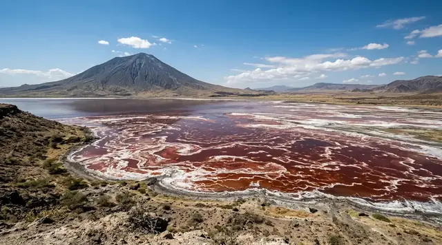
AI illustration
 Edited by
 Žuvintas is often described as a lake turning into a marsh. From above, the phrase appears literal: dark channels divide floating reed islands, open water breaks into irregular mirrors, and the shoreline seems to have wandered into the basin. Yet the lake has not disappeared. It is a living, shallow stage in a long succession from water to wetland—one that human drainage, nutrient inputs and water-level control have accelerated, complicated and now partly tried to repair.
This is Lithuania's oldest protected landscape and the core of its only biosphere reserve. Its silence is guarded rather than freely available. Most of the strict reserve is closed, and the ordinary visitor receives one deliberate line into it: a 410-metre boardwalk through reeds to an observation tower beside the visitor centre at Aleknonys. That small permission is enough to see why Žuvintas matters, provided the journey does not become an excuse to leave the trail, summon birds with sound or market a managed cultural wetland as untouched wilderness.
A lake in the act of becoming land
Lake Žuvintas occupies a broad, low basin left by the last glaciation. The current protected-area profile calls it eutrophic and gives an average depth of only 0.6 metres. That number changes how the landscape reads. Light reaches much of the bottom, rooted plants can occupy large areas, and every season of stems, leaves and sediment adds material to a basin that was never deep. Reed and bulrush rhizomes knit into floating mats; sedges and shrubs take firmer ground; open water survives between them as pools and channels rather than one clean oval.
Long-term maps show the direction without supporting a dramatic obituary. One landscape study measured visible open water at about 674 hectares in 1961 and 619 hectares in 2003, while floating vegetation and islands occupied roughly 324 to 330 hectares. Those figures depend on the mapping method and date, but they establish the essential truth: Žuvintas remained a lake while becoming more internally divided. The historical lake basin is commonly reported near 970 hectares; that is not the same measurement as the unobstructed water visible in a later aerial image.
Succession is natural. Lakes accumulate sediment and organic matter, plants colonise shallows, and wetland communities replace one another over centuries. At Žuvintas, however, the rate and pattern have also responded to sluices, canalised inflows, catchment drainage, fertiliser and the loss of traditional cutting and grazing. Calling the process simply natural erases responsibility; calling it simply degradation erases the wetland habitats now present. The honest story is a slow geological transition redirected by fast human decisions.
Žuvintas has not turned into land; it is showing every stage between lake and land at once.
 AI illustration
Protection began with birds in 1937
Professor Tadas Ivanauskas argued for Lithuanian reserves as early as 1921. On 5 April 1937, protection at Žuvintas became real, making it the country's first modern protected area. The initial reserve covered the lake and roughly one kilometre around it, and prohibited the hunting of birds and mammals. The decision was not made because the landscape looked empty. It came because the basin was visibly important to breeding and migrating waterbirds and because unregulated use could empty it of life.
The institution grew through several legal forms. Today's Žuvintas Biosphere Reserve was established on 19 November 2002 from the Žuvintas strict nature reserve and the Žaltytis and Amalvas botanical-zoological reserves. UNESCO added the wider landscape to the World Network of Biosphere Reserves in 2011. Ramsar recognition had arrived in 1993 for a 7,500-hectare wetland. These dates describe layers of recognition, not four interchangeable names for one boundary.
The numbers need the same care. Lithuania's protected-area service gives the legal biosphere reserve as 18,573.8 hectares. UNESCO's current profile reports a 60,273-hectare biosphere-reserve surface, reflecting its wider zonation and reporting framework. Within that, the Ramsar site is 7,500 hectares and the historic strict reserve is about 5,442 hectares. A traveller should never use the largest number to imply that sixty thousand hectares are open for recreation. The most protected core is precisely where ordinary access is most limited.
Žuvintas became protected because people could see that abundance was not the same as invulnerability.
Natural succession, human acceleration
Botanist Zofija Sinkevičienė's long record makes the change measurable. Surveys in 1961–1963 recorded fourteen stonewort species and fourteen pondweed species. By 1981–1982, seventeen submerged-plant species recorded in the early study had disappeared, and her wider conclusion counted twenty losses across the research period. The shift was not a simple march from clear water to reeds. Different plant communities expanded, collapsed and briefly recovered as chemistry, depth and disturbance changed.
A dam built in 1968 raised the lake level by about 0.31 metres. Later regulation, unusually low spring levels, intensified agriculture and excess nitrogen and phosphorus reshaped conditions. Some submerged vegetation improved temporarily during the agricultural stagnation of the 1990s, then declined again by 2004. Canalised streams could carry water and nutrients quickly into the basin while bypassing the slower filtering work of meanders, floodplain grass and marsh. A shallow lake amplifies every alteration because there is little depth in which to dilute it.
Restoration therefore extends beyond the water's visible edge. Blocking drainage ditches, managing sluices, reducing catchment nutrient loads and restoring fen or wet-meadow hydrology can matter more than clearing a photogenic channel. Recent UNESCO priorities include restoring water regimes and meadow, fen and bog habitats while supporting more nature-compatible farming. Modelling of the basin has been blunt about the limits: the natural water regime is now hardly reversible, and simply removing the sluice-gates would drop the level by more than a metre and destroy the lake outright. What the models do support is replacing sluice-gates with overflow weirs, clearing woody growth from the surrounding wetlands and blocking drainage ditches. A study of Lake Simnas, immediately upstream in the same Dovinė catchment, found that removing cyanobacteria and macrophytes barely moved water quality at all, while halving external phosphorus inputs cut mean total phosphorus by 58 per cent. Žuvintas teaches an unfashionable lesson: the reserve outside the postcard—the fields, ditches and working villages—can determine whether the lake inside the reserve survives.
The lake's boundary is drawn in reeds, but its hydrology begins far beyond them.
Floating islands and a depth of 0.6 metres
From the visitor-centre tower, the lake may first resemble a meadow with pieces of sky set into it. The apparent ground is often vegetation: rafts of interlaced rhizomes and accumulated organic matter that can shift, split or ground themselves. Older reserve descriptions call them floating islands. They are not stable picnic ground, and their softness is part of the wetland's architecture—cover for nesting birds, feeding edges for fish and insects, and a machine for capturing more sediment.
The average depth of 0.6 metres does not mean a uniform ankle-deep sheet. Historical measurements recorded deeper points, and channels, mud, plant mats and fluctuating levels make any informal crossing unpredictable. Black mineral and organic silt can be much deeper than the water above it. The basin's sluice and inflows redistribute mud during floods, while reed roots hide the transition between a solid edge and a floating surface. This is one reason the boardwalk is a permission line as well as a convenience.
Stay on it even when a clearer photograph appears one step away. Do not launch a kayak, wade, fish, fly a drone or enter from an unsigned track unless the reserve administration has explicitly authorised that activity for that place and date. Local residents retain narrowly defined rights for limited fishing and seasonal gathering under law; those are not tourist privileges. Respecting them means understanding that equal admiration does not produce equal access.
At Žuvintas, what looks like shore may be a floating root-mat holding a small world above deep mud.
Birds need openness that people must help maintain
The reserve profile records 234 bird species and describes Žuvintas as a major breeding and migration site. Spring and autumn can bring thousands of moving birds, but the experience is acoustic as often as visual: cranes beyond the haze, bitterns pulsing inside reeds, rails concealed at water level. Arrival never guarantees spectacle. Wind, water, harvest, migration timing and disturbance can move activity beyond the range of the visitor-centre telescopes.
One emblem of the wider reserve is the aquatic warbler, Acrocephalus paludicola, among Europe's rarest migratory songbirds. Lithuania is one of the few remaining breeding countries, and wet sedge meadows within the Žuvintas landscape are managed for its habitat. The bird does not simply require more reeds. It favours open, wet, sparsely vegetated fen and meadow conditions that can disappear when mowing and grazing cease and scrub advances. Protecting a wetland may therefore involve cutting biomass, restoring water and keeping parts of it visibly open.
Never use call playback to pull a hidden bird toward the trail. Keep voices low, control dogs on a lead and accept distance through binoculars or the centre's telescopes. Exact nesting locations should remain unadvertised. A rare species is not content owed to a visitor, and a photograph gained by making it reveal itself can consume energy needed for territory, feeding or young. The strongest field note may be a sound heard once and left unrecorded.
A bird reserve succeeds when the bird can ignore the observer.
 AI illustration
The 410-metre permission corridor
The ordinary route into Žuvintas begins at the visitor centre in Aleknonys. Its exhibition, ‘Žuvintas—a country of birds,’ explains the reserve's history and management; a rooftop observation point and telescopes look across the basin. From nearby, a timber educational trail runs 410 metres through the reedbed to a birdwatching tower. It is short enough to sound incidental and long enough to shift the senses from road and building to wind moving through stems.
Current directorate information says the nature trail is free for individual visitors and open only in daylight, from sunrise to sunset; the car park is available from 08:00 to 20:00. The centre itself is closed Monday, open Tuesday to Friday from 09:00 to 18:00 and Saturday from 10:00 to 15:00. In 2026 the independent exhibition price is €4 for adults and €2 for listed concessions, with limited free admission for young children. Check the official page immediately before travel because staffing, ice, repairs or conservation can override routine hours.
Everywhere else in the strict reserve requires a permit and an authorised purpose. Do not interpret an open gate, faint vehicle track or satellite-map line as a second walking route. Keep dogs leashed, do not collect plants, avoid noise, and carry out every scrap. In wet weather the boards can be slick; in winter snow can conceal edges; in summer reeds reduce the breeze and concentrate insects. The trail is access infrastructure, not a guarantee of a dry or barrier-free surface.
Four hundred and ten metres is not a small visit when every metre has been negotiated with a strict reserve.
A protected landscape where people still work
UNESCO's biosphere model does not place nature on one side and people on the other. Its Žuvintas profile describes small, dispersed communities and a landscape shaped by agriculture, haymaking and pasturage. Some residents have regulated rights to gather cranberries or fish through the ice under specific conditions. These practices are not loopholes for visitors, nor evidence that protection is weak. They are part of a zoned attempt to hold strict conservation, research and viable rural life in one system.
The loss of mowing and grazing can be as consequential as overuse. When wet meadows are abandoned, tall vegetation and willow advance, and open-habitat birds lose the structure they need. Conservation mowing, biomass removal and renewed low-intensity grazing can look less ‘wild’ than leaving everything alone, yet they continue a cultural ecology formed by generations of work. Ask who manages the view before describing it as pristine.
Spend accordingly. Stay in a registered room in Simnas, Marijampolė, Alytus or a rural homestead that confirms access and transport. Buy food in local businesses, pay the visitor-centre fee, and use a local guide when available. Do not photograph residents over fences, block farm tracks or demand entry because a place was promoted online. Biosphere-reserve communities are collaborators in protection, not scenery arranged around it.
Žuvintas is not nature after people; it is a negotiation between strict refuge and a working countryside.
The last kilometres require a plan
The centre's address is Kampelių g. 10, Aleknonys, Alytus district. A car or prearranged ride is the simplest approach, using official parking and leaving agricultural entrances clear. The wider road network connects through Simnas and Alytus, but the final rural kilometres are exactly where a broad journey planner can become misleading. A pin on a map is not proof of a scheduled stop, a safe walking verge or a waiting taxi.
The Alytus district timetables in force since 1 September 2025 include sparse services between Alytus and Simnas — M11 via Parėčėnai, M12 and M13 running through Simnas, M14 continuing to Kalesninkai, and the M22 circular. None of them reaches Aleknonys, and the municipality now publishes its schedules through a third-party journey planner rather than on its own pages, so a printout ages quickly. They do not establish a dependable direct bus to the visitor centre. A car-free visitor should confirm the exact dated service to Simnas, arrange the onward and return transfer before leaving Alytus, and keep the driver's number. Cycling the final leg is possible for experienced riders in suitable weather, but rural traffic, darkness, wind and limited shoulders require lights, visibility and an offline route.
Build an overnight margin rather than gambling on a same-day chain. Early morning is officially recommended for birdwatching, yet it may fall outside visitor-centre hours; use only the freely open trail under the conditions posted on site and never leave the route to improve a view. Fog, frost, summer heat and storms can all change a very short walk. Žuvintas rewards the traveller who arrives with fewer demands and enough time to let the wetland remain mostly inaccessible.
The hardest part of Žuvintas is not walking 410 metres; it is arranging the kilometres that make those metres legitimate.
What popular coverage gets wrong about Žuvintas
The popular version — the one that surfaces in listicles and casual summaries, and that our own title flirts with — is an obituary: Lithuania's famous bird lake has died, choked by reeds, and what remains is marsh. The measurements cited in this dossier do not support the funeral.
The landscape study of the basin put visible open water at about 674 hectares in 1961 and about 619 hectares in 2003 — a lake becoming more internally divided, not a lake disappearing. The larger figure of roughly 970 hectares that circulates alongside the obituary describes the historical lake basin, a different measurement altogether, and setting the two side by side manufactures a drama the mapping does not show.
The second mistake is to present the change as either purely natural infilling or purely human ruin. Sinkevičienė's long botanical record shows plant communities collapsing and partly recovering as conditions changed, the 1968 dam raised the water level by about 0.31 metres, and the modelling of the basin is blunt in the other direction: removing the sluice-gates now would drop the lake by more than a metre and destroy it outright. Žuvintas is neither a corpse nor an untouched wilderness. It is a shallow lake whose future is being negotiated in sluices, ditches and fields — which is a better story than the obituary, and a true one.
Hiddencorners position
Present Žuvintas as a changing lake and a managed cultural wetland, not as a vanished body of water or an untouched secret. Enter through the Aleknonys visitor centre and designated boardwalk, treat the strict-reserve boundary as conservation rather than inconvenience, and support the communities whose fields and water decisions affect the basin. The honest hook is transformation; the honest practice is restraint.
Why the Silence Index is 81
Žuvintas earns a high score because access is deliberately narrow, the strict core excludes casual wandering, the basin is surrounded by reed, bog and low-density countryside, and early or shoulder-season hours can be dominated by wind and birds rather than engines. The boardwalk carries only a small number of visitors at once.
The visitor centre hosts school groups and organised visits, agricultural machinery works beyond the core, and migration periods attract birdwatchers. Reedbeds also conceal rather than eliminate roads and activity. Silence here is protected but concentrated; it should not be confused with ownership of an empty view.
Corner Codex — D-030
- Place
- Žuvintas Biosphere Reserve, Lithuania
- Coordinates
- Approx. 54.457°N, 23.641°E (official protected-area map point; visitor centre at Kampelių g. 10, Aleknonys)
- Getting there
- Road or prearranged transfer via Simnas/Alytus; regional buses reach Simnas on limited schedules, but no dependable direct visitor-centre connection should be assumed
- Rules
- Use the 410 m educational trail and visitor centre only under current posted conditions; the remaining strict reserve requires a permit and authorised purpose
- Season
- April–May and September–October for migration, or June for long light and wet-meadow life; winter access depends on snow, ice, daylight and current notices
- Silence Index
- 81 / 100
- Still open
- Whether catchment restoration can slow ecological decline while keeping farms, meadows and small communities viable
Silence Index
A legacy editorial rating based on desk research. It is not an acoustic measurement or a safety rating.
Earlier and later dossiers used different fourth inputs. Individual input scores were not recorded, so these totals cannot be independently reproduced or used for precise comparisons between places.
The Traveler's Panel · checked
Changing information. Prices, permits, seasons and road access change, sometimes at short notice. Everything here is a starting point for your own confirmation — not a quote, and not a guarantee. Verify with the operator and the relevant official body before you book.
| Three boundaries | 18,573.8 ha Lithuanian legal reserve; 60,273 ha UNESCO MAB reporting surface; 7,500 ha Ramsar site—different frameworks, not contradictory measurements |
| Lake character | Eutrophic and extremely shallow, with an official current average depth of 0.6 m, reed islands, channels and extensive marsh |
| Public route | 410 m timber educational trail through reeds to a birdwatching tower; individual access is currently free in daylight |
| Visitor centre | Kampelių g. 10, Aleknonys; Monday closed, Tue–Fri 09:00–18:00, Saturday 10:00–15:00 on the current 2026 page |
| Entry price | Exhibition €4 adult and €2 listed concessions; trail free for individuals; conditions and group charges require a live check |
| Access limit | The rest of Žuvintas Strict Nature Reserve is permit-only; local gathering and fishing rights do not extend to tourists |
| Main hazards | Slippery or icy boards, concealed deep mud, ticks and mosquitoes, rural-road traffic, sparse transport and sudden weather |
Getting there
- Check the directorate's current visitor-centre page and any trail notice for the exact date.
- If travelling without a car, confirm the dated Alytus–Simnas service and book both directions of the last-mile transfer.
- Arrive through Kampelių g. 10 and use the official car park without blocking farm or emergency access.
- Begin inside the visitor centre when it is open; use the exhibition, rooftop view and telescopes to understand the basin before the trail.
- Walk only the signed 410 m boardwalk, keep quiet and allow groups or wildlife to pass without crowding the tower.
- Leave enough daylight and transport margin to return without taking an unsigned shortcut through the reserve.
Indicative costs — verify before booking
| Visitor-centre exhibition | Current 2026 price €4 adult; €2 for listed concession groups; verify eligibility and opening before arrival |
| Educational trail | Free for individual visitors under current daylight access rules |
| Centre excursion | €3 per person in addition to entry, generally priced around a minimum group of ten; arrange in advance |
| Last-mile transfer | No stable published tourist fare; agree price and return collection directly before travel |
| Verify | Prices and availability change. Confirm current details directly before booking. |
What to pack
- Binoculars and a quiet field notebook; no playback speaker or drone
- Waterproof footwear with grip for wet boards and rural approaches
- Tick repellent, tick tool and long clothing for the warmer months
- Rain and wind layer, sun protection and insect protection
- Offline map, charged phone, power bank and written return arrangement
- Water and food that do not depend on the visitor centre or a nearby café being open
Where to stay
Simnas is the nearest practical small-town base, while Alytus and Marijampolė offer more transport and accommodation. Rural homesteads can place spending closer to the reserve, but confirm road access, meals and check-in before arrival. Wild camping, sleeping beside the trail or using the strict reserve after hours is not responsible; choose registered accommodation and keep an early-morning visit within the posted daylight route.
Safety & responsible travel
- Never step from the boardwalk onto a plant mat or apparent shore; floating vegetation can conceal deep water and mud.
- The strict reserve beyond the designated trail is permit-only—do not follow tracks, anglers or local users into it.
- Keep dogs leashed, voices low and all food or litter under control.
- Do not use bird-call playback, disclose nest locations or crowd a sighting.
- Use lights and reflective clothing if cycling rural roads, and avoid arriving or departing after dark.
- Recheck ice, storm, fire and temporary closure notices; routine hours do not override an active restriction.
Nearby, and quieter
Amalvas offers a separate wetland viewpoint and polder birdwatching tower within the wider reserve landscape, while Lake Žaltytis has its own observation tower; each requires a current access check rather than an assumed extension of the Žuvintas trail. Buktos forest adds a contrasting hornbeam-rich woodland ecosystem on authorised routes. Simnas provides church, town services and a human-scale base without pretending that the entire biosphere reserve is one continuous visitor attraction.
Where it is
Lithuania · 54.4570°N 23.6410°E · Open in Google Maps · OpenStreetMap
Key locations
- Aleknonys — the visitor centre and the 410-metre boardwalk to the birdwatching tower
54.4553°N 23.6586°E - Ežeras Žuvintas — the eutrophic lake averaging 0.6 m deep, most of it strict reserve
54.4692°N 23.6300°E - Ežeras Žaltytis — one of the two botanical-zoological reserves folded in during 2002
54.4039°N 23.4264°E - Ežeras Amalvas — the other 2002 reserve, with the fen and wet meadow now managed for aquatic warbler
54.5286°N 23.5858°E - Simnas — nearest town with beds and the lake immediately upstream in the Dovinė catchment
54.3819°N 23.6458°E - Alytus — the transport hub; no scheduled bus reaches Aleknonys from here
54.3956°N 24.0386°E
Coordinates are for orientation and are accurate to roughly the width of the feature named, not to a doorway. Several of these points are inside protected areas or need a permit, a guide or a boat — read the access notes above before you plan a route to any of them.
Sources & further reading — checked
- UNESCO Man and the Biosphere Programme — Žuvintas. Used for the 2011 designation, 60,273 ha reporting surface, population profile, glacial and hydrological landscape, community activities and current restoration priorities.
- Lithuanian State Service for Protected Areas — biosphere reserves. Used to verify that Žuvintas is Lithuania's only biosphere reserve and the official national area figure of 18,573.8 ha.
- Lithuanian State Service for Protected Areas — Žuvintas Biosphere Reserve. Used for 2002 establishment, incorporated reserves, average lake depth, biodiversity, strict-reserve purposes and prohibited activities.
- Lithuanian State Service for Protected Areas — protected-area history. Used for Ivanauskas's 1921 proposal and Žuvintas's status as Lithuania's first modern protected area in 1937.
- State Service for Protected Areas — Žuvintas, Lithuania's oldest protected area. Used for the 5 April 1937 date, initial one-kilometre protection belt and early hunting prohibition.
- Ramsar Sites Information Service — Žuvintas. Used for Ramsar site no. 628, 4 October 1993 designation, 7,500 ha area and wetland-complex description.
- Dzūkija–Suvalkija Protected Areas Directorate — Žuvintas visitor centre. Used for the address, exhibition, telescopes, current 2026 opening hours, prices, daylight trail access and permit boundary.
- State Service for Protected Areas — Žuvintas Lake educational trail. Used for the 410 m boardwalk, reedbed route and birdwatching tower.
- Dzūkija–Suvalkija Protected Areas Directorate — places to visit. Used to cross-check the trail, early-morning birdwatching advice and separate Amalvas and Žaltytis observation sites.
- Sinkevičienė — Long-term changes of macrophyte vegetation in Lake Žuvintas. Used for the 1961–2004 plant record, early species counts, submerged-species losses, 1968 water-level change and nutrient impacts.
- Taminskas et al. — Landscape transformation in the Žuvintas basin. Used for mapped changes in visible open water and floating vegetation, canalised inflows and catchment hydrology.
- Management and restoration of Natura 2000 sites in the Dovinė River Basin. Used for natural succession, twentieth-century acceleration, meadow abandonment and hydrological restoration context.
- Taminskas et al. — Sedimentation processes in Lake Žuvintas. Used for shallow-lake sedimentation, water-level records, sluice regulation and flood-driven mud deposition.
- Alytus District Municipality — suburban bus timetable changes from 1 September 2025. The current route structure serving Simnas — M11 Alytus–Simnas via Parėčėnai, M12/M13 via Simnas, M14 Alytus–Simnas–Kalesninkai and the M22 circular — with no route reaching the visitor centre at Aleknonys.
- Alytus District Municipality — transport. The municipality's statement that current suburban timetables are published through the stops.lt Edzūkija planner rather than on its own pages, and the contact route for confirming a specific service.
- Water — Lake Water Quality Under Biomass Removal Scenarios (2025). A study of Lake Simnas, upstream of Žuvintas in the same Dovinė catchment — not of Žuvintas itself. It finds that removing cyanobacteria and macrophytes produced no substantial improvement in chlorophyll-a or total phosphorus, while a 50% cut in external phosphorus inputs produced a 58% fall in mean TP and a 47% fall in peak chlorophyll-a.
- Ramsar Sites Information Service — site record 628. The live Ramsar record: site no. 628, Žuvintas, designated 04-10-1993, 7,500 ha — against the archived Information Sheet PDF, which gives the designation date as 04/10/1994.
- Bank of Lithuania — Žuvintas Biosphere Reserve. An independent confirmation of the 2011 addition to the World Network of Biosphere Reserves, the 1937 founding on Ivanauskas's initiative as Lithuania's first protected area, the 2002 government establishment of the biosphere reserve, and a lake now estimated at about 940 ha.
- Taminskas et al. — Possibilities to restore the natural water regime in Lake Žuvintas and surrounding wetlands. The modelling case that the natural water regime is hardly reversible — full sluice removal would drop the level by over a metre and destroy the lake — and that replacing sluice-gates with overflow weirs, removing woody growth and blocking drainage ditches are the workable measures.
Official and scientific bodies are the authority for safety, regulatory and scientific claims. Commercial operators are used only for practical detail such as tour length, meeting points and indicative pricing — never for a safety or scientific statement.
Corrections to this dossier
This article has been corrected. The changes are listed here, dated, and also in the site-wide corrections log.
- — An earlier version cited a paper about a different Lithuanian lake. The citation has been replaced with the study that actually concerns Žuvintas, and the figure it supported rechecked.
How this was made
Desk research. Compiled from official bodies, scientific and conservation sources, established journalism and licensed operators. Not based on a personal visit.
Editor’s method note — what we checked, corrected and could not verify
- Desk research only. Nobody from this publication has been to Žuvintas. The dossier is built from Lithuania's State Service for Protected Areas, the Dzūkija–Suvalkija Protected Areas Directorate, the Ramsar Sites Information Service, UNESCO's biosphere programme and Lithuanian peer-reviewed limnology.
- One source was replaced and one description rewritten. The Alytus district bus link had gone dead, and we substituted the municipality's current schedule notice, which is better anyway because it names the routes: M11, M12/M13, M14 and the M22 circular all serve Simnas, and none of them reaches Aleknonys.
- The more serious correction is a live URL that did not say what we claimed. The 2025 paper in Water on biomass-removal scenarios studies Lake Simnas, not Lake Žuvintas — Žuvintas appears only as the downstream lake. Its conclusion is genuinely relevant and now cited accurately: removing cyanobacteria and macrophytes changed almost nothing, while halving external phosphorus inputs cut mean total phosphorus by 58 per cent. That supports the article's argument about catchment management, but it is not a study of this lake.
- The UNESCO designation year is 2011, and the article states it correctly. We could not open UNESCO's own Žuvintas page — the site returned a rejection rather than content on repeated attempts — so we have kept it as a source, said so here, and confirmed the year against the Bank of Lithuania and the reserve's own history instead. The 60,273-hectare figure attributed to UNESCO's reporting surface therefore rests on a page we could not read, which is why the article is careful to separate it from the 18,573.8-hectare legal reserve.
- Ramsar's own records disagree with each other. The live site record for no. 628 gives a designation date of 4 October 1993; the archived Information Sheet PDF for the same site gives 4 October 1994. We keep 1993, which is what the live record says and what the article states, and name the conflict rather than averaging it. Lithuania's protected-areas service also gives two dates for the biosphere reserve itself: 19 November 2002 on the Žuvintas page and 23 November 2002 in its biosphere-reserves table.
- The Taminskas landscape-transformation paper behind the 674-hectare and 619-hectare open-water figures is now blocked to us by a robots rule at its repository. We have left the source in place and flagged it rather than dropping a measurement we cannot currently re-read.
- Things we could not verify: UNESCO's own Žuvintas page and therefore the 60,273-hectare reporting surface; the open-water hectare series, whose source is now access-blocked; the correct Ramsar designation year, where Ramsar contradicts itself; whether the 234-bird-species figure has been revised since the profile was written; whether the strict reserve is still about 5,442 hectares under the current legal boundary; the current aquatic warbler breeding numbers in the Žuvintas landscape; whether any bus reaches within reasonable walking distance of Aleknonys on any given day, since the municipality now publishes timetables only through a third-party planner; and the average lake depth of 0.6 m, which every Lithuanian source repeats without naming the survey it comes from.
- Coordinates for the key locations are from GeoNames. The Aleknonys pin marks the village rather than the door of the visitor centre at Kampelių g. 10, which the reserve directorate does not publish as a coordinate, so the boardwalk head may sit a few hundred metres from the marker.
AI is used to draft this text, and a human checks it. Tony Hall is responsible for editorial verification against the reference list. Our standard is to distinguish documented facts, disputed accounts and claims we could not verify. Errors can remain; readers can report them through the corrections page. The illustrations are AI-created and labelled as such — no photograph on this site is presented as a record of a real place. Full disclosure · Editorial policy.
Access details change — recheck before you travel. Found an error? Tell us — corrections are dated and shown in place.