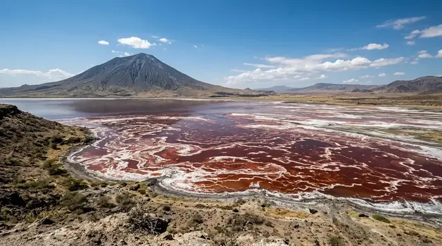
AI illustration
 Written and edited by
 The analyser inside the Mauna Loa Baseline Observatory measures the air every hour of every day. NOAA's own documentation states that on average, across the entire record, only 9.0 of those 24 hours are retained as background carbon dioxide. The rest are flagged and set aside — and setting them aside is not a flaw in the Keeling Curve. It is the thing that makes it a measurement of the planet rather than a measurement of a mountain.
Silence Index — D-186
Genuinely remote
Ranks 40 of 99 scored dossiers — quieter than 60% of the others we have scored. A low score is not a warning; it describes who else will be standing next to you.
How the total is weighted. These are the fixed weights of the four inputs, the same on every dossier — not this place’s scores. We do not publish per-input bars, because the per-input values were never recorded article by article and inventing four plausible numbers that sum to the total would be a fabrication dressed as a chart.
This dossier was scored before 2 September 2026, when the fourth input became night darkness. It keeps the input it was reasoned with until it is re-scored at its next source re-check; the methodology page records the change.
The index is a desk instrument scored by this publication, not a field measurement. How it is calculated, and where it fails.
What this dossier is built from
Nobody from this publication has been to Mauna Loa. Nobody could: at the time of writing there is no site access for the general public to the observatory and NOAA has not established a public opening date. What follows is assembled from the operating laboratory's own technical documentation — the pages in which NOAA's Global Monitoring Laboratory explains, in unglamorous detail, exactly what its instrument does and exactly which of its own numbers it declines to plot — together with the Scripps CO₂ Program's parallel record, Charles David Keeling's 1960 paper in Tellus, the peer-reviewed paper defining the current world calibration scale, the United States Geological Survey's eruption record, the National Park Service, the Hawai'i Department of Transportation, and Hawai'i state law.
This is not an exposé. Everything in it is published by the people who run the machine. The point is that almost nobody reads it, and the caption under the famous graph is the poorer for that.
The machine in the building
Start with the physical arrangement, because it settles a lot of arguments.
Two separate intake lines draw ambient air from the top of a 38-metre tower next to the observatory — NOAA is explicit that the height is there "to avoid any influence on the measurements by human activities at the observatory". The air is dried before it is measured: it passes through a cold trap where the water vapour freezes out as ice on the walls. Temperature, pressure and flow rate inside the instrument are all actively controlled.
Since April 2019 the analyser has used cavity ring-down spectroscopy. A laser beam is reflected back and forth inside an optical cavity; the laser is switched off and the light intensity inside the cavity decays exponentially as it leaks out. The instrument measures the rate of absorption rather than the magnitude of it, which is what makes it stable over decades rather than over an afternoon. Before 2019 the same job was done by an infrared absorption analyser, air pumped slowly through a small cylindrical cell with flat windows at both ends.
The hour is choreographed. Each of the two intake lines is measured for five minutes, alternating. Once an hour a reference gas is measured for five minutes. Roughly every two weeks a full calibration sequence is run against a set of standards; once a day, two target tanks are measured, fifteen measurements each. The point of the targets is that their true values are known and the instrument is not told them — they are a continuous, unannounced exam.
The result of all this is a stack of five-minute averages, and from those, hourly means. And it is at that moment, between the hourly mean and the graph, that the interesting decision happens.
Why two-thirds of the hours never reach the curve
Take the most important sentence first, because it is the one that gets left out of every angry paraphrase of what follows. NOAA writes: "No data are thrown away." Every hour the analyser produces is calculated, archived and published, flagged or not. Nothing is deleted. What the flags do is mark which hours are eligible for the background record.
Take the second most important sentence next, which is NOAA's own statement of purpose: "We still want to eliminate the influence of CO₂ absorbed or emitted locally by plants and soils, or emitted locally by human activities." That is the whole enterprise in one line. The observatory is not trying to find out what the air is doing at 3,397 metres on a Hawaiian volcano. It is trying to find out what the well-mixed free troposphere is doing, and the local mountain is in the way.
There are four rules, and they are arithmetic rather than judgement.
- The variability flag, V. Within a given hour, the standard deviation of the five-minute averages should be less than 0.30 ppm. Background air, NOAA notes, is air in which CO₂ "changes only very gradually because the air has been mixed for days". An hour that jitters is an hour that has been touched by something nearby.
- The upslope wind flag, U. During the day warm air flows up the slope, typically reaching the observatory at 9am local time or later, carrying air whose CO₂ has been drawn down by plants photosynthesising lower on the island. Hours from 11am to 7pm local time — 21 to 5 UTC — are flagged as likely affected.
- The step-change flag, D. Where the hour-to-hour change exceeds 0.25 ppm, the hour is flagged. Real background air does not lurch.
- The isolation flags, S and N. A single unflagged hour marooned in flagged data gets an S; an hour with no unflagged data within plus or minus eight hours gets an N. These are the rules that stop a lucky minute from being promoted to a measurement.
Now the number that provoked this dossier. NOAA states: "On average over the entire record there are 9.0 retained hours per day with background CO₂ mole fractions." Nine hours out of twenty-four. In the worked example the laboratory publishes for 2014, 3,323 hours — 37.9% of the year — carried no flag at all, while 2,680 hours, 30.6%, were flagged for upslope wind and 1,063 hours, 12.1%, for step change.
Roughly two-thirds of the hours the machine records are deliberately not in the graph. This is the part that reads like a scandal and is in fact the opposite. An instrument that plotted all 24 hours would be publishing a beautiful daily sawtooth of Hawaiian vegetation breathing, with the global signal buried inside it. The selection is not a thumb on the scale; the selection is the scale.
What popular coverage gets wrong
The version that circulates — in museum captions, in classroom slides, in the standard broadcast explainer, and in a great deal of otherwise careful science journalism — runs roughly like this. Since 1958 an instrument on a mountain in Hawai'i has simply measured the air, continuously and without interruption, in the same place. The graph is nature speaking without an editor. Its authority comes from being unbroken.
Three things are wrong with that, and all three are documented by the operators.
First, the instrument does not measure "the atmosphere". It measures the air outside a specific building on a specific volcano, and a written rule book decides which of those measurements count as background. The site was picked for that reason: NOAA's own explanation is that "the observatory is surrounded by many miles of bare lava, without any vegetation or soil". It was chosen for what it does not have. The observatory also protrudes through the marine temperature inversion layer, which separates the more polluted air below from the cleaner free troposphere above. Everything about the choice of that spot is an act of editing performed in advance, with a bulldozer.
Second, the editing was there from the first paper. In Tellus in 1960, Keeling reported that at Mauna Loa "a less prominent variability has been found in approximately half of the records", attributed to release of carbon dioxide by nearby volcanic vents, combustion on the island, and lower concentrations in air brought upslope. His response was to select: "The values reported here are averages of data for periods of downslope winds or strong lateral winds when the concentration remained nearly constant for several hours or more." The founding document of the Keeling Curve is a document about which hours to trust.
Third, it is not unbroken, and the operators have never claimed it was. There are at least three gaps. Scripps records that its programme "was actually shut down for a period in 1964 following congressionally mandated budget cuts". The 1984 eruption of Mauna Loa opened a gap in the record from 26 March to 29 April — thirty-four days — closed afterwards by hauling a generator up the mountain. And then there is 2022.
The graph that walked 21 miles north
Mauna Loa erupted late on 27 November 2022; lava broke to the surface at approximately 11:30pm HST. On the following night a flow crossed the Mauna Loa Weather Observatory Road at about 8pm. The instrument lost power at 6:30pm on 28 November and stopped recording. The eruption ran twelve days, covering some 36 square kilometres and sending flows 18 kilometres north, stopping 2.8 kilometres short of the Daniel K. Inouye Highway. It buried around a mile of the access road under lava up to 30 feet deep and destroyed sixty power poles.
What happened next is the part the museum caption cannot accommodate. NOAA's page carries it in plain type: "Due to the eruption of the Mauna Loa Volcano, measurements from Mauna Loa Observatory were suspended as of Nov. 29, 2022. Observations from December 2022 to July 4, 2023 are from a site at the Maunakea Observatories, approximately 21 miles north of the Mauna Loa Observatory."
Scripps installed a nearly identical analyser on Maunakea, operational from 14 December 2022, processed with the same algorithms used at Mauna Loa. NOAA's system went in on 8 December. The laboratory's director, Vanda Grubišić, put the cost of the interruption at ten days: "Thanks to a swift action by our laboratory staff and support from the University of Hawai'i, the interruption in the key long-term records was only 10 days." Mauna Loa observations resumed in July 2023, and the plan was to keep Maunakea running for at least a further year so the two sites could be compared directly.
Our own arithmetic on the published coordinates supports NOAA's distance: the observatory sits at 19.5362°N, 155.5763°W and the Maunakea summit area at about 19.82°N, 155.47°W, which is roughly 34 kilometres, or just under 21 miles. For seven months the most famous line in climate science was drawn by an instrument on a different mountain.
Maunakea is not a neutral piece of hardware to have borrowed. It is a summit of profound cultural and religious significance to Native Hawaiians, and its governance is contested law, not settled background. Act 255 of 2022 found that "Mauna Kea serves as an important cultural and genealogical site to the people of Hawaii, particularly to Native Hawaiians", created an eleven-member Mauna Kea Stewardship and Oversight Authority with seats reserved for practitioners and lineal descendants of practitioners of Native Hawaiian traditional and customary practices, and required it to protect those rights "and not unduly burden individuals exercising these rights". The Office of Hawaiian Affairs sued on 17 January 2024 to challenge the Act's constitutionality. That the CO₂ record spent seven months there is a fact about the record. It is not a fact that anybody should use to make the mountain sound like a spare room.
The two checks: a rival instrument and a physical scale
If a rule book decides which hours count, the obvious question is whether a different rule book would give a different curve. This is the best-answered question in the whole subject, and the answer is on NOAA's own page.
Two organisations measure CO₂ at Mauna Loa. Scripps has done so since March 1958; NOAA since May 1974. They are not a single operation with two logos. NOAA writes of Scripps: "They have always maintained their own manometric calibration scale, they use a different analyzer system, and their data selection techniques for selecting background air are different from, and independent of, our methods." Different scale, different instrument, different rule book, same air.
The result: "the average difference during 1974-2004 between the Scripps and our monthly means is 0.04 ppm, and that the standard deviation of the annual mean differences is 0.12 ppm." Four hundredths of a part per million, against a signal that has risen by well over a hundred ppm since 1958. NOAA's summary of the accuracy this buys is that the measurements are "generally accurate to better than 0.2 ppm".
That is what a selection rule looks like when it is doing its job. Two independent editors, working from different principles on the same raw material, produce the same line. The redundancy is deliberate; Scripps describes it as an essential element of any robust long-term measurement programme.
One more layer sits beneath all of it. NOAA's Global Monitoring Laboratory is the World Meteorological Organization Global Atmosphere Watch Central Calibration Laboratory for CO₂, methane, nitrous oxide, sulphur hexafluoride and carbon monoxide. The current CO₂ scale, WMO-CO2-X2019, rests on 19 primary standards covering roughly 250 to 800 ppm, whose values come from repeated manometric determinations made every two to three years.
Hall and colleagues, publishing the revision in Atmospheric Measurement Techniques in 2021, recorded that the new scale is 0.18 ppm greater than its predecessor at 400 ppm — a change of 0.045%, which they describe as small in proportion and significant in atmospheric monitoring. The expanded uncertainty at 400 ppm is 0.17 ppm. The network compatibility goal the whole system is chasing is 0.1 ppm in the Northern Hemisphere and 0.05 in the Southern.
Those are the numbers that ought to be on the museum caption. A global reference scale was moved by 0.18 ppm and every historic calibration was retroactively recomputed, because 0.18 ppm mattered. That is not an institution being casual with its data.
The road, the power, and what is still not fixed
We re-checked the observatory's status page on the day of writing rather than relying on anything older, because this is the part that changes. As of now, NOAA's notice reads: the 2022 eruption cut off road access to the observatory; construction on the temporary Mauna Loa Access road was completed on 26 March 2026; there is no site access for the general public and NOAA has not established a public opening date; GML and its scientific partners are working to bring mission-critical projects back online; and "it is still unclear when utility infrastructure will be replaced and power re-established to the site."
Read that carefully. The road is three and a half years late and temporary. The grid is still gone. For more than a year after the eruption, staff reached the observatory once a week by helicopter, and limited power was restored to four key buildings by augmenting existing solar generation and adding batteries — enough to bring back about a third of the site's atmospheric measurements by December 2023. Announcing the road's completion, Grubišić told a Hawai'i news outlet that the reopening dated to 26 March 2026, that the temporary route runs about 1.2 miles across the 2022 flows, and that no timeline had been set for restoring power.
Meanwhile the numbers keep arriving. July 2026 came in at 429.12 ppm against 427.87 a year earlier. The week beginning 16 August 2026 averaged 426.98 ppm, against 425.60 a year before and 402.11 a decade ago, published with the standing caveat that the last year of data remain preliminary pending recalibration of reference gases. The building has no mains electricity and the graph has not missed a week.
Why the Silence Index is 81
Access friction is close to the ceiling: there is presently no lawful way for a member of the public to be at this site, no opening date, and the only road is a temporary track laid across a lava flow. Visitor volume is effectively nil for the same reason. Physical remoteness is high but not extreme — the observatory is a staffed federal facility roughly seventeen miles up a spur from a 60 mph highway, and it does not score like an unlandable island. The fourth input we have weighted is unresolved questions, because they are unusually live here: nobody has published a date for power, a date for reopening, or a decision on whether the permanent road is ever built. What we have not weighted is night darkness, which would flatter the score — this is one of the darkest accessible skies on earth and it is not what the dossier is about.
What the instrument is actually for
The Keeling Curve's authority does not come from being continuous. It comes from being disciplined — from a rule book old enough to have been written in longhand by Keeling in 1960, applied by two independent organisations, tied to a physical scale that gets moved by 0.18 ppm when the manometry says so, and published in full including every hour it declines to use.
"Nature speaking without an editor" is a nice phrase and a bad description. There is an editor. The editor is a five-line rule about standard deviations, wind directions and hour-to-hour steps, it is written down, it is public, and it throws nothing away. Between December 2022 and July 2023 the editor worked from a mountain twenty-one miles to the north, and said so on the page. The graph on the museum wall is not a photograph of the sky. It is nine well-chosen hours a day, taken from a building with no mains power, checked against a rival instrument that agrees to within four hundredths of a part per million, and it is far more impressive as what it actually is than as what the caption claims.
Corner Codex — D-186
- Site
- Mauna Loa Baseline Observatory (MLO), north flank of Mauna Loa, Hawai'i
- Coordinates
- 19.5362°N, 155.5763°W, per NOAA's own site metadata
- Elevation
- 3,397 m (11,135 ft) above sea level
- First CO₂ reading
- 29 March 1958, at 313 ppm — Scripps, under C. D. Keeling
- Latest published
- July 2026 monthly mean 429.12 ppm; week of 16 August 2026, 426.98 ppm
- Sampling
- Two inlets at the top of a 38 m tower, alternating five minutes each
- Analyser
- Cavity ring-down spectroscopy since April 2019; infrared absorption before that
- Hours retained
- 9.0 per day on average across the whole record, after flagging
- Scale
- WMO-CO2-X2019, 19 primary standards, maintained by NOAA as WMO's CO₂ laboratory
- NOAA vs Scripps
- Mean monthly difference 0.04 ppm across 1974–2004
- Record gaps
- 1964 (budget), 26 Mar–29 Apr 1984 (eruption), 10 days from 28 Nov 2022
- Access
- No public access. Temporary road completed 26 March 2026; power not yet restored
- Silence Index
- 81 / 100
The Traveler's Panel · checked
Changing information. Prices, permits, seasons and road access change, sometimes at short notice. Everything here is a starting point for your own confirmation — not a quote, and not a guarantee. Verify with the operator and the relevant official body before you book.
| What it is | NOAA atmospheric baseline observatory at 3,397 m; the CO₂ site since 1958 |
| Hours retained | 9.0 of 24 per day on average, after four published selection rules |
| What is flagged | SD of 5-min averages >0.30 ppm; 11am–7pm local; hour-to-hour steps >0.25 ppm |
| Discarded? | Nothing. NOAA states plainly that no data are thrown away — flagged, not deleted |
| The 2022 gap | Power lost 6:30pm, 28 Nov 2022; record continued from Maunakea, 21 miles north |
| Public access | None. No opening date. Temporary road completed 26 March 2026 |
| Power | No mains supply. Limited solar and battery since mid-2023 |
| Where to see the data | gml.noaa.gov/ccgg/trends — updated weekly, published in full |
Getting there — Hilo → Daniel K. Inouye Highway (Route 200) → Mauna Loa Observatory Road — closed to the public
- You cannot go. This is not a permit puzzle to be solved with paperwork and patience: NOAA's own status notice states that there is no site access for the general public to the Mauna Loa Observatory and that no public opening date has been established. Before the eruption the laboratory ran occasional tours; the page describing them is currently unreachable, and there is nothing to book.
- The physical route, for orientation only. The observatory sits on the north flank of Mauna Loa at 19.5362°N, 155.5763°W. The approach is from the Daniel K. Inouye Highway, the road across the saddle between Mauna Loa and Mauna Kea, which Hawai'i's Department of Transportation describes as a high-speed facility with sections posted at 60 mph and with enforced no-parking zones between mile markers 16 and 31. The observatory spur climbs roughly seventeen miles from there to 11,135 feet.
- That spur is the thing the 2022 eruption ate. On the night of 28 November 2022 a lava flow crossed the Mauna Loa Weather Observatory Road at about 8pm, burying roughly a mile of it under deposits up to thirty feet deep and taking out sixty power poles. For more than a year NOAA staff reached their own observatory once a week by helicopter. Construction of a temporary 1.2-mile access road across the flows was completed on 26 March 2026.
- The road being finished is not the same as the site being open, and NOAA has been careful to say so. It is a working federal atmospheric baseline station running on solar panels and batteries, with mission-critical instruments being brought back online in sequence. There is no visitor infrastructure and nothing at the top for a member of the public to do.
- If you want the substance of this place rather than the address of it, the honest route is the data. NOAA publishes the Mauna Loa record at monthly, weekly and daily resolution, updated continuously, alongside the documentation of exactly which hours were used to build it. Reading the selection-criteria page next to the graph takes about twenty minutes and is the closest thing to a visit that is currently available to anybody outside the laboratory.
Indicative costs — verify before booking
| What it costs | Nobody should be pricing this. There is no public access to the observatory and no opening date; there is nothing to buy |
| Tours | Suspended. NOAA's visiting and tours page is currently unreachable and no bookings exist |
| The data | Free, complete and public, including every flagged hour that is not in the curve |
| What it actually cost | Three and a half years without a road, a mile of it buried under lava up to thirty feet deep, sixty power poles, and weekly helicopter access |
| Still unpaid | Mains power. NOAA states it is unclear when utility infrastructure will be replaced and power re-established to the site |
What to pack
- Nothing. There is no lawful way for a visitor to be at this site, and the responsible packing list for a working atmospheric baseline observatory is an empty one.
- For the saddle itself, if you are crossing it lawfully on the highway: the Daniel K. Inouye Highway is a fast road across open lava at over 6,000 feet, with enforced no-parking zones and no shoulder to improvise on. Fuel and water before you start; there is nothing between the two coasts.
- For Maunakea, if you are going to the Visitor Information Station at 9,200 feet: warm layers and time to acclimatise. Four-wheel drive is required above the station, and the University of Hawai'i advises that pregnant women, people in poor health and children under 13 should not go higher.
- A copy of NOAA's selection-criteria page, read before you look at the Keeling Curve again. It is the single most useful object connected with this place.
Where to stay
Nobody stays at the observatory and nobody should try. The practical base for anything on this side of the island is Hilo, 19.72991°N 155.09073°W, a city of about 43,263 people at 18 metres above sea level with the island's main airport four kilometres away — roughly fifty miles and eleven thousand vertical feet from the instrument this dossier is about. Kailua-Kona, on the dry western coast at 19.64016°N 155.99912°W, is the alternative and the busier one. Between them runs the Daniel K. Inouye Highway across the saddle, which is the only road that puts a traveller anywhere near either summit; the Mauna Kea Visitor Information Station at 9,200 feet is the highest point on this island a visitor can lawfully reach without special arrangements, and it is on the other mountain. In August 2026 the wider picture is worse than usual: Hurricane Lala destroyed roads and bridges in the Kaʻū District, left Hawai'i Volcanoes National Park without power, phones or internet, and a further storm closed the park again on 21 August. Check everything twice before booking anything.
Safety & responsible travel
- Do not repeat the nine-hours figure as though it were a revelation of concealment. NOAA publishes it, publishes every flagged hour alongside it, and states that no data are thrown away. The selection removes local contamination — island vegetation drawing CO₂ down by day, combustion below, and volcanic CO₂ from Mauna Loa's own crater — and two independent programmes applying different rules agree to 0.04 ppm.
- Do not treat Maunakea as a convenient outbuilding of the CO₂ record. It is a place of deep cultural and religious significance to Native Hawaiians, its governance is the subject of live state legislation and live litigation, and the observatories there operate under an access regime that is genuinely contested. Anyone writing about the seven months the curve spent up there owes that context.
- Do not drive up the observatory spur to look. It is closed, it crosses a 2022 lava flow on a temporary alignment, and the people using it are servicing instruments on battery power.
- Do not park on the Daniel K. Inouye Highway to photograph the mountains. Hawai'i DOT enforced no-parking zones across a fifteen-mile stretch during the eruption for exactly this reason.
- Check the National Park Service before assuming anything about Hawai'i Volcanoes National Park is open. Hurricane Lala left the park without power, phones or internet in August 2026, and it closed again on 21 August ahead of a further storm.
Nearby, and quieter
The other mountain is the story. Maunakea, 4,207 metres and about 21 miles north, hosted the world's most famous CO₂ record for seven months while Mauna Loa's road lay under lava, and it is a summit of profound cultural and genealogical significance to Native Hawaiians whose management passed in 2022 to a new eleven-member Stewardship and Oversight Authority under Act 255, with the Office of Hawaiian Affairs suing in January 2024 to have the Act repealed. The Mauna Kea Ice Age Natural Area Reserve, at 19.78689°N 155.4698°W and 3,612 metres, protects the highest glacial landscape in the Pacific. South of the saddle, Hawai'i Volcanoes National Park contains the high Northeast Rift Zone fissures that fed the 2022 flows, though the park is currently working through a two-year construction programme at the Kīlauea summit and, in August 2026, storm damage on top of it. And Mauna Loa itself — 4,169 metres, 34 eruptions since 1843, alert level green as of 7 August 2026 — is the only thing on this list that has ever succeeded in stopping the Keeling Curve.
Getting there, in order
- 1Hilo
- 2Daniel K. Inouye Highway (Route 200)
- 3Mauna Loa Observatory Road — closed to the public
Each leg is a separate booking and a separate chance to be weathered out. Build spare days into the chain, not onto the end of it.
Where it is
Mauna Loa Baseline Observatory, north flank of Mauna Loa, Hawai'i · 19.5362°N 155.5763°W · Open in Google Maps · OpenStreetMap
Key locations
- Mauna Loa Baseline Observatory — NOAA's own site metadata; 3,397 m; no public access and no opening date
19.5362°N 155.5763°W - Mauna Loa summit — GeoNames; USGS gives 4,169 m and 34 eruptions since 1843
19.4722°N 155.5922°W - Mauna Kea summit — GeoNames; USGS gives 4,207 m — the curve's temporary home, Dec 2022 to Jul 2023
19.8236°N 155.4708°W - Halepōhaku, Mauna Kea State Park — Visitor Information Station; 2,804 m per UH Hilo, 2,884 m per GeoNames
19.7639°N 155.4583°W - Mauna Kea Ice Age Natural Area Reserve — GeoNames; 3,612 m
19.7869°N 155.4698°W - Hilo — GeoNames; population 43,263 at 18 m — the practical base
19.7299°N 155.0907°W - Hilo International Airport — GeoNames; the arrival point for the windward side
19.7161°N 155.0561°W - Kailua-Kona — GeoNames; population 11,975 — the leeward alternative
19.6402°N 155.9991°W
Coordinates are for orientation and are accurate to roughly the width of the feature named, not to a doorway. Several of these points are inside protected areas or need a permit, a guide or a boat — read the access notes above before you plan a route to any of them.
Sources & further reading — checked
- NOAA Global Monitoring Laboratory — 'How we measure background CO₂ levels on Mauna Loa'. The full selection rule book: the V flag for hourly standard deviation of five-minute averages above 0.30 ppm, the U flag for 11am–7pm local time (21–5 UTC), the D flag for hour-to-hour change above 0.25 ppm, the S and N isolation flags, the statement 'No data are thrown away', 'On average over the entire record there are 9.0 retained hours per day with background CO₂ mole fractions', the 2014 breakdown (3,323 unflagged hours, 37.9%; 2,680 U, 30.6%; 1,063 D, 12.1%), the two intakes on a 38 m tower, the cold-trap drying, the CRDS description, the April 2019 changeover from infrared absorption, and 'the observatory is surrounded by many miles of bare lava, without any vegetation or soil'
- NOAA Global Monitoring Laboratory — 'Carbon Cycle Greenhouse Gases: CO₂ measurements (NDIR)'. The pre-2019 infrared analyser and its hourly cycle (minutes 0–24 line 1, 25–44 line 2, 45–59 the three reference gases W3, W2, W1); the same five selection flags; and the comparison with Scripps — 'the average difference during 1974-2004 between the Scripps and our monthly means is 0.04 ppm, and that the standard deviation of the annual mean differences is 0.12 ppm', plus the statement that Scripps 'have always maintained their own manometric calibration scale, they use a different analyzer system, and their data selection techniques for selecting background air are different from, and independent of, our methods'
- NOAA Global Monitoring Laboratory — 'Trends in Atmospheric Carbon Dioxide: Mauna Loa'. July 2026 monthly mean of 429.12 ppm against 427.87 ppm in July 2025; the statement that measurements 'were suspended as of Nov. 29, 2022'; that 'Observations from December 2022 to July 4, 2023 are from a site at the Maunakea Observatories, approximately 21 miles north of the Mauna Loa Observatory'; resumption in July 2023; Scripps measurements from March 1958 and NOAA's from May 1974 run in parallel; and the preliminary status of the last year of data
- NOAA Global Monitoring Laboratory — Mauna Loa weekly CO₂. The week beginning 16 August 2026 at 426.98 ppm, against 425.60 ppm a year earlier and 402.11 ppm ten years earlier, last updated 23 August 2026; average day-to-day variability of 0.38 ppm across the record; and the same eruption and Maunakea relocation notice
- NOAA Global Monitoring Laboratory — Mauna Loa Observatory site page and status notice. The status notice re-checked on the day of writing: the 2022 eruption cutting road access; 'Construction on the temporary Mauna Loa Access road was completed on 26 March, 2026'; no public site access and no established public opening date; and 'It is still unclear when utility infrastructure will be replaced and power re-established to the site.' Also the elevation of 3,397 m / 11,135 ft and position at 19.5362°N, 155.5763°W
- NOAA Global Monitoring Laboratory — Mauna Loa Observatory, About Us. The observatory constructed in 1956 and continuously in operation since; its status as an atmospheric baseline station of the Global Monitoring Laboratory; the elevation of 3,397 m; and the description of the site protruding through the marine temperature inversion layer which separates polluted lower air from the cleaner free troposphere
- NOAA Global Monitoring Laboratory — measurement site record for MLO. Site metadata: latitude 19.5362°N, longitude 155.5763°W, elevation 3,397.00 m above sea level, site code MLO, local standard time plus 10 hours equals UTC, established 1957, and the ten programmes running there including carbon cycle in situ observations from 1974
- NOAA Global Monitoring Laboratory — Mauna Loa Observatory programmes. The seven measurement programmes at the site — greenhouse gases and carbon cycle, ozone and water vapour, halocarbons and atmospheric trace species, aerosols and air quality, lidar, solar radiation, and NDACC — and the note that Scripps's critical CO₂ records were restored
- NOAA Global Monitoring Laboratory — Scripps CO₂ cooperative programme at Mauna Loa. NOAA's record of the Scripps programme at the site: date started January 1958, and continuous CO₂ concentrations recorded with a non-dispersive infrared instrument drawing from three possible inlets
- NOAA Global Monitoring Laboratory — Central Calibration Laboratory. That NOAA GML is the WMO Global Atmosphere Watch Central Calibration Laboratory for CO₂, CH₄, N₂O, SF₆ and CO, and that scales are named for the year in which they are adopted
- NOAA Global Monitoring Laboratory — the WMO CO₂ calibration scale. WMO-CO2-X2019 based on 19 primary standards covering a nominal range of 250–800 ppm; value assignment from manometric determinations repeated approximately every two to three years, the latest included episode being 2015–2017; retroactive application to all NOAA calibrations; and the hierarchy of primary, secondary and tertiary standards
- NOAA Global Monitoring Laboratory — Mauna Loa news listing. The dated sequence of announcements: 19 December 2022 on the University of Hawai'i partnership at the Mauna Kea Observatories, 6 February 2023 on the planned renovation once road access is restored, 6 June 2024 on accelerating CO₂ accumulation, and the 26 March 2026 road-completion notice with no public opening date
- NOAA Research — 'One year after the eruption, Mauna Loa Observatory has resumed key science activities' (13 December 2023). Approximately one mile of access road buried under lava up to 30 feet deep and 60 power poles destroyed; staff visiting once a week by helicopter; limited power restored to four key buildings by augmenting solar generation and adding batteries; roughly 33 per cent of measurements restored; and Vanda Grubišić's statement that 'the interruption in the key long-term records was only 10 days'
- NOAA — 'University of Hawaii, NOAA to gather climate change data following Mauna Loa eruption'. That the replacement system was installed on 8 December 2022 at the Maunakea Observatories, intended to provide records of global CO₂ similar to those gathered for more than six decades at Mauna Loa, with Steve Thur quoted on the value of the Hawai'i record
- Scripps Institution of Oceanography — Scripps CO₂ Program. That the programme began in 1957 at La Jolla and the South Pole and in 1958 at Mauna Loa; that the primary in situ Mauna Loa record is based on measurements made with an analyser at the site while other station records are based on flask samples returned to La Jolla; and that isotopic measurements began in 1978
- Scripps CO₂ Program — Primary Mauna Loa CO₂ record. The record running 1958 to present at 19.5°N, 155.6°W, 3,397 m, published as monthly means in CSV, with Ralph Keeling named as the contact for methodological questions
- The Keeling Curve (Scripps) — 'Historic Keeling Curve Observation Interrupted by Volcanic Eruption' (29 November 2022). The eruption at 1:30am PST on 28 November 2022 and the loss of power to the CO₂ equipment at 6:30pm the same day; the 1984 precedent of a gap from 26 March to 29 April closed by bringing a generator to the observatory; and Ralph Keeling's assessment, 'It's a big eruption and it's in a bad place'
- The Keeling Curve (Scripps) — 'Update on CO₂ readings commencing at Maunakea' (10 January 2023). That the Scripps analyser at Maunakea has been operational since 14 December 2022; that it is a nearly identical instrument; that results are processed using the same algorithms used at Mauna Loa; and that the plan was to continue Maunakea measurements for at least a full year after Mauna Loa resumed, to allow close comparison
- The Keeling Curve (Scripps) — 'The History of the Keeling Curve'. The first Mauna Loa reading of 313 ppm in March 1958; the statement that the Scripps programme 'was actually shut down for a period in 1964 following congressionally mandated budget cuts'; the funding threats through the 1970s and 1980s; and the description of redundancy between the Scripps and NOAA programmes as essential to a robust long-term measurement programme
- Tellus (Series A) — C. D. Keeling, 'The Concentration and Isotopic Abundances of Carbon Dioxide in the Atmosphere', vol. 12 no. 2, pp. 200–203 (1960), DOI 10.3402/tellusa.v12i2.9366. The founding paper: three gas analysers with strip chart recorders at stations in Antarctica, Hawai'i and California; variability at Mauna Loa in approximately half the records attributed to nearby volcanic vents, island combustion and upslope air; the selection statement that 'The values reported here are averages of data for periods of downslope winds or strong lateral winds when the concentration remained nearly constant for several hours or more'; and a northern Pacific increase of between 0.5 and 1.2 ppm per year
- Atmospheric Measurement Techniques — Hall and others, 'Revision of the World Meteorological Organization Global Atmosphere Watch (WMO/GAW) CO₂ calibration scale', 14, 3015–3032 (2021). The definition of WMO-CO2-X2019; the new scale being 0.18 ppm greater than its predecessor at 400 ppm, a change of 0.045%, called significant for atmospheric monitoring; 19 primary standards including four new ones extending to 800 ppm; the expanded uncertainty of 0.17 ppm (0.043%) at 400 ppm; and the network compatibility goals of 0.1 ppm in the Northern Hemisphere and 0.05 ppm in the Southern
- World Meteorological Organization — Greenhouse Gas Bulletin No. 21 (October 2025). Global mean CO₂ of 423.9 ± 0.2 ppm for 2024, an increase of 3.5 ppm on 2023 described as the largest one-year rise since modern measurements began in 1957, 152% of the 278.3 ppm pre-industrial level, from 179 contributing stations, with Scripps Mauna Loa and South Pole measurements used for the 1960–1979 portion of the long record
- American Chemical Society — National Historic Chemical Landmark, 'The Keeling Curve'. The landmark dedications on 30 April 2015 at Mauna Loa Observatory and 12 June 2015 at Scripps; Keeling's manometer controlled for temperature, pressure and volume to a precision of 0.1%; the Applied Physics Corporation infrared gas analysers; and 'The first reading from Mauna Loa, dated March 29, 1958, measured the atmospheric CO2 concentration at 313 ppm'
- American Physical Society — 'March 1958: Charles Keeling begins long-term measurements of atmospheric CO₂ on Mauna Loa'. The 29 March 1958 first reading at 313 ppm; the use of infrared spectrometers giving continuous readouts; and the note that a small gap occurred in 1964 when instruments broke down after funding cuts, with no duration specified
- US Geological Survey — 'November 27–December 10, 2022 Eruption of Mauna Loa'. Lava breaking to the surface at approximately 11:30pm HST on 27 November 2022; fissures at high elevation on the Northeast Rift Zone within Hawai'i Volcanoes National Park; flows extending 12 miles (19 km) north-northeast and stopping within 1.7 miles (2.8 km) of the Daniel K. Inouye Highway; and the flow crossing the Mauna Loa Weather Observatory Road at approximately 8pm on 28 November
- US Geological Survey Hawaiian Volcano Observatory — 'New USGS Data Release: Mauna Loa 2022 eruption geospatial data'. The eruption continuing for twelve days, lava covering approximately 36 square kilometres (14 square miles), flows reaching 18 kilometres (11 miles) north and up to 3 kilometres (2 miles) south-west, and the released geodatabase, shapefiles, KMZs and thermal map rasters
- US Geological Survey — 'March 25–April 15, 1984 Eruption of Mauna Loa'. The satellite infrared signal at 1:25am on 25 March 1984, the migration of activity to the north-east rift zone with vents at 2,850 m, the flow advancing 29 km by 29 March to within about 6.5 km (4 miles) of the outskirts of Hilo, and the eruption ending on 15 April
- US Geological Survey — Mauna Loa volcano summary. Summit elevation of 4,169 m (13,679 ft); 34 eruptions since the first well-documented historical eruption in 1843; the most recent beginning 27 November 2022; and the current aviation and volcano alert level of green/NORMAL as of 7 August 2026
- US Geological Survey — Mauna Kea volcano summary. Summit elevation of 4,207 m (13,803 ft) at approximately 19.82°N, 155.47°W; most recent eruption between 6,000 and 4,000 years ago; a moderate threat rating; and the description of the volcano as a shield built on the flank of Kohala's eastern rift zone
- US Geological Survey Hawaiian Volcano Observatory — 'Volcano Watch: Mauna Loa Observatory, Keeling Curve recognized as landmark'. The observatory placed at 3,350 m (11,000 ft) on Mauna Loa's north flank; the National Historic Chemical Landmark designation of 30 April 2015; and the statement that MLO scientists 'are careful to exclude these data from the background CO₂ record' when volcanic CO₂ reaches the site, having also used the excluded records to estimate Mauna Loa's own emissions
- State of Hawai'i — Act 255, Session Laws of Hawai'i 2022 (Mauna Kea Stewardship and Oversight Authority), as published by the Department of Land and Natural Resources. The legislative finding that 'Mauna Kea serves as an important cultural and genealogical site to the people of Hawaii, particularly to Native Hawaiians'; the eleven-member Authority including a lineal descendant of a practitioner and a recognised practitioner of Native Hawaiian traditional and customary practices; the five-year transition from 1 July 2023 with full transfer from the University of Hawai'i on 1 July 2028; the bar on new or renewed leases during transition; and the duty to protect traditional and customary rights and 'not unduly burden individuals exercising these rights'
- Office of Hawaiian Affairs — 'OHA lawsuit seeks repeal of the Mauna Kea Stewardship and Oversight Authority'. That the Authority began meeting in June 2023 to manage Mauna Kea lands held in the ceded lands trust; that OHA has no representative on it; that OHA filed suit on 17 January 2024 challenging the Act's legality and constitutionality; and Board Chair Carmen 'Hulu' Lindsey's statement that 'Mauna Kea represents a sacred space for Native Hawaiians'
- University of Hawai'i at Hilo, Center for Maunakea Stewardship — Visitor Information Station. The station at 9,200 ft (2,804 m) open 9am to 9pm daily; the summit road above it unpaved, rough and steep with four-wheel drive required; and the warning that pregnant women, people in poor health and children under 13 should not go above the station because of altitude
- National Park Service, Hawai'i Volcanoes National Park — 'Most of Hawaiʻi Volcanoes National Park Remains Closed and Without Power Due to Hurricane Lala Impacts' (17 August 2026). Hurricane Lala causing widespread island-wide devastation, particularly in the Kaʻū District where roads and bridges were destroyed by flooding; campgrounds, backcountry, Volcano House and Kilauea Military Camp closed; 'The park still has no power, phones, or internet'; and downed trees cleared from Mauna Loa Road among others
- National Park Service, Hawai'i Volcanoes National Park — 'Hawaiʻi Volcanoes National Park Will Close Friday Ahead of New Storm System' (20 August 2026). The park and its Kahuku Unit closing by 5pm on Friday 21 August 2026 ahead of a storm system forecast to bring torrential rainfall and high winds to Hawai'i Island
- Hawai'i Department of Transportation — 'Reminder: Do not park on DKI (Saddle Road) to observe Mauna Loa eruption'. Enforcement of no-parking zones between mile markers 16 and 31 on the Daniel K. Inouye Highway during the eruption, and the description of DKI as a high-speed facility with sections posted at 60 mph
- GeoNames gazetteer — Hawai'i Island features. The coordinates used in this dossier's panel: Hilo at 19.72991°N 155.09073°W, population 43,263; Hilo International Airport at 19.71607°N 155.05606°W; Kailua-Kona at 19.64016°N 155.99912°W; Mauna Loa at 19.47217°N 155.59221°W; Mauna Kea at 19.82361°N 155.47083°W; and the Mauna Kea Ice Age Natural Area Reserve at 19.78689°N 155.4698°W
- GeoNames gazetteer — Mauna Kea State Park, Halepōhaku area. The Halepōhaku area of Mauna Kea State Park at 19.76389°N, 155.45833°W, given an elevation of 2,884 m — a figure that does not match the 2,804 m the University of Hawai'i gives for the Visitor Information Station at the same place
- Big Island Video News — 'Mauna Loa Observatory Road Restored, 3 Years After Lava Flow' (20 May 2026). Cited only for the announcement and the interview: NOAA Global Monitoring Laboratory director Vanda Grubišić dating the reopening of the road to MLO to 26 March 2026, the temporary route running about 1.2 miles across the 2022 flows, no timeline yet set for restoring power, and limited solar and battery systems installed in mid-2023 supporting 68% of measurement programmes
Official and scientific bodies are the authority for safety, regulatory and scientific claims. Commercial operators are used only for practical detail such as tour length, meeting points and indicative pricing — never for a safety or scientific statement.
How this was made
Desk research. Compiled from official bodies, scientific and conservation sources, established journalism and licensed operators. Not based on a personal visit.
Editor’s method note — what we checked, corrected and could not verify
- Desk research only. Nobody from this publication has been to Mauna Loa or to Maunakea, and at the time of writing there is no public site access to the observatory at all.
- Every URL cited was opened and read before citation. Sources that could not be opened are listed at the end of this note and are cited nowhere in the piece.
- The framing rule for this dossier, decided before drafting: the selection criteria are what make the Keeling Curve a measurement of the planet rather than of a hillside, and they are described that way throughout. NOAA's sentence 'No data are thrown away' and its stated purpose — eliminating the influence of CO₂ absorbed or emitted locally by plants, soils and human activity — appear before the 9.0-hours figure, deliberately. Anybody quoting the nine-hour number as evidence of concealment is quoting against this dossier, not from it.
- The independence check is the load-bearing part of that argument and is not our inference. NOAA states on its own page that Scripps maintains a separate manometric calibration scale, a different analyser system, and data selection techniques that are different from and independent of NOAA's, and that the mean monthly difference between the two records across 1974–2004 is 0.04 ppm with a standard deviation of annual mean differences of 0.12 ppm.
- The observatory's road and power status was re-verified against NOAA's own status notice on the day of writing rather than taken from any earlier summary, because it is the element most likely to change. As read: temporary road completed 26 March 2026, no public access, no established public opening date, and no date for utility infrastructure or mains power.
- The 21-mile relocation figure is NOAA's own. We checked it independently against the published coordinates for the observatory (19.5362°N, 155.5763°W) and the Maunakea summit area (approximately 19.82°N, 155.47°W) and make it roughly 34 km, just under 21 miles. That arithmetic is ours and is labelled as such in the body.
- Two figures for the same place disagree and we print both rather than choose. The GeoNames gazetteer gives 2,884 m for the Halepōhaku area of Mauna Kea State Park; the University of Hawai'i gives 2,804 m for the Visitor Information Station there. Similarly, NOAA gives the observatory's elevation as 3,397 m while the USGS Hawaiian Volcano Observatory's Volcano Watch column rounds it to 3,350 m.
- Maunakea is treated as a place with living cultural and legal standing rather than as a convenient shelf for an instrument. The material on Act 255 comes from the statute as published by Hawai'i's Department of Land and Natural Resources, and the material on the litigation from the Office of Hawaiian Affairs, a state agency and a party to it. We take no position on that dispute and we do not present the CO₂ relocation as a settled or trivial matter of logistics.
- One newspaper source is used, once, and only for what only a newspaper can supply: an interview with NOAA's laboratory director announcing the road's reopening, the 1.2-mile length of the temporary route, and the 68% figure for restored measurement programmes. NOAA's own press release on the same subject returned 403 and is not cited.
- Sources we could not read, and therefore did not cite: NOAA's news releases 'Access to NOAA's world-renowned Mauna Loa Observatory restored' and 'Having dodged lava flows, NOAA's Mauna Loa research facility to get upgrades', both 403; NOAA's raw monthly Mauna Loa CO₂ data file and its trends change log, both robots-blocked; the NOAA GML pages for daily Mauna Loa means, for visiting and tours, for the Maunakea cooperative CO₂ programme, and the site record for MKO, all robots-blocked; Scripps's monthly in-situ Mauna Loa CSV, 404; the University of Hawai'i at Mānoa news release on the telescope hosting the instrument, robots-blocked; and the National Park Service's Mauna Loa Road page, 404.
- Things we could not verify: which specific Maunakea facility housed the NOAA and Scripps analysers between December 2022 and July 2023, no source we opened naming the telescope; the elevation of that temporary site, which matters for comparing the two records and which we could not find published anywhere; whether the Maunakea measurements continued for the full further year Scripps planned, and what the site-to-site comparison found; the exact number of hours or days lost from the record in the 1964 shutdown, which every source describes only as 'a period'; whether the 2022 gap was ten days for both the NOAA and the Scripps instrument or for one of them; any date, even indicative, for mains power returning to the observatory or for a permanent road; whether the temporary road will be replaced or simply maintained; the current status of Mauna Loa Road inside Hawai'i Volcanoes National Park after Hurricane Lala, the park's own road page having returned 404 while the park itself was closed for a further storm on 21 August 2026; and what proportion of hours are retained in recent years rather than across the record as a whole, NOAA publishing the 9.0-hour average and a worked example for 2014 but no annual series.
AI is used to draft this text, and a human checks it. Every figure, date and quotation above was verified by Tony Hall against the source cited for it in the reference list; where sources disagree, the disagreement is shown rather than resolved, and where a claim could not be confirmed it is either marked unverified or left out. The illustrations are AI-created and labelled as such — no photograph on this site is presented as a record of a real place. Full disclosure · Editorial policy.
Access details change — recheck before you travel. Found an error? Tell us — corrections are dated and shown in place.