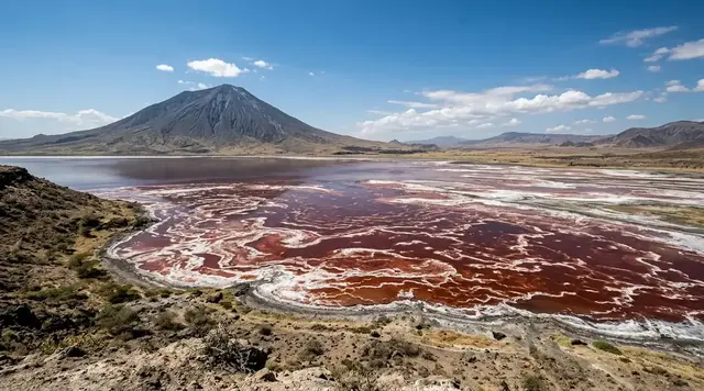
AI illustration
 Written and edited by
 In December 2023 a team from the British Antarctic Survey counted about 194,350 pairs of chinstrap penguins on Zavodovski. The last comparable figure, from 2011, was roughly 600,000. Between those two counts a volcano buried up to half the island in ash while the adult birds were moulting and physically unable to go to sea. The obvious conclusion is the wrong one.
Silence Index — D-044
Genuinely remote
Ranks 40 of 99 scored dossiers — quieter than 60% of the others we have scored. A low score is not a warning; it describes who else will be standing next to you.
How the total is weighted. These are the fixed weights of the four inputs, the same on every dossier — not this place’s scores. We do not publish per-input bars, because the per-input values were never recorded article by article and inventing four plausible numbers that sum to the total would be a fabrication dressed as a chart.
The index is a desk instrument scored by this publication, not a field measurement. How it is calculated, and where it fails.
This is a desk-researched dossier. Nobody from this publication has been to Zavodovski, and almost nobody has: the island has been landed on a handful of times in two centuries. It is built from the British Antarctic Survey, the Darwin Initiative's final project report, the Smithsonian Institution's Global Volcanism Program, the Government of South Georgia and the South Sandwich Islands and its published management plans, CCAMLR, the US National Snow and Ice Data Center, the Agreement on the Conservation of Albatrosses and Petrels, and peer-reviewed seabird ecology.
Zavodovski is the northernmost of the eleven volcanic islands and rocks of the South Sandwich chain, which runs more than four hundred kilometres north to south in the Southern Ocean between South Georgia and the Antarctic Peninsula. It is not large. Most of it is a single active cone, Mount Curry, rising to 551 metres, with ash flats and lava aprons around its base. Those flats hold what is usually described as the largest penguin colony on Earth.
What the 2023 survey actually did
The expedition was funded by a Darwin Plus grant of £440,264 under the project title "Evidence-based conservation of key biodiversity in the South Sandwich Islands", led by the British Antarctic Survey with Oxford Brookes and Edinburgh universities, and with the Antarctic Research Trust and the territory's own government contributing in kind.
The team sailed on the charter yacht Vinson of Antarctica from the Falkland Islands, about thirteen hundred miles and seven days of open ocean away. The full field period ran from 27 November to 28 December 2023. The window actually spent at the island was 10 to 16 December, and inside that window only about four days were workable; storms took the rest.
The count itself was done from the air. The final report records DJI Mavic 3 Enterprise multirotor drones flown on terrain-following plans at 70 to 100 metres above ground level, with the principal survey on 14 December achieving better than 90% coverage of the colonies. Two crewed aerial surveys were flown by the Royal Air Force in an A400M out of Mount Pleasant in the Falklands, on 12 and 20 December, to cross-check the drone imagery against something taken from much higher up. Satellite optical and radar imagery from 2016, 2020 and 2025 was used to track the total area occupied by nesting birds over time.
There is a small inconsistency worth flagging, because it is the kind of thing that propagates. The British Antarctic Survey's own news release and the wire copy derived from it give the drone flight altitude as 50 metres. The project's final report to the Darwin Initiative gives 70 to 100 metres. We have used the report's figure, because it is the technical document, but we cannot reconcile the two and have not seen either corrected.
The numbers
Chinstrap penguins: about 194,350 breeding pairs in December 2023, against roughly 600,000 pairs in 2011. That is a loss of about two-thirds in thirteen years, which the report expresses as an annual rate of −3.76%.
Macaroni penguins on the same island over the same period went the other way: roughly 90,000 pairs in 2011 to about 220,730 pairs in 2023, a rise of about two and a half times, or +2.93% a year.
The survey also produced the first modern counts of several other species. Southern giant petrels, which the Agreement on the Conservation of Albatrosses and Petrels had on the books at 64 pairs from a January 2011 census of the ash plains near Reek Point, came in at 178 pairs — nearly triple. Antarctic fur seals were counted at 1,154 cows, 1,265 pups and 545 bulls.
Two of those three trends are upward. That matters for what comes next.
What popular coverage gets wrong
The story that circulates about Zavodovski is a volcano story. It was set in March 2016, when Mount Curry began erupting, and it took hold because the timing was genuinely appalling: adult chinstraps moult in late summer, and a moulting penguin has no waterproofing and cannot go to sea. A million birds were effectively grounded when the ash started falling. The Global Volcanism Program's bulletin records ashfall over one-third to one-half of the island, with fishing vessels photographing bombs being thrown from the crater. Conservation organisations flagged the risk at the time, correctly. Wire agencies, aggregators and a long tail of wildlife sites then converted a risk into a cause, and the two-thirds decline is now widely narrated as the aftermath of an eruption.
The project's own final report says otherwise, and says it plainly: a large decline had already occurred between 2011 and January 2016, before the eruption occurred. The rate of loss after 2016 is not distinguishable from the rate of loss before it. And the macaroni penguins, which share the island, were rising throughout — including through the eruption year. Ash that killed two-thirds of one species while the population of another two and a half times over is not a mechanism anyone has proposed.
There is a second, quieter error worth correcting, and it comes from a better source. The most widely cited global assessment of the species, published in Scientific Reports in 2020, put the world population at about 3.42 million breeding pairs across 375 extant colonies, found that 45% of colonies with usable historical data had probably or certainly declined against a 1980s baseline, and noted that more than a third of the global population sits in a few very large colonies in the South Sandwich Islands where numbers appeared stable. That was a reasonable reading of what was available in 2020. It is now the part of that paper that has not survived. The South Sandwich colonies were not stable; they were simply uncounted.
The lesson is not that the 2020 assessment was careless. It is that the largest single reservoir of a declining species was, until three years ago, a number from 2011 that nobody had been able to check.
The explanation that is on the table
The project's leading hypothesis is a climate-driven regime shift: a warming that has gone against the maritime Antarctic chinstrap and in favour of the sub-Antarctic macaroni. Zavodovski sits close to the boundary between those two zones, which is exactly where you would expect such a shift to show first and show hardest.
The report explicitly sets aside the two simplest alternatives. Direct competition between the two penguins is judged unlikely, because tracking data show the species using different marine distributions during the breeding season. Competition for nesting ground is judged unlikely too, because the total area occupied by nesting penguins has shrunk — the island is not full. And local fishing pressure can be excluded almost entirely: no krill fishing has taken place in CCAMLR Subarea 48.4, which contains the South Sandwich Islands, for more than twenty years.
That last point is the one most often missed. If you want to blame the krill fishery for Zavodovski, you have to explain how a fishery that does not operate there did it. The wider Antarctic krill catch is rising sharply — CCAMLR's own figures show 624,918 tonnes in 2025 against 498,350 tonnes in 2024, the highest in the record and more than double the 1990 peak — but all of that is taken in Subareas 48.1 to 48.3, further west.
What is happening in the water column is harder to dismiss. Antarctic sea ice has behaved abnormally for four consecutive years. The National Snow and Ice Data Center recorded a minimum of 1.98 million square kilometres on 1 March 2025, tying 2022 and 2024 for second lowest, and the fourth year running below two million; the 2025 maximum of 17.81 million square kilometres was the third lowest in a 47-year satellite record, above only 2023 and 2024. Krill recruitment is tied to winter sea ice. Chinstraps eat krill. Nobody has yet demonstrated the chain end to end at Zavodovski, and this dossier will not pretend otherwise.
The same trend, elsewhere
Zavodovski is not an outlier, which is both the reassuring and the alarming part.
An analysis published in Diversity in 2023, covering 133 breeding colonies across the Antarctic Peninsula and South Orkney Islands between 1960 and 2020 — roughly 60% of the global population — found that 62% of colonies decreased over forty to fifty years, most of them by more than half, and that the regional population fell by about 30% across three generations. Its author argued that this meets the IUCN threshold for Vulnerable under criterion A2.
A drone survey of Antarctic Specially Protected Area No. 133 on Nelson Island in the South Shetlands, posted as a preprint in October 2025, counted 38,080 nests at Harmony Point in December 2024 against roughly 90,000 pairs in the mid-1990s — a 57% fall. It used the same equipment class as the Zavodovski work, a DJI Mavic 3 at 100 metres, which is a small sign of how quickly this method has become standard.
Put together, the picture is of a species losing ground across its range, with the last large uncounted stronghold turning out, on being counted, to have been losing ground too.
Who is allowed to go, and why almost nobody does
The South Sandwich Islands sit inside a marine protected area of 1.24 million square kilometres, declared in 2012, within which the no-take zones were greatly expanded in April 2025 following an independent five-year review, and now cover about 470,000 square kilometres. Trawling is prohibited throughout. All coastal waters shallower than 100 metres are closed to fishing.
On land the position is stricter still. In 2022 the entire landmass of the territory — some 3,800 square kilometres — was declared a protected area, split into a South Georgia Terrestrial Protected Area and a South Sandwich Islands Terrestrial Protected Area. The management plan finalised in October 2023 is unambiguous about the second: access to the SSI protected area is prohibited, and will only be granted in special circumstances, on a demonstration that the risk of introducing non-native species has been reduced as near to zero as possible. Tourism landings on the South Sandwich Islands will not be permitted.
This is not a formality dressed up as a rule. Biosecurity is the whole point. The territory's own guidance states the reasoning bluntly: a single non-native species, pest or disease can cause long-term or irreversible damage, and the vectors are clothing, equipment and cargo. South Georgia spent years and a great deal of money removing rodents; the South Sandwich Islands have never had them, and the cheapest way to keep it that way is to keep people off.
Ships may cruise past under the ordinary entry-control regime, which is administered from the Falklands. Landing is a different question, and the answer is no.
Why the Silence Index is 81
Footfall and access both score at the extreme end. There is no accommodation, no landing, no tourism, no airstrip, and reaching the island means a week of Southern Ocean in a small vessel followed by a landing that is only possible on a small number of days a year. Night darkness is as complete as it gets: the nearest permanent settlement is on another island group hundreds of kilometres away.
What holds the score down — and this is the only reason it is not in the nineties — is the acoustic floor, which at Zavodovski is close to the worst on Earth. A colony of several hundred thousand pairs of chinstraps is continuously, structurally loud, and the surf on an exposed volcanic shore does not stop. The Silence Index measures how found a place is, and by every human measure this island is unfound. It is not, in any sense, quiet.
The question the survey leaves
The South Sandwich Islands protected areas were designed around the assumption that the marine system there was intact and the terrestrial system was safest left alone. The first assumption now needs testing. A no-take zone protects a colony from fishing; it does not protect it from a shift in where the krill are, and the one species on Zavodovski that is thriving is the one whose ecological preferences point north, towards warmer water.
The honest position is that we now know the trend and do not know the mechanism. The 2023 expedition deployed satellite transmitters on birds and collected guano for DNA analysis of diet precisely to start closing that gap, and its tracking data has already fed into successive extensions of the no-take zones. What it cannot do is tell you what to manage for, if the thing that is changing is the water rather than the fishing.
One more thing is worth saying about a place this hard to reach. The 2011 figure that anchors the whole comparison is itself a single estimate that the 2023 report does not describe the method for. The two-thirds decline is real and is not seriously in doubt — the satellite record of shrinking occupied area supports it independently — but the precision implied by "600,000 to 194,350" is greater than the evidence carries. The next count will be the one that settles the rate, and on current form it will be about a decade away.
Corner Codex — D-044
- Place
- Zavodovski Island, northernmost of the South Sandwich Islands
- Coordinates
- 56.30°S, 27.57°W — about 2,100 km east-south-east of the Falklands
- The volcano
- Mount Curry, 551 m, basaltic stratovolcano; last eruption 30 March – 15 June 2016
- Ash cover, 2016
- One-third to one-half of the island, by satellite imagery
- Chinstraps, 2011
- About 600,000 breeding pairs
- Chinstraps, 2023
- About 194,350 breeding pairs — a fall of roughly two-thirds
- Rate of loss
- −3.76% a year, unchanged either side of the eruption
- Macaronis
- About 90,000 pairs in 2011, about 220,730 in 2023 — up 2.93% a year
- Southern giant petrels
- 64 pairs in 2011, 178 pairs in 2023
- Fieldwork
- 27 November – 28 December 2023; four days ashore, 10–16 December
- Access
- Tourism landings not permitted. Access to the SSI protected area is prohibited
- Silence Index
- 81 / 100
The Traveler's Panel · checked
Changing information. Prices, permits, seasons and road access change, sometimes at short notice. Everything here is a starting point for your own confirmation — not a quote, and not a guarantee. Verify with the operator and the relevant official body before you book.
| Can you visit | No. Tourism landings on the South Sandwich Islands will not be permitted |
| Who can | Holders of a Regulated Activity Permit, in special circumstances, for science |
| The colony | About 194,350 chinstrap pairs in December 2023, down from about 600,000 in 2011 |
| The volcano | Mount Curry, 551 m. Last confirmed eruption 30 March – 15 June 2016 |
| The other trend | Macaroni penguins up from about 90,000 to about 220,730 pairs over the same period |
| Nearest people | King Edward Point, South Georgia — about 750 km west, population around 22 |
Getting there — Stanley, Falkland Islands → 7 days by chartered yacht → Zavodovski (landing by permit only)
- There is no scheduled way to reach Zavodovski and no legal way to land as a visitor. The 2023 expedition chartered a yacht from the Falkland Islands and spent seven days crossing about 1,300 miles of Southern Ocean to get there.
- Even with permission, the island grants very few working days. The 2023 team had the window of 10 to 16 December and found roughly four days usable; storms took the rest.
- Some expedition cruise itineraries include ship cruising past the South Sandwich Islands under the territory's entry-control regime. That is a different activity from landing, and the distinction is legal rather than practical.
- Any activity beyond ordinary tourism — drones, submersibles, camping ashore, research — requires a Regulated Activity Permit from the territory's government, administered from the Falkland Islands.
- Aircraft, helicopters and unsupported field projects are not authorised anywhere in the territory.
Indicative costs — verify before booking
| Visiting | Not possible. Landing on the South Sandwich Islands is prohibited |
| Ship cruising past | Subject to Entry Control Ordinance 2022 notification through the operator |
| Research access | Regulated Activity Permit, granted only in special circumstances |
| What a survey costs | The 2023 Darwin Plus grant for the whole project was £440,264 |
| Note | Any operator advertising a Zavodovski landing is advertising something not permitted |
What to pack
- Nothing, because you are not going. This entry exists to say so plainly rather than to invent a kit list for a place with a standing prohibition on landing.
- For anyone travelling in the wider territory: biosecurity cleaning of all clothing, boots, bags and equipment is mandatory and inspected, and it is the single most consequential thing a visitor does.
- Velcro, boot treads and camera-bag seams are the specific failure points named in the territory's biosecurity procedures.
- Cold-water immersion and Southern Ocean small-boat experience, if you are ever in a position to need any of this.
Where to stay
There is nowhere to stay. There is no building, no shelter, no cache and no permanent human presence anywhere in the South Sandwich Islands, and there never has been. The 2023 expedition lived aboard a chartered yacht and worked ashore in day windows between storms. The nearest inhabited point is King Edward Point on South Georgia, roughly 750 kilometres west, where the resident population is around twenty-two people, and the nearest place with hotels is Stanley in the Falkland Islands, a week away by sea.
Safety & responsible travel
- Do not repeat the volcano story. The 2016 eruption is real, the ash cover is real, and it is not what caused the chinstrap collapse — most of the loss had already happened by January 2016 and the rate did not change afterwards.
- Do not describe the South Sandwich Islands as a place to visit. The territory's own management plan states that tourism landings will not be permitted, and repeating the opposite creates pressure on the strictest biosecurity regime in the sub-Antarctic.
- If you cruise the territory, follow the biosecurity procedures exactly. The islands have never had rodents. South Georgia spent years and a great deal of money getting rid of theirs.
- Report unusual animal mortality to the government rather than to social media. There is a standard operating procedure for exactly this and it exists because these colonies are monitored roughly once a decade.
- Be careful about blaming the krill fishery here specifically. There has been no krill fishing in CCAMLR Subarea 48.4 for more than twenty years. The fishery is a legitimate concern in other subareas and a poor explanation for this island.
Nearby, and quieter
Everything nearby is another volcano. Saunders Island, about 170 km south, carries Mount Michael and one of only about eight persistent lava lakes on Earth, in near-continuous eruption since November 2014. Visokoi Island holds Hodson, 835 m, with a morphology young enough to suggest recent activity. Leskov Island, the smallest of the chain at 0.3 km², is the eroded remnant of an andesitic stratovolcano with fumaroles recorded in 1911 and 1964. Bristol Island erupted in 2016, the same year as Zavodovski. South Georgia, 750 km west, is the only part of the territory open to managed tourism and is a completely different proposition: whaling stations, a museum, a post office and a resident government.
Getting there, in order
- 1Stanley, Falkland Islands
- 27 days by chartered yacht
- 3Zavodovski (landing by permit only)
Each leg is a separate booking and a separate chance to be weathered out. Build spare days into the chain, not onto the end of it.
Where it is
Zavodovski Island, South Sandwich Islands · 56.3000°S 27.5700°W · Open in Google Maps · OpenStreetMap
Key locations
- Zavodovski Island (Mount Curry) — the northernmost South Sandwich island and the volcano that erupted in 2016
56.3000°S 27.5700°W - Visokoi Island (Hodson) — the next island south, 835 m, with reported but unconfirmed eruptions
56.7120°S 27.1760°W - Leskov Island — the smallest of the chain at 0.3 km squared, west of the main arc
56.6560°S 28.1400°W - Saunders Island (Mount Michael) — carries one of about eight persistent lava lakes on Earth
57.8000°S 26.4830°W - King Edward Point, South Georgia — the nearest permanent settlement and the seat of territorial administration
54.2828°S 36.4939°W
Coordinates are for orientation and are accurate to roughly the width of the feature named, not to a doorway. Several of these points are inside protected areas or need a permit, a guide or a boat — read the access notes above before you plan a route to any of them.
Sources & further reading — checked
- British Antarctic Survey — Scientists count penguins on remote sub-Antarctic island. The December 2023 expedition, the seven-day 1,300-mile crossing from the Falklands, the three weeks in camp, the satellite tagging and guano DNA work, Norman Ratcliffe's quote on how limited the existing data was, and the 50 m drone altitude figure this dossier flags as inconsistent with the project report
- Darwin Initiative — DPLUS186 final report, Evidence-based conservation of key biodiversity in the South Sandwich Islands. The core figures: 194,350 chinstrap and 220,730 macaroni pairs in 2023 against 600,000 and 90,000 in 2011; rates of −3.76% and +2.93% a year; the finding that a large decline had already occurred between 2011 and January 2016 before the eruption; the regime-shift hypothesis; the rejection of competition and nesting habitat as explanations; the absence of krill fishing in Subarea 48.4 for over 20 years; the Mavic 3 Enterprise drones at 70–100 m; the RAF A400M flights of 12 and 20 December 2023; the Vinson of Antarctica; the 178 giant petrel pairs and the fur seal counts; and the £440,264 grant
- British Antarctic Survey — Zavodovski Expedition project page. The project title and April 2023 to March 2025 span, the description of it as the first comprehensive scientific survey of the island, the named BAS authors and the collaborating institutions
- Smithsonian Global Volcanism Program — Zavodovski. Mount Curry at 551 m, coordinates 56.3°S 27.57°W, basaltic stratovolcano, the 30 March to 15 June 2016 eruption at VEI 1 with ashfall over one-third to one-half of the island, and the earlier 1819 eruption observed by Bellingshausen
- Smithsonian Global Volcanism Program — Bulletin report on Zavodovski, February 2017. The 2016 plume observations from 30 March onward, satellite imagery showing up to half the island coated in ash, the MODIS plume record through the year, and fishing vessels photographing bombs ejected from the crater
- Agreement on the Conservation of Albatrosses and Petrels — Mount Curry erupts. The name Mount Curry for the volcano, the March 2016 onset, satellite confirmation of one-third to one-half ash cover by July 2016, and the January 2011 baseline of 64 southern giant petrel pairs on the ash plains near Reek Point
- Strycker et al. — A global population assessment of the Chinstrap penguin, Scientific Reports 10 (2020). The global estimate of about 3.42 million breeding pairs across 375 extant colonies, the finding that 45% of colonies with historical data had declined against a 1980s baseline against 18% increasing, and the statement that South Sandwich Islands populations appeared stable — the claim the 2023 survey overturns
- Krüger — Decreasing Trends of Chinstrap Penguin Breeding Colonies, Diversity 15(3) (2023). 133 colonies on the Antarctic Peninsula and South Orkneys analysed for 1960–2020, 62% of colonies decreasing over 40–50 years with most losing more than half, an approximately 30% regional decline over three generations, and the argument that this meets IUCN criterion A2
- Drone survey of ASPA No. 133, Nelson Island — bioRxiv preprint, October 2025. 38,080 chinstrap nests counted at Harmony Point in December 2024 against roughly 90,000 pairs in the mid-1990s, a 57% decline, using a DJI Mavic 3 at 100 m over 14 flights
- Government of South Georgia & the South Sandwich Islands — Marine Protected Area. The 1.24 million km² MPA established in 2012, no-take zones expanded to 470,000 km² in April 2025 after the independent five-year review, the ban on trawling throughout, and the closure of all coastal waters shallower than 100 m
- Government of South Georgia & the South Sandwich Islands — Terrestrial Protected Area. The 2022 designation of the entire 3,800 km² landmass, the split between the South Georgia and South Sandwich Islands protected areas, and the closure of the South Sandwich Islands to visitors except under special circumstances
- Government of South Georgia & the South Sandwich Islands — Terrestrial Protected Area management plan (October 2023). The explicit statements that access to the SSI Terrestrial Protected Area is prohibited, that tourism landings on the South Sandwich Islands will not be permitted, and the near-zero non-native species risk test for any exception; and Zavodovski's inclusion in the boundary
- Government of South Georgia & the South Sandwich Islands — The South Sandwich Islands. Eleven volcanic islands and rocks over more than 400 km, Montagu the largest at 110 km² and Leskov the smallest at 0.3 km², multiple eruptions since 2000, Mount Michael's lava lake as one of about eight in the world, and the 2022 protected-area declaration
- Government of South Georgia & the South Sandwich Islands — How to visit. The Entry Control Ordinance 2022 regime, the Regulated Activity Permit requirement for drones, submersibles and non-tourism work, the prohibition on aircraft and unsupported field projects, and the statement that the islands are accessible only by sea with no visitor accommodation ashore
- Government of South Georgia & the South Sandwich Islands — Biosecurity. The standard operating procedures for visitors, vessels and cargo, and the stated principle that a single non-native species, pest or disease can cause long-term or irreversible damage, with clothing, equipment and cargo named as the vectors
- CCAMLR — Krill fisheries. The 2025 Antarctic krill catch of 624,918 tonnes against 498,350 tonnes in 2024, the highest in the record and more than double the 1990 peak of 376,099 tonnes, and the confinement of all current fishing to Subareas 48.1 to 48.4
- National Snow and Ice Data Center — Sea Ice Today analyses. The 1 March 2025 Antarctic minimum of 1.98 million km², tying 2022 and 2024 for second lowest and the fourth consecutive year below 2.0 million km²; and the 2025 maximum of 17.81 million km², third lowest in the 47-year satellite record
- Phys.org / British Antarctic Survey — Scientists count penguins on remote sub-Antarctic island (January 2024). The syndicated version of the BAS release, confirming the 50 m drone figure in circulation and the satellite tagging and guano collection programme
- Polar Journal — Chinstraps recounted in Antarctica. Independent reporting of the global assessment, the South Sandwich archipelago as the largest concentration of the species, and the attribution of decline to krill availability and sea-ice change with additional pressure from the commercial fishery
- Smithsonian Global Volcanism Program — Saunders Island (Mount Michael). Mount Michael at 843 m, 57.8°S 26.483°W, its 500 m summit crater and persistent lava lake, and near-continuous eruption since November 2014
- Smithsonian Global Volcanism Program — Leskov Island. Leskov Island at 56.656°S 28.14°W and 190 m, the eroded remnant of a small andesitic stratovolcano with fumarolic activity recorded in 1911 and 1964
- Smithsonian Global Volcanism Program — Hodson, Visokoi Island. Visokoi Island's volcano at 56.712°S 27.176°W and 835 m, with youthful morphology and uncertain reported eruptions in 1830 and 1930
- GeoNames — King Edward Point, South Georgia. Coordinates 54°16'58″S, 36°29'38″W for the administrative and research station from which the territory's waters are managed
- UK Foreign, Commonwealth & Development Office — South Georgia and South Sandwich Islands travel advice. Confirmation that the territory is a British Overseas Territory administered by a commissioner based in the Falkland Islands, and the standing advice that no travel there can be guaranteed safe
Official and scientific bodies are the authority for safety, regulatory and scientific claims. Commercial operators are used only for practical detail such as tour length, meeting points and indicative pricing — never for a safety or scientific statement.
How this was made
Desk research. Compiled from official bodies, scientific and conservation sources, established journalism and licensed operators. Not based on a personal visit.
Editor’s method note — what we checked, corrected and could not verify
- Desk research only. Nobody from this publication has been to the South Sandwich Islands, and under the 2023 management plan nobody from this publication could go.
- The brief's central claim survives checking and is the article's spine: the 2016 eruption did not cause the chinstrap collapse. The Darwin Plus final report states directly that a large decline had already occurred between 2011 and January 2016.
- We correct the brief on one point of fact. The brief gives the ash cover as between one-third and one-half; the Global Volcanism Program and ACAP support that range, but the project's own final report says simply that the eruption covered a third of the island. We print the range and name the sources rather than picking one.
- We could not reconcile the drone flight altitude. The Darwin Plus report says 70–100 m above ground level; the British Antarctic Survey's own news release and the wire copy derived from it say 50 m. Neither has been corrected as far as we can see. We use the report's figure and flag the discrepancy in the text.
- The 600,000-pair figure for 2011 is used by the project as its baseline, but the final report does not describe the method behind it. The direction and rough magnitude of the decline are independently supported by satellite measurement of shrinking occupied area; the precision is not. We say so.
- Where the 2020 global assessment in Scientific Reports says South Sandwich populations appeared stable, we do not treat that as an error by its authors. It was the best available reading before anyone counted, and we present it as superseded rather than wrong.
- Coordinates for the South Sandwich islands are taken from the Smithsonian Global Volcanism Program's volcano records, and for King Edward Point from GeoNames. We give no coordinates for individual colonies on Zavodovski: none are published at a resolution we would trust, and pinning a colony we cannot verify would be worse than leaving it out.
- Things we could not verify: the source and method of the 2011 penguin count; whether the 2023 results have yet appeared in a peer-reviewed journal rather than a project report; the correct drone flight altitude; whether the chinstrap decline is driven principally by krill availability, sea-ice change or something else, which the report itself leaves open; the current IUCN Red List category and assessment date for the chinstrap penguin, whose assessment pages we could not open; the exact 2026 status of Mount Curry, which the Global Volcanism Program still lists as last erupting in 2016 with no bulletin since; whether any further landing has been permitted since December 2023; and the CCAMLR conservation measure text setting the Area 48 krill trigger level, which returned a 403 to every route we tried.
AI is used to draft this text, and a human checks it. Every figure, date and quotation above was verified by Tony Hall against the source cited for it in the reference list; where sources disagree, the disagreement is shown rather than resolved, and where a claim could not be confirmed it is either marked unverified or left out. The illustrations are AI-created and labelled as such — no photograph on this site is presented as a record of a real place. Full disclosure · Editorial policy.
Access details change — recheck before you travel. Found an error? Tell us — corrections are dated and shown in place.