AI illustration
 Written and edited by
 The 2013 survey of the Hindenburg Wall recorded 1,108 species and could not put a name to 89 of them. Thirteen years later most of those names are still not published. In the same period Papua New Guinea passed a new Protected Areas Act, and mineral exploration continued in the same limestone country. The inventory is running slower than the land decisions it was meant to inform.
Silence Index — D-051
Genuinely remote
Ranks 32 of 99 scored dossiers — quieter than 68% of the others we have scored. A low score is not a warning; it describes who else will be standing next to you.
How the total is weighted. These are the fixed weights of the four inputs, the same on every dossier — not this place’s scores. We do not publish per-input bars, because the per-input values were never recorded article by article and inventing four plausible numbers that sum to the total would be a fabrication dressed as a chart.
This dossier was scored before 2 September 2026, when the fourth input became night darkness. It keeps the input it was reasoned with until it is re-scored at its next source re-check; the methodology page records the change.
The index is a desk instrument scored by this publication, not a field measurement. How it is calculated, and where it fails.
This is a desk-researched dossier. Nobody from this publication has been to the Hindenburg Wall. It is built from the Wildlife Conservation Society's rapid biodiversity assessment as archived by James Cook University, Papua New Guinea's Mining Act 1992 as published by its own Mineral Resources Authority, the Constitution of Papua New Guinea, the Protected Areas Act 2024 as recorded by UNEP, the UNESCO World Heritage Centre's tentative list, Ok Tedi Mining Limited's own corporate disclosures, the Extractive Industries Transparency Initiative, the UNEP-WCMC World Database on Protected Areas, Papua New Guinea's national newspaper, GeoNames, and taxonomic literature.
Before anything else: this is inhabited country under customary tenure, and the people who hold it are not context. Landowners from villages including Bultem, Finalbin, Migalsim and Kawarobip guided the survey teams to the sites. The Faiwol language was recorded in use. The project coordinator, Nathan Whitmore, described the report as reflecting both the work of international and national scientists and the traditional ecological knowledge of people from Finalbin, Kawarobip, Migalsim, Telefomin and Tabubil. The report's own central recommendation is that participatory land-use planning with those communities has to happen before any conservation area or World Heritage nomination, not after.
The wall itself
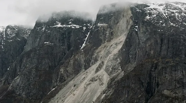
The Hindenburg Wall is a series of large limestone escarpments running about 50 kilometres within the Hindenburg Range in North Fly District, Western Province, and running eastward from close to the border with Indonesian Papua. Papua New Guinea's own national newspaper describes vertical faces exceeding a kilometre in height. European explorers named it in 1912–13. It is one of the karst systems that Papua New Guinea proposed to UNESCO in June 2006 under the serial nomination The Sublime Karsts of Papua New Guinea, alongside the Nakanai Range in East New Britain and the Muller Range in Southern Highlands, under a mixed set of criteria — (v), (vii), (viii), (ix) and (x).
The conditions are extreme and are the reason the biology is what it is. The area receives over seven metres of rain a year, under near-permanent cloud, on very steep ground. The tentative list submission notes that the giant scarps generate unique patterns of air movement that affect how the rock erodes, and describes a landscape of tower karst and successive collapse phases. Nothing about this country is easy to walk across, which is a large part of why so little of it had been surveyed.
What the 2013 survey found
The Wildlife Conservation Society's rapid biodiversity assessment ran fieldwork in three blocks in February and early March 2013 — the Tabubil environs on 6 to 10 February and again from 25 February to 1 March, Tupnonbil from 11 to 24 February, and Kawarobip from 24 to 28 February — and published in 2015. It was financed by Papua New Guinea Sustainable Development Program Ltd and conducted in partnership with the country's Department of Environment and Conservation.
Three elevation bands were covered: the Tabubil lowlands at roughly 350 to 1,075 metres, the Bilbilokabip and Tupnonbil mid-elevation sites around 1,770 metres, and the high montane sites at Mount Minni and Kawarobip between about 2,383 and 2,529 metres.
The headline totals are 1,108 species recorded, of which 89 were suspected new to science and 17 carry IUCN listings above Least Concern. Broken down, the survey found 452 plants across 105 families with 23 new to science; 172 ants with at least 26 new species, and nine invasive ant species found only near Tabubil; 165 butterflies with four or five new; 53 dragonflies and damselflies with 13 to 16 new, and 43% of montane odonates potentially new; 24 frogs of which at least 10 are undescribed and six appear entirely new to science; 13 reptiles with one undescribed; 157 birds including nine on conservation lists; 33 non-volant mammals with 14 new regional records; 11 bats; and 12 native fish including the vulnerable Ok Tedi rainbowfish.
The mammal records included first occurrences on the southern side of the Hindenburg Range for the great-tailed triok, the mountain mammelomys and Louise's mirzamys. Tree kangaroos are present and are described in the report as culturally paramount, used in bride price and social exchange. Echidnas are present and elusive.
Four of the described frog species carry IUCN Data Deficient status because their distributions are so poorly understood — which is a useful reminder that "described" and "understood" are different achievements.
What popular coverage gets wrong
Coverage of surveys like this one almost always frames the place as untouched wilderness awaiting discovery, and then treats the species count as the argument for protection. Two things are wrong with that, and the report itself says so.
The first is that this country is not empty. The assessment records that village life around the Hindenburg Wall still turns to a large extent on subsistence gardening and hunting, that hunting follows a seasonal calendar keyed to gardening cycles and tree fruiting, and that the people who live there hold detailed knowledge of the wildlife. Much of that knowledge is sacred and revealed only at initiation, and certain species names may not be disclosed to the uninitiated on pain of death. A survey team that arrives with mist nets and pitfall traps is not the first party to have catalogued this fauna. It is the first to have written it down in a form that a government agency will accept.
The second error is more consequential and is a matter of law. The frame of "protect it before the miners get there" implies that securing the land settles the question. Under Papua New Guinea's legal architecture it does not, because land and minerals are held separately.
The overwhelming majority of Papua New Guinea's land is customary land, held by clans and families under customary tenure rather than by the State. Reporting on the 2024 Act puts it at more than 90%; the figure drawn from Papua New Guinea's own Protected Area Policy is 97%. The Constitution recognises this: section 53(5)(d) contemplates property taken in accordance with custom, and section 54 permits laws that resolve customary land disputes outside the courts. National Goal 4 commits the country to conserving its natural resources and environment for the collective benefit of all, including its valued birds, animals, fish, insects, plants and trees.
But section 5 of the Mining Act 1992 states that all minerals existing on, in or below the surface of any land in Papua New Guinea are the property of the State. Surface title and subsurface title are two different things held by two different parties. What a landowner controls is access and compensation, not the mineral. Section 155 provides that there is no entry until compensation is agreed or determined; section 156 provides for compensation agreements; section 157 lets a warden determine the amount when the parties cannot agree. Section 3 requires a development forum before a special mining lease is granted, to consider the views of the people affected. Section 20 provides for exploration licences on the Board's recommendation, and section 23 gives the holder exclusive occupancy for exploration purposes.
That is a framework of consultation, compensation and process. It is not a veto. Saying so is not cynicism about Papua New Guinea's law; it is the difference between the question the biologists were answering and the question the landowners actually face.
The mining that is already there
The report is explicit that mineral exploration was ongoing in the vicinity while the survey ran, and warns that the discovery of large deposits, together with associated transport infrastructure, could result in industrial-scale development. Its recommendation is correspondingly practical rather than absolutist: negotiated land use plans to contain the footprint of industrial development and to mitigate or offset its effects.
This is not a hypothetical region. Ok Tedi Mining Limited operates the Mount Fubilan open-cut copper, gold and silver mine in the Star Mountains, about 16 kilometres from the Indonesian border and roughly thirty kilometres north-west of the Hindenburg Range's mapped centre. It has run since 1984, moves more than 60,000 tonnes of ore a day through a plant handling up to 24 million tonnes a year, pipes concentrate 156 kilometres to the port of Kiunga, and currently plans closure in 2050. The town of Tabubil — population around 10,000 — was built to serve it, with an airport, workshops, schools and a hospital, and Tabubil is where the 2013 survey's lowland sites were.
The report names Ok Tedi Mining Limited as a party that should be at the table for participatory land-use planning, alongside communities, government and provincial stakeholders, precisely so that the various parties' assumptions about the land do not diverge. That is a more honest recommendation than asking a company to leave.
It is also less adversarial than it sounds, because of who owns the company. Papua New Guinea's Extractive Industries Transparency Initiative disclosures record the State holding 67% of Ok Tedi Mining Limited and three Mineral Resources Development Company subsidiaries, representing landowners, holding the remaining 33%. The extractive sector as a whole accounted for 27% of GDP, 88.6% of exports and 23.1% of government revenue in 2023. EITI's own validation is blunt about the weak point: the subnational distribution mechanisms — royalty shares, dividends, compensation payments, development levies and Special Support Grants — are complex, and reporting on what actually reaches landowners is not clear, reliable or timely.
The law changed after the brief was written
The most important development since the survey is not taxonomic. In February 2024 Papua New Guinea passed a Protected Areas Act, numbered Act No. 9 of 2024, and it changes the terms on which a place like the Hindenburg Wall could be protected.
The Act establishes a National Conservation Council to manage a Protected Area Network, makes the Managing Director of the Conservation and Environment Protection Authority responsible for it, and requires a register of declared protected areas. It creates four categories: national protected areas including national parks and maritime sanctuaries; regional protected areas including community conservation areas and private protected areas; protected areas with sustainable forest management; and special management areas for particular species or ecosystems. It allows local-level governments to declare traditional sacred sites as protected areas. And it requires free, prior and informed consent before an owner surrenders any property right over a protected area.
Context for how much ground that has to cover: the World Database on Protected Areas listed 57 protected areas for Papua New Guinea in its August 2026 release, with no other effective area-based conservation measures recorded at all. Less than 4% of the country's land and about 1% of its sea are currently protected, against a stated goal of 30% by 2030. The Act is backed by a Biodiversity and Climate Fund seeded with US$60 million from the Global Environment Facility, and carries penalties up to K200,000 and five years' imprisonment.
The criticisms are worth recording alongside the provisions. Doubts have been raised about the Conservation and Environment Protection Authority's capacity to administer the network, about whether the government will deliver its financial commitments, about the practical difficulty for remote communities of obtaining the national identity documents needed to form incorporated land groups, and about landowner scepticism towards surrendering custody of land to any third party. One official put the consent principle simply: communities decide whether to allocate areas for conservation, and if they do not, they are not forced.
That is the right principle and it also means the timetable is not in the biologists' hands.
The naming problem
Eighty-nine candidate new species is a field estimate made by specialists in the collections, not a count of published names. Formal description is slow, unglamorous and chronically underfunded, and it requires type specimens, comparison against museum material and a journal willing to publish.
We tried to establish how many of the 89 have since been formally described, and could not. The most likely home for the frogs would be the microhylid genus Oreophryne, which has been actively worked on in New Guinea; the largest recent tranche, ten new species published in Zootaxa in 2016, came from the Papuan Peninsula and adjacent islands rather than the Star Mountains. That is a single negative result and it does not settle the question. We record it as an open item rather than guessing at a number.
The gap matters because of how conservation instruments work. A World Heritage nomination, an IUCN Red List assessment and a national protected area declaration all take evidence in the form of named, described, assessed taxa. An unnamed frog cannot be listed as threatened. A specimen in a jar labelled "sp. nov." carries no weight in a development forum. The inventory finished, in the sense of fieldwork, thirteen years ago. In the sense that matters legally it has barely started.
Why the Silence Index is 84
Access friction is high in a way that is not really about distance. There is no road to the wall, no trail infrastructure, no tourism, and no way to go without the agreement of the customary owners — which is a social permission rather than a permit and cannot be bought at a counter. Seven metres of annual rainfall and persistent cloud make even helicopter access unreliable.
Footfall is very low but not zero: this is inhabited, gardened and hunted country, and the survey teams were guided to the sites by people who use them. The acoustic floor is a montane rainforest at 1,700 to 2,500 metres, which is naturally noisy and industrially quiet.
What holds the score below the nineties is proximity. A working open-cut mine, a town of ten thousand with an airport, and a 156-kilometre concentrate pipeline are all within a day of the survey area, and there is active mineral exploration in the vicinity. Light, helicopter traffic and road noise from the Tabubil side are real. This is not a place at the end of the world; it is a place at the edge of a mine.
The question the report is actually asking
The brief's framing — should a species inventory carry weight in a land decision before the species have names? — is the right question, and the 2015 report answers it in a way that is easy to miss because it is phrased as a recommendation rather than an argument.
Its priority is not the World Heritage file. It is participatory rural appraisal and land-use planning with the communities, done first, so that the various parties' understandings of what the land is for do not diverge. The World Heritage nomination and the conservation area come after, and are to be developed through community consultation. Its other recommendations are of the same kind: community education about fire risk, which has already caused notable vegetation change and which drought makes worse; culturally acceptable income generation attached to any protected status; and more survey work specifically in karst, which the 2013 fieldwork barely touched.
Read that way, the 89 unnamed species are not the argument. They are evidence that the argument cannot yet be made on the terms the international instruments require — and that the people who will actually decide are the ones who already know the animals, in a language in which some of their names may not be said aloud.
Corner Codex — D-051
- Place
- Hindenburg Range, North Fly District, Western Province, Papua New Guinea
- Coordinates
- 5.2639°S, 141.5136°E — the range; the wall runs about 50 km within it
- The formation
- A series of large limestone escarpments, named by European explorers in 1912–13
- Rainfall
- Over 7 metres a year, with persistent cloud cover
- Survey dates
- February and early March 2013; report published 2015
- Species recorded
- 1,108 animals and plants
- Suspected new to science
- 89, including 26+ ants, 23 plants, 13–16 dragonflies, 6 frogs
- IUCN threatened
- 17 species above Least Concern
- Elevation surveyed
- About 982 m near Tabubil to 2,529 m at Mount Minni
- Land tenure
- Customary. Villages including Bultem, Finalbin, Migalsim and Kawarobip
- Minerals
- Property of the State under section 5 of the Mining Act 1992
- Silence Index
- 84 / 100
The Traveler's Panel · checked
Changing information. Prices, permits, seasons and road access change, sometimes at short notice. Everything here is a starting point for your own confirmation — not a quote, and not a guarantee. Verify with the operator and the relevant official body before you book.
| Who owns it | Customary landowners. Villages including Bultem, Finalbin, Migalsim, Kawarobip |
| Who owns the minerals | The State, under section 5 of the Mining Act 1992 |
| Permission | Landowner agreement, not a ticket. There is no counter to buy access at |
| Rainfall | Over 7 metres a year, with persistent cloud. Plan around it, not through it |
| Nearest town | Tabubil, population around 10,000, built for the Ok Tedi mine |
| Protected status | None yet. Tentative World Heritage listing since 2006, no nomination filed |
Getting there — Port Moresby → Tabubil (air) → helicopter or multi-day walk, with landowner agreement
- Tabubil is the practical gateway. It has an airport because Ok Tedi Mining built one, and it is the base from which the 2013 survey worked its lowland sites.
- Beyond Tabubil there is no road to the wall and no trail infrastructure. The survey reached its mid- and high-elevation camps at Tupnonbil and Kawarobip with local guides; anyone else would be doing the same thing or flying.
- Nothing happens here without the agreement of the customary landowners. That is a relationship rather than a permit, it takes time to arrange, and it is not something a visitor can shortcut through a government office.
- Weather is the binding constraint. Over seven metres of rain a year with near-permanent cloud makes helicopter access unreliable and ground travel slow on very steep karst.
- There is no tourism industry here in any form. Anyone going is going as a researcher, a company employee, a government officer or a guest of the landowners.
Indicative costs — verify before booking
| Access fee | There is none to pay. What is required is agreement, negotiated locally |
| Getting to Tabubil | Scheduled domestic flights from Port Moresby; check current operators |
| Beyond Tabubil | Charter helicopter or guided walking, arranged privately |
| Guides and porters | Engaged from the villages that hold the land. Rates are negotiated, not published |
| Note | No published tariff exists because no visitor economy exists |
What to pack
- Rain gear that works in seven metres a year. This is not a place where showers pass.
- Warm layers for 2,400 metres in permanent cloud, which is colder than the latitude suggests.
- Malaria precautions for the lowland approach through Tabubil and the Fly lowlands.
- Total self-sufficiency in first aid. The nearest hospital is the mine's, at Tabubil.
- Nothing that looks like a collecting kit unless you have agreed in advance what you are doing with it. Specimens taken from customary land without agreement are a serious matter, and much of the local knowledge of these species is restricted by initiation.
Where to stay
There is no accommodation at the Hindenburg Wall and no established camp. The 2013 survey built temporary camps at Tupnonbil and at Mount Minni and Kawarobip and worked out of them. Tabubil, about thirty kilometres to the north-west, is the only place with beds, shops, fuel and a hospital, and it exists because Ok Tedi Mining built it for a workforce — an airport, workshops, warehouses, housing, banks, schools and medical facilities in the middle of very steep rainforest. Kiunga, downriver on the Fly, is the other town of any size and is the port at the end of the mine's 156-kilometre concentrate pipeline. Everywhere else is a village, and staying in one is a matter of invitation.
Safety & responsible travel
- Do not describe this region as empty, untouched or unclaimed. It is inhabited, gardened and hunted country under customary tenure, and the survey that produced the species list was guided to its sites by the people who hold the land.
- Do not publish or press for restricted knowledge. The report records that much traditional knowledge of wildlife here is sacred and revealed only at initiation, with some species names withheld from the uninitiated.
- Engage guides and porters from the landowning villages and settle terms before starting. That is both the report's model and the only economy this area gets from outside interest.
- Be accurate about the law when you write about it. Land is customary; minerals belong to the State. Conflating the two overstates what landowners control and understates what they are up against.
- Take the fire warning seriously. The report identifies fire as having already caused notable vegetation change, worsened by recent droughts, and recommends community education about it.
- Support description, not just discovery. Eighty-nine unnamed species is a finding about taxonomic capacity as much as about biodiversity, and unnamed species carry no weight in any of the instruments that could protect this place.
Nearby, and quieter
Ok Tedi's Mount Fubilan mine is the dominant feature of the region and the reason the infrastructure exists; the peak itself has been dismantled in the course of mining since 1984. The wider Star Mountains run west to the Indonesian border, sixteen kilometres from the mine. The Fly River system drains the whole area south to the Gulf of Papua and carries both the mine's downstream legacy and the country's largest wetlands. The other two components of the proposed Sublime Karsts World Heritage nomination are a long way off: the Muller Range in Southern Highlands, whose plateau the submission describes as virtually uninhabited, and the Nakanai Range in East New Britain, with underground rivers the submission claims exceed comparable systems anywhere.
Getting there, in order
- 1Port Moresby
- 2Tabubil (air)
- 3helicopter or multi-day walk, with landowner agreement
Each leg is a separate booking and a separate chance to be weathered out. Build spare days into the chain, not onto the end of it.
Where it is
Hindenburg Range and Wall, Western Province, Papua New Guinea · 5.2639°S 141.5136°E · Open in Google Maps · OpenStreetMap
Key locations
- Hindenburg Range — the range carrying about 50 km of limestone escarpment
5.2639°S 141.5136°E - Tabubil — the mining town and survey base, population about 10,270
5.2736°S 141.2292°E - Mount Fubilan — the Ok Tedi open-cut mine; the peak itself has been mined away since 1984
5.0900°S 141.2181°E - Kiunga — the Fly River port at the end of the 156 km concentrate pipeline
6.1217°S 141.2906°E
Coordinates are for orientation and are accurate to roughly the width of the feature named, not to a doorway. Several of these points are inside protected areas or need a permit, a guide or a boat — read the access notes above before you plan a route to any of them.
Sources & further reading — checked
- Alonso, Aplin, Arihafa, Armstrong, Hammer, Hulcr, Kagl, Ken, Bensolo, Lamaris, Lucky, Müller, Richards, Sarnat, Theischinger, Venter, Whitmore & Woxvold — A Rapid Biodiversity Assessment of Papua New Guinea's Hindenburg Wall Region (Wildlife Conservation Society, 2015), via James Cook University Research Online. The whole factual spine: fieldwork dates in February and early March 2013; 1,108 species recorded with 89 suspected new to science and 17 IUCN-listed above Least Concern; the three survey areas and their elevations from about 350 m at Tabubil to 2,529 m at Mount Minni; the customary landowners of Bultem, Finalbin, Kawarobip and Migalsim; subsistence gardening and hunting; sacred knowledge revealed only at initiation and species names withheld from the uninitiated; ongoing mineral exploration in the vicinity; the 50 km of limestone escarpment named in 1912–13; over 7 m of annual rainfall; and the recommendations on land-use planning, World Heritage nomination, mining mitigation, fire and karst survey
- James Cook University Research Online — record for A rapid biodiversity assessment of Papua New Guinea's Hindenburg Wall Region. The full author list and 2015 publication date, the 109-page extent, publication by the Wildlife Conservation Society, financing by Papua New Guinea Sustainable Development Program Ltd, and partnership with Papua New Guinea's Department of Environment and Conservation
- Academia.edu mirror — A rapid biodiversity assessment of Papua New Guinea's Hindenburg Wall Region. The taxonomic breakdown used in this dossier: 452 plants across 105 families with 23 new; 172 ants with 26+ new and nine invasive species near Tabubil only; 165 butterflies; 53 odonates with 13–16 new and 43% of montane odonates potentially new; 24 frogs with at least 10 undescribed and six entirely new; 13 reptiles; 157 birds with nine conservation-listed; 33 non-volant mammals with 14 new regional records; 11 bats; 12 native fish including the vulnerable Ok Tedi rainbowfish; the Faiwol language; and the naming of Ok Tedi Mining Limited as a party to land-use planning
- Mineral Resources Authority, Papua New Guinea — Mining Act 1992. Section 5, that all minerals existing on, in or below the surface of any land in Papua New Guinea are the property of the State; section 155, no entry until compensation is agreed or determined; sections 156 and 157 on compensation agreements and warden determinations; section 3 on the development forum before a special mining lease; and sections 20 and 23 on exploration licences and exclusive occupancy for exploration
- PacLII — Constitution of the Independent State of Papua New Guinea. National Goal 4 on conserving and using natural resources and the environment for the collective benefit of all, including valued birds, animals, fish, insects, plants and trees; section 54 permitting laws to resolve customary land disputes outside the courts and to restrict non-citizen interests in land; and section 53(5)(d) on property taken in accordance with custom
- UNEP Law and Environment Assistance Platform — Papua New Guinea Protected Areas Act (No. 9 of 2024). The creation of the National Conservation Council and the Protected Area Network, with the Managing Director of the Conservation and Environment Protection Authority responsible and a register of declared areas; the four categories of protected area; the power of local governments to declare traditional sacred sites; the recognition of property rights under customary law; and the requirement of free prior informed consent before an owner surrenders any property right over a protected area
- Mongabay — Conservationists welcome new PNG Protected Areas Act, but questions remain (April 2024). The Act's passage in February 2024 and its 30 by 30 target; more than 90% of Papua New Guinea's land held under customary tenure; less than 4% of land and about 1% of sea currently protected; the Biodiversity and Climate Fund seeded with US$60 million from the Global Environment Facility; penalties up to K200,000 and five years; and the criticisms over CEPA capacity, financing, national identity documents for incorporated land groups, and landowner scepticism
- UNESCO World Heritage Centre — The Sublime Karsts of Papua New Guinea (tentative list). Submission on 6 June 2006 by Papua New Guinea's Department of Environment and Conservation under criteria (v), (vii), (viii), (ix) and (x); the three components of Nakanai Range, Muller Range and Hindenburg Range; the giant scarps of the Hindenburg Wall and their effect on air movement and erosion; and the tower karst and successive collapse phases
- Ok Tedi Mining Limited — Ok Tedi Mining. The Mount Fubilan open-cut copper, gold and silver mine in the Star Mountains region of Western Province, about 16 km east of the Indonesian border; operating since 1984; more than 60,000 tonnes of ore a day through a plant handling up to 24 million tonnes a year; the 156 km concentrate pipeline to Kiunga and the 125 km pyrite pipeline to Bige; life of mine planning to closure in 2050; and the construction of Tabubil with its airport, schools and medical facilities
- Mapress / Zootaxa — Kraus, Ten new species of Oreophryne (Anura, Microhylidae) from Papua New Guinea (2016). That the largest recent tranche of new New Guinea microhylid frogs came from the Papuan Peninsula and adjacent islands of the East Papuan Composite Terrane, not from the Star Mountains — the single negative result behind our statement that we could not establish how many of the Hindenburg Wall's 89 candidates have been described
- GeoNames — Hindenburg Range, Western Province. Coordinates 5°15'50″S, 141°30'49″E for the range that carries the wall
- GeoNames — Tabubil. Coordinates 5°16'25″S, 141°13'45″E and a population of 10,270 for the mining town that was the base for the survey's lowland sites
- GeoNames — Kiunga. Coordinates 6°7'18″S, 141°17'26″E and a population of 11,536 for the Fly River port at the end of the concentrate pipeline
- GeoNames — Mount Fubilan. Coordinates 5.09°S, 141.2181°E for the peak that has been dismantled in the course of developing the Ok Tedi Mine since 1984
- IISD SDG Knowledge Hub — Papua New Guinea Works to Improve Management of Protected Areas. The 97% figure for customary land, sourced to Papua New Guinea's own Protected Area Policy; 59 formally registered protected areas as of 2020 covering about 4% of land and seascape, or 2.5 million hectares, against 14.5 million hectares identified as of conservation interest; the role of CEPA in registering protected areas and drafting the policy and bill; and the recognition of spiritually significant tambu areas maintained by communities
- The National (Papua New Guinea) — Scientists publish report on Hindenburg Wall survey. The wall running about 50 km eastward from the Indonesian border with vertical faces exceeding one kilometre in height; project coordinator Nathan Whitmore's statement that the report reflects both the work of international and national scientists and the traditional ecological knowledge of local people from Finalbin, Kawarobip, Migalsim, Telefomin and Tabubil; and the government's proposal of the Hindenburg Wall as a UNESCO World Heritage area
- Protected Planet / UNEP-WCMC World Database on Protected Areas — Papua New Guinea. 57 total protected areas recorded for Papua New Guinea as of the August 2026 database release, 42 of them with management effectiveness evaluations, and zero other effective area-based conservation measures — the baseline against which the 2024 Act's 30 by 30 ambition has to be read
- Extractive Industries Transparency Initiative — Papua New Guinea. The extractive sector at 27% of GDP, 88.6% of exports and 23.1% of government revenues in 2023; the ownership of Ok Tedi Mining Limited, 67% by the State and 33% by three Mineral Resources Development Company subsidiaries representing landowners; and EITI's finding that subnational distribution mechanisms — royalty shares, dividends, compensation payments, development levies and Special Support Grants — are complex and lack clear, reliable and timely reporting
- Mineral Resources Authority, Papua New Guinea — official site. The Authority's role as regulator of exploration and mining tenements and custodian of all mineral and earth sciences data in the country, and its digital cadastre portal publishing tenement licence and application boundaries to EITI transparency standards — the register we could not query for current Hindenburg Range tenements
- Wildlife Conservation Society — Papua New Guinea programme. The current shape of the organisation that produced the 2015 assessment: programme areas in ecosystem protection, communities, livelihoods and sustainable natural resource management, with field operations concentrated on Manus, New Ireland and the Bismarck Forest Corridor rather than on Western Province — the practical reason the Hindenburg Wall work has had no obvious successor
Official and scientific bodies are the authority for safety, regulatory and scientific claims. Commercial operators are used only for practical detail such as tour length, meeting points and indicative pricing — never for a safety or scientific statement.
How this was made
Desk research. Compiled from official bodies, scientific and conservation sources, established journalism and licensed operators. Not based on a personal visit.
Editor’s method note — what we checked, corrected and could not verify
- Desk research only. Nobody from this publication has been to the Hindenburg Wall or to Western Province.
- The brief's three facts check out against the report itself: 1,108 species with 89 suspected new to science and 17 IUCN-listed above Least Concern; three survey areas; and ongoing mineral exploration in the vicinity during the fieldwork.
- We correct the brief on elevation. It gives the survey band as roughly 980 to 2,400 m. The report's own site elevations run from about 350 m in the Tabubil lowlands to 2,529 m at Kawarobip, with 982 m and 2,383 m appearing as individual camp elevations rather than as the range. We use the report's numbers.
- We correct the brief on chronology. The brief treats the land question as undecided in the abstract. Papua New Guinea passed a Protected Areas Act in February 2024, Act No. 9 of 2024, which requires free, prior and informed consent before any surrender of property rights over a protected area. That is the most important thing to have changed since the brief was written and it changes what protection would mean here.
- We have been careful to separate surface tenure from mineral ownership, because they are held by different parties. Land is customary; minerals are the property of the State under section 5 of the Mining Act 1992. What the Act gives landowners is compensation, a development forum and no entry before compensation is settled — process, not a veto. We state this plainly rather than implying that securing the land would settle the question.
- Figures for the proportion of Papua New Guinea under customary tenure vary between sources from more than 90% to 97%. We print both and name where each comes from: the lower figure from reporting on the 2024 Act, the higher one from Papua New Guinea's own Protected Area Policy as summarised by the IISD.
- Several Papua New Guinea legal and institutional sources returned 403 errors and are listed in the sources with that fact stated: PacLII's Land Act 1996 and Conservation Areas Act 1978, FAOLEX's protected areas policy record, and SPREP's data portal entry. No claim in this dossier rests on any of them.
- Things we could not verify: how many of the 89 candidate species have since been formally described and published, which is the brief's own open question and remains open; whether any World Heritage nomination file for the Sublime Karsts has progressed beyond the 2006 tentative listing; the current status and holders of exploration tenements in the Hindenburg Range, since the Mineral Resources Authority's tenement register was not reachable; whether any participatory land-use planning of the kind the report recommends has actually been carried out; the present population of the villages named in the report; whether any part of the Hindenburg Wall has been declared under the 2024 Act; and the text of the Land Act 1996 and Conservation Areas Act 1978, both of which returned 403.
AI is used to draft this text, and a human checks it. Every figure, date and quotation above was verified by Tony Hall against the source cited for it in the reference list; where sources disagree, the disagreement is shown rather than resolved, and where a claim could not be confirmed it is either marked unverified or left out. The illustrations are AI-created and labelled as such — no photograph on this site is presented as a record of a real place. Full disclosure · Editorial policy.
Access details change — recheck before you travel. Found an error? Tell us — corrections are dated and shown in place.