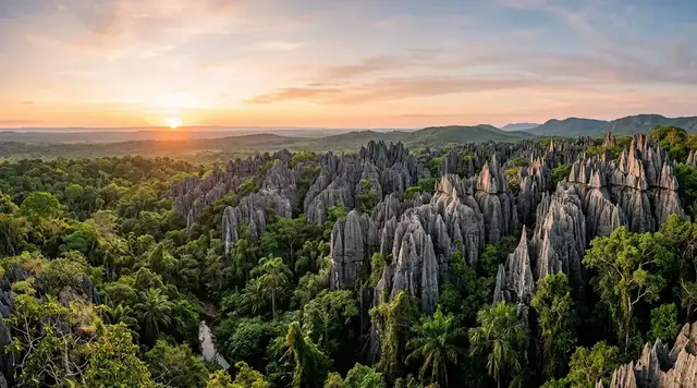
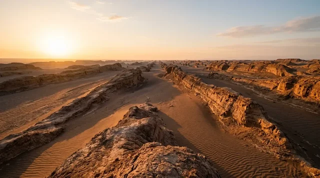
AI illustration
 Written and edited by
 Two peer-reviewed papers explain where this water comes from and they contradict each other. One ran time-lapse cameras through a whole Antarctic summer and found no upwelling at all. The other modelled thirty years of archived chemistry and found ion ratios that only a deep aquifer can produce. Both are careful. Neither has been withdrawn.
Silence Index — D-058
Effectively unvisited
Ranks 7 of 99 scored dossiers — quieter than 94% of the others we have scored. A low score is not a warning; it describes who else will be standing next to you.
How the total is weighted. These are the fixed weights of the four inputs, the same on every dossier — not this place’s scores. We do not publish per-input bars, because the per-input values were never recorded article by article and inventing four plausible numbers that sum to the total would be a fabrication dressed as a chart.
This dossier was scored before 2 September 2026, when the fourth input became night darkness. It keeps the input it was reasoned with until it is re-scored at its next source re-check; the methodology page records the change.
The index is a desk instrument scored by this publication, not a field measurement. How it is calculated, and where it fails.
This is a desk-researched dossier. Nobody from this publication has been to Wright Valley, and almost nobody goes: Don Juan Pond is a Special Feature within Antarctic Specially Managed Area No. 2 and a Restricted Zone under the US Antarctic Program's code of conduct, entry to which must be part of a pre-approved science plan. It is built from the primary papers in Scientific Reports, Earth and Planetary Science Letters, The Cryosphere and Nature Geoscience, the SCAR Composite Gazetteer, the Antarctic Treaty management plan for the Dry Valleys, the McMurdo Dry Valleys LTER, NASA Earth Observatory and Guinness World Records. Where two research groups disagree we set out both cases and do not adjudicate.
What the pond is
Don Juan Pond sits in a closed basin in the South Fork of Wright Valley, south of the flat-topped massif called the Dais. It was found on 11 October 1961 during a US Navy helicopter reconnaissance and named for two of the officers aboard, Lieutenants Donald Roe and John Hickey. It is very shallow — generally about ten centimetres, deepening to around twenty-three — and it is the type locality of antarcticite, calcium chloride hexahydrate, a mineral first described from this water.
What makes it remarkable is the chemistry. Dickson and colleagues describe hyper-salinity of about 40 per cent by mass, of which about 90 per cent is calcium chloride. Toner, Catling and Sletten give up to 40 per cent salt by weight of which 95 per cent is CaCl₂. Calcium chloride brine has a eutectic temperature of about −52 °C, which is why the pond stays liquid through an Antarctic winter when the surface temperature reaches −50 °C.
The published wording is worth quoting exactly, because it is routinely upgraded. Dickson et al. write that the pond rarely freezes, even when surface temperature descends to −50 °C during austral winter. Rarely is not never.
The case for deliquescence
In January 2013 Dickson, Head, Levy and Marchant published the first direct observational test of where the water comes from, in Scientific Reports. They installed time-lapse cameras imaging the pond and its watershed at five-minute intervals from late November 2009 through January 2010, acquiring 16,280 images.
What they saw was surface hydrology. Water tracks on the slopes above the pond responded rapidly to moist air by hydrating and darkening — deliquescence, salts in the soil pulling moisture directly out of the atmosphere. Those tracks, together with small amounts of snowmelt, generated brines capable of controlling summertime water levels in the pond. And what they did not see is the load-bearing negative: evidence for internal filling of the pond from upwelling of a deep aquifer was not found during the imaging campaign.
The implication the paper drew was for Mars. If a near-surface process can produce and maintain brine at these temperatures without any deep plumbing, then the recurring dark streaks observed on Martian slopes need no aquifer to explain them either. That framing is why the paper travelled so widely, and NASA's Earth Observatory summary of it — written in 2014 — says the water most likely comes from the atmosphere.
The case for deep groundwater
Four years later Toner, Catling and Sletten argued the opposite in Earth and Planetary Science Letters, on completely different evidence: not what the pond looks like over one season, but what it is made of over thirty years.
Their argument turns on two ratios. Don Juan Pond's potassium-to-chloride ratio is 0.0006 ± 0.0002 and its magnesium-to-chloride ratio 0.011 ± 0.002 — heavily depleted compared with every other surface water chemistry in Wright Valley. Those ratios stayed essentially constant across archived analyses from 1961 to 1993, within experimental error. A pond fed by evolving surface processes should not hold a fixed composition for three decades.
The falsification is sharper still. Modelled closed-basin evaporation of shallow groundwater produces magnesium- and potassium-rich brines that do not match a CaCl₂-dominated pond, and predicts that carnallite and bischofite would precipitate after six and twelve cycles respectively. Neither mineral has been observed at Don Juan Pond. Meanwhile groundwater sampled from the DVDP-13 borehole, drilled in 1975, is CaCl₂-rich and compositionally similar to the pond though less concentrated — Ca²⁺ at 2.062 mol/kg at 58 m depth against 4.127 at the pond surface. Their mixing model finds that shallow groundwater at only 3 to 6 per cent of inflow would already perturb the ratios.
Their conclusion is that deep groundwaters are responsible for the chemistry of the pond, cycling through a regional flow-through system on roughly yearly timescales rather than accumulating. The University of Washington's release quotes Toner directly: you couldn't get Don Juan Pond from these shallow groundwaters — it's definitely coming from the deep groundwater.
What the geophysics found, and what it did not
The obvious way to settle this is to look underground, and in 2022 Dugan and colleagues published exactly that in The Cryosphere: airborne electromagnetic surveys flown over Wright Valley in 2011 and 2018, mapping subsurface resistivity to about 600 metres.
They found a zone of low resistivity — 12 to 14 ohm-metres, between 23 and 36 metres depth — overlapping the hypothesised aquifer position, in fractured Ferrar Dolerite rather than sediment. Unfrozen brine at depth near Don Juan Pond exists. That is real support for the geochemical case.
But the same paper is explicit about the limits of what it showed. The authors state they cannot establish a direct subsurface connection between Lake Vanda and Don Juan Pond from their data, though a deep connection below 500 metres, or one outside the surveyed transects, may be present. They confirmed widespread unfrozen brine; they did not resolve valley-wide groundwater connectivity.
So the position as it stands is: a deep brine body exists near the pond, and the pond's chemistry looks like deep brine, and nobody has demonstrated the pathway between them. Meanwhile the only season-long direct observation of the pond filling found surface water tracks doing the work and no upwelling. Both of those can be true. The proportions are the unanswered question — how much of the annual water budget is deep brine and how much is deliquescence and snowmelt — and no source we opened puts a number on it.
What popular coverage gets wrong
"The saltiest water on Earth." This is the sentence attached to Don Juan Pond almost everywhere, and it has been superseded. Pérez and Chebude, publishing in Aquatic Geochemistry in 2017, measured total dissolved solids of 433 g/kg at Gaet'ale Pond in Ethiopia's Danakil Depression — a similar chloride chemistry with a calcium to magnesium ratio of 3.1 by weight, but more concentrated, which they attribute to temperature and solubility. Guinness World Records now recognises Gaet'ale at 43.3 per cent salt by weight against 40.2 per cent for Don Juan Pond, 23.1 per cent for the Dead Sea and 3.38 per cent for the oceans. Don Juan Pond is the saltiest natural water in Antarctica, and one of the two saltiest on Earth. It is not the saltiest.
"It never freezes." The peer-reviewed source says it rarely freezes. A May 2026 Live Science piece, which is otherwise careful and quotes Toner directly, says it never freezes. The distinction is not pedantry: a pond that rarely freezes is one where the ice-free condition is a property of the brine's concentration at that moment, which varies with how much water has arrived and how much has evaporated — which is precisely the thing the two competing hypotheses disagree about.
The salinity number itself. Dickson et al. give about 40 per cent. Toner et al. give up to 40 per cent. The Antarctic Treaty management plan gives about 40 per cent. Guinness gives 40.2. The University of Washington's own press release about Toner's paper gives almost 45 per cent — a figure higher than the paper it is describing. When a press office inflates its own researchers' number by five percentage points, everything downstream inherits it.
"Scientists have worked out where the water comes from." Both sides have been reported as settled at different times. NASA's Earth Observatory page, dated to January 2014 imagery, frames the question as hydrologists having long thought groundwater fed the pond until recent Brown University work showed the water most likely comes from the atmosphere — a sentence written three years before the geochemistry pushed it back the other way. Anyone reading that page today gets one side of a live argument presented as a correction. This is what happens when a durable institutional page freezes one moment in an ongoing disagreement.
The other thing this pond does
There is a second finding here that has nothing to do with the water's origin and deserves its own paragraph. Samarkin and colleagues reported in Nature Geoscience in 2010 that Don Juan Pond emits nitrous oxide at fluxes rivalling those measured from fertilised tropical soils, and that the process is abiotic. Laboratory work reacting nitrite-rich brine with iron(II)-bearing minerals reproduced it. The pond is described as metabolically dormant: this is chemistry, not biology.
That matters for the Mars framing more than the aquifer argument does. It means a nitrous oxide signal in a planetary atmosphere is not by itself evidence of life, because a cold hypersaline brine in contact with the right minerals will produce it without anything alive being involved.
Why the Silence Index is 91
Don Juan Pond is protected as a Special Feature within Antarctic Specially Managed Area No. 2, the McMurdo Dry Valleys — approximately 17,500 km² designated by Measure 1 (2004), with the current plan adopted as Measure 18 (2015). The management plan describes it as a hypersaline ecosystem containing unique salt deposits and instructs visitors to avoid walking through the pond and adjacent salt deposits and not to disturb them. The US Antarctic Program's day-trip code of conduct classes it as a Restricted Zone: entry must be part of a pre-approved science or work plan and requires notification to the NSF Environmental Officer at the time of the visit.
There is no route in that is not a helicopter. Footfall is a handful of permitted scientists in a good season. The acoustic floor is the lowest in this archive — a dry valley with no ice movement, no vegetation, no vertebrates and, for much of the year, no wind-borne sound. What holds it just below the mid-nineties is honest bookkeeping on the night component: the work seasons that bring anyone here at all are the months of continuous daylight, so a visitor's experience of this place is one of absolute quiet and no darkness whatsoever.
Why the argument is worth having
It would be easy to treat this as an academic dispute about a pond you could step across. The reason it is not is what each answer implies elsewhere.
If Dickson is right, then a shallow, local, atmospheric process can generate and sustain the most concentrated brine on the continent, and the dark streaks on Martian slopes need nothing beneath them — no aquifer, no plumbing, no reservoir. If Toner is right, then this pond is the surface expression of a regional deep groundwater system running through fractured bedrock beneath a valley that looks, from above, entirely dry — and the Martian equivalent is a great deal more interesting, which is exactly what Toner said when asked.
The 2022 geophysics found brine at 23 to 36 metres and could not connect it to the pond. The 2013 cameras watched all summer and saw no upwelling. Thirty years of chemistry say deep. One season of images says surface. That is where it stands, and the responsible thing to report is that it stands there.
Corner Codex — D-058
- Place
- South Fork of Wright Valley, south of the Dais, Victoria Land, Antarctica
- Coordinates
- 77°34′S, 161°11′E (SCAR gazetteer); 77.5630°S, 161.1896°E (ASMA plan)
- Discovered
- 11 October 1961, by US Navy helicopter reconnaissance
- Named for
- Lieutenants Donald Roe and John Hickey, US Navy squadron VX-6
- Depth
- Generally about 10 cm, deepening to about 23 cm
- Salinity
- About 40% by mass (Dickson et al.); 40.2% (Guinness); 'almost 45%' (UW release)
- Composition
- About 90% CaCl₂ (Dickson et al.) or 95% (Toner et al.)
- Eutectic
- −52 °C for CaCl₂ brine; the pond rarely, not never, freezes
- Type locality of
- Antarcticite, calcium chloride hexahydrate
- Deep brine imaged
- Low resistivities of 12–14 Ω m at 23–36 m depth (Dugan et al., 2022)
- Protection
- A Special Feature and Restricted Zone within ASMA No. 2
- Silence Index
- 91 / 100
The Traveler's Panel · checked
Changing information. Prices, permits, seasons and road access change, sometimes at short notice. Everything here is a starting point for your own confirmation — not a quote, and not a guarantee. Verify with the operator and the relevant official body before you book.
| Status | Special Feature in ASMA No. 2; Restricted Zone in the USAP code of conduct |
| Access | Helicopter only, and only as part of an approved science or work programme |
| Salinity | About 40% by mass, roughly 90–95% of it calcium chloride |
| Freezing | Rarely, not never — the CaCl₂ eutectic is about −52 °C |
| Open question | Deep aquifer or surface deliquescence. Both cases are published |
| Not the record | Gaet'ale Pond in Ethiopia is more saline, at 43.3% against 40.2% |
Getting there — Christchurch → McMurdo Station → helicopter into Wright Valley → pre-approved science plan and NSF Environmental Officer notification
- There is no visitor access to Don Juan Pond. It is a Special Feature within Antarctic Specially Managed Area No. 2 and a Restricted Zone under the US Antarctic Program's code of conduct: entry must be part of a pre-approved science or work plan, with notification to the NSF Environmental Officer at the time of the visit.
- The practical route for permitted personnel runs through McMurdo Station and then by helicopter into Wright Valley. Landings outside facility zones must be logged with GPS coordinates and reported in an end-of-season environmental report.
- Wright Valley holds three semi-permanent field camps and is one of the most intensively studied catchments in Antarctica, which is precisely why the salt features are protected from the researchers as well as from anyone else.
- Tourist activity in the Dry Valleys is confined to a single designated Tourism Zone near the Canada Glacier, in Taylor Valley. That is not this valley and not this pond.
- The management plan's instruction for anyone who does reach it is short: avoid walking through the pond and the adjacent salt deposits, and do not disturb them.
Indicative costs — verify before booking
| Entry | Not available at any price. Access is by science permit, not by payment |
| Who funds it | National Antarctic programmes. The nearest logistics hub is McMurdo Station |
| Honest note | This is one of the small number of places in this archive where the correct answer to 'can I go' is no |
What to pack
- Not applicable in the usual sense. What matters here is contamination control: the code of conduct requires brushing off footwear and cleaning clothing to avoid cross-contamination between catchments.
- Nothing that can be dropped, spilled or deposited. Sampled water and foreign material must never be returned to the lakes, the lake ice or the surrounding ground.
- For permitted work, the salt crust itself is the fragile thing. It is a record of climate and it does not repair.
Where to stay
Nobody stays at Don Juan Pond. Wright Valley holds three semi-permanent field camps supporting research programmes, and everything else runs out of McMurdo Station on Ross Island, several hundred kilometres away by helicopter. There is no lodge, no hut open to visitors and no tourism zone in this valley — the Dry Valleys ASMA designates exactly one Tourism Zone and it is near the Canada Glacier in Taylor Valley. Camping within the ASMA is governed by the code of conduct, which asks that tents go on snow rather than bare ground where possible and that historic tent sites marked by rock circles be reused in preference to opening new ones.
Safety & responsible travel
- Do not repeat the claim that this is the saltiest water on Earth. Gaet'ale Pond in the Danakil Depression was measured higher in 2017 and Guinness recognises it.
- Do not say the pond never freezes. The paper everyone is citing says rarely.
- Do not report the water-source question as settled in either direction. Two peer-reviewed groups disagree, and the geophysics that was expected to resolve it explicitly did not.
- If you are working in the Dry Valleys, treat the salt deposits as data. The management plan protects them because they are a rare and sensitive hypersaline system of high scientific value, not because they are pretty.
- Be careful with the Mars framing in both directions. A nitrous oxide flux here is abiotic, produced by brine reacting with iron-bearing minerals — which is a caution against reading any single planetary signal as biology.
Nearby, and quieter
Don Quixote Pond, its deliberately named counterpart, lies about five kilometres north in the North Fork of Wright Valley at 101 metres — saline, seasonally frozen, and the largest of five such features in that basin. Lake Vanda, 75 metres deep and 5.2 square kilometres, sits further east in the same valley, fed by the Onyx River flowing inland from Lake Brownworth beneath the Wright Lower Glacier and with no outflow at all. Whether Vanda and Don Juan Pond share a deep plumbing system is one of the open questions this dossier is about; the 2022 airborne survey could not establish that they do. All of it lies inside ASMA No. 2, roughly 17,500 square kilometres of the largest ice-free area on the continent.
Getting there, in order
- 1Christchurch
- 2McMurdo Station
- 3helicopter into Wright Valley
- 4pre-approved science plan and NSF Environmental Officer notification
Each leg is a separate booking and a separate chance to be weathered out. Build spare days into the chain, not onto the end of it.
Where it is
Don Juan Pond and Wright Valley, Victoria Land, Antarctica · 77.5667°S 161.1833°E · Open in Google Maps · OpenStreetMap
Key locations
- Don Juan Pond — the pond itself, in the South Fork of Wright Valley south of the Dais
77.5667°S 161.1833°E - Don Quixote Pond — saline and seasonally frozen, in the North Fork north of the Dais, at 101 m
77.5330°S 161.1650°E - Lake Vanda — the valley's deep lake, 75 m and no outflow; any link to the pond is unresolved
77.5308°S 161.5707°E - Lake Brownworth — meltwater lake at the valley's east end and the source of the Onyx River
77.4344°S 162.7597°E
Coordinates are for orientation and are accurate to roughly the width of the feature named, not to a doorway. Several of these points are inside protected areas or need a permit, a guide or a boat — read the access notes above before you plan a route to any of them.
Sources & further reading — checked
- Dickson, Head, Levy & Marchant — Scientific Reports 3: 1166 (30 January 2013). Hyper-salinity of about 40% by mass with about 90% CaCl₂; depth generally around 10 cm deepening to about 23 cm; the statement that the pond rarely freezes even at −50 °C; the time-lapse campaign at five-minute intervals from late November 2009 to January 2010 yielding 16,280 images; deliquescence in water tracks with snowmelt controlling summertime levels; and the finding that no evidence for internal filling from a deep aquifer was observed
- Toner, Catling & Sletten — Earth and Planetary Science Letters 474: 190–197 (2017). Up to 40% salt by weight of which 95% is CaCl₂; the −52 °C eutectic; K/Cl of 0.0006 ± 0.0002 and Mg/Cl of 0.011 ± 0.002; ionic ratios essentially constant from 1961 to 1993; the DVDP-13 borehole comparison with Ca²⁺ at 2.062 mol/kg at 58 m against 4.127 at the pond surface; the predicted carnallite and bischofite that are never observed; and the conclusion that deep groundwaters are responsible for the pond's chemistry
- Dugan et al. — The Cryosphere 16: 4977–4983 (2022). Airborne electromagnetic surveys of 2011 and 2018 mapping resistivity to about 600 m; low resistivities of 12–14 Ω m from 23 to 36 m depth overlapping the hypothesised aquifer in fractured Ferrar Dolerite; and the explicit statement that a direct subsurface connection between Lake Vanda and Don Juan Pond cannot be established from the data
- Samarkin et al. — Nature Geoscience 3(5): 341–344 (2010). Abiotic nitrous oxide emission from the hypersaline pond at fluxes rivalling fertilised tropical soils; the 2006–2008 field measurements; the laboratory reproduction by reacting nitrite-rich brine with Fe(II)-bearing minerals; and the description of the pond as metabolically dormant
- Pérez & Chebude — Aquatic Geochemistry 23: 109–117 (2017). Total dissolved solids of 433 g/kg at Gaet'ale Pond in the Danakil Depression, a calcium to magnesium ratio of 3.1 by weight, and the finding that it exceeds Don Juan Pond's salinity — a new record for the most saline water body on Earth
- Guinness World Records — Saltiest lake. The recognition of Gaet'ale Pond at 43.3% salt by weight against 40.2% for Don Juan Pond, 23.1% for the Dead Sea and 3.38% for the world's oceans
- University of Washington News — Salt pond in Antarctica is fed from beneath (15 November 2017). Jonathan Toner's direct quotations on deep groundwater and on the Mars implication; the six-month cycling estimate; the explicit contradiction of the 2013 near-surface seep hypothesis; and the 'almost 45 percent salts by weight' figure that exceeds the paper's own
- SCAR Composite Gazetteer of Antarctica — Don Juan Pond. Coordinates of 77°34′00″S, 161°11′00″E; the location south of the Dais in the South Fork of Wright Valley; discovery on 11 October 1961 by US Navy helicopter reconnaissance; the naming for Lieutenants Donald Roe and John Hickey of Air Development Squadron Six; and the discovery of calcium chloride hexahydrate, antarcticite, in the pond
- SCAR Composite Gazetteer of Antarctica — Don Quixote Pond. Coordinates of 77°31′58.8″S, 161°09′54.1″E at 101 m; its description as a saline and seasonally frozen pond in a closed catchment in the North Fork of Wright Valley north of the Dais; and the 1966 New Zealand naming
- Antarctic Treaty — Measure 18 (2015), Management Plan for ASMA No. 2, McMurdo Dry Valleys. The ASMA at approximately 17,500 km² designated by Measure 1 (2004) with this plan adopted as Measure 18 (2015); Don Juan Pond's protection to safeguard a rare and sensitive hypersaline ecosystem of high scientific value; the salinity figure of about 40%; and the permit and coordination requirements
- Antarctic Treaty — ASMA No. 2 management plan, Special Features schedule. Don Juan Pond listed at 77.5630°S, 161.1896°E as a Special Feature described as a hypersaline ecosystem containing unique salt deposits, with instructions to avoid walking through the pond and adjacent salt deposits and not to disturb them; and the zoning of twelve Facilities Zones, one Tourism Zone and nine Special Features
- US Antarctic Program — Code of Conduct, McMurdo Dry Valleys ASMA day trips. Don Juan Pond's designation as a Restricted Zone; the requirement that entry to Scientific and Restricted Zones be part of a pre-approved science or work plan with notification to the NSF Environmental Officer; and the instruction that vulnerable salt deposits should not be disturbed
- US Antarctic Program — Code of Conduct, McMurdo Dry Valleys research and overnight stays. The prohibition on depositing sampled water or foreign material into lakes or onto surrounding ground, the restrictions on helicopter landings on lake ice, and the cross-contamination protocols for footwear and clothing
- NASA Earth Observatory — Saltiest Pond on Earth. Salinity given as over 40 per cent; the pond described as ankle-deep and ellipse-shaped; the 3 January 2014 Advanced Land Imager scene; and the framing that hydrologists long thought groundwater fed the pond until recent work showed the water most likely comes from the atmosphere — a page that presents one side of a still-open argument as a correction
- McMurdo Dry Valleys LTER — Lake Vanda. Lake Vanda at 77.5308°S, 161.5707°E; maximum depth 75 m, area 5.2 km², length 8 km, width 2 km, elevation 143 m; ice thickness of 2.8–4.2 m; and the lake's supply from the Onyx River originating at Lake Brownworth with no outflow
- McMurdo Dry Valleys LTER — Lake Brownworth. Lake Brownworth at 77.4344°S, 162.7597°E at 5 m elevation, a meltwater lake west of the Wright Lower Glacier at the east end of Wright Valley and the source of the Onyx River
- Hume-independent check — Schutte et al., Geophysical Research Letters (2022). Abiotic nitrous oxide production from Don Juan Pond sediments and brine at Mars-analogue temperatures of −40 °C. The publisher returned HTTP 403 and we could not read the paper; it is listed here as a lead we could not open, not as a source we are relying on
- US Board on Geographic Names — Antarctic names service. The US federal naming authority for Antarctic features, which we tried for a second independent gazetteer reading of Don Juan Pond's coordinates; the record page redirected to the board's landing page and we fell back on the SCAR gazetteer
- IUCN / Antarctic Treaty Secretariat — ASMA No. 2 management plan attachment (ATCM38). The Antarctic Treaty Secretariat's authoritative copy of the same management plan. The file returned as binary and could not be parsed; the Japanese Ministry of the Environment's published English PDFs of the identical instrument were used instead
- Mindat — Don Juan Pond, Wright Valley, type locality of antarcticite. The mineralogical record of the pond as the type locality of antarcticite. The site returned HTTP 403 and we could not read it; the antarcticite attribution in this dossier rests on the SCAR gazetteer entry instead
Official and scientific bodies are the authority for safety, regulatory and scientific claims. Commercial operators are used only for practical detail such as tour length, meeting points and indicative pricing — never for a safety or scientific statement.
How this was made
Desk research. Compiled from official bodies, scientific and conservation sources, established journalism and licensed operators. Not based on a personal visit.
Editor’s method note — what we checked, corrected and could not verify
- Desk research only. Nobody from this publication has been to Wright Valley, and access to Don Juan Pond requires a pre-approved science plan and notification to the NSF Environmental Officer.
- The brief concluded that the deep-groundwater side currently has the stronger evidence. We do not adopt that judgement. Dugan et al. imaged unfrozen brine at 23–36 m but state explicitly that they cannot establish a subsurface connection between Lake Vanda and the pond; Dickson et al.'s season-long imaging remains the only direct observation of the pond filling, and it found no upwelling. We give both cases and decline to pick.
- The brief's claim that the pond does not freeze at −50 °C is an overstatement of the source. Dickson et al. write that it rarely freezes at that temperature. We use their wording.
- The brief gave the pond as roughly 40% salt by mass with about 90% CaCl₂, citing Dickson et al. Toner et al. give up to 40% with 95% CaCl₂, Guinness gives 40.2%, and the University of Washington's press release on Toner's own paper gives almost 45%. We print the spread and note that the press office's figure exceeds the paper's.
- We correct the widely repeated claim that this is the saltiest water on Earth. Pérez and Chebude measured 433 g/kg at Gaet'ale Pond in 2017, and Guinness World Records now recognises Gaet'ale at 43.3% against Don Juan Pond's 40.2%.
- Two gazetteer positions for the pond differ slightly: the SCAR Composite Gazetteer gives 77°34′00″S, 161°11′00″E and the ASMA management plan gives 77.5630°S, 161.1896°E — about 400 m apart. We print both and use the SCAR value on the map.
- Three sources we wanted could not be read: the Schutte et al. 2022 paper in Geophysical Research Letters (HTTP 403), the Antarctic Treaty Secretariat's own copy of the ASMA plan (returned as unparseable binary, so the Japanese Ministry of the Environment's published English PDFs of the same instrument were used), and the mindat type-locality record (HTTP 403). All three are listed in the source table with that caveat rather than silently dropped.
- Things we could not verify: the proportion of the pond's annual water budget attributable to deep brine versus deliquescence and snowmelt, which no source we opened quantifies; whether the deep system connects to Lake Vanda, which Dugan et al. state they could not resolve; the pond's surface area, given only as ankle-deep and ellipse-shaped by NASA and as roughly six football fields by a popular account we do not rely on; how many times the pond has actually been observed frozen, and when; the SCAR gazetteer's elevation for Don Juan Pond, which its entry omits although the Don Quixote entry gives 101 m; whether any measurement of the pond postdates the 1961–1993 archive Toner et al. modelled; and whether the 2011 and 2018 airborne surveys have been repeated since.
AI is used to draft this text, and a human checks it. Every figure, date and quotation above was verified by Tony Hall against the source cited for it in the reference list; where sources disagree, the disagreement is shown rather than resolved, and where a claim could not be confirmed it is either marked unverified or left out. The illustrations are AI-created and labelled as such — no photograph on this site is presented as a record of a real place. Full disclosure · Editorial policy.
Access details change — recheck before you travel. Found an error? Tell us — corrections are dated and shown in place.