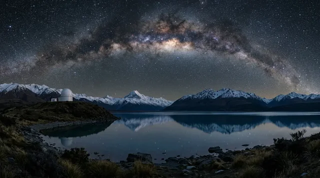
AI illustration
 Written and edited by
 The Salar de Uyuni is flat enough that space agencies use it to check whether their satellites are telling the truth. It sits on top of the largest identified lithium resource in the world. Bolivia has never managed to convert a single tonne of that into a certified reserve — and the reason is a technical distinction most coverage skips.
Silence Index — D-034
Quiet, but findable
Ranks 70 of 99 scored dossiers — quieter than 30% of the others we have scored. A low score is not a warning; it describes who else will be standing next to you.
How the total is weighted. These are the fixed weights of the four inputs, the same on every dossier — not this place’s scores. We do not publish per-input bars, because the per-input values were never recorded article by article and inventing four plausible numbers that sum to the total would be a fabrication dressed as a chart.
This dossier was scored before 2 September 2026, when the fourth input became night darkness. It keeps the input it was reasoned with until it is re-scored at its next source re-check; the methodology page records the change.
The index is a desk instrument scored by this publication, not a field measurement. How it is calculated, and where it fails.
The flattest useful thing on Earth
This is a desk-researched dossier; nobody from this publication has crossed the salar. It is built from NASA and ESA, the USGS, peer-reviewed geophysics and hydrology, Bolivian government and research sources, and established news reporting.
Start with the measurement, because everything else follows from it. In September 2002 a kinematic GPS survey crossed a block of the salar 45 by 54 kilometres and found total relief of 77 centimetres. Across the wider surface the published description is less than one metre of vertical relief over nine thousand square kilometres. The survey's absolute accuracy was 2.2 cm.
That survey was not done out of curiosity. It was commissioned to provide ground truth for NASA's ICESat mission — a satellite designed to measure the thickness of ice sheets, which is only useful if you know how much the instrument itself lies. Salt flats are chosen for this because they are large, stable surfaces amenable to detailed surveying, with an albedo similar to that of ice sheets.
The results are the reason Uyuni matters to people who will never visit it. Against the Uyuni reference surface, ICESat showed zero bias relative to WGS-84 with 4.0 cm overall uncertainty, and 1.8 cm under optimal conditions. The comparison also exposed a previously unreported 3.1 cm bias between two of the satellite's own lasers — a flaw that would otherwise have propagated silently into a global record of ice loss.
ESA now names CryoSat and Copernicus Sentinel-3 as instruments calibrated against this surface. NASA confirms ICESat and Envisat. A Bolivian salt pan is, in a real sense, part of the infrastructure by which the world measures its own melting.
Why it stays flat
Because it repairs itself, once a year.
The crust reaches eleven metres thick in places, built of alternating layers of hard halite and crumbly crystal aggregate, with 30 to 40 per cent porosity holding brine. Each wet season the surface floods, and the flooding regenerates it through the dissolution and redeposition of salt. High points dissolve; hollows fill. Over time this drives the whole surface toward the local gravitational equipotential — it settles into the shape of the Earth's gravity field, which is about as close to a natural spirit level as the planet offers.
The mirror, finally measured
The reflection that fills every photograph of this place was, until recently, described rather than quantified. In September 2025 that changed.
A study using 392,000 radar altimeter bursts from Sentinel-3A and 3B between 2016 and 2024 tested the mirror directly. A field measurement on 20 February 2024 recorded the water layer at 1.8 centimetres deep. For radar-smooth conditions, vertical surface displacement has to stay within about half a millimetre — the water has to be not merely shallow but almost perfectly still.
The window runs from late January to early March, peaking in February, and in a wet year up to about half of altimeter bursts register as radar-smooth. The study's own caution is the sentence tour operators do not print: the whole Salar de Uyuni is not a uniform mirror.
And the year-to-year variation is severe. December-to-February rainfall was 222 mm in 2021-22, 87 mm in 2022-23, and 265 mm in 2023-24 — a threefold swing between consecutive seasons, loosely associated with ENSO but not reliably predicted by it. Anyone booking a February trip for the reflection is buying a probability, not a product.
The resource that is not a reserve
Underneath the crust is the part of this story that never quite resolves.
The interstitial brine carries up to 4.7 grams of lithium per litre, concentrated toward the southeast. The USGS credits Bolivia with 23 million tonnes of measured and indicated lithium resources — the largest national figure in the world, against a global total around 150 million tonnes.
And Bolivia appears nowhere in the USGS reserves table. World reserves stand at 37 million tonnes; the listed holders include Australia, Chile, China, Argentina, the United States, Canada, Brazil, Zimbabwe, Mali and Portugal. Bolivia is absent.
This is not an insult or an accounting error. The definitions are precise: a resource is material whose economic extraction is currently or potentially feasible, while reserves are the part that could be economically extracted at the time of determination. Reserves require demonstrated economics — prefeasibility and feasibility work — and Bolivia has never produced it. A Bolivian analyst notes the country's figures are inferred resources lacking that validation, and recalls an official claim of 100 million tonnes in 2010 that the USGS never recognised.
There is also a reason nobody outside the state has ever been in a position to do that work. Protection of the salar is written into the Bolivian constitution, and the law that follows from it holds that only the state may extract lithium here. Changing that would take a referendum or a constitutional reform. So the feasibility study that would convert resource into reserve can only be commissioned by the one body that has never managed to finish one.
The physical reasons are real. The brine carries unusually high magnesium and potassium that must be stripped out, raising cost. The basin is cooler and rainier than Chile's Atacama, so evaporation ponds work slowly. Output figures are correspondingly modest and genuinely disputed — reported variously as 2,000, 2,400, about 3,500 and a projected 3,600 tonnes, against a plant nameplate capacity of 15,000. Reuters, reporting in November 2025, had YLB hoping for about 3,500 tonnes from its conventional evaporation operation that year and put the plant's utilisation at 17% in 2024 and a projected 23% in 2025. Chile, for comparison, produces on the order of 300,000 tonnes a year. No audited Bolivian figure exists.
The political reasons are equally real. Around two billion dollars of contracts with a Chinese consortium and Russia's Uranium One were signed in 2023 and 2024 and never ratified. Congressional debate was suspended in February 2025 after public outcry; a Potosí court ordered a halt; a July 2025 session descended into physical chaos, with the energy minister doused with water and pelted with rubbish. Then the government changed. Rodrigo Paz took office after the 2025 election, and as of a trade-press review dated January–February 2026 neither contract had been ratified, withdrawn or cancelled: both remain under congressional scrutiny while the new administration reviews the country's lithium agreements with Chinese and Russian companies. Paz's government has denied any intention to privatise YLB while saying it would favour public–private partnerships, and has approved Supreme Decree 5503, offering fifteen years of fiscal stability and reduced tax to large projects in strategic sectors including mining. Three years after signature, two billion dollars of agreements are still neither in force nor dead.
Fifty-three Indigenous communities around the salar reported learning of the deals through social media rather than official consultation, citing ILO Convention 169.
The water question underneath all of it
The constraint least discussed is the one most likely to decide the outcome.
A 2025 study of 28 active or prospective lithium basins across the Andean plateau found freshwater inflows of just 2 to 33 millimetres a year, and that standard global hydrologic models overestimate availability drastically — one by around 75 mm/yr, another by 219. All but one basin studied is classified as critically water-scarce before accounting for mining expansion.
Direct lithium extraction, the technology intended to bypass slow evaporation, may make this worse rather than better: a 2023 review in Nature Reviews Earth & Environment notes that many DLE technologies might require larger freshwater volumes than current evaporative practices. The fix for the slow-evaporation problem may cost more of the one thing the basin does not have.
Why the Silence Index is 64
This is the lowest score of the five places in this batch, and honestly so. Access friction is modest: a flight or an overnight bus from La Paz, a well-established three-day circuit, no permit, no cap. Footfall is substantial — a Potosí tourism official estimates around 250,000 visitors a year, while conceding that no detailed register exists. What keeps the score in the sixties is the scale of the surface itself, which absorbs vehicles at a rate few landscapes can, and the genuine emptiness of the southern circuit above 4,000 metres. The unresolved column is unusual here: what is contested is not the geology but the economics and the hydrology.
The part that should change your booking
We would not normally give a safety section this much room. Here it is warranted.
On 1 March 2025 at seven in the morning, two buses collided head-on on the Uyuni–Colchani road. Thirty-seven people were killed and thirty-nine injured across four hospitals in Uyuni. Police said one vehicle had crossed into the oncoming lane, and that passengers had seen one of the drivers drinking alcohol. Bolivian roads kill roughly 1,400 people a year.
On 9 June 2019 a tour vehicle flipped on the salar itself, killing two British nineteen-year-olds, Freddie McLennan and Joe Atkins, and their twenty-two-year-old Bolivian driver, Alberto Barco.
The UK's Foreign, Commonwealth and Development Office states the position without softening it: there are no official minimum standards for tour operators; get local advice and only use reputable companies. It also records that accidents involving public transport, and long-distance buses in particular, are common and have affected British nationals, and that drivers drive for longer than would be permitted under UK law. Note what that last clause is and is not: it is about hours at the wheel, not alcohol. The drink-driving in the March 2025 crash is a separate matter and rests on what passengers told the police, not on any government advisory.
Add the altitude. The salar sits near 3,697 metres and the southern circuit crosses ground above 4,000 and touches around 5,000. The US State Department places Uyuni in its high-altitude warning band and notes that in remote areas such as the salt flats the nearest medical care is several hours away.
None of that is a reason not to go. It is a reason to choose the operator on something other than price, to ask directly about seatbelts and driver rotation, to refuse a vehicle whose driver has been drinking, to acclimatise in La Paz, Potosí or Sucre first rather than flying in and starting a 5,000-metre circuit the same day, and to carry medical evacuation cover.
The flattest place on Earth is legible from orbit to within four centimetres. Getting across it safely is the part nobody has solved.
Corner Codex — D-034
- Place
- Salar de Uyuni, Potosí department, southwest Bolivia
- Coordinates
- 20.133°S, 67.489°W
- Altitude
- About 3,697 m above the WGS-84 ellipsoid
- Relief
- 77 cm of total vertical variation across a surveyed 45 × 54 km block
- Area
- Contested — 9,000 to 10,582 km² depending on where the boundary is drawn
- Crust
- Up to 11 m thick, 30–40% porosity, holding lithium-rich brine
- Lithium resource
- 23 million tonnes — the largest national figure on Earth
- Lithium reserves
- Bolivia does not appear in the USGS reserves table at all
- Silence Index
- 64 / 100
The Traveler's Panel · checked
Changing information. Prices, permits, seasons and road access change, sometimes at short notice. Everything here is a starting point for your own confirmation — not a quote, and not a guarantee. Verify with the operator and the relevant official body before you book.
| Dry season | April to November — hard white crust, full access, Incahuasi Island |
| Mirror window | Late January to early March, peaking February |
| Mirror depth | A couple of centimetres of water, and never uniform across the surface |
| Standard trip | 3 days / 2 nights, shared Land Cruiser, 6 passengers |
| Altitude | 3,697 m on the salar; the southern circuit touches about 5,000 m |
| Biggest risk | The driving, not the landscape |
Getting there — La Paz → Uyuni (fly ~1 hr, or drive 10–12 hrs)
- Uyuni town is the base. Fly from La Paz in about an hour, or take the overnight bus in 10–12 hours — the bus is cheaper and is also where the FCDO's warning about long-distance coaches applies most directly.
- The classic product is the 3-day, 2-night circuit in a shared Toyota Land Cruiser, typically six passengers, or five with an English-speaking guide.
- Day one covers the train cemetery, Colchani, the salt museum, Incahuasi Island and sunset on the flat. Day two runs the lagoon chain — Cañapa, Hedionda, Honda, Chiarkota — the Siloli desert and Laguna Colorada. Day three takes in the Sol de Mañana geysers, Polques hot springs, the Dalí desert and Laguna Verde before returning.
- Many itineraries can exit south to San Pedro de Atacama in Chile instead of returning to Uyuni, usually for a small transfer fee.
- In the wet season parts of the salar become inaccessible, and the mirror is not evenly distributed. Ask the operator which sectors they can actually reach on the day.
Indicative costs — verify before booking
| Shared 3-day tour | From about US$229 per person |
| English-speaking guide | A supplement of roughly US$42–105 per person depending on group size |
| Entrance fees | Usually excluded — around Bs 210 total (Eduardo Avaroa reserve, Polques, Incahuasi), about US$30 |
| Private or premium | US$1,200–1,750 per person |
| Transfer to San Pedro de Atacama | About US$15 shared |
What to pack
- Sunglasses that actually block UV, and sunscreen for the underside of your chin. The salt reflects almost everything back up at you.
- Serious warm layers. Night two is often cold-water only, in a basic refuge, at altitude.
- Waterproof footwear if you are going in mirror season — you will be standing in brine.
- Altitude medication if your doctor advises it, and the discipline to acclimatise first.
- Cash in bolivianos for entrance fees, which are almost never included.
Where to stay
Uyuni town has hostels and mid-range hotels and exists largely to service the circuit; it is functional rather than charming. The salt hotels at Colchani, built from blocks cut out of the crust, are the local speciality — verify that any you book has proper waste handling, since a building made of salt on a salt flat has nowhere obvious to put anything. Nights two and three on the standard circuit are in basic refuges with shared rooms, often with cold water only, at well over 4,000 metres. Do not expect otherwise and you will be fine.
Safety & responsible travel
- Choose the operator on safety, not price. There are no official minimum standards in Bolivia — ask about seatbelts, vehicle age and driver rotation, and be willing to walk away.
- Refuse to travel with a driver who has been drinking. This is not hypothetical here: police reported exactly that in the 2025 bus collision that killed 37 people.
- Do not drive on the flooded surface where operators say not to. The crust regenerates seasonally but the vehicles crossing it are the one variable nobody is measuring.
- Read the lithium story before you form an opinion about it locally. The communities around the salar learned about the largest contracts affecting their water from social media.
Nearby, and quieter
The southern circuit is the real hinterland: Laguna Colorada with its flamingos and red algal bloom, the Sol de Mañana geyser field at nearly 5,000 m, the Dalí desert, and Laguna Verde under Licancabur. Potosí, four hours away, was once one of the richest cities on Earth on the silver of Cerro Rico, and remains the most instructive place in Bolivia to think about what extraction has historically done here. San Pedro de Atacama lies across the Chilean border at the circuit's southern exit.
Getting there, in order
- 1La Paz
- 2Uyuni (fly ~1 hr, or drive 10–12 hrs)
Each leg is a separate booking and a separate chance to be weathered out. Build spare days into the chain, not onto the end of it.
Where it is
Salar de Uyuni, Bolivia · 20.1330°S 67.4890°W · Open in Google Maps · OpenStreetMap
Key locations
- Uyuni — the base town; the flight from La Paz and the overnight bus both end here
20.4594°S 66.8250°W - Joya Andina Airport, Uyuni — about an hour from La Paz, and the alternative to the coach warning
20.4497°S 66.8419°W - Colchani — salt village at the edge of the crust; the March 2025 bus crash was on this road
20.3000°S 66.9333°W - Isla Incahuasi — the cactus island that anchors day one of the standard circuit
20.2390°S 67.6218°W - Laguna Colorada — day two of the southern circuit, inside the Eduardo Avaroa reserve
22.2197°S 67.7669°W
Coordinates are for orientation and are accurate to roughly the width of the feature named, not to a doorway. Several of these points are inside protected areas or need a permit, a guide or a boat — read the access notes above before you plan a route to any of them.
Sources & further reading — checked
- Borsa et al. — Topography of the salar de Uyuni, Bolivia, from kinematic GPS (Geophysical Journal International, 2008). Less than 1 m of vertical relief over 9,000 km²; total relief of 77 cm across a surveyed 45 × 54 km block; surface elevation about 3,697 m; survey accuracy of 2.2 cm; and the self-regenerating flatness driven toward the gravitational equipotential by seasonal flooding
- Fricker et al. — Assessment of ICESat performance at the salar de Uyuni (Geophysical Research Letters, 2005). That the survey was commissioned as ground truth for NASA's ICESat mission, and why salt flats are used: large, stable, surveyable surfaces with an albedo similar to ice sheets
- Borsa, Fricker & Brunt — A Terrestrial Validation of ICESat Elevation Measurements (IEEE TGRS, via NASA). Zero bias relative to WGS-84 with 4.0 cm uncertainty and 1.8 cm under optimal conditions, and the previously unreported 3.1 cm bias between ICESat's Laser 2 and Laser 3 exposed by the comparison
- ESA — Uyuni salt flat, Bolivia. That surface elevation variation of less than 1 m makes the salar ideal for calibrating satellite radar altimeters, naming CryoSat and Copernicus Sentinel-3
- NASA Earth Observatory — An Expanse of White in Bolivia. Confirmation that Uyuni has been used to calibrate sensors aboard ICESat and Envisat, and crust thickness exceeding 10 m in many areas
- Vignudelli, Abileah, Pacheco Mollinedo & De Biasio — Satellite radar altimetry reveals changes in water surface smoothness in the Salar de Uyuni (Communications Earth & Environment, 2025). 392,000 Sentinel-3A/3B bursts from 2016–2024; the field measurement of a 1.8 cm water layer on 20 February 2024; the ±0.5 mm displacement threshold for radar smoothness; the late January-to-early March window peaking in February; the finding that the salar is not a uniform mirror; and DJF rainfall of 222, 87 and 265 mm across three consecutive seasons
- Risacher & Fritz — Quaternary geochemical evolution of the salars of Uyuni and Coipasa (Chemical Geology, 1991). Crust to a maximum thickness of 11 m in alternating layers with 30–40% porosity, and interstitial brine carrying up to 4.7 g/L lithium concentrated toward the southeast
- USGS — Mineral Commodity Summaries 2026: Lithium. Bolivia credited with 23 million tonnes of measured and indicated lithium resources — the largest national figure — against world resources of about 150 million tonnes; and Bolivia's complete absence from the reserves table, where world reserves stand at 37 million tonnes
- USGS — Mineral Commodity Summaries 2026: Appendixes. The formal definitions separating a resource, whose economic extraction is currently or potentially feasible, from reserves, which could be economically extracted at the time of determination
- NASA Earth Observatory — Lithium Harvesting at Salar de Uyuni. The high magnesium and potassium content requiring removal, and the cooler, rainier basin that slows evaporation compared with Chile's Atacama
- Kirshen et al. — Freshwater inflows to closed basins of the Andean plateau (Communications Earth & Environment, 2025). Freshwater inflows of only 2–33 mm/year across 28 lithium basins; global models overestimating availability by roughly 75 and 219 mm/yr; and all but one basin classified as critically water-scarce before accounting for mining expansion
- Vera et al. — Environmental impact of direct lithium extraction from brines (Nature Reviews Earth & Environment, 2023). That many direct lithium extraction technologies might require larger freshwater volumes than current evaporative practices
- Mining.com — Chaos in Bolivian Congress over China, Russia lithium contracts. The suspension of congressional debate in February 2025, the Potosí court order halting both contracts, and the July 2025 session in which the energy minister was doused with water and pelted with rubbish
- Reuters, via Mining.com — Bolivia is rethinking lithium deals with China, Russia in US pivot (7 November 2025). YLB's hope of about 3,500 tonnes in 2025 against a 15,000-tonne nameplate capacity, plant utilisation of 17% in 2024 and a projected 23% in 2025, and Chile's roughly 300,000 tonnes for comparison
- Mining Technology — New president, new policy: Bolivia's shift against lithium protectionism (30 January 2026, updated 24 February 2026). That neither the CATL/CBC nor the Uranium One contract has been ratified, withdrawn or cancelled and both remain under congressional scrutiny; that protection of the salar is in the constitution and only the state may extract lithium, changeable only by referendum or constitutional reform; the denial of any intent to privatise YLB; and Supreme Decree 5503
- Mongabay — Bolivian communities push back against foreign-backed lithium projects. That 53 Indigenous communities around the salar reported learning of the Chinese and Russian contracts through social media rather than official consultation, citing ILO Convention 169
- Al Jazeera — At least 37 killed as two buses collide in Bolivia. The 1 March 2025 head-on collision on the Uyuni–Colchani road: 37 killed and 39 injured, the police account that one vehicle crossed into the oncoming lane, passenger reports of a driver drinking, and the roughly 1,400 annual road deaths in Bolivia
- ITV News — British teenagers killed in Bolivia car crash named. The 9 June 2019 tour vehicle rollover on the salar that killed Freddie McLennan, Joe Atkins and their driver Alberto Barco
- UK FCDO — Bolivia travel advice: safety and security. That there are no official minimum standards for tour operators, the advice to use only reputable companies, that accidents involving long-distance buses are common and have affected British nationals, and that drivers drive for longer than would be permitted under UK law — a statement about hours, not alcohol
- US Department of State — Bolivia International Travel Information. The Level 2 advisory, the placement of Uyuni in the 10,000–13,000 ft altitude warning band, and the note that in remote areas such as the salt flats the nearest medical care is several hours away
- Radio Kollasuyo — Estiman que un cuarto de millón de visitantes llega hasta el Salar de Uyuni. The Potosí departmental estimate of around 250,000 visitors a year, extrapolated from reserve entries, with the official's concession that no detailed register exists
Official and scientific bodies are the authority for safety, regulatory and scientific claims. Commercial operators are used only for practical detail such as tour length, meeting points and indicative pricing — never for a safety or scientific statement.
How this was made
Desk research. Compiled from official bodies, scientific and conservation sources, established journalism and licensed operators. Not based on a personal visit.
Editor’s method note — what we checked, corrected and could not verify
- Desk research only. No one from this publication has crossed the salar.
- The area figure is contested between 9,000 and 10,582 km² across official sources, because the boundary between hard crust and surrounding saline mudflat is drawn differently. We give the range rather than pick one.
- Bolivia's actual lithium output is genuinely unsettled — four sources give 2,000, 2,400, about 3,500 and 3,600 tonnes. No audited figure exists and we do not assert one.
- No official visitor count exists. The 250,000 figure is a departmental official's extrapolation and he says so himself.
- No aggregate accident statistics for salar tours exist in any official source. The two incidents we report are individually verified; compiled lists circulating online are self-published and were not used.
- Corrected on 14 August 2026: an earlier version of this page said the FCDO warns that Bolivian bus drivers exceed UK legal alcohol limits. It does not. What it says is that drivers drive for longer than would be permitted under UK law — a statement about hours at the wheel. The drink-driving allegation belongs to the March 2025 crash and comes from passengers via the police, not from any government advisory. We record the error rather than fixing it silently.
- Five things we could not verify: whether either lithium contract has moved in Congress since the February 2026 trade-press review, which is the most recent position we can source; any audited Bolivian production figure for any year; the constitutional article and the statute number behind the state-only extraction rule, which we have from a secondary account rather than from the text; whether the 2019 rollover produced any prosecution or operator sanction; and current 2026 circuit prices, for which every figure in circulation comes from aggregators.
- Coordinates for the key locations come from the GeoNames gazetteer, except Isla Incahuasi, which GeoNames records only as a hill some 14 km from where every map and image places the island; for that one point we follow the Wikidata position, which is not a primary source. Laguna Colorada sits well south of the map frame — it is on the standard three-day circuit rather than on the salar itself.
AI is used to draft this text, and a human checks it. Every figure, date and quotation above was verified by Tony Hall against the source cited for it in the reference list; where sources disagree, the disagreement is shown rather than resolved, and where a claim could not be confirmed it is either marked unverified or left out. The illustrations are AI-created and labelled as such — no photograph on this site is presented as a record of a real place. Full disclosure · Editorial policy.
Access details change — recheck before you travel. Found an error? Tell us — corrections are dated and shown in place.