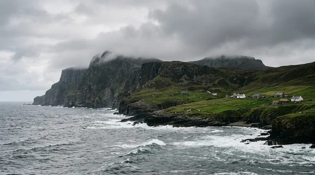
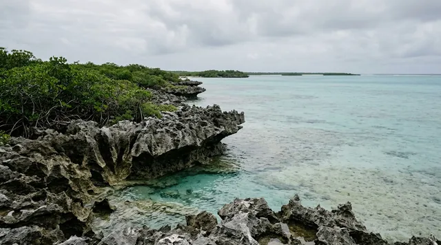
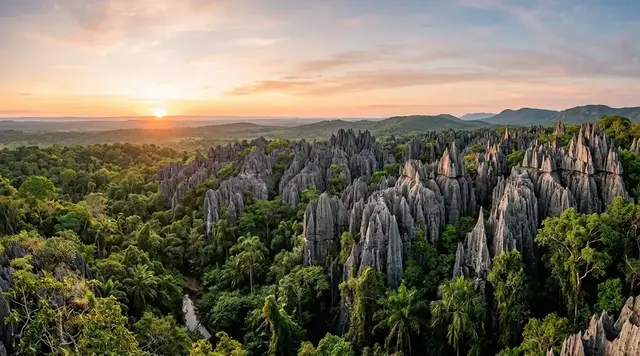
AI illustration
 Written and edited by
 On 23 November 2025 a volcano in the Danakil that had not erupted in twelve thousand years put a plume fifteen kilometres into the sky and dropped ash as far as China. Two weeks earlier, Tigrayan forces crossed into Afar and took six villages. Neither event appears in most of what is written about visiting this place, and both of them change the answer.
Silence Index — D-036
Effectively unvisited
Ranks 10 of 99 scored dossiers — quieter than 91% of the others we have scored. A low score is not a warning; it describes who else will be standing next to you.
How the total is weighted. These are the fixed weights of the four inputs, the same on every dossier — not this place’s scores. We do not publish per-input bars, because the per-input values were never recorded article by article and inventing four plausible numbers that sum to the total would be a fabrication dressed as a chart.
This dossier was scored before 2 September 2026, when the fourth input became night darkness. It keeps the input it was reasoned with until it is re-scored at its next source re-check; the methodology page records the change.
The index is a desk instrument scored by this publication, not a field measurement. How it is calculated, and where it fails.
Read the safety section first
This is a desk-researched dossier; nobody from this publication has been to the Danakil, and we are not encouraging anyone to go. It is assembled from peer-reviewed geology and microbiology, NASA and ESA, the Smithsonian's Global Volcanism Program, UK and US government travel advice, UN reporting and established news.
We normally put the practical material at the end. Here it goes first, because the gap between what is published about this place and what the governments actually say is wider than for anywhere else in this archive.
The United States says do not go. Ethiopia overall is Level 3, Reconsider Travel, as updated 1 April 2026. Within it, the advisory is explicit: "Do not travel to the Afar Region due to armed conflict, unrest, and crime." It carries the kidnap indicator, notes that terrorist groups have targeted foreigners for kidnapping, and records that US government employees need special authorisation to travel outside Addis Ababa at all.
The United Kingdom draws a narrower line but records a harder practical fact. The FCDO advises against all travel only within 10 km of the Eritrean border. But the same advice, updated 29 May 2026, states that foreign nationals are currently unable to travel to airports in Afar regional state due to restrictions by the Ethiopian authorities. On the Danakil specifically it instructs: when booking, check that your group will be supported by an armed police or military escort.
And the usual staging region is closed. The FCDO advises against all travel to Tigray, and records that all civilian flights to and from Tigray have been suspended since 29 January 2026.
The attacks are not hypothetical. On 18 January 2012, in northern Afar, at least five tourists were killed — two Hungarians, two Germans, an Austrian — two were wounded, and four people were kidnapped including an Ethiopian driver and a policeman. In December 2017 a German tourist was shot dead by gunmen while camping near Erta Ale. Neither attack was ever conclusively attributed.
What changed recently is the war. The 2020–2022 Tigray conflict killed at least 600,000 people by the African Union's estimate and ended with the Pretoria agreement in November 2022. That agreement is visibly failing. In November 2025 Afar's regional administration said Tigrayan forces attacked Megale district in north-west Afar and seized six villages. In February 2026 the UN human rights chief warned the situation remained highly volatile with clashes near the Afar border continuing unabated. In August 2026 fighting broke out in western Tigray, described as the most serious incident since Pretoria.
We could not verify, from any government, embassy or established news source, whether commercial Danakil tours are operating at all in 2026. Operator websites say yes. Operator websites are not evidence.
What the heat record actually measures
With that established, the geology is extraordinary, and it is worth getting right.
"The hottest inhabited place on Earth" is a claim about annual mean air temperature, and that distinction is the whole thing. The peer-reviewed figure for Dallol is an average annual temperature of 36 to 38 °C. The number usually quoted — 34.4 °C — traces to Guinness World Records, which gives 34 °C as a mean across 1960 to 1966, with a mean daily maximum of 41.1 °C. That is a six-year average from a measurement period that ended sixty years ago, and the decimal that gets repeated has no primary source we could open.
Researchers working at Dallol in January 2016 and 2017 recorded that air temperature rarely exceeded 40 to 45 °C. So the Danakil is not the hottest place ever measured on any given day. It is the place where the heat never lets up — which is a harder thing to live in, and exactly what the annual-mean framing captures.
Three records get conflated constantly, and they measure three different quantities. Death Valley holds the highest air temperature ever recorded, 56.7 °C in 1913. Iran's Lut Desert holds the highest land surface temperature, 80.8 °C — a satellite skin reading of the ground itself, which NASA notes is not comparable to an air temperature measured a metre and a half up. Dallol holds neither. It holds the annual mean, with people in it.
Dallol is not alive, and that is the discovery
The photographs of Dallol — acid yellows, sulphur greens, rust reds — are usually captioned as microbial mats or algae. They are not.
The definitive geochemical study reports pH values from 0.1 down to −1.7, brine temperatures reaching 108 °C, and dissolved iron up to 150 grams per litre. Its conclusion is that the colours derive from the slow diffusion of oxygen and the progressive oxidation of dissolved ferrous iron, combined with iron complexation and evaporation — and that life does not play a dominant geochemical role there at all. The palette is rust, not biology.
Then the 2019 paper in Nature Ecology & Evolution, which is misreported in both directions. Belilla and colleagues identified two distinct physicochemical barriers to life in the presence of liquid water: magnesium-dominated chaotropic brines with low water activity, and the combination of hyperacidity with salt saturation. Their finding, in their own words, is that active microbial life is absent from the polyextreme Dallol ponds and the Black and Yellow lakes — regardless of temperature.
That is half the paper. The other half is in the title: where life was present, it consisted of hyperdiverse ultrasmall archaea across multiple phyla. And a third finding, the one that matters most for anyone thinking about Mars: the team found abiotic silica biomorphs mimicking the shape and size of ultrasmall cells, and warned that this calls for caution in interpreting morphological biosignatures on Earth and beyond.
So Dallol is simultaneously a sterility finding, a hyperdiversity finding, and a false-positive warning. Coverage picks one and drops the rest.
The ground is coming apart
Three tectonic plates — Arabian, Somali, Nubian — are separating here, thinning the crust. At about 13°N the Arabia–Nubia extension has transferred completely into the Danakil Depression at roughly 20 mm a year, while the Danakil block itself rotates at 1.9 degrees per million years.
What that means in practice was demonstrated in September 2005, when a 60-kilometre segment of the Dabbahu rift was torn open by the injection of about 2.5 km³ of magma. The rift opened by up to eight metres. There were 163 earthquakes above magnitude 3.9 between 14 September and 4 October, and most of the intrusion happened in under a week. Seismic rupture accounted for only 8% of the deformation — the rest was the ground simply pulling apart.
Erta Ale's lava lake has existed since at least 1967, possibly since 1906, which is why it gets called permanent. It is not. The north crater, quiet for roughly fifty years, began forming a new lava lake on 27 January 2023, about 350 metres across. Through 2025 the Global Volcanism Program logged thermal anomalies at both pit craters and, in July, a dense black plume attributed to crustal collapse above the lava lake. By the week of 26 November to 2 December 2025, the report describes white plumes, extensive ashfall, and a newly collapsed area in the north caldera measuring roughly 685 by 385 metres — with no confirmed lava lake observation that week.
And then, on 23 November 2025, Hayli Gubbi. A volcano with no eruption in the Holocene record — nothing since roughly 6250 BCE — erupted at about 11:30 local time, sending a gas and ash plume 10 to 15 kilometres above sea level, a pyroclastic plume 130 km north, and ash that reached China the following day. The main crater grew from about 330 to 390 metres; two new craters formed. Air India cancelled eleven flights. No deaths were reported, but a local administrator described the aftermath plainly: many villages covered in ash, and as a result their animals had little to eat.
The salt trade, without the romance
The camel caravans are real, still photographed, and in documented decline.
Thirteen months of ethnographic fieldwork in Berahle district found that since 2010, trucks have slowly replaced the camel caravans, leading to a steady decline in the trade. The economics explain why anyone still does it and why nobody would choose to: slabs are cut with simple axes and prised out with wooden poles, each brick sells for about four Ethiopian birr — roughly twenty US cents at the mine, a camel carries up to thirty bricks, and the walk to Berhale takes one to two days.
Meanwhile the industrial trade has moved elsewhere and into other hands. Lake Afdera supplies about 95% of Ethiopia's salt; one firm holds 71% of domestic capacity, and the federal government owns 80% of the Afar Salt Producers' Share Company. Of 750 Afar small-scale producers at Afdera, 500 were displaced by that firm's expansion — in terms one study puts as violating customary land ownership principles. In 2004 the Lubakubo clan was forcibly removed from the Dobi region to enable commercial salt extraction.
Amole salt bars served as currency in Ethiopia into the mid-twentieth century, and the Afar have mined and traded this salt for at least two thousand years. What exists now is a residual trade running alongside a mechanised industry largely owned by people who are not Afar.
Lucy did not live here
One geographical correction, because it is repeated everywhere. Lucy — Dinkinesh — Australopithecus afarensis, was found on 24 November 1974 at Hadar, and dates to just under 3.18 million years. Ardi, Ardipithecus ramidus, at about 4.4 million years, comes from the Middle Awash and Gona.
Both sites are in the Afar Region, in the Awash river valley. Neither is in the Danakil Depression, which is the northern hyperarid salt-and-volcano sector containing Dallol, Lake Karum and Erta Ale. And the habitat is wrong too: Ardi lived in a river-margin forest in a wooded grassland landscape. The famous hominins came from somewhere green.
Why the Silence Index is 90
Access friction is close to the maximum in the archive: one government says do not go, the other records that foreigners cannot fly into the region's airports, the conventional staging region is under an all-travel warning with flights suspended, and an armed escort is expected where access exists at all. Footfall is unknown and almost certainly negligible. The acoustic floor is a below-sea-level desert with no infrastructure. The unresolved column is unusually full: whether tours are running, what the current permit and escort regime is, how many people work the salt pans today, and what Erta Ale's lava lake is doing this month — the last confirmed observation describes a collapsed caldera, not a lake.
What this place asks of a visitor
Not whether you can withstand the heat. Whether your presence is defensible.
The tourist economy here sits on top of a workforce earning about twenty cents a salt brick, in a region where extraction has repeatedly dispossessed the people who live there, where an ash fall in November 2025 left villages' animals with nothing to eat, and where a war that killed six hundred thousand people is visibly restarting along the regional border.
The Danakil is one of the most geologically remarkable places on the planet. It is also, right now, somewhere two governments are telling you not to go, for reasons that have names and dates. We have set out the science because it deserves to be understood. We have set out the advisories because they deserve to be obeyed.
Corner Codex — D-036
- Place
- Afar Region, northeastern Ethiopia, at the Afar triple junction
- Coordinates
- 14.242°N, 40.3°E
- Elevation
- Roughly 110–125 m below sea level at the salt pans
- The heat claim
- Annual mean of 36–38 °C — a mean, not a peak. Field air temperature rarely exceeds 40–45 °C
- Dallol chemistry
- pH 0.1 to −1.7; brines to 108 °C; dissolved iron up to 150 g/L
- Erta Ale
- Lava lake since at least 1967. North caldera collapsed further in November 2025
- Hayli Gubbi
- Erupted 23 November 2025 — no eruption in the Holocene record before that
- US advisory
- Level 4: Do Not Travel to the Afar Region. Ethiopia overall Level 3
- UK advisory
- Foreign nationals cannot currently fly into Afar's airports
- Silence Index
- 90 / 100
The Traveler's Panel · checked
Changing information. Prices, permits, seasons and road access change, sometimes at short notice. Everything here is a starting point for your own confirmation — not a quote, and not a guarantee. Verify with the operator and the relevant official body before you book.
| Can you go | The US says no — Afar is Level 4, Do Not Travel |
| UK position | Foreign nationals cannot currently fly into Afar's airports |
| Staging region | Tigray is under an all-travel warning; civilian flights suspended since 29 January 2026 |
| Escort | The FCDO instructs travellers to check for armed police or military escort |
| Season, historically | November–February. Summer is not survivable for organised travel |
| Are tours running in 2026 | Unverified. Operator sites say yes; no government or news source confirms |
Getting there — Historically Mekele → Danakil by 4×4 convoy. See the advisory note below
- The historical route was a 4×4 convoy from Mekele in Tigray, with a permit, a local Afar guide and an armed escort — a structure that tells you what the risk was understood to be even in calm years.
- That route is currently compromised at both ends. The FCDO advises against all travel to Tigray and records that civilian flights to and from Tigray have been suspended since 29 January 2026.
- The FCDO separately records that foreign nationals are currently unable to travel to airports in Afar regional state because of restrictions imposed by the Ethiopian authorities.
- The A1 Addis Ababa–Djibouti road passes through Afar, and the FCDO warns of irregular armed clashes between ethnic groups along it.
- Start with your own government's advice, not with a booking site. If you cannot get travel insurance for the itinerary, that is the market telling you something.
Indicative costs — verify before booking
| Tour cost | We are not publishing one. Whether tours legally operate in 2026 is unverified, and quoting a price implies a recommendation |
| Insurance | Assume standard policies are void against a Level 4 advisory. Specialist cover, if obtainable, is a real cost |
| Escort | Armed police or military escort is expected by the FCDO where access exists |
| The salt | For scale: a miner is paid about four Ethiopian birr — roughly twenty US cents — per salt brick cut by hand |
What to pack
- Nothing on this list makes an unsafe journey safe. It is here for completeness.
- Water far beyond your estimate, and rehydration salts. The constraint is the annual mean, not the peak — there is no cool part of the day to recover in.
- Full sun and dust cover. Volcanic ash has fallen widely across the region since November 2025.
- A respirator rated for volcanic ash if anywhere near Erta Ale or Hayli Gubbi.
- Every medication you might need. Evacuation is not a service that reliably exists here.
Where to stay
There is no conventional accommodation in the depression. The historical pattern was camping with a convoy, often sleeping outdoors on the salt or on the rim of Erta Ale, with everything carried in. Mekele was the staging town; it is in Tigray, which is now under an all-travel warning from the FCDO with civilian flights suspended. Semera, the Afar regional capital, is the alternative on paper, but the FCDO records that foreign nationals cannot currently fly into Afar's airports. In practice there is no verified route in.
Safety & responsible travel
- Read the US and UK advisories in full before anything else. They are the most important documents about this place, and they are free.
- Do not photograph salt workers as scenery. They are paid roughly twenty cents a brick, in an industry whose profits largely leave the region, and 500 Afar producers at Afdera were displaced by a single company's expansion.
- If you go and a guide or escort tells you to turn back, turn back. Five tourists were killed in one attack in 2012 and another in 2017.
- Do not touch or sample the Dallol pools. They run to pH −1.7 and 108 °C, and they are an active research site.
- Weigh the ethics honestly. Villages in Afar lost their grazing to ashfall in November 2025 and a war that killed 600,000 people is restarting on the regional border.
Nearby, and quieter
Erta Ale and Dallol are the two set pieces, about 100 km apart, and both sit inside the advisory. Lake Afdera, the salt lake that supplies about 95% of Ethiopia's salt, lies to the south. Further afield in the Afar Region — but a genuinely different landscape, in the Awash valley rather than the depression — are Hadar and the Middle Awash, where Lucy and Ardi were found. Ethiopia's northern historical circuit at Lalibela and Axum sits in or beside the conflict zone and carries its own advisories.
Getting there, in order
- 1Historically Mekele
- 2Danakil by 4×4 convoy. See the advisory note below
Each leg is a separate booking and a separate chance to be weathered out. Build spare days into the chain, not onto the end of it.
Where it is
Danakil Depression, Afar, Ethiopia · 14.2420°N 40.3000°E · Open in Google Maps · OpenStreetMap
Key locations
- Erta Ale — the shield volcano and its lava lake; a tourist was shot dead near here in 2017
13.6010°N 40.6660°E - Dallol — the hydrothermal field with the 36–38 °C annual mean
14.2400°N 40.3000°E - Lake Assale (Karum) — the salt pan the Afar cut bricks from, about 120 m below sea level
14.0231°N 40.4089°E - Berhale — one to two days' walk with a camel, and where the salt is sold on
13.8617°N 40.0214°E - Lake Afdera — supplies about 95% of Ethiopia's salt — the industrial trade that moved
13.2664°N 40.9033°E - Mekele — the staging city; civilian flights suspended since 29 January 2026
13.4967°N 39.4753°E
Coordinates are for orientation and are accurate to roughly the width of the feature named, not to a doorway. Several of these points are inside protected areas or need a permit, a guide or a boat — read the access notes above before you plan a route to any of them.
Sources & further reading — checked
- US Department of State — Ethiopia Travel Advisory. Ethiopia at Level 3 as of 1 April 2026, with the explicit instruction 'Do not travel to the Afar Region due to armed conflict, unrest, and crime'; the kidnap indicator; and the restriction on US government employees travelling outside Addis Ababa
- UK FCDO — Ethiopia travel advice: regional risks. Advice against all travel within 10 km of the Eritrean border; the statement that foreign nationals are currently unable to travel to airports in Afar regional state; and the instruction to check for armed police or military escort when booking Danakil travel
- UK FCDO — Ethiopia travel advice. The all-travel warning for Tigray and the suspension of all civilian flights to and from Tigray since 29 January 2026
- Al Jazeera — Tourists killed in Ethiopia attack (January 2012). The 18 January 2012 attack in northern Afar: at least five tourists killed, two wounded and four people kidnapped, and the disputed attribution
- Africanews — Ethiopia confirms death of German tourist (December 2017). The December 2017 shooting of a German tourist camping near Erta Ale, and the absence of established attribution
- Al Jazeera — Tigray fighters enter Ethiopia's Afar region (November 2025). The Afar administration's statement that Tigrayan forces attacked Megale district and seized six villages, and the African Union's estimate of at least 600,000 deaths in the 2020–2022 war
- UN News — Türk warns on Ethiopia (February 2026). The UN human rights chief's warning that the situation remains highly volatile, with clashes near the Afar border continuing unabated
- Al Jazeera — Fighting breaks out in western Tigray (August 2026). The most serious incident since the Pretoria agreement
- Cavalazzi et al. — The Dallol Geothermal Area, Northern Afar (Astrobiology, 2019). The peer-reviewed average annual temperature of 36–38 °C and pH ≈ 0, and the framing of Dallol as a planetary field analogue
- Guinness World Records — Hottest places. The origin of the widely repeated figure: 34 °C annual mean over 1960–1966 with a mean daily maximum of 41.1 °C; and Death Valley's 56.7 °C air-temperature record
- Belilla et al. — Hyperdiverse archaea near life limits at the polyextreme geothermal Dallol area (Nature Ecology & Evolution, 2019). The two physicochemical barriers to life; the finding that active microbial life is absent from the polyextreme ponds and the Black and Yellow lakes; the hyperdiverse ultrasmall archaea elsewhere; and the abiotic silica biomorphs that mimic cells
- Belilla et al. — full text (bioRxiv preprint). The measured parameters — pH down to −1.6, temperatures to 108 °C, salinity 37–42% — and the field observation that air temperature rarely exceeded 40–45 °C in January 2016 and 2017
- Kotopoulou et al. — A Polyextreme Hydrothermal System Controlled by Iron (ACS Earth and Space Chemistry, 2018). pH from 0.1 to −1.7, brines to 108 °C, dissolved iron up to 150 g/L, and the conclusion that the colours derive from iron oxidation rather than from life
- NASA Earth Observatory — Iran's Lut Desert. The 80.8 °C land surface temperature record and NASA's explanation of why skin temperature and air temperature are not comparable
- NASA Earth Observatory — Curiosities of the Danakil Depression. Lake Karum at 116 m below sea level; the three-plate setting; and the Afar people's roughly 2,000-year history of mining and trading the salt
- ESA — Earth from Space: The Danakil Depression (November 2025). The depression at 120 m below sea level and the plate-separation setting
- Wright et al. — Magma-maintained rift segmentation in the 2005 Afar dyking episode (Nature, 2006). The 60 km segment torn open by ~2.5 km³ of magma with up to 8 m of opening; 163 earthquakes above magnitude 3.9 between 14 September and 4 October 2005; and seismic rupture accounting for only 8% of the deformation
- McClusky et al. — Kinematics of the southern Red Sea–Afar Triple Junction (GRL, 2010). Arabia–Nubia extension transferring completely to the Danakil Depression at ~20 mm/yr, and the Danakil block rotating at 1.9 ± 0.1°/Myr
- Smithsonian Global Volcanism Program — Erta Ale. The summit lava lake active since at least 1967 and possibly 1906, and the most recent eruption listed as 2025
- Global Volcanism Program — Erta Ale bulletin, June 2023. The new lava lake forming in the north crater from 27 January 2023 after roughly 50 years of quiet, about 350 m across
- Global Volcanism Program — Erta Ale weekly report, 26 November–2 December 2025. White plumes from both pit craters, extensive ashfall, and a newly collapsed area in the north caldera of roughly 685 × 385 m, with no confirmed lava lake observation that week
- Smithsonian Global Volcanism Program — Hayli Gubbi. The 23 November 2025 VEI 4 eruption of a volcano with no eruption in the Holocene record
- Al Jazeera — Ethiopian volcano erupts after 12,000 years (November 2025). The plume height, the ash reaching China, the eleven cancelled Air India flights, and the local administrator's account of villages covered in ash with animals left with little to eat
- Trojer — Arho: The Afar Salt Trade of Northeastern Ethiopia (Journal of Anthropological Films, 2021). That trucks have slowly replaced the camel caravans since 2010, leading to a steady decline in the trade — from thirteen months of fieldwork in Berahle district
- Al Jazeera — Endangered camel caravans of the Ethiopian salt mines (2016). The tools, the roughly four birr (~20 US cents) per brick paid at the mine, up to 30 bricks per camel, and the one-to-two-day walk to Berhale
- Dereje Feyissa — The political economy of salt in the Afar Regional State (Review of African Political Economy, 2011). Lake Afdera supplying ~95% of Ethiopia's salt; one firm holding 71% of domestic capacity; federal ownership of 80% of the Afar Salt Producers' Share Company; 500 of 750 Afar small-scale producers displaced; and amole salt bars as currency into the mid-20th century
- Abeshu — Displacement and Resistance Strategies of the Pastoralist Afar in Ethiopia (Anthropologica, 2025). The 2004 forced removal of the Lubakubo clan from the Dobi region to enable commercial salt extraction, and the resistance that followed
- Institute of Human Origins, Arizona State University — About Lucy. Lucy found on 24 November 1974 at Hadar, Australopithecus afarensis, 47 bones representing about 40% of one skeleton, dated to just under 3.18 million years
- Gani & Gani — River-margin habitat of Ardipithecus ramidus at Aramis (Nature Communications, 2011). That Ardi lived in a river-margin forest in a wooded grassland landscape on the Awash — not in the Danakil Depression
- Schaegis et al. — Novel Bathymetry of Lake Afdera (Frontiers in Earth Science, 2021). Lake Afdera's surface at 112 m below sea level with a maximum depth of ~80 m — the lowest known point in the depression
Official and scientific bodies are the authority for safety, regulatory and scientific claims. Commercial operators are used only for practical detail such as tour length, meeting points and indicative pricing — never for a safety or scientific statement.
How this was made
Desk research. Compiled from official bodies, scientific and conservation sources, established journalism and licensed operators. Not based on a personal visit.
Editor’s method note — what we checked, corrected and could not verify
- Desk research only. No one from this publication has been to the Danakil, and nothing in this dossier is a recommendation to go.
- The safety section is placed first, against our usual structure, because the gap between published travel content and government advice is wider here than anywhere else in the archive.
- We distinguish throughout between annual mean air temperature (Dallol's claim), peak air temperature (Death Valley) and land surface temperature (the Lut). Any list ranking all three together is comparing different quantities.
- We do not publish a tour price. Whether commercial Danakil tours legally operate in 2026 could not be verified from any government, embassy or established news source — only from operator marketing, which we do not treat as evidence.
- Six things we could not verify: the 1967 Pedgley paper behind the '34.4 °C' decimal; whether any meteorological station still operates at Dallol; the current permit and escort regime from the Afar regional tourism bureau; the current salt-mining workforce at the Karum pans; the exact location of the January 2012 attack, which two sources place differently; and whether an Ethiopian guide also died in the December 2017 attack.
- The widely printed '155 m below sea level' could not be verified. Confirmed figures span 112–120 m at the surface, with Lake Afdera's floor near 192 m.
- Coordinates for the key locations are from the Smithsonian Global Volcanism Program for Erta Ale and from the GeoNames gazetteer for Dallol, Lake Assale, Berhale, Lake Afdera and Mekele. Hamed Ela, the village most convoys sleep at, is in none of the gazetteers we could open and is deliberately left off rather than guessed. Erta Ale's pin is the summit caldera, not the lava lake, which moves.
AI is used to draft this text, and a human checks it. Every figure, date and quotation above was verified by Tony Hall against the source cited for it in the reference list; where sources disagree, the disagreement is shown rather than resolved, and where a claim could not be confirmed it is either marked unverified or left out. The illustrations are AI-created and labelled as such — no photograph on this site is presented as a record of a real place. Full disclosure · Editorial policy.
Access details change — recheck before you travel. Found an error? Tell us — corrections are dated and shown in place.