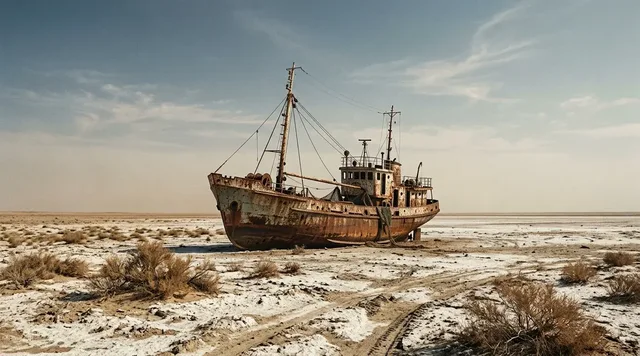
AI illustration
 Written and edited by
 The UN Environment Programme says Lake Chad has fallen to less than 1,500 square kilometres and is ninety per cent gone. A peer-reviewed multi-satellite reconstruction says its extent has been essentially flat for twenty years and that the lake is not shrinking. The Lake Chad Basin Commission, which was created in 1964 to administer this exact body of water, publishes a current figure of eight to fourteen thousand square kilometres. All three sentences are in print today. This dossier is not going to tell you which one wins.
Silence Index — D-189
Genuinely remote
Ranks 55 of 99 scored dossiers — quieter than 45% of the others we have scored. A low score is not a warning; it describes who else will be standing next to you.
How the total is weighted. These are the fixed weights of the four inputs, the same on every dossier — not this place’s scores. We do not publish per-input bars, because the per-input values were never recorded article by article and inventing four plausible numbers that sum to the total would be a fabrication dressed as a chart.
This dossier was scored before 2 September 2026, when the fourth input became night darkness. It keeps the input it was reasoned with until it is re-scored at its next source re-check; the methodology page records the change.
The index is a desk instrument scored by this publication, not a field measurement. How it is calculated, and where it fails.
What this dossier is built from
This is desk research. Nobody from this publication has been to Lake Chad, and at the time of writing there is no shore of it that a British or American government would advise a visitor to stand on. What follows is assembled from the UN Environment Programme's newsroom; a paper in Scientific Reports; the Lake Chad Basin Commission's Strategic Action Programme, Regional Biodiversity Action Plan and transboundary diagnostic analysis; NASA's Earth Observatory and the USGS Earthshots archive; the Global Lakes and Wetlands Database and the journal paper describing it; UNHCR's operational data portal and FAO's country briefs; UNESCO records; four national travel advisories; and the GeoNames gazetteer.
It is not a story about a lake disappearing. It is a story about what happens when two credible institutions, both still standing behind their numbers, describe the same water and give answers that cannot be laid on top of each other.
The two witnesses
The first witness is the UN Environment Programme. On 28 February 2018 it published a piece headed "The tale of a disappearing lake", which opens: "Lake Chad, once one of Africa's largest lakes, is in distress." The load-bearing sentences are these. "Over the last 60 years, the lake's size has decreased by 90 per cent as a result of over use of the water, extended drought and the impacts of climate change." And: "The surface area of the lake has plummeted from 26,000 square kilometers in 1963 to less than 1,500 square kilometers today." The page carries a last-modified date of 21 April 2020. It carries no editor's note, no correction and no update notice.
The second witness is a paper published on 26 March 2020 in Scientific Reports by Pham-Duc, Sylvestre, Papa, Frappart, Bouchez and Crétaux, combining MODIS optical imagery at 500-metre resolution, altimetry from Topex-Poseidon, Jason-1, Jason-2, Jason-3, ENVISAT and SARAL, and GRACE gravimetry. Its abstract states that "Lake Chad extent has remained stable during the last two decades, despite a slight decrease of its northern pool", that groundwater — which supplies about seventy per cent of the lake's annual water storage change — has been increasing since the 2000s, and that "over the last two decades, Lake Chad is not shrinking and recovers seasonally its surface water extent and volume". For the southern pool, the monthly average minimum and maximum surface water extent across 2001 to 2018 are given as 1,520 ± 60 km² in August and 1,830 ± 40 km² in January, a nearly flat linear trend. Total open-water extent across the whole lake ran from about 5,800 km² in 2001–02 down to a minimum near 1,800 km² in 2010 and back up.
Note what has just happened. UNEP's "less than 1,500 square kilometres" is not far off the same paper's figure for the southern pool at its seasonal low. The number is not the disagreement. The verb is.
What popular coverage gets wrong
The version that circulates in climate journalism, in Sahel fundraising appeals and in the standing copy of a good many NGOs runs roughly as follows: Lake Chad is vanishing; it has lost ninety per cent of its surface since the 1960s; it is still going; and unless something is done it will be gone. The first two clauses are supported by the record. The third is not, and the fourth is nobody's finding.
On the ninety per cent, the two witnesses agree, which is worth saying loudly because it is routinely reported as though it were the contested part. The Scientific Reports paper's own introduction says the lake was "ranked at the world's sixth largest inland water body with an open water area of 25,000 km2 in the 1960s", that it "shrunk dramatically at the beginning of the 1970s and reduced to less than 2,000 km2 during the 1980s, decreasing by more than 90% its area". The commission's Strategic Action Programme says the water surface "shrank significantly from 25,000 km2 in the early 1960s to 1,350 km2 in the 1980s", "a loss of 90%". The transboundary diagnostic analysis records a high of 283.41 metres of lake level and almost 26,000 km² in 1962 against a low of 275.35 metres and less than 3,000 km² in 1984. NASA gives at least 22,000 km² in 1963 and a low of "just 300 square kilometers" in the 1980s. The figures for the collapse vary by a factor of seven at the bottom end; the fact of the collapse does not vary at all.
What the record does not support is the present continuous. NASA's Earth Observatory states that "lake levels now appear to be stable, and rainfall is increasing somewhat". USGS Earthshots says "the fluctuations in lake water levels have stabilized in recent years, but it is still a dynamic environment". The commission's own Strategic Action Programme says "the average filling level improved significantly over the last two decades, although it is yet to attain its levels in the 1960s". The brief prepared for the commission's GEF project by Odada, Oyebande and Oguntola noted that "over the past few years, the lake and river water levels have been slowly rising". Nobody with an instrument is currently reporting a shrinking lake. The dispute is about a number, not about a direction.
Why an area figure here is a choice, not a measurement
An editor may reasonably object that we can in fact adjudicate: the 2020 paper measures, the 2018 press page rhetoricises, and the honest thing is to say so. We do not think that survives contact with the object.
Lake Chad is under three metres deep. The transboundary diagnostic analysis puts its average depth at about 1.5 metres; the brief for the same project gives four to eight metres in the northern pool and two to four in the southern. A lake that shallow, sitting on a nearly flat plain, does not have an edge. It has a gradient, and the gradient is occupied. The same brief describes the surface as "a mixture of island archipelagos (23%), reed beds (39%), and open water (38%)". By that accounting, open water is a minority of the thing called Lake Chad. The diagnostic analysis, describing the lake at a fuller state, says instead that "the percentage of the free water represents only about 70 percent of the total area". The commission's Regional Biodiversity Action Plan says "even with high water masses, the lake still has a large number of islands and open water covers about 70% of the total lake area". So the open-water fraction is itself published at 38 per cent and at 70 per cent, by the same institution, depending on which state of the lake is being described.
Now put a satellite over it. Optical remote sensing sees open water well and sees water under reeds badly. The team behind the Global Lakes and Wetlands Database, publishing in Earth System Science Data in 2025, define waterbodies as "all standing or flowing open water surfaces of any size, typically detectable by optical remote sensing", and everything else as "emergent and bare wetlands beyond waterbodies". They then say the quiet part: "seasonal fluctuations in inundation caused by changes in vegetation and/or saturated soils are not as reliably mapped and contribute disproportionately to the large uncertainties in global wetland estimates." That is a general statement about wetlands. Lake Chad is close to being its worst case.
So a figure for the surface area of Lake Chad requires four prior decisions: whether marsh counts, whether the archipelago counts, whether the northern pool counts in a year when it is dry, and which month you take. Change any one and the answer moves by a multiple, not a margin. Neither institution states, next to its number, which decisions it made.
The third witness, which contradicts itself
If two institutions disagreeing were the whole story it would be a thinner one. The Lake Chad Basin Commission — founded at Fort Lamy on 22 May 1964 by Cameroon, Niger, Nigeria and Chad, joined by the Central African Republic in 1996 and Libya in 2008 — publishes both positions itself.
Its Strategic Action Programme 2023–2037, adopted in 2022 by the sixteenth summit of heads of state and government and still the headline document on its publications page, contains this paragraph: "In recent decades, the lake's water surface shrank significantly from 25,000 km2 in the early 1960s to 1,350 km2 in the 1980s. It represents a loss of 90% as a result of variability and climate change. (UNEP, 2010). Today, the water surface oscillates between 8,000 and 14,000 km2 based on annual rainfall conditions." Read that twice. The commission cites UNEP for the collapse, and then gives a present-day figure between five and nine times UNEP's present-day figure, in the same paragraph, without remarking on it.
Its Regional Biodiversity Action Plan 2023–2028, dated 31 July 2023, manages the same trick inside a single document. In one place: "the lake has shrunk considerably, covering only about 2,500 km2 during high periods." In another: "the surface area of the lake itself has decreased from 25,000 km² in the 1960s to 2,500 km² in the 1970s and 1980s, only to increase again to 12,000 km² in 2012." Both sentences are the commission's. They are not compatible.
None of this is fraud and we do not think it is even carelessness. It is what happens when an organisation inherits a figure for open water and a figure for flooded area from different technical traditions and has no mechanism for noticing that both have ended up in one document. The point for our purposes is narrower: the contradiction is live. UNEP's page was last touched on 21 April 2020, a month after the paper that contradicts it appeared, and the number was left standing. The commission's Strategic Action Programme was re-posted on its own site in February 2026. This is not an obituary for a bad statistic. It is a standing disagreement.
The lake underneath the argument
Some of the confusion has a physical cause. At a lake level of about 279 metres a ridge becomes visible between Baga Kawa and Baga Kiekra, and the lake divides into a northern and a southern pool. The commission's documents call it the Grand Barriers; the Scientific Reports paper calls it "an east-west vegetation-covered sand barrier named 'The Great Barrier'", and describes a third zone in the east, "The Archipelagos", made of sand dunes that flood according to the season. The two lobes, on NASA's account, have never reconnected into a single lake since the 1970s.
The pools behave differently. The southern pool is fed almost directly by the Chari and Logone, which between them deliver more than ninety per cent of the water, and it is the pool that has been stable. The northern pool depends on spillover across the barrier; the paper records it going completely dry in dry seasons between 2005 and 2012, and finds a slight decrease over the study period. Averaging a stable pool and an intermittent one produces a number that describes neither.
The variability is also older than the satellite era. NASA notes that the French explorer Jean Tilho reported parts of the lake dried up in 1910, and that the lake "has experienced wet and dry periods for thousands of years". Between the early 1960s and the mid-1980s lake levels fell three metres below the 1900–2010 mean, and inflow fell from about 53 billion cubic metres a year in 1961–62 to about 7 billion in 1984–88.
One small thing tells you how unsettled the object is. GeoNames, the gazetteer most mapping software falls back on, carries Lake Chad as a single point at 13.124281°N, 14.45396°E, attributed to four countries, with no area attached. DAHITI, the German altimetry database holding 24,210 water targets worldwide, lists 65 in Chad and 162 in Nigeria; we could find no Lake Chad target in either, though it carries surface area, volume and bathymetry for Lake Iro, a fraction of the size.
What rests on the number
This has to be said carefully, because the basin holds a severe and continuing humanitarian emergency, and the emergency is not a rhetorical device.
UNHCR's operational data for the Nigeria situation, as of 1 August 2026, records 426,448 Nigerian refugees and 3,263,182 internally displaced people across the four countries, of whom 2,333,190 are in Nigeria. FAO's country brief for Chad, dated 27 January 2026, puts 1.93 million people in Crisis or worse between October and December 2025 and records about 226,000 displaced in Lac Province as of May 2025. Its Niger brief records 1.86 million in the same phase and nearly 460,000 internally displaced as of December 2025; its Nigeria brief records about 25.1 million people facing acute food insecurity in the October–December 2024 window. Those figures are not in dispute between our two witnesses, and nothing in this dossier qualifies them.
What the disagreement does touch is the causal story told over the top of them: that a vanishing lake is driving the displacement, and that restoring the lake would relieve it. UNEP's 2018 piece accompanied a conference held in Abuja from 26 to 28 February 2018 under the theme "Saving Lake Chad to restore its basin's ecosystem for sustainable development, security and livelihoods". If extent has in fact been flat since 2001 while displacement rose through the same period, that framing needs a different mechanism. It does not need less money.
We had intended to set out the costings of Transaqua, the proposed inter-basin transfer that would bring water from the Congo, and we cannot. The commission's own site search returns no results for the name. Its Strategic Action Programme does not mention it. The only reference we found anywhere in the commission's published material is a single line on a page dated 2 November 2025 promising "support for inter-basin transfer studies and hydraulic infrastructure". We are not going to print a price for a scheme we could not find in the record of the body that would host it.
Why we are not resolving this
The tempting conclusion is that the satellites win. It is tempting because it is nearly true and feels like rigour. We think it is wrong in three ways.
First, they are not answering the same question. The paper measures open-water extent, month by month, from 2001 to 2018, and reports a trend. UNEP states a level and a sixty-year change. A flat trend since 2001 does not contradict a ninety per cent loss since 1963; both can be true, and on the evidence both are.
Second, the figure UNEP gives is not obviously wrong even as a level. "Less than 1,500 square kilometres" sits just under the paper's own southern-pool minimum of 1,520 ± 60 km². It is wrong for the whole lake and roughly right for the part of it that is reliably wet. Which it was meant to be, the page does not say.
Third, no institution has withdrawn anything. UNEP's page stands; the commission's two inconsistent documents both stand. A publication that announced a winner here would be substituting its own definitional preference for a decision the responsible bodies have not made, and presenting the result as a finding. We would rather print all three numbers, name all three sources, explain what each is counting, and leave the reader holding the same unresolved thing we are holding.
Why the Silence Index is 72
Remoteness is only moderate and pulls the score down hard: this is not an empty place. Millions of people live on and around this water, there are towns on every shore, and the lake is fished, farmed and, at Bol, poldered. Access friction runs the other way and is close to maximum — the United States rates Chad and Niger Level 4 and names the Lake Chad area as a Boko Haram stronghold; Cameroon's Far North and Nigeria's Borno and Yobe states are Level 4 within lower national ratings; the FCDO advises against all travel to the Lake Chad region of Chad, to four Nigerian states, and to the whole of Niger. Visitor volume is effectively nil. The fourth input is unresolved questions, and it does the rest of the work: the basic dimension of this place is published three ways by three bodies that have not corrected each other. A densely inhabited working lake behind a hard security cordon, with an unsettled surface area, comes out in the low seventies rather than the nineties.
What would settle it
Very little, and it would not be a new satellite. What would settle it is an editorial act: either institution publishing, beside its number, the four decisions it made — marsh, archipelago, northern pool, month. The instruments are already good enough. The Global Lakes and Wetlands Database maps thirty-three separate waterbody and wetland types at 500-metre resolution precisely because one class was never going to be enough.
Until that happens, the position is this. Lake Chad lost the great majority of its area between 1963 and the mid-1980s, and that is not seriously contested by anyone. What it has done since 2001 depends entirely on what you have decided the lake is, and the two bodies with standing to decide have published different answers and left them both up. We can report that. We cannot resolve it, and we are not going to pretend otherwise by choosing the witness whose method we happen to find more congenial.
Corner Codex — D-189
- Place
- Lake Chad, shared by Chad, Cameroon, Niger and Nigeria
- Gazetteer position
- 13.124281°N, 14.45396°E — GeoNames gives a point and no boundary
- UNEP's figure
- 26,000 km² in 1963 falling to 'less than 1,500 square kilometers today'
- The satellite figure
- Southern pool 1,520 ± 60 to 1,830 ± 40 km², flat trend, 2001–2018
- The commission's figure
- 'Today, the water surface oscillates between 8,000 and 14,000 km²'
- Depth
- Under 3 m; average about 1.5 m; northern pool 4–8 m, southern 2–4 m
- Surface composition
- Archipelagos 23%, reed beds 39%, open water 38% (LCBC-GEF figures)
- Main inflow
- The Chari and Logone rivers, more than 90 per cent of the water
- Governing body
- Lake Chad Basin Commission, founded at Fort Lamy on 22 May 1964
- Access
- US Level 4 for Chad and Niger; FCDO advises against all travel to the lake
- What is agreed
- The lake lost more than 90 per cent of its area between 1963 and 1985
- What is not
- Whether that sentence should be in the past tense
- Silence Index
- 72 / 100
The Traveler's Panel · checked
Changing information. Prices, permits, seasons and road access change, sometimes at short notice. Everything here is a starting point for your own confirmation — not a quote, and not a guarantee. Verify with the operator and the relevant official body before you book.
| UNEP's number | 'Less than 1,500 square kilometers today' — published 2018, still standing |
| The paper's number | Southern pool 1,520–1,830 km², flat trend across 2001–2018 |
| The commission's number | 8,000 to 14,000 km², 'based on annual rainfall conditions' |
| Agreed by everyone | More than 90 per cent lost between the early 1960s and the mid-1980s |
| Disputed | Whether anything has been lost since 2001 |
| Depth | Under 3 m; about 1.5 m on average. This is why the edge is an opinion |
| Advisories | Chad and Niger US Level 4; Borno, Yobe and Cameroon's Far North Level 4 |
| Visitors | No published figure. We do not believe there is meaningful tourism here |
Getting there — N'Djamena → Bol or Baga Sola by road, under Chadian escort. Every shore is under a do-not-travel advisory
- There is no visitor route to Lake Chad and this panel is not going to invent one. The nearest functioning international airport to the southern shore is N'Djamena, which sits on the Chari roughly eighty kilometres upstream of the water it feeds, and from which Bol and Baga Sola in Chad's Lac province are reachable by road. That is the geography. The access question is governed entirely by security and by permission.
- The United States rates Chad Level 4, do not travel, updated 30 April 2026, and states in terms that 'the Lake Chad area and the border with Borno State, Nigeria, is a Boko Haram stronghold'. Niger is Level 4, updated 29 January 2026, naming 'the Diffa Region (Lake Chad Basin)' among the areas where recent attacks and kidnappings have occurred. Nigeria is Level 3 nationally with Borno and Yobe states at Level 4. Cameroon is Level 2 nationally with the Far North Region at Level 4, and travel within twenty kilometres of the Chadian and Nigerian borders prohibited outright.
- The British position is the same and in places broader. The FCDO advises against all travel to the Lake Chad region of Chad, against all travel to Borno, Yobe, Adamawa and Gombe states in Nigeria, and against all travel to the whole of Niger.
- In practice, movement on the Chadian shore is by military or administrative escort arranged through the provincial authorities, and it is arranged for humanitarian, governmental and research purposes. We could not identify any lawful mechanism by which a private visitor obtains such an escort, and we are not going to describe one speculatively.
- If you are going anyway, you are almost certainly going as staff of an organisation that has its own security protocol, and that protocol supersedes anything on this page.
Indicative costs — verify before booking
| What it costs | Nobody should be pricing this. There is no visitor route to price |
| Escorted movement | Arranged by provincial authorities for humanitarian, official and research travel. We found no published tariff and will not estimate one |
| Transaqua | We print no cost for the Congo transfer scheme. The commission's own site search returns no result for the name and its Strategic Action Programme does not mention it |
| What we will not quote | Tour prices. We found no operator we would cite and no state schedule of fees for any of the four shores |
| The real cost | Borne locally. FAO records about 226,000 people displaced in Chad's Lac province as of May 2025 |
What to pack
- Nothing, because you are not going. If you are, it is under an employer's security plan and that plan dictates the list.
- For anyone working on the basin from a desk: the commission's Strategic Action Programme and its Regional Biodiversity Action Plan, read side by side, because their surface area figures do not match and the mismatch is the subject.
- A habit of asking, of every Lake Chad figure you encounter, which of four things it counts — open water, marsh, archipelago, or all three — and in which month.
- The Pham-Duc paper's distinction between the northern and southern pools, without which almost every published trend for 'the lake' is an average of two unlike things.
Where to stay
There is no visitor accommodation on Lake Chad that this publication would describe, and describing one would be a small act of irresponsibility given four concurrent government advisories. The towns exist and are substantial: Bol, seat of Chad's Lac province, has a recorded population of 51,389 and an airstrip at Bol Bérim; Baga Sola sits on the Chadian shore a little to the west; Diffa in Niger holds 54,082 people and N'Guigmi 32,035; Maiduguri, the Borno State capital and the humanitarian hub for the Nigerian shore, holds about 1,110,000. Every one of these is a working town with a market, and every one is inside an area to which at least one of the British and American governments advises against all travel. Practical basing for anyone with a legitimate reason to be here is N'Djamena, population 1,359,526, from which the Chadian shore is a road journey and the other three shores are a different country's security problem.
Safety & responsible travel
- Do not repeat 'ninety per cent gone' in the present tense. The ninety per cent is real and agreed; the tense is not. NASA, the USGS and the commission all describe recent levels as stable or improving.
- Do not use the opposite error either. Nothing in the satellite record says the basin's emergency is overstated, and this dossier does not say so. UNHCR counted 3,263,182 internally displaced people across the four countries as of 1 August 2026.
- Name the definition whenever you cite an area. An unqualified square-kilometre figure for Lake Chad is not a measurement, and passing one on without its definition is how three irreconcilable numbers came to be in circulation at once.
- Be careful with imagery. Landsat comparisons of 1963 against a recent year are honest about the collapse and silent about the last twenty-five years, which is the period actually in dispute.
- If you are fundraising on this lake, fundraise on the displacement and food security figures, which are published, dated and not contested. They do not need a shrinking lake behind them.
Nearby, and quieter
The wider basin holds several things that are easier to reach in principle and still hard in practice. Waza Biosphere Reserve in Cameroon's Far North, designated by UNESCO in 1979 and covering 71,592.56 hectares, is bounded to the south by the Yagoua-Limani dunes, which the UNESCO record describes as 'representing the ancient limit of Lake Chad' — a shoreline of a lake that has not existed for thousands of years, and a useful corrective to the idea that the present lake is the natural one. The reserve contains the Waza Logone Floodplains Ramsar Site and holds elephant, leopard, Kordofan giraffe and more than three hundred bird species; it also sits inside the Far North Region, which the United States rates Level 4. Far to the north-east, in Chad's Ennedi, the Lakes of Ounianga were inscribed by UNESCO in 2012 under criterion (vii): eighteen lakes in two groups across 62,808 hectares, in a place receiving under two millimetres of rain a year, kept alive by groundwater and left over from a much larger prehistoric lake. Between the two lies the Bahr el-Ghazal trough, running north-east from Lake Chad towards the Bodélé Depression, which is the floor of that older lake and now one of the largest dust sources on earth.
Getting there, in order
- 1N'Djamena
- 2Bol or Baga Sola by road, under Chadian escort. Every shore is under a do-not-travel advisory
Each leg is a separate booking and a separate chance to be weathered out. Build spare days into the chain, not onto the end of it.
Where it is
Lake Chad, Sahel — Chad, Cameroon, Niger and Nigeria · 13.1243°N 14.4540°E · Open in Google Maps · OpenStreetMap
Key locations
- Lake Chad — the gazetteer's single point for the lake; GeoNames attaches no area or boundary
13.1243°N 14.4540°E - Bol — seat of Chad's Lac province, population 51,389, with the Bol Bérim and Bol Guini polders
13.4673°N 14.7135°E - Baga Sola — Chadian shore town on the southern pool, with its own polder recorded separately
13.5375°N 14.3140°E - Baga — Kukawa, Borno State — western marker of the Grand Barriers ridge between the pools
13.0953°N 13.8225°E - N'Guigmi — Niger, population 32,035, on the northern pool that goes dry in dry seasons
14.2494°N 13.1092°E - Diffa — regional capital in Niger, population 54,082; named in the US advisory as Lake Chad Basin
13.3153°N 12.6111°E - N'Djamena — Chad's capital on the Chari, population 1,359,526, upstream of the lake it feeds
12.1067°N 15.0444°E - Maiduguri — Borno State capital, about 1,110,000 people, the hub for the Nigerian shore
11.8469°N 13.1571°E
Coordinates are for orientation and are accurate to roughly the width of the feature named, not to a doorway. Several of these points are inside protected areas or need a permit, a guide or a boat — read the access notes above before you plan a route to any of them.
Sources & further reading — checked
- UN Environment Programme — 'The tale of a disappearing lake' (28 February 2018, last modified 21 April 2020). The sentence at issue: 'The surface area of the lake has plummeted from 26,000 square kilometers in 1963 to less than 1,500 square kilometers today', plus the 90 per cent claim, 135 fish species and 200,000 tonnes of fish in the 1960s, nearly 40 million people in the basin, and the Abuja conference of 26–28 February 2018. No correction notice appears
- Pham-Duc, Sylvestre, Papa, Frappart, Bouchez and Crétaux — 'The Lake Chad hydrology under current climate change', Scientific Reports 10:5498 (26 March 2020). The abstract's finding that 'Lake Chad extent has remained stable during the last two decades' and that 'Lake Chad is not shrinking'; southern pool extent of 1,520 ± 60 km² and 1,830 ± 40 km²; total extent ~5,800 km² in 2001–02 and ~1,800 km² in 2010; groundwater supplying ~70% of annual storage change and rising since the 2000s; depth under 3 m
- Lake Chad Basin Commission — Lake Chad Basin Strategic Action Programme (SAP) 2023–2037, adopted 2022 by the 16th Summit of Heads of State and Government. The paragraph citing (UNEP, 2010) for a fall from 25,000 km² to 1,350 km² and then stating 'Today, the water surface oscillates between 8,000 and 14,000 km2'; hydrographic basin 2,380,000 km² and Conventional Basin 984,455 km²; about 50 million people; and the note that filling levels improved over the last two decades
- Lake Chad Basin Commission — Regional Biodiversity Action Plan (LCB-RBAP) 2023–2028 (31 July 2023). The same document stating both that the lake covers 'only about 2,500 km2 during high periods' and that its area 'decreased from 25,000 km² in the 1960s to 2,500 km² in the 1970s and 1980s, only to increase again to 12,000 km² in 2012', plus open water at 'about 70% of the total lake area'
- LCBC–GEF Project on the Reversal of Land and Water Resources Degradation — Transboundary Diagnostic Analysis of the Lake Chad Basin. The two pools becoming visible at about 279 m with the Grand Barriers ridge between Baga Kawa and Baga Kiekra; a 1962 high of 283.41 m and almost 26,000 km² against a 1984 low of 275.35 m and under 3,000 km²; average depth 1.5 m; free water about 70% of total area; inflow of 53 billion m³ in 1961–62 against 7 billion in 1984–88; the Bahr el-Ghazal trough
- Odada, Oyebande and Oguntola — 'Lake Chad: Experience and Lessons Learned Brief' (supporting paper hosted by the UNCCD Drought Toolbox). The composition figures this dossier leans on — 'island archipelagos (23%), reed beds (39%), and open water (38%)'; northern pool depth 4–8 m and southern 2–4 m against a 1.5 m average; a current area of 1,350 km²; and the observation that lake and river levels 'have been slowly rising'
- NASA Earth Observatory — 'The Rise and Fall of Africa's Great Lake' (9 November 2017, updated 14 November 2025). A 1963 extent of 'at least 22,000 square kilometers' and an 1980s low of 'just 300 square kilometers'; the Normal, Small and Dry Small Lake Chad states; a three-metre fall below the 1900–2010 mean level; and the statement that 'lake levels now appear to be stable, and rainfall is increasing somewhat'
- NASA Earth Observatory — 'The Ups and Downs of Lake Chad' (25 November 2017, updated 31 January 2026). That the two lobes 'have never reconnected into a single lake' since the 1970s; that the lake 'has experienced wet and dry periods for thousands of years'; Jean Tilho's 1910 report that parts of the lake had dried up; and the 'less than a tenth' formulation
- US Geological Survey — Earthshots: Lake Chad, West Africa. A 1960s extent of 'about 25,000 square kilometers'; the lake now spanning 'less than a tenth of the area it covered in the 1960s'; and the statement that 'the fluctuations in lake water levels have stabilized in recent years, but it is still a dynamic environment'
- Lehner and 29 others — 'Mapping the world's inland surface waters: an upgrade to the Global Lakes and Wetlands Database (GLWD v2)', Earth System Science Data 17, 2277–2329 (2025). The definitional distinction between waterbodies as open water 'typically detectable by optical remote sensing' and other wetlands; and the statement that seasonal inundation under vegetation or saturated soils is 'not as reliably mapped' and contributes disproportionately to uncertainty in global wetland estimates
- HydroSHEDS — Global Lakes and Wetlands Database (GLWD) product page. GLWD v2 released in 2025, mapping 33 waterbody and wetland types across 18.2 million km² of wetlands for the 1990–2020 period at 15 arc-second resolution, roughly 500 m at the equator — the evidence that one water class was never going to be enough
- Lake Chad Basin Commission — Publications and Reports. The commission's current publication list, showing the Strategic Action Programme still posted as the headline strategic document with a site date of 4 February 2026, alongside the Water Charter, the annual monitoring reports and the April 2026 Water Security and Resilience Assessment
- Lake Chad Basin Commission — About Us. The founding of the commission on 22 May 1964 by Cameroon, Niger, Nigeria and Chad, the accession of the Central African Republic in 1996 and Libya in 2008, and observer status for Egypt, the Republic of the Congo and the Democratic Republic of the Congo
- Lake Chad Basin Commission — 'Integrated Water Resources Management in the Lake Chad Basin' (2 November 2025). The single line of published commission material this dossier could find on inter-basin transfer — 'Support for inter-basin transfer studies and hydraulic infrastructure' — with no scheme named, no volume and no cost attached
- Lake Chad Basin Commission — site search for 'Transaqua'. Returns 'Sorry, but nothing matched your search terms' — the basis for this dossier's refusal to print costings for the Congo-to-Chad transfer scheme routinely attributed to the commission in outside coverage
- UNHCR — Operational Data Portal, Nigeria Situation (figures as of 1 August 2026). 426,448 Nigerian refugees — 278,077 in Niger, 126,320 in Cameroon, 22,051 in Chad — and 3,263,182 internally displaced people across the four countries, of whom 2,333,190 are in Nigeria, 510,855 in Cameroon, 219,595 in Chad and 199,542 in Niger
- FAO GIEWS — Country Brief: Chad (reference date 27 January 2026). 2025 aggregate cereal production forecast at about 3 million tonnes, 9 per cent above the five-year average; about 1.93 million people in Crisis or above between October and December 2025; and about 226,000 people displaced in Lac Province as of May 2025
- FAO GIEWS — Country Brief: Niger (reference date 30 January 2026). 2025 cereal production forecast at about 5.9 million tonnes, 13 per cent above average; about 1.86 million people in Crisis or above between October and December 2025; and internal displacement of nearly 460,000 people as of December 2025, with violence increasing in Diffa
- FAO GIEWS — Country Brief: Nigeria (reference date 7 April 2025). 2024 cereal production of about 28.5 million tonnes; nearly 25.1 million people facing acute food insecurity between October and December 2024; internal displacement of about 3.4 million in the North-East, North-West and North-Central zones; and flooding in Borno State
- UNCCD — Great Green Wall Initiative. The initiative launched by the African Union in 2007 across 22 countries, targeting 100 million hectares of restored land, 250 million tonnes of carbon and 10 million green jobs by 2030, with more than USD 14 billion raised and pledged — and no Lake Chad figure of its own
- US Department of State — Chad Travel Advisory (updated 30 April 2026). Level 4, Do Not Travel, for crime, terrorism, unrest, inadequate health infrastructure, kidnapping and landmines, with the statement that 'the Lake Chad area and the border with Borno State, Nigeria, is a Boko Haram stronghold'
- US Department of State — Nigeria Travel Advisory (updated 8 April 2026). Level 3 nationally with Level 4, Do Not Travel, for Borno and Yobe states among others due to terrorism, crime and kidnapping, and the statement that violence in north-east Nigeria has forced about 2 million Nigerians to leave their homes
- US Department of State — Niger Travel Advisory (updated 29 January 2026). Level 4, Do Not Travel, naming 'the Diffa Region (Lake Chad Basin)' among the areas where recent attacks and kidnappings have occurred, and listing Boko Haram and ISIS-WA among the active groups
- US Department of State — Cameroon Travel Advisory (updated 15 May 2026). Level 2 nationally with Level 4, Do Not Travel, for the Far North Region owing to terrorism, kidnapping and improvised explosive devices, plus a prohibition on travel within 20 km of the borders with the Central African Republic, Chad and Nigeria
- UK Foreign, Commonwealth and Development Office — Chad travel advice (updated 6 August 2026). The FCDO advising against all travel to the Lake Chad region, to Borkou, Ennedi Ouest, Ennedi Est and Tibesti provinces, to western Kanem including Nokou, and to within 30 km of Chad's other borders
- UK Foreign, Commonwealth and Development Office — Nigeria travel advice, regional risks (updated 20 August 2026). Advice against all travel to Borno, Yobe, Adamawa and Gombe states for a high and increasing threat from Boko Haram or Islamic State West Africa, a high threat of kidnap and violent attacks, and ongoing military operations
- UK Foreign, Commonwealth and Development Office — Niger travel advice (updated 19 June 2026). Advice against all travel to Niger as a whole, citing terrorist and criminal kidnappings of foreign nationals and an ongoing risk of attacks throughout the country including Niamey
- GeoNames gazetteer — Lake Chad. The gazetteer entry: Lake Chad, feature class lake, attributed to Chad, Nigeria, Niger and Cameroon, given as a single point at 13.124281°N 14.45396°E with no area and no boundary attached
- GeoNames gazetteer — Bol, Lac, Chad. Bol at 13.46729°N 14.713517°E, seat of a first-order administrative division, population 51,389, together with gazetteer entries for the Bol Bérim and Bol Guini polders and Bol Bérim airport — the lake's irrigation works recorded as landscape features
- GeoNames gazetteer — Baga Sola, Lac, Chad. Baga Sola as a populated place at 13.537504°N 14.313953°E and a separate polder entry at 13.542849°N 14.286848°E, both in Lac region
- GeoNames gazetteer — Baga, Kukawa, Borno State, Nigeria. Baga at 13°5′43″N 13°49′21″E in Kukawa, Borno State — the western marker of the Grand Barriers ridge named in the transboundary diagnostic analysis
- GeoNames gazetteer — Diffa, Bosso and N'Guigmi, Niger. Diffa town at 13°18′55″N 12°36′40″E with 54,082 people, Bosso at 13°41′55″N 13°18′34″E, and N'Guigmi at 14°14′58″N 13°6′33″E with 32,035 people — the last of these a former lakeside town on the northern pool
- GeoNames gazetteer — N'Djamena, Chad. N'Djamena at 12.10671°N 15.04440°E with a population of 1,359,526 — the capital sits on the Chari, roughly 80 km upstream of the lake it feeds
- GeoNames gazetteer — Maiduguri, Borno State, Nigeria. Maiduguri at 11.84692°N 13.157122°E, population about 1,110,000, the Borno State capital and the humanitarian hub for the Nigerian shore of the lake
- DAHITI — virtual stations in Chad. DGFI-TUM's altimetry database, holding water level, surface area and volume series for 24,210 targets worldwide and 3,106 in Africa. Its 65 Chadian targets include 27 stations on the Chari and 15 on the Logone and a full surface area, volume and bathymetry record for Lake Iro — and no target we could find for Lake Chad itself
- DAHITI — virtual stations in Nigeria. The 162 Nigerian targets, including Kainji Lake, Tiga Lake and the Jebba and Oyan reservoirs, again with no Lake Chad entry — the check that keeps this dossier's claim about DAHITI honest
- UNESCO — Waza Biosphere Reserve, Cameroon. Designated in 1979, 71,592.56 hectares, bounded to the south by the Yagoua-Limani dunes 'representing the ancient limit of Lake Chad', containing the Waza Logone Floodplains Ramsar Site, with elephant, leopard, Kordofan giraffe and more than 300 bird species
- UNESCO World Heritage Centre — Lakes of Ounianga, Chad. Inscribed in 2012 under criterion (vii), 62,808 hectares with a 4,869-hectare buffer; 18 lakes in two groups in a hyperarid setting under 2 mm of annual rainfall, fed by groundwater, and surviving from a much larger prehistoric lake of less than 10,000 years ago
- World Bank — Population, total (SP.POP.TOTL), 2024, for Chad, Niger, Nigeria and Cameroon. Nigeria 232,679,478; Cameroon 29,123,744; Niger 27,032,412; Chad 20,299,123 — the national denominators against which the basin's 40 to 50 million figure should be read
Official and scientific bodies are the authority for safety, regulatory and scientific claims. Commercial operators are used only for practical detail such as tour length, meeting points and indicative pricing — never for a safety or scientific statement.
How this was made
Desk research. Compiled from official bodies, scientific and conservation sources, established journalism and licensed operators. Not based on a personal visit.
Editor’s method note — what we checked, corrected and could not verify
- Desk research only. Nobody from this publication has been to Lake Chad or to any of the four countries that share it, and this dossier makes no claim to have seen the water.
- Every URL cited was opened and read before citation. Sources that could not be opened are listed near the end of this note and are cited nowhere in the piece.
- The central refusal is deliberate. UNEP's 'less than 1,500 square kilometers today' and the Pham-Duc paper's finding that the lake 'is not shrinking' are both printed here in full, attributed, with their methods described. We do not average them, we do not pick one, and we do not present the peer-reviewed source as having superseded the agency source. Neither institution has withdrawn or amended its statement.
- We checked whether the contradiction is still live rather than historical. UNEP's page carries a last-modified date of 21 April 2020, four weeks after the paper appeared, and shows no correction. The Lake Chad Basin Commission's Strategic Action Programme, adopted in 2022, was still posted as its headline strategic document when we read the site in August 2026.
- The Lake Chad Basin Commission is treated as a third witness rather than a tiebreaker, because its own documents disagree. Its Strategic Action Programme gives a present-day surface of 8,000 to 14,000 km²; its Regional Biodiversity Action Plan of 2023 gives about 2,500 km² in one sentence and 12,000 km² for 2012 in another. We print all of them.
- Where figures for the 1960s extent differ — 22,000 km² (NASA), 25,000 km² (USGS, the Pham-Duc paper and the commission) and 26,000 km² (UNEP and the transboundary diagnostic analysis) — we print the spread and name each source rather than choosing a round number.
- The definitional argument in the body rests on published composition figures, not on our own modelling: archipelagos 23 per cent, reed beds 39 per cent and open water 38 per cent in the LCBC–GEF brief, against 'about 70 per cent' free water in the transboundary diagnostic analysis and in the commission's biodiversity plan. We do not attempt to reconcile those either; they describe different states of the same lake.
- We looked for the Transaqua inter-basin transfer in the record of the body that would host it and did not find it. The commission's site search returns nothing for the name and its Strategic Action Programme does not mention it. Accordingly this dossier prints no route, no volume and no cost for that scheme, and the panel prices nothing.
- Humanitarian figures are reported as published by UNHCR and FAO and are not used to argue anything about the lake's extent. Nothing in this dossier should be read as suggesting that because the lake's area has been stable since 2001 the emergency in the basin is smaller than reported. Those are separate questions and we keep them separate.
- Coordinates in the panel come from the GeoNames gazetteer, which records Lake Chad as a single point with no area. Shore settlements, the Bol and Baga Sola polders and the towns of the northern pool are taken from the same source. We could not obtain an official national mapping coordinate from any of the four riparian states.
- Sources we could not read, and therefore did not cite: OCHA's Lake Chad Basin page and IOM's Displacement Tracking Matrix page for the Lake Chad Basin crisis, both 403; the Ramsar Sites Information Service search and the Ramsar country profile for Chad, which returned 502 and 403 respectively, so no Ramsar designation is cited here despite the lake holding several; the full GIWA Regional Assessment 43 PDF at wedocs.unep.org and UNEP's own site search, both robots-blocked; Gao and others' 2011 paper on the causes of the shrinking of Lake Chad at IOPscience, robots-blocked; the IRD Expertise Collégiale volume on the development of Lake Chad, 404; Bonifica's Transaqua pages, which failed DNS resolution; the World Bank's Lake Chad Development and Climate Resilience Action Plan, whose document portal served no text; the Copernicus Global Land Service lake water level product page, 404; and the USDA G-REALM reservoir monitor, 503.
- Things we could not verify: which definition of 'surface area' UNEP intended in 2018, the page not saying; what was changed when that page was modified on 21 April 2020; whether the Lake Chad Basin Commission has an internal position reconciling the 8,000–14,000 km² figure in its Strategic Action Programme with the 2,500 km² figure in its biodiversity plan; the source and date of the '(UNEP, 2010)' citation the commission attaches to the 90 per cent claim, which we could not trace to a specific UNEP publication; any surface extent measurement for Lake Chad after the Pham-Duc study's 2018 cut-off, no later peer-reviewed reconstruction having been reachable from here; whether DAHITI holds a Lake Chad target filed under Cameroon or Niger, having checked only its Chad and Nigeria listings; whether the IPCC's Sixth Assessment discusses Lake Chad at all, our reading of the Africa chapter having returned no mention and the chapter being too long for us to be confident the whole of it was rendered; the current status, route, volume and cost of the Transaqua scheme; the present extent of the northern pool in any given month; and whether any visitor could lawfully and safely reach the lake in 2026, which we do not believe they can.
AI is used to draft this text, and a human checks it. Every figure, date and quotation above was verified by Tony Hall against the source cited for it in the reference list; where sources disagree, the disagreement is shown rather than resolved, and where a claim could not be confirmed it is either marked unverified or left out. The illustrations are AI-created and labelled as such — no photograph on this site is presented as a record of a real place. Full disclosure · Editorial policy.
Access details change — recheck before you travel. Found an error? Tell us — corrections are dated and shown in place.