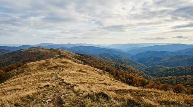
AI illustration
 Edited by
 West of Vaasa, the Baltic is losing an argument with the land. Kvarken rises by something between eight and nine millimetres a year — the institutional figures range from 8.5 to about 9, and none of them is the round centimetre that travel writing likes to quote. Stones clear the surface, islands meet, passages close and yesterday's bay begins the long change into meadow. Here, a coastline is not an edge. It is a process visible within one human life.
The Finnish archipelago forms the low half of a transboundary UNESCO site shared with Sweden's High Coast. Its 5,600 islands lie in water averaging less than ten metres deep, so small vertical changes create large horizontal consequences. The most legible first visit begins at Svedjehamn, where red fishing storehouses stand below the Saltkaret tower and parallel De Geer moraine ridges make the old ice sheet's retreat readable from above.
When the weight of ice leaves
The last continental ice sheet did not simply cover this coast; it depressed the crust beneath an immense weight. As the ice melted, pressure eased and the land began a slow rebound. UNESCO describes uplift across the High Coast–Kvarken property at around 0.9 metres per century, with total rebound since deglaciation about 10,500 years ago reaching some 290 metres. The movement continues because the crust has not yet reached equilibrium.
The rate itself is quoted three ways by three institutions and it is worth setting them beside each other rather than averaging. UNESCO's 0.9 metres per century works out at 9 millimetres a year. The joint High Coast/Kvarken World Heritage organisation gives about 8 to 9 millimetres. The City of Vaasa gives 8.5. The figure of a full centimetre a year, which circulates widely, is not supported by any of them.
The World Heritage organisation also supplies the distinction that reconciles most of the confusion. Absolute uplift of 8 to 9 millimetres is what the crust does. Apparent uplift — what a shoreline, a jetty or a boat channel actually experiences, once a rising sea is subtracted — is roughly 6 millimetres a year. Both numbers are correct and they describe different things, which is why accounts that quote only one of them tend to disagree. Even at the smaller figure, the archipelago gains about a square kilometre of new land annually.
Kvarken is unusually good at revealing the change because it is so low and shallow. UNESCO records a mean sea depth of less than ten metres in the archipelago, against depths reaching 293 metres on the Swedish High Coast opposite. A rise measured in millimetres can therefore uncover wide shoals, lengthen points and expose boulder fields. The same process that sounds negligible on a ruler can make a familiar boat channel unusable across generations.
The World Heritage value is the continuity of that process, not a frozen scenic composition. New islands appear and unite; peninsulas expand; inlets narrow into lagoons, lakes, marshes and peat-forming wetlands. A visitor does not need to witness the ground moving. Comparing the open view, the mapped channels and the vegetation succession already shows geology continuing in present tense.
Most coasts are drawn as lines. Kvarken is a verb.
 AI illustration
The washboard beneath the forest
Kvarken's signature landforms are De Geer moraines: parallel ridges of stones, gravel and finer material deposited at or near the retreating ice margin. From above they resemble a washboard or strings of beads crossing shallow water. UNESCO identifies them among the exceptional glacial formations that distinguish the archipelago's 5,600 islands.
The ridges control what happens after emergence. Water can remain between them while alder, reed, sedge and eventually forest colonise the higher strips. A flad is a shallow lagoon still linked to the sea; a gloe is farther along the sequence, increasingly or entirely cut off. Metsähallitus describes these sheltered water bodies as characteristic habitats created by land uplift.
That sequence is delicate precisely because it looks ordinary at ground level. A low wet hollow may be a young shoreline habitat rather than spare land. Avoid driving, launching or cutting across reeds and shore meadow outside established access. The geological story depends on vegetation and water as much as it depends on stones.
The ice left ridges; time keeps changing what lives between them.
Svedjehamn makes the movement visible
Svedjehamn on Björkö is the clearest road-accessible introduction. Rows of red shoreside storehouses frame a harbour that was busy with fishing into the twentieth century. The place is not an abandoned heritage set: boats, summer businesses, grazing animals and nearby homes keep it part of a living archipelago. Park only where directed and keep private jetties and sheds private.
The Saltkaret observation tower stands about 800 metres from the parking area. From its upper platform, the low parallel moraine ridges become legible across the water and forest. The famous view is wide rather than dramatic: no cliff or alpine summit announces World Heritage status. The achievement is learning to see centimetres of vertical change expressed as whole corridors of new land.
The Bodvattnet circuit is listed by Luontoon at 3.8 kilometres, with a 3.5-kilometre demanding accessible alternative. It links the tower landscape to old harbour structures, shore meadow and young forest. Trail condition matters: roots, wet sections and seasonal maintenance can change the experience. The official system says there is no winter maintenance on the trails, although the road toward Saltkaret is an exception kept open in winter.
Saltkaret does not make the landscape taller. It makes slow movement readable.
A 2026 bus with only seventy-five minutes at the harbour
For travellers without a car, Visit Vaasa's 2026 World Heritage Bus offers a narrow seasonal window. It is scheduled on Tuesdays, Thursdays and Saturdays from 23 June through 8 August. The route starts in Vaasa, pauses at the World Heritage Gateway by the Replot Bridge and continues to Svedjehamn. The listed adult fare is 15 euros and the fare for children aged three to twelve is 5 euros.
The timetable is useful but compressed. The bus reaches Svedjehamn at about 11:30 and leaves at 12:45, giving roughly seventy-five minutes. Saltkaret is realistic at a steady pace; the full Bodvattnet loop is not a responsible promise inside that interval. There is no guide on the bus, and limited seats make advance purchase sensible.
A deeper visit needs a different plan: bicycle, rental car, taxi, organised tour or an overnight base on Replot or Björkö. The World Heritage Gateway is about a twenty-minute drive from Vaasa and has a free information lobby, gallery, maps and staffed services on its published schedule. Check its current hours rather than carrying forward the previous season's calendar.
Public access exists here, but its timetable does not turn a living coast into a checklist.
The outer islands require more than a map
Many Kvarken routes begin where the road ends. The shallow archipelago hides stones just below the surface, and land uplift means local navigation knowledge remains valuable even when a chart is current. Luontoon notes that numerous trails are on islands reached by private boat, rented boat or kayak, while partner operators can provide transport and cruises.
The 2026 programme shows how conditional that access is. Visit Vaasa lists scheduled inner-archipelago cruises from 20 June to 30 August and smaller Mickelsörarna trips from late June into July, with weather reservations. The listed Mickelsörarna boat carries no more than twelve passengers and starts at 65 euros. Separate Valsörarna and Norrskär excursions were already fully booked when checked, a reminder that a published island is not an available island.
Paddling belongs to competent cold-water travellers with a marine forecast, chart, buoyancy equipment, communication plan and an honest turning point. Calm reeds near a launch do not describe the exposed water beyond them. Use recognised landings, avoid bird islets during nesting, keep distance from seals and know whether a proposed line touches a protected reserve.
In a rising archipelago, local memory is part of the navigation equipment.
 AI illustration
Fishing harbours are not scenery without owners
Kvarken's geology is World Heritage, but the red buildings that make Svedjehamn recognisable come from work. Fishing, seal hunting, farming, boatbuilding and seasonal movement shaped the settlements. The Björkö Boat Museum and local information points preserve that material history more honestly than a photograph cropped to remove every sign of livelihood.
The traditional mail row recalls almost three centuries of carrying post between the Finnish archipelago and Holmön in Sweden. In alternating years, wooden boats depart from one side or the other. Summer grazing is another living practice: sheep are taken by boat to outer islands, where their feeding keeps parts of the cultural landscape open.
Neither tradition licenses visitors to enter working sheds, handle boats or step around gates. Buy locally, ask before photographing people at work and close every livestock gate exactly as found. Silence in Kvarken is compatible with residence and labour; it should never be manufactured by pretending the communities are absent.
The harbour remains beautiful because it was built for work, not because work disappeared.
Sleep where impact can be absorbed
Luontoon states that temporary camping is possible under Finland's everyman's rights except in restricted areas, and recommends camping near established rest areas. That permission is not a universal invitation to occupy a shore meadow, private yard, busy landing or bird island. A legal pitch can still be a poor one if it blocks use or expands damage.
Vargis has a designated camping area, and the wider region offers registered cottages, guesthouses and caravan facilities. Replot and Björkö put an overnight visitor closer to early and late light; Vaasa offers rail connections, food and a larger accommodation supply. Booking an established bed usually creates less uncertainty than interpreting general access rights on a complex protected coast.
Open fire is a separate question from access. On state recreation sites it belongs at designated structures and only when current warnings and site rules permit it. A wildfire warning overrides the attraction of a campfire. Carry food that does not depend on flame, pack out waste and leave shared shelters ready for the next person.
Everyman's rights work only when every visitor also accepts every visitor's responsibility.
Silence between road, reed and open sea
Kvarken's quiet is distributed unevenly. The Replot Bridge, Gateway, Svedjehamn parking area and Saltkaret tower concentrate arrivals. A summer bus can place many people at the same viewpoint for the same short interval. That does not invalidate the landscape, but it means a silence claim based only on the gateway would be misleading.
Beyond the road corridor, 5,600 islands and a large marine area divide movement into narrow channels and weather-dependent landings. Morning and evening on an overnight stay can feel spacious even near Björkö, while an authorised outer-island trip produces a different scale of separation. The ethical limit is wildlife: quiet is never permission to seek an emptier nesting island.
The best itinerary gives the process more time than the panorama. Begin at the Gateway, walk Saltkaret and Bodvattnet without rushing, stay locally and add water only when forecast, operator and protected-area rules align. Kvarken is hidden in plain sight because its greatest event happens too slowly for spectacle and fast enough to make every old map provisional.
The coast changes quietly; the responsible visitor learns to notice without forcing it to perform.
What popular coverage gets wrong about Kvarken
The claim that follows Kvarken around listicles and social-media posts is that the land here rises by a full centimetre a year, and that a visitor can more or less watch new islands surfacing. Both halves mislead.
No institution cited in this dossier supports the centimetre. UNESCO gives uplift of around 0.9 metres per century; the joint High Coast/Kvarken World Heritage organisation gives about 8 to 9 millimetres a year, and the City of Vaasa 8.5. The World Heritage organisation also supplies the distinction the rounded figure erases: absolute uplift of 8 to 9 millimetres is what the crust does, while apparent uplift — what a jetty or a boat channel actually experiences once the rising sea is subtracted — is roughly 6 millimetres a year. Even at the smaller figure the archipelago gains about a square kilometre of new land annually, which needs no exaggeration to be remarkable.
The second misreading is scenic. Coverage that borrows drama from Sweden's High Coast implies cliffs; UNESCO records a mean sea depth of less than ten metres on the Finnish side against depths reaching 293 metres opposite, and the famous view from Saltkaret is wide rather than vertical. Nobody watches the ground move. What Kvarken offers is change made legible by comparison — charts, harbours and ridges slowly outgrown by the land — and a visitor primed for spectacle will walk straight past the slower thing actually on display.
Hiddencorners position
Hiddencorners recommends at least one night on Replot or Björkö, with Svedjehamn and the Bodvattnet route treated as one unhurried landscape rather than a timed photo stop. Use the 2026 World Heritage Bus only for the shorter Saltkaret introduction. Add an outer-island boat or paddle only through current, weather-aware arrangements, and regard nesting islands, seal reserves, private jetties, grazing gates, wildfire warnings and shallow navigation as hard constraints.
Why the Silence Index is 75
Kvarken scores 75 because 5,600 low islands, a shallow sea and many weather-dependent landings disperse people rapidly beyond the road corridor. Overnight hours around Björkö and professionally reached outer islands can be remarkably quiet, while the continuing uplift gives the landscape a form of change that makes no sound at all.
The main gateway is not remote. Replot is connected by road, Svedjehamn has parking and summer businesses, and Saltkaret is a recognised World Heritage viewpoint. The 2026 bus, organised cruises and peak-summer day trips create predictable pulses. Silence must be sought in timing and duration, not claimed from the destination name alone.
Corner Codex — D-025
- Place
- Kvarken Archipelago, Finland
- Coordinates
- Approx. 63.36°N, 21.29°E at Svedjehamn and Saltkaret
- Getting there
- From Vaasa across the Replot Bridge by road, bicycle, tour or the limited 2026 World Heritage Bus; outer routes require suitable boat transport or expert cold-water paddling
- Rules
- Respect private shores and livestock, restricted nature areas, nesting islets and seal reserves; camp only where rights and zoning allow, and light fires only at permitted structures when no warning is in force
- Season
- June–September offers the broadest trail, bus and boat access; the 2026 World Heritage Bus runs 23 June–8 August, while winter trails generally have no maintenance
- Silence Index
- 75 / 100
- Still open
- How a World Heritage landscape protects a geological process that continually redraws the relationship between water, property, navigation and habitat
Silence Index
A legacy editorial rating based on desk research. It is not an acoustic measurement or a safety rating.
Earlier and later dossiers used different fourth inputs. Individual input scores were not recorded, so these totals cannot be independently reproduced or used for precise comparisons between places.
The Traveler's Panel · checked
Changing information. Prices, permits, seasons and road access change, sometimes at short notice. Everything here is a starting point for your own confirmation — not a quote, and not a guarantee. Verify with the operator and the relevant official body before you book.
| World Heritage | Finland's only natural UNESCO site, paired with Sweden's High Coast |
| Archipelago | About 5,600 islands; mean sea depth under 10 m |
| Uplift | About 0.9 m per century across the World Heritage landscape |
| First view | Saltkaret tower, about 800 m from Svedjehamn parking |
| Main walk | Bodvattnet 3.8 km; demanding accessible option 3.5 km |
| 2026 bus | Tuesday, Thursday and Saturday, 23 June–8 August; advance booking advised |
| Bus stopover | About 75 minutes in Svedjehamn; no guide on board |
| Outer islands | Weather-dependent local boat, cruise or experienced cold-water paddling |
| Main hazards | Cold water, submerged boulders, wind, ticks, wildfire warnings and wildlife closures |
Getting there
- Choose whether the short 2026 bus visit or an overnight road-based itinerary matches the desired depth.
- Check current World Heritage Gateway hours, trail notices, wildfire warnings and marine forecast.
- If using the bus, buy the limited seat in advance and plan Saltkaret rather than promising the full loop.
- For a longer visit, book an established bed on Replot or Björkö and travel with food and weather layers.
- Walk the signed Bodvattnet route suited to current mobility and ground conditions.
- Reserve any outer-archipelago trip with a listed operator and confirm the exact landing and wildlife restrictions.
- On the day of boat or paddle travel, accept cancellation when wind, visibility or local judgement requires it.
- Leave time in Vaasa after the archipelago rather than tying a weather-sensitive return to a fixed flight.
Indicative costs — verify before booking
| World Heritage Bus 2026 | Listed at €15 adult and €5 child aged 3–12; runs only on selected summer dates |
| Gateway lobby and gallery | Free; the Weichsel exhibition lists a separate admission fee |
| Weichsel exhibition | Listed at €6 adult, €5 retired and €3 discounted; verify current price and hours |
| Bodvattnet and Saltkaret | No general trail ticket stated; travel, food and parking arrangements remain the visitor's cost |
| Mickelsörarna boat 2026 | From €65 per person on listed dates, maximum 12 passengers and weather reservation |
| Other cruise or guide | Route, duration and group dependent; confirm conservation practice as well as price |
| Verify | Prices and availability change. Confirm current details directly before booking. |
What to pack
- Windproof and waterproof layers for exposed Baltic weather
- Walking shoes for roots, rock, wet ground and shore meadow
- Food and water beyond the short serviced summer window
- Tick and mosquito protection plus a post-walk tick check
- Binoculars so birds and seals can be watched from distance
- Offline map, charged phone and power bank
- For independent paddling: proper buoyancy, immersion protection, chart and reliable communication
Where to stay
Vaasa is the easiest rail-connected base and has full services, but it turns Kvarken into a day excursion. Registered cottages, guesthouses and small businesses on Replot and Björkö make early and late visits possible while keeping spending in the archipelago. Camping is possible under Finland's everyman's rights outside restrictions, with official guidance recommending the vicinity of rest areas; Vargis provides a designated option. Never treat a private jetty, shore meadow, landing or bird island as an informal campsite.
Safety & responsible travel
- Treat Baltic water as cold even in summer; wear suitable protection for any independent paddle.
- Use a current marine forecast and turn back before sheltered reeds give way to exposed water.
- Expect submerged boulders and changing shallow channels; do not improvise a motorboat route from a road map.
- Stay off nesting islets and check protected zones and seal-reserve boundaries before departure.
- Follow current wildfire warnings; an open fire is not allowed merely because a fireplace exists.
- Use signed trails, close livestock gates and keep clear of working boats, sheds and private jetties.
- There is generally no winter trail maintenance; sea ice requires specific local knowledge and equipment.
- Carry tick protection, inspect skin after grass and woodland, and seek local advice on current conditions.
Nearby, and quieter
Vaasa's waterfront and inner-archipelago cruises offer a gentler introduction with rail access and services. South of the main World Heritage gateway, Sommarö has signed trails and recreation structures; north, Mickelsörarna requires scheduled or chartered water access. Sweden's High Coast is the steep geological counterpart across the Gulf of Bothnia, but it is a separate journey rather than a casual same-day extension.
Where it is
Finland · 63.3600°N 21.2900°E · Open in Google Maps · OpenStreetMap
Key locations
- Svedjehamn — the red storehouse harbour on Björkö where most first visits begin
63.3597°N 21.3022°E - Saltkaret — the tower about 800 m from the car park that makes the moraine ridges legible
63.3579°N 21.2913°E - World Heritage Gateway, Replot — the visitor centre by the Replot Bridge and the 2026 bus stop
63.2068°N 21.4624°E - Vaasa — rail, beds and the start of the seasonal World Heritage Bus
63.1000°N 21.6167°E - Mickelsörarna — outer islands reached only by the twelve-passenger summer boat
63.4299°N 21.7513°E - Valsörarna — outer-island excursion already fully booked when we checked
63.4217°N 21.0715°E
Coordinates are for orientation and are accurate to roughly the width of the feature named, not to a doorway. Several of these points are inside protected areas or need a permit, a guide or a boat — read the access notes above before you plan a route to any of them.
Sources & further reading — checked
- UNESCO — High Coast / Kvarken Archipelago. Primary World Heritage source for 5,600 islands, De Geer moraines, mean sea depth, uplift rate and the continuing transition from bays to lakes and wetlands.
- Metsähallitus — Kvarken Archipelago World Heritage Site. Managing-authority context for flads, gloes, Natura 2000 protection, villages and the way seabed becomes land and beach becomes forest.
- Luontoon — Kvarken hiking and outdoor recreation. Official route source for Bodvattnet, Björkö–Panike, island access, service structures, accessibility and lack of winter trail maintenance.
- Luontoon — staying overnight in Kvarken. States that camping is possible under everyman's rights except in restricted areas, and that there are designated camping areas and rental cabins. The page's detail on specific sites, including Vargis, did not render for us and is not carried by this citation.
- Luontoon — Kvarken instructions and rules. The official landing point for destination-specific rules. On inspection it is a navigation hub rather than a rulebook: the substance sits in the linked Introduction and Nature sections, and this dossier cites it only as the place a traveller should start, not as the source of any particular restriction.
- High Coast / Kvarken Archipelago World Heritage — the land uplift phenomenon. The World Heritage site's own joint organisation gives current uplift as about 8–9 mm a year across the property, and makes the distinction that matters: apparent uplift, measured against a rising sea, is roughly 6 mm a year. It also states that the Kvarken Archipelago gains about one square kilometre of new land annually.
- City of Vaasa — land uplift. The municipal figure for the Kvarken region specifically: 8.5 mm a year, with the effect amplified by overgrowth and seabed sedimentation. The lowest of the three institutional figures this dossier cites.
- Visit Vaasa — World Heritage Bus 2026. Date-specific source for 2026 operating days, stops, seventy-five-minute Svedjehamn visit, fares, lack of onboard guide and Saltkaret distance.
- Visit Vaasa — World Heritage Gateway. Official visitor-centre source for the free lobby, exhibition, services, accessibility, location, admission prices and need to verify seasonal hours.
- Visit Vaasa — boat trips in Kvarken. Current 2026 source for scheduled inner-archipelago cruises, Mickelsörarna trips, weather reservations and limited Valsörarna and Norrskär access.
- Visit Vaasa — the gems of the archipelago. Official destination description of Svedjehamn's red storehouses, De Geer moraine scenery and views from Saltkaret and Bodvattnet.
- Metsähallitus — seal reserves. Formal guidance for Finnish seal reserves: entry forbidden year-round within half a nautical mile — 926 m — of the islets marked on reserve maps without a Metsähallitus permit; passage through a reserve permitted between 16 June and 31 January if that distance is kept; boating allowed without permit on official ship lanes; and hunting prohibited throughout.
Official and scientific bodies are the authority for safety, regulatory and scientific claims. Commercial operators are used only for practical detail such as tour length, meeting points and indicative pricing — never for a safety or scientific statement.
How this was made
Desk research. Compiled from official bodies, scientific and conservation sources, established journalism and licensed operators. Not based on a personal visit.
Editor’s method note — what we checked, corrected and could not verify
- Desk research only. Nobody from this publication has been to Kvarken. The dossier is built from UNESCO, Metsähallitus and its Luontoon visitor service, the joint High Coast/Kvarken World Heritage organisation, and the City of Vaasa.
- Ten sources were checked and twelve are now listed. None was broken, but two needed their descriptions corrected and two were added to settle the uplift figure.
- The land-uplift rate is quoted inconsistently everywhere, including here, and we are going to name the sources rather than pick a number. UNESCO's World Heritage listing gives about 0.9 metres per century, which is 9 mm a year. The site's own joint organisation gives about 8–9 mm a year. The City of Vaasa gives 8.5 mm a year. The figure of 1 cm a year that circulates in travel writing is not supported by any of the three.
- The reconciliation is more interesting than the range. The joint World Heritage organisation distinguishes absolute uplift, at 8–9 mm a year, from apparent uplift measured against a rising sea, at roughly 6 mm a year. That is the number a shoreline actually experiences, and it is the one most likely to be missing from any account that quotes a single figure. The same source gives the Kvarken Archipelago about one square kilometre of new land each year.
- Two source descriptions were wrong and have been rewritten. The Luontoon hiking page was cited here for the Bodvattnet and Björkö–Panike routes; it names neither, and carries only general guidance on island access, accessible structures and the absence of winter maintenance except on the road to Saltkaret. The Luontoon instructions-and-rules page was cited as an authority for access, camping, fire and fishing rules; it is a navigation hub with no rules on it.
- Where the 2026 seasonal detail could be checked, it held. The World Heritage Bus runs Tuesdays, Thursdays and Saturdays from 23 June to 8 August 2026 at €15 adult and €5 for children aged three to twelve, reaching Svedjehamn about 11:30 and leaving at 12:45 — the seventy-five-minute window the article turns on — with no guide on board and Saltkaret 800 m from the parking area. The Valsörarna and Norrskär excursions were shown as fully booked with a waiting list when checked, which is why the article says a published island is not an available island.
- Things we could not verify: the Bodvattnet circuit lengths of 3.8 km and 3.5 km, which the Luontoon page we opened does not give, although Visit Vaasa describes an approximately 3.5 km circular trail; the twelve-passenger limit and €65 starting price for the Mickelsörarna boat; the status of the Vargis camping area; the Björkö Boat Museum's current opening; the alternating-year mail row to Holmön and the practice of taking sheep to outer islands by boat for summer grazing, neither of which appears in the sources we could open; whether the inner-archipelago m/s Tiira cruises ran their full 20 June to 30 August season; and the current wildfire-warning position, which changes daily and which no dossier can carry.
- Coordinates for the key locations are from the City of Vaasa's own page for the World Heritage Gateway, from DBpedia's rendering of the Vaasa article, and from OpenStreetMap via Mapcarta for Svedjehamn, Saltkaret, Mickelsörarna and Valsörarna. No Finnish national gazetteer we could open gives a position for the Saltkaret tower, so that pin fixes the tower's map location rather than a surveyed point.
AI is used to draft this text, and a human checks it. Tony Hall is responsible for editorial verification against the reference list. Our standard is to distinguish documented facts, disputed accounts and claims we could not verify. Errors can remain; readers can report them through the corrections page. The illustrations are AI-created and labelled as such — no photograph on this site is presented as a record of a real place. Full disclosure · Editorial policy.
Access details change — recheck before you travel. Found an error? Tell us — corrections are dated and shown in place.