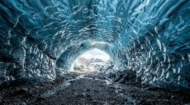
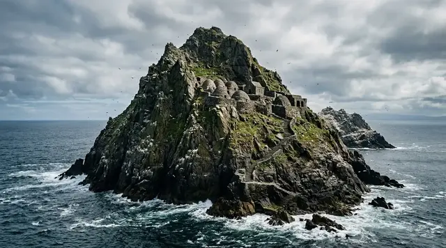
AI illustration
 Edited by
 At Latvia's northwestern tip, a forested coast points into two waters. For almost half a century, reaching it meant entering a Soviet military border zone: permits, checkpoints, patrols and a shoreline watched for escape. The restriction limited building and outside traffic, but it also narrowed the lives of the Livonian villages already rooted there. Slītere's quiet is therefore real, complicated and never evidence that nobody belonged.
The national park now protects an unusual archive of Baltic Sea history: a 30–50-metre ancient shoreline, long dry dune ridges separated by wet hollows, broadleaf forest, raised bog, grey dunes and more than ten thousand hectares of coastal water. Cape Kolka is the famous punctuation mark, yet the fuller journey runs between Šlītere lighthouse, Pēterezers, Mazirbe and the Liv Coast villages. This dossier treats the park as protected nature and inhabited cultural space, not as an abandoned Soviet curiosity.
The coast that became a border
After the Soviet occupation of Latvia, the northern Kurzeme coast became a controlled western edge of the USSR. Kolka had a border-guard post and a Baltic Fleet observation point; fencing, patrols and permission systems governed access to the beach and sea. The University of Latvia Livonian Institute records that Soviet sailors and border guards occupied separate compounds in the village, while the lighthouse estate was folded into military surveillance. The last Soviet forces and border guards left in September 1992.
That closure is often turned into an easy tourism story: the Iron Curtain kept people out, so nature flourished. The ecology did benefit in places from low development and long forest continuity, but the sentence is incomplete unless it names who paid. Fishing, travel, boat ownership and ordinary contact with the sea were restricted. Families left, village services contracted and a small indigenous language community endured another layer of pressure. A quiet coast can be both biologically rich and historically wounded.
Military traces remain part of the landscape, but they are not invitations to trespass. Structures may be unstable, contaminated, privately owned or still within controlled land. Visit interpreted sites and official museums instead of entering bunkers, towers or fenced compounds. Irbene's radio astronomy centre, outside the park to the southwest, is the responsible place to encounter a former Soviet installation when official tours are available. Slītere itself deserves attention beyond rust and concrete.
The forest did not choose the border, and the villages were never empty space.
 AI illustration
A shoreline older than the Iron Curtain
Slītere's protected history began in 1923, not with the collapse of the Soviet Union. An 1,100-hectare natural monument was created around the Blue Hills, later becoming a reserve and, in 2000, a national park. Current official material gives 16,360 hectares of land and 10,130 hectares of marine water under the park framework. The law divides the territory into strict, regulated, nature-reserve, landscape-protection and neutral zones; a road on the map does not mean the forest beside it is open for wandering.
The Blue Hills are the old edge of the Baltic Ice Lake, a wooded escarpment rising roughly 30 to 50 metres above the coastal plain. Beneath them, later stages of the sea left parallel ridges known locally as kangari. Between those dry, forested ribbons lie vigas: narrow waterlogged hollows, fens and swampy strips. Walk across the pattern and the ground alternates between pine roots, wet sedge, broadleaf shade and peat. Slītere is an open-air history of shorelines whose water has retreated.
This topography explains the park's compressed biodiversity. Lime-rich seepage, old broadleaf trees, decaying wood, dry dune pine forest, wet forest, bog and sea sit close enough to exchange species while remaining distinct habitats. Fallen trunks and hollow trees are not neglect; they are shelter, fungal substrate and insect habitat. The most respectful photograph may require accepting a branch across the view instead of moving it for a cleaner frame.
At Slītere, a forest walk crosses several former seas without ever leaving the trees.
Līvõd rānda is present tense
The chain of settlements from the Irbe side to Kolka is known as the Liv Coast, Līvõd rānda. Latvian and Livonian names coexist: Mazirbe is Irē, Kolka is Kūolka, Košrags is Kuoštrõg. The names are not decorative folklore. They encode waterways, fields, dunes, homesteads and the memory of a Finnic-speaking indigenous people whose culture shaped fishing, seafaring and settlement on this shore.
Mazirbe became a Livonian civic and cultural centre between the world wars. The Livonian Union began active work there in 1923, and the Livonian Community House opened in 1939. Soviet border policy, deportation, war, emigration and language shift reduced the community, but the correct tense is survival and revival, not disappearance. In the 2025–2026 academic year, the University of Latvia Livonian Institute reported 35 participants and eight teachers in a state-supported Livonian language and culture programme.
A responsible visit buys smoked fish, bread, accommodation or guiding from current residents without turning houses into museum exhibits. Use the bilingual place names when they are offered, ask before photographing people or private yards, and recognise that a building that appears unused may be a family property, seasonal home or cultural site. The coast's small population does not make every path public. Heritage remains alive when visitors leave agency—and income—with the people carrying it.
A language with learners, teachers and new work is not a relic, however quiet its coast may sound.
Cape Kolka: a meeting, not a line
At Cape Kolka, the open Baltic and the Gulf of Riga meet around the end of the Irbe Strait. On some days the boundary is visible as crossing wave trains, streaks of foam or water of slightly different colour. On others it is almost entirely imagined. The cape is not a fixed needle on a map: waves and current move sand along both sides, rebuilding the point after storms and erasing earlier footprints.
Local records show how quickly that geometry changes. After 2000, severe storms cut into the Gulf side and washed away about three hectares before a broader pale beach later accumulated again. The working Kolka lighthouse does not stand on the tourist beach; it is roughly six kilometres offshore on an artificial island built between 1872 and 1875 at the end of a shallow bank. When it was first lit in June 1875 the island was five kilometres out. The extra kilometre is the sand bank's own work, and a useful measure of how far the underwater cape continues beyond the beach.
Do not wade outward to make the meeting point more dramatic. Cross-currents, cold water, surf and shifting depth can become dangerous close to a shore that looks gentle. The Cape Kolka visitor centre is open year-round in some form and maintains toilets, parking and seasonal services, but natural access is not a promise of rescue or lifeguarding. Read conditions from land, keep children and dogs controlled, and leave storm days to the sea.
The map ends at Kolka, but the cape continues underwater for kilometres.
The bottleneck above the cape
Kolka's shape also works in the air. Migrating land birds moving north in spring concentrate at the cape before crossing open water, while autumn brings sea birds along the coast. Latvia's Nature Conservation Agency describes the spring movement as a grand concentration, and its Slītere bird reference now summarises four decades of records for 270 species. The attraction is not one guaranteed flock but the way weather, wind and geography briefly gather journeys from several countries.
A calm early morning can produce calls long before identification: cranes beyond the trees, terns along the water, passerines dropping into pines. Strong headwinds may hold birds back; a following wind can carry them over before casual visitors arrive. That uncertainty is part of the place. A birding trip should be built around patience, a telescope or binoculars and current local knowledge, not playback, drones or pressure to report a rarity.
Keep distance from roosts and feeding lines, especially on the narrow cape where every person occupies a large share of the usable beach. Dogs should remain controlled under current rules. If experts or rangers redirect access, the detour is the experience—not an obstacle to it. The park exists so that migration can continue without every bird spending energy reacting to observers.
At the cape, silence is sometimes the space a bird needs before committing to open water.
 AI illustration
The dunes are cultural habitats
The open grey dunes near Kolka can look self-made, but many survived through human use. Liv Coast residents grazed animals, dried fishing nets and stored boats on sandy ground, suppressing shrubs and young trees. When those practices declined, parts of the open habitat began turning into scrub and forest. Conservation here is not simply leaving nature alone; it can mean carefully restoring an older relationship between work and land.
In February 2025, the Nature Conservation Agency began grey-dune restoration beside the Cape Kolka Pine Trail parking area and bird tower, reporting the work the following month. The agency describes grey dunes as among Europe's most threatened habitats and rare in Latvia, with lichens, mosses, low herbs and dwarf shrubs occupying only a narrow coastal strip: about 2,326 hectares in the whole country and 89 hectares inside Slītere. Cutting encroaching growth may look harsh for a season, yet it protects the low, light-demanding community that gives the habitat its name.
Visitors can help by treating the open ground as alive rather than blank sand. Use the established trail and beach access, do not drive or park on vegetation, and avoid arranging lichens, driftwood or stones for photographs. A footprint in loose beach sand is temporary; a tyre or repeated shortcut through a lichen mat can persist. The same restraint applies to fire: current wildfire restrictions overrule any general assumption about outdoor cooking.
Some of Slītere's wildest-looking ground is the memory of careful human use.
Three walks, three different permissions
The Šlītere Nature Trail begins near the lighthouse and descends the ancient escarpment into species-rich forest and wet ground. It lies in a more sensitive zone and has traditionally required a park guide; infrastructure has also closed temporarily for repair. Official events used the trail again in 2025, but that is not proof of unrestricted everyday access. Contact the Slītere Nature Centre before planning it, and expect a guided, educational visit rather than a self-directed shortcut.
Pēterezers offers a different cross-section: a roughly 3.5-kilometre route over wooded ridges and wet hollows around the lakes. Roots, narrow boards, insects and standing water make it a real forest walk, not a paved promenade. Cape Kolka's Pine Trail is shorter—about 1.2 kilometres—and introduces wind-shaped old pines, grey and white dunes and the beach. Both still require a live check for storm damage, forestry work, restoration or seasonal notices.
The Slītere lighthouse and Nature Centre provide the best first conversation. Current official information lists indoor educational activity from 1 May to 15 October, with walks and outreach offered on specified weekdays year-round; group programmes require advance registration. The centre is wheelchair accessible and its educational entry is listed as free, but individual lighthouse access, seasonal staffing and special events can follow different arrangements. Confirm rather than extrapolate.
A marked trail is not a single promise; in Slītere, each route belongs to a different habitat and rule.
The three-hour bus and the long margin
Kolka is reachable without a car, but the timetable should shape the trip rather than sit beneath it. The current 1188 journey planner lists direct or through regional services from Riga on routes 7946 and 7950, typically taking just over three hours for about 156 kilometres. Sample listings showed several outward departures but far fewer useful returns. Seasonal restructures have affected the Talsi–Kolka network, so a screenshot from a previous month is not a ticket home.
For one night, the bus becomes an advantage: arrive, walk the village and cape after day traffic leaves, then continue only when the confirmed return allows. For multiple villages, a bicycle can work in stable weather, but distances, wind, unlit roads and limited supplies are substantial. Carry repair basics and lights, and do not assume every guesthouse, café or shop opens outside midsummer. A taxi rescue from the far coast can cost more than the entire bus journey.
Driving adds flexibility but not permission. Use official parking, keep sandy access clear for residents and emergency vehicles, and never turn a forest verge into a campsite. The Cape Kolka centre publishes seasonal parking charges and permits paid overnighting in a vehicle within its managed lot; that does not legalise sleeping in other car parks or dunes. Registered village accommodation distributes money locally and turns a hurried cape photograph into a coast understood over time.
On the Liv Coast, the last bus is not a detail—it is the edge of the day's map.
What popular coverage gets wrong about Slītere
The shorthand that circulates in listicles is tidy: the Iron Curtain sealed this coast, nature flourished in the vacuum, and when the soldiers left in 1992 Latvia inherited an accidental wilderness scattered with photogenic Soviet ruins. Each clause needs correcting, and the sources cited in this dossier do the work.
Protection did not begin with the border. The official record has an 1,100-hectare natural monument created around the Blue Hills in 1923, decades before the occupation, growing into a reserve and then the national park of 2000. The closed years did leave low development and long forest continuity, but the University of Latvia Livonian Institute's account of Kolka shows what the same closure cost: sailors and border guards in separate compounds in the village, the lighthouse folded into military surveillance, fishing and ordinary contact with the sea restricted, families leaving. A quiet coast can be biologically rich and historically wounded at the same time.
The other error is the past tense applied to the Livonians. Casual summaries describe a vanished people; the Livonian Institute reported 35 participants and eight teachers in a state-supported Livonian language and culture programme in the 2025–2026 academic year, and Mazirbe's Community House of 1939 belongs to a living civic movement rather than a museum. Coverage that reduces Slītere to rust and concrete mistakes both the age of its protection and the tense of its culture.
Hiddencorners position
Read Slītere as a living coast where geology, conservation and Livonian culture overlap. Begin at the Nature Centre or a village institution, use current signed routes, spend with residents and let access restrictions stand. Do not market Soviet exclusion as an ecological gift without naming its human cost, and do not make military ruins the main story of a park whose oldest shorelines predate every border.
Why the Silence Index is 78
Away from Cape Kolka's car park and the midsummer coast road, Slītere contains large forests, bogs, wet hollows and sparsely settled shore. The topography absorbs sightlines, public transport limits casual access, and an early Pēterezers walk or shoulder-season village stay can be genuinely quiet.
Cape Kolka is a national destination, migration hotspot and coach stop. Summer weekends, festivals and good bird weather concentrate people on a narrow point, while the road connects every village. Silence is uneven and seasonal, not an entitlement to empty communities.
Corner Codex — D-029
- Place
- Slītere National Park, Latvia
- Coordinates
- Approx. 57.7565°N, 22.6000°E (Cape Kolka visitor area)
- Getting there
- Regional bus from Riga to Kolka on current routes such as 7946/7950, or road via Talsi/Roja or Ventspils; village-to-village cycling requires wind, distance and supply planning
- Rules
- Follow the park's functional zoning and current Nature Conservation Agency notices; use designated routes, protect dunes and birds, obtain a guide where required, and respect private village land
- Season
- Late May–June and September balance migration, services and fewer visitors; midsummer is busiest, while winter brings sparse transport, darkness, ice and storm exposure
- Silence Index
- 78 / 100
- Still open
- How conservation can protect a coast without repeating the border's habit of treating residents as secondary to the landscape
Silence Index
A legacy editorial rating based on desk research. It is not an acoustic measurement or a safety rating.
Earlier and later dossiers used different fourth inputs. Individual input scores were not recorded, so these totals cannot be independently reproduced or used for precise comparisons between places.
The Traveler's Panel · checked
Changing information. Prices, permits, seasons and road access change, sometimes at short notice. Everything here is a starting point for your own confirmation — not a quote, and not a guarantee. Verify with the operator and the relevant official body before you book.
| Protected area | Official park material lists 16,360 ha of land plus 10,130 ha of marine water; the current park law also defines multiple functional zones |
| Landscape key | 30–50 m ancient Baltic Ice Lake shore, kangari dune ridges, wet vigas, bog, forest, grey dunes and sea |
| Bird record | 270 species covered by four decades of Slītere records; spring land-bird bottleneck and autumn seabird passage |
| Public transport | Riga–Kolka listings are roughly 3 h 7 min to 3 h 17 min; departures and returns vary by date and season |
| First contact | Slītere National Park Nature Centre at Šlītere lighthouse; group programmes require advance registration |
| Main hazards | Cold cross-currents at Cape Kolka, ticks, wildfire restrictions, storm-felled trees, sparse services and unstable military remnants |
| Cultural rule | Līvõd rānda is a living Livonian homeland; homes, yards, names and community buildings are not abandoned props |
Getting there
- Check the Nature Conservation Agency park page, trail notices and 1188 timetable for the exact travel date.
- Reserve a registered village room before relying on a late arrival or early departure.
- Use Kolka for the cape and Pine Trail, then add Mazirbe or Šlītere only when transport and opening arrangements are confirmed.
- Contact the Nature Centre in advance for the Šlītere trail, lighthouse education or a specialist walk.
- Carry enough food, water, lights and weather protection to miss a café without creating an emergency.
- At Cape Kolka, stay on land, watch birds from distance and leave any restoration or closed area untouched.
Indicative costs — verify before booking
| Riga–Kolka regional bus | Sample current 1188 listings showed €7.80 each way; fare and service date must be reconfirmed |
| Cape Kolka managed parking | Published 2026 page lists seasonal hourly/day rates and €10 overnight vehicle use; verify on arrival |
| Nature Centre education | Official page lists no admission charge; programmes and individual lighthouse access still require a live check |
| Guide or village programme | Provider, language, group size and season dependent; book directly and pay the stated local rate |
| Verify | Prices and availability change. Confirm current details directly before booking. |
What to pack
- Windproof and waterproof layers for an exposed two-sea cape
- Closed shoes, tick protection and a tick-removal tool for forest and dune grass
- Binoculars; leave drones and playback out of migration areas
- Offline map, charged phone, power bank and bus screenshots for the same date
- Water and food for a full interval between village services
- Bicycle lights, repair kit and reflective layer if travelling between villages
Where to stay
Choose a registered guesthouse, campsite or homestay in Kolka, Mazirbe, Košrags or another Liv Coast village and confirm meals before arrival. One or two nights support residents and reveal the coast after day traffic. Do not treat a quiet dune car park, forest verge or private yard as informal camping; use a designated site or the explicitly managed overnight option at Cape Kolka.
Safety & responsible travel
- Do not swim or wade at Cape Kolka when cross-current, surf, cold water or local warnings make the point unsafe.
- Never enter derelict military structures, fenced compounds or unmarked land.
- Check trail status after storms and follow guide-only or closure instructions without detouring around them.
- Wildfire warnings override normal fire permissions; use only authorised sites when conditions allow.
- Control dogs and keep distance from feeding, resting and migrating birds.
- Carry an overnight margin when relying on sparse regional transport.
Nearby, and quieter
With official booking, the Ventspils International Radio Astronomy Centre at Irbene interprets a former Soviet military complex without unsafe exploration. Dundaga adds castle and service history inland. West of the park, the coast toward Oviši and Miķeļtornis continues the Livonian place-name landscape; east toward Roja, services increase but the same cold-water and dune ethics remain.
Where it is
Latvia · 57.7565°N 22.6000°E · Open in Google Maps · OpenStreetMap
Key locations
- Kolkasrags — the cape where the open Baltic meets the Gulf of Riga, and the visitor centre
57.7589°N 22.6047°E - Kolka lighthouse — the working light on its artificial island, now about 6 km offshore
57.8024°N 22.6340°E - Šlītere lighthouse — top of the Blue Hills escarpment, where the nature trail starts
57.6283°N 22.2889°E - Lielais Pēterezers — the lake among the kangari ridges and wet vigas hollows
57.6539°N 22.2603°E - Mazirbe — the Livonian civic centre, Irē; the Community House opened here in 1939
57.6831°N 22.3172°E - Košrags — one of the inhabited Liv Coast villages, Kuoštrõg in Livonian
57.6972°N 22.3597°E - Irbene — the former Soviet radio-astronomy centre outside the park, visited on official tours
57.5614°N 21.8606°E
Coordinates are for orientation and are accurate to roughly the width of the feature named, not to a doorway. Several of these points are inside protected areas or need a permit, a guide or a boat — read the access notes above before you plan a route to any of them.
Sources & further reading — checked
- Nature Conservation Agency of Latvia — Slītere National Park. Used for park area, 1923/2000 protection history, ancient shoreline, kangari-viga landscape, habitats and bird-migration context.
- Latvian law — Slītere National Park Law. Used for the park's purpose, functional zones, administration and the principle that access differs by zone.
- Nature Conservation Agency — Slītere National Park Nature Centre. Used for current 2025–2026 education periods, advance registration, accessibility, contact and admission information.
- Nature Conservation Agency — Slītere nature trail notice. Used to document infrastructure closure history and official alternative trails; current status must still be reconfirmed.
- Nature Conservation Agency — 2025 grey-dune restoration. Used for the Pine Trail restoration site, habitat rarity and the cultural practices that historically kept grey dunes open.
- Nature Conservation Agency — birdwatching in Slītere (2019 guide). The agency's catalogue entry for its 2019 Slītere birdwatching guide, the origin of the 270-species figure. The catalogue page itself is metadata and a download link; we could not open the PDF, and the species count therefore rests on the entry rather than on the document.
- Nature Conservation Agency — Birds at Cape Kolka. Used for spring bottleneck, autumn seabird passage and sustainable birdwatching context.
- University of Latvia Livonian Institute — Kolka lighthouse history. Used for Soviet border-guard and naval presence, local testimony, the September 1992 departure and Livonian lighthouse lives.
- University of Latvia Livonian Institute — 2026 events. Used for current Livonian language education, 35 learners, eight teachers and ongoing revitalisation work.
- University of Latvia Livonian Institute — Livonian place-name catalogue. Used for Livonian village names and Mazirbe/Irē's documented cultural history.
- Cape Kolka Visitor Centre — services. Used for current visitor services, year-round access pattern, parking rates and managed overnight vehicle option.
- Cape Kolka — coastal processes. Used for documented storm erosion and the cape's changing sand geometry.
- 1188 Latvia transport — Riga to Kolka. Used for current route numbers, sample departures, journey duration, distance and fare; exact-day results must be rechecked.
- 1188 Latvia transport — Kolka to Riga. Used to show that return choices can be much thinner than outward service.
- Lauku ceļotājs — Slītere National Park routes. Pēterezers at 3.5 km, the Cape Kolka Pine Trail at 1.2 km, and the Šlītere Nature Trail listed as accessible only with a guide.
- Nature Conservation Agency — Slīteres nacionālais parks (Latvian page). The Latvian-language official figures of 16,360 ha of land and 10,130 ha of sea, and the 1923-to-2000 protection chronology — used because the agency's English page gives 16,365 ha for the same territory.
- Lauku ceļotājs — The Kolka lighthouse. The working Kolka lighthouse standing on an artificial island created between 1872 and 1875, six kilometres offshore today at the end of the sand bank, against five kilometres when it was built; first lit June 1875, current metal tower in service from 1 July 1884.
- Lauku ceļotājs — The Slītere Lighthouse. The Šlītere lighthouse as the home of the Slītere Nature Education Centre since it stopped serving as a navigation light in 2000, with a viewing floor 102 m above sea level.
Official and scientific bodies are the authority for safety, regulatory and scientific claims. Commercial operators are used only for practical detail such as tour length, meeting points and indicative pricing — never for a safety or scientific statement.
How this was made
Desk research. Compiled from official bodies, scientific and conservation sources, established journalism and licensed operators. Not based on a personal visit.
Editor’s method note — what we checked, corrected and could not verify
- Desk research only. Nobody from this publication has been to Slītere or Cape Kolka. The dossier is built from Latvia's Nature Conservation Agency, the national park law, the University of Latvia Livonian Institute, the Cape Kolka visitor centre, the Latvian rural tourism association and the 1188 journey planner.
- All fifteen original sources still load. None was deleted. Four were added during this audit. Two source descriptions were rewritten because the page did not say quite what we claimed.
- We corrected a date in the body. Grey-dune restoration beside the Cape Kolka Pine Trail car park began in February 2025, not March; the agency's news item is dated 19 March 2025 and describes work that had already started the previous month. The same page gives figures the article did not carry: grey dunes cover about 2,326 hectares in the whole of Latvia and 89 hectares within Slītere.
- The park's own agency gives two different areas in two languages. The Latvian page says 16,360 hectares of land; the English page says 16,365. Both give 10,130 hectares of sea. We keep the Latvian figure, which is the one the article was written from, and cite both pages.
- The trail lengths also disagree between official sources. The Nature Conservation Agency's own 2023 closure notice describes Pēterezers as 3.4 km and the Cape Kolka Pine Trail as 12 km; Lauku ceļotājs gives 3.5 km and 1.2 km. We follow Lauku ceļotājs, as the article does, because 12 km is almost certainly a transcription of 1.2 km, but we are naming the conflict rather than hiding it.
- The Soviet border-zone history checks out as stated. The University of Latvia Livonian Institute records a border-guard post in Kolka village and a Baltic Fleet technical observation point at the cape, the lighthouse keeper's house taken over as barracks, and the departure of the Soviet army and border guards in September 1992. We have not softened the point the article makes about who paid for that quiet.
- We could not establish whether the Šlītere lighthouse is currently open to individual visitors. The agency's own page describes indoor sessions between 1 May and 15 October with advance registration for groups and lists no admission charge; a regional tourism site advertises daily summer hours of 10:00 to 18:00 without naming a year. The article's cautious phrasing — contact the Nature Centre and confirm rather than extrapolate — stands.
- Things we could not verify: whether the Šlītere Nature Trail has reopened since its 2023 closure for a deteriorating 122-metre boardwalk section, which the agency has never publicly rescinded; whether the lighthouse is open to individuals in 2026; the 270-species bird figure, which sits behind a PDF we could not open; the current 2026 status of the Riga–Kolka bus network after seasonal restructuring, since 1188 returns only same-day results; the current price of any guided park programme; how much of the three hectares of Gulf-side land lost to storms after 2000 has since rebuilt, which the visitor centre illustrates photographically without quantifying; and whether the Cape Kolka parking rates we recorded apply for the whole of 2026.
- Coordinates for Kolkasrags, the Šlītere lighthouse, both Pēterezers lakes, Mazirbe, Košrags and Irbene are from GeoNames. The offshore Kolka lighthouse is pinned at 57.8024, 22.6340, where GeoNames' Domes Ness Lighthouse and OpenStreetMap agree; that is about 5 km out, against the roughly 6 km given in the body, and the difference is the measurement's starting point rather than a contradiction.
AI is used to draft this text, and a human checks it. Tony Hall is responsible for editorial verification against the reference list. Our standard is to distinguish documented facts, disputed accounts and claims we could not verify. Errors can remain; readers can report them through the corrections page. The illustrations are AI-created and labelled as such — no photograph on this site is presented as a record of a real place. Full disclosure · Editorial policy.
Access details change — recheck before you travel. Found an error? Tell us — corrections are dated and shown in place.