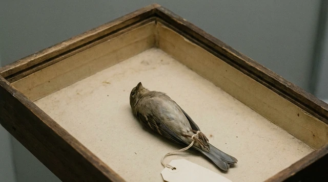
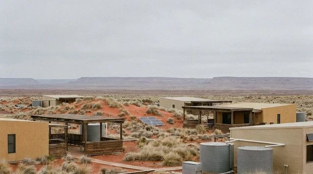
AI illustration
 Edited by
 The Cornish name for St Michael's Mount is Karrek Loos y'n Koos — the grey rock in the wood. It is not poetry. Mount's Bay holds a submerged forest that surfaces at the lowest tides, and the name is a memory of standing among trees on ground that is now under the sea. The island has been watching the water come in for longer than anyone has been charging admission.
Who actually owns it
This is a desk-researched dossier; nobody from this publication has crossed the causeway. It is built from Historic England's statutory listings, the National Trust, the Mount's own operator, the RNLI, peer-reviewed geology and sea-level science, and established news.
The ownership is unusual and it is routinely reported wrong.
In 1954 Francis St Aubyn, third Lord St Levan, gave most of the island to the National Trust together with a substantial endowment for its upkeep — confirmed independently in Historic England's register entry. But the family retained a 999-year lease to live in the castle, and they run the entire visitor business: the castle, the harbour, the boats, the gardens, the shops and the cafés.
So "owned by the National Trust" is true of the freehold and misleading about everything a visitor actually encounters. The Trust maintains the island's physical infrastructure. The family sells you the ticket.
One wording detail worth noting, because the two parties do not describe it identically: the Mount's own site says the family run the visitor business under licence from the National Trust, while the family's estate company describes the 999-year lease as covering residence. Lease and licence may be two separate instruments, and neither party publishes the terms or any revenue split.
James and Mary St Aubyn, Lord and Lady St Levan, live in the castle with their children. About thirty people live on the island year-round, and at least one person in each household has a role in looking after the Mount — residence is tied to employment. The family's own estate company says "about twelve families," which sits a little awkwardly against thirty people; both figures are official.
 AI illustration
The membership question, answered precisely
This is the single most useful thing this dossier can tell a British reader, because both common versions are wrong.
National Trust members do not pay for the castle or the garden. But:
They must still book a ticket. The daily allocation is split evenly between paying visitors and Trust members, and on busy days one allocation sells out before the other — so a member can be turned away on a day when tickets are still available, and vice versa. Members pay for parking. Members pay the boat fare, £3.20 each way, exactly as everyone else does, because the boats and the car park are not National Trust services. And the Mount is exempt from all National Trust schemes, vouchers and promotions, including the Explorer Pass.
The garden is free to members not because the Trust owns it but because the St Aubyn family allow it.
The island is open Sunday to Friday and closed on Saturdays, 09:45 to 17:00, with last entry onto the island at 15:45.
The causeway is not medieval
It is open around four hours a day, depending on tides and weather, and takes about fifteen minutes to walk. The Mount does not publish it as "X hours either side of low water," and nor should anyone else — the figure is a daily total, and it moves.
The official warning is worth quoting rather than paraphrasing: crossing outside the suggested times "can be hazardous. When the causeway is submerged, it can limit visibility, the path is uneven, there can be strong currents and the sea rises quickly." Swimming or wading across is not advised.
And the granite underfoot is largely new. Restoration began in 2007, was accelerated by the February 2014 storms, and the final stone was laid in 2016. It took roughly 218,000 man hours, 3,511 tonnes of concrete, four miles of marine-grade stainless steel reinforcement bar and 4,560 pins to secure the kerbstones. Original stones were recovered from the beach and relaid on top. What you walk on is a twenty-first-century engineered structure wearing a medieval surface.
The tide, honestly
We could find no record of any death on the causeway or from tidal cut-off at the Mount — no news report, no inquest coverage, no RNLI or Coastguard release. That is an absence of published evidence rather than proof of a clean record, and we are stating it that way.
What is documented is the mechanism. On 12 July 2026 nine people were cut off by the tide at Chapel Rock, on Marazion beach — a Mount ferry took them off before the Penlee inshore lifeboat arrived. Note the location: the sands beside the causeway, not the paved crossing itself. That distinction matters, because it is where people actually get caught.
The national picture puts it in scale. Over the past decade the RNLI recorded 7,971 incidents involving people cut off by the tide across the UK and Ireland, with 452 lives saved. Around ten million people say they have been cut off or nearly cut off at some point; 60% of those were surprised by the tide's speed; only about a quarter can adequately read a tide table. Research with Bangor University found the common error: people expect the tide to come straight in towards the shore, slowly, rather than flowing laterally along channels and around sandbanks — which is exactly how you end up on the wrong side of water you did not see arrive.
When neither the causeway nor the boat works
The standard advice is walk at low tide, take the boat at high tide. It is not reliable.
The ferries run only between 15 March and 31 October. Outside that, access is on foot via the causeway, with an amphicraft in winter opening. Strong winds or rough seas can close the island outright, normally with 24 hours' notice.
And on Sunday 7 June 2026, stormy seas filled the channel at Chapel Rock with sand. Boats ran only until 12:30; the causeway did not open until 14:45. For roughly two hours there was no access to the island at all. Affected tickets were honoured to 12 June.
The forest under the bay
The name is the best thing about this place.
Karrek Loos y'n Koos — the grey rock in the wood — records a landscape in which the Mount stood among trees. The submerged forest of Mount's Bay is still there, and it surfaces occasionally: it was exposed on 12 March 2024, at the year's lowest tide of 0.22 m at Newlyn, only the fourth sighting in a decade at Chyandour beach.
Radiocarbon dates from the bay and its margins run from 12,070 ± 80 BP at 32 metres below datum, through 4,278 ± 50 BP at Gulval and 3,656 ± 150 BP at Newlyn, to 3,050 ± 65 BP at Ponsandane. The popular figure of a 4,000-to-6,000-year-old forest is broadly consistent with that.
But the caveat in the underlying paper is important and almost never carried over: dates from Holocene palaeosols below datum "do not indicate when the soil was submerged, merely that the soil had not been inundated at the date given." They are minimum ages for dry land, not drowning dates. Anyone writing that the forest sank in 4000 BC is overstating what the carbon says.
The rock itself is a granite cupola — megacrystic K-feldspar granite of the Cornubian Batholith, sixty metres high, carrying greisen-bordered mineralised veins with cassiterite, wolframite, chalcopyrite and arsenopyrite in the wave-cut platform. The Mount is literally made of tin-bearing ground.
Which connects to a live research story. Historic England records Bronze and Iron Age occupation and the Mount's possible identification with Ictis, the tin-trading island of classical sources. In May 2025 Durham University archaeologists published chemical evidence in Antiquity that tin ingots from shipwrecks off Israel from around 1300 BC, and off Mediterranean France from around 600 BC, originated in south-west Britain — and the team is now excavating on the Mount itself, which has long been thought to be the island Pytheas described. A two-century argument may be settled here.
There is also a hoard. In 2009 the assistant head gardener found a 48-piece late Bronze Age assemblage in a rock cavity on the garden slopes, authenticated by the British Museum, including a buckle with no known parallel in Great Britain.
 AI illustration
The history, with the tradition labelled
The Mount was granted to the abbey of Mont St Michel in Normandy in the late eleventh century, and a church was built here by Abbot Bernard between 1135 and 1144. Note the direction: this was a grant of the Cornish site to the Norman house, not a foundation by it and not a twinning. Mont-Saint-Michel is the parent, not the sibling.
The church was significantly reconstructed after earthquake damage in 1275 — a claim that carries statutory weight, since it appears in the Grade I listing rather than only in folklore. Most of the present fabric is fourteenth century; the bells date from 1385 and 1408.
Dissolution came in 1548. Sir Francis Basset fortified it for the Royalists; the garrison capitulated in 1646, and Captain John St Aubyn — nominated by Parliament — bought the Mount from Basset's son in 1659. Piers St Aubyn's extension of 1873–78 added five floors at the south-east corner. Historic England's assessment is unusually direct: "St Michael's Mount is unique, there is no other building in England which has such a remarkable situation."
And the story everyone repeats — that St Michael appeared to fishermen in 495 — should be labelled as what it is. The Mount's own site frames it as "tales tell"; Marazion Town Council says "reportedly." Neither cites a contemporary document and neither statutory listing mentions it. It is a tradition recorded long after the fact, not a date.
Why the Silence Index is 40
This is among the lowest scores in the archive. Access friction is minimal — a Cornish A-road, a car park at Marazion, a fifteen-minute walk. Footfall is 403,711 a year onto a nine-hectare garden and a small castle. The acoustic floor is poor in season: the causeway is a queue and the harbour is a working visitor site. What lifts it off the bottom is the tide, which imposes a genuine rhythm no amount of management can override, and the fact that when the island closes for weather it closes completely. It is one of the few crowded places in Britain that regularly tells everybody to go away.
Storm Goretti, and the gardeners on ropes
On 8–9 January 2026 the Met Office issued a red warning for wind covering the Isles of Scilly and much of Cornwall, with gusts of 100 mph or more forecast in the exposed west. Storm Goretti felled 119 trees on the Mount, with widespread damage to camellias, hydrangeas and rhododendrons. The head gardener's account of the count is worth having: "On Friday morning, we assessed it quickly and noticed around 70–80 trees were down, but it wasn't until later on Monday when we made the area safe that the count escalated to 119." Replanting is being deliberately delayed.
The garden that took the hit is a genuine oddity. The rock acts as a gigantic radiator, absorbing heat by day and releasing it at night, and the granite walls do the same — producing a microclimate in which frosts are rare and aloes, agave, aeoniums and lampranthus grow on a Cornish cliff. It is Grade II registered, about nine hectares, with terraces built between 1876 and 1908.
And the maintenance is genuinely extraordinary, confirmed independently by both the Trust and the operator: the gardeners abseil. They rope up several times a year, working roughly fifty metres above the sea, removing invasive Hottentot fig that damages the stonework, planting aloes and aeoniums into crevices, and strimming. There is a five-week abseiling refresher each October.
The two organisations' accounts differ on frequency and name different head gardeners, which is a small illustration of the larger point: this is one island run by two bodies that do not always publish the same thing.
The bay is still rising
Three miles from the Mount, at Newlyn, sits the tide gauge that defines sea level for the whole of Britain. Ordnance Datum Newlyn was fixed from fifteen-minute visual observations taken continuously between 1915 and 1921, and the record has run since May 1915.
It measures a mean sea-level rise of 1.8 mm a year across the century — about 180 millimetres in total — rising to 3.8 mm a year over 1993 to 2014.
That is the closing thought. The bay that drowned a forest is still rising, and it is being measured from the beach next door. The National Trust's own hazard mapping projects the share of its sites facing the highest hazard level going from 5% to 17% by 2060 under a worst-case scenario. The grey rock in the wood has already watched the wood go under. It is not finished watching.
Corner Codex — D-012
- Place
- Mount's Bay, off Marazion, west Cornwall
- Coordinates
- 50.117°N, 5.478°W
- Cornish name
- Karrek Loos y'n Koos — the grey rock in the wood
- Ownership
- National Trust freehold since 1954; the St Aubyn family hold a 999-year lease
- Residents
- About 30 people, in roughly a dozen households
- Causeway
- Open about four hours a day. Rebuilt 2007–2016 on 3,511 tonnes of concrete
- Visitors
- 403,711 in 2025
- Boats
- 15 March – 31 October only. £3.20 one way, including Trust members
- Storm Goretti
- 8–9 January 2026. 119 trees felled on the island
- Silence Index
- 40 / 100
Silence Index
A legacy editorial rating based on desk research. It is not an acoustic measurement or a safety rating.
Earlier and later dossiers used different fourth inputs. Individual input scores were not recorded, so these totals cannot be independently reproduced or used for precise comparisons between places.
The Traveler's Panel · checked
Changing information. Prices, permits, seasons and road access change, sometimes at short notice. Everything here is a starting point for your own confirmation — not a quote, and not a guarantee. Verify with the operator and the relevant official body before you book.
| Open | Sunday to Friday, 09:45–17:00. Closed Saturdays. Last island entry 15:45 |
| Causeway | About four hours a day, tide and weather depending. 15 minutes to walk |
| Ferries | 15 March – 31 October only. £3.20 adult one way, £1.60 under-16 |
| Castle & Garden | £32.00 advance / £37.00 on the day from 2 September 2026 |
| Trust members | Free entry, but must pre-book from a rationed allocation |
| Garden season | 1 May – 4 September 2026, Monday to Friday, 10:00–15:45 |
Getting there — Marazion → the Mount, on foot or by ferry
- Park at Marazion and walk the causeway when it is open — about fifteen minutes on granite setts. Check the crossing times before you set out, not after.
- When the causeway is covered, ferries run between 15 March and 31 October, about five minutes, landing at Chapel Rock, Gwelva or Top Tieb depending on the tide — a five to twenty minute walk from the island.
- Do not assume one or the other always works. On 7 June 2026 sand filled the Chapel Rock channel, boats stopped at 12:30 and the causeway did not open until 14:45 — two hours with no access at all.
- The island can close entirely for strong wind or rough seas, normally with 24 hours' notice.
- Book ahead whichever ticket you need. Trust members book from a separate allocation that can sell out independently of the paying one.
Indicative costs — verify before booking
| Castle & Garden | £32.00 advance / £37.00 on the day (adult), from 2 September 2026 |
| Castle only | £18.00 / £21.00 adult · £9.00 / £10.50 child 5–15 |
| Garden only | £14.00 / £16.00 adult · £7.00 / £8.00 child |
| Ferry | £3.20 adult each way · £1.60 under-16 — Trust members pay this too |
| Parking | Charged separately at Marazion. Trust members and Blue Badge holders pay |
| Under-5s | Free |
What to pack
- Footwear with grip. The causeway is wet granite and the climb to the castle is steep, uneven and cobbled.
- A waterproof — Mount's Bay makes its own weather and there is limited shelter.
- A tide table or the operator's crossing times, checked on the day.
- Cash or card for the ferry, which is not covered by any Trust membership.
- Patience in July and August: 400,000 visitors a year arrive through one causeway and one harbour.
Where to stay
Marazion faces the Mount across the sands and is the obvious base — hotels and B&Bs with a view that changes completely twice a day, which is the whole point of coming. Penzance, three miles west, has the rail terminus, the Scilly ferry and far more choice. Newlyn, just beyond it, is a working fishing port and holds the tide gauge that defines sea level for Britain. Staying overnight in Marazion means you can cross on the first opening of the causeway, which is the only time of day the island is quiet.
Safety & responsible travel
- Cross when the causeway is open and not otherwise. The operator warns of limited visibility, uneven footing, strong currents and fast-rising water, and swimming or wading across is not advised.
- Watch the sands at Chapel Rock rather than only the paved crossing. Nine people were cut off there in July 2026, and the RNLI records nearly 8,000 tidal cut-off incidents nationally in a decade.
- Remember that about thirty people live here and their homes are not part of the attraction.
- Keep off the garden terraces' cliff edges. Gardeners work those slopes on ropes fifty metres above the sea; there is a reason there is no path.
- If you are a Trust member, book properly rather than turning up on the card. The allocation is capped and split, and arriving without a ticket wastes a place someone else could have had.
Nearby, and quieter
Mont-Saint-Michel is the parent house across the Channel, and the comparison is instructive in both directions — same dedication, same tidal geometry, forty times the visitors. Closer to hand: Penzance and the Penlee gallery, Newlyn's harbour, and the Minack Theatre and Porthcurno further west. Chyandour beach occasionally exposes the submerged forest that gives the Mount its Cornish name, at the very lowest tides of the year.
Getting there, in order
- 1Marazion
- 2the Mount, on foot or by ferry
Each leg is a separate booking and a separate chance to be weathered out. Build spare days into the chain, not onto the end of it.
Where it is
St Michael's Mount, Marazion, Cornwall · 50.1170°N 5.4780°W · Open in Google Maps · OpenStreetMap
Key locations
- St Michael's Mount — the island end of the causeway: harbour, castle and the nine-hectare garden
50.1161°N 5.4778°W - Marazion — the mainland end: paid car park, and members pay for it too
50.1256°N 5.4750°W - Chapel Rock — where the causeway leaves the beach, and where nine people were cut off in July 2026
50.1225°N 5.4755°W - Newlyn tidal observatory — the gauge that has defined Ordnance Datum since 1915
50.1030°N 5.5428°W - Penlee Lifeboat Station — the RNLI station covering Mount's Bay
50.1039°N 5.5488°W - Chyandour — beach where the submerged forest surfaced at the lowest tide of 2024
50.1275°N 5.5225°W
Coordinates are for orientation and are accurate to roughly the width of the feature named, not to a doorway. Several of these points are inside protected areas or need a permit, a guide or a boat — read the access notes above before you plan a route to any of them.
Sources & further reading — checked
- Historic England — Registered Park and Garden list entry 1000654. Statutory confirmation of the 1954 transfer with endowment; the late-11th-century grant to the abbey of Mont St Michel and Abbot Bernard's church of 1135–44; the 1646 capitulation and John St Aubyn's purchase in 1659; the Grade II garden registration of about 9 ha; the eastern terraces built 1876–1908; and Bronze and Iron Age occupation with the possible identification as Ictis
- Historic England — Church of St Michael, list entry 1310728. That the church underwent significant reconstruction following earthquake damage in 1275, with most fabric 14th century, and bells of 1385 and 1408
- Historic England — list entry 1143795. The castle's development including Piers St Aubyn's extension of 1873–78, and the assessment that no other building in England has such a remarkable situation
- St Michael's Mount — Looking After the Mount. The 1954 gift with endowment; the division of responsibilities; the description of the family running the visitor business under licence; and approximately 30 residents with at least one person per household employed in looking after the Mount
- St Aubyn Estates — St Michael's Mount. The family's own statement of the 999-year lease to live in the castle, and the figure of about twelve families living permanently on the island
- St Michael's Mount — Visiting FAQs. That Trust members need no ticket payment but must book; that the daily allocation is split evenly between paying visitors and members and one can sell out before the other; that parking and boats are not National Trust services; and that the garden is free to members because the family allow it
- St Michael's Mount — Ticket prices. The 2026 summer and standard price schedules for castle, garden and combined tickets; and the exemption from all National Trust schemes, vouchers and promotions including the Explorer Pass
- National Trust — St Michael's Mount. Independent confirmation that members pay the one-way boat fee of £3.20 adult and £1.60 child, and that members and Blue Badge holders pay for parking
- St Michael's Mount — Causeway. That the causeway is open around four hours each day depending on tides and weather, takes about fifteen minutes to walk, and the verbatim hazard warning
- St Michael's Mount — The final stone is laid on the causeway. Restoration from 2007, accelerated by the February 2014 storms and completed in 2016, using about 218,000 man hours, 3,511 tonnes of concrete, four miles of stainless reinforcement bar and 4,560 kerbstone pins
- St Michael's Mount — Boating. Ferries operating 15 March to 31 October, the five-minute crossing, fares including for National Trust members, and the three tidal landing points
- St Michael's Mount — Public announcement, June 2026. That on 7 June 2026 sand filled the Chapel Rock channel, boats ran only to 12:30 and the causeway did not open until 14:45 — roughly two hours with no access to the island
- RNLI — Research reveals 10m people in danger of tidal cut off (April 2025). 7,971 tidal cut-off incidents across the UK and Ireland over a decade with 452 lives saved; that 60% of those cut off were surprised by the tide's speed; and that only about a quarter can adequately read a tide table
- Bangor University — Why do people frequently get cut off by the tide?. The RNLI collaboration published in Ocean and Society, and the finding that people expect the tide to come straight in slowly rather than flowing laterally along channels
- RNLI — Penlee RNLI double tasking (July 2026). Nine people cut off by the tide at Chapel Rock on Marazion beach on 12 July 2026, taken off by a Mount ferry before the inshore lifeboat arrived
- ALVA — 2025 visitor figures. 403,711 visits in 2025
- St Michael's Mount — Taking Stock After the Storm. 119 trees felled by Storm Goretti with damage to camellias, hydrangeas and rhododendrons, the head gardener's account of the escalating count, and the deliberate delay to replanting
- Met Office — Red warning for wind issued as Storm Goretti approaches (January 2026). The red wind warning of 8–9 January 2026 covering the Isles of Scilly and much of Cornwall, with gusts of 100 mph or more forecast in the exposed west
- St Michael's Mount — The Garden Terraces. The microclimate produced by the rock and walls acting as a radiator; the planting; the extreme weeding on the granite cliffs; and the five-week abseiling refresher each October
- National Trust — Our work at St Michael's Mount. Independent confirmation of the abseiling: gardeners roping up three times a year about 50 m above the sea to remove invasive Hottentot fig and plant into crevices
- Geological Conservation Review — St Michael's Mount (GCR 36). The 60 m granite cupola of megacrystic K-feldspar granite in the Cornubian Batholith, and the greisen-bordered mineralised veins carrying cassiterite, wolframite, chalcopyrite and arsenopyrite
- French (1999) — Geoscience in South-West England (Ussher Society). The radiocarbon series for Mount's Bay from 12,070 ± 80 BP at −32.0 m OD through Gulval, Newlyn and Ponsandane; and the critical caveat that dates from Holocene palaeosols below datum indicate only that the soil had not been inundated by that date
- ITV News West Country — Low tide reveals buried forest (March 2024). The Cornish name Karrek Loos y'n Koos; the peat beds dated to 4,000–6,000 years old; and the 12 March 2024 exposure at 0.22 m at Newlyn, the fourth sighting in a decade
- NERC Open Research Archive — A Century of Sea Level Measurements at Newlyn. Mean sea-level rise at Newlyn of 1.8 mm/yr across the century — about 180 mm — rising to 3.8 mm/yr over 1993–2014
- National Tidal and Sea Level Facility — The Newlyn Tidal Observatory. The record running from May 1915, and Ordnance Datum Newlyn fixed from continuous observations between 1915 and 1921
- Durham University — Bronze Age Britain traded tin with the Mediterranean (May 2025). Chemical evidence that tin ingots from wrecks off Israel (c.1300 BC) and Mediterranean France (c.600 BC) originated in south-west Britain, and the current excavation on St Michael's Mount as the probable Ictis
- St Michael's Mount — Bronze Age hoard. The 2009 discovery of a 48-piece late Bronze Age hoard on the garden slopes, authenticated by the Royal Albert Memorial Museum and the British Museum, including a buckle with no known parallel in Great Britain
- St Michael's Mount — History and legends. The 495 tradition framed as 'tales tell', and the Benedictine possession and 1135 construction from the operator's own account
- Country Life — St Michael's Mount, Cornwall. That the 999-year lease covers running the visitor business including the harbour, gardens, shops and cafés, and that James and Mary St Aubyn currently live in the castle
- BBC News — National Trust climate hazard mapping. The projection that the share of Trust sites facing the highest hazard level rises from 5% to 17% by 2060 under a worst-case scenario
Official and scientific bodies are the authority for safety, regulatory and scientific claims. Commercial operators are used only for practical detail such as tour length, meeting points and indicative pricing — never for a safety or scientific statement.
How this was made
Desk research. Compiled from official bodies, scientific and conservation sources, established journalism and licensed operators. Not based on a personal visit.
Editor’s method note — what we checked, corrected and could not verify
- Desk research only. No one from this publication has crossed the causeway.
- The National Trust membership position is stated precisely because both common versions are wrong. Members get castle and garden free, but only against a capped, pre-booked, separately rationed allocation; they pay for parking and every boat crossing; and the Mount is exempt from all Trust schemes including the Explorer Pass.
- We could find no record of any death on the causeway or from tidal cut-off at the Mount. That is an absence of published evidence, not proof of a clean record, and we say so rather than implying the crossing is safe.
- The radiocarbon dates for the submerged forest are minimum ages for dry land, not drowning dates — the underlying paper is explicit, and the distinction is almost never carried over.
- Where the Mount and the National Trust publish different figures — abseiling frequency, the head gardener's name, garden terrace dates, and 'about 30 residents' against 'about twelve families' — we give both and attribute rather than choosing.
- Eight things we could not verify: the causeway's length, which no authoritative source publishes; any 'hours either side of low water' figure; site-specific rescue statistics for the Mount or Marazion; any death attributable to the crossing; how the Trust and family split revenue, which neither publishes; whether the 999-year lease and the trading licence are one instrument or two; the frequently asserted 1414 transfer to Syon Abbey, for which no primary source was found; and the visitor-number divergence between ALVA's 403,711 and the estate company's roughly 350,000.
- The widely repeated '80-metre causeway' is a misreading of Historic England, which says the causeway passes east of Chapel Rock some 80 m south of Marazion. That is not its length.
- Coordinates for the key locations: the Newlyn tidal observatory is at the position PSMSL publishes for station 202, 50.103 N 5.542833 W. The Mount, Marazion and Chyandour are from GeoNames; Chapel Rock and the Penlee lifeboat station are from OpenStreetMap via Mapcarta, neither being in the gazetteer.
AI is used to draft this text, and a human checks it. Tony Hall is responsible for editorial verification against the reference list. Our standard is to distinguish documented facts, disputed accounts and claims we could not verify. Errors can remain; readers can report them through the corrections page. The illustrations are AI-created and labelled as such — no photograph on this site is presented as a record of a real place. Full disclosure · Editorial policy.
Access details change — recheck before you travel. Found an error? Tell us — corrections are dated and shown in place.