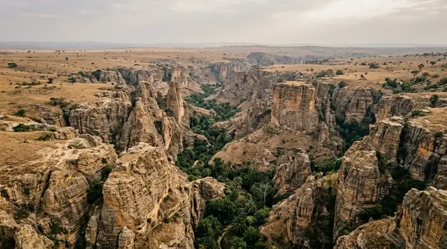
AI illustration
 Written and edited by
 The nomination file Laos submitted to UNESCO carries a table of all fifteen component sites with their unexploded-ordnance status. Most of the entries read: jar groups and pathways cleared. One reads: not cleared. Only one component — Site 21, the quarry — is recorded as fully cleared. This is a World Heritage property where the safe area is a shape, not a boundary.
Silence Index — D-144
Genuinely remote
Ranks 61 of 99 scored dossiers — quieter than 39% of the others we have scored. A low score is not a warning; it describes who else will be standing next to you.
How the total is weighted. These are the fixed weights of the four inputs, the same on every dossier — not this place’s scores. We do not publish per-input bars, because the per-input values were never recorded article by article and inventing four plausible numbers that sum to the total would be a fabrication dressed as a chart.
The index is a desk instrument scored by this publication, not a field measurement. How it is calculated, and where it fails.
This is a desk-researched dossier. Nobody from this publication has stood on the Xiangkhouang plateau. It is built from the UNESCO World Heritage Centre's property file and the Lao nomination document; the National Regulatory Authority for the UXO/Mine Action Sector, UXO Lao and MAG; the Convention on Cluster Munitions, the Landmine and Cluster Munition Monitor and Mine Action Review; UNDP's reporting on the Lao UXO sector working group; the Lao National Tourism Administration; the Plain of Jars Archaeological Project and its 2021 paper in PLOS ONE; the US State Department's travel advisory; and the GeoNames gazetteer. Everything in the safety sections is sourced to a regulator or a clearance operator and dated.
What was inscribed, and what "cleared" means
The property is Megalithic Jar Sites in Xiengkhuang – Plain of Jars, inscribed in 2019 under criterion (iii) by Decision 43 COM 8B.19. It is a serial property of fifteen components totalling 174.56 hectares, with a buffer zone of 1,012.94 hectares. That is a very small core area for a landscape people imagine as vast: the protected ground is under two square kilometres in aggregate, scattered across roughly eighty kilometres of plateau from Site 28 in the west to Site 23 in the east.
The nomination document is the most useful thing published about this place, because it prints a clearance status against each component. Reading down that column is the article:
- Sites 1, 2, and the five component groups of Site 3 — jar groups and pathways cleared.
- Site 8, the quarry at Phou Keng's foot — pathway only; additional clearance planned.
- Site 21 — fully cleared. It is the only one.
- Site 12, Site 23 and Site 52 — jar groups and pathways cleared, but not open to visitors.
- Site 25 — jar groups cleared, additional clearance planned.
- Site 28 — clearance planned.
- Site 42 — not cleared.
Almost every published account of the Plain of Jars says it was cleared for inscription. UNESCO's own property description says the State Party has recently achieved the clearance of UXO from the components. Both statements are defensible and both are misleading if you stop there, because the unit of clearance is the jar group and the path between jar groups, not the site. What has been made safe is a route through a hazard, and the route is the whole of the safe area.
This is not a criticism of the clearance. Clearing 174 hectares to full depth in a landscape with this contamination density would take years and money that the sector does not have. It is a criticism of the sentence "the site has been cleared", which invites a visitor to think of a perimeter when what exists is a corridor.
The marker rule, stated plainly
At the visitable sites the cleared ground is delimited by markers, and the convention is that you walk on the marked side and not on the other. Different operators have used different marker systems in Laos over thirty years, so we are not going to tell you which colour means what, because we could not verify the current scheme at the jar sites from a regulator or operator source and inventing that detail would be worse than admitting the gap. What we can state, because the Lao National Tourism Administration states it: visitors are advised to walk only on the known routes.
The US State Department's Laos advisory, at Level 2 since 21 November 2024, puts it as: do not touch unknown metal objects, and avoid travelling off well-used roads, tracks and paths because of unexploded ordnance. It names Xieng Khouang among the provinces with large numbers of unexploded bombs.
The practical translation is short. Stay between the markers. Do not step off the path to line up a photograph. Do not enter a bomb crater — several of the best-known craters sit immediately beside Site 1 and Site 2 and they are exactly the ground nobody cleared. Do not pick anything up.
The bombing, in the numbers that are actually sourced
The figures that circulate about Laos are large and often unattributed, so here are the ones with an institution behind them.
The Landmine and Cluster Munition Monitor records that the United States dropped more than two million tonnes of ordnance on Lao PDR between 1964 and 1973, including more than 270 million submunitions. MAG, which has worked in Laos since 1994, estimates that about thirty per cent of those submunitions failed to detonate. The Convention on Cluster Munitions secretariat's own retrospective puts an initial estimate of 8,470 square kilometres of cluster munition contamination and around 70,000 individual strike locations, with a typical strike footprint of about twelve hectares.
What remains is where the sources stop agreeing, and we are printing all four. The Landmine Monitor gives roughly 1,500 square kilometres of confirmed hazardous area at the end of 2024 — 1,502.08 on the precise figure. The Convention's Laos country profile, dated September 2024, gives about 1,745. MAG's own Laos page gives approximately 1,800. The Convention's fifty-years retrospective gives 195,704 hectares of confirmed hazardous area as of December 2023, which is 1,957 square kilometres. These are not contradictions so much as different survey cut-offs and different definitions of "confirmed", but a reader deserves to see the spread rather than a single tidy number.
Clearance rates disagree too. For 2024, the Landmine Monitor reports 75.03 square kilometres cleared — 70 of agricultural land, 5.03 of development area. Mine Action Review reports 71.7 square kilometres and notes that this was the highest single-year figure recorded in any state party since the Convention was adopted in 2008. UXO Lao's own cumulative account, covering 1996 to 2025, gives over 1.89 million items destroyed, more than 58,000 hectares cleared and 6,700 confirmed hazardous sites surveyed across nine provinces including Xiangkhouang.
The Article 4 deadline under the Convention was originally 1 August 2020. It has been extended twice and now runs to 1 August 2030. Mine Action Review's assessment is blunt: on the scale of the contamination, Laos will need multiple further extensions.
And the casualties are current, not historical. Bounpheng Sisawath, Director General of the National Regulatory Authority, reported eleven UXO incidents in 2025 causing twenty-one casualties, of whom five died. At the mid-year sector working group meeting on 8 July 2025 the half-year figure was seven incidents, twelve casualties and four deaths, with sixty-seven per cent of the victims children. In the first half of 2025 the sector surveyed 9,413 hectares, cleared 2,717 across fourteen provinces and destroyed 35,446 items, and the meeting recorded that annual targets would be difficult to achieve because of funding cuts. By late 2025 the year-to-date figures had reached 5,268 hectares cleared and 59,039 devices destroyed, about seventy per cent of target.
That last point matters more than any of the tonnage. The clearance of the Plain of Jars is not a completed historical act. It is an underfunded programme, running now, that has cleared paths through one small part of a contaminated province.
What the excavations have actually found
The jars are the visible part of a mortuary landscape, and the evidence for that is not thin. Excavation around the jars at Sites 1, 2 and 52 has documented secondary bundle burials marked with limestone slabs, secondary pit burials, ceramic jar burials and primary interments — several distinct practices coexisting in the same ground. Tooth ablation has been recorded in individuals from Site 1.
Then, in 2026, the strongest result yet. Skopal, Pradier, Bounxayhip and colleagues published in Antiquity the excavation of Jar 1 at Site 75 — an exceptionally large vessel — and found inside it a collective mortuary assemblage: disarticulated secondary interments of at least thirty-seven individuals, radiocarbon dated to roughly AD 890 to 1160. The paper places that in a period of increasing regional interaction and mobility across Southeast Asia.
That is the answer to the question everyone claims is unanswered, at least for that jar and that period: it was an ossuary. It is not necessarily the answer for every jar, and it says nothing about what the people who cut and placed the jars two millennia earlier intended them for. But "we have no idea what they were for" stopped being a defensible sentence some time ago, and it stopped being one completely in 2026.
What popular coverage gets wrong
Three claims, all checkable.
"Nobody knows what the jars were for." See the section above. Burial evidence around the jars is documented across several sites and several practices, and as of 2026 there is a jar excavated with thirty-seven people in it. The funerary interpretation is the working consensus, not a guess. What is genuinely open — and far more interesting than the version in circulation — is the chronology. Louise Shewan of Melbourne, Dougald O'Reilly of ANU, Thonglith Luangkoth of the Lao Department of Heritage and colleagues published dating results in PLOS ONE in 2021 combining radiocarbon, optically stimulated luminescence and uranium–lead zircon analysis. The OSL ages from sediments beneath jars at Site 2 place the jars in position at roughly 1240 to 660 BCE. The radiocarbon dates on bone and charcoal from mortuary contexts at Sites 1 and 2 fall in the ninth to thirteenth centuries CE, with individual bone dates of calAD 772–950 and calAD 1046–1219.
Read those two together. The burials are roughly two thousand years younger than the jars. The authors' conclusion is that the placement of the megaliths preceded the mortuary activity around them — that these are sites which were reused, and which held ritual significance across an enormous span of time. That is a much stranger and better story than "mysterious jars", and it is not the one that gets told.
It also puts the published sources in direct conflict, which is worth naming. UNESCO's own property description dates the jar civilisation to approximately 500 BCE to sometime after 500 CE. The 2021 dating paper puts jar placement centuries earlier and the burials centuries later. The property page predates the paper. We print both and leave the reconciliation to the people doing the work.
"There are 2,100 jars across ninety sites." Numbers of this shape circulate widely and we could not trace any of them to a source that counts. What is countable: UNESCO's serial property has fifteen components. The Lao National Tourism Administration gives roughly 300 jars at Site 1, about 90 at Site 2 and around 150 across the seven groups of Site 3 — that is, about 540 jars at the three sites nearly every visitor sees. The Plain of Jars Archaeological Project, a joint Australian–Lao endeavour with Australian Research Council funding from 2016 to 2020, reports discovering more than twenty new sites during survey, which tells you the total is unstable by definition. A landscape where new sites are still being found does not have a settled inventory.
"How they moved the jars is understood." It is not, and the researchers say so. The 2021 work matched the zircon age signature of a jar at Site 1 to a sandstone outcrop about eight kilometres away — Site 21, Phou Keng — establishing the quarry with reasonable confidence. O'Reilly's own comment on the transport question is that it remains a mystery. Some of these vessels weigh several tonnes. The quarry is established; the logistics are not.
Getting there, and what we could not price
Phonsavan is the base, at 19.4501°N, 103.1880°E. Lao Airlines runs scheduled flights from Vientiane into the airport there. Overland it is a long mountain drive from Luang Prabang or Vientiane, and the road is the reason most people arrive tired.
Site 1, Thong Hai Hin, sits about ten kilometres south-west of town on the UNESCO coordinate N19°25'51.8" E103°9'7.98". Sites 2 and 3 are further south, roughly twenty to twenty-five kilometres out, and are usually done as one circuit. Site 21, the quarry at Phou Keng, was opened to visitors in 2012 after clearance and is the only component recorded as fully cleared. The Lao National Tourism Administration notes that a local bus can get you to Site 3 but not to Sites 1 and 2, which in practice means hiring a driver or joining a minibus tour from Phonsavan.
We could not find an official published entrance fee for any of the sites from a Lao government source, and we are not going to launder an operator figure into one. Expect a modest per-site charge in kip at a booth, carry cash, and confirm the current amount with your guesthouse in Phonsavan the night before. The MAG UXO visitor information centre in Phonsavan has long been the standard first stop for context before going out to the sites; we could not confirm its current opening status from MAG's own website, which does not mention it, so treat it as worth asking about rather than guaranteed.
Go with a guide. Not because the paths are hard to follow, but because a local guide is the person who will tell you which ground is which, and because the money is one of the few tourism revenues that stays in Xiangkhouang.
Why the Silence Index is 70
High, and earned by geography rather than by exclusivity. Footfall pressure is genuinely light: Xiangkhouang is not on the Luang Prabang–Vang Vieng–Vientiane circuit that carries most visitors to Laos, and Site 1 on a busy day holds a few dozen people across thirty-four hectares. Access friction is moderate — flights exist, roads exist, no permit is needed — but Phonsavan is a full day's travel from anywhere most people are, and that filters hard. The acoustic floor across the plateau is very low; this is cropped upland grassland with almost no through traffic and no industry. Night darkness is close to complete outside the town.
What keeps the score from going higher is that the three main sites have ticket booths, parking and a well-worn circuit, and the components you would actually have to yourself are the ones nobody may enter. What holds it up, and what makes this place unlike anywhere else in the archive, is that the constraint on where you may walk is not a rope put there for the grass. It is a line between ground somebody has searched and ground nobody has.
Corner Codex — D-144
- Place
- Xiangkhouang Plateau, Xiangkhouang Province, northern Laos
- World Heritage status
- Inscribed 2019 under criterion (iii); Decision 43 COM 8B.19
- Serial property
- 15 component sites · 174.56 ha core · 1,012.94 ha buffer
- Components fully cleared
- One — Site 21, the Phou Keng quarry
- Components not cleared
- Site 42. Site 28 has clearance planned only
- Ordnance dropped
- Over 2 million tonnes, 1964–1973, including 270 million submunitions
- Submunition failure rate
- About 30 per cent, on MAG's estimate
- Contamination remaining
- 1,500–1,800 km², depending on which agency you ask
- Cleared nationally, 2024
- 75.03 km² (Landmine Monitor) or 71.7 km² (Mine Action Review)
- Casualties, 2025
- 11 incidents, 21 casualties, 5 deaths (NRA Director General)
- Jars placed
- About 1240–660 BCE by OSL. Burials around them: 9th–13th century CE
- Silence Index
- 70 / 100
The Traveler's Panel · checked
Changing information. Prices, permits, seasons and road access change, sometimes at short notice. Everything here is a starting point for your own confirmation — not a quote, and not a guarantee. Verify with the operator and the relevant official body before you book.
| Status | UNESCO World Heritage since 2019, criterion (iii), 15 component sites |
| Open to visitors | Sites 1, 2 and 3 (five groups), plus Site 21 the quarry |
| Clearance | Jar groups and pathways only at most components. Site 21 is the only full clear |
| The rule | Walk only on known routes. Do not enter craters. Do not touch metal objects |
| Base | Phonsavan, 19.4501°N 103.1880°E, flights from Vientiane on Lao Airlines |
| Entrance fee | Charged in kip at each site. No official published figure found |
| Advisory | US Level 2 (21 November 2024), with Xieng Khouang named for UXO |
Getting there — Vientiane or Luang Prabang → Phonsavan (flight or mountain road) → Site 1, then Sites 2 and 3
- Fly Vientiane to Phonsavan on Lao Airlines, or drive from Luang Prabang or Vientiane. Both road journeys are long mountain routes and take most of a day; the flight takes about forty minutes and is the reason most visitors have any time at the sites at all.
- Site 1, Thong Hai Hin, is about ten kilometres south-west of Phonsavan and is the one everyone sees. Sites 2 and 3 are roughly twenty to twenty-five kilometres further south and are normally combined into one circuit with Site 1.
- Site 21, the Phou Keng quarry, was cleared and opened to visitors in 2012 and is the only component UNESCO's nomination file records as fully cleared. It is west of the others and requires a deliberate detour.
- The Lao National Tourism Administration notes that a local bus serves Site 3 but not Sites 1 and 2. In practice that means a hired driver, a minibus tour from Phonsavan, or a motorbike if you are confident on unsealed roads.
- Take a guide. The value is not navigation; it is having somebody who knows which ground has been searched, and it keeps the money in Xiangkhouang.
Indicative costs — verify before booking
| Site entrance | A per-site charge in kip at a booth. No official published figure found |
| Driver for the three-site circuit | Arranged in Phonsavan; agree the total in advance |
| Guide | Worth paying for properly. The safety value is real, not decorative |
| MAG visitor information centre | Traditionally free with donations; current status unconfirmed |
| Getting there | Lao Airlines Vientiane–Phonsavan, or a full day by road either direction |
What to pack
- Closed walking shoes. Not for comfort — for the same reason you stay on the path.
- Cash in kip. There is no card infrastructure at the site booths.
- Sun and rain layers. The plateau sits above 1,000 metres, is exposed, and the weather turns.
- Water. There is little sold at the sites and the circuit takes most of a day.
- Nothing magnetic or metallic you plan to wave at the ground, and no drone without checking the current Lao rules.
Where to stay
Phonsavan is the only practical base and has a modest range of guesthouses and small hotels along the main street, plus a handful of better places on the edge of town. It is a functional provincial capital rebuilt after the war rather than a tourist town, which is part of its interest. Muang Khoun, the old provincial capital to the south-east, was destroyed by bombing and retains ruined stupas and temple remains; it has minimal accommodation. There is nothing to stay in at the jar sites themselves, all of which close at dusk.
Safety & responsible travel
- Stay between the markers and on the known routes. UNESCO's own nomination file records that at most components only the jar groups and the pathways between them have been cleared.
- Do not enter bomb craters, however photogenic. They sit immediately beside Sites 1 and 2 and they are exactly the ground that was not cleared.
- Do not touch, move or collect any metal object. Report it to your guide or to UXO Lao.
- Do not climb into or sit on the jars. They are two-and-a-half to three thousand years old and several are cracked.
- Buy the war-scrap souvenirs with care, or not at all. Spoon-making from aluminium scrap at Ban Napia is a genuine local livelihood, but anything sold as an ordnance component is a different transaction and an illegal one to export.
- Support the clearance sector rather than commenting on it. UXO Lao and MAG both publish their annual figures, and the 2025 sector meeting recorded that targets would be missed for lack of funding.
Nearby, and quieter
Site 21 at Phou Keng is the quarry the jars at Site 1 were cut from, matched by zircon analysis in 2021 and about eight kilometres from the site — the only component recorded as fully cleared. Ban Napia, the spoon village, works aluminium war scrap into utensils. Muang Khoun holds the bombed remains of the old provincial capital including That Foun and the seated Buddha at Wat Piawat. Tham Piu cave, north-east of Phonsavan, is a war memorial and should be approached as one. Further afield, Vieng Xai in Houaphanh province holds the cave complex the Pathet Lao leadership occupied through the bombing.
Getting there, in order
- 1Vientiane or Luang Prabang
- 2Phonsavan (flight or mountain road)
- 3Site 1, then Sites 2 and 3
Each leg is a separate booking and a separate chance to be weathered out. Build spare days into the chain, not onto the end of it.
Where it is
Megalithic Jar Sites, Xiangkhouang Plateau, Laos · 19.4000°N 103.2000°E · Open in Google Maps · OpenStreetMap
Key locations
- Site 1 (Thong Hai Hin) — the largest and most visited component, about 300 jars over 33.97 hectares
19.4311°N 103.1522°E - Site 2 — about 90 jars on two wooded hills, with bomb craters at the perimeter
19.3194°N 103.1536°E - Site 3 (Groups 1 and 3) — reached across paddy from the village; around 150 jars across seven groups
19.2930°N 103.1507°E - Site 8 (quarry) — quarry component with the pathway cleared and further clearance planned
19.2842°N 103.1531°E - Site 21 (Phou Keng) — the source quarry for Site 1's jars and the only component recorded as fully cleared
19.4781°N 103.0872°E - Phonsavan — provincial capital, airport and the base for every site visit
19.4501°N 103.1880°E
Coordinates are for orientation and are accurate to roughly the width of the feature named, not to a doorway. Several of these points are inside protected areas or need a permit, a guide or a boat — read the access notes above before you plan a route to any of them.
Sources & further reading — checked
- UNESCO World Heritage Centre — Megalithic Jar Sites in Xiengkhuang – Plain of Jars. Inscription in 2019 under criterion (iii); fifteen component sites; property area 174.56 ha and buffer zone 1,012.94 ha; the statement that the State Party recently achieved clearance of UXO from the components; and the property's own dating of approximately 500 BCE to after 500 CE
- UNESCO World Heritage Centre — Megalithic Jars Sites in Xiengkhuang, nomination file. The table of all fifteen components with their individual areas and UXO clearance status — jar groups and pathways cleared at most, pathway only at Site 8, fully cleared at Site 21, clearance planned at Site 28, and not cleared at Site 42
- UNESCO World Heritage Centre — Megalithic Jar Sites in Xiengkhuang, maps. The official coordinates of each of the fifteen components, 1587-001 to 1587-015, used for the key-location points on the map panel
- UNESCO World Heritage Centre — Megalithic Jar Sites in Xiengkhuang, documents. That the inscription instrument is Decision 43 COM 8B.19 (2019) and that the ICOMOS evaluation, nomination text and management plan are lodged with the property
- Shewan, O'Reilly, Luangkhoth et al. — Dating the megalithic culture of Laos: radiocarbon, optically stimulated luminescence and U/Pb zircon results (PLOS ONE, 2021). OSL ages of 2.7–3.3 ka (1240–660 BCE) for sediments beneath jars at Site 2; radiocarbon dates on mortuary material from Sites 1 and 2 in the ninth to thirteenth centuries CE, including calAD 772–950 and calAD 1046–1219; matching zircon age groupings between a Site 1 jar and the Site 21 quarry; and the conclusion that megalith placement preceded the mortuary activity
- Phys.org — Researchers solve more of the mystery of Laos megalithic jars (March 2021). The research team and institutions, the OSL placement window of 1240–660 BCE, the quarry match to an outcrop about eight kilometres from Site 1, and O'Reilly's statement that how the jars were moved remains a mystery
- Skopal, Pradier, Bounxayhip et al. — The death jar: a new mortuary tradition at the Plain of Jars, Lao PDR (Antiquity 100(412), 2026). The excavation of Jar 1 at Site 75 containing a collective secondary mortuary assemblage of at least 37 disarticulated individuals, radiocarbon dated to circa AD 890–1160; and the wider record of secondary bundle burials marked by limestone slabs at Sites 1, 2 and 52, ceramic jar burials, primary interments and tooth ablation at Site 1
- Plain of Jars Archaeological Project. That PJARP is a joint Australian–Lao project with the Lao Ministry of Information, Culture and Tourism, funded by the Australian Research Council from 2016 to 2020, and that survey discovered more than twenty new jar sites
- Landmine and Cluster Munition Monitor — Lao PDR, Impact. More than two million tonnes of ordnance dropped on Lao PDR in 1964–1973 including more than 270 million submunitions; approximately 1,500 km² of confirmed hazardous area remaining at end-2024, given precisely as 1,502.08 km²; and 75.03 km² cleared during 2024, split 70 km² agricultural and 5.03 km² development area
- Landmine and Cluster Munition Monitor — Lao PDR, Impact (2023 edition). The same contamination and clearance series for the preceding reporting year, and the description of Lao PDR as carrying the world's highest level of contamination by unexploded cluster munition remnants
- UXO Lao — About us. UXO Lao's own cumulative figures for 1996–2025: over 1.89 million items destroyed including 1 million cluster munitions; more than 58,000 hectares cleared; 6,700 confirmed hazardous sites surveyed over 59,000 hectares; risk education reaching 4.9 million people; and operations in nine provinces including Xiangkhouang
- UXO Lao — UXO victims. Around 12,000 UXO-related accidents since 1973; the 1996–2017 series of 904 accidents and 1,154 casualties; and the finding that more than half of victims are children and more than 81 per cent male
- MAG (Mines Advisory Group) — Laos. MAG's presence in Laos since 1994; the estimate that about 30 per cent of the 270 million submunitions failed; approximately 1,800 km² still requiring clearance; 10,471,115 m² released and 6,301 items destroyed in 2025; over 1,200 staff; and operations in Xieng Khouang and Khammouane provinces
- Convention on Cluster Munitions — Lao PDR country profile (September 2024). Signature on 3 December 2008, ratification 18 March 2009, entry into force 1 August 2010; the Article 4 deadline extended twice to 1 August 2030; approximately 1,745 km² of confirmed hazardous area remaining; and 62.09 km² cleared with 82,000 cluster munitions destroyed in 2023
- Convention on Cluster Munitions — Assessing the true cost of the cluster munition legacy in Lao PDR 50 years on. An initial estimate of 8,470 km² of cluster munition contamination; around 70,000 individual strike locations with a footprint of about twelve hectares each; and 195,704 hectares of confirmed hazardous area as of December 2023
- Mine Action Review — Clearing Cluster Munition Remnants 2025. That Lao PDR cleared 71.7 km² in 2024, the highest single-year total recorded in any state party since the Convention was adopted in 2008, and the assessment that Laos will need multiple further extensions beyond the 1 August 2030 deadline
- UNDP Lao PDR — UXO/Mine Action Sector Working Group meeting (8 July 2025). January–June 2025 performance: 9,413 ha surveyed, 2,717 ha cleared across fourteen provinces, 35,446 items destroyed; seven accidents in four provinces causing twelve casualties and four deaths with 67 per cent of victims children; and the warning that annual targets would be missed because of funding cuts
- Laotian Times — Clearance teams destroy over 1,000 UXO items in Champasak province (28 January 2026). The National Regulatory Authority Director General's figures for 2025: eleven UXO incidents causing twenty-one casualties including five deaths; 5,268 hectares cleared in the first eleven months at 70 per cent of target; 59,039 devices destroyed; and around a quarter of all villages still contaminated
- Lao National Tourism Administration — Xiangkhouang Province. Approximately 300 jars at Site 1, about 90 at Site 2 and around 150 across the seven groups of Site 3; that Site 21 at Phou Keng was cleared and opened to visitors in 2012; Lao Airlines flights from Vientiane to Phonsavan; that local buses serve Site 3 but not Sites 1 and 2; and the instruction to walk only on known routes
- US Department of State — Laos Travel Advisory. Level 2 as of 21 November 2024; the instruction not to touch unknown metal objects and to avoid travelling off well-used roads, tracks and paths; and the naming of Xieng Khouang among the provinces with large numbers of unexploded bombs
- UNDP Lao PDR — Hazardous Ground: cluster munitions and UXO in the Lao PDR. The standing UNDP account of the scale and distribution of cluster munition contamination in Laos, used here as background against which the more recent agency figures are read
- GeoNames gazetteer — Phonsavan, Xiangkhouang. The decimal coordinates for Phonsavan, 19.4501°N 103.1880°E, used as the gateway point on the map panel
Official and scientific bodies are the authority for safety, regulatory and scientific claims. Commercial operators are used only for practical detail such as tour length, meeting points and indicative pricing — never for a safety or scientific statement.
How this was made
Desk research. Compiled from official bodies, scientific and conservation sources, established journalism and licensed operators. Not based on a personal visit.
Editor’s method note — what we checked, corrected and could not verify
- Desk research only. Nobody from this publication has been to Xiangkhouang.
- Every UXO statement is sourced to the Lao National Regulatory Authority, UXO Lao, MAG, the Convention on Cluster Munitions, Mine Action Review or the Landmine and Cluster Munition Monitor, and dated. We have not softened any of it and we have not inflated any of it.
- The central correction is to the meaning of the word cleared. UNESCO's property description says the State Party achieved clearance of UXO from the components; the nomination file, on the same site, records the status component by component, and most read 'jar groups and pathways cleared'. Site 42 reads 'not cleared'. Only Site 21 is recorded as fully cleared. That distinction is the article.
- Four institutions give four different figures for Laos's remaining confirmed hazardous area — about 1,500 km² (Landmine Monitor, end-2024), about 1,745 (Convention country profile, September 2024), about 1,800 (MAG) and 195,704 hectares or 1,957 km² (Convention retrospective, December 2023). We print all four rather than picking one.
- Clearance for 2024 is reported as 75.03 km² by the Landmine Monitor and 71.7 km² by Mine Action Review. We print both.
- We correct the brief's framing of the archaeology. The funerary interpretation is not unresolved; the chronology is. The 2021 PLOS ONE dating places jar emplacement at roughly 1240–660 BCE and the burials around them in the ninth to thirteenth centuries CE, about two thousand years apart. That also puts the paper in conflict with UNESCO's own 500 BCE to after 500 CE framing on the property page, and we say so.
- The strongest single piece of evidence against the 'nobody knows' framing is nine months old. Skopal and colleagues published the excavation of Jar 1 at Site 75 in Antiquity in 2026: a collective secondary burial of at least 37 individuals inside a single jar, dated circa AD 890–1160. Site 75 is not one of the fifteen inscribed components and is not open to visitors; we have not put it on the map.
- We deliberately do not describe the colour convention of the clearance markers at the jar sites, because we could not verify the current scheme from a regulator or operator source. The instruction we do give — walk only on the known routes — is the Lao National Tourism Administration's own wording.
- Coordinates for the components come from UNESCO's own maps listing for the property, 1587-001 to 1587-015. Phonsavan is from GeoNames. Where the nomination table and the maps listing differ by a few hundred metres we have used the maps listing.
- Things we could not verify: any official entrance fee for Sites 1, 2, 3 or 21 from a Lao government source; the current operating status of the MAG UXO visitor information centre in Phonsavan, which MAG's own site does not mention; the present marker colour convention at the jar sites; the full text of Decision 43 COM 8B.19 and the ICOMOS evaluation, neither of which we could open directly; a traceable source for the widely repeated total number of jars and jar sites; annual visitor numbers for the property; whether the clearance planned at Sites 8, 25 and 28 has since been carried out; and Xiangkhouang province's own contaminated-area figure, which none of the national reports we opened broke out.
AI is used to draft this text, and a human checks it. Every figure, date and quotation above was verified by Tony Hall against the source cited for it in the reference list; where sources disagree, the disagreement is shown rather than resolved, and where a claim could not be confirmed it is either marked unverified or left out. The illustrations are AI-created and labelled as such — no photograph on this site is presented as a record of a real place. Full disclosure · Editorial policy.
Access details change — recheck before you travel. Found an error? Tell us — corrections are dated and shown in place.