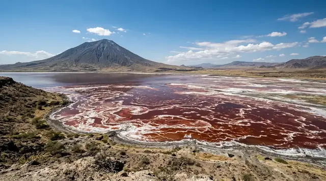
AI illustration
 Edited by
 Fourteen kilometres beyond Donegal, a ferry enters a harbour where the place names change first. An Baile Thiar, An Baile Thoir, An Lár and Úrbaile are not Gaelic labels added for visitors; they are the four named settlements of Toraigh, an island where Irish remains a language of neighbours, work, school and ordinary disagreement. The boat can leave with the afternoon crowd. The language does not leave with it.
Toraigh is regularly described as Ireland's most remote inhabited island. The phrase is accurate enough to attract attention, but it can flatten a living Gaeltacht community into a distant object. Around 140 people share a five-kilometre island with a school, shop, post office, health service, social club, artists, fishing and ferry work. Its north coast rises into protected cliffs; its southern ground holds the road and houses. A responsible visit begins by noticing that the island is not an empty edge. It is somebody's centre.
The language after the engine fades
The official name is Toraigh. The island belongs to the Donegal Gaeltacht, and the ferry operator identifies Ulster Irish as the principal Irish dialect in use. Comharchumann Thoraí, the island cooperative, goes further: it describes Toraigh as one of the country's densest communities of native Irish speakers. That distinction is not a tourism performance. It is infrastructure made of conversation.
A visitor does not need fluent Irish to arrive respectfully. A greeting such as 'Dia dhuit' and a place-name attempted without theatre can show attention, but silence is also useful. Listen to which language a person chooses. Do not interrupt private conversation to request a translation, record speech without permission or treat a bilingual exchange as proof that an ancient world survives untouched. Irish here is contemporary: it carries school notices, ferry changes, jokes, planning debates, work and the same daily complexity as any other language.
The state-approved Toraigh language plan exists because continuity cannot be taken for granted. Housing, employment, education, services and the proportion of daily speakers all affect whether a language remains communal rather than ceremonial. Tourism can support that ecology when money stays on the island and Irish is encountered on local terms. It weakens it when residents become unpaid interpreters in a visitor's search for authenticity.
The rarest thing on Toraigh is not a word preserved from the past. It is a language still being asked to do tomorrow's work.
A ferry measured two ways
The official passenger and goods ferry operates year-round from Magheroarty Pier. Current operator information calls the crossing about forty-five minutes; the island cooperative allows approximately fifty-five. Both descriptions are useful. Sea state, tide and vessel operation decide which clock feels true on the day. Magheroarty is tidal, and the operator warns that sailings can be moved or cancelled. The live timetable or ferry app matters more than a screenshot saved weeks earlier.
In July and August, the published timetable can show several outward and return sailings each day. That frequency makes a day trip possible, not resilient. A weather change can erase the neat interval between arrival and departure. An overnight booking turns the ferry from a countdown into an entrance, spreads spending beyond the pier and leaves time for the road after the day passengers have gone.
The fare page currently lists a €25 visitor adult return, with singles at half the return price, but the value belongs to the live booking page rather than this article. Peak-season online booking is advised, and groups of ten or more should reserve throughout the year. Build a mainland buffer before a flight, rail connection or prepaid hotel. If the sea delays the boat, Toraigh has not broken the itinerary; the itinerary failed to include Toraigh.
The timetable tells you when the ferry hopes to move. The Atlantic tells the ferry whether hope is enough.
One road across a wedge
Toraigh is roughly five kilometres long, about one kilometre wide and 3.58 square kilometres in area. Its shape matters. The island rises from a lower southern shoreline toward harder northern ground, with a single main road linking the lighthouse in the west to Port a Dúin in the east. Most visitor services sit around An Baile Thiar near the harbour; beyond it, homes, fields and the line of the road make an apparently simple map.
Simple does not mean empty. A field is not public space because no fence is obvious, and a lane beside a house is not a scenic pull-off. Use mapped routes, gates and local advice. Walk on the side expected by local traffic, give working vehicles room and ask before entering land to improve a photograph. The cooperative maintains paths, signs, benches, toilets and bins; it also asks visitors to take away or correctly dispose of waste.
The island shop and post office lie a short walk from the harbour, and Club Thoraí serves food and drink with music at advertised times. A local taxi or minibus may be available by arrangement. These details are not minor comforts around the 'real' landscape. They are the living systems that make settlement possible. Spend with them before describing the island as isolated.
A road this short can still contain a school run, a delivery route, an ambulance journey and somebody's walk home.
The high ground is in the east and north
Many short guides misplace Toraigh's drama in a vague western edge. The geography is more exact. The 1832 lighthouse stands to the west. The broken towers and promontories of Tor Mór rise at the eastern end, reaching about eighty-three metres, while hard cliffs continue along much of the north coast. The south is lower, with bedrock shore and boulder beach. Orientation matters because a beautiful but incorrect description is still misinformation.
Dún Bhaloir occupies the eastern promontory in landscape and mythology, and natural rock forms create the famous Tors. None is a managed viewpoint with rails along every drop. The community visitor guidance states plainly that the high ground provides no walker protection. Wind can arrive side-on, wet grass can remove friction and mist can turn the return line into guesswork. Keep a body-length margin from any edge, then add more for a gust.
Use the island's sightseeing map and ask about conditions before committing to the eastern circuit. A guided walk can join geology, archaeology and place names without encouraging shortcuts. Drones add another layer of risk: homes, nesting birds and emergency aviation are not backgrounds. Fly only if every legal, ecological and privacy requirement is satisfied; in many conditions, leaving the aircraft packed is the better decision.
Toraigh's cliff begins before the drop—at the point where the wind becomes stronger than the plan.
 AI illustration
Stones that are not stage props
The island cooperative traces human activity through a Neolithic dolmen, Bronze Age remains and promontory forts before the monastic story associated with Colmcille. Near the settled road, the surviving bell tower and Tau cross compress long periods into a small walking area. The cooperative dates the tower to the early monastic site and the Tau cross to around the twelfth century; archaeology should be approached as evidence, not as scenery for climbing.
Toraigh's mythology is equally visible. Balor of the Evil Eye, the Fomorians and the wishing stone at Dún Bhaloir appear in island stories and visitor literature. Folklore does not require literal belief to matter, nor does it give a traveller permission to perform a ritual at an unsafe edge. A story can orient people to landscape without turning that landscape into a theme park.
Do not move stones, stand on carved remains, rub surfaces, leave coins or create new cairns. Photograph from stable ground without blocking the road or entering private plots. The most responsible interpretation separates what is archaeologically established, what the community records and what belongs to narrative tradition. Toraigh is rich enough to hold all three without forcing them into one claim.
A monument does not become more meaningful because a visitor touched it. Meaning often survives because generations did less.
An island that learned to paint itself
Toraigh's visual-art tradition is often called the Tory School of painting. Visiting artist Derek Hill encouraged local painters in the mid-twentieth century, and artists including James Dixon developed direct, highly individual images of boats, houses, storms and island life. The important fact is not that an outsider 'discovered' creativity. It is that islanders turned their own visual language into an enduring body of work.
Painting sits beside song, storytelling, music and performance in the island's cultural life. Creative Ireland's Living Heritage project describes these practices as living inheritance rather than nostalgic residue. That distinction changes visitor behaviour. An artist is not a picturesque character waiting beside a canvas. A session in the club is not background audio for a video. Attend what is advertised, ask before filming and buy work directly or through the named gallery when possible.
The same rule applies to the former custom of an island 'king', a role widely reported after the death of Patsy Dan Rodgers in 2018. Treating that title as a novelty can obscure the practical work of representing and welcoming a small community. Toraigh does not need a visitor to restore an imagined kingdom. It needs time, language, livelihoods and the freedom to decide which traditions continue.
The island did not become art when somebody arrived with paint. The paint became useful when islanders chose what it should say.
Cliffs full of protected life
Toraigh is both a Special Protection Area and part of the Tory Island Coast Special Area of Conservation. The National Parks and Wildlife Service lists fulmar, corncrake, razorbill and puffin among the SPA's qualifying interests. Its coastal-habitat work also records storm petrel, shag, common gull, kittiwake, guillemot, black guillemot, chough and peregrine around the hard cliffs, stacks and islets.
A designation is not a promise that every species will be visible. Corncrakes hide in vegetation; seabirds shift with season, food and weather; a puffin seen through binoculars is not an invitation to close the distance. Remain on recognised ground, keep dogs under effective control, never play calls and avoid ledges or vegetation that birds are using. If a bird changes posture or direction because of you, the encounter is already too close.
The island's protected coast is also working land beside homes. Conservation and community are not rival attractions placed on different parts of a map. They depend on the same restraint: fewer shortcuts, less noise, no litter, no disturbance for a photograph and no assumption that remoteness makes impact disappear. On an island this small, impact becomes local very quickly.
The cliff may hold thousands of birds, but the ethical distance is decided one nest at a time.
Hiddencorners position
Hiddencorners recommends at least two nights on Toraigh, with accommodation reserved before ferry tickets and a mainland buffer after the return. Use Toraigh as the official place name, follow the community map, buy from the island shop, club, accommodation and artists, and let residents choose the language and depth of any conversation. The eastern and northern cliffs require conservative weather judgment; the monastic remains and living culture require the same restraint in another form. This is a Gaeltacht community that welcomes visitors, not a cultural performance owned by the ticket holder.
Why the Silence Index is 82
Toraigh scores 82 because it lies roughly fourteen kilometres into the North Atlantic, every visitor arrival is concentrated through a weather-dependent ferry and the population is only around 140. Outside the harbour pulse, one road, low southern fields and protected northern cliffs distribute people quickly. After the last day boat, engine noise recedes and ordinary island life becomes audible again.
The island is neither unknown nor without services. It has several daily sailings in parts of summer, accommodation, a shop and post office, health and emergency provision, a social club, guided tourism and a celebrated art tradition. Day visitors can cluster around An Baile Thiar and the heritage sites. Silence here means scale and timing, not abandonment.
Corner Codex — D-022
- Place
- Toraigh (Tory Island), Ireland
- Coordinates
- 55.2635°N, 8.21672°W (NPWS SPA reference point); island about 5 km by 1 km
- Getting there
- Official year-round ferry from Magheroarty Pier; operator estimates about 45 minutes and the island cooperative about 55, with tides and weather able to change or cancel sailings
- Rules
- Use mapped routes and gates, stay far back from unprotected cliffs, protect archaeological remains and nesting birds, dispose of or remove waste, and ask before photographing or recording residents
- Season
- May–September for longer light, more visitor services and frequent sailings; every month remains weather-dependent, while winter and spring may also have a separately published helicopter service
- Silence Index
- 82 / 100
- Still open
- Can tourism support the homes, work and language that keep Toraigh alive without turning Irish-speaking community life into a product?
Silence Index
A legacy editorial rating based on desk research. It is not an acoustic measurement or a safety rating.
Earlier and later dossiers used different fourth inputs. Individual input scores were not recorded, so these totals cannot be independently reproduced or used for precise comparisons between places.
The Traveler's Panel · checked
Changing information. Prices, permits, seasons and road access change, sometimes at short notice. Everything here is a starting point for your own confirmation — not a quote, and not a guarantee. Verify with the operator and the relevant official body before you book.
| Official name | Toraigh; Tory Island is the familiar English form |
| Community | Around 140 residents across four named settlements |
| Language | Donegal Gaeltacht; Ulster Irish is the local dialect |
| Ferry | Magheroarty–Toraigh, approximately 45–55 minutes; confirm live changes |
| Current visitor adult return | €25 on the operator's live price table; singles are half, recheck before booking |
| Island shape | About 5 km long, 1 km wide and 3.58 km² |
| Highest named point | Tor Mór, about 83 m at the eastern end |
| Services | Shop/post office, food and drink, limited accommodation, health and emergency provision |
| Main hazards | Cancelled sailings, unprotected cliff edges, wind, wet ground and wildlife disturbance |
Getting there
- Reserve island accommodation first; bed supply is limited and an overnight stay is more resilient than a day trip.
- Check the date-specific Tory Ferry timetable and book online in peak season. Groups of ten or more should reserve throughout the year.
- Reconfirm on the day because Magheroarty is tidal and weather can move or cancel sailings.
- Arrive at Magheroarty with manageable luggage, waterproof layers, medication and enough flexibility for a delayed return.
- At the harbour, obtain the community visitor map and check current advice before walking the high eastern or northern ground.
- Use the shop, club, guided services, accommodation and art outlets so spending remains on Toraigh.
- Keep at least one mainland buffer day before any expensive or inflexible onward connection.
Indicative costs — verify before booking
| Visitor adult ferry return | €25 on the live operator price table checked 29 July 2026; a single is half |
| Visitor student return | €15 on the current operator table; carry the required proof and reconfirm eligibility |
| Visitor family return | €60 on the current operator table; verify the included party before purchase |
| Accommodation | Very limited hotel, B&B and self-catering supply; request current direct rates and cancellation terms |
| Guided walk or taxi | Arrange locally and confirm price, availability and payment method in advance |
| Heritage and ordinary walking | No general admission fee; support community facilities and island artists instead |
| Verify | Prices and availability change. Confirm current details directly before booking. |
What to pack
- Full waterproof jacket and trousers, plus warm layers even in midsummer
- Boots with reliable grip for wet grass, rock and soft ground
- Essential medication and a compact delay reserve
- Some cash as well as a payment card; small-island connectivity can fail
- Refillable water bottle and a small amount of food outside service hours
- Offline community map, charged phone and power bank
- Binoculars and a long lens so birds and residents never need to be approached
- Soft, manageable luggage suitable for the passenger ferry
Where to stay
The community visitor page lists a small hotel, apartment and other limited B&B or rental supply, but names and operating status can change faster than copied travel pages. Contact the cooperative or property directly, confirm meals, check-in, payment and cancellation terms, and explain any mobility needs. Two nights allow the eastern walk and heritage sites to be separated rather than rushed. Camping is not an automatic right over fields, dunes or near homes; any plan requires lawful access, landholder consideration, fire safety and a no-trace exit.
Safety & responsible travel
- Check the live ferry app or operator before leaving for Magheroarty and keep a buffer after the return.
- Stay well back from every cliff edge; the high ground has no continuous walker protection.
- Use community maps and local advice rather than an improvised line from a phone app.
- Do not climb the bell tower, Tau cross, walls or cairns, and never move archaeological stone.
- Keep away from nesting birds, do not play calls and keep dogs under effective control.
- Ask before photographing people, homes, school activity, artists at work or music sessions.
- Use bins only as directed and take excess refuse back to the mainland.
- In an emergency, follow island responders; remoteness makes prevention more important, not rescue less professional.
Nearby, and quieter
Magheroarty and Bloody Foreland are the natural mainland companions, with coastal views back toward Toraigh and communities where Irish remains part of daily life. Gweedore offers accommodation, food and language context without turning the island into an isolated curiosity. Inishbofin, Donegal, lies offshore to the south but has far less visitor infrastructure and is not an automatic extension. Arranmore is larger and reached by a separate ferry from Burtonport; give it its own itinerary rather than collecting islands as day-trip badges.
Where it is
Ireland · 55.2635°N 8.2167°W · Open in Google Maps · OpenStreetMap
Key locations
- An Baile Thiar (West Town) pier — the harbour, and the shop, post office and club a short walk from it
55.2630°N 8.2258°W - Tory Island Lighthouse — the 1832 light at the western end of the island's one road
55.2727°N 8.2494°W - Tor Mór — the eastern promontory holding Dún Bhaloir, with no walker protection
55.2636°N 8.1906°W - Port an Dúin — the eastern end of that road, and a quay usable only in calm
55.2561°N 8.1939°W - Magheroarty Pier — tidal mainland pier the year-round ferry sails from
55.1466°N 8.1753°W
Coordinates are for orientation and are accurate to roughly the width of the feature named, not to a doorway. Several of these points are inside protected areas or need a permit, a guide or a boat — read the access notes above before you plan a route to any of them.
Sources & further reading — checked
- Comharchumann Thoraí — island home. Island-authored source for the contemporary community, employment, services and the stated priority of sustaining linguistic and cultural heritage.
- Comharchumann Thoraí — Toraigh overview. Primary community source for dimensions, settlements, first-language context, population history, Tor Mór, lighthouse, monastic remains and island geography.
- Comharchumann Thoraí — visitor information. Used for the shop, post office, accommodation, health and emergency services, club, taxi, public facilities, waste request and cliff-safety warning.
- Comharchumann Thoraí — travel to Toraigh. Authority for the almost-14-km position, year-round ferry, Magheroarty departure, approximate 55-minute crossing and seasonal helicopter reference.
- Tory Ferry — about, island and live prices. Current operator source for 14.5-km position, dimensions, four settlements, Donegal Gaeltacht, coordinates and live visitor return prices.
- Tory Ferry — FAQ. Current operator guidance for peak booking, weather and tidal disruption, approximate 45-minute crossing, bicycles, pets and ticket transfer conditions.
- Tory Ferry — date-specific timetables. Authority for current seasonal sailing patterns and the instruction to check same-day changes.
- Government of Ireland — Toraigh language plan. Official confirmation that the Toraigh language plan was approved under the Gaeltacht language-planning process.
- National Parks and Wildlife Service — Tory Island SPA. Official coordinates, protected status and qualifying bird interests: fulmar, corncrake, razorbill and puffin.
- NPWS — Tory Island Coast SAC coastal habitats. Used for hard-cliff extent, stacks and islets, seabird colonies and the conservation objective for vegetated sea cliffs.
- Government of Ireland — populated offshore islands. The official table of Ireland's twenty populated offshore islands, giving Toraigh at 144 in the 2011 census and 119 in 2016, against a combined island total falling from 2,879 to 2,734. The table stops at 2016 and does not carry the 2022 figure.
- Central Statistics Office — Census 2022, Table F1019: Population of Inhabited Islands, 2011 to 2022. The census figures themselves, from the Irish statistics office rather than a summary of it: Toraigh, Donegal recorded 141 residents in 2022 and 119 in 2016, with 144 in 2011 — the arc behind this dossier's 'around 140'. An earlier version of this dossier said no Irish government page stated the figure; that was wrong, and this is the table.
- Creative Ireland — Toraigh Living Heritage. Used for the living continuity of Irish, song, storytelling, music and visual culture, and the warning against reducing tradition to nostalgia.
Official and scientific bodies are the authority for safety, regulatory and scientific claims. Commercial operators are used only for practical detail such as tour length, meeting points and indicative pricing — never for a safety or scientific statement.
Corrections to this dossier
This article has been corrected. The changes are listed here, dated, and also in the site-wide corrections log.
- — An earlier version said no Irish government page publishes the island's census population. It does: the Central Statistics Office publishes it in Census 2022 table F1019 — 141 in 2022 against 119 in 2016. That table is now the citation.
How this was made
Desk research. Compiled from official bodies, scientific and conservation sources, established journalism and licensed operators. Not based on a personal visit.
Editor’s method note — what we checked, corrected and could not verify
- Desk research only. Nobody from this publication has been to Toraigh. The dossier leans first on Comharchumann Thoraí, the island's own cooperative, then on the ferry operator, the National Parks and Wildlife Service, and Irish government publications.
- All twelve original sources still load and thirteen are now listed. Nothing had to be deleted.
- One source description was materially wrong and has been rewritten. The Irish government's populated-offshore-islands publication was described here as general historical census context; what it actually contains is a table giving Toraigh at 144 in 2011 and 119 in 2016, and it stops there. It does not support the article's figure of around 140. We have added the 2022 census count of 141 and been explicit about where it comes from.
- The population sources disagree in a way worth stating rather than smoothing. The island cooperative's own page gives 145 or more, and describes a fall from about 400 at the mid-nineteenth-century peak to a low of 119 in 1991. The government table gives 119 for 2016. The 2022 census gives 141. All three can be true of different years; what cannot be done is to cite the cooperative's figure and the government's table as though they agreed.
- The crossing time is genuinely reported two ways and the article already says so. Tory Ferry's FAQ gives approximately 45 minutes; the cooperative's travel page gives approximately 55. Distance is reported as 14 km by the cooperative and 14.5 km by the operator. We keep both pairs rather than choosing.
- We could not confirm the fare. The article states a €25 visitor adult return with singles at half price. The operator's FAQ points to a price table at the foot of its About page, and that table did not render on any fetch we made, so the figure now rests on a check made in July 2026 rather than on anything we could re-read during this audit. Anyone travelling should treat it as indicative.
- Things we could not verify: the current visitor, student and family ferry fares, for the reason above; the 2026 sailing pattern, since the timetables page carries no dates and directs readers to the day's homepage; whether the Toraigh language plan's funding, approved in December 2020 at up to €100,000 a year, has continued or been renewed; whether the accommodation listed by the cooperative — a twelve-bed hotel, a four-guest apartment and Airbnb supply — is currently trading; the current condition of the SPA's qualifying bird interests, which the NPWS pages state but do not assess; whether the Tory Island Foundation's Living Heritage portal, whose funded phase ran July to September 2021, is still online; and whether the office of King of Tory has been filled since 2018, which no source we opened addresses.
- Coordinates for the key locations come from GeoNames for Tor Mór, Port an Dúin and the lighthouse, from the ferry operator's own site for Magheroarty, and from eOceanic's sailing directions for the West Town pier head, given there as 55° 15.782' N 008° 13.548' W. Dún Bhaloir itself has no published coordinate we could find, so it is described against Tor Mór, the promontory it stands on. The Placenames Database of Ireland blocks automated access, which is why an Irish official gazetteer is not the source here.
AI is used to draft this text, and a human checks it. Tony Hall is responsible for editorial verification against the reference list. Our standard is to distinguish documented facts, disputed accounts and claims we could not verify. Errors can remain; readers can report them through the corrections page. The illustrations are AI-created and labelled as such — no photograph on this site is presented as a record of a real place. Full disclosure · Editorial policy.
Access details change — recheck before you travel. Found an error? Tell us — corrections are dated and shown in place.