AI illustration
 Edited by
 On 30 June 2023 the Icelandic Meteorological Office logged ninety-five earthquakes under Mýrdalsjökull before half past six in the morning, eight of them above magnitude 3, the largest 4.4. Its advice was specific: keep away from where the river Múlakvísl comes out of Kötlujökull, and stay off Kötlujökull itself. Kötlujökull is the glacier the Katla ice cave is in, and tours were selling that summer as they sell this one.
This is a desk-researched dossier. Nobody from this publication has been inside the cave. It is built from the Icelandic Meteorological Office, the Iceland Glaciological Society's data reports in Jökull, Almannavarnir, Vatnajökulsþjóðgarður, the Icelandic Tourist Board, Katla UNESCO Global Geopark, the Smithsonian's Global Volcanism Program, and peer-reviewed glaciology and volcanology. Operator pages are used only as evidence of what operators claim.
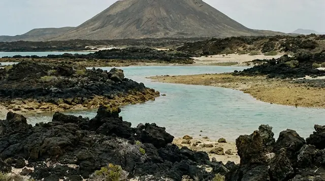
The cave sits in Kötlujökull, which leaves the eastern side of Mýrdalsjökull through a breach in the Katla caldera between Hábunga and Kötlukollar and spreads across the lowland between the mountains Sandfell and Hafursey. Above it is an ice cap of about 520 square kilometres by the 2019 national inventory, or 535 by Katla Geopark's reckoning. Under that is a caldera of roughly 100 km², filled with ice up to about 740 metres thick. The ice cap's high point, Goðabunga, is given as 1,493 metres by the glaciologists, 1,510 by the Geopark, 1,500 by the Met Office and 1,490 by the Smithsonian. Almost every number attached to this place has at least two published values.
Two products, one name
The most useful thing to understand before booking is that "Icelandic ice cave" now describes two different products sold under one word.
The blue caves people picture are on Breiðamerkurjökull, inside Vatnajökull National Park, and they are a winter product. Since the 2025–26 season those caves have run October to April and been closed from May through September. Thirty of thirty-four applicant companies received permits. Guides are capped at eight to sixteen guests depending on tour type, guests must be registered, and the Nature Conservation Agency can cap total numbers to stop queueing. That trade is worth four to five billion krónur a year.
The Katla ice cave is not that. It is on Mýrdalsjökull, outside any national park, and runs year-round with departures through the afternoon in July. Arctic Adventures advertises it as "Iceland's only year-round natural ice cave." The claim is close to true, and the reason is not that Kötlujökull is safer. It is that Kötlujökull is not covered by the rules that closed the others.
 AI illustration
The black is not one eruption
The stripes are the reason to go, and the usual gloss — that they are the 1918 eruption — is at best a third of the story.
Katla has produced at least twenty-one eruptions in the past 1,100 years by the Met Office's count. Óladóttir and colleagues, reading soil tephra sections rather than written records, identified 208 tephra layers across about 8,400 years. The Eldgjá fissure event of about 934 to 940 laid down roughly 1.3 km³ of tephra with some 18 km³ of lava. The eruption of 17 October 1755 to 13 February 1756 is rated a possible VEI 5. The 1918 eruption, 12 October to 4 November, was a VEI 4 that put about 0.7 km³ of tephra into the air. Any of these can be in the ice, and so can ash that is not Katla's: the 2010 Eyjafjallajökull eruption dusted this ice cap heavily, and its fingerprint is in the mass-balance record.
The 1918 layer is genuinely traceable, which is what makes it quotable. Radio-echo sounding finds it 200 to 300 metres down in the central ice cap, and as deep as 460 metres at the western caldera rim. On Sléttjökull it surfaces at around 900 to 1,000 metres as the ice above ablates away, and its migration has been used since 1988 as a substitute for stake measurements. That is the mechanism by which old ash reaches a cave wall: not that the cave is old, but that ablation strips the ice above the layer until the layer outcrops.
One operator advertises the ice as 800 years old. We found no published age for ice at Kötlujökull's terminus and would want one before repeating it. The tephra depths point the other way: a century of accumulation burying the 1918 layer under 200 to 300 metres of ice implies a very fast-turning glacier.
What the ash actually does
The standard explanation for why this cave survives summer is that volcanic ash insulates the glacier. That is half of a real effect, stated in the wrong direction.
Dragosics and colleagues put ash from the 2010 Eyjafjallajökull eruption on snow and ice in the laboratory and outdoors and measured what happened. Thin layers do not insulate; they darken the surface, absorb more sunlight and accelerate melting. Maximum melt occurred at about one to two millimetres thickness. The switch to insulation came only at 9 to 15 millimetres for the coarser ash and about 13 for the finer.
The field record agrees. In the geodetic mass balance of Mýrdalsjökull for 1999 to 2021, the most negative year is 2010 — −2.06 m w.e. — and the authors attribute the outlier to the Eyjafjallajökull eruption. Ash fell on this glacier and the glacier melted faster.
Ash does insulate under the debris-covered snout, where sediment is centimetres to metres thick rather than millimetres. That is real and locally important. It is not the same claim as "the ash keeps the cave cool," and it does not make a summer cave stable, because what closes ice caves in summer is not surface temperature but meltwater volume and ceiling loading.
The ice cap is going, slowly, in fits
Mýrdalsjökull's geodetic mass balance from 1999 to 2021 averages −1.23 ± 0.10 metres water equivalent per year. The interesting part is the shape: −1.83 for 1999–2005, −1.45 for 2005–2010, −0.64 for 2010–2016 and −0.41 for 2016–2021. Kötlujökull's catchment tracks it, from −1.64 to −0.40 across the same endpoints. A decade of deceleration, not a straight line down.
And then it turned again. The Met Office's summary of the 2024–25 glacier year, published on 29 June 2026 from about 130 measurement sites, reports that the slower phase of 2012–2020 has ended and Icelandic glaciers are losing mass about as fast as they did between 1995 and 2011, after unusual autumn and winter warmth and one of the warmest summers on record. In the Glaciological Society's data report, Kötlujökull's front came back thirty metres, measured by Jóhannes Marteinn Jóhannesson. Sólheimajökull's western tongue lost 93 metres, Öldufellsjökull 75 and Sléttjökull 35.
A correction to our own file. An earlier draft of our Sólheimajökull dossier had Sléttjökull advancing about 35 metres in 2024–25. The row in Jökull 75 reads −35, and the report's summary line is meirihluti jökulsporða hörfa — the majority of termini are retreating. Sléttjökull retreated. That page was corrected on 13 August 2026, and we record the error here rather than fix it silently.
 AI illustration
The swarms, and what they were not
Katla shakes. In summer 2016 the Met Office logged over a hundred shallow caldera earthquakes from 1 June, roughly four times the monthly average, with two magnitude 3.2 events on 26 July; it called this typical summertime unrest, comparable to 2012 and 2014, with no deformation and no tremor to suggest magma moving. At the end of September 2016 a stronger swarm did push the aviation colour code from green to yellow.
Then 2023. A swarm on 4 May produced three events above magnitude 4. On 30 June came the ninety-five earthquakes quoted at the top of this piece. The Met Office attributed that sequence mainly to elevated geothermal processes, while saying magma could not be entirely ruled out, and pointed to unusually high conductivity in Múlakvísl and gas at Láguhvolar. It warned that the earthquakes raised the risk of rock and ice fall, and told people to stay off Kötlujökull. On 20 October 2025 a further swarm began, several events above magnitude 3 and a largest of 4.4, developing much as May and June 2023 had, with no conductivity change to suggest a flood was coming.
One disagreement is worth naming. Iceland Review, reporting on the day, gave the May 2023 maximum as M4.5. The Met Office's October 2025 notice puts it at M4.8. Magnitudes are routinely revised after review. We give both and prefer neither.
The flood that does not need an eruption
The 1918 jökulhlaup is the number that should be in a visitor's head. Peak discharge exceeded 300,000 cubic metres per second, carrying ice and sediment alongside the water. Roughly eight cubic kilometres of water came out, about sixty per cent in the first eight hours. Some 2.5 km³ of material — around two and a half billion tonnes — was moved onto Mýrdalssandur, and the coastline at Kötlutangi grew by roughly fourteen square kilometres. Katla Geopark gives a general range of 100,000 to 300,000 m³/s for Katla floods, and notes that an eruption melts five to ten per cent of the ice cap, which then takes decades to recover.
But the floods that matter to a person standing on the ice in an ordinary year are the ones with no eruption behind them. Geothermal cauldrons in the caldera melt ice from below, water accumulates, the seal fails. It happened in July 1999 down Jökulsá á Sólheimasandi, in July 2011 down Múlakvísl — taking the Ring Road bridge with it — and again from 8 to 11 July 2025, when cauldrons 13 and 14 drained into Leirá Syðri and Skálm with about a hundred accompanying earthquakes, a sulphur smell and a public warning about gas. No eruption in any of the three. Almannavarnir's response plan works on one to two eruptions a century, alerts by SMS to phones in the affected area, and states plainly that the time available to evacuate is short. Kötlujökull's meltwater is Múlakvísl, and Route 1 crosses it.
 AI illustration
Which rules actually apply here
On 25 August 2024 an ice wall collapsed during a summer ice-cave tour on Breiðamerkurjökull. An American visitor was killed and his pregnant fiancée injured, from a group of twenty-three; some two hundred rescuers and two helicopters searched two days for people who, it emerged, did not exist. The regulatory response was fast and specific, and worth reading closely for what it does not cover.
Vatnajökull National Park's operator contracts had expired on 30 September 2024. The park withdrew its new tender, extended the old contracts to 30 October, and banned access through 31 October to all ice formations "under an ice roof, overhanging/slanted or arched" — walls, moulins, channels, caves and arches alike. New contracts took effect on 1 November 2024. They require a guide qualification of Jökla 3 or equivalent, set guest-to-guide numbers and registration, specify equipment, name a lead guide responsible for daily joint safety assessment of each cave and of overhanging ice, and fund an oversight council through a per-client fee.
None of it reaches the Katla ice cave. Those are contractual conditions on access to a national park, imposed by the park — since 1 January 2025, by the Nature Conservation Agency of Iceland, which absorbed it. Mýrdalsjökull is not in Vatnajökull National Park, and not in the Vatnajökull World Heritage property. It lies in Katla UNESCO Global Geopark, a different UNESCO programme with no regulatory power over tour operations.
What does apply at Kötlujökull is the Act on the Icelandic Tourist Board, No. 96/2018. Every operator running organised tours must hold a safety plan for each tour type — risk assessment, operating procedures covering staff qualifications and customer ratios, contingency plan, incident report — in Icelandic and English, reviewed at least annually and after any incident, and producible on demand. Non-compliance carries daily fines of ISK 50,000 to 500,000. That duty is real and enforced by audit.
What does not exist is a standard for the thing itself. In April 2025 the Tourist Board's Dagbjartur Brynjarsson said flatly that there are no rules for ice-cave tours on glaciers outside Vatnajökull National Park, that the Board has no authority to issue them, and that a ministerial regulation or an act of parliament would be required. The Board's requirements on guide knowledge and training for glacier work remain leiðbeinandi reglur — advisory. As far as we can establish that is still the position in August 2026. The operator's judgement is the control.
What popular coverage gets wrong
Three claims, all checkable.
"Katla is overdue." This misuses a recurrence interval. The Met Office's figure — at least 21 eruptions in 1,100 years, an average repose of about 50 years — is an arithmetic mean over an irregular series, not a schedule. A mean generated by intervals ranging from a decade to most of a century tells you nothing about when the next one falls, and volcanic systems do not accumulate obligation. The Met Office does not say "overdue"; it says the next eruption is expected to be preceded by detectable precursors — increased seismicity, changed seismic patterns, inflation, changes in gas flux. Óladóttir and colleagues place Katla in the first interval of the third Holocene cycle of its plumbing system, a stage of uniform magma composition and relatively low eruption frequency. Katla Geopark also lists three possible small eruptions in 1955, 1999 and 2011 that never broke the ice, which makes even the 108-year figure a statement about ice-penetrating eruptions rather than about the volcano.
"Ice caves are safe in summer here because of the ash." Thin ash increases melt; the insulating threshold is around a centimetre; the worst mass-balance year on this ice cap is the year ash fell on it. The honest version is that this cave is open in summer because nobody has the legal power to close it and because operators judge each formation daily. The casualties at Breiðamerkurjökull were on a summer ice-cave tour, and the response of the only authority in Iceland with power to act was to stop summer ice-cave tours entirely.
"The new ice-cave rules cover this." They do not, and the geography is the reason. Reporting that says Iceland tightened its ice-cave rules after 2024 is describing changed contract terms inside one national park, on one glacier, administered by one agency. Kötlujökull is outside all three.
Getting there, and what it costs
Route 1 to Vík í Mýrdal, 187 kilometres from Reykjavík, then a modified super jeep east across the outwash plain. There is no self-drive option and no walk-in. Tröll Expeditions meets at the Vík Inn and quotes about forty minutes of jeep each way inside a three-hour tour; South Adventure runs four departures a day at ISK 29,990; Katlatrack charges ISK 39,900 with a minimum age of 12, against Tröll's 8 in winter and 6 in summer. Helmets, headlamps and crampons are provided. The band runs roughly ISK 30,000–42,000.
One claim on operator pages is simply wrong about the physics. Ice caves do not form, as one widely read guide has it, "when the water underneath a glacier freezes." They are drained meltwater conduits — water carves the passage and abandons it when discharge drops. That is also why they close: the cave is a river that is not currently running.
 AI illustration
Why the Silence Index is 45
Mid-range, and it should be. The friction is genuine — no road, no self-drive, guided access only, a venue that moves — but it is commercial rather than regulatory, and it is dissolving. Vík now supports several operators running the same crossing several times a day through the summer, which is exactly the season the equivalent caves inside Vatnajökull National Park are shut. Iceland took about 2.27 million departing foreign passengers through Keflavík in 2025, and 79 per cent of foreign travellers went to the south coast. What holds the score up is the ground itself: a glacier the Met Office has told people to stay off, a river that has removed the Ring Road bridge within living memory, and a volcano that will give a few hours' notice at best.
Corner Codex — D-019
- Place
- Kötlujökull, the eastern outlet of Mýrdalsjökull, south Iceland
- Coordinates
- Approx. 63.63°N, 18.87°W; tours meet in Vík í Mýrdal, 187 km from Reykjavík
- Parent ice cap
- Mýrdalsjökull: 520 km² (2019 inventory) or 535 km² (Geopark); about 140 km³
- Ice thickness
- Mean about 230 m; up to roughly 740–750 m over the Katla caldera
- Under the ice
- Katla — a caldera of about 100 km², given by the Met Office as 9 × 14 km
- Mass balance
- −1.23 ± 0.10 m w.e. a⁻¹, 1999–2021; worst single year 2010 at −2.06
- Terminus, 2024–25
- Kötlujökull −30 m, observer Jóhannes Marteinn Jóhannesson (Jökull 75)
- Last eruption through the ice
- 12 October to 4 November 1918, VEI 4, about 0.7 km³ of tephra
- The 1918 flood
- Peak over 300,000 m³/s; some 8 km³ of water; about 14 km² of new coast
- Eruption record
- At least 21 in 1,100 years; 208 tephra layers across about 8,400 years
- Rules that apply
- Safety plans under Act 96/2018. No ice-cave regulation outside Vatnajökull
- Silence Index
- 45 / 100
Silence Index
A legacy editorial rating based on desk research. It is not an acoustic measurement or a safety rating.
Earlier and later dossiers used different fourth inputs. Individual input scores were not recorded, so these totals cannot be independently reproduced or used for precise comparisons between places.
The Traveler's Panel · checked
Changing information. Prices, permits, seasons and road access change, sometimes at short notice. Everything here is a starting point for your own confirmation — not a quote, and not a guarantee. Verify with the operator and the relevant official body before you book.
| Season | Year-round, unlike the Vatnajökull caves, which are closed May–September |
| Which glacier | Kötlujökull, eastern outlet of Mýrdalsjökull — not Vatnajökull |
| Rules that apply | Act 96/2018 safety plans. No ice-cave regulation outside Vatnajökull NP |
| Access | Licensed super jeep from Vík only. No self-drive, no walk-in |
| Tour length | About 3 hours from Vík, roughly 40 minutes of jeep each way |
| Indicative price | ISK 29,990–39,900 per adult from operator pages, 2026. Not a quote |
| Minimum age | 6 to 12 depending on operator and season — check before booking |
| Check daily | en.vedur.is for Katla status and jökulhlaup notices · road.is · safetravel.is |
Getting there — Keflavík (KEF) → Route 1 → Vík í Mýrdal
- Fly to Keflavík and drive Route 1 east to Vík í Mýrdal, about 187 km from Reykjavík. Scheduled south-coast buses also serve Vík, and meeting the tour in town is the lowest-impact option.
- All access to the cave is by licensed super jeep from Vík across the outwash plain east of town. There is no road to the glacier and no lawful self-drive route; do not attempt one.
- Meeting points are in Vík itself — the Vík Inn lobby, the Icewear Magasin car park and Austurvegur, depending on operator. Arrive about twenty minutes early.
- Before travelling, check the Icelandic Meteorological Office for Katla's status and for jökulhlaup notices. The Office has twice in recent years advised staying off Kötlujökull during seismic swarms — most explicitly on 30 June 2023.
- In winter treat the drive as the main hazard of the day and check road.is and vedur.is before leaving Reykjavík. The south coast changes weather faster than the forecast interval.
- Book ahead year-round. Summer departures fill and winter ones are weather-limited.
Indicative costs — verify before booking
| Standard tour from Vík | ISK 29,990 (South Adventure) to ISK 39,900 (Katlatrack), 2026 |
| Priced in dollars | Tröll from about US$240; Arctic Adventures from about US$195 |
| Extended and private tours | Higher; per-person or per-vehicle depending on operator |
| Included | Guide, super-jeep transfer, helmet, headlamp and crampons |
| Not included | Waterproof outer layers — rentable at roughly US$12 an item |
| Verify | These are advertised starting prices read off operator pages, not quotes. Confirm directly, and check the Met Office the same day. |
What to pack
- Waterproof shell and warm mid-layers. The cave mouth funnels wind in July as well as January.
- Wool or synthetic base layers. No cotton next to the skin.
- Sturdy waterproof boots stiff enough to take a strap-on crampon; the crampons are provided.
- Gloves, hat and eye protection — glare off ice and wind-driven grit off the black sand.
- Water and a snack. The jeep crossing is longer and rougher than the tour length suggests.
Where to stay
Vík í Mýrdal is the obvious base and the only sensible one: it is the meeting point for every operator running this cave, it has hotels, guesthouses, fuel and food, and it puts Reynisfjara and Dyrhólaey ten minutes away. Staying in Vík rather than driving out from Reykjavík also means you can take a morning departure, which is the better light inside the ice, and can absorb a cancellation without losing a day. Further east, Kirkjubæjarklaustur is about seventy kilometres on and works if you are continuing toward Skaftafell and Jökulsárlón. Note that Vík sits below Mýrdalsjökull and inside the Katla civil-protection area; alerting is by SMS to phones in the affected zone.
Safety & responsible travel
- Do not go onto Kötlujökull without a licensed guide, and do not treat a summer booking as evidence of safety. There is no Icelandic regulation governing ice-cave tours outside Vatnajökull National Park, and the Tourist Board has said it lacks the power to make one.
- Check the Met Office before you go, not the booking platform. Seismic swarms at Katla have produced explicit advice to stay off this glacier, most recently in June 2023.
- Understand the flood hazard. Kötlujökull drains into Múlakvísl, which took out the Ring Road bridge in July 2011 without an eruption. Do not linger in river channels on the sandur.
- Stay inside the roped line and accept cancellations. In the absence of regulation, the operator's willingness to turn back is the only real safeguard in the system.
- Do not repeat 'the ash insulates the glacier.' Thin tephra accelerates melt; Mýrdalsjökull's worst measured mass-balance year is 2010, the year ash fell on it.
- Accessibility: the walk from the drop-off is short and mostly flat, but the surface is volcanic gravel and ice and the jeep crossing is rough. Ask operators directly rather than relying on the word 'accessible' in marketing copy.
Nearby, and quieter
Reynisfjara and its basalt stacks are minutes west of Vík, with sneaker waves that have killed repeatedly — stay well back from the water. Dyrhólaey's arch and puffin cliffs sit alongside. Mýrdalssandur east of town is the outwash plain the 1918 jökulhlaup rebuilt, and Hafursey rises out of it beside the route to the glacier. Þakgil, up a gravel track north-east of Vík, is the quiet counterweight to the cave. Sólheimajökull, half an hour west, is the same ice cap's other famous outlet — and as of the Met Office's notice of 22 July 2026 its margin carried a hazard warning and operators had suspended trips. The winter blue caves in Vatnajökull National Park are a separate trip, two and a half hours east, under a separate and much stricter regime.
Getting there, in order
- 1Keflavík (KEF)
- 2Route 1
- 3Vík í Mýrdal
Each leg is a separate booking and a separate chance to be weathered out. Build spare days into the chain, not onto the end of it.
Where it is
Iceland · 63.6300°N 18.8700°W · Open in Google Maps · OpenStreetMap
Key locations
- Vík í Mýrdal — the town 187 km from Reykjavík where every super-jeep tour meets
63.4194°N 19.0097°W - Mýrdalsjökull — the ice cap Kötlujökull leaves through the caldera breach
63.6432°N 19.1737°W - Katla — the caldera under the ice, at least 21 eruptions in 1,100 years
63.6315°N 19.0623°W - Sandfell — the northern mountain of the gap the glacier tongue spreads through
63.6524°N 18.8201°W - Hafursey — the southern mountain of the same gap, crossed on the jeep run
63.5229°N 18.7771°W - Múlakvísl — Kötlujökull's meltwater river; the 2011 flood took the Ring Road bridge
63.4059°N 18.8886°W
Coordinates are for orientation and are accurate to roughly the width of the feature named, not to a doorway. Several of these points are inside protected areas or need a permit, a guide or a boat — read the access notes above before you plan a route to any of them.
Sources & further reading — checked
- Icelandic Meteorological Office — Katla volcano. The ice-filled 9 × 14 km caldera with the central volcano rising to 1,500 m; at least 21 eruptions in the past 1,100 years; an average historical repose of about 50 years; the last ice-penetrating eruption in 1918; the Eldgjá event of about 939 CE at roughly 20 km³; and jökulhlaups as the characteristic accompanying hazard
- Icelandic Meteorological Office — 100 years since Katla erupted. That the 1918–2018 gap is the longest since a Katla eruption, and — importantly — the Office's own framing: it does not say 'overdue', it says the next eruption is expected to be preceded by detectable precursors including increased seismicity, changed seismic patterns, inflation and changes in gas flux
- Icelandic Meteorological Office — Earthquakes in Mýrdalsjökull (30 June 2023). Ninety-five earthquakes by 06:30, eight above M3 and a largest of M4.4; the largest activity since autumn 2016; attribution mainly to elevated geothermal processes with magma not ruled out; high conductivity in Múlakvísl and gas at Láguhvolar; and the explicit advice to avoid where Múlakvísl leaves Kötlujökull and to stay off Kötlujökull itself
- Veðurstofa Íslands — Kröftug jarðskjálftahrina í Mýrdalsjökli (20 October 2025). The swarm beginning about 10:30 on 20 October 2025, several events above M3 and a largest of M4.4; the assessment that it was developing as the May and June 2023 swarms had; no change in conductivity to indicate an impending jökulhlaup; and the description of May 2023's largest event as M4.8
- Iceland Review — Three Earthquakes Over M4 at Katla Volcano (4 May 2023). The 4 May 2023 swarm with three events above M4 and a largest reported at M4.5 — the figure that conflicts with the Met Office's later M4.8 — the aviation colour code raised to yellow, and confirmation that no flood began
- Icelandic Meteorological Office — On the micro-earthquake activity at Mýrdalsjökull (29 July 2016). Over 100 shallow caldera earthquakes from 1 June 2016, about four times the monthly average, two M3.2 events on 26 July, three small Múlakvísl floods, and the assessment that this was typical summertime unrest with no deformation or tremor indicating magma movement
- Icelandic Meteorological Office — Seismic swarm at Katla (30 September 2016). The 29–30 September 2016 swarm with several events around M3 or larger, no tremor, and the aviation colour code raised from green to yellow
- Icelandic Meteorological Office — A jökulhlaup from Mýrdalsjökull into the rivers Leirá Syðri and Skálm (July 2025). The 8–11 July 2025 outburst from cauldrons 13 and 14 south of Austmannsbunga; nearly 100 accompanying earthquakes with a largest of M2.7 on 10 July; the sulphur smell near Skálm and the gas-pollution warning; and confirmation that no eruption occurred
- Icelandic Meteorological Office — Increased hazard at the margin of Sólheimajökull (22 July 2026). The thinned and unstable ice ridge, the new eastern lagoon, the rockfall hazard along most of the access path, and the suspension of tours by operators — used here for the neighbouring outlet of the same ice cap
- Veðurstofa Íslands — Jöklar á Íslandi halda áfram að rýrna (29 June 2026). The 2024–25 round at about 130 sites; the finding that the slower phase of 2012–2020 has ended and mass loss has returned to 1995–2011 rates; unusual autumn and winter warmth and one of the warmest summers on record; and that change is greatest on the larger outlets of Vatnajökull, Langjökull and Mýrdalsjökull
- Jökull 75 (2026) — Hrafnhildur Hannesdóttir, Jökulsporðamælingar 2024–2025. The Iceland Glaciological Society's front-variation data report: Kötlujökull −30 m, observer Jóhannes Marteinn Jóhannesson; Sólheimajökull western tongue −93 m; Öldufellsjökull −75 m; Sléttjökull −35 m; and the summary that the majority of glacier termini are retreating
- Jökull 73 (2023) — Geodetic mass balance of Mýrdalsjökull ice cap, 1999–2021. Mýrdalsjökull at 520 km² in 2019, about 140 km³ and a mean thickness near 230 m, with ice up to about 750 m over the roughly 100 km² caldera and a high point of 1,493 m at Goðabunga; mass balance of −1.23 ± 0.10 m w.e. a⁻¹ for 1999–2021 across sub-periods of −1.83, −1.45, −0.64 and −0.41; Kötlujökull's catchment from −1.64 to −0.40; and 2010 at −2.06 m w.e., attributed to the Eyjafjallajökull eruption
- Annals of Glaciology — Estimating local surface glacier mass balance from migration of the 1918 Katla eruption tephra layer on Sléttjökull. The 1918 tephra layer at 200–300 m depth in the central ice cap and up to 460 m at the western caldera rim, outcropping on Sléttjökull at about 900–1,000 m a.s.l., and its use as a mass-balance marker from 1988 to 2020 — the mechanism by which old ash reaches an exposed ice surface
- Dragosics et al. — Insulation effects of Icelandic dust and volcanic ash on snow and ice (Arabian Journal of Geosciences, 2016). Laboratory and outdoor experiments with 2010 Eyjafjallajökull ash: maximum melt at a layer thickness of 1–2 mm, with insulation beginning only at 9–15 mm for 500 μm ash and about 13 mm for 90 μm ash — the basis for correcting the claim that ash keeps the cave cool
- Óladóttir et al. — Katla volcano, Iceland: magma composition, dynamics and eruption frequency as recorded by Holocene tephra layers (Bulletin of Volcanology, 2008). 208 tephra layers across about 8,400 years of Holocene activity, divided into eight intervals of 510–1,750 years and two cycles, with Katla presently in the first interval of the third cycle — a stage of uniform magma composition and relatively low eruption frequency
- Tómasson — The jökulhlaup from Katla in 1918 (Annals of Glaciology). Peak discharge above 3 × 10⁵ m³/s; about 8 km³ of floodwater with roughly 60% in the first eight hours; about 2.5 km³ and 2.5 billion tonnes of material; roughly 0.5 km³ of ice moved; 0.7 km³ of airborne tephra; the eruption onset on 12 October 1918; and the Kötlutangi headland of some 14 km² added to the coast
- Smithsonian Global Volcanism Program — Katla. A summit elevation of 1,490 m; the 1918 eruption dated 12 October to 4 November at VEI 4; the 1755–56 eruption from 17 October to 13 February at a possible VEI 5 with large jökulhlaups and evacuations; and Eldgjá at about 18 km³ of lava and 1.3 km³ of tephra
- Katla UNESCO Global Geopark — Katla geosite. A caldera of about 100 km² in a volcanic system some 110 km long and 30 km wide; at least 20 eruptions since settlement plus three possible small eruptions in 1955, 1999 and 2011 that did not break the ice; jökulhlaup discharges of 100,000–300,000 m³/s; and the estimate that an eruption melts 5–10% of the ice cap, which then takes decades to recover
- Katla UNESCO Global Geopark — Kötlujökull geosite. Kötlujökull leaving the eastern side of Mýrdalsjökull through a breach in the Katla caldera between Hábunga and Kötlukollar and spreading between Sandfell and Hafursey; its ice caves; and the fact that most jökulhlaups from Katla in the last 1,100 years have passed through this glacier, including 1721 and 1755
- Katla UNESCO Global Geopark — Mýrdalsjökull geosite. The Geopark's own figures of 535 km² and 140 km³, a mean thickness of 230 m and a maximum near 740 m in the northern caldera, and summits of Goðabunga 1,510 m, Hábunga 1,497 m, Austmannsbunga 1,377 m and Kötlukollar 1,320 m — the alternative set to the inventory's
- Vatnajökulsþjóðgarður — Ice Cave Tours and Glacier Hikes: decision on withdrawal of advertisement and extension of contracts. Contracts expiring 30 September 2024, extended through 30 October; the ban to 31 October on all ice formations under an ice roof, overhanging, slanted or arched; new contracts taking effect 1 November 2024; and the requirements on guide education (Jökla 3 or equivalent), guests per guide and their registration, and equipment
- Iceland Review — Stricter Safety Rules Imposed for Vatnajökull Ice-Cave Tours (16 October 2024). The post-collapse contract conditions at Breiðamerkurjökull: a designated lead guide, daily joint safety assessment of caves and overhanging ice, waiver of compensation claims over access restrictions, and a professional oversight council funded by per-client fees, drawn from the park, operators, SAF, FASK and the mountain guides' association
- The Reykjavík Grapevine — Visitor Numbers May Be Limited On Vatnajökull Ice Cave Tours (16 September 2025). The Vatnajökull cave season running October to April with caves closed May through September; 8–16 guests per guide by tour type; 30 of 34 applicant companies permitted for 2025–26; two-year contracts moving toward five; a trade worth ISK 4–5 billion a year; and the Nature Conservation Agency's power to cap total visitors
- The Reykjavík Grapevine — Debate Over Five- Or Six-Month Summer Halt On Ice Cave Tours (11 March 2025). The professional advisory board's recommendation of a 15 April to 15 October halt inside Vatnajökull National Park, the operators' split over the dates, and the explicit limitation of the proposal to the national park
- The Reykjavík Grapevine — Breaking Point: Fatal Ice Cave Accident Raises Big Questions For Tourism Safety (6 September 2024). The 25 August 2024 ice-wall collapse at Breiðamerkurjökull: one American visitor killed and his pregnant fiancée injured from a group of 23; about 200 rescuers and two helicopters searching two days for people who did not exist; the operator Ice Pic Journeys; and the account of a system resting on annual park permits and good faith
- Iceland Review — Ice Cave Tours Unregulated Beyond Vatnajökull (3 April 2025). Dagbjartur Brynjarsson of the Icelandic Tourist Board stating that no rules exist for ice-cave tours outside Vatnajökull National Park, that the Board has no authority to issue them, and that a ministerial regulation or an act of parliament would be required — the legal position that governs the Katla ice cave
- Ferðamálastofa / Icelandic Tourist Board — Safety plans. The requirement under Act on the Icelandic Tourist Board No. 96/2018 that every organised tour type have a safety plan comprising risk assessment, operating procedures covering staff qualifications and customer ratios, contingency plan and incident report; in Icelandic and English; reviewed annually and after incidents; audited at random; with daily fines of ISK 50,000–500,000
- Ferðamálastofa — Leiðbeinandi reglur um öryggismál. That the Board's safety requirements — including the knowledge, experience and training expected of guides on glacier trips — were issued as advisory guidance pending binding regulation, not as enforceable rules
- Almannavarnir — Viðbragðsáætlun vegna Kötlu og Eyjafjallajökuls. The civil-protection plan: Katla erupting roughly once or twice a century; modelled flood routes including Sólheimasandur and Markarfljót; alerting by SMS to phones in the affected area; and the warning that the time available to evacuate is short
- Vatnajökulsþjóðgarður — news archive. The establishment of the Nature Conservation Agency of Iceland on 1 January 2025, which now administers Vatnajökull National Park and therefore the ice-cave contracts
- Arctic Adventures — Katla Ice Cave Tour. The tour operating on Kötlujökull; the marketing claim of 'Iceland's only year-round natural ice cave'; the Icewear Magasin meeting point in Vík; a three-hour duration; a minimum age of 6; provided helmet, crampons and safety gear; and a starting price near US$195
- Tröll Expeditions — Katla Volcano Ice Cave. Meeting at the Vík Inn; about three hours with a 40-minute super-jeep transfer each way; helmets, headlamps and crampons provided; minimum age 8 in winter and 6 in summer; year-round operation; and a starting price near US$240
- Katlatrack — Katla Ice Cave. The cave placed in Kötlujökull; ISK 39,900; three to four hours; meeting at Austurvegur 16 in Vík; minimum age 12; operating all year subject to conditions; and the unsupported commercial claim that the ice is 800 years old
- South Adventure — Katla Ice Cave Tour. ISK 29,990 for a three-hour tour on Kötlujökull, daily year-round, with four departures a day from the Icewear car park in Vík — the lower end of the current price band
- Perlan — A Complete Guide to the Katla Ice Cave. A widely read guide placing the cave in Kötlujökull and stating it can be visited any month — and containing the incorrect explanation that natural ice caves form 'when the water underneath a glacier freezes', quoted here as the claim being corrected
- Ferðamálastofa — Ferðaþjónusta í tölum, samantekt fyrir árið 2025. About 2.27 million departing foreign passengers through Keflavík in 2025 and 79% of foreign travellers visiting South Iceland — the pressure the south coast is absorbing
- UNESCO World Heritage Centre — Vatnajökull National Park, Dynamic Nature of Fire and Ice. Iceland's glacier World Heritage property, inscribed in 2019 under criterion (viii), which contains neither Mýrdalsjökull nor Kötlujökull — the boundary that decides which rules apply
Official and scientific bodies are the authority for safety, regulatory and scientific claims. Commercial operators are used only for practical detail such as tour length, meeting points and indicative pricing — never for a safety or scientific statement.
How this was made
Desk research. Compiled from official bodies, scientific and conservation sources, established journalism and licensed operators. Not based on a personal visit.
Editor’s method note — what we checked, corrected and could not verify
- Desk research only. No one from this publication has been to the Katla ice cave, and the reporting leans on the Icelandic Meteorological Office, the Iceland Glaciological Society's data reports in Jökull, Vatnajökull National Park's own contract decisions and peer-reviewed glaciology rather than on operator marketing.
- The previous version of this dossier said the glacier here 'is heavily insulated by layers of volcanic ash' and offered that as the reason the cave survives summer. We have replaced that with the measured physics. Dragosics and colleagues found maximum melt at a tephra thickness of 1–2 mm, with insulation beginning only at 9–15 mm, and the geodetic mass balance of Mýrdalsjökull records 2010 — the year Eyjafjallajökull's ash fell on it — as the most negative year in the 1999–2021 series at −2.06 m w.e. Thin ash accelerates melt.
- We removed the framing that Katla is 'statistically due'. That phrasing does not appear in the Met Office's own material, which instead says the next eruption is expected to be preceded by detectable precursors. An average repose of about 50 years is an arithmetic mean over an irregular series, not a schedule, and Óladóttir and colleagues place Katla in a Holocene stage characterised by relatively low eruption frequency. Katla Geopark also records three possible small eruptions in 1955, 1999 and 2011 that never broke the ice, which makes the 108-year repose a statement about ice-penetrating eruptions specifically.
- We established precisely which post-2024 rules apply here, because the previous version implied a stricter regime than exists. The conditions imposed after the fatal collapse of 25 August 2024 — Jökla 3 guide qualification, guest ratios and registration, a designated lead guide, daily joint safety assessment, a fee-funded oversight council — took effect on 1 November 2024 as contractual terms of access to Vatnajökull National Park. Mýrdalsjökull is not in that park, not in the Vatnajökull World Heritage property, and not covered. What applies at Kötlujökull is the safety-plan duty under Act 96/2018 and nothing more specific.
- We added the seismic record the previous version summarised as a single 2024 jökulhlaup: the 2016 unrest and colour-code change, the May and June 2023 swarms, and the swarm of 20 October 2025. The most consequential detail for a visitor is that on 30 June 2023 the Met Office told people to stay off Kötlujökull. Where sources disagree — Iceland Review's M4.5 for the May 2023 maximum against the Met Office's later M4.8 — we give both.
- We corrected one of our own pages. An earlier draft of our Sólheimajökull dossier had Sléttjökull advancing about 35 m in the 2024–25 glacier year. The row in Jökull 75 reads −35 and the report's summary is that the majority of termini retreated. Both pages were corrected on 13 August 2026 and we record the error rather than fixing it in silence.
- Where the ice cap's basic dimensions are published twice, we give both rather than choosing: 520 km² from the national inventory against 535 from Katla Geopark, and a high point at Goðabunga variously 1,490, 1,493, 1,500 and 1,510 m.
- Things we could not verify: Katla's aviation colour code on 13 August 2026, because the Met Office publishes it on a daily-updated map rather than a citable page, so we describe the history of changes rather than asserting a current state; the age of the ice at Kötlujökull's terminus, advertised by one operator as 800 years, for which we found no published measurement; which specific eruptions the visible bands in the cave belong to, which as far as we can tell has never been sampled and published; whether Kötlujökull's caves have ever been surveyed for stability, as opposed to assessed daily by guides; the exact GPS location and land tenure of the current cave site, which operators do not publish and which moves between seasons; whether the Icelandic minister has issued or drafted any ice-cave regulation since the Tourist Board's April 2025 statement, on which we found nothing later; the number of visitors carried to the Katla ice cave annually, which does not appear in Ferðamálastofa's site-level data; and whether any injury or fatality has occurred on this specific tour, since the rescue-service callout records we tried would not open.
- Coordinates for the key locations are all from GeoNames. Kötlujökull itself is not in GeoNames, in the Icelandic place-name register we could reach, or on Katla Geopark's own geosite page, which carries no coordinates — so the glacier tongue is not pinned, and the two mountains it spreads between, Sandfell and Hafursey, bracket where it and the cave are. The cave mouth itself moves from season to season and no operator publishes its position.
AI is used to draft this text, and a human checks it. Tony Hall is responsible for editorial verification against the reference list. Our standard is to distinguish documented facts, disputed accounts and claims we could not verify. Errors can remain; readers can report them through the corrections page. The illustrations are AI-created and labelled as such — no photograph on this site is presented as a record of a real place. Full disclosure · Editorial policy.
Access details change — recheck before you travel. Found an error? Tell us — corrections are dated and shown in place.