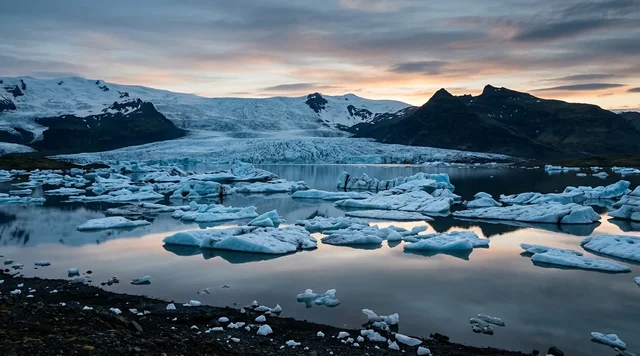
AI illustration
 Edited by
 The road that actually reaches Landmannalaugar is not the one most guides name. It is F224, a spur four kilometres long that leaves Fjallabaksleið nyrðri and ends in an unbridged river. Over the last five summers Vegagerðin opened the section above it as early as 23 May and as late as 23 June. Nothing about this place runs to a calendar, and almost every sentence written about it is a month or a road number out.
What this is, and what it is not
This is a desk-researched dossier. Nobody from this publication has stood in the warm stream at Landmannalaugar. It is assembled from the 1979 designation notice in the Icelandic official gazette, the reserve's own management plan, Vegagerðin's road register and opening-date tables, the Smithsonian Global Volcanism Program, peer-reviewed petrology and glaciovolcanology, the price lists and booking systems of the bodies that actually take the money, and Icelandic news reporting from this summer.
Landmannalaugar sits inside Friðland að Fjallabaki, a nature reserve declared on 13 August 1979 — forty-seven years ago today — by the Ministry of Education under Iceland's Nature Conservation Act of 1971, and published as Stjórnartíðindi B no. 354/1979. The notice is short and blunt. Motor vehicles are permitted only on roads and marked tracks. Camping is permitted only on marked sites. Damaging vegetation or removing natural specimens is prohibited. Rubbish must be carried out and may not be buried. Horses are confined to marked routes and grazing at Landmannalaugar itself is forbidden.
The reserve covers 44,633.4 hectares — 446.3 square kilometres — and lies entirely above 500 metres, with a mean annual temperature of 0 to 1°C. Its own 2021–2030 management plan gives 446.24 km². The two figures differ by six hundredths of a square kilometre and we mention it only because the number that circulates in travel coverage, 470 km², matches neither.
One more correction that matters more than it sounds. The reserve is no longer administered by Umhverfisstofnun, the Environment Agency of Iceland. That agency ceased to exist on 31 December 2024. On 1 January 2025 its work was split between a new Icelandic Environment and Energy Agency and Náttúruverndarstofnun, the Nature Conservation Agency of Iceland, which took the protected areas, roughly 130 of them plus three national parks, and now runs Landmannalaugar. It was Náttúruverndarstofnun that granted Ferðafélag Íslands permission in September 2025 to renew the hot and cold water wells at the site, and it is Náttúruverndarstofnun that operates the car park. Coverage still citing Umhverfisstofnun is citing a dissolved body.
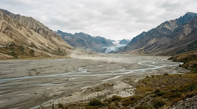
 AI illustration
Why the mountains are those colours
Landmannalaugar sits on the western edge of Torfajökull, which is not a mountain so much as a volcanic complex about 600 square kilometres across with a caldera at its centre. The Smithsonian Global Volcanism Program puts roughly 225 cubic kilometres of silicic extrusive rock here and calls it the largest area of silicic and intermediate volcanism in Iceland. The complex rises about 500 metres above the surrounding basalt plains and reaches 1,280 metres.
The caldera's size is genuinely disputed. The Global Volcanism Program describes a 12-kilometre-wide Pleistocene caldera. Iceland's own UNESCO tentative-list submission of April 2013 gives about 16 kilometres west to east and about 12 kilometres north to south, and puts the caldera's age near 500,000 years. We are not going to average those. The honest statement is that the short axis is agreed at roughly twelve kilometres and the long axis is not.
Rhyolite is the pale, silica-rich end of the volcanic rock series, and in Iceland it is rare — the island is overwhelmingly basalt. How it forms here has been argued over for decades. The most useful measurement comes from Martin and Sigmarsson, writing in Contributions to Mineralogy and Petrology in 2007: the Torfajökull rhyolites carry an oxygen isotope value of 2.4‰ and a strontium concentration of 12.2 parts per million, which they read as partial melting of hydrated metabasaltic crust followed by heavy feldspar fractionation, rather than the simple crystal fractionation of basalt that produces silicic rock elsewhere. In their reading, silicic magma inside or close to the rift zone is principally melted crust. The mountains you are looking at are the old floor of Iceland, remelted.
The colour is not the rock's own. Rhyolite weathers pale. What paints Landmannalaugar is the geothermal system underneath it — the same heat that warms the stream people bathe in.
Torfajökull holds what Iceland's Institute of Natural History calls the country's largest and probably most powerful high-temperature geothermal area, one of about twenty such fields on the island, with boiling pools, mudpots, fumaroles, sulphur deposits and chemically altered ground. That alteration is the pigment. Hydrothermal fluids and steam work through the rhyolite, and the mineral assemblages and iron oxidation states they leave behind produce the ochres, rusts, greens and purples. The dark ground at the foot of the slopes is the opposite process: fresh, unaltered, obsidian-bearing lava.
Bláhnúkur, and eruptions under ice
The blue-black cone immediately south of the hut is worth knowing about because it was built under a glacier. Hugh Tuffen's doctoral work at the Open University on subglacial rhyolite volcanism at Torfajökull put Bláhnúkur at under 0.1 cubic kilometres, erupted beneath ice at least 350 metres thick during the last glacial period. Nearby sites in the same study produced phreatomagmatic ash piles over 300 metres deep. The variable, in his modelling, is discharge rate: slow eruptions fill their meltwater cavity and end up intrusive, fast ones do not and go explosive.
1477, and the date that keeps getting mangled
The lava field you cross to reach Brennisteinsalda is Laugahraun. The Global Volcanism Program assigns it, together with Námshraun, to Torfajökull's most recent eruption, in 1477 CE. That is the last confirmed activity at the volcano; before it come a rhyolite flow around 1170 and Hrafntinnuhraun around 870.
The same year, the Veiðivötn fissure system to the north produced one of the largest explosive eruptions in Iceland of the last twelve centuries. A 2021 study in Climate of the Past identifying its cryptotephra in a Greenland ice core describes a VEI 6 event, more than 10 cubic kilometres of basaltic tephra from a fissure 60 to 65 kilometres long, and dates it to early 1477 — most probably February — on the strength of a votive letter written on 11 March 1477 describing the ashfall in northern Iceland. That is an unusually hard date for a fifteenth-century eruption: a contemporary document, corroborated by ice chemistry.
Two things follow, and popular coverage muddles both. Laugahraun is a Torfajökull rhyolite flow, not part of the Veiðivötn basaltic eruption; they were simultaneous, which is itself the interesting fact, because basaltic intrusion into a hot silicic system is a plausible trigger. And the date is 1477, not "around 1480", not "the fifteenth century" as a vague gesture, and certainly not the "about 800 years old" that appears in more than one guide. It is five hundred and forty-nine years old this year, give or take a season.
What popular coverage gets wrong
Start with the road number, because it is checkable in thirty seconds and almost nobody gets it right. Vegagerðin's road register describes F224 Landmannalaugavegur as running "af Fjallabaksleið nyrðri að Landmannalaugum" — from Fjallabaksleið nyrðri to Landmannalaugar. That is the road that reaches the site. F208 is Fjallabaksleið nyrðri, the through route. F225 is Landmannaleið, the Dómadalur approach from Landvegur north of Hekla, which joins F208 near Frostastaðavatn — a way of getting close, not a way of arriving. Our own previous version of this article named F225 as an access road to Landmannalaugar and did not mention F224 at all. That was wrong.
Second, and more dangerous: the recurring claim that a two-wheel-drive car can manage it. F-roads are legally restricted to four-wheel-drive vehicles, and F224 ends at an unbridged ford. SafeTravel, run by Iceland's search and rescue association, states the position on insurance without hedging: no insurance covers the damage of a vehicle while crossing a river. Not the collision damage waiver, not the gravel protection, not the premium package. A drowned engine on the last four kilometres of your holiday is entirely yours. SafeTravel is equally direct about the legal line — F-roads and gravel roads are not off-road driving; driving off them is.
Third, the numbers that get repeated without a source. The reserve is 446 km², not 470. And the temperature of the bathing stream, given as 36–40°C in essentially every account including our own previous one, we could not trace to any published measurement by any Icelandic agency. It is plausible, it matches how a hot inflow mixing with a cold one behaves, and it may well be right. We now say so rather than presenting it as established.
The opening dates, which are not "late June"
Vegagerðin publishes year-by-year opening dates for the highland routes, broken into sections. For the section that matters — F208 from Sigalda to Landmannalaugar — the last five years read: 12 June 2021, 23 June 2022, 1 June 2023, 12 June 2024 and 23 May 2025. Earliest 23 May, latest 23 June. That is a one-month spread with a centre of gravity in the first half of June, not "late June to mid-September".
The continuation east, Laugar to Eldgjá, runs consistently later: 1 July, 6 July, 16 June, 25 June and 19 June across the same five years. F225 Landmannaleið sits between them at 18 June, 24 June, 9 June, 18 June and 11 June.
One oddity we will not paper over. Vegagerðin prints a 2021–2025 mean for the Sigalda–Landmannalaugar section of 2 June, which is earlier than four of the five dates in its own row. We could not reconcile that and we have not used it. The year-by-year dates are the usable figures.
Note also that the road opening and the site opening are different events. In 2026 the Trex highland bus ran from 19 June to 6 September, and compulsory parking booking runs 20 June to 13 September. The road can be legally open for three weeks before the services start.
 AI illustration
Getting there, and what it costs
The scheduled bus is the sane option and the numbers are public. Trex leaves Reykjavík City Hall at 07:30 and reaches Landmannalaugar at 11:20 — three hours fifty minutes — with a second departure at 12:30 between 26 June and 23 August. One way from Reykjavík is 14,900 ISK, from Hella 13,900 ISK, with returns at double. Reykjavík Excursions runs a competing Highland Bus from BSÍ, quoting about five hours.
If you drive, you must book the car park. The system was introduced in 2024 to stop the daily congestion on the access road, and for 2026 it is compulsory for vehicles arriving between 09:00 and 16:00 from 20 June to 13 September, with booking opened on 1 April. A car of up to five seats is 1,500 ISK, a six-to-nine-seater 2,450, a motorcycle 750, and buses run from 5,500 to 16,500 ISK by size. The fee bundles in the day-visitor service charge for the toilets and changing facilities. Access is enforced by number-plate cameras, so the registration on the booking has to be right. Arrivals before 09:00 or after 16:00 do not need a reservation.
Ferðafélag Íslands runs the hut and campsite. The hut has 78 beds over two floors with a gas kitchen and running water, and a warden through the summer; a bed is 17,000 ISK a night. Camping is 3,400 ISK for an adult, 1,700 for ages seven to seventeen, free at six and under. Showers are not included and cost 1,100 ISK. The current price list runs from 1 May 2026 to 30 April 2027. Hut cancellations refund 75% at 56 days or more, 50% between 55 and 21 days, and nothing inside twenty days; weather is not grounds for a refund.
The Laugavegur, in its own numbers
Ferðafélag Íslands gives the route in four stages: Landmannalaugar to Hrafntinnusker 12 km with 470 metres of ascent, Hrafntinnusker to Álftavatn 12 km, Álftavatn to Emstrur 16 km, Emstrur to Þórsmörk 15 km. That is 55 kilometres. The huts along it are smaller than the one you start from: Hrafntinnusker 52 places, Álftavatn 72, Hvanngil 60, Emstrur 60, Þórsmörk 75.
Three rivers on the route are unbridged — Bratthálskvísl, Bláfjallakvísl and Þröngá — and some are crossed on snow bridges early in the season. Ferðafélag Íslands warns of snowstorms in the middle of July and notes that pitching a tent outside designated areas is absolutely prohibited. SafeTravel's wading advice is worth memorising: cross in the morning when levels are lowest, choose the wide braided sections rather than the narrow deep ones, loosen every strap on your pack, and link arms at the elbow in threes.
Driving off the road, and what it now costs
Article 31 of Iceland's Nature Conservation Act No. 60/2013 states it in five words: it is prohibited to drive motorised vehicles off roads. Breaches carry criminal penalties under Article 90. The minimum fine has been reported as 350,000 ISK; a documented on-the-spot payment in 2019 came to 450,000 ISK, set above the minimum because of the extent of soil damage.
This is a live argument in Iceland this summer, not a historical note. Over the weekend of 21–22 June 2026, two foreign tourists driving Land Rovers were fined several hundred thousand krónur each for damage at Einhyrningur, Kötlujökull, Emstruleið and Kerlingarfjöll — the last two on the Laugavegur and its approaches. The police chief for South Iceland confirmed that confiscating the vehicles was legally possible through the courts but was not pursued in that case. Icelandic reporting put the applicable range at 10,000 to 1,000,000 ISK depending on severity; we could not locate the underlying schedule and flag that.
Drones are a separate permit regime that most visitors do not know about. Flying one inside Friðland að Fjallabaki between 15 June and 15 September requires written permission from Náttúruverndarstofnun, granted case by case with time-of-day restrictions attached.
 AI illustration
Why the Silence Index is 58
The friction here is structural rather than discretionary. For roughly nine months of the year you cannot arrive at all. When you can, the filter is a legal 4x4 requirement, an unbridged river and a booking system with cameras on it.
What holds the score at 58 rather than higher is footfall, and there are counts. The reserve's management plan records 47,598 visitors at Landmannalaugar between 1 June and 30 September 2013, rising to 83,926 in 2018 and 71,483 in 2019, from the vehicle and visitor counting programme run by Rögnvaldur Ólafsson and Gyða Þórhallsdóttir. Those are pre-pandemic numbers into a site with 78 beds, and they are the reason the car park now has a reservation system.
The solitude at Landmannalaugar is real but it is a matter of hours rather than of place. The day buses arrive around 11:20 and leave at 14:30 and 18:00. Everything before and after those times belongs to the people who booked a bunk or carried a tent. That is the whole trick, and it is not much of a secret — it is simply inconvenient, which in the Highlands amounts to the same thing.
Corner Codex — D-011
- Place
- Landmannalaugar, Friðland að Fjallabaki, southern Highlands of Iceland
- Coordinates
- 63.99°N, 19.06°W — hut and campsite at roughly 600 m
- Reserve
- Designated 13 August 1979; 44,633.4 ha (446.3 km²); entirely above 500 m
- Managed by
- Náttúruverndarstofnun since 1 January 2025 — not Umhverfisstofnun
- Access road
- F224 Landmannalaugavegur, off F208 Fjallabaksleið nyrðri. 4x4 only
- Road opening
- F208 Sigalda–Landmannalaugar: 23 May 2025 to 23 June 2022 over five years
- Rhyolite
- About 225 km³ of silicic rock — the largest such complex in Iceland
- Last eruption
- 1477 CE, which laid down Laugahraun and Námshraun
- Hut
- 78 beds, 17,000 ISK a night; camping 3,400 ISK; shower 1,100 ISK
- Parking
- Booking compulsory 20 June–13 September 2026, 09:00–16:00. 1,500 ISK a car
- Season count
- 83,926 visitors 1 June–30 September 2018; 71,483 in 2019
- Silence Index
- 58 / 100
Silence Index
A legacy editorial rating based on desk research. It is not an acoustic measurement or a safety rating.
Earlier and later dossiers used different fourth inputs. Individual input scores were not recorded, so these totals cannot be independently reproduced or used for precise comparisons between places.
The Traveler's Panel · checked
Changing information. Prices, permits, seasons and road access change, sometimes at short notice. Everything here is a starting point for your own confirmation — not a quote, and not a guarantee. Verify with the operator and the relevant official body before you book.
| Access road | F224 Landmannalaugavegur off F208. Not F225 — that is the Dómadalur approach |
| Road opening | F208 Sigalda–Landmannalaugar: 23 May 2025 earliest, 23 June 2022 latest |
| Bus 2026 | Trex 19 June–6 September. Reykjavík 07:30, arrive 11:20. 14,900 ISK one way |
| Parking | Compulsory booking 20 June–13 Sept 2026, 09:00–16:00. Car 1,500 ISK. Camera-enforced |
| Hut | 78 beds, 17,000 ISK. Camping 3,400 ISK adult, shower 1,100 ISK extra |
| Insurance | No insurance covers vehicle damage in a river crossing. None |
| Off-road fine | Minimum reported 350,000 ISK; 450,000 ISK paid in a documented 2019 case |
| Managed by | Náttúruverndarstofnun since 1 January 2025 |
Getting there — Reykjavík → Hella → the Highlands
- Decide between bus and 4x4 before you book anything else. The Trex highland bus ran 19 June to 6 September in 2026, departing Reykjavík City Hall at 07:30 and reaching Landmannalaugar at 11:20, with a second 12:30 departure from 26 June to 23 August. Returns leave at 14:30 and 18:00. Reykjavík Excursions runs a Highland Bus from BSÍ on a similar pattern.
- If you drive, the route is Route 26 or Route 32 to F208 Fjallabaksleið nyrðri, then the F224 spur. F225 Landmannaleið is the alternative approach over Dómadalur and joins F208 near Frostastaðavatn; it is not itself the access road.
- Check the year-by-year opening dates rather than a season. Vegagerðin opened the Sigalda–Landmannalaugar section on 12 June 2021, 23 June 2022, 1 June 2023, 12 June 2024 and 23 May 2025. The Laugar–Eldgjá continuation runs one to three weeks later.
- Book the car park. From 20 June to 13 September 2026, vehicles arriving between 09:00 and 16:00 must have a reservation; number-plate cameras control access, so the registration must match. 1,500 ISK for a car of up to five seats, and the fee includes the day-visitor facility charge.
- Book the hut through Ferðafélag Íslands well ahead — there are 78 beds and there were 83,926 recorded visitors in the 2018 season. The campsite is larger but also busy in the peak weeks.
Indicative costs — verify before booking
| Hut bed, per person per night | 17,000 ISK (Ferðafélag Íslands, price list 1 May 2026–30 April 2027) |
| Camping, adult per night | 3,400 ISK · ages 7–17 1,700 ISK · under 7 free |
| Shower | 1,100 ISK — not included in either fee |
| Parking, car up to 5 seats | 1,500 ISK · 6–9 seats 2,450 ISK · motorcycle 750 ISK |
| Parking, buses | 5,500 ISK (10–19 seats) · 9,500 (20–32) · 16,500 (33–64) |
| Trex bus, one way | 14,900 ISK from Reykjavík · 13,900 ISK from Hella · returns double |
| Hut cancellation | 75% refunded at 56+ days, 50% at 55–21 days, nothing inside 20 days |
| Verify | Prices and seasons change annually. Confirm with Ferðafélag Íslands, Náttúruverndarstofnun and the bus operator before booking. |
What to pack
- Full waterproofs and warm layers in any month. The reserve lies entirely above 500 m with a mean annual temperature of 0–1°C, and Ferðafélag Íslands specifically warns of snowstorms in mid-July.
- Wading shoes if you are walking the Laugavegur. Three rivers on the route are unbridged and SafeTravel is explicit that crossing barefoot is worse.
- Swimwear and a quick-dry towel. Showers at the site are a separate 1,100 ISK.
- Food for the whole stay. There is a small seasonal café and shop and no supermarket inside the reserve.
- Your booking reference and the correct vehicle registration. Car park access is controlled by number-plate recognition.
Where to stay
The choice on site is the 78-bed hut or the campsite, both run by Ferðafélag Íslands, and in July and August both need planning. Many visitors instead base at Hella or Hvolsvöllur in the lowlands and come up for a long day — which is exactly the pattern the counting programme picked up, and the reason the car park had to be rationed. Staying the night is the only way to get the version of Landmannalaugar that the photographs imply: the buses leave at 14:30 and 18:00, and what is left after that is the reason to carry a sleeping bag up an F-road.
Safety & responsible travel
- Do not attempt the ford in a two-wheel-drive car, and do not assume any policy covers you if you do. SafeTravel states flatly that no insurance covers damage to a vehicle while crossing a river.
- Stay on roads and marked tracks. That has been the rule since the 1979 designation notice, and Article 31 of the Nature Conservation Act No. 60/2013 makes off-road driving a criminal offence. Two tourists were fined several hundred thousand krónur each in June 2026 for damage including sites on the Laugavegur.
- Camp only on marked sites. The 1979 notice restricts camping to designated areas and Ferðafélag Íslands calls pitching outside them absolutely prohibited.
- Get written permission before flying a drone. Inside Friðland að Fjallabaki, drone use between 15 June and 15 September requires a permit from Náttúruverndarstofnun.
- Accessibility: rough ground, a river crossing, shared bunkrooms and a natural stream with an uneven bed. This is not a serviced or step-free site.
Nearby, and quieter
Deeper into Fjallabak, the Ljótipollur crater lake and the Hnausapollur and Stútur explosion craters off F208 and F225 take a fraction of the traffic. Eldgjá sits on the F208 continuation east, which opens one to three weeks after the Landmannalaugar section. Southward the Laugavegur runs 55 km through Hrafntinnusker, Álftavatn, Hvanngil and Emstrur to Þórsmörk, and every hut on it is smaller than the one at the trailhead.
Getting there, in order
- 1Reykjavík
- 2Hella
- 3the Highlands
Each leg is a separate booking and a separate chance to be weathered out. Build spare days into the chain, not onto the end of it.
Where it is
Iceland · 63.9900°N 19.0600°W · Open in Google Maps · OpenStreetMap
Key locations
- Landmannalaugar — the hut, campsite, warm stream and the car park you now have to book
63.9932°N 19.0601°W - Bláhnúkur — the cone erupted under at least 350 m of ice, immediately south of the hut
63.9771°N 19.0687°W - Frostastaðavatn — where F225 Landmannaleið joins F208, the through route
64.0198°N 19.0581°W - Hrafntinnusker — first Laugavegur hut, 12 km and 470 m of ascent out
63.9334°N 19.1803°W - Þórsmörk — the far end of the 55 km Laugavegur
63.6833°N 19.4833°W - Sigalda — start of the F208 section whose opening has run 23 May to 23 June
64.1500°N 19.2500°W
Coordinates are for orientation and are accurate to roughly the width of the feature named, not to a doorway. Several of these points are inside protected areas or need a permit, a guide or a boat — read the access notes above before you plan a route to any of them.
Sources & further reading — checked
- Umhverfisstofnun / Náttúruverndarstofnun — Fjallabak Nature Reserve: about the nature reserve. Designation in 1979; area of 44,633.4 hectares (446.3 km²); the whole reserve lying above 500 m; mean annual temperature of 0–1°C; and the requirement to stay on marked roads
- Stjórnartíðindi B no. 354/1979 — Auglýsing um friðland að Fjallabaki. The designation notice itself, signed by the Ministry of Education on 13 August 1979 under the Nature Conservation Act No. 47/1971, with the boundary description and the original restrictions on vehicles, camping, vegetation, waste and grazing
- Friðland að Fjallabaki — Stjórnunar- og verndaráætlun 2021–2030. The management plan's own area figure of 446.24 km²; the description of Torfajökull as Iceland's largest rhyolite area and most powerful high-temperature field; and the visitor counts of 47,598 (2013), 83,926 (2018) and 71,483 (2019) for 1 June–30 September
- Umhverfisstofnun — Icelandic Environment and Energy Agency and Nature Conservation Agency of Iceland established. The Environment Agency of Iceland ceasing operations on 31 December 2024 and the split into two successor agencies on 1 January 2025, with protected areas going to Náttúruverndarstofnun
- Vatnajökulsþjóðgarður — The Nature Conservation Agency of Iceland is established. The remit of the new agency from 1 January 2025: nature conservation, protected areas, biodiversity and hunting management, and the national parks
- Náttúruverndarstofnun — permit to Ferðafélag Íslands for works at Landmannalaugar, 18 September 2025. Confirmation that Náttúruverndarstofnun is the consenting authority at Landmannalaugar, and the conditions attached to renewing the hot and cold water wells
- Náttúruverndarstofnun — Permit for the use of a drone in the Fjallabak Nature Reserve, 18 July 2025. That drone use inside the reserve between 15 June and 15 September is subject to written permission, granted case by case with location and time-of-day conditions
- UNESCO World Heritage Centre — Torfajökull Volcanic System / Fjallabak Nature Reserve (tentative list, 15 April 2013). The Torfajökull area of about 600 km²; the caldera given as about 16 km west–east by 12 km north–south and about 500,000 years old; elevations of 600–1,200 m; and up to eleven Holocene eruptions
- Smithsonian Institution, Global Volcanism Program — Torfajökull. About 225 km³ of silicic extrusive rock, the largest area of silicic and intermediate volcanism in Iceland; a 12-km-wide Pleistocene caldera; a summit of 1,280 m; and 1477 CE as the most recent confirmed eruption
- Smithsonian Institution, Global Volcanism Program — Torfajökull eruptive history. The assignment of Námshraun and Laugahraun to the 1477 CE eruption, with Hrafntinnuhraun around 1170 and 870 CE and older tephrochronologically dated events
- Abbott et al. — Climate of the Past 17, 565–585 (2021): cryptotephra from the Icelandic Veiðivötn 1477 CE eruption in a Greenland ice core. The Veiðivötn 1477 eruption as VEI 6 with over 10 km³ of basaltic tephra from a 60–65 km fissure, dated to early 1477 — most likely February — on a votive letter of 11 March 1477 and confirmed by ice-core cryptotephra
- Martin & Sigmarsson — Contributions to Mineralogy and Petrology 153 (2007), 593–605. The oxygen isotope value of 2.4‰ and strontium of 12.2 ppm in Torfajökull rhyolites, read as partial melting of hydrated metabasaltic crust with feldspar fractionation rather than simple fractional crystallisation
- Tuffen, H. (2002) — Subglacial rhyolite volcanism at Torfajökull, Iceland (PhD thesis, The Open University). Bláhnúkur at under 0.1 km³ erupted beneath ice at least 350 m thick, phreatomagmatic ash over 300 m thick at a neighbouring site, and the discharge-rate control on eruption style
- Náttúrufræðistofnun (Icelandic Institute of Natural History) — Geothermal heat. About twenty delimited high-temperature fields in Iceland, and the Torfajökull caldera as the largest and most powerful of them, with hot springs, mudpots and fumaroles
- Vegagerðin — Opnun fjallvega (opening of mountain roads). Year-by-year opening dates 2021–2025: F208 Sigalda–Landmannalaugar on 12 June, 23 June, 1 June, 12 June and 23 May; Laugar–Eldgjá on 1 July, 6 July, 16 June, 25 June and 19 June; F225 Landmannaleið on 18 June, 24 June, 9 June, 18 June and 11 June
- Vegagerðin — Vegaskrá, leiðarlýsing (road register route descriptions). The official definition of F224 Landmannalaugavegur as running from Fjallabaksleið nyrðri to Landmannalaugar, of F208 as the through route past Eldgjá and Landmannalaugar, and of F225 Landmannaleið as the Dómadalur approach joining F208 at Frostastaðavatn
- Vegagerðin — Mountain roads. That opening depends on spring and early-summer weather with snowpack the dominant factor, rather than on a fixed calendar
- Rögnvaldur Ólafsson, Gyða Þórhallsdóttir & Auður Þórunn Rögnvaldsdóttir — Ferðahættir að Fjallabaki (Stofnun rannsóknasetra Háskóla Íslands, hosted by Vegagerðin). The vehicle-counting methodology behind the Landmannalaugar visitor figures, the counter network across northern Fjallabak, and the July–August concentration of traffic
- SafeTravel (ICE-SAR) — Highland driving. That no insurance covers damage to a vehicle while crossing a river; that F-roads are typically closed from mid-September until June or July; and that driving off an F-road or gravel road is off-road driving and strictly forbidden
- SafeTravel (ICE-SAR) — River crossing on foot. The wading guidance used for the Laugavegur: cross in the morning at lower flow, choose wide braided sections over narrow deep ones, wear wading shoes, loosen pack straps and link arms in groups
- Althingi — Lög um náttúruvernd nr. 60/2013. Article 31: it is prohibited to drive motorised vehicles off roads, with the listed exceptions, and unlawful off-road driving carrying criminal penalties under Article 90
- InforMEA / UNEP — Nature Conservation Act (No. 60 of 2013), Iceland. The Act's entry into force on 8 March 2013 and its structure, including Chapter V on off-road driving and Chapter XV on coercive measures and sanctions
- Vísir — Kom ekki til skoðunar að gera Land Rover-jeppana upptæka (June 2026). Two foreign tourists fined several hundred thousand krónur each for off-road damage at Einhyrningur, Kötlujökull, Emstruleið and Kerlingarfjöll over 21–22 June 2026; the South Iceland police chief on confiscation; and a reported penalty range of 10,000–1,000,000 ISK
- Vísir — Staðgreiddi 450 þúsund króna sekt vegna utanvegaaksturs (June 2019). A 450,000 ISK fine paid on the spot for off-road driving, set above the stated 350,000 ISK statutory minimum because of the extent of soil damage
- Iceland Review — Authorities look to raise fines for off-road driving (July 2019). The 350,000 ISK minimum fine for off-road driving, and that higher amounts are often issued
- Ferðafélag Íslands — Landmannalaugar hut. The hut's 78 beds over two floors, the gas kitchen and running water, the summer warden, the 17,000 ISK nightly rate, an approximate 20 June–15 September season, and the 2026 requirement to pre-book parking for arrivals between 09:00 and 16:00
- Ferðafélag Íslands — Laugavegur trail. Stage distances of 12, 12, 16 and 15 km totalling 55 km; hut capacities of 52 at Hrafntinnusker, 72 at Álftavatn, 60 at Hvanngil, 60 at Emstrur and 75 at Þórsmörk; the unbridged Bratthálskvísl, Bláfjallakvísl and Þröngá; and the prohibition on camping outside designated areas
- Ferðafélag Íslands — Gistiskilmálar og verðskrá (accommodation terms and price list). The price list running 1 May 2026 to 30 April 2027; half price for under-18s and free for under-7s; showers excluded from accommodation and facility fees; and the 75% / 50% / nil hut cancellation ladder
- Ferðafélag Íslands booking system — Landmannalaugar campsite. Camping at 3,400 ISK for adults and 1,700 ISK for ages 7–17, free under 7, with the shower fee of 1,100 ISK charged separately
- Parka — Landmannalaugar parking (operated by Náttúruverndarstofnun). Compulsory booking for arrivals 09:00–16:00 between 20 June and 13 September 2026; 1,500 ISK for a car up to five seats, 2,450 for six to nine, 750 for a motorcycle and 5,500 to 16,500 for buses; number-plate camera enforcement; and booking opening on 1 April
- Umhverfisstofnun / Náttúruverndarstofnun — Landmannalaugar. That the parking reservation system was implemented in 2024 to reduce the daily congestion on the access road and car parks, that the site remains accessible around the clock, and the encouragement to arrive by bus
- Trex — Landmannalaugar highland bus. The 2026 season of 19 June to 6 September; departure from Reykjavík City Hall at 07:30 arriving 11:20, a second 12:30 departure from 26 June to 23 August, returns at 14:30 and 18:00, and one-way fares of 14,900 ISK from Reykjavík and 13,900 ISK from Hella
- Icelandia / Reykjavík Excursions — Highland Bus to Landmannalaugar. The competing scheduled highland bus from BSÍ in Reykjavík, quoted at about five hours each way for the 2026 summer and autumn season
- Visit South Iceland (Markaðsstofa Suðurlands) — Landmannalaugar Nature Reserve. That Landmannalaugar is named for a hot pool rising at the edge of the Laugahraun lava; that road 224 is the access route; the summer café and horse rental; and a parking-booking window of 20 June–15 September, 08:00–15:00, which conflicts with the operator's own dates
Official and scientific bodies are the authority for safety, regulatory and scientific claims. Commercial operators are used only for practical detail such as tour length, meeting points and indicative pricing — never for a safety or scientific statement.
How this was made
Desk research. Compiled from official bodies, scientific and conservation sources, established journalism and licensed operators. Not based on a personal visit.
Editor’s method note — what we checked, corrected and could not verify
- Desk research only. Nobody from this publication has been to Landmannalaugar, and every figure below can be checked against the linked source rather than against our impressions.
- We corrected the access road. Our previous version named F208 and F225 as the ways in and did not mention F224. Vegagerðin's own road register defines F224 Landmannalaugavegur as the road from Fjallabaksleið nyrðri to Landmannalaugar; F225 Landmannaleið is the Dómadalur approach that joins F208 at Frostastaðavatn. Visit South Iceland independently names road 224 as the access route.
- We corrected the managing authority. The Environment Agency of Iceland was dissolved on 31 December 2024 and protected areas passed to Náttúruverndarstofnun on 1 January 2025. Our previous version, and most current travel coverage, still credits Umhverfisstofnun.
- We replaced 'broadly late June to mid-September' with Vegagerðin's published year-by-year dates. Over 2021–2025 the Sigalda–Landmannalaugar section of F208 opened between 23 May and 23 June. We note but do not use the five-year mean printed in the same table, 2 June, which is earlier than four of the five dates in its own row and which we could not reconcile.
- We replaced indicative prices with the current published ones: 17,000 ISK for a hut bed, 3,400 ISK for adult camping, 1,100 ISK for a shower, and 1,500 ISK for a car park space under a booking system that is compulsory between 09:00 and 16:00 from 20 June to 13 September 2026.
- We left two disagreements visible rather than resolving them. The caldera is 12 km wide according to the Global Volcanism Program and about 16 by 12 km according to Iceland's UNESCO tentative-list submission. The reserve is 446.3 km² on the agency's public page and 446.24 km² in its own management plan, and neither supports the 470 km² that circulates elsewhere. Visit South Iceland gives the parking window as 20 June–15 September, 08:00–15:00, while the operator gives 20 June–13 September, 09:00–16:00 for 2026.
- We downgraded the bathing temperature. The 36–40°C figure that appears everywhere, including in our own previous version, could not be traced to any published measurement by an Icelandic agency, and is now presented as unverified rather than as fact.
- Things we could not verify: the exact 2026 opening date for F208 and F224, which no official source we could reach publishes retrospectively; any official measurement of the bathing stream's temperature; the current physical arrangement of the ford and any footbridge at the Landmannalaugar car park; the car park's capacity in vehicles; the regulation or schedule behind the 10,000–1,000,000 ISK off-road penalty range reported in Icelandic media; visitor counts for Landmannalaugar after the 2019 season, the most recent figures we could find; the number of walkers completing the Laugavegur in a season; the article of the 1971 Nature Conservation Act under which the reserve was designated, since the 1979 notice cites Article 21 while the published English translation of that Act places nature reserves at Article 24; and the current-year status of the roads on the day you read this, which must be checked against umferdin.is rather than against any article, including this one.
- Coordinates for the key locations are from Visit South Iceland's GPS listing for the reserve (N63° 59' 35.321" W19° 3' 36.307") and otherwise from GeoNames. Sigalda is given by GeoNames only to the nearest minute of arc, so its four decimal places are the source's rounding rather than real precision. Brennisteinsalda, which the Laugahraun crossing leads to, is in no gazetteer we could open and the two secondary positions we found disagree by more than a kilometre, so it is left out.
AI is used to draft this text, and a human checks it. Tony Hall is responsible for editorial verification against the reference list. Our standard is to distinguish documented facts, disputed accounts and claims we could not verify. Errors can remain; readers can report them through the corrections page. The illustrations are AI-created and labelled as such — no photograph on this site is presented as a record of a real place. Full disclosure · Editorial policy.
Access details change — recheck before you travel. Found an error? Tell us — corrections are dated and shown in place.