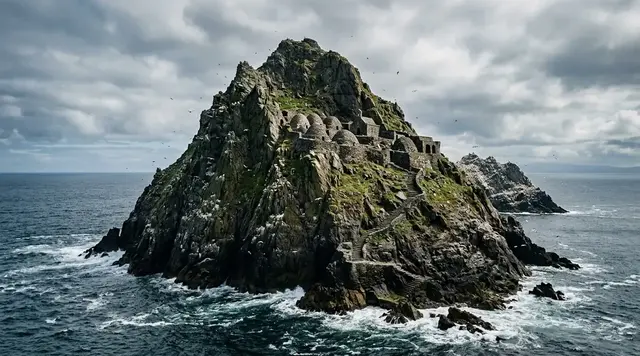
AI illustration
 Edited by
 At the edge of the Helgeland coast, 451 people share a municipality of more than 418 islands, islets and skerries. Only four have permanent settlement. On Husøy, the largest cluster of homes faces the serrated wall of Sanna across a channel that carries commuters, groceries, school journeys and drinking water. In Træna, the sea is not the view beyond the village. It is the road inside it.
The Arctic Circle crosses this archipelago without a sign in the water. Midnight light can hold the horizon open for roughly six weeks, while autumn and winter expose the same islands to westerly weather. Express boats and a car ferry connect Træna to the mainland; a local boat links its small communities. Those services make a visit possible, but never frictionless. The right itinerary does not try to defeat distance. It learns how an inhabited place has built a life around it.
Water is the road
Statistics Norway recorded 451 residents in Træna in the first quarter of 2026. Municipal plans describe more than 418 islands, islets and skerries, with permanent settlement on Husøy, Selvær, Sanna and Sandøy. The numbers sound like a riddle until the harbour comes into view. A municipality normally imagined as one patch of land is here a pattern of channels, landing stages and weather windows. The public realm continues past the end of every road because the boat is part of the road.
Husøy is the practical centre. Most residents live there, alongside the municipal offices, church, museum, grocery shop, café, accommodation and the main passenger landings. Sanna rises immediately west, its mountains making the profile that identifies Træna from far out at sea. Selvær lies farther north among lower rock and fishing water. Sandøy has a small permanent community; nearby Holmen and many other islands hold holiday houses or no services at all. Calling the archipelago one destination hides how much planning may sit inside a two-kilometre crossing.
The regional operator Reis Nordland currently lists the Træna local express boat as route 18-195, the Træna–Stokkvågen ferry as route 18-192 and the Bodø–Sandnessjøen coastal express as NEX1, route 23-731. Route numbers are more dependable than copied departure times, but even they do not replace the date-specific journey planner. Holidays bring deviations, small islands may have limited calls and weather can change the practical sequence. A traveller should build from the live public-transport system outward, not draw a perfect island circuit and then hope a boat appears beneath it.
The last road in Træna does not end at the quay. It changes material.
Four islands, four versions of near
Husøy can be crossed on foot with little drama. Visit Helgeland's culture walk is about three kilometres and one to two hours, beginning near the ferry pier, shop and tourist information. It passes contemporary art, the Petter Dass Chapel, a water-tower viewpoint, Træna Church and the museum. The scale is small, yet the walk is not an outdoor museum loop. It threads homes, working buildings and the places residents use every day. A slow pace should create attention, not a licence to photograph through windows.
Selvær is a different community, with permanent residents, a small shop and fishing-related accommodation. Sanna has very few permanent residents, many holiday homes and the archipelago's most recognisable mountains. Sandøy is smaller and quieter still. Visit Helgeland warns that some outlying islands have neither food service nor toilets. That absence is not a charming inconvenience to solve behind a shed; it is a planning instruction. Use facilities before boarding, carry what is needed, and bring every trace back.
Public boats are lifelines before they are sightseeing craft. Stand clear while freight and local passengers move, keep luggage compact, and do not occupy shelter or priority seating for equipment. If a connection would leave no margin for a missed call, spend another night. The distance between islands may look trivial from a summit, but wind, schedule and a small vessel's operating pattern decide what 'near' means on the day. Collecting every inhabited island is less valuable than understanding one without making local movement harder.
An archipelago is not a checklist separated by blue. Each channel has somebody's ordinary journey inside it.
Fresh water crosses salt water
Træna's remoteness is easiest to understand through drinking water. The municipality states that Husøy has two water-treatment plants. Its fresh-water source lies on Sanna across the channel, while a desalination plant provides another part of the system. Selvær also uses desalination. Beneath the dramatic horizon is a piece of municipal engineering that turns geography into a daily service: water gathered or made on one island, treated, monitored and delivered where people live.
That system changes the meaning of a visitor's long shower, laundry cycle or careless leak. Norway is often imagined as inexhaustibly wet, but rainfall and ocean are not the same as ready drinking water on a low offshore island. Accommodation providers know the current situation; follow their guidance without comparing it to mainland habits. Refill rather than multiplying bottles, report a running toilet or tap promptly, and do not assume that a festival weekend or a run of dry weather leaves infrastructure untouched.
Water also explains why Træna should not be described as self-sufficient in a romantic sense. Treatment chemicals, replacement parts, fuel, technicians and public funding connect the islands to systems far beyond the horizon. Local resilience is real, but it is organised work rather than isolation. The most revealing view may be from Husøy's modest water tower: houses below, Sanna across the channel and a supply network invisible between them. The landscape is spectacular because people live within it, not because modern life has failed to arrive.
On an island surrounded by water, the rare achievement is not finding water. It is making the right water arrive every day.
Nine thousand years inside one cave
Kirkhelleren opens on Sanna like a dark nave cut into the mountain. Archaeological material from the cave and island reaches back at least eight to nine thousand years, evidence that people were fishing and using this exposed coast deep in the Stone Age. Træna Museum presents part of that record on Husøy and describes the archipelago as Norway's oldest fishing community. The useful claim is not that one unchanged village survived for nine millennia; it is that marine resources repeatedly made this difficult outer coast habitable.
The museum also holds objects from Sanna, including a gold ring with Latin inscription found in a potato field, and twentieth-century material that returns prehistory to an ordinary household scale. The culture walk introduces Alma Holmen, who photographed life in Træna after receiving a camera from her brother Theodor in Hawaii in 1925. Their letters and images connect two island worlds without pretending that Træna stood outside migration. People have always left, returned, corresponded and carried ideas across the water.
Kirkhelleren is one of Helgeland's large, open caves, but accessibility does not make its sediment disposable. Visit only by the recognised approach, take nothing, mark nothing and never light a fire. The cave is also used for occasional concerts, including during Trænafestivalen. A stage in a protected cultural place is possible because organisers manage access and safety; it does not create a general permission for private lighting, amplified sound or a styled shoot. Let the scale come from stone and time rather than props.
Kirkhelleren does not preserve a single beginning. It preserves repeated decisions to return to a hard coast.
The mountain route enters a tunnel
Sanna's summits look far more severe than their height suggests because they rise directly from sea level. Trænstaven is the isolated tooth in the famous profile, while Gompen offers the established visitor hike. The official description rates the old construction-road route to Gompen as easy, about 2.4 kilometres one way with roughly 225 metres of ascent and thirty to sixty minutes of walking each way. Those numbers describe the route, not the weather around it.
The walk starts at Sanna's express-boat dock and climbs through an unlit tunnel. A headlamp or flashlight is required. Above it, the construction road reaches a ridge with views across Husøy, Selvær and the Helgeland coast. The radar installation at the top imposes precise limits: visitors may not enter the station area or make close-up photographs of it. The shorter descent trail is steeper, less maintained and recommended only for experienced hikers in proper boots; it should be avoided when wet and slippery.
The most important constraint may be the return boat. Visit Helgeland explicitly warns that Sanna has limited calls, so a summit cannot be allowed to consume the departure margin. Save the timetable offline, turn around early and carry enough light for the tunnel even under the midnight sun. Trænstaven itself belongs in a different category: exposed terrain or a specialist guided outing, not a spontaneous extension because the sky is clear at the dock. A low walk to Kirkhelleren and the shoreline remains a complete encounter with Sanna.
A mountain can be only 225 metres above the boat and still be one missed decision away from a night you did not plan.
 AI illustration
A festival changes the island's arithmetic
For most of the year, Træna's population is measured in hundreds — Statistics Norway recorded 451 in the first quarter of 2026. During Trænafestivalen, music occupies Husøy and unusual venues such as the Petter Dass Chapel and Kirkhelleren. The 2026 edition ran from 8 to 11 July, and the organiser's own information page is the only place we could find that in writing; the destination material describes the venues without ever giving a date, which is how a festival appears to lapse when it has not. The event is central to the archipelago's contemporary identity, not an imported interruption. It has helped make an outer-coast municipality visible through art, volunteer work and travel. Yet it also changes the basic arithmetic of beds, boats, water, waste and personal space.
A festival visit and a quiet Træna visit are different journeys. For the festival, use the organiser's official transport and accommodation instructions, reserve early, follow venue access rules and expect crowds. Do not arrive without a lawful sleeping plan because a map appears to contain empty grass. For ordinary island life, choose another week and stay long enough for the museum, Husøy walk and Sanna connection to occur without racing. Neither version is more authentic; each has different responsibilities.
The Petter Dass Chapel reveals how culture can fit the scale of place. Built in 1997, not consecrated and holding about thirty people, it remembers Petter Dass and those lost at sea. Karl Erik Harr's art gives the interior its emotional weather. When open, enter quietly and yield to ceremonies or local use. Træna Church nearby dates from 1773 on an older church foundation. These are not merely picturesque festival backdrops. They are small rooms through which the community explains risk, memory and continuity to itself.
For one weekend the audience may outnumber the village. The village still carries the consequences after the audience leaves.
Fishing keeps the address inhabited
Municipal plans describe fishing and aquaculture as foundations of Træna's economy. That fact is visible in boats, sheds, gear and working waterfronts, but the most important activity may occur when a visitor sees nothing dramatic: a delivery unloaded, a crew sleeping before departure, maintenance carried out beside a quay. Do not block access for a photograph or treat equipment as public furniture. Ask before photographing identifiable workers and keep well clear of moving vessels.
Tourism can strengthen an island economy when it purchases accommodation, meals, guiding, museum visits and transport directly. It can also extract value while leaving pressure behind: a hurried day passenger carrying mainland food, flying a drone over houses and using facilities without spending locally. The answer is not to turn every encounter into a transaction. It is to recognise which businesses and public systems make the visit possible, and to pay fairly for what is offered.
Træna's municipal vision uses words that translate as vitality, creativity and diversity. They resist the easiest remote-island story, in which a shrinking place waits passively to be discovered. Residents are working on housing, services, culture, fisheries, water and transport in the present tense. A hidden-corner article should not freeze that work into a final portrait. Population, café hours, boat calls and accommodation change; the respectful guide points readers back to the people and institutions that maintain the current version.
The secret of an inhabited island is rarely scenery. It is enough work, repeated often enough, to keep an address possible.
Midnight sun, winter dark and borrowed silence
The Arctic Circle crosses Træna, bringing midnight sun from late May for roughly six weeks. Continuous light does not guarantee a visible sun: cloud, sea fog and westerly fronts still pass across the horizon. In winter, darkness and weather tighten the travel window, while aurora may appear on clear nights from roughly September into March or April. Market the light honestly. A traveller receives conditions, not a celestial appointment.
Birds use the surrounding skerries with less flexibility than tourists. Visit Helgeland's responsible-travel guidance stresses distance from wild and domestic animals, dogs on leads, good boating practice and seasonal landing prohibitions in seabird reserves. Those bans apply even when an island looks empty and a kayak can physically reach it. Slow near shore, avoid motor noise and never make birds rise for a better frame. Binoculars are part of the ethical equipment, not an optional luxury.
Træna's silence is borrowed from timing. At a harbour arrival or festival stage, the islands can be social and loud. After a local boat turns away, one may hear wind on a wall, gulls, a generator and a door closing across the water. None of that is emptiness. Stay two or three nights, let one plan fail without replacing it immediately, and the archipelago begins to feel coherent. Its hidden quality is not that most people have never heard the name. It is that daily life remains larger than the visitor's brief claim on it.
The quiet begins when the traveller stops asking the island to prove how remote it is.
Hiddencorners position
Hiddencorners recommends a minimum of three nights based on Husøy, with one flexible day for Sanna and no essential mainland connection immediately after the return. Use the current Reis Nordland journey planner, treat the local boat as community infrastructure, carry a headlamp for Gompen's tunnel and turn back before a timetable becomes a rescue problem. Visit Kirkhelleren as an archaeological place, not a private stage. Buy locally, conserve treated water and obey seabird-reserve landing restrictions. Træna is remote, creative and inhabited; each word should remain visible in the way a visitor behaves.
Why the Silence Index is 80
Træna scores 80 because 451 residents are distributed through a marine municipality of more than 418 islands, islets and skerries, with permanent settlement on only four. Public transport is limited by schedule and weather, outlying islands have few or no visitor facilities, and the spaces between boat calls can be remarkably still. Sanna's mass also absorbs the scale of small groups quickly.
The archipelago is not unknown or inaccessible. It has express-boat and ferry links, established accommodation, a grocery shop, café, museum, marked walks and a nationally recognised music festival. In summer, day visitors and festival crowds can concentrate on Husøy and Sanna. The score describes ordinary scale outside peak events, not pristine isolation.
Corner Codex — D-023
- Place
- Træna, Norway
- Coordinates
- Approx. 66.50°N, 12.10°E; the Arctic Circle crosses the archipelago
- Getting there
- Reis Nordland NEX1 express boat on the Bodø–Sandnessjøen coastal route, the Træna–Stokkvågen ferry route 18-192, and local island boat route 18-195; always use the live journey planner
- Rules
- Respect private homes and working quays, stay on recognised routes, leave archaeological material untouched, conserve treated water, keep distance from wildlife and obey seasonal landing bans in seabird reserves
- Season
- Late May–July for midnight light and broadest visitor activity; August–September for quieter travel; autumn and winter require greater weather buffers and limited-light planning
- Silence Index
- 80 / 100
- Still open
- Can a municipality use culture and tourism to sustain four small island communities without making one festival weekend the measure of an entire year?
Silence Index
A legacy editorial rating based on desk research. It is not an acoustic measurement or a safety rating.
Earlier and later dossiers used different fourth inputs. Individual input scores were not recorded, so these totals cannot be independently reproduced or used for precise comparisons between places.
The Traveler's Panel · checked
Changing information. Prices, permits, seasons and road access change, sometimes at short notice. Everything here is a starting point for your own confirmation — not a quote, and not a guarantee. Verify with the operator and the relevant official body before you book.
| Population | 451 in Q1 2026, according to Statistics Norway |
| Archipelago | More than 418 islands, islets and skerries in municipal planning documents |
| Permanent settlement | Husøy, Selvær, Sanna and Sandøy |
| Main base | Husøy, with the principal services and transport landings |
| Mainland routes | NEX1 passenger express and ferry route 18-192 from Stokkvågen |
| Local route | Reis Nordland route 18-195; Sanna calls are limited |
| Gompen | About 2.4 km and 225 m ascent one way on the construction road |
| Water | Husøy receives fresh water from Sanna and also has desalination; Selvær uses desalination |
| Main hazards | Marine disruption, missed boat calls, cold water, wind, wet rock and tunnel darkness |
Getting there
- Choose Husøy accommodation and reserve it before building the transport sequence; three nights provide a useful weather margin.
- Plan the exact date in the Reis Nordland journey planner, checking NEX1, ferry route 18-192 and local route 18-195 as appropriate.
- Recheck holiday deviations and same-day service messages; never base an expensive onward connection on the final possible boat.
- On Husøy, begin with the three-kilometre culture walk, museum and tourist information so the archipelago has context before Sanna.
- For Sanna, note the last practical return before leaving the dock and set a conservative turnaround alarm.
- Carry a headlamp for the Gompen tunnel, stay outside the radar area and do not make close-up photographs of the installation.
- Approach Kirkhelleren on the recognised route, take nothing, leave no marks and avoid any private sound, fire or lighting installation.
- Keep one unscheduled day for weather, local advice or simply remaining on Husøy when the sea says no.
Indicative costs — verify before booking
| Express boat or ferry | Use Reis Nordland's date-specific fare and journey planner; route and ticket rules vary by service |
| Local island boat | Check route 18-195 and the current fare product before travel |
| Træna Heritage Walk | The current 2026 guided listing shows NOK 900; verify availability and inclusions before booking |
| Museum | Opening is seasonal, at events or by request; confirm current admission and access directly |
| Accommodation | Small island supply ranges from rooms to cabins; request live rates and cancellation terms |
| Husøy and Gompen walks | No general trail admission, but transport, guiding and local spending remain part of the real cost |
| Verify | Prices and availability change. Confirm current details directly before booking. |
What to pack
- Waterproof jacket and trousers, warm mid-layer, hat and gloves even in summer
- Headlamp or flashlight for the unlit Gompen tunnel, plus spare power
- Boots with secure grip for wet road, grass and rock
- Offline Reis Nordland tickets, timetables and island map
- Essential medication and one day's compact delay reserve
- Refillable bottle used according to local water guidance
- Binoculars or a long lens instead of approaching birds or homes
- Small luggage that can be moved quickly on a working passenger landing
Where to stay
Base on Husøy for the most resilient access to the shop, café, museum, visitor information and main boat services. Current destination listings include rooms, apartments and architect-designed cabins, while Selvær has small fishing-related accommodation; availability and season can change. Confirm whether meals, kitchen access, linen, arrival transfer and cancellation due to marine disruption are included. Do not assume that open ground on Sanna, Holmen or Sandøy is a campsite: Norway's right to roam carries duties, and settlement, cultivated land, fire risk, wildlife reserves and lack of toilets sharply narrow what is responsible.
Safety & responsible travel
- Check the live Reis Nordland planner and service messages before every inter-island or mainland movement.
- Allow a mainland buffer before flights or other inflexible reservations; marine weather can cancel more than one connection.
- Carry a working headlamp through Gompen's tunnel and remain outside the radar-station area.
- Use the construction road for the straightforward Gompen route; avoid the steeper descent trail when wet and unless genuinely experienced.
- Set the Sanna turnaround time from the return boat, not from summit ambition.
- Do not enter unadvertised caves, move rock, light fires, scratch walls or disturb archaeological sediment.
- Cold water, wind and tide require proper paddling competence and equipment; hire a local guide when that experience is absent.
- Keep dogs leashed, give birds and livestock generous distance and obey all seasonal no-landing zones.
- Conserve treated water and report leaks promptly to the accommodation provider.
- In an emergency, follow local responders and remember that prevention protects a small community's limited resources.
Nearby, and quieter
Stokkvågen, Lovund, Onøy and Sandnessjøen are linked into the same Helgeland transport geography, but each deserves its own weather margin. Lovund has a major puffin colony with seasonal sensitivities; do not treat it as a last-minute wildlife add-on. Sandnessjøen is the useful mainland base for the Seven Sisters and onward NEX1 travel. Nesna can fit a coastal itinerary, while the Vega archipelago lies farther south and requires separate planning. The strongest route follows public boats slowly rather than collecting every island visible from the deck.
Where it is
Norway · 66.5000°N 12.1000°E · Open in Google Maps · OpenStreetMap
Key locations
- Husøy — the practical centre: municipal offices, museum, shop and the main landings
66.4954°N 12.0749°E - Sanna — the mountain island across the channel, and Husøy's fresh-water source
66.5056°N 12.0469°E - Kirkhelleren — the cave on Sanna holding eight to nine thousand years of material
66.5024°N 12.0531°E - Trænstaven — the isolated tooth in the profile; exposed terrain, not a spontaneous extension
66.5119°N 12.0476°E - Selvær — the northern community with its own shop and desalination plant
66.5877°N 12.2411°E - Sandøy — the fourth permanently settled island
66.5203°N 12.1546°E - Stokkvågen — mainland terminal for the Træna car ferry, route 18-192
66.3383°N 13.0142°E
Coordinates are for orientation and are accurate to roughly the width of the feature named, not to a doorway. Several of these points are inside protected areas or need a permit, a guide or a boat — read the access notes above before you plan a route to any of them.
Sources & further reading — checked
- Statistics Norway — Kommunefakta Træna. Official source for the Q1 2026 population of 451 and current municipal indicators.
- Træna Municipality — cultural heritage plan. Municipal context for the cultural importance and vulnerability of Sanna, Kirkhelleren and the surrounding heritage landscape.
- Træna Municipality — water and wastewater. Primary source for Husøy's treatment plants, fresh-water source on Sanna and desalination on Husøy and Selvær.
- Reis Nordland — express-boat timetables. Transport authority for NEX1 route 23-731, Træna local route 18-195 and holiday-deviation guidance.
- Reis Nordland — ferry timetables. Transport authority for Træna–Stokkvågen route 18-192 and the instruction to use the live journey planner.
- Reis Nordland — photo-safari travel tip. Used for the practical Sandnessjøen–Træna coastal-express context and advance-ticket advice in busy periods.
- Visit Helgeland — Træna Museum. Official destination and museum context for the 9,000-year archaeological record, Kirkhelleren finds, gold ring, chapel and responsible-travel rules.
- Visit Helgeland — Culture walk on Husøya. Used for the three-kilometre route, church date, water-tower viewpoint, museum exhibitions, facilities and current mountain and wildlife guidance.
- Visit Helgeland — Gompen hike. Authority for route length, ascent, tunnel and headlamp requirement, limited Sanna calls, radar restrictions and the steeper-trail warning.
- Visit Helgeland — caves and caving. Official safety and leave-no-trace guidance for Kirkhelleren and other advertised Helgeland caves.
- Visit Helgeland — Træna Heritage Walk. Current 2026 listing for the Water Tower, Sanna view, Petter Dass Chapel, museum route and displayed guided price.
- Visit Helgeland — Træna destination guide. Current destination source for the roles and facilities of Husøy, Selvær, Sanna, Sandøy and Holmen.
- Visit Helgeland — festivals. Official destination context for Trænafestivalen alongside four other Helgeland festivals, and confirmation that it uses the Petter Dass chapel and the cave of Kirkhelleren as venues. The page carries no dates.
- Trænafestivalen — festival information. The organiser's own page: the 2026 festival ran 8–11 July on Husøy, with travel by express boat or ferry from Bodø, Sandnessjøen or Stokkvågen, camp access at NOK 795 for a tent pitch and one person plus NOK 399 for each additional person, transport and camping sold separately from festival passes, and a request to leave vehicles on the mainland because island parking is limited.
Official and scientific bodies are the authority for safety, regulatory and scientific claims. Commercial operators are used only for practical detail such as tour length, meeting points and indicative pricing — never for a safety or scientific statement.
How this was made
Desk research. Compiled from official bodies, scientific and conservation sources, established journalism and licensed operators. Not based on a personal visit.
Editor’s method note — what we checked, corrected and could not verify
- Desk research only. Nobody from this publication has been to Træna. The dossier is built from Statistics Norway, Træna municipality, the regional transport authority Reis Nordland, Visit Helgeland and the festival organiser.
- Thirteen sources were checked and fourteen are now listed. None was broken; all still load and, with the exceptions noted below, still support what was claimed of them.
- The festival was the item most likely to have quietly died, and it had not. Trænafestivalen ran 8–11 July 2026 on Husøy, confirmed on the organiser's own information page. That has now passed, and Visit Helgeland's product page has already rolled forward to July 2027 without giving dates. Anyone reading this in the second half of 2026 should assume the next edition is a year away and confirm directly.
- We added the organiser as a source because none of the existing thirteen carried a date for the festival. Visit Helgeland's festivals page describes the chapel and Kirkhelleren venues but says nothing about when.
- Two municipal sources are blocked to us and we say so rather than citing them silently. Træna kommune's water and wastewater page and its 2020–2030 cultural heritage plan both refuse automated retrieval through robots.txt. The article's statements about Husøy's two treatment plants, the fresh-water source on Sanna and desalination on Husøy and Selvær therefore rest on a reading made before this audit and could not be re-confirmed.
- One small imprecision in a source is worth flagging because it could mislead. Visit Helgeland's caves page refers to 'Kirkhelleren on the island of Træna'; the cave is on Sanna, as the same organisation's own destination guide makes clear. Træna is the municipality and the archipelago, not a single island.
- The population figure is current and unambiguous: Statistics Norway records 451 residents in the first quarter of 2026. The archipelago figure of more than 418 islands, islets and skerries comes from municipal planning documents we could not open during this audit.
- Things we could not verify: the 2027 festival dates; whether the Træna Heritage Walk at NOK 900 was actually bookable in the 2026 season, its listing showing availability from August to November without confirming the year; current express-boat and ferry fares, which Reis Nordland publishes only through a date-specific journey planner; the museum's opening hours, described only as 'at events, on request and during the summer season'; the count of 418 islands, islets and skerries, which we could not re-open; the current status of Husøy's and Selvær's desalination plants; and whether Sanna's express-boat calls in 2026 were frequent enough to make the Gompen walk a same-day return, which the article treats as the binding constraint and which only the live planner can answer.
- Coordinates for the key locations are from GeoNames and from Kartverket's central place-name register, which supplied Trænstaven and Sandøy. Kirkhelleren is the exception: it is not in the Norwegian register under that spelling or any variant we tried, and its position here comes from a secondary place database. It falls on the eastern side of Sanna, which is where the cave is, but it is the one point in this list we could not confirm against an official source. Gompen, the established hike above the tunnel, is likewise unregistered and is left out.
AI is used to draft this text, and a human checks it. Tony Hall is responsible for editorial verification against the reference list. Our standard is to distinguish documented facts, disputed accounts and claims we could not verify. Errors can remain; readers can report them through the corrections page. The illustrations are AI-created and labelled as such — no photograph on this site is presented as a record of a real place. Full disclosure · Editorial policy.
Access details change — recheck before you travel. Found an error? Tell us — corrections are dated and shown in place.